267 résultats
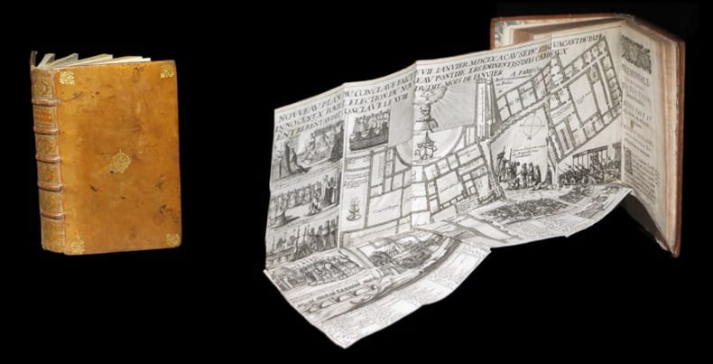
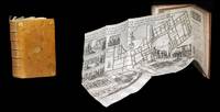
1643309321643. S.l. chez l'Autheur sic 1643 - A Paris de l'Imprimerie de Robert Mansion 1636 - A Paris chez Antoine de Sommaville 1655 - A Paris s.ÂŽ. 1604 pour le troisiÂme texte ; divisÂŽ en trois parties ˆ pagination sÂŽparÂŽe. 3 ouvrages le dernier composÂŽ de 3 parties reliÂŽs en un fort vol. au format in-12 173 x 112 mm de 1 f. bl. 3 ff. n.fol. et 106 pp. ; 1 f. bl. ; 4 ff. n.fol. et 111 pp. ; 3 ff. n.fol. et 50 pp. ; 3 ff. n.fol. et 63 pp. ; 72 pp. et 2 ff. n.fol. de PrivilÂge in fine. Reliure de l'ÂŽpoque de plein veau glacÂŽ blond larges fleurons angulaires et fleuron central dorÂŽs portÂŽs sur chacun des plats dos ˆ nerfs ornÂŽ de filets gras ˆ froid roulette dorÂŽe sur les nerfs caissons d'encadrement dorÂŽs filets verticaux dorÂŽs filets en pointillÂŽs dorÂŽs larges fleurons dorÂŽs semis de pointillÂŽs dorÂŽs piÂce de titre de maroquin fauve titre dorÂŽ palette dorÂŽe en tÂte et queue roulette dorÂŽe sur les coupes tranches mouchetÂŽes. Le prÂŽsent exemplaire renferme trois textes ; reliÂŽs en un volume. Le CÂŽrÂŽmonial de l'ÂŽlection des Papes closant le prÂŽsent volume est ici bien complet de ses 3 parties ainsi que de ses deux grandes planches dÂŽpliantes gravÂŽes. Les deux premiers ouvrages sont l'oeuvre de Nicolas Sanson d'Abbeville cÂŽlÂbre cartographe s'il en est. Coiffe infÂŽrieure arasÂŽe. Quelques t‰ches brunes sur les plats. Contre-gardes absentes. Quelques feuillets lÂŽgÂrement oxydÂŽs et rousseurs dans les corps d'ouvrages. Restauration ancienne au revers de chacun des planches. Du reste belle condition. Rare. b42961 unknown
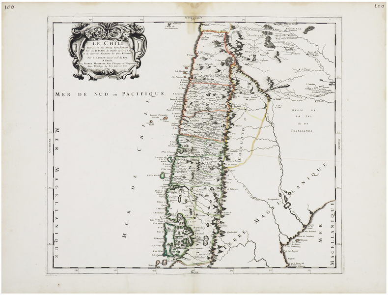
1669LBW-6487Paris, Pierre Mariette, 1669. 395 x 446 mm.
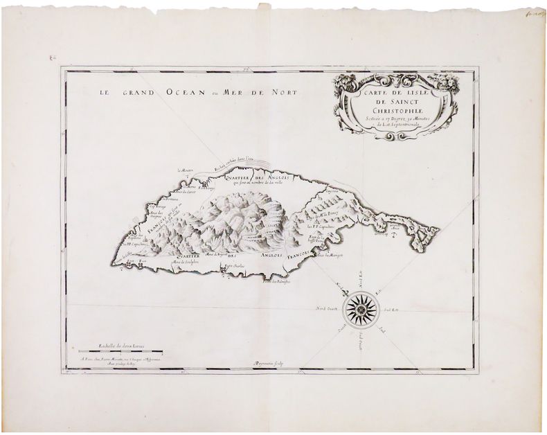
1670LBW-606Paris, Pierre Mariette, [1670]. 308 x 424 mm.
164330932S.l., chez l'Autheur [sic], 1643 - A Paris, de l'Imprimerie de Robert Mansion, 1636 - A Paris, chez Antoine de Sommaville, 1655 - A Paris, s.é., 1604 (pour le troisième texte ; divisé en trois parties à pagination séparée). 3 ouvrages (le dernier composé de 3 parties) reliés en un fort vol. au format in-12 (173 x 112 mm) de 1 f. bl., 3 ff. n.fol. et 106 pp. ; 1 f. bl., ; 4 ff. n.fol. et 111 pp. ; 3 ff. n.fol. et 50 pp. ; 3 ff. n.fol. et 63 pp. ; 72 pp. et 2 ff. n.fol. de Privilège in fine. Reliure de l'époque de plein veau glacé blond, larges fleurons angulaires et fleuron central dorés portés sur chacun des plats, dos à nerfs orné de filets gras à froid, roulette dorée sur les nerfs, caissons d'encadrement dorés, filets verticaux dorés, filets en pointillés dorés, larges fleurons dorés, semis de pointillés dorés, pièce de titre de maroquin fauve, titre doré, palette dorée en tête et queue, roulette dorée sur les coupes, tranches mouchetées.
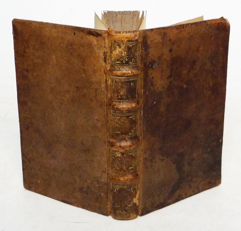
1682za2213A Paris, chez l'Auteur, aux Galleries du Louvre, vis à vis l'Eglise de St Nicolas Relié 1682 "In-12 (9,8 x 16 cm), reliure plein veau, dos à 4 nerfs orné de caissons dorés, liseré doré sur les coupes, tranches mouchetées, titre comple : ""Introduction à la géographie, première partie. Où sont 1. Indiquées les Sciences dont la Géographie emprunte plusieurs Principes. 2. La Description des differentes Manieres dont cette Science est Représentée. 3. L'Explication des Termes de toutes les Parties de la Geographie. 4. Une Instruction de toutes les Parties de la Geographie. 4. Une Instruction de l'Usage des Cartes."", pagination comme suit : page de titre, préface (6 pp. non numérotées), avis au lecteur (2 pp. non numérotées), table des chapitres (9 pp. non numérotées, fautes à corriger, extrait du Privilege du Roy, 292 pp., table alphabetique (13 pp. non numérotées), avertissement (5 pp. non numérotées). Le plan de cet ouvrage de 320 pages est composé de trois parties. Dans la première, l'auteur place la géographie dans la cosmoraphie, puis il distingue entre globes et cartes, avant de décrire, comme l'avait fait Lubin, le vocabulaire de la géographie. Guillaume Sanson conclut cette partie par un chapitre sur l'usage des cartes. La deuxième partie s'intéresse aux relations entre l'astronomie et la géographie, décrivant le globe soit par par zones, soit par la grille des latitudes et longitudes. Enfin, la troisième partie, dite de géographie naturelle, rassemble pêle-mêle la liste des découpages du globe, selon les grilles évoquées dans la deuxième partie, puis en fonction des continents et des mers, voire selon d'autres critères comme les géographies historique, politique et sacrée, ou linguistique. La description de l'ensemble des Etats du monde y occupe 20 pages (et semble avoir été inspirée par l'Atlas du monde publié par Nicolas Sanson en 1665). Il s'agit donc d'abord d'une géographie assez théorique qui viserait à faire connaître le vocabulaire ainsi que les catégories de la géographie. Pourquoi cette introduction n'offre-t-elle pas plus de description de la géographie du monde ? Parce que la géographie --comme Guillaume Sanson l'écrit dans la préface-- ""est présentement à la Portée de tout le Monde, puisqu'avec cette méthode il ne faut que des yeux et des cartes"" (Sanson 1682). Deux hypothèses en découlent. La première fait de ce livre avant tout un prospectus pour les cartes des Sanson. La seconde y voit une tentative, par la famille Sanson, de captation de la géographie par la cartographie. De plus, on trouve dans l'édition de 1682 un avertissement passionnant de la main de Sanson, situé après la table alphabétique des matières. Il y critique la ""Méthode pour apprendre facilement la géographie"" de Jacques Robbe (1678), ainsi que la ""Description de Univers contenant les différents systèmes du monde"" à paraître (1683) de Manesson-Mallet, le traitant sans retenue de plagiaire. Plus loin, ayant mis en garde des acheteurs de cartes que les copistes étaient foison, Sanson note qu'il fait encore partie des vivants : ""Quelques uns nous effacent hardiment du nombre des Vivans, d'autres ont voulu persuader que nous estions retournez en Province, & qu'il y en avoit qui avoient eu assez d'effronterie pour prendre notre Nom ; de sorte que nous avons fait mettre à la Teste de cette Introduction Que nous demeurons aux Galleries du Louvre, pour desabuser le Public, & faciliter par là de Dessein de ceux qui voudront nous faire l'honneur de venir chez nous pour s'éclaircir de quelques difficultez, ou pour prendre avis touchant nos Ouvrages qu'ils voudront avoir."" ; quelques épidermures au dos, coiffe supérieure et coins du premier plat un peu usés, par ailleurs intérieur frais, bon état général. Livraison a domicile (La Poste) ou en Mondial Relay sur simple demande."
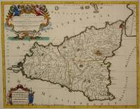
1692M7516Paris: Hubert Jaillot c. 1692. Very Good. Notes: Title cartouche in upper left features Sicilian coat of arms winged angels and merpeople while the scale in the lower left is held on each side by allegorical figures of labour and harvest. Mount Etna is represented pictorially. Size : 418x530 mm 16.46x20.87 Inches Coloring: Hand Colored in Outline Category: Maps Mediterranean Islands; Hubert Jaillot unknown
1696206066Amsterdam: Alexis-Hubert Jaillot 1696. unbound. very good. Map. Engraving with hand outline. Image measures 23" x 35".<br/><br/> Stunning map showing the vast extent of the German Empire including parts of Poland Bohemia Hungary Austria Croatia Italy France and the Netherlands. Exquisite and subtle coloring beautifully detailed. Based on a plate by Nicolas Sanson reworked and published in "Atlas Nouveau" by Jaillot. Severe toning due to early acid backing chipping to edges and corners and some tears. Priced as is. Alexis-Hubert Jaillot 1632--1712 was a French sculptor engraver publisher and cartographer. He served as official geographer to King Louis XIV and worked with other prominent mapmakers of the period such as Nicolas Sanson He is best known for his Atlas Nouveau of 1674.<br/><br/> Alexis-Hubert Jaillot unknown books
1696206066Amsterdam: Alexis-Hubert Jaillot 1696. unbound. very good. Map. Engraving with hand outline. Image measures 23" x 35".<br/> <br/> Stunning map showing the vast extent of the German Empire including parts of Poland Bohemia Hungary Austria Croatia Italy France and the Netherlands. Exquisite and subtle coloring beautifully detailed. Based on a plate by Nicolas Sanson reworked and published in "Atlas Nouveau" by Jaillot. Severe toning due to early acid backing chipping to edges and corners and some tears. Priced as is. Alexis-Hubert Jaillot 1632--1712 was a French sculptor engraver publisher and cartographer. He served as official geographer to King Louis XIV and worked with other prominent mapmakers of the period such as Nicolas Sanson He is best known for his Atlas Nouveau of 1674.<br/> <br/> Alexis-Hubert Jaillot unknown
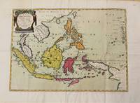
1654M10780Paris 1654. Very Good. Notes: Detailed map of Southeast Asia by Nicholas Sanson 1600-1667 renowned French cartographer. Size : 402x560 mm 15.83x22.05 Inches Coloring: Original Hand Coloring Category: Maps Asia South East Indonesia & Papua New Guinea; Maps Asia South East Thailand Laos Vietnam Cambodia & Burma / Myanmar; Maps Asia South East Philippines; unknown
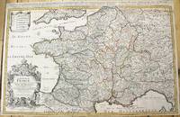
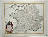
1690M10380Paris: H. Jaillot c.1690. Very Good backed on acid free tissue paper for long term preservation. Notes: Large and detailed map of France with a large decorative cartouche in the lower left two sheets joined. Size : 565x896 mm 22.24x35.28 Inches Coloring: Original Outline Coloring Category: Maps Europe France; H. Jaillot unknown
1650M2494Paris 1650. Very Good; light age toning; some browning on lower half of the map. Size : 547x433 mm 21.5x17 Inches Coloring: Original Hand Coloring Category: ; Maps Misc Curiosities Title Pages Games etc. unknown
1665M1736Paris: Mariette Pierre 1665. Excellent; some light browning on upper margin. Size : 410x535 mm 16.125x21 Inches Coloring: Original Hand Coloring Category: ; Maps Europe France Mariette, Pierre unknown
165556109Paris. 1655. Attractive map of Morocco and parts of Algeria. Maps by Sanson in original colour are rare. Nicolas Sanson was founder of the French school of mapmakers at a time when the leadership in European cartography passed from the Low Countries to France. Copper engraving. Very good condition. Some light browning to the centre fold. Attractive water mark. Original colour. Size: 53 x 40 cm. 21 x 15½ inches unknown
1693LBW-6390Paris, H. Jaillot, 1693. En deux feuilles jointes formant une carte de 785 x 584 mm.
1665M589Paris: Mariette Pierre 1665. Excellent. Size : 410x560 mm 16.125x22 Inches Coloring: Hand Colored Reference: Mojski Piotr Maria "Cartographia Rappersviliana Polonorum" page 387 number 31; Category: ; Maps Europe Poland Lithuania Mariette, Pierre unknown
1658LBW-7393Paris, chez l'auteur, [1658]. 390 x 555 mm.
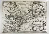
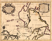
1700M11077Paris 1700. Excellent. Notes: Second state. Published in Description De Tout L'Universe-Halma.<br>An excellent example of Nicolas Sanson's map of Canada and the Great Lakes Lake Superior and Lake Michigan Lac du Puans are shown open-ended.<br>Engraved in the bottom-right corner outside the neat-line is "A.d.Winter Schulp". Additions include a latitude and longitude grid; mountains and trees filling in the blank areas east of James Bay and in northern Labrador; and the three latitude and longitude values that were previously missing in three of the corners on the border. Size : 207x308 mm 8.15x12.13 Inches Coloring: Black & White Reference: Burden #575; Kershaw #137 Plate 85 Category: Maps Canada East; Maps North America Great Lakes; unknown
1655M5101Paris 1655. Excellent. Size : 395x560 mm 15.5x22 Inches Coloring: Original Outline Coloring Category: ; Maps Europe Poland Lithuania unknown
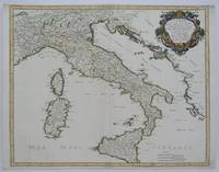
1665M5118Paris 1665. Very Good central fold reinfrced. Notes: There is a water mark on the right hand portion of the map. Size : 435x540 mm 17.125x21.25 Inches Coloring: Original Outline Coloring Category: ; Maps Europe Italy unknown
1666M1204Paris: Mariette Pierre 1666. Very Good. Size : 410x555 mm 16.125x21.875 Inches Coloring: Hand Colored Reference: Mojski Piotr Maria "Cartographia Rappersviliana Polonorum" page 388 number 32; Category: ; Maps Europe Poland Lithuania Mariette, Pierre unknown
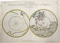
1657M954Paris 1657. Very Good; some occasional mild browning. Notes: 17th century French map of Arctic and Antarctic regions. It was published in Cartes générales de toutes les parties du monde. <br><br>Nicolas Sanson 1600–1667 was a renowned French cartographer termed by some as the "father of French cartography." His works are known for their incorporation of the most up to date information of the time and their clean modern style. Size : 390x537 mm 15.375x21.125 Inches Coloring: Hand Colored in outline Category: ; Maps Polar Arctic Regions; Maps Polar Antarctic Regions unknown
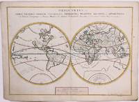
1657M8883Paris 1657 . Very Good. Notes: A handsome 17th century map of the known world typifying Sanson's scientific style of cartography. Embodying the most up to date information of the period Sanson's map depicts California as an island with Antarctica and Australia still largely unknown. A land bridge connects Asia to North America and touches Japan. A very accurate map for the period. Nicolas Sanson 1600–1667 was a French cartographer termed by some the creator of French geography in which he's been called the "father of French cartography." <br><br><br> Size : 380x537 mm 14.96x21.14 Inches Coloring: Original Hand Coloring Reference: Shirley R.W. World 400; Pastoureau M. Sanson V A 98. Category: Maps World; unknown
169317230Paris: Hubert Jaillot. 1693. Other. In excellent condition. Minor offsetting of the old outline colors to the paper. 465 by 610mm 18 by 24 inches. 465 by 610mm 18 by 24 inches. Copper Engraving color by Jaillot Alexis-Hubert & Sanson N published 1693 by Hubert Jaillot Paris. Image size: 465 by 610mm 18 by 24 inches. By Jaillot after Sanson a landmark of late 17th-century French cartography of North America. Alexis-Hubert Jaillot c.16321712 was one of the most important French cartographers and map publishers of the late 17th century. He collaborated with the pioneering geographer Nicolas Sanson 16001667 and his sons to produce finely engraved large-format maps of the world's regions publishing in Paris from 1670 onwards. Jaillot's maps are distinguished by their impressive scale rich baroque cartouches and the high quality of their engraving. His map of Canada and New France 1693 is a landmark document of 17th-century French geographical knowledge of North America reflecting decades of French colonial exploration and mission activity in the St. Lawrence and Great Lakes regions.Large and decorative map of Canada by the French cartographer Nicolaus Sanson and Hubert Jaillot. Published in the 'Atlas Noveau.' this atlas was a masterpiece in the French cartography in the 17th century. The atlas was specially designed for Louis XIV and due of the very large size of the plates most maps were printed from two plates it took Hubert Jaillot over 12 years to complete the 'Atlas Noveau.'. Canada is very detailled shown on the map as well Labrador Terra Neuf & Nouvelle France are shown in engraved territory borders. The map is rich in detail with many cities and place names rivers lakes mountains bays etc. In excellent condition. Minor offsetting of the old outline colors to the paper. Hubert Jaillot. unknown
169490853Veuve de Jacques Langlois Veuve de R. Chevillon Jacques Langlois | Paris 1694 | 9.5 x 16.5 cm | Relié
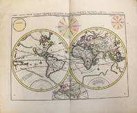
1696M10191Amsterdam: Covens & Mortier c.1696. Very Good. Size : 393x540 mm 15.47x21.26 Inches Coloring: Original Hand Coloring Category: Maps World; Covens & Mortier unknown