SANSON, NicolasBiblio.com
442 résultats
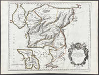
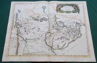
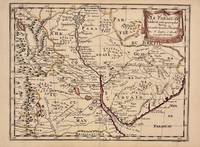
1657326341Paris 1657. unbound. Map. Original outline coloring. Sheet measures 8 3/4" x 12 1/8". Image measures 8" x 10 5/8". Paris: Nicolas Sanson 1657.<br/> <br/> This rare 17th century map by Nicolas Sanson with original color depicts the region showing present day Paraguay Uruguay with parts of Brazil and Argentina. Mountains are rendered pictorially and cities rivers and notations describing indigenous populations are labeled. In very good condition.<br> <br> Nicolas Sanson 1600-1667 is considered the founder of the French school of cartography. In reaction to the prevailing trend of Dutch lavishness Sanson favored minimal details focusing rather on accurate cartography than ornament.<br/> <br/> unknown
1700104160<p>Copper engraved map double page 24" x 20" hand colored and large uncolored title cartouches. Some minor soiling a little wear along centerfold with old verso repair normal aging; very good. Samson 1600-1667 is often referred to as the father of French cartography. Louis XIII was impressed with his work and appointed him "Geographe Ordinaire du Roi". During his career Sanson would produce about 300 maps and his major atlas "Cartes Generales de Toutes les Parties du Monde" would represent an important part of his body of work. While two of his sons continued publication of his maps after his death Pieter Schenk 1655-1718 an important publisher and engraver in his own right published this map. The map is attractively colored and gives a detailed view of the provinces of France. The map is also decorated with a large title cartouche. Bagrow p. 185. map hist website.</p>
1683297468Paris 1683. unbound. Map. Copper engraving with hand coloring. Image measures 7 5/8 x 11 1/4 inches.<br/> <br/> This map published in Paris in Afrique en plusieurs cartes is one of Sanson's small atlas maps of depicting various African regions. This map offers extensive detail on the cities of North Africa as well as topographical and geographical features with mountains beautifully rendered in profile. Nicolas Sanson 1600-1667 is considered the founder of the French school of cartography. In reaction to the prevailing trend of Dutch lavishness Sanson favored minimal details focusing rather on accurate cartography than ornament. This map is a fine example of his work.<br/> <br/> unknown
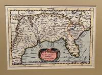
173422619Utrecht 1734. Full-title: La Floride. Par N. Sanson d' Abbeville Geogr. Ordre du Roy. Copper engraved double-page hand colored map. Neat pencil writing on verso "Henri Du Sauzet 1734". Image size 7" x 9 7/8". Tipped in double-mat. Fold line down center else a fine copy. The map covers southern states and coastline from Secotan in Virginia to Planuco in Mexico. Showing political and administrative boundaries major cities towns villages rivers mountains drainage etc. <br /> <br /> Nicolas Sanson 1600 – 1667 was a French cartographer who served under two kings in matters of geography. He has been called the "father of French cartography." <br /> <br /> Henri Du Sauzet 1686/87 - 1754 was a bookseller/publisher in Amsterdam during the early to mid-eighteenth century. unknown
166725060Paris: P. Mariette 1667. Other. The centre fold minor spotting else in excellent condition. 395 by 565mm 15 by 22 inches. Rare and decorative large-format historical map of Europe showing the locations of Church Councils and Synods in original outline color. By Guillaume Sanson 16331703 Géographe du Roy published by Pierre Mariette Paris 1667. Image: 395 x 565 mm 15.5 x 22 inches. Decorated with a superb allegorical title cartouche depicting a Catholic council in session a unique historical and cartographic document. Guillaume Sanson 16331703 was a leading French cartographer who inherited the celebrated family firm from his father Nicolas Sanson 16001667 known as the 'Father of French Cartography' and official Géographe du Roy to Louis XIV. Like his father Guillaume held the title of Géographe Ordinaire du Roy. Much of his work after 1671 was published in collaboration with Alexis-Hubert Jaillot and together the Sanson dynasty dominated French cartography throughout the 17th century. Their maps are held in the Bibliothèque nationale de France the British Library and major research collections worldwide.This large and striking map plots the locations of ecumenical councils national synods provincial councils and diocesan synods across Europe a unique cartographic subject of combined religious and historical significance. The coverage extends from the British Isles and Iberian Peninsula across to the eastern Mediterranean including Cyprus and Syria with North Africa also shown. Political borders are rendered in hand-applied outline color. The splendid allegorical title cartouche depicts a Catholic council in session and was engraved to the highest standard of the Parisian workshop. The Geographia Synodica is among the most unusual and collectible maps ever published of Europe: a historic document of scholarship faith and cartographic craft. In excellent condition. Original outline color fresh and vivid. The centrefold shows minor spotting as expected for a 17th-century map of this size; all else excellent. No tears or significant foxing. 395 x 565 mm. P. Mariette unknown
16546571Paris 1654. Copper engraving 37 x 48 cms modern hand-colour blank verso. Nicolas Sanson 1600-1667 founder of the Sanson dynasty of map-makers is considered by many to be the father of the French school of cartography. He was a prolific and original map-maker admired for the clarity and scientific accuracy of his maps. Map unknown
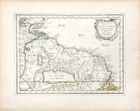
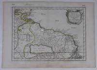
165766689Paris. c.1657. A very attractive and finely engraved map of the north eastern South American country of Guiana. The map is highlighted by numerous rivers tributaries mountains villages inlets bays and a very large inland equatorial lake that was thought to exist. Published in "Cartes Generales de toutes les parties du monde." Size: 285 x 360 mm. Copperplate engraving with original outline colouring. Fine condition. unknown
165756721Histoire et Geographie de l'Amerique. 1657. Attractive map of Paraguay. Title cartouche at top right. Maps by Sanson in original colour are rare. Nicolas Sanson was founder of the French school of mapmakers at a time when the leadership in European cartography passed from the Low Countries to France. Copper engraving. Fine condition; very light offsetting. Original outline colour. Size: 28.5 x 21.5 cm. 11 x 8½ inches unknown
2021x-0198754957Oxford Univ Pr 2021. Hardcover. New. 656 pages. 9.50x6.50x1.75 inches. Oxford Univ Pr hardcover
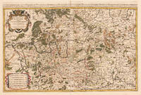
169233439Paris: H. Jaillot 1692. In ausgezeichnetem Zustand. . 570 by 850mm 22 by 33 inches. Hand-Colored Original Copperplate Engraving by Charles Hubert Alexis Jaillot & Nicolaus Sanson depicting Le Cercle de Franconie subdivise entous les Estats qui le composent. Dressè sur les Memotres les plus Nouveaux Parle Sr. Sanson Geographe Ordinaire du Roy. A Paris Chez H. Iaillot joignant les grands Augustins aux dewe Globes. Avec Privilege du Roypour Vingt Ans. 1692. Published Paris H. Jaillot 1692. Sheet: 570 by 850mm 22 by 33 inches. A fine and original hand-colored example of Jaillot's celebrated cartographic work documenting this region of Germany with the precision and decorative artistry characteristic of the 16900s. Alexis-Hubert Jaillot c.1632-1712 was one of the foremost French cartographers of the late 17th and early 18th centuries. Working in Paris he produced magnificent large-format maps of European territories often in collaboration with Nicolas Sanson -- considered the father of French cartography. Jaillot's maps are known for their striking decorative cartouches generous size and fine hand coloring representing the pinnacle of French Baroque cartography.This original copperplate engraving with original hand coloring depicts the region of Le Cercle de Franconie subdivise entous les Estats qui le composent. Dressè sur les Memotres les plus Nouveaux Parle Sr. Sanson Geographe Ordinaire du Roy. A Paris Chez H. Iaillot joignant les grands Augustins aux dewe Globes. Avec Privilege du Roypour Vingt Ans. 1692. published in Paris H. Jaillot 1692. The map features a decorative Baroque cartouche containing the title inscription. A distance scale is incorporated within the cartouche or alongside it. The map records the political and geographic boundaries of the region as understood in 1692 offering a fascinating window into the history of German territorial organization. Sheet measures 570 by 850mm 22 by 33 inches. In good condition overall with minor signs of age appropriate for a 17th-century engraving. Ready to frame. H. Jaillot unknown
16709482<p>Scarce map engraving outlined in original color from Sanson's <em>Cartes Generales de Toutes les Parties du Monde. </em>The image measures approximately 19.75 x 16.5 in 50 x 42 cm; page measures 23.25 x 17.5 in 59 x 44.5 cm.</p> Pierre Mariette
1723202384Amsterdam: Mortier Pieter II 1723. unbound. very good. Map. Engraving with hand coloring. Image measures 14.5" x 19.25".<br/> <br/> Includes parts of modern day Morocco Algeria Tunisia and Libya. Nicolas Sanson 1600-1667 is considered the founder of the French school of cartography. In reaction to the prevailing trend of Dutch lavishness Sanson favored minimal details focusing rather on accurate cartography than ornament. Large decorative title cartouche. Map is in good condition with ample margins. Staining along centerfold. Chipped near edges along centerfold.<br/> <br/> Mortier, Pieter II unknown
3253Americas: Amsterdam Francois Halma 1705. Copper engraved map of Peru by N. Sanson from Halma's Algemeene Werelde Beschryving Vol. 3 Black and white; title in Dutch; verso blank; strapwork title cartouche. Small map of Tierra del Fuego showing both the Strait of Magellan and Le Maire Strait. Inland detail is confined to a mountain range and several rivers and the mythical Destroit de Browers is labeled at far right. This map appeared in Algemeene Weereld-Beschryving nae de Rechte Verdeeling der Landschappen Plaetsen Zeeën Rivieren &c. Geographisch Politisch Historisch Chronologisch en Genealogisch a Dutch edition of A. Phérotée de la Croix's Nouvelle Methode Pour Apprendre Facilement la Geographie Universelle which first appeared in 1690. Dark impression. Nicolas Sanson d'Abbeville.1600-67 ' father of the French cartography' and founder of the Sanson firm. Atlas ' Cartes générales de toutes les parties du Monde' 1658-70 and a pocket atlas in 4 parts 1652-1705. Sanson's small maps from A. Phérotée de la Croix's Nouvelle Methode Pour Apprendre Facilement la Geographie Universelle. first published in 1652 and engraved by A. Peyrounin were copied several times by various map publishers. Johann David Zunners made copies of Sanson's maps for his German translation of Die Gantze Erd-Kugel in 1679. Johannes Ribbius and Simon de Vries published copies in 1682 and 1683 with new maps engraved by Antoine d'Winter. The plates were later sold to Francois Halma who used them in 1699 and then again in 1705 with the titles re-engraved in Dutch. François Halma 1653 - 1722 Dutch publisher/printer; dealer/auction house. Cartographer and publisher of maps active in Utrecht Amsterdam Franeker and Leeuwarden. Published 'Description de l'Univers' 1700; 'Algemene Wereldtbescrijving' 1705; 'Corpus Inscriptionum' 1707 and 'Lexicon Philosophicum' 1713. Halma acquired many of the plates for Algemeene Weereld-Beschryving from Joannes Ribbius who had enlisted the services of engraver Antoine de Winter to make copies of the maps in Nicolas Sanson's quarto atlases of the four continents. De Winter made very few geographical changes and maintained the attribution to Sanson on the newly engraved plates. Halma supplemented the Sanson maps with about a dozen new maps engraved in the same style as Sanson's without any attribution on the maps as well as 23 panoramic views of famous cities around the world. Keoman: Hal 1; Phillips 528. Americas South America Tierra del Fuego Magellanica Strait of Magellan Amsterdam Francois Halma 1705 unknown
#[37942]Paris Pierre Mariette 1656. Engraved map of Suriname coloured in outline with fine cartouche. Ca. 245 x 345 cm. A reduced derivative of the famous Sanson map of 1650 published in an early edition of the small Sanson atlas L'Europe Dediée a Monseigneur . . . Le Tellier Secret. D'Estat &c. Engraved by A. Peyrounin. unknown
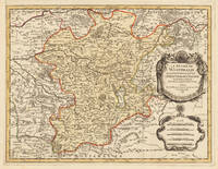
169633637Paris 1696. Schönes tadelloses Exemplar. . 803 by 560mm 31 by 22 inches. Hand-Colored Original Copperplate Engraving by Alexis-Hubert Jaillot & N. Sanson depicting Le Duché De Westphalie ainsi qu`il est presentement possedé par L`Eslecteur De Cologne. Tiré des Memoires les pl. recents Par le Sr. Sanson Geographe Ordinaire du Roy A Paris. Published Paris 1696. Sheet: 803 by 560mm 31 by 22 inches. A fine and original hand-colored example of Jaillot's celebrated cartographic work documenting this region of Germany with the precision and decorative artistry characteristic of the 16900s. Alexis-Hubert Jaillot c.1632-1712 was one of the foremost French cartographers of the late 17th and early 18th centuries. Working in Paris he produced magnificent large-format maps of European territories often in collaboration with Nicolas Sanson -- considered the father of French cartography. Jaillot's maps are known for their striking decorative cartouches generous size and fine hand coloring representing the pinnacle of French Baroque cartography.This original copperplate engraving with original hand coloring depicts the region of Le Duché De Westphalie ainsi qu`il est presentement possedé par L`Eslecteur De Cologne. Tiré des Memoires les pl. recents Par le Sr. Sanson Geographe Ordinaire du Roy A Paris. published in Paris 1696. The map records the political and geographic boundaries of the region as understood in 1696 offering a fascinating window into the history of German territorial organization. Sheet measures 803 by 560mm 31 by 22 inches. In good condition consistent with its age of over 320 years. Ready to frame. unknown
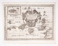
53608c.1700. Original engraved map 19 x26.5 cm. overall sheet size 22 x 29 cm. of the Canaries with inset of Madeira. Central vertical fold. [c.1700] unknown
1668014632Paris: Cartes Generales de Toutes les Parties du Monde. 1668. Hand coloured. Map measures 55x40.cm plus margin. Some light surface wear or dust marking. Map in good condition. Boldly engraved map of the region of present day Paraguay Uruguay northern Argentina and parts of Chile and Brazil. The Rio de la Plata is the main feature of the map which extends north to the mythical Lago de los Xarayes. The mountains and volcanoes of the Cordillera de los Andes are also prominently shown. There is good detail of topography missions and villages. The decorative title cartouche is adorned with two female figures fruit and flowers. Very Good. Cartes Generales de Toutes les Parties du Monde.. unknown
170054043Nicolas Bion: L'Usage des Globes. Amsterdam: Francois Halma. 1700. Map showing north-east South America from Trindad to the mouth of the Amazon - modern day Guyana and Surinam. Several large fictitious lakes make up much of the unexplored interior. Maps by Sanson in original colour are rare. Nicolas Sanson was founder of the French school of mapmakers at a time when the leadership in European cartography passed from the Low Countries to France. This map was published in Bion's treatise on globes. Nicolas Bion was a famous French mathematical and scientific instrument maker. Copper engraving. Very good condition. Small 1cm. very faint library stamp on border not affecting map. Original colour. Size: 27.5 x 20 cm. 11 x 8 inches. unknown
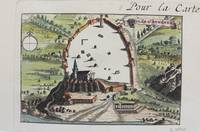
1690M9477Paris c.1690. Very Good. Notes: A charming map of Athens Greece during the late 17th century. Size : 103x154 mm 4.06x6.06 Inches Coloring: Hand Colored Category: Maps City Maps; Maps Europe Greece Macedonia; unknown
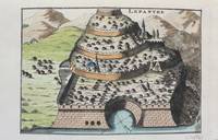
1690M9478Paris c.1690. Very Good. Notes: A charming map of Lepanto Greece during the late 17th century. Size : 105x153 mm 4.13x6.02 Inches Coloring: Hand Colored Category: Maps Europe Greece Macedonia; unknown
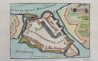
1690M9472Paris c.1690. Very Good. Notes: A charming map of Santa Maura on the island of Lefkada Greece during the late 17th century. <br><br> Size : 104x153 mm 4.09x6.02 Inches Coloring: Hand Colored Category: Maps Europe Greece Macedonia; unknown
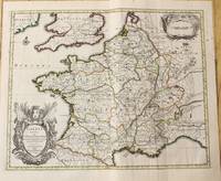
1710M10329Amsterdam: Jean Covens & Corneille Mortier c.1710. Very Good. Size : 378x486 mm 14.88x19.13 Inches Coloring: Original Outline Coloring Category: Maps Europe France; Jean Covens & Corneille Mortier unknown
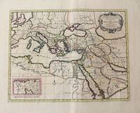
1710M10321Amsterdam: Jean Covens & Corneille Mortier c.1710. Very Good. Size : 402x520 mm 15.83x20.47 Inches Coloring: Original Hand Coloring Category: Maps Mediterranean Sea; Maps Asia Middle East; Jean Covens & Corneille Mortier unknown
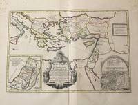
1710M10319Amsterdam: Jean Covens & Corneille Mortier c.1710. Very Good. Notes: With 2 inset maps showing the Holy Land and Hierusalem. Size : 375x550 mm 14.76x21.65 Inches Coloring: Original Hand Coloring Category: Maps Asia Near East Turkey; Maps Asia Middle East Holy Land & Palestine; Maps Mediterranean Sea; Jean Covens & Corneille Mortier unknown
1710M10250Amsterdam: Jean Covens & Corneille Mortier c.1710. Very Good. Size : 370x493 mm 14.57x19.41 Inches Coloring: Original Hand Coloring Category: Maps Asia Middle East Holy Land & Palestine; Maps Asia Middle East Iran Iraq; Jean Covens & Corneille Mortier unknown