SANSON, NicolasBiblio.com

946 résultats
170054022Nicolas Bion: L'Usage des Globes. Amsterdam: Francois Halma. 1700. Attractive map of north eastern Africa including Egypt and northern Libya. Much of the charm of early maps of Africa lies in how they show the interior of the continent which was not explored until the 19th century. Maps by Sanson in original colour are rare. Nicolas Sanson was founder of the French school of mapmakers at a time when the leadership in European cartography passed from the Low Countries to France. This map was published in Brion's treatise on globes. Nicolas Brion was a famous French mathematical and scientific instrument maker. Copper engraving. Very good condition. Darkened edges to margins. Faint inkstamp on right margin not affecting map. Original colour. Size: 27 x 17 cm. 10½ x 6½ inches. unknown
1830P49500Paris, J.-B. Baillière 1830 [ augmentée d'un supplément dans lequel sont compris les nouveaux termes introduits dans le langage des sciences médicales et accessoires jusqu'à ce jour"], xii + 619pp. (relié avec un Catalogue des livres de l'éditeur Baillière mai 1832, 32pp.), reliure plein-cuir (titre et faux-nerfs dorés au dos, charnière supérieure peu cassée), feuilles de garde marbrées, 22cm., texte imprimé en 2 colonnes, intérieur en bel état
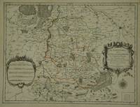
30597Paris: Jaillot. 1681. 43 x 57 cm. Original outline colour. Single page folio map of Limborg and its envirions. Blank on verso. Small tear with loss to upper right margin. Some light stains at right margin though not affecting image otherwise in very good condition. Paris: Jaillot. 1681 unknown
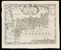
169915831Amsterdam: Chez Arnout van Ravenstein 1699. 222 by 272mm. 8.75 by 10.75 inches. Engraved map. Second state of the plate first published in Halma's pirated edition of Sanson's 'L'Asie en plvsiers cartes nouvelles et exactes; ' as part of 'L'Europe; L'Asie; L'Amerique en Pluiers Cartes' 1683. A direct copy of Sanson's map of 1652 the only differences being the lack of a privilege and a date in the cartouche the addition of the signature of the engraver Antoine de Winter in the lower left corner. This issue is distinguished by the addition of mountains added in 'Isle de Corey' and 'Terre de Iesso'; and the 'Mer de Japan' above 'Oriental'. Francois Halma 1653-1722 set up his printing business in Utrecht in 1674 where he issued a number of pirated maps and atlases. In this instance since Sanson was dead Halma may have felt that there no harm and much profit to be gained from re-printing his work. The engraver Antoine de Winter c1652-1700 achieved some notoriety for plagiarizing Petter Gedda's charts of the Baltic Sea selling them on to Loots and Doncker for inclusion in their atlases who were subsequently sued and ordered to surrender the plates and pay a fine of 300 florins. Sanson originally credited "Caardin sic Varenius" and 'others' for his map. Generally the geography follows that of Moreira/Blancus only a small portion of the eastern coast of Korea is shown without stating whether it is an island or not and there is only a hint of Hokkaido in the far northeast corner with the place name Matzumay. Varenius or Bernhard Varen fl1622-1650 was a German physician geographer and natural historian. He settled in Amsterdam and was a friend of the Blaeu family. He published 'Descriptio regni Japonia ' in 1649 and came to be known as 'the father of physical geography' Hubbard. Sanson 1600-1667 was a French mapmaker. He supposedly began to make maps to supplement his study of history and a map of Ancient Gaul made early in his career brought him to the attention of Cardinal Richelieu. This foothold in the French court allowed him to rise to the position of Geographe du Roi teaching both Louis XIII and Louis XIV. Louis XIII even made him a counsellor of state. Sanson produced an atlas 'Cartes Generales de Toutes les Parties du Monde' which contained important maps of the post roads and waterways of France. He also produced two major maps of North America: 'Amerique Septentrionale' 1650 was the first map to show the Great Lakes in a recognisable form aided by Sanson's access to The Jesuit Relations a collection of accounts by French missionaries to the area. The map was also drawn on a sinusoidal projection which Sanson was the first to use. In 1656 he made 'Le Canada ou Nouvelle France' which showed the Great Lakes in greater detail and included accurate representations of the Hudson Bay area the Delaware and the Gulf of Saint Lawrence. After Sanson's death the business was carried on by his two surviving sons and grandson in partnership with Hubert Jaillot. Sanson family members were revered among the foremost map makers in France for nearly a century. A leading exemplar of the French school of seventeenth-century cartography Nicholas Sanson I is widely regarded as the founder of modern geography and it is generally held that the so called "Great Age" of French cartography originated with his publications Hubbard 51.2. Chez Arnout van Ravenstein, unknown
16909797Amsterdam c. 1690. Copper engraving 19.2 x 24.5 cm modern hand colour blank verso. Sansons small map of the Mughal Empire was published in his 1652 atlas of Asia L'Asie en plusieurs cartes nouvelles et exactes. The date privilege and name of the engraver were omitted from later states of the plate but our example appears to be a Dutch version re-engraved for Francois Halmas Description de tout l'Univers. Nicolas Sanson 1600-1667 founder of the Sanson dynasty of map-makers is considered by many to be the father of the French school of cartography. He was a prolific and original map-maker admired for the clarity and scientific accuracy of his maps. Map unknown
16548874Paris: Pierre Mariette 1654. Copper engraving 41.5 x 47.5 cm original hand-colour in outline trivial spotting blank verso. Showing parts of European Russia and Ukraine in antiquity. For Greco-Roman geographers and ethnographers Sarmatia was in western Scythia bordering the Roman Empire. Nicolas Sanson 1600-1667 founder of the Sanson dynasty of map-makers is considered by many to be the father of the French school of cartography. He was a prolific and original map-maker admired for the clarity and scientific accuracy of his maps. Map Pierre Mariette unknown
48297Paris Lutetiae Parisiorum Sumptibus et Impensis Autoris 1647. 3 ouvrages en 1 volume. 1. 2 feuillets blancs. 8 feuillets. 246 pages. 2. 13 feuillets. 283 pages. 3. 2 feuillets blancs. Page de titre. Carte gravée. 11 feuillets. 2 feuillets blancs. 15x9 Cm. Plein veau de l'époque. Dos à nerfs orné et doré un peu frotté. Pièce de titre doré. Charnières fendues. Petits accidents aux coiffes. Rousseurs et quelques taches. Les deux premiers ouvrages sont des critiques très rares du "Pharum Gallia Antiquae" de Philippe Labbé que Sanson rectifie sur plusieurs points. À la suite on trouve une courte description de la Judée accompagnée d'une belle carte dépliante. Bon exemplaire comportant l'exlibris gravé d'Henri Liébaux. Paris, Lutetiae Parisiorum Sumptibus et Impensis Autoris, 1647. unknown
14357382-nnew. unknown
ria9780198754954_inpHardcover. New. New Book; Fast Shipping from UK; Not signed; Not First Edition; This volume offers a ground-breaking investigation into women's contribution to the description analysis and codification of languages across a wide range of linguistic and cultural traditions. The chapters explore a variety of sphere hardcover
20141-3838178408Presses Académiques Francophones 2014. Paperback. New. 212 pages. French language. 8.66x5.91x0.48 inches. Presses Académiques Francophones paperback
2011DADAX0197264832British Academy 2011-11-07. 1. hardcover. New. 9.20x1.30x6.20. Buy with confidence. Excellent Customer Service & Return policy. British Academy hardcover
1812006820Paris: Chez Jean Md d'Estampes 1812 Engraving 59 x 90 cm old color. The first edition of this map was published in 1674 by Hubert Jaillot under the title "La Russie Blanche ou Moscovie divisee suivant l'étendue des Royaumes Duches." It was incorporated into numerous atlases by Jaillot and his successors until approximately 1720 when it became evidently outdated. However around 1812 it was reissued likely to illustrate the French-Russian war. Chez Jean Md d'Estampes unknown
a8664Le Cercle de Westphalie. 25x38 inches. A double panel map profesionally joined together at seam. Colored in outline. Highly detailed. VG. . unknown
1983BN255751München : Beck Verlag 1983. 1983. Tagebücher der Henker von Paris : 1685 - 1847. - 2 Bände komplett Hrsg. von Eberhard Wesemann u. Knut-Hannes Wettig / Bibliothek des 18. Jahrhunderts <br/><br/>Tagebücher der Henker von Paris : 1685 - 1847. - 2 Bände komplett Hrsg. von Eberhard Wesemann u. Knut-Hannes Wettig / Bibliothek des 18. Jahrhunderts Henri Sanson München : Beck Verlag unknown
126769aafParis, Nicolas Sanson, 1667, 35x53 cm., Kupferdrukkarte schwarz / carte gravés sur cuivre, 1 feuille, montée sur toile. 45x62 cm.
183035931830 Paris: chez les principaux libraires, 1830. In-8: 13.5 x 21 cm, ii-379 pp. Reliure de l'époque en demi-basane. Dos lisse orné de bandes dorées. Titre sur pièce de couleur verte. Bas du mors supérieur légèrement fendu et quelques rares rousseurs pâles sans gravité, sinon ouvrage solide et en très bon état. Une curiosité.
1674ag662Jaillot H. Carte 1674 Carte de 43 x 57 cm en une partie : frontières colorées ; petites déchirures marginales sans gravité, bon exemplaire. Livraison a domicile (La Poste) ou en Mondial Relay sur simple demande.
1675bb3400Jaillot H. Carte 1675 Carte de 41 x 56 cm en une partie : frontières colorées ; petits défauts, très bon exemplaire. Livraison a domicile (La Poste) ou en Mondial Relay sur simple demande.
1675ag657Jaillot H. Carte 1675 Carte de 41 x 56 cm en une partie : frontières colorées ; petits défauts, très bon exemplaire. Livraison a domicile (La Poste) ou en Mondial Relay sur simple demande.
1695bb3406Jaillot H. Carte 1695 Carte de 43 x 57 cm en une partie : frontières colorées ; petites déchirures marginales sans gravité, bon exemplaire. Livraison a domicile (La Poste) ou en Mondial Relay sur simple demande.
1695ag659Jaillot H. Carte 1695 Carte de 43 x 57 cm en une partie : frontières colorées ; petites déchirures marginales sans gravité, bon exemplaire. Livraison a domicile (La Poste) ou en Mondial Relay sur simple demande.
1676bb3407Jaillot H. Carte 1676 Cartes en deux parties, 53 par 90 cm ; frontières surlignées en couleur, très bel exemplaire. Livraison a domicile (La Poste) ou en Mondial Relay sur simple demande.
1676ag661Jaillot H. Carte 1676 Cartes en deux parties, 53 par 90 cm ; frontières surlignées en couleur, petites déchirures marginales, bel exemplaire. Livraison a domicile (La Poste) ou en Mondial Relay sur simple demande.
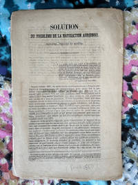
18501240111.28<p>Ledoyon Paris 1850. Good. Two ballooning pamphlets/flyers: Sanson's "Solution du probleme de la navigation aerienne" and: Lettre-Journel de Paris November 19 1870 with an account of a military balloon flight with a manuscript letter attached with stamp and corresponding verso text excised but with a "Par Ballon Monte" cancellation hand stamp and London-received postal hand stamp intact: an early airmail letter; from Wikipedia: "Historically balloons were used to transport mail from Paris during the Siege of Paris of 1870-1871. About 66 unguided mail balloons were released from Paris ." Few such letters have survived.</p> Ledoyon, Paris
0197264832New. Brand new and still unused unknown