946 résultats
1760M7988Paris: Sr. Delamarche c.1760. Very Good. Notes: Engraved by Delahaye. Large scale attractive map of France. Size : 493x668 mm 19.41x26.30 Inches Coloring: Original Hand Coloring Category: Maps Europe France; Sr. Delamarche unknown
1650M6678Paris: Pierre Mariette c. 1650. Very Good;. Notes: Title cartouche bordered by two outward-facing birds of prey.<br><br>Norwich writes: "This is an early Sanson map. An odd feature is the name Barditus Mons given to a long chain of mountains running continuously from somewhere in Angolato Algoa Bay. No place names appear even on the coast of the southern part of the continent which is labelled 'Agi Symba' a name usually referring to the northern African region and inhabitants are 'Anthropophagi Aethiopes' or cannibals." Size : 396x553 mm 15.59x21.77 Inches Coloring: Hand Colored Reference: Norwich's Map 35. Category: Maps Africa Continent; Pierre Mariette unknown
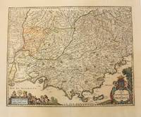
1656M6320Paris 1656. Very Good. Notes: This map shows the southern coast of France. Size : 425x535 mm 16.75x21 Inches Coloring: Original Hand Coloring Category: Maps Europe France unknown
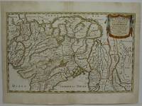
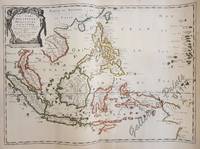
1654M5952Paris 1654. Very Good some mild discoloration along the margins. Size : 350x555 mm 13.75x21.875 Inches Coloring: Original Outline Coloring Reference: Gole 16; Nebenzahl 3.9B Category: Maps Asia South East Thailand Laos Vietnam Cambodia & Burma / Myanmar; Maps Asia Central India & Sri Lanka / Ceylon; unknown
166710027Paris 1667. No Binding. Near Fine. 12 ½ x 17 inches. Original outline color; excellent. Earliest map of Martinique listed in Phillips featuring attractive original color and an elegant cartouche. This map depicts the situation on the island before 1660 when it was still largely inhabited by natives and only about half of it had been claimed by colonists for sugar cane farming. The map goes so far as to mark with a printed line the partition dividing the "demeure des François" and the "demeure des savages." However by 1660 the entirety of the native population was either dead expelled or in slavery and Martinique was a full-fledged sugar cane-farming European colony. Phillips Maps P. 389. unknown books
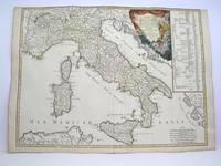
1778M3888Paris: Delamarche 1778. Very Good. Size : 515x685 mm 20.25x27 Inches Coloring: Original Outline Coloring Category: ; Maps Europe Italy Delamarche unknown
166710027Paris 1667. No Binding. Near Fine. 12 ½ x 17 inches. Original outline color; excellent. Earliest map of Martinique listed in Phillips featuring attractive original color and an elegant cartouche. This map depicts the situation on the island before 1660 when it was still largely inhabited by natives and only about half of it had been claimed by colonists for sugar cane farming. The map goes so far as to mark with a printed line the partition dividing the "demeure des François" and the "demeure des savages." However by 1660 the entirety of the native population was either dead expelled or in slavery and Martinique was a full-fledged sugar cane-farming European colony. Phillips Maps P. 389. unknown
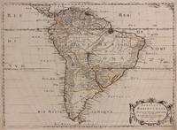
1650309461Paris: Pierre Mariette 1650. unbound. Abraham Peyrounin. Map. Engraving with original outline color. Image measures 15 3/4" x 21 3/4"<br/> <br/> This exceptionally fine map of South America covers the continent in fine detail. Coastlines are extensively labeled and mountains beautifully rendered in profile. The Orinoco and Amazon Rivers as well as Rio de la Plata are prominently rendered. Sanson refrains from drawing a southern coastline to Tierra del Fuego and the relatively unknown Amazon region is depicted in minimal detail. Sanson does however include the mythical lake "Lac de Parime" and the city of gold "Manoa del Dora" between the Orinoco and Amazon rivers. Nice dark impression. In very good condition. Minor dampstain to lower margin not affecting the image and some faint stains near the center of the map - otherwise clean and bright. Hard to find. <Br> <br> Nicolas Sanson 1600-1667 is considered the founder of the French school of cartography. In reaction to the prevailing trend of Dutch lavishness Sanson favored minimal details focusing rather on accurate cartography than ornament.<br/> <br/> Pierre Mariette unknown
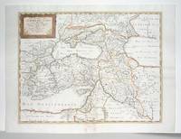
1660M2926Paris: Mariette Pierre 1660. Very Good; some browning on the lower margin near the fold. Size : 407x517 mm 16x20.375 Inches Coloring: Hand Colored Category: ; Maps Mediterranean Sea; Maps Asia Near East Turkey; Mariette, Pierre unknown
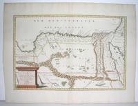
1655M2801Paris: Mariette Pierre 1655. Excellent. Size : 345x523 mm 13.625x20.625 Inches Coloring: Original Outline Coloring Category: Maps Africa North Egypt Mariette, Pierre unknown
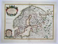
1708M4264Paris 1708. Very Good central fold reinforced mounted on acid free canvas. Size : 474x655 mm 18.625x25.75 Inches Coloring: Hand Colored in Outline Category: ; Maps Europe Scandinavia unknown
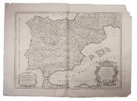
1708E7GCJJB1RUYXParis 1708. Hubert Jaillot Engraved map on 2 assembled sheets 55.5 x 78 cm engraved by Cordier. With title in decorated cartouche on the bottom right corner scales and privilege in decorated cartouche on the bottom left corner and a few lines coloured in green. Large map of Spain and Portugal this state with a privilege for 20 years granted in 1708. Engraved by Cordier after the map by Nicolas Sanson.Strengthened fold damaged corners but map in very good condition.l Cf. Pastoureau Jail. II A map 91. unknown
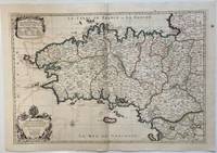
1693324404Paris: Alexis-Hubert Jaillot 1693. Map. Engraving with hand colored outline. Image measures 21" x 31"<br/> <br/> This large 17th century double-page map features the Brittany region of France. Cities towns abbeys government buildings rivers ports and harbors are labeled. Mountains forests and wetlands are depicted pictorially. The attention to detail in topography and population centers hints at the abundance of the region known for its production of Muscadet wine cheese boar seafood and other agricultural products. Executed by Nicolas Sanson in dedication to his son this map was published by Alexis-Hubert Jaillot in Paris and later reproduced in Amsterdam by Jaillot and Pierre Mortier. This early edition is scarce and hard to find. In very good condition with some offsetting to left side and a spot in the right margin. <br> <br> Nicolas Sanson 1600-1667 is considered the founder of the French school of cartography. In reaction to the prevailing trend of Dutch lavishness Sanson favored minimal details focusing rather on accurate cartography than ornament.<br/> <br/> Alexis-Hubert Jaillot unknown
3238Americas: Amsterdam Francois Halma 1705. Copper engraved map of North America by N. Sanson from Halma's Algemeene Werelde Beschryving Vol. 3 Black and white; title in Dutch; verso blank; strapwork title cartouche. Attractive small map showing North America with California as an Island California is shown with an indented northern coastline in the Foxe form. The detached coastline to the northwest of California is named Terre de Iesso ou Ieco rather than reflecting Sanson's earlier belief that it was an extension of the American continent. The R. de Nort drains into the Gulf of California from a large interior lake in the country of Les Apaches. The two western-most Great Lakes are left open-ended and Lake Erie remains unnamed. Engraved by Antoine d'Winter. This is the third state which includes a peninsula inserted northeast of California the Carolinas attributed to the French N. Iork added below N. Amstredam and an umlaut over the "Roy" in the title. This map appeared in Algemeene Weereld-Beschryving nae de Rechte Verdeeling der Landschappen Plaetsen Zeeën Rivieren &c. Geographisch Politisch Historisch Chronologisch en Genealogisch a Dutch edition of A. Phérotée de la Croix's Nouvelle Methode Pour Apprendre Facilement la Geographie Universelle which first appeared in 1690. Dark impression; dampstaining to edges not entering image. Nicolas Sanson d'Abbeville.1600-67 ' father of the French cartography' and founder of the Sanson firm. Atlas ' Cartes générales de toutes les parties du Monde' 1658-70 and a pocket atlas in 4 parts 1652-1705. Sanson's small maps from A. Phérotée de la Croix's Nouvelle Methode Pour Apprendre Facilement la Geographie Universelle. first published in 1652 and engraved by A. Peyrounin were copied several times by various map publishers. Johann David Zunners made copies of Sanson's maps for his German translation of Die Gantze Erd-Kugel in 1679. Johannes Ribbius and Simon de Vries published copies in 1682 and 1683 with new maps engraved by Antoine d'Winter. The plates were later sold to Francois Halma who used them in 1699 and then again in 1705 with the titles re-engraved in Dutch. François Halma 1653 - 1722 Dutch publisher/printer; dealer/auction house. Cartographer and publisher of maps active in Utrecht Amsterdam Franeker and Leeuwarden. Published 'Description de l'Univers' 1700; 'Algemene Wereldtbescrijving' 1705; 'Corpus Inscriptionum' 1707 and 'Lexicon Philosophicum' 1713. Keoman: Hal 1; Phillips 528; Burden #545; McLaughlin #89-3. Americas North America California as Island Amsterdam Francois Halma 1705 unknown
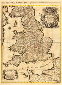
169317484Paris: H. Jaillot 1693. Other. In very good condition. 757 by 582mm 29¾ by 23 inches. 757 by 582mm 29¾ by 23 inches. Copper-engraving handcolored in outline when published. Minor offsetting of the old outline colors to the paper. Printed around 1693 by Hubert Jaillot in Paris printed from two plates and published in his great atlas the Atlas Noveau.. Large and decorative map of England by the French cartographer Nicolaus Sanson and Hubert Jaillot. Published in the 'Atlas Noveau.' this atlas was a masterpiece in the French cartography in the 17th century. The atlas was specially designed for Louis XIV and due of the very large size of the plates most maps were printed from two plates it took Hubert Jaillot over 12 years to complete the 'Atlas Noveau.'. England is very detailled shown on the map as well the various counties are shown in engraved territory borders. The maps are rich in detail with many cities and place names rivers mountains castles etc. The map is ornated with a very large fine allegoric title cartouche with coat of arms in the upper right corner as well a decorative cartouche with a milage scale in the lower left corner. H. Jaillot unknown
165461177<p>40.1 x 56 cm original outline hand-colour copper engraving. EXTREMELY RARE map probably from ''Cartes generales de toutes les parties du monde' . Condition: with folds as issued with water stains and professionally repaired tear on lower left margin not affecting plate. Reference: Quirino p. 83; BMC Printed Maps XII col.867; Cat.Nat.mar.Mus.271 map 15; Nordenskiöld 275 vol.1 map 17; pastoureau Sanson V map 12.</p> Pierre Mariette, Paris.
169231056(Paris/Amsterdam), Hubert Jaillot, 1692. 58,5x88,5 cm. Kobberstukket Danmarkskort med Nordtyskland, Skåne, Halland og Blekinge i fuld håndkolorering med 2 store barok-kartoucher (titelkartouche & målestokskartouche). Lille revnedannelse i foldningen øverst og nederst. nederste bladkant repareret uden tab. På kraftigt papir sammensat af to pladetryk.
169231056Paris/Amsterdam Hubert Jaillot 1692. 585x885 cm. Kobberstukket Danmarkskort med Nordtyskland Skåne Halland og Blekinge i fuld håndkolorering med 2 store barok-kartoucher titelkartouche & målestokskartouche. Lille revnedannelse i foldningen øverst og nederst. nederste bladkant repareret uden tab. På kraftigt papir sammensat af to pladetryk. <br/><br/><em>Dette store Jaillot-kort er det største af det 17.århundredes Danmarkskort udfærdiget med forlæg i Sanson's Danmarkskort i mindre format. "Jaillot-typen" er kendt for den pukkelryggede fremstilling af Jylland. - Bramsen gengiver trykket fra 1674 og omtaler p. 114 at kartouchen med en kvinde på en sky først forekommer 1696. Her foreligger både kvinden skyen og dateringen 1692. </em> unknown
1696M8798Paris : Pierre Mariette c. 1696. Very Good. Notes: Fine detailed map of the straight of the Bosphorus and the city of Constantinople. Size : 405x528 mm 15.94x20.79 Inches Coloring: Hand Colored Category: Maps Asia Near East Turkey; Pierre Mariette unknown
17757London: J. Hooke at the Flower-de-Luce in Fleet Street & 2 others 1720. title continued: Being a Collection of Letters That passed between an English Lady and an English Gentleman in France who took an affection to each other by reading accidentally one another's Occasional Compositions both in Prose and Verse.First edtion First Issue. Engraved head and tail pieces. 8vo 7 3/4 x 4 3/4 inches pages: xxiv Dedication to Sir Richard Steele:xxv-lxviii A Critical Essay.by way of Letter from Mr. John Porter.:131 contemporary full panelled tan calf 20th Century very neat reback in tan calf with lettering piece. Contemporary signature 'Nichs Marshall' on front fly. Anon. Rare. Clio was Fowke's "literary" name for herself while Strephon was the poet and journalist William Bond. The work is an exchange of letters in verse and prose. Fowke's poetry sometimes expresses her frustration with the conventional expectations of a woman's place in 18th Century society; her former friend and fellow-writer Eliza Haywood attacked Fowke in a scandalous account of her relationships which affected the poet's reputation badly. London: J. Hooke, at the Flower-de-Luce, in Fleet Street [& 2 others], 1720. unknown
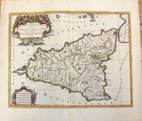
1696M10189Amsterdam: Covens & Mortier c.1696. Very Good. Size : 420x540 mm 16.54x21.26 Inches Coloring: Hand Colored Category: Maps Mediterranean Islands; Covens & Mortier unknown
1692001000Paris: Chez H. Jaillot 1692. First edition thus. Map. Good/No jacket as issued. Large double page copper engraved map 23" x 34 1/2". Contains wide margins and a decorative cartouche. Hand-colored boundaries and cartouche. General age-toning with minor browning. Nicely framed in modern rope effected matte gold frame 32" x 42" with gilt bordered white mat and acrylic glaze. A good copy of this scarce map. All text in French Printed just 9 years after the Ottomans besieged Vienna. Extra shipping may apply for foreign orders. Chez H. Jaillot unknown
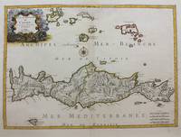
1658M9417Paris: Nicolas Sanson c.1658. Very Good upper fold area expertly repaired. Notes: A fine map of Crete from the mid 17th century. <br>The map also shows nearby islands such as Santorini Stampalia and Milo. The map has a decorative cartouche and details cities borders and geographical features. Size : 394x553 mm 15.51x21.77 Inches Coloring: Hand Colored Category: Maps Europe Greece Macedonia; Nicolas Sanson unknown
1659M4916Paris 1659. Very Good. Notes: Map of Baltic region of Estonia Latvia including Riga to Vilnius Wilna and parts of Lithuania. <br><br>Nicolas Sanson 1600–1667 was a renowned French cartographer termed by some as the "father of French cartography." His works are known for their incorporation of the most up to date information of the time and their clean modern style. Size : 410x535 mm 16.125x21 Inches Coloring: Original Outline Coloring Reference: Category: Maps Europe Estonia Latvia unknown
1669LBW-6487Paris, Pierre Mariette, 1669. 395 x 446 mm.