946 résultats
1666M1204Paris: Mariette Pierre 1666. Very Good. Size : 410x555 mm 16.125x21.875 Inches Coloring: Hand Colored Reference: Mojski Piotr Maria "Cartographia Rappersviliana Polonorum" page 388 number 32; Category: ; Maps Europe Poland Lithuania Mariette, Pierre unknown
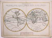
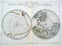
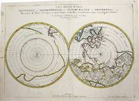
1657M954Paris 1657. Very Good; some occasional mild browning. Notes: 17th century French map of Arctic and Antarctic regions. It was published in Cartes générales de toutes les parties du monde. <br><br>Nicolas Sanson 1600–1667 was a renowned French cartographer termed by some as the "father of French cartography." His works are known for their incorporation of the most up to date information of the time and their clean modern style. Size : 390x537 mm 15.375x21.125 Inches Coloring: Hand Colored in outline Category: ; Maps Polar Arctic Regions; Maps Polar Antarctic Regions unknown
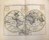
1657M8883Paris 1657 . Very Good. Notes: A handsome 17th century map of the known world typifying Sanson's scientific style of cartography. Embodying the most up to date information of the period Sanson's map depicts California as an island with Antarctica and Australia still largely unknown. A land bridge connects Asia to North America and touches Japan. A very accurate map for the period. Nicolas Sanson 1600–1667 was a French cartographer termed by some the creator of French geography in which he's been called the "father of French cartography." <br><br><br> Size : 380x537 mm 14.96x21.14 Inches Coloring: Original Hand Coloring Reference: Shirley R.W. World 400; Pastoureau M. Sanson V A 98. Category: Maps World; unknown
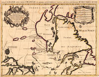
169317230Paris: Hubert Jaillot. 1693. Other. In excellent condition. Minor offsetting of the old outline colors to the paper. 465 by 610mm 18 by 24 inches. 465 by 610mm 18 by 24 inches. Copper Engraving color by Jaillot Alexis-Hubert & Sanson N published 1693 by Hubert Jaillot Paris. Image size: 465 by 610mm 18 by 24 inches. By Jaillot after Sanson a landmark of late 17th-century French cartography of North America. Alexis-Hubert Jaillot c.16321712 was one of the most important French cartographers and map publishers of the late 17th century. He collaborated with the pioneering geographer Nicolas Sanson 16001667 and his sons to produce finely engraved large-format maps of the world's regions publishing in Paris from 1670 onwards. Jaillot's maps are distinguished by their impressive scale rich baroque cartouches and the high quality of their engraving. His map of Canada and New France 1693 is a landmark document of 17th-century French geographical knowledge of North America reflecting decades of French colonial exploration and mission activity in the St. Lawrence and Great Lakes regions.Large and decorative map of Canada by the French cartographer Nicolaus Sanson and Hubert Jaillot. Published in the 'Atlas Noveau.' this atlas was a masterpiece in the French cartography in the 17th century. The atlas was specially designed for Louis XIV and due of the very large size of the plates most maps were printed from two plates it took Hubert Jaillot over 12 years to complete the 'Atlas Noveau.'. Canada is very detailled shown on the map as well Labrador Terra Neuf & Nouvelle France are shown in engraved territory borders. The map is rich in detail with many cities and place names rivers lakes mountains bays etc. In excellent condition. Minor offsetting of the old outline colors to the paper. Hubert Jaillot. unknown
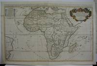
1719M5162Paris 1719. Excellent. Size : 580x890 mm 22.875x35 Inches Coloring: Original Outline Coloring Category: ; Maps Africa Continent unknown
140897aafA Amsterdam, chez P(ieter) Mortier et Compagnie: Avec Privilege, 1696-1708, Bildgröße - Karte 55 x 75 cm. (inkl. Wappen u. d. Titel über dem Rand 57x83 cm.), Carte géographique coloriée, français (1696-1708), publiée dans : Atlas Nouveau, Contenant toutes les Parties du Monde, ou sont exactement remarqués les Empires, Monarchies, Royaumes, Estats, Républiques & Peuples, entre 1696-1708. Unter Glas im Goldrahmen (92 x 66 cm).
2570Americas: Paris Par N Sanson . Chez Pierre Mariette. 1656-8. Copper engraved map of the Caribbean by Nichols sanson from his"Cartes Generales De Toutes Les Parties Du Monde". Original outline colour; verso blank. The map shows all the islands of the Caribbean with the southern tip of Florida and the coasts to the south. Decorative title cartouche . Good impression; slight dampstaining to edges far from plate ; small stain just below cartouche. Nicolas Sanson 1600-1667 is generally acknowledged as the founder of the great French school of geographers and cartographers that supplanted the Dutch as the leading European map-makers. His work was acclaimed for its geographical accuracy and high standard of engraving. As a consequence his many maps received a wide diffusion. His career marks the start of the process by which Paris superseded Amsterdam as the centre of European map production. Nicolas studied Ancient History as a young man and this awoke in him an interest in classical geography. His first map of ancient Gaul was made in 1618 when he was only 18. Sanson had three sons Nicolas 1626-1648 Guillaume d.1703 and Adrien d.1708 and a grandson Pierre Moullard-Sanson d.1730 all of whom were involved in the family's map-making activities. After Sanson settled in Paris his work came to the attention of King Louis XIII who eventually appointed Sanson Geographe Ordinaire du Roi one of whose duties was to tutor the King in geography. Sanson published some 300 maps in his career though his first most famous atlas the folio "Cartes Generales De Toutes Les Parties Du Monde" was not published until 1658. He would go into partnership with Pierre Mariette a publisher of prints. Sanson also prepared a series of quarto atlases of the different continents. These scarce atlases are more frequently encountered in the Dutch piracy engraved by Anthony d'Winter first published in 1683. The Sanson atlases are rarely found with a standard set of maps; the practice seems to have been that additional or revised plates would be inserted as available. After Sanson's death the business was continued by his two surviving sons and grandson in partnership with and later superseded by Alexis Hubert Jaillot. Credit must go Jaillot and Pierre Duval for re-engraving his maps many still unprinted at his death and re-publishing them in face of strong competition from the Dutch who continued to dominate the market until the end of the century. Americas Caribbean Antilles Lucayan Archipelago Paris Par N Sanson ... Chez Pierre Mariette. 1656-8 unknown
169490853Veuve de Jacques Langlois Veuve de R. Chevillon Jacques Langlois | Paris 1694 | 9.5 x 16.5 cm | Relié
19541440<p>Aerovoz revista mensual organo oficial de la federacion aerea nacional de cuba director calixto sanchez white 4 anos desde enero de 1954 hasta junio de 1957 director macario fernandez coleccion en 2 volumenes.en muy buen estadorevista ilustrada.es una revista muy rara sobre la aviacion cubana de la republica.con interesantes articulos y resenas historicas y de la actualidad.</p> Talleres editorial puga,guanabacoa hardcover
1696M10191Amsterdam: Covens & Mortier c.1696. Very Good. Size : 393x540 mm 15.47x21.26 Inches Coloring: Original Hand Coloring Category: Maps World; Covens & Mortier unknown
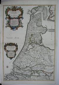
1674M1744Paris: Jaillot Hubert 1674. Very Good to Excellent. Size : 572x840 mm 22.5x33 Inches Coloring: Original Outline Coloring Category: ; Maps Europe Benelux Jaillot, Hubert unknown
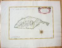
1658M7057Paris 1658. Very Good;. Notes: An early map of the Island of St. Christopher that includes a decorative compass rose in sea area and an ornamental title cartouche in top right decorated with scrolls ribbons and fruit. This is the first printed map of St. Kitts published in "Cartes Generales De Toutes Les Parties Du Monde."<br>With wide margins. Size : 314x429 mm 12.36x16.89 Inches Coloring: Original Outline Coloring cartouche and compass hand coloured Category: Maps West Indies Other Islands; unknown
16575033Paris 1657. Par N. Sanson d'Abbeville Geographe ordre du Roy. Spence 3017 lists a slightly different title but undoubtedly the same map. 53x38 cms. Period outline color central fold very good condition. A double hemisphere map to the North and South poles. The North pole is connected to Greenland and Spitzbergen but there is little other detailed coastline in the polar area. Europe Russia and Canada are delineated. The South pole is based on the great unknown Southland of Magellan. The tip of S. America is shown and a large land mass which encompasses the whole of the hemisphere but nothing else. unknown
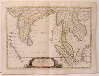
1654M2656Paris 1654. Excellent. Size : 385x530 mm 15.125x20.875 Inches Coloring: Original Hand Coloring Reference: Nebenzahl 3.9C Category: Maps Asia South East; Maps Asia Central India & Sri Lanka / Ceylon; unknown
04086London: S.W. Fores 1801. Three of George Moutard Woodward's Hand-Colored Prints from "Symptoms of the Shop"<br /> <br /> WOODWARD George Moutard artist SANSON Francis printmaker. Symptoms of the Shop. London: S.W. Fores 1801. <br /> <br /> First edition. Quarto 10 1/8 x 8 1/16 inches; 257 x 265 mm. Three of twelve hand colored 'Satirical' stipple engravings on wove paper drawn by Woodward and etched by Sanson numbers 7 8 and 10. Each with the plate number at the top right margin and with lithographed text at the top of the image. On each of the lower margins is "Pub. June 1st 1801 by S.W. Fores No.50 Piccadilly Prints and Drawings lent on the plan of a Library Folio's of Caricature lent out for the Evening." / Symptoms of the Shop" / "Drawn by G. Woodward Etchd by F. Sansom". Some light marginal soiling otherwise near fine.<br /> <br /> Plate #7. "After all there is nothing like the true old orthodox principles."<br /> Plate #8. "I have brought your Honor home your new suit."<br /> Plate #10. "Madam - I was once a Minister and used to negotiations."<br /> <br /> Very rare. According to OCLC there are only two complete set in libraries and institutions worldwide The Lewis Walpole Library CT. has a complete colored set Princeton NJ also has a complete set but does not mention 'colored'. Yale university has nine of the twelve colored plates missing numbers 1 7 & 8. Harvard MA has one plate.<br /> <br /> These two artists previously collaborated on Every Body in Town BC-28 Every Body Out of Town BC-29 and Pigmy Revels: All Alive in Lilliput BC-62 all published by Fores. Each plate depicts two persons engaged in humorous wordplay relating to the characteristics of a trade or calling. William Gordon. A catalogue of the Books Drawings Prints and Periodicals forming the William A. Gordon Library of British Caricature. <br /> <br /> The three images present here include:<br /> <br /> Plate 7. A man sitting in a wooden chair lifts his hand for emphasis and declares: "After all there is nothing like the true old orthodox principles." An obese clergyman in a padded armchair on the right responds: "Orthodox principles - ah my dear friend you put me in mind of old times - when I was but a simple vicar. How I used to charm my congregation - slim as a Bedles wand - & delicate as a new wash'd surplice - but since I have been raised to higher dignities I do nothing but remain in my chair; bulky & unweildy as a Folio Church Service. - oh how elegantly I used to manage my discourses - fifteen minutes to a point by the clock under the gallery - never exceeded - short praye - text - and devision - one - two - three & away - that was my method."<br /> <br /> Plate 8. A man with a parcel under his arm bows slightly and says: "I have brought your Honor home your new suit." A stout bespectacled lawyer replies: "Suit - ah - Mr. Buckram you did not know me when I practiced in the Courts - I could have shewn you suits that would have puzzled Judge Blackstone himself - none of your simple matters - brim full of Law as a brief bag - intricate as the Temple avenues -& long as Westminster Hall - Shy Clients sometimes - but it would not do with Paul Parchment - sure to have them on way or other. - Once in never out that was my motto."<br /> <br /> Plate 10. A former Minister holding his hat wearing a bag-wig and with his pocket filled with scrolls addresses a woman: "Madam - I was once a Minister and used to Negotiations I shall therefore be happy to treat with you on Matrimonial Speculation - I have ample credentials ready to ratify my powers and if you please will enter into preliminaries immediately - but let me have a sight glance at your project and be assured I will deliver to you my contre projet as soon as the definitive treaty is concluded and duly guaranteed." The woman who is short and plump looks aghast at the proposition. London: S.W. Fores, 1801 unknown
019030457XNew. Brand new and still unused unknown
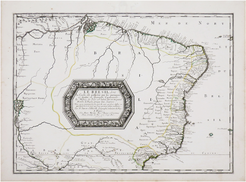
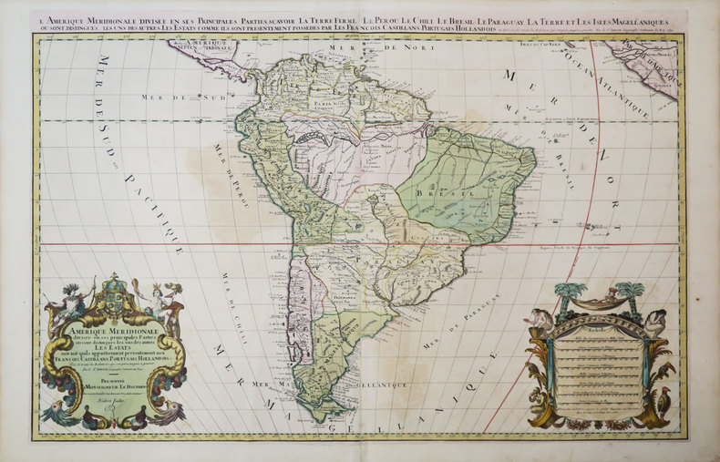
1658LBW-7142Paris, Pierre Mariette, 1656 [1658]. 394 x 542 mm.
16986703sans lieu [Amsterdam], sans nom [Pierre Mortier], sans date [circa 1698]. In-8 de [2]-30 pages, 25 cartes, 1 pl., 26 pages, couverture de papier marbré du temps (traces de plis au dos, coins un soupçon cornés).
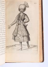
169490853Paris: Veuve de Jacques LangloisVeuve de R. ChevillonJacques Langlois 1694. Fine. Veuve de Jacques Langlois Veuve de R. Chevillon Jacques Langlois Paris 1694 9.5 x 16.5 cm Relié Rare illustrated first edition with 5 copper-engraved plates hors-texte including 2 folding plates cf. Barbier II 302. Schwab 517. Hage Chahine 4320. Wilson 200. Absent from Blackmer and Atabey. Our copy lacks the two dedication leaves to Rouillié often missing with repairs to the joints and one corner and a manuscript ex-libris on the title-page. Contemporary full mottled fawn calf spine with five raised bands gilt and decorated with gilt compartments and floral tools tan calf title-label gilt fillets to the edges partly faded speckled edges. Sanson a zealous apostolic missionary tireless traveller and accomplished diplomat arrived in Persia in 1683 learning Armenian Turkish and Persian while travelling through the kingdom in order to ""consoler les chrétiens qui y habitent"". He took an interest in everything ""murs situation antiquités"" of the regions he crossed and eventually gained access to the Palace ""qui ne sont accordées qu'aux grands seigneurs de Perse"" attending all audiences and taking part in every banquet.</p><p>He spent three years close to Soliman before returning to France bringing Louis XIV a personal message from the ""roi"" of Persia. Provenance: copy from the library of the literary critic Émile Faguet 18471916 with his vignette bookplate pasted to the inside board. Veuve de Jacques LangloisVeuve de R. ChevillonJacques Langlois hardcover
17053903Attractive original hand-color. Pin-head size stain just south of Mississippi delta please see image. An otherwise very nice clean copy. Paper size: 8 1/4 x 12 1/4 in 210 x 310 mm. Image size: 7 x 9.8 in 178 x 250 mm. ; All shipments through USPS insured Priority Mail.
169616269Paris: Alexis Hubert Jaillot 1696. Copper-engraved map with full original colour and gold embellishment in excellent condition. A stunning map of Normandy by Alexis Jaillot an exceptional example with gilt embellishments.<br/> <br/> One of the most important figures in French cartography Nicolas Sanson initiated the great school of French geographers. Born in Abbeville in 1600 Sanson established his first printing house in Paris in 1638. He soon became geographer to the king establishing himself as one of the most influential cartographers on the Continent. He was succeeded by his sons Adrien and Guillaume and by his son-in-law Pierre Duval who continued to publish a wealth of maps using Sanson's name. At the close of the seventeenth century Sanson's plates were purchased by the influential cartographer Alexis Hubert Jaillot who continued to publish his maps and atlases under Sanson's title. This stunning map of Normandy is based on Sanson's map published in 1650 but was redrawn and enlarged by Jaillot. It shows the provinces of Normandy as well as the northern tip of Brittany and part of the English Channel. Both Jersey and Guernsey are included as is Mont St. Michel off the coast of St. Malo. In keeping with all of Sanson's and Jaillot's superb maps forests rivers and towns are meticulously identified and named. The map includes an ornate cartouche in the upper section as well as a scale and key.<br/> <br/> Tooley Maps & Map-Makers pp. 40-41. Alexis Hubert Jaillot unknown
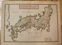
1656M8114Paris c.1656. Very Good. Size : 375x521 mm 14.76x20.51 Inches Coloring: Original Hand Coloring Category: Maps Asia Far East Japan & Korea; unknown
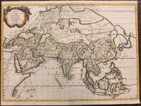
1667M8921Paris: Pierre Mariette 1667. Very Good. Notes: An important map of Asia by Nicolas Sanson showing the boundaries of the major historic civilizations of this continent. Examples include Assyria Syria Asia Minor Armenia Arabia Felix Libya Sarmatia Thracia Graecia Persia India China Ethiopia Scythia and Gangem. <br><br>Sanson 1600–1667 was a French cartographer termed by some as the "father of French cartography." His works are known for their incorporation of the most up to date information of the time and their clean modern style. Size : 402x470 mm 15.83x18.50 Inches Coloring: Original Hand Coloring Category: Maps Asia Continent; Pierre Mariette unknown
1375867A Paris: chez Paul Ledoux, Ponthieu, H. Langlois et Cie, 1827 in-8, frontispice (portrait lithographié d'Ali-Pacha), lxxvi (notes sur l'auteur)-xxxix (notice géographique sur l'Albanie et sur les moeurs de ses habitants)-(2) (rectifications)-415 pages. Demi basane brune à coins, dos lisse, pdt de cuir rouge, tranches jaunes, rel. légèrement frottée, qq rousseurs, sinon bel exemplaire. Ex-libris gravé armorié de T. de Valenzi. L'auteur Samson Cerfberr de Medelsheim (Strasbourg vers 1780 - Paris 1826), juif alsacien fut mercenaire dans l'armée ottomane après s'être converti à l'islam, puis en 1816-1819 servit dans l'armée du chef ottoman albanais Ali Pasha de Janina (Ioannina).
1691LBW-3673Paris, H. Jaillot, 1691. En deux feuilles jointes de 573 x 884 mm.