442 résultats
195779200MAUGARD 1957. Broché. Etat moyen. in-8. . MAUGARD unknown
16511111150111Paris 1651. Map. Very Good. Paris: Sanson Marriette 1651. 55.3 x 39.2 cm. Black-and-white copper plate engraved chart of primarily Eastern Europe with Turkey in the lower right panel. Modern hand-coloring applied to political boundaries. Title cartouche in upper right corner. Numbered 299 in upper right corner. Otherwise clean unmarked sheet with slight toning to edges. Vertical crease down center from atlas extraction. Minor chipping to edges. Colors are bright and vivid. Lines remain crisp and clear.<br><br>Nicolas Sanson was a Jesuit-trained French cartographer who attracted attention with a detailed accurate map of Gaul which he constructed when only 18. Active from 1627 Sanson issued his first map of importance the Postes de France which was published by Melchior Tavernier in 1632. After publishing several general atlases himself he became the associate of Pierre Mariette a publisher of prints.<br><br>The following map is one of the many prints Sanson collaborated with Mariette on. Unlike Jaillots future reproductions the original plates maintain a more modest decorative style with understated cartouches and less flourish or embellishment. Please feel free to view our photographs of this piece. Paris unknown
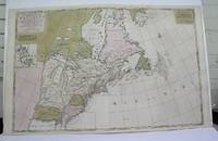
1698M3704Paris 1698. Excellent. Notes: Rather rare original coloured version of this map an important 17th century map of the Great Lakes and East coast with an inset map of Boston.<br><br>Cumming qtd in Arkway: "in spite of its scope and size it has a good deal of information for the Carolina Coast".<br><br>This map by Sanson first appeared in Mortier's sea atlas "Le Neptune Francois"; interestingly it is not generally found in Sanson or Jaillot atlases. Size : 650x924 mm 25.625x36.375 Inches Coloring: Original Hand Coloring Reference: Arkway 58:23 Category: Maps Canada East; Maps United States New England unknown
2004H-405-5902004. Paperback. Good. Former library book. Different cover. Different publisher. Ammareal gives back up to 15% of this item's net price to charity organizations. paperback
BN105020Softcover. La place verte - roman <br/><br/>La place verte - roman paperback
2005X-343-635STE ECRIVAINS 2005. Paperback. Good. Former library book. Different cover. Ammareal gives back up to 15% of this item's net price to charity organizations. STE ECRIVAINS paperback
BN105048STE ECRIVAINS. Softcover. Le rêve de lumière <br/><br/>Le rêve de lumière STE ECRIVAINS paperback
2005H-405-5922005. Paperback. Good. Former library book. Different cover. Different publisher. Ammareal gives back up to 15% of this item's net price to charity organizations. paperback
BN105021Softcover. Les yeux bleus - la non-voyance vous écrit <br/><br/>Les yeux bleus - la non-voyance vous écrit paperback
PR120639Map of the States of Savoy Piedmont and Nice. Titled above on the right: ""LES ESTATS DE SAVOYE PIEMONT et le COMTE de NICE Par le Sr: Sanson Geog Ordinaire du Roy.'With address of the publisher on the bottom right: 'a Amsterdam chez Pierre Schenk avec Privilege de .'.On the bottom left the various scales. Hand colored etching and engraving on laid paper; plate mark: 577 x 485 mm total: 625 x 531 mm; besides some smudges along the margins and a folding crease at center in very good condition. unknown
1678200041AG1678. Paris Sanson d'Abbeville 1678. Original hand-coloured engraving. Plate Size: 53.6 cm x 41.7 cm. Sheet Size: 61.8 cm x 46.5 cm. Original map. In very good condition. Faint signs of browning to map. Minor paper imperfections to the outer margins. Small stain to map near centre-fold. A richly detailed map showing the northern part of Portugal. Relief on map depicted pictorially and border inlaid with longitudinal and latitudinal details The map is dominated by three rivers: the Tajo Tagus in the south the Douro and the Minho further north. The Spanish kingdom and regions such as Leon are included and the great city of Salamanca can be seen. The lower part of the map runs out before the Tagus estuary empties into the Atlantic at Lisbon. The ornamental title cartouche is in the lower right corner of the map. Off the coast is a large warship flying the coat-of-arms Kingdom of Portugal and the Algarves. The sails of the boat carry Latin text commemorates the commercial and maritime exploits of King John IV in Africa Arabia Ethiopia Persia India and Brazil. Nicolas Sanson 20 December 1600 7 July 1667 was a French cartographer termed by some the creator of French geography in which he's been called the "father of French cartography." The French school of Geography was unprecedented in its attention to precision and scientific detail and discarded much of the decorative embellishments of previous maps as irrelevant. From Sanson's time in the second half of the seventeenth century until the latter part of the eighteenth century French geographical conceptions were more influential than those put forward by any other nation. He was tutor to Louis XIII and Louis XIV. Sanson published over 300 maps. In 1692 Hubert Jaillot collected Sanson's maps in an Atlas nouveau. Wikipedia unknown
1824620C22Paris : Bechet Jeune 1824. Cloth. Very Good. 8.5" by 5.5". None. An interesting volume written by three notable French surgeons exploring medical procedures and knowledge of the early nineteenth century. Volume IV only. Lacking volumes I II and III. New edition second edition. Revised and expanded this work discusses new surgical practises surgical dressings and operations of the early 19th century. Written in the original French. With the binder label to the tail of the front pastedown of C. Cooper & Co Ltd. Written by three medical professionals R. B. Sabatier L. J. Sanson and L. J. Begin each of whom were highly regarded medical professionals and surgeons. Ink inscription to the reverse of the title page which reads 'Birmingham Library 14 Days Forfeiture 2d per day over.' In a full cloth binding. Externally generally smart. Light rubbing to the head and tail of the spine resulting in a small amount of fraying. Large crack to the front joint with patches of rubbing to the rear joint. Patches of rubbing also to the extremities. Small white flecks spots to the tail of the front board perhaps paint. Light offsetting to the front and rear endpapers with a small binders label to the tail of the front pastedown. Internally firmly bound. Pages are generally clean with the odd spot and handling mark heavier to the title page. Small amount of loss to the tail of the half-title page. Ink inscription to the reverse of the title page. Very Good Bechet Jeune hardcover
2-24828Bruxelles Librairie Médicale de J.-B. Tircher 1834 due volumi in-8vo cartonato coevo pp. VIII-562 556 due frontespizi con incisione zilografica con motto ciascno con timbretto in ceralacca con le iniziali V.C. Piccolo strappo al dorso del primo volume. unknown
18335778GB1833. Dritte Ausgabe. 5 Bde. Paris J.-B. Baillière 1833. XI 731 S. mit 1 gefalteten Tabelle - 2 Bl. 672 S. - 2 Bl. 621 S. - 2 Bl. 715 S. - 2 Bl. 832 S. Halblederbände der Zeit mit goldgeprägtem Rückentitel stärker berieben vorderes Außengelenk bei Bd. 1 angeplatzt. Schnitt staubig Vorsätze etwas leimschattig. Durchgehend mäßig stockfleckig mit stellenweise stärker braunfleckigen Seiten. Vorsätze bzw. Schmutztitel mit Besitzvermerken von alter Hand und geprägtes Wachssiegel auf Titel bei Bd. 1 und 4 entfernt. unknown
182811433MADRID: Imprenta de Verges 1828. Primera edición.- 4º.- Plena pasta española doble tejuelo y dorados en el lomo.- 5 tomos.- I: VIII.- 479 páginas.- II: 392 páginas.- 1 hoja de Advertencia.- III: 402 páginas.- 1 hoja Erratas.- IV: 372 páginas.- V: 396 páginas.- 2 hojas Erratas. . Palau 271872 Imprenta de Verges hardcover
1832104565Imprenta De Repulles. Very Good. 1832. Second Edition. Hardcover. Leatherbound. 1832. Some wear to the bindings. 5 volume set complete. Spanish language. Madrid Imprenta de Repulles. Marbled endpapers. Second Edition. ; 8vo 8" - 9" tall . Imprenta De Repulles hardcover
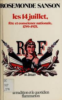
1976I-352-508Flammarion 1976. Paperback. Good. Edition 1976. Ammareal gives back up to 15% of this item's net price to charity organizations. Flammarion paperback
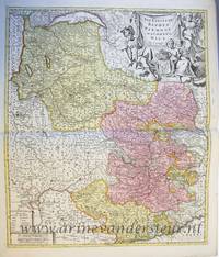
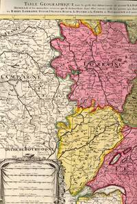
1700BB614331700. unknown. gebraucht gut gefaltete Landkarte mit Mittelfalz Papier altersbedingt etwas fleckig und gebräunt sonst GUTES EXEMPLAR. 442 x 575 cm. Blatt: 535 x 605 cm. l'Archevesche et l'Elctorat de Mayence et le Palatinat du Rhein Lorraine Suisse l'Alsace Sueve la Duche et la Comte de Bourgogne et d'autres Provinces voisines de France et Italie. Altkolorierter Kupferstich um 1700 Für Ihre Zufriedenheit versenden wir mit DHL und ausschließlich mit Trackingcode für eine sichere Sendungsverfolgung! Weitere Angebote unter antiquariat-kastanienhof unknown
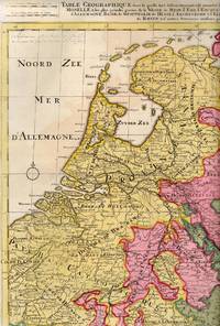
1710BB614341710. unknown. gebraucht gut gefaltete Landkarte mit Mittelfalz Papier altersbedingt etwas fleckig und gebräunt sonst GUTES EXEMPLAR. 445 x 575 cm. du Rhein Meuse Moselle et les plus grandes parties de le Weser le Mein l'Ems l'Escault l'Issel et les autres rivieres qui fe dechargent dans elles comme aussi les Provinces d'Allemagne Basse de Westphalie de Hesse l'Archeveche et l'Elctorat de Cologne et de Treves avec les parties de Majence et le Palatinat du Rhein et d'autres Provinces voisines. Altkolorierter Kupferstich um 1710 Blatt: 535 x 605 cm Für Ihre Zufriedenheit versenden wir mit DHL und ausschließlich mit Trackingcode für eine sichere Sendungsverfolgung! Weitere Angebote unter antiquariat-kastanienhof unknown
1720M8856Amsterdam: Pierre Mortier 1720. Very Good. Notes: A fine large scale map of Mediterranean Sea Italy Greece Eastern Europe Turkey. The map depicts the Ottoman Empire in the mid to late seventeenth century. Size : 530x864 mm 20.87x34.02 Inches Coloring: Original Hand Coloring Category: Maps Europe Balkans; Maps Mediterranean Sea; Maps Europe Italy; Maps Europe Greece Macedonia; Maps Asia Near East Turkey; Pierre Mortier unknown
1760M7988Paris: Sr. Delamarche c.1760. Very Good. Notes: Engraved by Delahaye. Large scale attractive map of France. Size : 493x668 mm 19.41x26.30 Inches Coloring: Original Hand Coloring Category: Maps Europe France; Sr. Delamarche unknown
1700M7994Paris c. 1700. Very Good. Notes: Engraved by Cordier.<br>A map of Central Germany. Frankfurt appears at the south-center of the map. Size : 457x648 mm 17.99x25.51 Inches Coloring: Original Hand Coloring Category: Maps Europe Germany; unknown
1700M7991Paris: S. Jallot c. 1700. Very Good. Notes: Map of Northern Germany Size : 650x460 mm 25.59x18.11 Inches Coloring: Original Hand Coloring Category: Maps Europe Germany; S. Jallot unknown
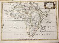
1650M6678Paris: Pierre Mariette c. 1650. Very Good;. Notes: Title cartouche bordered by two outward-facing birds of prey.<br><br>Norwich writes: "This is an early Sanson map. An odd feature is the name Barditus Mons given to a long chain of mountains running continuously from somewhere in Angolato Algoa Bay. No place names appear even on the coast of the southern part of the continent which is labelled 'Agi Symba' a name usually referring to the northern African region and inhabitants are 'Anthropophagi Aethiopes' or cannibals." Size : 396x553 mm 15.59x21.77 Inches Coloring: Hand Colored Reference: Norwich's Map 35. Category: Maps Africa Continent; Pierre Mariette unknown
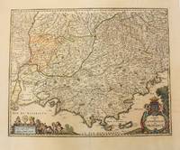
1656M6320Paris 1656. Very Good. Notes: This map shows the southern coast of France. Size : 425x535 mm 16.75x21 Inches Coloring: Original Hand Coloring Category: Maps Europe France unknown