442 résultats
167638217Paris: Sanson 1676. AN ATTRACTIVE MAP OF SPAIN AND PORTUGAL. 18 x 25 cm plate 23.5 x 32 cm sheet. FULLY COLORED by a later hand. Printed on fine laid paper. Reverse blank. A fine impression. A PRISTINE EXAMPLE with the paper FINE AND BRIGHT. Very scarce in such fine condition. <br/><br/> Sanson unknown
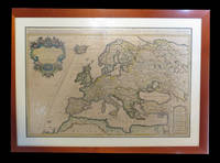
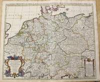
1696M10211Amsterdam: Covens & Mortier c.1696. Very Good. Size : 510x605 mm 20.08x23.82 Inches Coloring: Original Outline Coloring Category: Maps Europe Germany; Covens & Mortier unknown
165214178Paris: Sanson 1652. Double hemisphere world map showing the rivers and water bodies of the world. Original outline color. 20 3/4 x 15 3/4". Depicts Australia prior to Tasman's discoveries and labels North Australia "Beach" according to Marco Polo and California as an island. References: Shirley R.W. World 394. Sanson unknown
1654M5952Paris 1654. Very Good some mild discoloration along the margins. Size : 350x555 mm 13.75x21.875 Inches Coloring: Original Outline Coloring Reference: Gole 16; Nebenzahl 3.9B Category: Maps Asia South East Thailand Laos Vietnam Cambodia & Burma / Myanmar; Maps Asia Central India & Sri Lanka / Ceylon; unknown
1665M5118Paris 1665. Very Good central fold reinfrced. Notes: There is a water mark on the right hand portion of the map. Size : 435x540 mm 17.125x21.25 Inches Coloring: Original Outline Coloring Category: ; Maps Europe Italy unknown
6m5023H. Jaillot Paris 1696. Grenzkolorierte Kupferkarte gerahmt ca. 56 : 65 cm gebräunt. unknown
1690M10380Paris: H. Jaillot c.1690. Very Good backed on acid free tissue paper for long term preservation. Notes: Large and detailed map of France with a large decorative cartouche in the lower left two sheets joined. Size : 565x896 mm 22.24x35.28 Inches Coloring: Original Outline Coloring Category: Maps Europe France; H. Jaillot unknown
a8664Le Cercle de Westphalie. 25x38 inches. A double panel map profesionally joined together at seam. Colored in outline. Highly detailed. VG. . unknown
1273629809.Gpaperback. Good. Access codes and supplements are not guaranteed with used items. May be an ex-library book. paperback
1655M5583Paris 1655. Very Good. Size : 385x535 mm 15.125x21 Inches Coloring: Hand Colored Category: Maps Africa North unknown
1666M1204Paris: Mariette Pierre 1666. Very Good. Size : 410x555 mm 16.125x21.875 Inches Coloring: Hand Colored Reference: Mojski Piotr Maria "Cartographia Rappersviliana Polonorum" page 388 number 32; Category: ; Maps Europe Poland Lithuania Mariette, Pierre unknown
1665M589Paris: Mariette Pierre 1665. Excellent. Size : 410x560 mm 16.125x22 Inches Coloring: Hand Colored Reference: Mojski Piotr Maria "Cartographia Rappersviliana Polonorum" page 387 number 31; Category: ; Maps Europe Poland Lithuania Mariette, Pierre unknown
0428634230.Ghardcover. Good. Access codes and supplements are not guaranteed with used items. May be an ex-library book. hardcover
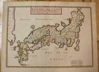
1656M8114Paris c.1656. Very Good. Size : 375x521 mm 14.76x20.51 Inches Coloring: Original Hand Coloring Category: Maps Asia Far East Japan & Korea; unknown
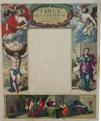
1650M2494Paris 1650. Very Good; light age toning; some browning on lower half of the map. Size : 547x433 mm 21.5x17 Inches Coloring: Original Hand Coloring Category: ; Maps Misc Curiosities Title Pages Games etc. unknown
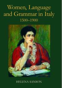
ria9780197264836_inpHardcover. New. New Book; Fast Shipping from UK; Not signed; Not First Edition; In the sixteenth century Italian was a literary language not accessible to the less educated among them women who would instead speak a local dialect. Little attention has been paid to women's linguistic education but this study show hardcover
174238209Amsterdam: Pierre Mortier 1742. A BEAUTIFUL HAND-COLORED MAP OF WESTERN LANGUEDOC and areas to the west and north. 60 x 45.5 cm plate 62 x 52 cm sheet. The areas described in the title are FULLY COLORED BY A CONTEMPORARY HAND. Printed on fine thick laid paper. Reverse blank. A fine impression. A PRISTINE EXAMPLE with the paper FINE AND BRIGHT. Very scarce in such fine condition. <br/><br/> Pierre Mortier unknown
8874Couverture rigide. Bon/1953. in-folio. Paris 1953 in-folio pet. XI 1bl 148pp 1 carte toile bleutée. Rel. de l'ép. Grande carte dépliante h.t. en couleur logée à l'intérieur du second plat représentant les précipitations annuelles de 1891 à 1930. Cachets gras d'une ancienne bibliothèque unknown
1690192941690. S.l. Alexis Hubert Jaillot 1680. Une grande carte 892 x 592 mm composÂŽe de deux feuillets contrecollÂŽs sous cadre moderne. Attractive 892 x 592 mm carte de la fin du XVIIÂme avec rehauts aquarellÂŽs du temps. Elle s'orne d'un important cartouche aux armes du Grand Dauphin Louis de France et s'agrÂŽmente en marge gauche de la figuration de vaisseaux ayant pris part ˆ un combat naval. Kupcik Cartes gÂŽographiques anciennes p. 159. Papier trÂs lÂŽgÂrement oxydÂŽ. PrÂŽsence de rares et claires rousseurs ou petites t‰ches. Deux plissures et une infime perforation en marge supÂŽrieure droite. Du reste belle condition. b42961 unknown
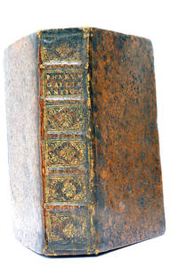
48297Paris Lutetiae Parisiorum Sumptibus et Impensis Autoris 1647. 3 ouvrages en 1 volume. 1. 2 feuillets blancs. 8 feuillets. 246 pages. 2. 13 feuillets. 283 pages. 3. 2 feuillets blancs. Page de titre. Carte gravée. 11 feuillets. 2 feuillets blancs. 15x9 Cm. Plein veau de l'époque. Dos à nerfs orné et doré un peu frotté. Pièce de titre doré. Charnières fendues. Petits accidents aux coiffes. Rousseurs et quelques taches. Les deux premiers ouvrages sont des critiques très rares du "Pharum Gallia Antiquae" de Philippe Labbé que Sanson rectifie sur plusieurs points. À la suite on trouve une courte description de la Judée accompagnée d'une belle carte dépliante. Bon exemplaire comportant l'exlibris gravé d'Henri Liébaux. Paris, Lutetiae Parisiorum Sumptibus et Impensis Autoris, 1647. unknown
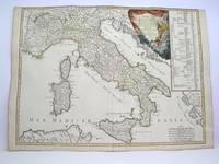
1778M3888Paris: Delamarche 1778. Very Good. Size : 515x685 mm 20.25x27 Inches Coloring: Original Outline Coloring Category: ; Maps Europe Italy Delamarche unknown
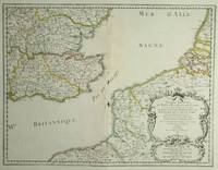
28812Paris: Sanson. 1654. 36.6 x 48 cm. Original outline colour. Double page map of the south east England shown with the adjacent coastline of France and Belgium. Title cartouche to lower right corner. Blank on verso. Wear to centrefold with some loss Paris: (Sanson). 1654 unknown
ria9780198754954_inpHardcover. New. New Book; Fast Shipping from UK; Not signed; Not First Edition; This volume offers a ground-breaking investigation into women's contribution to the description analysis and codification of languages across a wide range of linguistic and cultural traditions. The chapters explore a variety of sphere hardcover
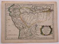
1657W2347Paris: Chez Sanson 1657. Image is 8 1/8 inches by 11 inches on a folded sheet measuring 9 inches by 12 13/16 inches. Original hand-colored copper-engraved map from Sanson's atlas of maps of the Americas: L'Amerique en Plusieurs Cartes. It is a map of the Viceroyalty of Peru that displays the Amazon River and its many tributaries. Nicolas Sanson 1600-1667 was the official geographer for the king of France. His map of Peru and the Amazon became the standard that was copied by almost all geographers/cartographers--even reproduced by Bion for his 1700 treatise on globes. Cintra and Oliveira argue that Sanson's map was a scientific one that holds up well even when compared to 21st century maps of the region. The map is in about very good condition: clean with bright original outline color; minimal foxing ; some edgewear and soiling in the margins. . First Edition. Single Sheet. Very Good-. 8 1/8 inches by 11 Inches. Map. Chez Sanson
92217Paris Sanson d'Abbeville Nicolas Ca 1660. In ivory mount. Mount size 16 x 13.5 inches 40.5cm x 35cm Engraved size 28cm x 22cm 11 x 8.5 inches In very good condition. Laid Down. Paris Sanson d'Abbeville, Nicolas Ca 1660 unknown