Sanson, HenriBiblio.com

442 résultats
1178214176.Gpaperback. Good. Access codes and supplements are not guaranteed with used items. May be an ex-library book. paperback
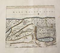
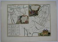
1710M10273Paris: Jean Covens & Corneille Mortier c.1710. Very Good. Size : 397x460 mm 15.63x18.11 Inches Coloring: Hand Colored Category: Maps Asia Middle East Holy Land & Palestine; Jean Covens & Corneille Mortier unknown
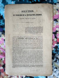
18501240111.28<p>Ledoyon Paris 1850. Good. Two ballooning pamphlets/flyers: Sanson's "Solution du probleme de la navigation aerienne" and: Lettre-Journel de Paris November 19 1870 with an account of a military balloon flight with a manuscript letter attached with stamp and corresponding verso text excised but with a "Par Ballon Monte" cancellation hand stamp and London-received postal hand stamp intact: an early airmail letter; from Wikipedia: "Historically balloons were used to transport mail from Paris during the Siege of Paris of 1870-1871. About 66 unguided mail balloons were released from Paris ." Few such letters have survived.</p> Ledoyon, Paris
170054377Nicolas Bion: L'Usage des Globes. Amsterdam: Francois Halma. 1700. An armillary sphere perused by three scholars at a table. Nicolas Sanson was founder of the French school of mapmakers at a time when the leadership in European cartography passed from the Low Countries to France. This map was published in Bion's treatise on globes. Nicolas Bion was a famous French mathematical and scientific instrument maker. Size: 125 x 175 mm. Copper engraving. Original colour. Mounted size: 295 x 360 mm. Fine condition. unknown
019030457XNew. Brand new and still unused unknown
04086London: S.W. Fores 1801. Three of George Moutard Woodward's Hand-Colored Prints from "Symptoms of the Shop"<br /> <br /> WOODWARD George Moutard artist SANSON Francis printmaker. Symptoms of the Shop. London: S.W. Fores 1801. <br /> <br /> First edition. Quarto 10 1/8 x 8 1/16 inches; 257 x 265 mm. Three of twelve hand colored 'Satirical' stipple engravings on wove paper drawn by Woodward and etched by Sanson numbers 7 8 and 10. Each with the plate number at the top right margin and with lithographed text at the top of the image. On each of the lower margins is "Pub. June 1st 1801 by S.W. Fores No.50 Piccadilly Prints and Drawings lent on the plan of a Library Folio's of Caricature lent out for the Evening." / Symptoms of the Shop" / "Drawn by G. Woodward Etchd by F. Sansom". Some light marginal soiling otherwise near fine.<br /> <br /> Plate #7. "After all there is nothing like the true old orthodox principles."<br /> Plate #8. "I have brought your Honor home your new suit."<br /> Plate #10. "Madam - I was once a Minister and used to negotiations."<br /> <br /> Very rare. According to OCLC there are only two complete set in libraries and institutions worldwide The Lewis Walpole Library CT. has a complete colored set Princeton NJ also has a complete set but does not mention 'colored'. Yale university has nine of the twelve colored plates missing numbers 1 7 & 8. Harvard MA has one plate.<br /> <br /> These two artists previously collaborated on Every Body in Town BC-28 Every Body Out of Town BC-29 and Pigmy Revels: All Alive in Lilliput BC-62 all published by Fores. Each plate depicts two persons engaged in humorous wordplay relating to the characteristics of a trade or calling. William Gordon. A catalogue of the Books Drawings Prints and Periodicals forming the William A. Gordon Library of British Caricature. <br /> <br /> The three images present here include:<br /> <br /> Plate 7. A man sitting in a wooden chair lifts his hand for emphasis and declares: "After all there is nothing like the true old orthodox principles." An obese clergyman in a padded armchair on the right responds: "Orthodox principles - ah my dear friend you put me in mind of old times - when I was but a simple vicar. How I used to charm my congregation - slim as a Bedles wand - & delicate as a new wash'd surplice - but since I have been raised to higher dignities I do nothing but remain in my chair; bulky & unweildy as a Folio Church Service. - oh how elegantly I used to manage my discourses - fifteen minutes to a point by the clock under the gallery - never exceeded - short praye - text - and devision - one - two - three & away - that was my method."<br /> <br /> Plate 8. A man with a parcel under his arm bows slightly and says: "I have brought your Honor home your new suit." A stout bespectacled lawyer replies: "Suit - ah - Mr. Buckram you did not know me when I practiced in the Courts - I could have shewn you suits that would have puzzled Judge Blackstone himself - none of your simple matters - brim full of Law as a brief bag - intricate as the Temple avenues -& long as Westminster Hall - Shy Clients sometimes - but it would not do with Paul Parchment - sure to have them on way or other. - Once in never out that was my motto."<br /> <br /> Plate 10. A former Minister holding his hat wearing a bag-wig and with his pocket filled with scrolls addresses a woman: "Madam - I was once a Minister and used to Negotiations I shall therefore be happy to treat with you on Matrimonial Speculation - I have ample credentials ready to ratify my powers and if you please will enter into preliminaries immediately - but let me have a sight glance at your project and be assured I will deliver to you my contre projet as soon as the definitive treaty is concluded and duly guaranteed." The woman who is short and plump looks aghast at the proposition. London: S.W. Fores, 1801 unknown
1650M2494Paris 1650. Very Good; light age toning; some browning on lower half of the map. Size : 547x433 mm 21.5x17 Inches Coloring: Original Hand Coloring Category: ; Maps Misc Curiosities Title Pages Games etc. unknown
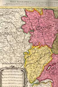
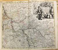
1700BB614331700. unknown. gebraucht gut gefaltete Landkarte mit Mittelfalz Papier altersbedingt etwas fleckig und gebräunt sonst GUTES EXEMPLAR. 442 x 575 cm. Blatt: 535 x 605 cm. l'Archevesche et l'Elctorat de Mayence et le Palatinat du Rhein Lorraine Suisse l'Alsace Sueve la Duche et la Comte de Bourgogne et d'autres Provinces voisines de France et Italie. Altkolorierter Kupferstich um 1700 Für Ihre Zufriedenheit versenden wir mit DHL und ausschließlich mit Trackingcode für eine sichere Sendungsverfolgung! Weitere Angebote unter antiquariat-kastanienhof unknown
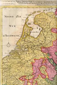
1710BB614341710. unknown. gebraucht gut gefaltete Landkarte mit Mittelfalz Papier altersbedingt etwas fleckig und gebräunt sonst GUTES EXEMPLAR. 445 x 575 cm. du Rhein Meuse Moselle et les plus grandes parties de le Weser le Mein l'Ems l'Escault l'Issel et les autres rivieres qui fe dechargent dans elles comme aussi les Provinces d'Allemagne Basse de Westphalie de Hesse l'Archeveche et l'Elctorat de Cologne et de Treves avec les parties de Majence et le Palatinat du Rhein et d'autres Provinces voisines. Altkolorierter Kupferstich um 1710 Blatt: 535 x 605 cm Für Ihre Zufriedenheit versenden wir mit DHL und ausschließlich mit Trackingcode für eine sichere Sendungsverfolgung! Weitere Angebote unter antiquariat-kastanienhof unknown
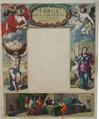
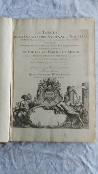
007346Paris Book. Good. Full-Leather. Elephant Folio - over 15 - 23" tall. 106 geographical tables. This copy has tables from various editions with printing dates from 1663 to 1741. The majority of tables date from 1663-1698. Most are in French but many also in Latin. The plates show different versions of the geographical tables. Please inquire for more details. The majority of tables are 20 inches some tables are 16 inches and are pasted on blank pages. The leather binding is worn at the top and bottom of spine and on corners and edges. Hardcover
1690M7990Paris: H. Jaillot c.1690. Very Good with some minor discoloration. Notes: Map of North-Central France Size : 460x610 mm 18.11x24.02 Inches Coloring: Original Hand Coloring Category: Maps Europe France; H. Jaillot unknown
ria9783847270140_inpHardcover. New. New Book; Fast Shipping from UK; Not signed; Not First Edition; N/A hardcover
3842419929.Gpaperback. Good. Access codes and supplements are not guaranteed with used items. May be an ex-library book. paperback
3847270141.Ghardcover. Good. Access codes and supplements are not guaranteed with used items. May be an ex-library book. hardcover
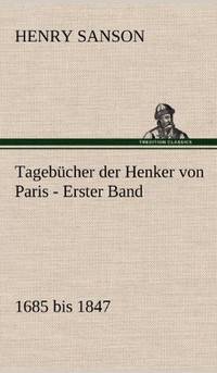
1983BN255751München : Beck Verlag 1983. 1983. Tagebücher der Henker von Paris : 1685 - 1847. - 2 Bände komplett Hrsg. von Eberhard Wesemann u. Knut-Hannes Wettig / Bibliothek des 18. Jahrhunderts <br/><br/>Tagebücher der Henker von Paris : 1685 - 1847. - 2 Bände komplett Hrsg. von Eberhard Wesemann u. Knut-Hannes Wettig / Bibliothek des 18. Jahrhunderts Henri Sanson München : Beck Verlag unknown
ria9783861957874_inpPaperback. New. New Book; Fast Shipping from UK; Not signed; Not First Edition; N/A paperback
18300024like new. unknown
198512442Leipzig 1985. Guter Zustand 2 Bde. Kiepenheuer 8°. Ln. goldgepr. Rechtsgeschichte unknown
3861957884.Gpaperback. Good. Access codes and supplements are not guaranteed with used items. May be an ex-library book. paperback
3861957876.Gpaperback. Good. Access codes and supplements are not guaranteed with used items. May be an ex-library book. paperback
1708M10193Amsterdam: Pierre Mortier c.1708. Very Good. Notes: "Theatre de la Guerre" Theater of War maps covering the battles raging in Europe and the Americas during the Spanish War of Succession 1701-1713 and the Northern War 1700-1721. The atlas maps are large folio size with most maps made of two sheets and many maps combining 4 or 6 sheets those also issued as wall maps separately. The atlas is most impressive for its large size and number of maps as well as being up to date for its time. <br><br> Size : 517x585 mm 20.35x23.03 Inches Coloring: Original Outline Coloring Category: Maps Europe Germany; Pierre Mortier unknown
1780M5122Paris 1780. Excellent. Size : 430x565 mm 16.875x22.25 Inches Coloring: Original Outline Coloring Category: ; Maps Asia Middle East Holy Land & Palestine unknown
73602Paris Pierrr Mariette 1656/ca. 1950. 13 x 17.5 cm 26 x 30 cm Rahmen vergoldet unter Passepartout Min. gebrauchspurig sonst tadell. Handkolorierte Faksimile. - Nicolas Sanson der Ältere auch: Nicolas Sanson d’Abbeville 1600 in Abbeville Frankreich- 1667 in Paris französischer Kartograph. Er gilt als der Vater der Geographie in Frankreich.In den Jahren 1618 bis 1667 schuf Sanson etwa 300 einzelne Karten sowie Atlanten und illustrierte Texte. Er wurde zum Geographe Ordinaire du Roy königlicher Kartenmacher ernannt und unterrichtete die Könige Ludwig XIII. und Ludwig XIV. in Geographie. 010 Paris, Pierrr Mariette, 1656/ca. 1950 unknown
GTC3777Texas Parks and Wildlife Press. Signed by both Sanson and Meinzer 1st ed.; fine condition DJ fine condition. Texas Parks and Wildlife Press unknown
3245Americas: Amsterdam Francois Halma 1705. Copper engraved map of Caribbean by N. Sanson from Halma's Algemeene Werelde Beschryving Vol. 3 Black and white; title in Dutch; verso blank; strapwork title cartouche. The map shows the islands of the Caribbean with the tip of Florida to the North and the coast line of Honduras and Venezuela to the South This map appeared in Algemeene Weereld-Beschryving nae de Rechte Verdeeling der Landschappen Plaetsen Zeeën Rivieren &c. Geographisch Politisch Historisch Chronologisch en Genealogisch a Dutch edition of A. Phérotée de la Croix's Nouvelle Methode Pour Apprendre Facilement la Geographie Universelle which first appeared in 1690. Dark impression. Upper margin short cut to plate mark ; extra folds to fit in binding; light dampstaining to lower margin just entering plate. Nicolas Sanson d'Abbeville.1600-67 ' father of the French cartography' and founder of the Sanson firm. Atlas ' Cartes générales de toutes les parties du Monde' 1658-70 and a pocket atlas in 4 parts 1652-1705. Sanson's small maps from A. Phérotée de la Croix's Nouvelle Methode Pour Apprendre Facilement la Geographie Universelle. first published in 1652 and engraved by A. Peyrounin were copied several times by various map publishers. Johann David Zunners made copies of Sanson's maps for his German translation of Die Gantze Erd-Kugel in 1679. Johannes Ribbius and Simon de Vries published copies in 1682 and 1683 with new maps engraved by Antoine d'Winter. The plates were later sold to Francois Halma who used them in 1699 and then again in 1705 with the titles re-engraved in Dutch. François Halma 1653 - 1722 Dutch publisher/printer; dealer/auction house. Cartographer and publisher of maps active in Utrecht Amsterdam Franeker and Leeuwarden. Published 'Description de l'Univers' 1700; 'Algemene Wereldtbescrijving' 1705; 'Corpus Inscriptionum' 1707 and 'Lexicon Philosophicum' 1713. Keoman: Hal 1; Phillips 528. Americas Caribbean Antilles Bahamas Cuba Amsterdam Francois Halma 1705 unknown