Sanson, NicolasBiblio.com

442 résultats
2570Americas: Paris Par N Sanson . Chez Pierre Mariette. 1656-8. Copper engraved map of the Caribbean by Nichols sanson from his"Cartes Generales De Toutes Les Parties Du Monde". Original outline colour; verso blank. The map shows all the islands of the Caribbean with the southern tip of Florida and the coasts to the south. Decorative title cartouche . Good impression; slight dampstaining to edges far from plate ; small stain just below cartouche. Nicolas Sanson 1600-1667 is generally acknowledged as the founder of the great French school of geographers and cartographers that supplanted the Dutch as the leading European map-makers. His work was acclaimed for its geographical accuracy and high standard of engraving. As a consequence his many maps received a wide diffusion. His career marks the start of the process by which Paris superseded Amsterdam as the centre of European map production. Nicolas studied Ancient History as a young man and this awoke in him an interest in classical geography. His first map of ancient Gaul was made in 1618 when he was only 18. Sanson had three sons Nicolas 1626-1648 Guillaume d.1703 and Adrien d.1708 and a grandson Pierre Moullard-Sanson d.1730 all of whom were involved in the family's map-making activities. After Sanson settled in Paris his work came to the attention of King Louis XIII who eventually appointed Sanson Geographe Ordinaire du Roi one of whose duties was to tutor the King in geography. Sanson published some 300 maps in his career though his first most famous atlas the folio "Cartes Generales De Toutes Les Parties Du Monde" was not published until 1658. He would go into partnership with Pierre Mariette a publisher of prints. Sanson also prepared a series of quarto atlases of the different continents. These scarce atlases are more frequently encountered in the Dutch piracy engraved by Anthony d'Winter first published in 1683. The Sanson atlases are rarely found with a standard set of maps; the practice seems to have been that additional or revised plates would be inserted as available. After Sanson's death the business was continued by his two surviving sons and grandson in partnership with and later superseded by Alexis Hubert Jaillot. Credit must go Jaillot and Pierre Duval for re-engraving his maps many still unprinted at his death and re-publishing them in face of strong competition from the Dutch who continued to dominate the market until the end of the century. Americas Caribbean Antilles Lucayan Archipelago Paris Par N Sanson ... Chez Pierre Mariette. 1656-8 unknown
17757London: J. Hooke at the Flower-de-Luce in Fleet Street & 2 others 1720. title continued: Being a Collection of Letters That passed between an English Lady and an English Gentleman in France who took an affection to each other by reading accidentally one another's Occasional Compositions both in Prose and Verse.First edtion First Issue. Engraved head and tail pieces. 8vo 7 3/4 x 4 3/4 inches pages: xxiv Dedication to Sir Richard Steele:xxv-lxviii A Critical Essay.by way of Letter from Mr. John Porter.:131 contemporary full panelled tan calf 20th Century very neat reback in tan calf with lettering piece. Contemporary signature 'Nichs Marshall' on front fly. Anon. Rare. Clio was Fowke's "literary" name for herself while Strephon was the poet and journalist William Bond. The work is an exchange of letters in verse and prose. Fowke's poetry sometimes expresses her frustration with the conventional expectations of a woman's place in 18th Century society; her former friend and fellow-writer Eliza Haywood attacked Fowke in a scandalous account of her relationships which affected the poet's reputation badly. London: J. Hooke, at the Flower-de-Luce, in Fleet Street [& 2 others], 1720. unknown
1954mon0000050986London 1954-01-01. Hardcover. Very Good. 2.5980 cent in x 18.3860 cent in x 13.1900 cent in. Complete with dust wrapper. Rare. London hardcover
2026x-0197609945Oxford University Press Inc 2026. Hardcover. New. 232 pages. 6.51x0.84x9.51 inches. Oxford University Press Inc hardcover
2000mon0004154885Oxford University Press 2/24/2026 12:00:01 A. hardcover. Like New. 0.9500 9.5000 6.5000. Oxford University Press hardcover
20192-169190225XIndependently published 2019. Paperback. New. 244 pages. 9.00x6.00x0.58 inches. Independently published paperback
20031-0972123342McD Century Pubns 2003. Paperback. New. 220 pages. 9.00x6.00x0.75 inches. McD Century Pubns paperback
ANAIS-0972123369New World Ayurveda. paperback. Good. 0x0x0. Buy with confidence. Excellent Customer Service & Return policy. New World Ayurveda paperback
0972123369.Gperfect. Good. Access codes and supplements are not guaranteed with used items. May be an ex-library book. unknown
2011SONG0972123369New World Ayurveda 2011-05-02. Revised. perfect. Used: Good. 0.00x0.00x0.00. Buy with confidence. Excellent Customer Service & Return policy. New World Ayurveda unknown
2003Q-0972123342MCD Century Publications 2003-06-01. Paperback. New. In shrink wrap. Looks like an interesting title! MCD Century Publications paperback
2003DADAX0972123342Brand: MCD Century Publications 2003-06-01. paperback. New. 1.00x10.00x9.00. Buy with confidence. Excellent Customer Service & Return policy. Brand: MCD Century Publications paperback
3248Americas: Amsterdam Francois Halma 1705. Copper engraved map of Colombia Venezuela and Panama by N. Sanson from Halma's Algemeene Werelde Beschryving Vol. 3 Black and white; title in Dutch; verso blank; strapwork title cartouche. The map shows the Isthmus of Panama and North Western South America including most of present day Columbia and part of Venezuela. Regional boundaries are shown along with missions towns major rivers and mountains. The mythical Lage de Parime with the fabled city of Manoa del Dorado is shown at bottom right. This map appeared in Algemeene Weereld-Beschryving nae de Rechte Verdeeling der Landschappen Plaetsen Zeeën Rivieren &c. Geographisch Politisch Historisch Chronologisch en Genealogisch a Dutch edition of A. Phérotée de la Croix's Nouvelle Methode Pour Apprendre Facilement la Geographie Universelle which first appeared in 1690. Dark impression. Nicolas Sanson d'Abbeville.1600-67 ' father of the French cartography' and founder of the Sanson firm. Atlas ' Cartes générales de toutes les parties du Monde' 1658-70 and a pocket atlas in 4 parts 1652-1705. Sanson's small maps from A. Phérotée de la Croix's Nouvelle Methode Pour Apprendre Facilement la Geographie Universelle. first published in 1652 and engraved by A. Peyrounin were copied several times by various map publishers. Johann David Zunners made copies of Sanson's maps for his German translation of Die Gantze Erd-Kugel in 1679. Johannes Ribbius and Simon de Vries published copies in 1682 and 1683 with new maps engraved by Antoine d'Winter. The plates were later sold to Francois Halma who used them in 1699 and then again in 1705 with the titles re-engraved in Dutch. François Halma 1653 - 1722 Dutch publisher/printer; dealer/auction house. Cartographer and publisher of maps active in Utrecht Amsterdam Franeker and Leeuwarden. Published 'Description de l'Univers' 1700; 'Algemene Wereldtbescrijving' 1705; 'Corpus Inscriptionum' 1707 and 'Lexicon Philosophicum' 1713. Keoman: Hal 1; Phillips 528. Americas South America Colombia Venezuela Amsterdam Francois Halma 1705 unknown
170058299Description de tout l'Univers 1700 published by F.Halma Amsterdam. Nicolas Sanson was founder of the French school of mapmakers at a time when the leadership in European cartography passed from the Low Countries to France. Copper engraving. Fine condition. Original colour with gold leaf highlights. Size: 17 x 18.5 cm. unknown
189370475Paris: Librairie Agricole De La Maison Rustique 1893. Quarter-leather. G/No Jacket as issued. 5 volumes published 1893-1901. Library markings; marbled boards; covers edge-rubbed with wear at corners; small scuff on front cover of volume 1; 401 386 366 376 350p illus indexes. NB: This is a heavy set which may incur a non-standard postage charge. Size: 12mo - over 6¾" - 7¾" tall <br/> <br/> Librairie Agricole De La Maison Rustique hardcover
6131577927.Gpaperback. Good. Access codes and supplements are not guaranteed with used items. May be an ex-library book. paperback
2011DADAX6131577927Omniscriptum 2011-06-22. paperback. New. 5.91x0.63x8.66. Buy with confidence. Excellent Customer Service & Return policy. Omniscriptum paperback
188834050Paris: Lib. agricole de la raison rustique 1888. Fine. Lib. agricole de la raison rustique Paris 1888-1893 11.50 x 18.50 cm 5 volumes reliés Third edition with some parts in first edition as revised and corrected. The first volume is part of the third printing of the third edition the following volumes are part of the second printing. Half red shagreen bindings spines with five raised bands set with gilt fillets and showing minor rubbing on some volumes spines decorated with gilt floral motifs three joints with slight lacks at heads blind fillet frames on red cardboard boards boards of first volume discolored contemporary bindings. Work illustrated with figures in the text. Some foxing. Rare. Lib. agricole de la raison rustique hardcover
2013728395.Gpaperback. Good. Access codes and supplements are not guaranteed with used items. May be an ex-library book. paperback
2013728387.Gpaperback. Good. Access codes and supplements are not guaranteed with used items. May be an ex-library book. paperback
2013728409.Gpaperback. Good. Access codes and supplements are not guaranteed with used items. May be an ex-library book. paperback
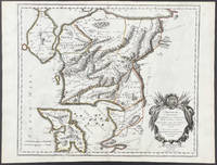
16709482<p>Scarce map engraving outlined in original color from Sanson's <em>Cartes Generales de Toutes les Parties du Monde. </em>The image measures approximately 19.75 x 16.5 in 50 x 42 cm; page measures 23.25 x 17.5 in 59 x 44.5 cm.</p> Pierre Mariette
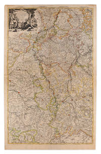
1710009148Amsterdam: Pierre Mortier 1710 Cooper engraving on two joined sheets measuring 59.5 x 95.5 cm with original outline coloring expertly cleaned and flattened. A good copy of a map of western Germany published in Amsterdam by Pierre Mortier to illustrate events of the War of the Spanish Succession. The first state with "2. Carte de la Meuse" added in manuscript. Pierre Mortier unknown
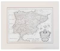
171013749441710. A map of Spain by French cartographer Nicolas Sanson 1600-1667 in a later Italian edition dated 1710. In Excellent condition with even age toning. Double matted. Mat: w 28.25 in. x h 23.5; Map: w 24.25 in. x h 19 in. Shelved at DuPont. 1374944. Arts & Antiques. unknown
2017x-0520295439Univ of California Pr 2017. Paperback. New. 273 pages. 6.00x9.00x0.50 inches. Univ of California Pr paperback