SansonBiblio.com

946 résultats
0428634230.Ghardcover. Good. Access codes and supplements are not guaranteed with used items. May be an ex-library book. hardcover
0282047352.Gpaperback. Good. Access codes and supplements are not guaranteed with used items. May be an ex-library book. paperback
193565715México: N. p. 1935. Small tear with 1/2 piece missing on near spine on front wrp and first 2 pages. illus. wrps. Poetry with themes of the workers/communist revolution in Mexico. Sansón was part of the post-Estridentist group in Mexico. Strong 3 color cover illustration by Lias Val . PRESENTATION COPY. N. p. unknown
1778M4133Paris: Fortin 1778. Very Good. Notes: Map showing Bohemia Silesia Moravia and Lusatia. Size : 420x545 mm 16.5x21.5 Inches Coloring: Hand Colored Category: Maps Europe Poland Lithuania Fortin unknown
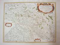
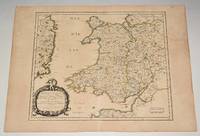
90477PARIS Chez l’Auteur 1658. Title cartouche to lower left corner. Blank on verso. In good condition. Some light tanning on edges with a few faint foxing marks. With original outline hand colouring. Engraved Size 17.5 x 23 inches Nicolas Sanson 1600-1667 sometimes called Nicolas Sanson d'Abbeville or Sanson d'Abbeville was the most important French cartographer of the 17th century. Tooley called Sanson "the founder of the French school of cartography." He began making maps in the late 1620s and in the 1630s he was working with Melchior Tavernier. Later Sanson worked in concert with the print publisher Pierre Mariette with whom he published his great atlas: Cartes générales de toutes les parties du monde 1658. After Sanson's death in 1667 his son Guillaume carried on the business in partnership with Alexis Hubert Jaillot. Guillaume established himself as a very important French mapmaker in his own right. PARIS Chez l’Auteur 1658 unknown
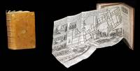
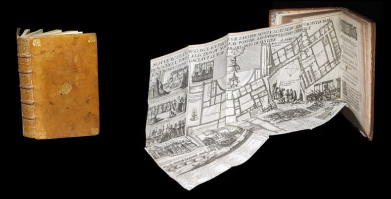
1643309321643. S.l. chez l'Autheur sic 1643 - A Paris de l'Imprimerie de Robert Mansion 1636 - A Paris chez Antoine de Sommaville 1655 - A Paris s.ÂŽ. 1604 pour le troisiÂme texte ; divisÂŽ en trois parties ˆ pagination sÂŽparÂŽe. 3 ouvrages le dernier composÂŽ de 3 parties reliÂŽs en un fort vol. au format in-12 173 x 112 mm de 1 f. bl. 3 ff. n.fol. et 106 pp. ; 1 f. bl. ; 4 ff. n.fol. et 111 pp. ; 3 ff. n.fol. et 50 pp. ; 3 ff. n.fol. et 63 pp. ; 72 pp. et 2 ff. n.fol. de PrivilÂge in fine. Reliure de l'ÂŽpoque de plein veau glacÂŽ blond larges fleurons angulaires et fleuron central dorÂŽs portÂŽs sur chacun des plats dos ˆ nerfs ornÂŽ de filets gras ˆ froid roulette dorÂŽe sur les nerfs caissons d'encadrement dorÂŽs filets verticaux dorÂŽs filets en pointillÂŽs dorÂŽs larges fleurons dorÂŽs semis de pointillÂŽs dorÂŽs piÂce de titre de maroquin fauve titre dorÂŽ palette dorÂŽe en tÂte et queue roulette dorÂŽe sur les coupes tranches mouchetÂŽes. Le prÂŽsent exemplaire renferme trois textes ; reliÂŽs en un volume. Le CÂŽrÂŽmonial de l'ÂŽlection des Papes closant le prÂŽsent volume est ici bien complet de ses 3 parties ainsi que de ses deux grandes planches dÂŽpliantes gravÂŽes. Les deux premiers ouvrages sont l'oeuvre de Nicolas Sanson d'Abbeville cÂŽlÂbre cartographe s'il en est. Coiffe infÂŽrieure arasÂŽe. Quelques t‰ches brunes sur les plats. Contre-gardes absentes. Quelques feuillets lÂŽgÂrement oxydÂŽs et rousseurs dans les corps d'ouvrages. Restauration ancienne au revers de chacun des planches. Du reste belle condition. Rare. b42961 unknown
164330932S.l., chez l'Autheur [sic], 1643 - A Paris, de l'Imprimerie de Robert Mansion, 1636 - A Paris, chez Antoine de Sommaville, 1655 - A Paris, s.é., 1604 (pour le troisième texte ; divisé en trois parties à pagination séparée). 3 ouvrages (le dernier composé de 3 parties) reliés en un fort vol. au format in-12 (173 x 112 mm) de 1 f. bl., 3 ff. n.fol. et 106 pp. ; 1 f. bl., ; 4 ff. n.fol. et 111 pp. ; 3 ff. n.fol. et 50 pp. ; 3 ff. n.fol. et 63 pp. ; 72 pp. et 2 ff. n.fol. de Privilège in fine. Reliure de l'époque de plein veau glacé blond, larges fleurons angulaires et fleuron central dorés portés sur chacun des plats, dos à nerfs orné de filets gras à froid, roulette dorée sur les nerfs, caissons d'encadrement dorés, filets verticaux dorés, filets en pointillés dorés, larges fleurons dorés, semis de pointillés dorés, pièce de titre de maroquin fauve, titre doré, palette dorée en tête et queue, roulette dorée sur les coupes, tranches mouchetées.
2016x-0520290852Univ of California Pr 2016. Paperback. New. 324 pages. 9.00x6.00x0.75 inches. Univ of California Pr paperback
0520290852.Gpaperback. Good. Access codes and supplements are not guaranteed with used items. May be an ex-library book. paperback
1652LBW041971652 192 x 243 mm.
FR17653Tampon bibliothèque franciscaine provinciale.
ROD0033102Xavier Mappus. 195ç. In-8. Broché. Bon état, Couv. convenable, Dos satisfaisant, Intérieur bon état. 213p;. . . . Classification Dewey : 265-Rites, cérémonies et sacrements
1960RO40183474Xavier Mappus. 1960. In-12. Broché. Bon état, Couv. légèrement passée, Dos satisfaisant, Intérieur frais. 213 pages. Etiquette de code sur le dos. Tampon de bibliothèque en page de garde.. . . . Classification Dewey : 265-Rites, cérémonies et sacrements
GF4737Lithographie format 37,5 x 25,5 cm marges comprises - Paris - imprimerie Lemercier - Vers 1880 -
16969749<p>Scarce original hand-colored engraving by Sanson published in Pierre Mortier's <em>Atlas Nouveau</em> or <em>Atlas Novum ad usum serenissimi</em>.</p><p>Image size is approximately 23 x 18.75 in 58.5 x 47.5 cm; page size is 24.75 x 21 in 63 x 53.5 cm.</p><p>Some minor staining and toning to edges not affecting the image.</p>
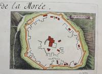
1690M9483Paris c.1690. Very Good. Notes: A charming map of Zarnata Greece during the late 17th century. Size : 103x152 mm 4.06x5.98 Inches Coloring: Hand Colored Category: Maps Europe Greece Macedonia; unknown
3252Americas: Amsterdam Francois Halma 1705. Copper engraved map of Peru by N. Sanson from Halma's Algemeene Werelde Beschryving Vol. 3 Black and white; title in Dutch; verso blank; strapwork title cartouche. The map shows the western part of the continent and the full course of the Amazon. The spurious Lac ou Mer de Parime is prominent as is the location of the mythical city Manoa el Dorado. This map appeared in Algemeene Weereld-Beschryving nae de Rechte Verdeeling der Landschappen Plaetsen Zeeën Rivieren &c. Geographisch Politisch Historisch Chronologisch en Genealogisch a Dutch edition of A. Phérotée de la Croix's Nouvelle Methode Pour Apprendre Facilement la Geographie Universelle which first appeared in 1690. Dark impression. Upper margin short cut to plate mark. Nicolas Sanson d'Abbeville.1600-67 ' father of the French cartography' and founder of the Sanson firm. Atlas ' Cartes générales de toutes les parties du Monde' 1658-70 and a pocket atlas in 4 parts 1652-1705. Sanson's small maps from A. Phérotée de la Croix's Nouvelle Methode Pour Apprendre Facilement la Geographie Universelle. first published in 1652 and engraved by A. Peyrounin were copied several times by various map publishers. Johann David Zunners made copies of Sanson's maps for his German translation of Die Gantze Erd-Kugel in 1679. Johannes Ribbius and Simon de Vries published copies in 1682 and 1683 with new maps engraved by Antoine d'Winter. The plates were later sold to Francois Halma who used them in 1699 and then again in 1705 with the titles re-engraved in Dutch. François Halma 1653 - 1722 Dutch publisher/printer; dealer/auction house. Cartographer and publisher of maps active in Utrecht Amsterdam Franeker and Leeuwarden. Published 'Description de l'Univers' 1700; 'Algemene Wereldtbescrijving' 1705; 'Corpus Inscriptionum' 1707 and 'Lexicon Philosophicum' 1713. Halma acquired many of the plates for Algemeene Weereld-Beschryving from Joannes Ribbius who had enlisted the services of engraver Antoine de Winter to make copies of the maps in Nicolas Sanson's quarto atlases of the four continents. De Winter made very few geographical changes and maintained the attribution to Sanson on the newly engraved plates. Halma supplemented the Sanson maps with about a dozen new maps engraved in the same style as Sanson's without any attribution on the maps as well as 23 panoramic views of famous cities around the world. Keoman: Hal 1; Phillips 528. Americas South America Peru Amsterdam Francois Halma 1705 unknown
184660753Nouvelle édition, augmentée d'une troisième partie inédite et précédée d'un avant-propos par de Pongerville, 1 vol. grand in-8 br., A. René et Cie, Paris, 1846, 320 pp. avec portrait en frontispice
200956863Nicolas Chaudun 2009 In-4 relié 25,2 cm sur 22,2. 191 pages. Bon état d’occasion.
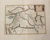
1710M10250Amsterdam: Jean Covens & Corneille Mortier c.1710. Very Good. Size : 370x493 mm 14.57x19.41 Inches Coloring: Original Hand Coloring Category: Maps Asia Middle East Holy Land & Palestine; Maps Asia Middle East Iran Iraq; Jean Covens & Corneille Mortier unknown
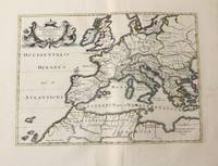
1710M10326Amsterdam: Jean Covens & Corneille Mortier c.1710. Very Good. Size : 375x525 mm 14.76x20.67 Inches Coloring: Original Hand Coloring Category: Maps Africa North; Maps Europe Continent; Maps Mediterranean Sea; Jean Covens & Corneille Mortier unknown
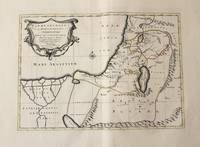
1710M10330Amsterdam: Jean Covens & Corneille Mortier c.1710. Very Good. Size : 368x495 mm 14.49x19.49 Inches Coloring: Original Outline Coloring Category: Maps Asia Middle East Holy Land & Palestine; Maps Africa North; Maps Africa North Egypt; Jean Covens & Corneille Mortier unknown
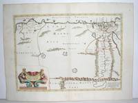
1640M2804Paris: Mariette Pierre 1640. Very Good. Size : 372x510 mm 14.625x20.125 Inches Coloring: Original Outline Coloring Category: Maps Africa North Egypt Mariette, Pierre unknown
2012PATRIMOINE2270223Paris, Réunion des Musées Nationaux, 2012, 21 x 29, 176 pages cousues sous couverture souple illustrée. Iconographie couleurs.
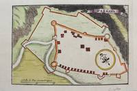
1690M9481Paris c.1690. Very Good. Notes: Map of Passava Greece during the late 17th century. Size : 104x153 mm 4.09x6.02 Inches Coloring: Hand Colored Category: Maps Europe Greece Macedonia; unknown