SANSON NicolasABAA

946 résultats
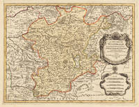
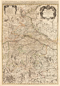
1652251161Paris 1652. unbound. Map. Engraving with hand outline color. Image measures 14 x 16.5%u201D.<br/><br/> This map of southeastern France includes the erstwhile provinces of Dauphiné corresponding roughly to the present departments of Isère Drôme and Hautes-Alpes as well as parts of Savoye and Bresse. At the time of the map%u2019s publication in 1652 Dauphiné was under the absolutist rule of King Louis XIV. The cartographer Nicolas Sanson as Royal Geographer to Louis XIV as well as Louis III likely understood the importance of this region to French interests of the time. The map thusly provides ample detail about the area including cities rivers mountains and significant forts. Hand-colored outlines indicate political boundaries. An elegant cartouche in the upper right corner of the map displays the title amidst scrollwork topped with the crown of the French monarchy. The map is in very good condition with full margins and no chips or tears. Nicolas Sanson 1600-1667 is considered the founder of the French school of cartography. In reaction to the prevailing trend of Dutch lavishness Sanson favored minimal details focusing rather on accurate cartography than ornament. This map points to his significant role within the French monarchy.<br/><br/> unknown books
118019aafParis, 1652, carte gravée sur cuivre, coloriée d’époque, 1 feuille. (31x38 cm).
174238209Amsterdam: Pierre Mortier 1742. A BEAUTIFUL HAND-COLORED MAP OF WESTERN LANGUEDOC and areas to the west and north. 60 x 45.5 cm plate 62 x 52 cm sheet. The areas described in the title are FULLY COLORED BY A CONTEMPORARY HAND. Printed on fine thick laid paper. Reverse blank. A fine impression. A PRISTINE EXAMPLE with the paper FINE AND BRIGHT. Very scarce in such fine condition. <br/><br/> Pierre Mortier unknown
1710902221AGAmsterdam:, Pierre Mortier, [um 1710]. Altkolorierter Kupferstich 42,5 x 56,5 cm, Blattgröße 49 x 63 cm.
169633637Paris 1696. Schönes tadelloses Exemplar. . 803 by 560mm 31 by 22 inches. Hand-Colored Original Copperplate Engraving by Alexis-Hubert Jaillot & N. Sanson depicting Le Duché De Westphalie ainsi qu`il est presentement possedé par L`Eslecteur De Cologne. Tiré des Memoires les pl. recents Par le Sr. Sanson Geographe Ordinaire du Roy A Paris. Published Paris 1696. Sheet: 803 by 560mm 31 by 22 inches. A fine and original hand-colored example of Jaillot's celebrated cartographic work documenting this region of Germany with the precision and decorative artistry characteristic of the 16900s. Alexis-Hubert Jaillot c.1632-1712 was one of the foremost French cartographers of the late 17th and early 18th centuries. Working in Paris he produced magnificent large-format maps of European territories often in collaboration with Nicolas Sanson -- considered the father of French cartography. Jaillot's maps are known for their striking decorative cartouches generous size and fine hand coloring representing the pinnacle of French Baroque cartography.This original copperplate engraving with original hand coloring depicts the region of Le Duché De Westphalie ainsi qu`il est presentement possedé par L`Eslecteur De Cologne. Tiré des Memoires les pl. recents Par le Sr. Sanson Geographe Ordinaire du Roy A Paris. published in Paris 1696. The map records the political and geographic boundaries of the region as understood in 1696 offering a fascinating window into the history of German territorial organization. Sheet measures 803 by 560mm 31 by 22 inches. In good condition consistent with its age of over 320 years. Ready to frame. unknown
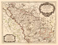
170024651Paris: H. Jaillot. 1700. Other. In excellent condition. 428 by 570mm 16 by 22 inches. 428 by 570mm 16 by 22 inches. Hand-Colored Original Copperplate Engraving by Alexis-Hubert Jaillot & N. Sanson depicting Le Duché de Berg le Comté de Homberg les Seigneuries de Hardenberg et de Wildenborg. Dressé surles Memoires les plus recents. Parle Sr. Sanson Geographe ordinaire du Roy. A Paris. Chez H. Iaillot joignant les grands Augustins aux deux Globes Aure Privilege du Roy. 1700. Published Paris H. Jaillot. 1700. Sheet: 428 by 570mm 16 by 22 inches. A fine and original hand-colored example of Jaillot's celebrated cartographic work documenting this region of Germany with the precision and decorative artistry characteristic of the 17000s. Alexis-Hubert Jaillot c.1632-1712 was one of the foremost French cartographers of the late 17th and early 18th centuries. Working in Paris he produced magnificent large-format maps of European territories often in collaboration with Nicolas Sanson -- considered the father of French cartography. Jaillot's maps are known for their striking decorative cartouches generous size and fine hand coloring representing the pinnacle of French Baroque cartography.This original copperplate engraving with original hand coloring depicts the region of Le Duché de Berg le Comté de Homberg les Seigneuries de Hardenberg et de Wildenborg. Dressé surles Memoires les plus recents. Parle Sr. Sanson Geographe ordinaire du Roy. A Paris. Chez H. Iaillot joignant les grands Augustins aux deux Globes Aure Privilege du Roy. 1700. published in Paris H. Jaillot. 1700. The map records the political and geographic boundaries of the region as understood in 1700 offering a fascinating window into the history of German territorial organization. Sheet measures 428 by 570mm 16 by 22 inches. In good condition overall with minor signs of age appropriate for a 18th-century engraving. Ready to frame. H. Jaillot. unknown
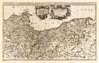
169625836Paris: Hubert Jaillot 1696. Other. In excellent condition. 545 by 874mm 21 by 34 inches. 545 by 874mm 21 by 34 inches. Hand-Colored Original Copperplate Engraving by Nicolas d Abbeville Sanson depicting Le Duche de Pomeranie divis en ses Principales Parties Dress sur les Memoires les plus Nouveaux. Par le Sr. Sanson. Geographe Ordinaire du Roy. A Paris Chez H Iaillot. joignant les grands Augustins aux deux Globes Avec Privilege du Roy Pourvingt Ans 1696. Published Paris Hubert Jaillot 1696. Sheet: 545 by 874mm 21 by 34 inches. A fine and original hand-colored example of Sanson's celebrated cartographic work documenting this region of Germany with the precision and decorative artistry characteristic of the 16900s. Nicolas d Abbeville Sanson was a cartographer active in the 1600s working in the tradition of European copper-engraved cartography. Their maps are valued by collectors for their historical accuracy and decorative quality.This original copperplate engraving with original hand coloring depicts the region of Le Duche de Pomeranie divis en ses Principales Parties Dress sur les Memoires les plus Nouveaux. Par le Sr. Sanson. Geographe Ordinaire du Roy. A Paris Chez H Iaillot. joignant les grands Augustins aux deux Globes Avec Privilege du Roy Pourvingt Ans 1696. published in Paris Hubert Jaillot 1696. The map records the political and geographic boundaries of the region as understood in 1696 offering a fascinating window into the history of German territorial organization. Sheet measures 545 by 874mm 21 by 34 inches. In good condition overall with minor signs of age appropriate for a 17th-century engraving. Ready to frame. Hubert Jaillot unknown
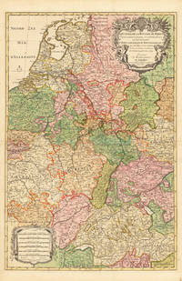
169233626Paris 1692. Schönes tadelloses Exemplar. . 803 by 560mm 31 by 22 inches. Hand-Colored Original Copperplate Engraving by Alexis-Hubert Jaillot & N. Sanson depicting Le Cours de la Riviere du Rhein depuis sa Source jusques a son Emboucheure ou sont distingues Tout les Estats et Souverainetes qui sont dessus et aux enuirons. Tire de tous les Memoires les plus Nouveaux Parle Sr. Sanson Geopgraphe Ordinaire du Roy. Published Paris 1692. Sheet: 803 by 560mm 31 by 22 inches. A fine and original hand-colored example of Jaillot's celebrated cartographic work documenting this region of Germany with the precision and decorative artistry characteristic of the 16900s. Alexis-Hubert Jaillot c.1632-1712 was one of the foremost French cartographers of the late 17th and early 18th centuries. Working in Paris he produced magnificent large-format maps of European territories often in collaboration with Nicolas Sanson -- considered the father of French cartography. Jaillot's maps are known for their striking decorative cartouches generous size and fine hand coloring representing the pinnacle of French Baroque cartography.This original copperplate engraving with original hand coloring depicts the region of Le Cours de la Riviere du Rhein depuis sa Source jusques a son Emboucheure ou sont distingues Tout les Estats et Souverainetes qui sont dessus et aux enuirons. Tire de tous les Memoires les plus Nouveaux Parle Sr. Sanson Geopgraphe Ordinaire du Roy published in Paris 1692. The map records the political and geographic boundaries of the region as understood in 1692 offering a fascinating window into the history of German territorial organization. Sheet measures 803 by 560mm 31 by 22 inches. In good condition overall with minor signs of age appropriate for a 17th-century engraving. Ready to frame. unknown
169228137Paris 1692. Other. Schönes tadelloses Exemplar. . 803 by 560mm 31 by 22 inches. Hand-Colored Original Copperplate Engraving by Alexis-Hubert Jaillot & N. Sanson depicting Le Cours de la Riviere du Rhein depuis sa Source jusques a son Emboucheure ou sont distingues Tout les Estats et Souverainetes qui sont dessus et aux enuirons. Tire de tous les Memoires les plus Nouveaux Parle Sr. Sanson Geopgraphe Ordinaire du Roy. Published Paris 1692. Sheet: 803 by 560mm 31 by 22 inches. A fine and original hand-colored example of Jaillot's celebrated cartographic work documenting this region of Germany with the precision and decorative artistry characteristic of the 16900s. Alexis-Hubert Jaillot c.1632-1712 was one of the foremost French cartographers of the late 17th and early 18th centuries. Working in Paris he produced magnificent large-format maps of European territories often in collaboration with Nicolas Sanson -- considered the father of French cartography. Jaillot's maps are known for their striking decorative cartouches generous size and fine hand coloring representing the pinnacle of French Baroque cartography.This original copperplate engraving with original hand coloring depicts the region of Le Cours de la Riviere du Rhein depuis sa Source jusques a son Emboucheure ou sont distingues Tout les Estats et Souverainetes qui sont dessus et aux enuirons. Tire de tous les Memoires les plus Nouveaux Parle Sr. Sanson Geopgraphe Ordinaire du Roy published in Paris 1692. The map records the political and geographic boundaries of the region as understood in 1692 offering a fascinating window into the history of German territorial organization. Sheet measures 803 by 560mm 31 by 22 inches. In good condition consistent with its age of over 330 years. Ready to frame. unknown
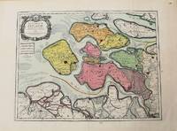
1693M10774Paris 1693. Very Good. Notes: Map of the county of Zeeland. Size : 440x575 mm 17.32x22.64 Inches Coloring: Original Hand Coloring Category: Maps Europe Benelux; unknown
19273836863267GLN-7, Spes 1927
19273836863308GLN-7, Spes 1927
19273836863432GLN-7, Spes 1927
19273836863552GLN-7, Spes 1927
19273836863669GLN-7, Spes 1927
19273836863897GLN-7, Spes 1927
19273813768152Exemplaire non relié, GLN-7, Spes 1927
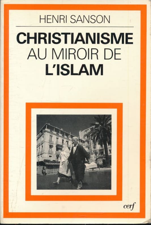
1984176059Cerf Cerf, 1984. In-8 broché de 195 pages. Bon état.
200418047694195HASP-97, Editions Parole et Silence 2004
1730910097CGAmsterdam:, Covens u. Mortier, um 1730. Teilkolorierter Kupferstich, 54 x 87 cm, Blattgröße 61 x 87 cm.
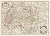
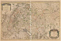
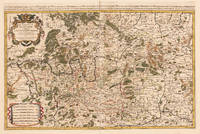
171037419Paris: Hubert Jaillot 1710. In ausgezeichnetem Zustand. 803 by 560mm 31½ by 22 inches. Kupferstichkarte in zeitgenössischem Grenzkolorit. Mit großer prächtiger allegorischer Kartusche sowie Meilenzeiger mit Legende. Erschienen im großen AtlasAtlas Nouveau contenant.Â’ von Nicolaus Sanson u. Hubert Jaillot. Dargestellt wird der schwäbische Kreis im Norden mit dem benachbarten Franken u. im Süden bis zum Bodensee. Im Osten noch mit Teilen von Bayern der Westen mit dem angrenzenden Frankreich. Das Kartenbild sorgfältig u. übersichtlich ausgearbeitet. Der Atlas Nouveau.Â’ entstand als Auftragsarbeitet für Ludwig XIV. und nahm einen Zeitraum von über 10 Jahren in Anspruch. Die Karten gelten bis heute noch als eine Meisterleistung der französischen Kartographie des 17.Jahrhunderts. Als Geburtsjahr Jaillots wird das Jahr 1632 angenommen da in seiner Sterbeurkunde sein Alter mit 80 Jahren angegeben war. Der Geburtsort war Avignon-lès-Saint-Claude damals ein kleiner Weiler in der Exklave der Freigrafschaft Burgund die dazu gehörte Spanisches Königreich. Jaillot hatte seit seiner Kindheit ein großes Talent für Kunst und Design. Bildhauerei lernte er bei seinem Bruder Pierre-Simón. Als Folge der französisch-spanischen Konflikte wurde ihre Heimatstadt verwüstet und so gingen die beiden Brüder 1657 nach Paris. Dort erlangten sie bald einen gewissen Ruf und den Titel „Sculpteur du Roy“. 1665 heiratete Jaillot in die Kartenverlegerfamilie Berey ein. Nach dem Tod seines Schwagers Nikolaus II. Berey 1640–1667 kaufte er die Berey-Kartensammlung von seiner Schwägerin. Dadurch erhielt er eine wertvolle Grundlage die er sofort vermarkten konnte ohne jemals selbst eine Karte erstellt zu haben. Jaillot stieg zu einem günstigen Zeitpunkt in das Kartengeschäft ein. Anfang 1668 gewann Ludwig XIV. den ersten seiner Réunionskriege und es begann eine Zeit in der Frankreich sein Territorium kontinuierlich erweiterte. Es entwickelte sich eine große Nachfrage nach Karten die die französischen Triumphe und die neuen Grenzen sowie bevorstehende Expansionspläne darstellten.Zu Jaillots Kartensammlung gehörten auch Druckplatten die von Pierre Duval 1619–1683 Neffe von Nicolas Sanson erstellt und ursprünglich an Nicolas Berey verkauft wurden. Doch Duval der auch seine eigenen Karten veröffentlichte weigerte sich seine alten Karten nachzudrucken. Auf dem Höhepunkt des Streits mit Duval rekrutierte Jaillot Ende 1670 Nicolas Sansons Söhne Guillaume und Adrien als Kartenmacher und Geschäftspartner. Mit ihnen konnte er neue Karten mit dem prestigeträchtigen Namen Sansons vermarkten. Sein erster Atlas aus dem Jahr 1681 Atlas Nouveau wurde ein so großer kommerzieller Erfolg dass andere Verlage begannen plagiierte Kopien zu verbreiten.Jaillot bemühte sich um königliche Schirmherrschaft und widmete viele seiner Kartenausgaben dem König. Schließlich wurde er am 20. Juli 1686 zum Géographe du Roy ernannt und erhielt eine jährliche Rente von 600 Livres. Dieser Titel sowie die protektionistische und kontrollierende Gesetzgebung ermöglichten es ihm sich erfolgreich gegen seine Plagiatoren zu wehren.Seit dem frühen 18. Jahrhundert gab Jaillot immer weniger Karten aus. Die Nachfrage nach zeitnah aktualisierten Karten nahm zu und er war immer weniger in der Lage auf die Anforderungen des Marktes zu reagieren. Jüngere Konkurrenten waren gut ausgebildete Geographen wie Guillaume Delisle die die Kartierung selbst durchführen konnten. Im Laufe der Zeit übergab Jaillot das Geschäft an seinen Sohn Bernard Jean-Hyacinthe.Alexis Hubert Jaillot starb am 2. November 1712 im Alter von 80 Jahren in Paris. Er wurde im Convent des Grands-Augustins beigesetzt. WikipediaNicolas Sanson der Ältere 20. Dezember 1600 in Abbeville Frankreich; † 7. Juli 1667 in Paris war ein französischer Kartograph. Seine Vorfahren stammten aus Schottland. Zwischen 1618 und 1667 schuf Sanson rund 300 Einzelkarten sowie Atlanten und illustrierte Texte.Seine Arbeit wurde von seinen Söhnen Nicolas Sanson 1626 Schottland; † 27. August 1648 in Paris Adrien Sanson † 1708 und Guillaume Sanson † 1703 seinem Neffen Pierre Duval 1619; † 1683 ausgeführt. sein Enkel Pierre Moulard Sanson † 1730 und Gilles Robert de Vaugondy 1688; † 1766 führten weiter. Wikipedia Hubert Jaillot unknown
167533301Paris: Hubert Jaillot 1675. Blatt gebräunt Mittelfalz mit nicht säurebeständigem Tape hinterlegt heller Streifen. . 803 by 560mm 31 by 22 inches. Hand-Colored Original Copperplate Engraving by Alexis-Hubert Jaillot & N. Sanson depicting Le Cercle de Souabe subdivisé en tous les Estats qui le Composent Tire ´sur les Memoires les plus noueaux Par le S. Sanson Geographe Ordinaire du Roy. A Paris Ches H. Laillot joingnant les Augustins aux deux Globes Auec Priuilege du Roy pour Vingt Ans. Published Paris Hubert Jaillot 1675. Sheet: 803 by 560mm 31 by 22 inches. A fine and original hand-colored example of Jaillot's celebrated cartographic work documenting this region of Germany with the precision and decorative artistry characteristic of the 16700s. Alexis-Hubert Jaillot c.1632-1712 was one of the foremost French cartographers of the late 17th and early 18th centuries. Working in Paris he produced magnificent large-format maps of European territories often in collaboration with Nicolas Sanson -- considered the father of French cartography. Jaillot's maps are known for their striking decorative cartouches generous size and fine hand coloring representing the pinnacle of French Baroque cartography.This original copperplate engraving with original hand coloring depicts the region of Le Cercle de Souabe subdivisé en tous les Estats qui le Composent Tire ´sur les Memoires les plus noueaux Par le S. Sanson Geographe Ordinaire du Roy. A Paris Ches H. Laillot joingnant les Augustins aux deux Globes Auec Priuilege du Roy pour Vingt Ans. published in Paris Hubert Jaillot 1675. The map records the political and geographic boundaries of the region as understood in 1675 offering a fascinating window into the history of German territorial organization. Sheet measures 803 by 560mm 31 by 22 inches. In good condition overall with minor signs of age appropriate for a 17th-century engraving. Ready to frame. Hubert Jaillot unknown
169233439Paris: H. Jaillot 1692. In ausgezeichnetem Zustand. . 570 by 850mm 22 by 33 inches. Hand-Colored Original Copperplate Engraving by Charles Hubert Alexis Jaillot & Nicolaus Sanson depicting Le Cercle de Franconie subdivise entous les Estats qui le composent. Dressè sur les Memotres les plus Nouveaux Parle Sr. Sanson Geographe Ordinaire du Roy. A Paris Chez H. Iaillot joignant les grands Augustins aux dewe Globes. Avec Privilege du Roypour Vingt Ans. 1692. Published Paris H. Jaillot 1692. Sheet: 570 by 850mm 22 by 33 inches. A fine and original hand-colored example of Jaillot's celebrated cartographic work documenting this region of Germany with the precision and decorative artistry characteristic of the 16900s. Alexis-Hubert Jaillot c.1632-1712 was one of the foremost French cartographers of the late 17th and early 18th centuries. Working in Paris he produced magnificent large-format maps of European territories often in collaboration with Nicolas Sanson -- considered the father of French cartography. Jaillot's maps are known for their striking decorative cartouches generous size and fine hand coloring representing the pinnacle of French Baroque cartography.This original copperplate engraving with original hand coloring depicts the region of Le Cercle de Franconie subdivise entous les Estats qui le composent. Dressè sur les Memotres les plus Nouveaux Parle Sr. Sanson Geographe Ordinaire du Roy. A Paris Chez H. Iaillot joignant les grands Augustins aux dewe Globes. Avec Privilege du Roypour Vingt Ans. 1692. published in Paris H. Jaillot 1692. The map features a decorative Baroque cartouche containing the title inscription. A distance scale is incorporated within the cartouche or alongside it. The map records the political and geographic boundaries of the region as understood in 1692 offering a fascinating window into the history of German territorial organization. Sheet measures 570 by 850mm 22 by 33 inches. In good condition overall with minor signs of age appropriate for a 17th-century engraving. Ready to frame. H. Jaillot unknown
1700M7991Paris: S. Jallot c. 1700. Very Good. Notes: Map of Northern Germany Size : 650x460 mm 25.59x18.11 Inches Coloring: Original Hand Coloring Category: Maps Europe Germany; S. Jallot unknown
a92271Paris 1681. Chez H. I Aillot. first edition Color map 33 x 22 inches with 2 inch blank border on all 4 sides. "Dresse sur les Memoirs les plus Nouveaux par le S. Sanson Geographe Ordinaire du Roy." Fancy pictorial circle around map title and similar around map's key. Densely decorated map with lines of color in red pink orange green. No tears. Folded in half. One very light stain appears water-based at center fold about 8 inches by 1 inch. Very pretty map with bold black outlines and bright colors. Good plus condition. Map - ephemera. . unknown