VERON ; TARDIEU ; REGAMEY, Félix ; (Collectif)Livre Rare Book

229 résultats
1875586694 vol. in-folio reliure de l'époque demi-veau blond, dos à 5 nerfs dorés orné, tête dorée, Hippolyte Heymann Editeur, Paris, London, 1875, 2 ff., 419 pp., 2 ff., 447 pp. avec 21 eaux fortes (tome 1) et 32 eaux-fortes, lithographies et chromolithographies (tome 2) ; 2 ff., 447 pp., 2 ff., 363 pp. avec 38 et 19 eaux-fortes, gravures sur acier et sur bois hors texte ; 2 ff., 326 pp. et 1 f., 2 ff., 2 ff., 327 pp. avec 29 eaux-fortes, gravures sur bois, et chromolithographies hors texte, et 24/29 eaux-fortes, gravures au burin et gravures sur bois hors texte ; 2 ff., 350 pp. et 1 f., 2 ff., 297 pp. avec 45/46 eaux-fortes, gravures au burin, gravures sur bois et photogravures hors texte, et 19 planches hors texte
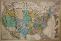
1848M7518Paris: A. Bes & F. Dubreuil Fils c. 1848. Very Good. Folding map flattened and backed acid-free tissue paper for long-term preservation. Two marginal tears repaired expertly. Notes: A scarce large-scale map of the Mexican-American War era and of the entire West. <br><br>To the very north the boundaries of the United States extend well into future British Columbia and within the current states of Washington and Oregon is carved the District of Columbia which was owned by the British. California Arizona and Nevada are together and California's central valley is highlighted for its gold deposits.<br><br>The map is based upon the Eustache Herisson map of the United States 1799 and its major cities. As various publications were made 1826 1834 the map started to take shape. Various projections of the Rocky Mountains were used based off of the Humboldt and Pike projections. Much of the Northwest is based off of the Lewis and Clark expedition. <br><br>This particular map is a scarce and important example as it focuses on the changes brought about by the Mexican-American War. The major differences in this regard are a small inset map of Central America and the delineation of the Mexican-American border; as this map shows all the territory that the United States had captured since the onset of the war. <br><br>Five inset maps depict Mexico and the cities of Washington Boston Philadelphia and New York. Size : 509x662 mm 20.04x26.06 Inches Coloring: Original Hand Coloring Category: Maps United States; A. Bes & F. Dubreuil Fils unknown
185719015Paris: J.-B. Baillière et fils 1857. SECOND AND FIRST EDITIONS. Later sheep-backed boards spine gilt. Somewhat foxed but otherwise very good. Typographic tables in the text. Two foundational texts in the forensic history of sex crimes. The first offered here in its second edition explores the medical and legal natures of flashing rape sexual assault pederasty and sodomy. The study defines the terms of sex crime vocabulary to establish consistency in related cases with lengthy entries for deflowering debauchery and penetration and it sets the range for what should be considered underage. Tardieu attempts to prove a typology of the sex criminal: hyper masculine mentally unstable and violent often with a misshapen penis. In the final part of the text he notes the transmission of STIs as a result of rape as a legal addendum and gives 21 case studies of criminal sex acts. The second title here in its first edition is the first French legal study on abortion. Abortion was an unmitigated crime in France at the time but as Tardieu explains the high rate of stillbirths made it difficult to determine which were purposefully inflicted. Here he describes eight different methods of abortion and supplies several case studies of each including chemical descriptions of abortive medications. He stresses the culpability of “wise women†who provide the necessary supplies and instructions for abortions and implores that they be strictly watched by law enforcement. This text was the medico-legal authority in France for the next 60 years. <br /> <br /> Both titles are rare: OCLC records 4 institutional copies of Étude médico-légale sur les attentats aux moeurs in the U.S. Penn NY Academy of Medicine Chicago and Michigan and only one copy of Étude médico-légale sur l’avortement Penn.<br /> <br /> Donaldson Homosexuality and medicine 176; Hirsch V: 516; Le Naour and Valenti Histoire de l’avortement passim. J.-B. Baillière et fils unknown
1802009981eyeParis: P. F. Tardieu. Good. 1802. First Edition. A large hard-to-find early United States map with hand-colored borders. The map is backed by heavy linen with reinforcing linen tape on split folds with holes at fold corners browning and light soil. The image is of the title area with an illustration and text on Niagara Falls. More scans available upon request. Inset map is Plan De La Ville De Washington Situee Sur Le Territoire De Columbia Cede Par Les Etats De Virginie Et Maryland Aux Etats Unis D-Amerique Map of Washington D. C. . Ex-Library of Congress. P. F. Tardieu updated the map from a 1796 original by prominent English mapmaker Aaron Arrowsmith as explained in his note above the title. ; 49 1/2" x 55 1/2" . P. F. Tardieu unknown books