Louise Tardieu d'Esclavelles EPINAYBiblio.com
628 résultats
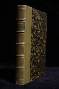
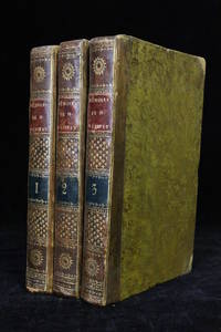
181849877à Paris: Chez Brunet 1818. Fine. Chez Brunet à Paris 1818 13 x 20 cm 3 volumes reliés First edition. There would be three editions the same year. Contemporary half brown sheep bindings with corners. Smooth spines decorated with gilt compartments and fleurons as well as red and blue morocco title and volume labels. Joints slightly cracked and showing some rubbing. Some dampstaining. ""Woman writer salonnière and friend of philosophers and famous writers in the 18th century Louise d'Épinay is the author of Memoirs whose originality is situated on two levels: from the point of view of content first because it is a history of her family and the literary events of the century a history however 'self-reflective' and filled with her own feelings and reflections; then from the point of view of form since it involves a singular combination of letters memories and first-person diary pages and short third-person narratives."" Sanda Nemeth-Badescu Dalhousie French Studies 2005. The famous muse of the late 18th century was indeed a friend of Rousseau Grimm Diderot Voltaire etc and her memoirs interspersed with correspondence best illustrate the world of letters of this late 18th century. Chez Brunet unknown
185552364Paris 1855. Fine. Paris 1855 11.50 x 18 cm relié New edition Half caramel calf binding spine with five raised bands set with gilt dots decorated with double gilt fillets marbled paper boards marbled endpapers and pastedowns contemporary binding. Handsome copy. hardcover
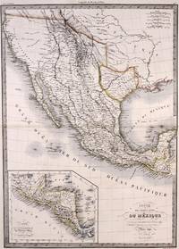
1842M7906Paris: P. Lehuby c. 1842. Very Good;. Notes: A rare and important version of Lapie's Mexico map circa 1842 which depicts Texas as an independent Republic. With an inset map in the lower left of Guatemala. Size : 550x395 mm 21.65x15.55 Inches Coloring: Original Outline Coloring Category: Maps United States South;Maps United States South Texas;Maps Central America Mexico; P. Lehuby unknown
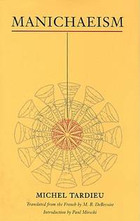
6703123University of Illinois Press pp. 136 . Hardback. New. University of Illinois Press hardcover
1821D7867Paris: Chez Masson et fils 1821. Hardcover. Very Good. 8vo 210 x 125mm. 660pp. 11 plates on various subjects; 1 principles of the head and symmetry of the face; 2 principles of the human body and anatomy; 3 orders of columns and architecture; 4 architecture for military naval or marine; 5 cosmography folding; 6 the mappe-monde in two hemispheres 400 x 230mm folding; 7 physics; 8 Seven Wonders of the World folding; 9 portraits of Greek mythology; 10 personifications of the sun and muses; 11 portraits of divine muses; and one in-text illustration of signs of the zodiac on p. 54. Contemporary calf marbled endpapers; intermittent browning and foxing plates are bright and clean. Good. Large oval engraved bookplate of Biblioteca Francisci Riccardi De Verna and royal armorial book label; stamp of Bibl. Gust. Galletti Florence to title. <br/><br/>French childrens encyclopedia from 1821 with folding mappe-monde plate by Tardieu in excellent shape. Stated fourth edition of Massons encyclopedia for children; the first was published in 1804. Massons encyclopedia is arranged as a series of questions and answers on an encyclopedic range of topics suitable for the schools of deux sexes. The folding mappemonde map is an exquisite addition to the encyclopedia and looks like it was harldy ever unfolded. All the wonderful and expertly executed plates are on a richer and sturdier paper that has resisted age well. The well-known Parisian engraver Pierre François Tardieu executed the map as well as the plate on cosmography. Chez Masson et fils hardcover
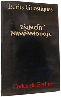
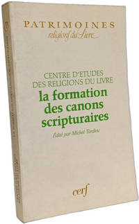
1984100145960Les Éditions du Cerf 1984. Bon Etat bords frottés intérieur propre. in12. 1984. Broché. Le livre présente une traduction et un commentaire du Codex de Berlin un manuscrit copte qui réunit plusieurs textes apocryphes chrétiens dont "L'évangile selon Marie" "Le livre des secrets de Jean" "La sagesse de Jésus et Eugnoste" et "L'acte de Pierre" Codex de Berlin Michel Tardieu Évangile selon Marie Textes apocryphes Manuscrit copte Christianisme ancien Éditions Cerf Traduction Commentaire Bible Études bibliques Traduction et commentaire Histoire du christianisme ancien Manuscrits coptes Les Éditions du Cerf unknown
1993100144063CERF 1993. bonne tenue proche du très bon état couverture et tranches un peu ternies intérieur propre. 2x23x15cm. 1993. Broché. 256 pages. Histoire des religions Religion et société History of religion Religious issues and debates Religion Sciences des religions CERF unknown
5441534like new. unknown
5441534-nnew. unknown
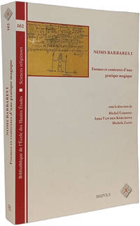
2013100146401BREPOLS 2013. Très bon état pages neuves intérieur propre. 3x23x15cm. 2013. Broché. 426 pages. Cet ouvrage collectif dirigé par Michel Tardieu constitue la première étude d'ensemble visant à comprendre le rôle et les mécanismes des 'noms barbares' en tant que pratique magique de nomination. Il analyse ces noms comme des objets magiques complexes faits de jeux de signes et de phonèmes et étudie leur transfert entre panthéons et la fusion des dynasties divines. Un chapitre spécifique par exemple examine les noms magiques d'Aphrodite dans un contexte de recette égyptienne de séduction noms barbares magie antique pratique magique onomastique Michel Tardieu Brepols Bibliothèque de l'École des Hautes Études volume 162 études religieuses papyri grecs magiques Études religieuses Magie antique Onomastique / Noms Histoire des religions Recherche académique Volume collectif BREPOLS unknown
51-6669Paris: Desaint; & Boubers Bruxelles. 1782. 8vo. 3 vols. 12 x 20 cm. Contemporary calf. Leather peeled from corner and edge of one volume but solid. 176 plates.Duhamel was a passionate advocate of fruit "Je n'ai garde cependant de conseiller tout le monde indistinctement de manger de toutes sortes de fruits" he dismisses contemporary opinion that fruit could adversely affect health and presents the work as a practical manual intended to aid the spread of both the cultivation and consumption of fruit. His earlier interest in pears is demonstrated by the subjects of the plates: 58 of pears; 32 of peaches; 20 of plums; 16 of cherries; 14 of apples. Other fruits include almonds apricots and strawberries. References: OCLC Number / Unique Identifier:6743922; Dunthorne 109; Great Flower Books p.55; Nissen BBI 550; ; Stafleu and Cowan 1546.3 vol. in-8 veau raciné doslisses ornés p. de titre et de tom. brun et vert reliure del'époque. Fortes épidermures et manques de cuir.176 planches 29 84 63 gravées concernant les arbresfruitiers fruits feuilles graines et bourgeons dessinées parMagd. Basseporte et Le Berriays et gravées par Benoist Maison-Neuve Mesnil Tardieu etc. Les bibliographes indiquent 180 voire181 planches en tout mais en réalité le nombre de planches varieselon les exemplaires et n'est pas fixe.Duhamel du Monceau est l'un des plus grands botanistes du XVIIIesiècle. Originaire de la petite noblesse la richesse de sa famille luipermit de poursuivre ses recherches en agronomie botaniquechimie et technologie navale bien que l'on retienne avant tout delui ses travaux sur les arbres fruitiers. Nissen IV 550. Paris: Desaint; & Boubers, Bruxelles. 1782. hardcover
221253Contentum Ltd. Loose sheet. New. Contentum Ltd. unknown
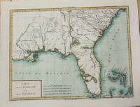
1799M5632Paris c. 1799. Very Good. Notes: The map depicts Florida during its time under Spanish control. Numerous Indian villages are located and roads are shown connecting early settlements. There are no engraved political divisions indicating the mapmaker's bias toward either the territorial claims of Spain or the United States. The map provides an excellent view of the Gulf Coast with a dramatically over-sized Tampa Bay. Numerous Indian villages are located and roads are shown connecting early settlements. The Bahamas are also well delineated.<br> Size : 335x440 mm 13.125x17.25 Inches Coloring: Hand Colored Category: Maps United States South Florida; Maps United States South States; unknown
1785M10371Paris c.1785. Excellent wide margins. Notes: A fine early plan of Warsaw is based upon the 4-sheet plan of Warsaw by Pierre Ricaud de Tirregaille entitled Plan de la ville de Varsovie first published in 1762 and Antonio Rizzi-Zannoni's single sheet version of the map published in 1772.<br>Pierre Ricaud de Tirregaille a French Architect and Engineer worked in Warsaw as a surveyor and as an army engineer. Crown Marchal Bielinski commissioned Tirregaille to prepare a detailed plan of the city of Warsaw which resulted in the first map of Warsaw based upon a scientific survey.<br>Rizzi-Zannoni's plan published in 1772 of which we have an example coincided with the efforts of Polish Nobles to enlist the assistance of French "democracy" experts in Paris including Rosseau and Malby to help restructure the Polish "Republic" on the eve of the first partition.<br> Size : 345x455 mm 13.58x17.91 Inches Coloring: Hand Colored Category: Maps City Maps; Maps Europe Poland Lithuania; unknown
B9781166777784New. unknown
51-3482Paris: Maradan 1793. . Folio. Unbound. 26.5 x 35cm. Plate vol. VI only. Frontispiece and title page to Vol. VI with 121 of 123 plates many double page to accompany the text vols. I-V. The atlas contains the maps by P. F. Tardieu and the views by N. Thomas.This is a larger paper copy than the normal 4to format.Chadenat 4792. Nissen ZBI 3076OCLC Number: 1051486954 plates and 490197769 text and platesIn folio : 2f. titre et 121/123 planches tome 1 : 28/29 planches manque la planche 1 ; tome 2 : 15/16 planches manque la planche 1 ; tome 3 : 22 planches ; tome 4 : 35 planches dont de nombreuses en double ; tome V : 21 planches dont quelques unes en doubles gravées par Tardieu d'après Thomas botanique fourneaux moulins monuments idoles costumes animaux et histoire naturelle. Grandes marges.En feuilles grandes marges en attente de reliure.Édition originale française. La première édition de ce voyage effectué par Pallas de 1768 à 1774 et paru à Saint-Petersbourg de 1771 à 1776 en 3 vol. in-4. Envoyé en mission par l'académie de Saint-Petersbourg pour observer le passage de Vénus devant le soleil Pallas 1741-1811 restera finalement six ans à explorer les contrées russes de la mer caspienne jusqu'à la frontière chinoise. Une des plus grandes expéditions commanditées par Catherine II. Paris: Maradan, 1793. unknown
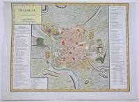
1792M4250Paris 1792. A tear on the right margin beyond the plate mark has been repaired upper margin shaved closely otherwise very good. Notes: A detailed and decorative city plan of Madrid and vicinity with a list of major edifices in two panels on the left and right hand sides. Size : 330x435 mm 13x17.125 Inches Coloring: Hand Colored Category: Maps City Maps; Maps Europe Spain unknown
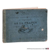
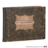
183578717Paris: Chez de Pelafol libraire c 1835. Oblong folio 26x34 cm. Original printed publishers wrappers with vignette soiled some small stains and a few loss of paper. - Missing: endpapers title the 2 large flding maps and 1 folding map "Ile de Bourbon". But still a nice collection of all the 86 engraved departemental maps & "Paris" & "Environs de Paris" coloured by hand in vivid colors and the folding maps: "Alger" and 5 of 6 of the colonial maps "Guyane" "Sénéal" "Martinique etc" Guadaloupe" and "Les Possessions Françaises Orientales" also coloured by hand. - Together 94 maps. Chez de Pelafol, libraire unknown
183078711Paris: Pelasol c. 1830. Oblong folio 25x33 cm. Contemporary half cloth covers marbled paper spine partly damaged; marbled paper rubbed and loss of paper at the borders; first endpapaers renewed. Calligraphed title with on verso "Table. composant l'Atlas"and explications of "Signes conventionnels pour les Departemens". And 97 engraved maps 'sous la direction de P. Tardieu' with explanatory texts printed in the margins in a very small type. A bit loose in binding small lightbrown spots in places. 97 maps complete: 2 large folding maps 'France' & 'Douanes'. - 86 'Departements'. 2 second copy of 'Seine' & 'environs de Paris' only these 2 handcoloured. - 1 'Alger' folding map - 6 'Colonies' folding maps. - Binding used; small waterstain in lower margins but on the whole an acceptable copy Pelasol hardcover
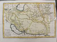
1797M10803Paris 1797. Very Good. Size : 195x288 mm 7.68x11.34 Inches Coloring: Hand Colored Category: Maps Asia Middle East Iran Iraq; unknown
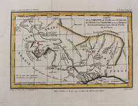
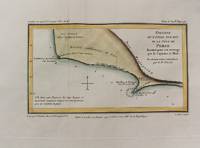
1797M10801Paris 1797. Very Good. Notes: Important early map of present day southern Iraq. Size : 132x208 mm 5.20x8.19 Inches Coloring: Hand Colored Category: Maps Asia Middle East Iran Iraq; unknown
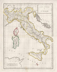
17985441798. Copper-line engraving with later hand-colouring. 450mm by 350mm platemark. French copper-line engraved map of Italy and Sicily with later outline hand-colouring. Published in Paris 1798.<br /> Central horizontal fold as issued. A couple of small stains.Scarce map from Mentelle & Chanlaire's Atlas Universel. etc. The engraving detail is very well executed in the style of other Tardieu maps. unknown
1797M10802Paris 1797. Very Good. Notes: Map of Northern side of the Persian gulf Iran. Size : 98x176 mm 3.86x6.93 Inches Coloring: Hand Colored Category: Maps Asia Middle East Iran Iraq; unknown