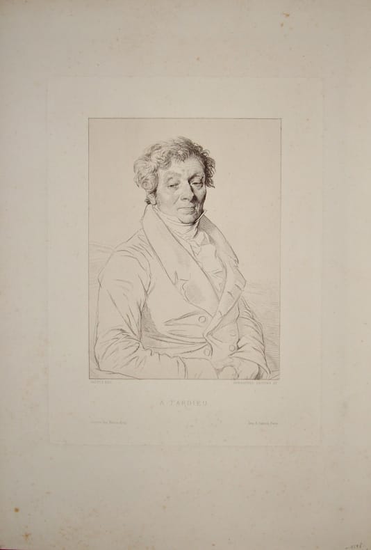
Gravure portrait de Ambroise TARDIEULivre Rare Book
Gustave TardieuLivre Rare Book
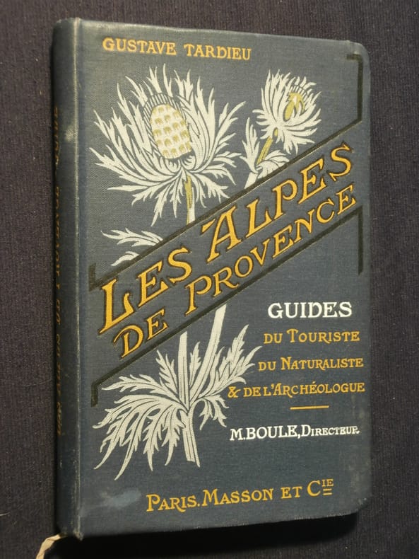
Les Alpes de Provence
1912199281912 Masson et Cie Reliure édieur illustrée, 312p. Très bon
Librairie Tant qu'il y aura des livres · Pontcharra, France50,00 €
1 707 résultats
GF4511Lithographie format 37,5 x 25,5 cm marges comprises - Paris - imprimerie Lemercier - Vers 1880 -
19513910Paris Cahiers du Sud 1951 Un volume in-8 broché, couverture jaune, 247 pages. Bon état.
1912199281912 Masson et Cie Reliure édieur illustrée, 312p. Très bon
16192942Paris 1916-1917. Hardcover. Very Good . Each volume approx. 300 p. 5 x 7 1/4 in. Half morocco binding with marbled boards gilt lettering on spines 5 raised bands top edge of text block gilt colored end papers. Condition of each volume is VERY GOOD: very light wear to covers and spines marbled boards very lightly worn a few lightly worn corners and spine edges light discoloration to some leather surfaces. Spine faded edges of text block very lightly darkened small book plate of David B. Ogden on inside of front cover pages very clean bindings very tight. LF LC- light soiling to end papers. Gaspard- small old worm hole at edge of text block. La France.- light soiling to end papers front hinge starting to crack this text alone from 1910 all others are from 1916-1917. NOTE- 10 volumes all in French all war memoirs pertaining to WW I all bound uniformly color variations in leather marbled boards end papers by Brentano's NY stamped on endpaper. hardcover
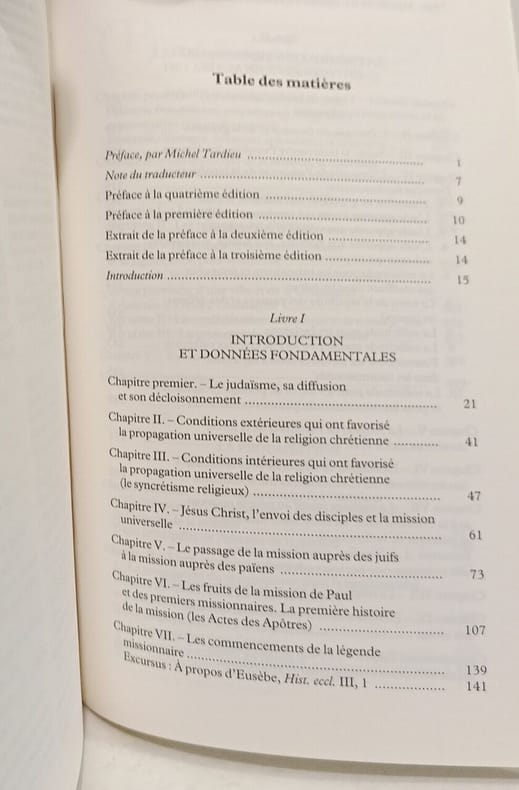
2004100150997CERF 2004 14 8x4 4x22 8cm. 2004. Broché. Cet ouvrage d'Adolf von Harnack traduit en français pour la première fois analyse en quatre parties la diffusion du christianisme durant les trois premiers siècles en examinant les conditions qui ont favorisé son expansion notamment le rôle du judaïsme les missions de Paul et l'établissement dans la société romaine. Il s'agit d'une somme magistrale qui complète l'Histoire romaine de Mommsen en abordant la question religieuse
1798005808Paris: Dezauche et Tardieu 1798. First edition. NA. Very Good. Spectacular topographical map printed in the sixth year of the Revolutionary French Republic -- the Directoire. The oversized copper engraved map assembled from six separate folding parts all linen backed. The map features a very beautiful and large allegorical title cartouche in one corner and a highly decorative key Explication des Signes contained in a large pastoral illustration and set in a pyramid monument. The individual pieces are 49 by 75 cm and the map in its entirety measures about 147 by 148 cm we are not counting overlapped margins. Slipcase which we believe is the original measures 19 by 13 by 5.5 cm. Fairly scarce with just five institutional holdings showing on OCLC First Search and all these national libraries: the British Library the BNF the Bayerishces Staatsbibliothek the Sachsiches Landesbibliothek the Biblioteca Nacional de Espana. Labels with handwritten details on the linen side of the maps exposed when the maps are folded and on the box. Lightest of scattered soiling on the map. The slipcase likewise. <br /><br /> Dezauche et Tardieu books
1798005808Paris: Dezauche et Tardieu 1798. First edition. NA. Very Good. Spectacular topographical map printed in the sixth year of the Revolutionary French Republic -- the Directoire. The oversized copper engraved map assembled from six separate folding parts all linen backed. The map features a very beautiful and large allegorical title cartouche in one corner and a highly decorative key Explication des Signes contained in a large pastoral illustration and set in a pyramid monument. The individual pieces are 49 by 75 cm and the map in its entirety measures about 147 by 148 cm we are not counting overlapped margins. Slipcase which we believe is the original measures 19 by 13 by 5.5 cm. Fairly scarce with just five institutional holdings showing on OCLC First Search and all these national libraries: the British Library the BNF the Bayerishces Staatsbibliothek the Sachsiches Landesbibliothek the Biblioteca Nacional de Espana. Labels with handwritten details on the linen side of the maps exposed when the maps are folded and on the box. Lightest of scattered soiling on the map. The slipcase likewise. Dezauche et Tardieu unknown
2026100150997CERF 2026. proche du très bon état intérieur propre bonne tenue. 14 8x4 4x22 8cm. 2026. Broché. Cet ouvrage d'Adolf von Harnack traduit en français pour la première fois analyse en quatre parties la diffusion du christianisme durant les trois premiers siècles en examinant les conditions qui ont favorisé son expansion notamment le rôle du judaïsme les missions de Paul et l'établissement dans la société romaine. Il s'agit d'une somme magistrale qui complète l'Histoire romaine de Mommsen en abordant la question religieuse Religion - Spiritualité Religion - Christianisme Histoire du christianisme Religion et société History of religion Christianity Religious issues and debates Eglise primitive Histoire de l'Eglise Religion CERF unknown
7598D'après Ingres. 3è état sur 3. Tirage de la Gazette des Beaux-Arts. Béraldi 69. IFF 74. Parfait état. Alexandre Tardieu était un graveur, membre de l'Institut (1756 - 1844). en feuille Très bon Paris Gazette des Beaux-Arts 27,5 x 21 à la cuvette (feuille 43,5 x 30).
1994RO30007497Editions d'organisation. 1994. In-12. Broché. Etat du neuf, Couv. fraîche, Dos impeccable, Intérieur frais. 340 pages.. . . . Classification Dewey : 4-Traitement des données. Informatique
ria9783030379575_inpPaperback. New. New Book; Fast Shipping from UK; Not signed; Not First Edition; The digital revolution is changing virtually every aspect of the business world. However most attempts at the digital transformation of enterprises fail - largely because of a lack of comprehensive and coherent strategy. This book take paperback
ria9783030379544_inpHardcover. New. New Book; Fast Shipping from UK; Not signed; Not First Edition; The digital revolution is changing virtually every aspect of the business world. However most attempts at the digital transformation of enterprises fail - largely because of a lack of comprehensive and coherent strategy. This book take hardcover
B9783030379575Paperback / softback. New. paperback
195690541956 Paris, l'Avant-Scène, 1956,
183760644<p>lithograph 3 maps on double-page sheet EXTREMELY RARE. Maps from "Atlas Journal de la Navigation Autour du Globe de la Frégate la Thétis et de la Corvette l'Esperance pendant les années 1824 1825 et 1826"; pl. 47; REFERENCE: Borba de Moraes I p. 115; Sabin 6874; cf. Ferguson 2236; Ferguson 1204; cf. Hill p. 31; Numa Broc Oceanie 89; cf. Nissen ZBI 483; Howgego B50. Condition: with heavy foxing in margins slight foxing on plate. Soft cover.</p> Arthus Bertrand, Paris.
183756149<p>lithograph map and 2 profiles on double-page sheet. EXTREMELY RARE map from "Atlas Journal de la Navigation Autour du Globe de la Frégate la Thétis et de la Corvette l'Esperance pendant les années 1824 1825 et 1826"; pl. 51; REFERENCE: Borba de Moraes I p. 115; Sabin 6874; cf. Ferguson 2236; Ferguson 1204; cf. Hill p. 31; Numa Broc Oceanie 89; cf. Nissen ZBI 483; Howgego B50.</p> Arthus Bertrand, Paris.
183756148<p>lithograph map and profile on double-page sheet. EXTREMELY RARE map from "Atlas Journal de la Navigation Autour du Globe de la Frégate la Thétis et de la Corvette l'Esperance pendant les années 1824 1825 et 1826"; pl. 50; REFERENCE: Borba de Moraes I p. 115; Sabin 6874; cf. Ferguson 2236; Ferguson 1204; cf. Hill p. 31; Numa Broc Oceanie 89; cf. Nissen ZBI 483; Howgego B50.</p> Arthus Bertrand, Paris.
183760646<p>lithograph double-page sheet EXTREMELY RARE. Map from "Atlas Journal de la Navigation Autour du Globe de la Frégate la Thétis et de la Corvette l'Esperance pendant les années 1824 1825 et 1826"; pl. 49; REFERENCE: Borba de Moraes I p. 115; Sabin 6874; cf. Ferguson 2236; Ferguson 1204; cf. Hill p. 31; Numa Broc Oceanie 89; cf. Nissen ZBI 483; Howgego B50. Condition: with foxing on neatline.</p> Arthus Bertrand, Paris.
183756150<p>lithograph double-page sheet. EXTREMELY RARE map from "Atlas Journal de la Navigation Autour du Globe de la Frégate la Thétis et de la Corvette l'Esperance pendant les années 1824 1825 et 1826"; pl. 52; REFERENCE: Borba de Moraes I p. 115; Sabin 6874; cf. Ferguson 2236; Ferguson 1204; cf. Hill p. 31; Numa Broc Oceanie 89; cf. Nissen ZBI 483; Howgego B50.</p> Arthus Bertrand, Paris.
18201103020030Grave par P.F. Tardieu 1820. Map. Very Good. 5-1/4 x 18-1/2 inches. Copperplate engraving of Constantinople including labeled geographic features and key in top-right corner listing them. Pierre Francois Tardieu 1711-1774 was a prominent French cartographer and engraver working in the mid 18th century. This print provides a fine example of his cartographic work and attention to detail. Two small pinholes on middle left side of image border. Smudge marks on top-right corner of border. Image itself remains clear and detailed. Ink lines are crisp and clean. A superior chart in excellent condition. Grave par P.F. Tardieu unknown
10121IZIS BIDERMANAS.In 4 couverture à rabats, illustrée, faux-titre, titre, 158 pages, 75 photos plus couverture de l’auteur. Texte en regard de Jean COCTEAU Blaise CENDRARS, Paul ELUARD, Francis PONGE, Louis PAUWELS, Henry MILLER, Francis CARCO, Jean TARDIEU, Maurice FOMBEURE, Claude ROY, Pierre EMMANUEL, André BRETON… Edition hors commerce n°149 réservée aux membres de la guilde du livre 1950. Très bon état
195065778Lausanne, La Guilde du Livre, 1950, Broché sous couverture rempliée., 156 pages. Très bon état.
70-1193Paris: 18th Century European Publisher 1700s. Original B&W gravure. 11.75 x 8.5 inches. Very Good. Some foxing around sides and margins image mostly fine. Penciled notation in bottom margin. Paris: [18th Century European Publisher], [1700s?]. unknown
70-1192Paris: 18th Century European Publisher 1700s. Original B&W gravure. 11.25 x 8 inches. Very Good. Light spots of foxing throughout. Penciled notation in bottom margin. Paris: [18th Century European Publisher], [1700s?]. unknown
1848M7518Paris: A. Bes & F. Dubreuil Fils c. 1848. Very Good. Folding map flattened and backed acid-free tissue paper for long-term preservation. Two marginal tears repaired expertly. Notes: A scarce large-scale map of the Mexican-American War era and of the entire West. <br><br>To the very north the boundaries of the United States extend well into future British Columbia and within the current states of Washington and Oregon is carved the District of Columbia which was owned by the British. California Arizona and Nevada are together and California's central valley is highlighted for its gold deposits.<br><br>The map is based upon the Eustache Herisson map of the United States 1799 and its major cities. As various publications were made 1826 1834 the map started to take shape. Various projections of the Rocky Mountains were used based off of the Humboldt and Pike projections. Much of the Northwest is based off of the Lewis and Clark expedition. <br><br>This particular map is a scarce and important example as it focuses on the changes brought about by the Mexican-American War. The major differences in this regard are a small inset map of Central America and the delineation of the Mexican-American border; as this map shows all the territory that the United States had captured since the onset of the war. <br><br>Five inset maps depict Mexico and the cities of Washington Boston Philadelphia and New York. Size : 509x662 mm 20.04x26.06 Inches Coloring: Original Hand Coloring Category: Maps United States; A. Bes & F. Dubreuil Fils unknown