283 résultats
New English Original cloth bdg. In publisher's special box. Elephant folio. (51,5 x 35 cm). In English and Turkish. 336 p. The book features maps in Italian, Greek, Hungarian, Armenian and Swedish. The collection is compiled from major museums and libraries around the World. This is a follow up to Maps of Turkey Through the Ages published in 2018. Presented by Prof. Cemal Sengör and preface by Ilber Ortayli. Contributed by Ilber Ortayli, Dogan Uçar, M. Sinan Genim, Ahmet Isik Dogan, Mehmet Perinçek, Mustafa Kaçar, Dogan Kuban, Cahit Kayra, Murat Önes, Misra Erkaya, Celal Sengör Ingiliz, Fransiz, Alman ve Rus kartograflarin Istanbul için özel olarak hazirladiklari 14.-19. yüzyillara ait haritalarin çogunlukta oldugu atlasta ayrica Italyanca, Yunanca, Macarca, Ermenice ve Isveççe Istanbul'un tarihteki haritalari yer aliyor. Roma ile ayni yillarda yerlesim alani olarak seçilen Istanbul'un antik dönemine iliskin Homerus'un anlatimina göre 17. ve 18.yüzyillarda çizilen haritalarin detaylarinda MÖ 513-480 yillarinda Istanbul ve Çanakkale Bogazlari üzerinde kurulan Darius Hispastes ve Kserkses köprülerinin anlatim ve çizim detaylari ilk kez Tarihte Istanbul Haritalari kitabinda yer aliyor. Dünya kütüphanelerinden derlenen pek çok harita ve belge ilk kez bu kitapta bir araya getirildi. Türkçe ve Ingilizce olarak hazirlanan Tarihte Istanbul Haritalari atlasi, Tarihte Türkiye Haritalari atlasinin devami niteliginde. Boyut Yayin Grubu'nun Koleksiyon Kitaplar serisinde Bülent Özükan'in hazirlayarak yayinladigi Tarihte Istanbul Haritalari kitabi, Osmanli ve Türk cografyasina iliskin büyük boyda yayinlanan (51.5 x 35 cm) kitaplar serisinin altincisini olusturuyor.
1960235211960. Bridge construction photo archive depicting the crews equipment and labor required to build a small road bridge during the postwar expansion of American highway and local road networks. The photographs likely document the 1960s to early 1970s when pre-stressed concrete beams had become common in bridge work and heavy trucking allowed long prefabricated members to be delivered directly to job sites. In the 1960s bridge construction relied much more on manual surveying paper plans and workers doing dangerous tasks directly on-site. The Occupational Safety and Health Act of 1970 which gave the federal government authority to enforce workplace safety standards was not revised until the 1990s. The photos show a different industry standard for safety enforcement on job sites compared to contemporary labor safety codes. The archive shows drilling foundations preparing abutments hauling girders positioning cranes and lowering long concrete beams into place over a creek or river crossing.<br /> <br /> Photo archive of 20 silver gelatin photographs 3.5 x 4 inches United States circa 1960s-1970s. Workers stand beside cranes tracked equipment tractor-trailers and long prestressed concrete beams at a rural or suburban bridge site. Trucks marked "Yost Construction Inc." haul bridge members through town and onto the work site while a drilling rig marked "Rotary Drilling" and "water systems and service" operates near the roadbed. Several scenes show cranes lifting or preparing to lift girders crews guiding beams by hand concrete supports rising from the water and the bridge span taking shape between tree-lined banks. A man is seen walking across the beam laid for the bridge in its early stages without strapping harnessing or today's standards of safety.<br /> <br /> The Federal-Aid Highway Act of 1956 accelerated road building across the United States and state and county bridge replacement projects followed the same demand for stronger crossings heavier vehicle loads and faster construction methods. This archive records the practical labor behind that expansion rather than finished civic architecture with attention on machines crew placement contractor trucks and the sequence of bridge assembly. Light handling wear and minor curling; overall in very good condition. unknown
492 pages. Index. With 1 chart, 389 figures and 19 tables. Colour map stored inside back board. "I hope this book helps foreigners as well as Chinese to understand the urban development process..." - from Preface. Clean, bright and unmarked with negligible wear. Appears unread. An excellent copy. Book
As New English Original bdg. in publisher's special slip-case. Mint. 4to. (32 x 23 cm). In Turkish and English abstracts. 3 volumes set: ([26], 1046 p.; [30], 1047-1926 pp.; [30], 1927-2876 pp). Ills. Mersin Sempozyumu. 19-22 Kasim 2008. 3 volumes set in special slip-case.
Fine English Paperback. 4to. (31 x 25 cm). In English. 511 p., color ills. "This is a temporary exhibition project to display the history of Istanbul from its foundation to its transformation into a capital city during the Roman and Byzantium Empires, and its rebirth by the Turkish conquest of the city in 1453. The exhibition will feature collections from the Istanbul Archeological Museum, Topkapi Palace Museum, Museum of Turkish and Islamic Arts as well as some other State museums, along side with rare and precious items coming from the British Museum, Hermitage Museum, Bargeloo Museum, the Louvre Museum and the Vatican Museum to present the impacts and interactions of the Byzantium Empire with other entities of its time. This will be the first time that a comprehensive exhibition is opened in Turkey on Byzantium. Additionally, Istanbul's history as an Imperial capital identified with history of Europe will be reflected with its bright and turbulent phases.".
New English Original decorative cloth bdg. Folio. (33 x 33 cm). In English and Turkish.155 p., color and b/w ills., maps (some folded). Some of plans - maps and their makers from the contents of book: "The earliest city planning sketches displaying the then status of the city are the plans drawn by Livio Amedeo Missir located at the Santa Maria Church.", The well-known geographer Jean Denis barbie de Bocage's plan, In 1830s, British Navy Officer's plans, Luigi Storari's plan, Lamec Saad's plan, Charles Goad's plans, Karl Baedeker's plans, and very important maps of Izmir (Smyrna - Smyrne) city. 500 copies were printed.
Fine Fine English Original bdg. with original dust wrapper. DJ. Folio. (39 x 32 cm). In English and Turkish. First Edition. 338 p., 291 ills. in total including b/w and colors: Color ills. of 245 maps (some of them 2 page-sized) and 46 small ills. including some of Constantinople photos and maps. The Pervititch maps that are published in this book should be interpreter from this general point of view. Istanbul realized its modernization in the second half on the 19th century. The frequent fires that occurred in the city were major disasters for its inhabitants, but at the same time created opportunities for the city administrators who intended to push through this modernization. In the aftermath of the 1870 Beyoglu fire, one of the biggest of these fires, a significant change occurered in the realitonship between society and fires. The population of Istanbul became acquainted with insurance that covered fire risks. Numerous insurance companies established branches in Istanbul. Fire insurance became a productive industry. This development turned maps showing the fire risks in the building stock of the city an extremely necessary source of information for insurance companies. Initially, insurance maps were commisioned to the C.E. Goad Company for a rahter limited area of the city between 1904-1906. Later, Jacques Pervititch prepared much more detailed maps covering almost the entire area of the city for the Central Office of Turkish Insurance Agents. Pervititch drew over 230 maps between 1922 and 1945.
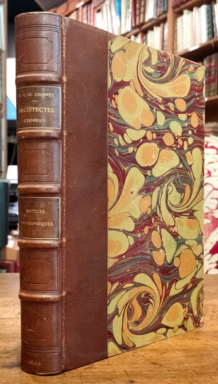
18995157Lyon, Bernoux et Cumin, 1899 ; grand in-8 ; demi-chagrin maroquiné havane, dos à nerfs orné de caissons à froid, titre doré, plats de couverture conservés (reliure de l'époque) ; IX (1bl.), 436 pp., (2) ff. de tables ; 2 dessins de Philibert de l'Orme en frontispice et 20 portraits photographiques hors-texte, nombreuses signatures en fac-similé.
Fine Turkish Paperback. Pbo. Mint. Large roy. 8vo. (25 x 17 cm). In Turkish. 9 volumes set: (4722, [394] p.). A very heavy set. Extra shipping cost will be required. ISTANBUL CONSTANTINOPLE Urbanism City planning Architecture Municipality studies.
New New English Original bdg. Dust wrapper. Oblong small 4to. (22 x 26 cm). In English. 340 p., b/w and color ills. Turgutreis, 1974. Turgutreis 1974 is a pioneering study of late 20th century urbanization engaging the evolution of a new municipality on the Bodrum peninsula along the Turkish Southeast Aegean coast. Since 1974, in less than four decades, three small villages with 2,464 inhabitants grew to a new city comprising more than 250,000 summer residents. This study documents in detail the timeless material culture of the original inhabitants, heavily grounded in subsistence agriculture and without modern infrastructure, and with a predominance of livelihoods related to grain and citrus production and traditional building crafts. By the turn of the millennium there had been a complete transition to a service economy for tourism with little left of the original built environment that was displaced by second homes and condominiums. The massive transformation of the original lifeworld typifies the urbanization of much of the Mediterranean coast during this same period, including the entire Bodrum peninsula. The story unfolds through an exacting documentation of the lives and livelihoods of fifteen of the original families including textual material and 140 original drawings and 250 photographs. Also included is an account of the historical development of the peninsula culled from a formal record of more than two thousand years. The research pushes the normative boundaries of built environment studies to include a lexicon of the traditional local building elements and methods, and their transition to modern practice. The field research entailed study over the entire period by the authors with teams from Columbia University and Middle East Technical University. Co-authors of the study are Suha Ozkan, Emeritus Professor of Architecture at METU; and Richard Plunz, Professor of Architecture at Columbia. Ozkan has been Deputy and Secretary General of the Aga Khan Award for Architecture between the years 1982 and 2006; and is presently founder of the Bodrum Architecture Library. Plunz has been Professor of Architecture at Columbia since 1974, where he has directed the Division of Architecture and the Urban Design Program. He is presently Director of the Urban Design Lab at Columbia's Earth Institute. CONTENTS: Preface: Turgutreis Now.; Introduction: What We Did.; The Environment in History.; Agriculture and Water.; The Grain Cycle. Ali and Nesibe Yavuz. Rabia Tolgar. Mehmet and Ayten Türk. Mehmet Ali and Ayten Gümüs. Hüseyin and Niyase Keskin; Mehmet and Hesna Keskin. Hakki and Zeynep Alkaç. Ali and Zeynep Karakas. Ayse Saygi.; Hatice Atilla.; Aydin and Nurten Dengiz.; Hasan Girgin.; Ahmet and Hatice Muglali.; Sevki and Zehra Bagci.; Muharrem Çaputçu, Hasan and Fatma Çaputçu.; 1974-1997 House Form and Cultural Displacement.; Fifteen Families in 1997.; Lexicon of Local Terms.; List of Illustrations.
Fine Fine English Original bdg. Dust wrapper. 4to. (34 x 25 cm). In Turkish. [2], [ix], 205 p., b/w photos and postcards, color plans of Izmir. Osmanli'dan Cumhuriyet'e Izmir planlari. Plans of Izmir - Smyrna, from the Ottoman Empire to the Republic of Turkey.
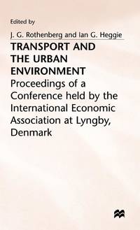
ria9780333150733_inpHardcover. New. New Book; Fast Shipping from UK; Not signed; Not First Edition; N/A hardcover
Fine Fine English Original bdg. Dust wrapper. 4to. (33 x 24 cm). In English. 230 p., ills., 8 numerous folded plates, map. The longest Roman water supply line [English Edition].
Fine Turkish, Ottoman (1500-1928) Paperback. Roy. 8vo. (24 x 17 cm). In Ottoman script. 320, [1] p. The book translated by Ali Suad, (Ottoman voyager, Najd Mutasarrif, and author), (1869-1933), including municipality methods according to the papers of the Third International Congress of City Planning held in Paris in 1925. "3rd UIV Congress takes place in Paris addressing systems of municipal government in various countries, land use policy of local authorities and its influence on the problem of housing, and large agglomerations. Congress receives a major report from Mr. G. Montagu Harris, then of the Ministry of Health in London, and who in the future will play a major role in IULA's life. Reports on the other subjects are made by Mr. Droogleever Fortuyn, who later will be Mayor of Rotterdam, and by Mr. Sellier, Mayor of Suresnes and Secretary-General of the Union des Villes et Communes de France. Over 720 delegates attend the congress and it is decided to attempt to rekindle links with the German union. ". (Source: Movimiento Municipal Internacional). Ali Suad, who was a constitutional intelligent and had his own style, writings, and poems, described the Ottoman Arab land between 1909-1912 as well. His voyages into Arabia includes two parts. The first one is 'Toward Najid' which was published in 'Tanin' newspaper as a 36 pieces-serialized. The second one is again published in the same newspaper, after that this travel note was published as a book. He was appointed as the 'mutasarrif' (a sort of local governor) of Najid, one of the most remote places of the Ottoman Empire, in 1909 by the governor of Basra, Süleyman Nazif. TBTK 13220. First and Only Edition.
1995wa830Universidade Tecnica de Lisboa Dos carré collé 1995 In-4 (21 x 29,2 cm), dos carré collé, 261 pages, texte en portugais ; petit choc au quatrième plat, par ailleurs bel état. Livraison a domicile (La Poste) ou en Mondial Relay sur simple demande.
New German Paperback. 4to. (32 x 24 cm). In German and Turkish. 405, [3] p., color and b/w ills. Das Werden einer Hauptstadt: Spuren deutschsprachiger Architekten in Ankara.= Bir baskentin olusumu: Avusturyali, Alman ve Isviçreli mimarlarin Ankara'daki izleri.
New Turkish Original bdg. HC. Folio. (42 x 34 cm). Text in Turkish and French. [xx], [66], 37, [1] p., color maps. Charles Edouard Goad'in Istanbul sigorta haritalari. Fire insurance maps of Istanbul by Charles Edouard Goad, (1848-1910). He was a cartographer and civil engineer, was born on 15 March 1848 at High Street, Camberwell, Surrey, the second son of Charles Goad, plumber, of London, and his wife, Caroline Ann (née Vogel). 1000 copies were printed.
56 pages. Features: Dr. John D. Strong; The Appalachian Trail; Detailed drawing of a newly designed lightship which will replace the ill-fated Nantucket; Surprising discoveries in the near east show that iron, glass, the arch, and bathrooms were in use far earlier than formerly supposed; Telepathy and Clairvoyance in a Trance Medium - an intensive series of tests conducted with a medium (Mrs. Eileen J. Garrett) and her spirit control showed the spirit to be no better as a telepathist than the medium; How bright is a lightning bug?; Various types of photographic exposure meters; Planets much larger than Jupiter are impossible; Copper and copper alloys are resisting corrosion; Back on the Land - The Subsistence Homestead movement is slowly reversing the urbanization trend - an experiment at Reedsville, West Virginia - article with photos; All-Wave Reception; Power from the Boulder Dam - two-pages of exceptional photos; Disordered glands can produce giants and dwarfs, fanatics and loafers; Rotating Wing Aircraft (helicopters) - intriguing possibilities; The Amateur Astronomer; photo of salvage bathysphere; Progress in Science - by Kermit Roosevelt; and more. Above-average external wear. Front cover nearly detached. Tape along backstrip. Not pretty but an informative vintage issue. Magazine
New New English Original bdg. Dust wrapper. In special light brown slip-case. 4to. (35 x 24 cm). In Turkish. 2 volumes set (211 p.; maps, color and b/w ills., 3 folding color maps). Researches on historical area of Sultanahmet / Istanbul.
New Turkish Original bdg. HC. Folio. (40 x 31 cm). In Turkish. 156 p., color ills., 4 foldig pages, 2 folded reprint maps in end-pocket. Plan, kroki ve haritalarda Kâgithane. Kagithane district of Istanbul (Constantinople) in old and rare plans and maps. A very comprehensive reference.
New New English Original bdg. Dusst wrapper. Folio. (32 x 24 cm). Edition in English. 310 p., many color and b/w ills. Environment and urbanism in the Ottoman Empire. Contents: Urbanism and environment in the pre-Islamic Turkic peoples, AHMET TASAGIL.; Islam and the environment, EROL ÖZVAR.; Nature, RECEP KARAKAYA.; Animals, M. MERT SUNAR.; Agriculture, FEHMI YILMAZ.; Disasters, SELIM KARAHASANOGLU.; People, EKREM TAK.; Industry and industrialization, EROL ÖZVAR, FEHMI YILMAZ.; Ottoman artisans and the state, MEHMET GENÇ.; Ottoman cities and urbanization, YUNUS UGUR.; The urbanization process in Southwest Anatolia, ZEKÂI METE.
New New English Paperback. Pbo. Dust wrapper. Small 4to. (26 x 18 cm). In Turkish. 2 volumes set: (463 p.; 508, [5] p). B/w ills. The protection and maintenance of historical waterways of Istanbul (Constantinople) based on the Ottoman archival documents. Osmanli arsiv belgelerinde Istanbul'un tarihî su yollari muhafazasi ve bakimi. 2 volumes set.
Fine English Paperback. Pbo. Oblong 4to. (21 x 29 cm). In Turkish. 194 p., b/w ills. ODTÜ'lü plancilar, 1963-1995.
Fine English Original bdg. HC. 4to. (28 x 22 cm). In English. 485 p., color and b/w ills. Istanbul an urban history. Byzantion, Constantinopolis, Istanbul. First Edition. This is not a book on archaeology, nor, although it lays particular stress on the architecture, an architectural history of Istanbul. It is an attempt to present the urban history of a world-city called Istanbul, Constantinople, Byzantion in different periods of its history. It delineates historical circumstances, or sudden ruptures, but above all, it attempts to present this unique world-city as experienced by its citizens and visitors, and as imagined by the world at large. While recent researches on the topography, history and monuments of the city are integrated in the text, my intention is to present the essence of the historical image of Istanbul contextually within physical, social and cultural framework. I have no intention of breaking new ground on the topography of the city, but I wish to convey the terms of a unique human experience in one of the longest surviving cities of the world, built in a most beautiful and enchanting landscape. The great Byzantine scholar R. Janin speaks of various "visages" of the city composed through the rhythms of life or caprices of the emperors. Most of this intricate relationships created in millennia between men, site, and artifact are gone and difficult to visualize. In writing this urban history, while I try to remain objective, I know that I create a literary model using as reference the least changed of the historical elements, the surviving monuments, the site with its basic shape and articulations, and contemporary accounts -not necessarily sources of hard facts, but as primary expressions, reactions and emotions. Thus tryingto keep myself away, as far as possible, from speculation and methods of criminal fiction, I have delineated the history of this grandiose, dramatic and often cruel city of Istanbul
New New Turkish Original bdg. Dust wrapper. In special box. Folio. (32 x 22 cm). Text in Turkish with facsimile of original Ottoman manuscript. 1045, [2] p., [860] p., color plates, facsimile. Levami'u'n-nur fi zulmet-i Atlas Minor. Inceleme-tipkibasim. Prep. by Ahmet Üstüner, H. Ahmet Arslantürk. [BOXED]. Annotated translation of Gerardius Mercator, (1512-1594)'s latin work known as Atlas Minor.