1 783 résultats
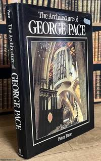
1990520116B.T. Batsford London 1990. Hardcover. Fine Condition/Near Fine Condition. 288 pages illustrated throughout. Original black cloth gilt lettered. With a lightly marked dustwrapper. Some staining to top edge. A detailed and richly illustrated account of the work of the twentieth-century ecclesiastical architect George G. Pace examining both his built projects and his written contributions to the field. It explores the fundamentals of church architecture through his new buildings restorations and furnishings and showcases the full range of his practice from designing modern churches to conserving ancient cathedrals and from wrought-iron fittings and carved lettering to guiding embroiderers in the creation of new vestments. Size: 22 x 30 cms. Category: Varied Books; Batsford Books ; New Arrivals; ISBN: 0713462736. ISBN/EAN: 9780713462739. This item may require more postage than the rates shown for delivery outside the UK. If extra postage is required we will contact you before processing your order and you will be given the details and option to decline the extra cost. 9780713462739 B.T. Batsford hardcover
Very Good English Original b/w portolan chart. Folded. A little foxing and some pencil markings and notes in Ottoman script in its period. Oblong double elephant folio. (70 x 102 cm). In English. Bosphorus to Kerempeh from the Russian survey of 1834 with additions and corrections by Commander W. J. L. Wharton., R. N. 1872-80. It's written 'London published according to Act of Parliament at the Hydrographic Office of the Admiralty Jare. 16th 1854. Also shows Killa Bay (Shile Bay) from a survey by Lieut. Comm. W. R. Pristen and the midshipmen of H. M. S. Royal Sovereign, 1920. Topography partly from a Turkish map. Up side of map, engraved a view from sea of entrance of the Bosphorus, Rumili (sic. Rumeli) Lighthouse and environment with several hills. And also shows Amastra (Ancient Amastris) from Russian surveys, 1834-41; Kosku Bay from a surbey by Capt. Spratt R. N. 1854; and Sungul Bay (Zonguldak) from the Heraclee Companys plans to 1915. A rare navigation chart.
New Turkish Paperback. Pbo. Roy. 8vo. (24 x 17 cm). In Turkish. 84 p., ills. Modernlik ve Türkiye'de modern camiler. Modernity and modern mosques in Turkey. Enlarged Second Edition.
1333107536.Gpaperback. Good. Access codes and supplements are not guaranteed with used items. May be an ex-library book. paperback
0666980446.Ghardcover. Good. Access codes and supplements are not guaranteed with used items. May be an ex-library book. hardcover
New English Paperback. 4to. (33 x 33 cm). In English and Turkish. 243 p., color and b/w ills. Erkut Sahinbas. 1968-1998 Mimarlik çalismalari.= 1968-1998 Architectural works. Introduction by C. Abdi Güzer. Sahinbas was born in Istanbul. Graduated from the Tarsus American College in Mersin in 1956. Received his Bachelor of Architecture degree in 1961 from the Middle East Technical University (METU), Ankara. Due to the influence of his proffessors J. Otto Spreckhelsen and Jakko Kaikkonen in METU, he developed an interest in Scandinavian Architecture and worked at the Ahti Korhonen-Eric Krakstorm Office in Copenhagen, Denmark in 1961 -1965. Received his Master of Architecture degree in 1964 from the Danish Royal Academy in Copenhagen where he taught architectural design with Professor Jorgen Bo. After returning back to Ankara in 1966, he taught at METU until 1975. Established his private office in 1968 and has been practicing architecture ever since. Served as the Chairman of the Association of Turkish Architects in Private Practice, between 1996 - 1998. Won the National Architectural Award of the Chamber of Turkish Architects twice; first in 1992 with the Bilkent Amfitheatre project, than in 1996 with the Bilkent University Library Annex.
As New English Paperback. Mint. 4to. (33 x 33 cm). In English and Turkish. 243 p., color and b/w ills. Erkut Sahinbas. 1968-1998 Mimarlik çalismalari.= 1968-1998 Architectural works. Introduction by C. Abdi Güzer. Sahinbas was born in Istanbul. Graduated from the Tarsus American College in Mersin in 1956. Received his Bachelor of Architecture degree in 1961 from the Middle East Technical University (METU), Ankara. Due to the influence of his proffessors J. Otto Spreckhelsen and Jakko Kaikkonen in METU, he developed an interest in Scandinavian Architecture and worked at the Ahti Korhonen-Eric Krakstorm Office in Copenhagen, Denmark in 1961 -1965. Received his Master of Architecture degree in 1964 from the Danish Royal Academy in Copenhagen where he taught architectural design with Professor Jorgen Bo. After returning back to Ankara in 1966, he taught at METU until 1975. Established his private office in 1968 and has been practicing architecture ever since. Served as the Chairman of the Association of Turkish Architects in Private Practice, between 1996 - 1998. Won the National Architectural Award of the Chamber of Turkish Architects twice; first in 1992 with the Bilkent Amfitheatre project, than in 1996 with the Bilkent University Library Annex.
Very Good Turkish, Ottoman (1500-1928) Original cromolithograph mounted on cloth. Folded. Some foxing and slimming on creases. Oblong double elephant folio. (97 x 107 cm). In Ottoman script. Shows the Bosphorus, Istanbul city with detailed place names. Black Sea at North, Marmara Sea at South and the Princes' Islands seen at southwest area. Mapmaker not described usual like in Turkish military maps. An extremely rare the Bosphorus map with its unusual size. Not in TBBMM library (The Grand Assembly of Turkish Republic Liibrary). Not in Military Libraries in Turkey.
Very Good Turkish, Ottoman (1500-1928) Original cromolithograph color map. Repaired. A good copy. Oblong atlas folio. (50 x 60 cm). In Ottoman script. [MAP of the BOSPHORUS] Bogaziçi; Kavaklar: Rumeli Kavagi, Belgrad, Hisarlar. Shows Asian and European shores, topography with detailed place names in its Bosphorus part of Anadolu and Rumeli Kavagi of Istanbul. At east, Belgrad; at northeast, Black Sea. No information on mapmaker. Hegira:: 1327 = Gregorian: 1911. Scale: 1/25.000. Rare.
Very Good Turkish, Ottoman (1500-1928) Original color map. Folded. Chipped and slightly tears on extremities. Slightly stained and yellowing on paper. Oblong atlas folio. (50 x 60 cm). In Ottoman script. [MAP of the BOSPHORUS / CONSTANTINOPLE] Kavaklar: Rumeli Kavagi, Hisarlar. Shows the Bosphorus, and its Kavaklar and Hisarlar shores. Mapmaker is not described. Scale: 1/25.000. Mubde-i tul: Hagia Sophia. This is one the serie of the Bonn projection maps which are the first map series in modern techniques in Turkey and the Ottoman Empire. This is one the serie of the Bonn projection maps which are the first map series in modern techniques in Turkey and the Ottoman Empire. In order to produce these maps covering Turkish territory, Reconnaissance Branch was incorporated into The Mapping Commission. The maps were produced in the datum based on the latitude and longitude of Ayasofya Mosque in equal area Bonn Projection. The field works for the 123 sheets covering the country were conducted by 76 staff. The production was completed in 18 years starting from east west. Field works continued without stopping except in years 1914 and 1920. This map series called also reconnaissance maps contributed a lot to producing 1:25.000 scale maps. Hegira: 1328 = Gregorian: 1911. A good copy. Very scarce.
Very Good Turkish, Ottoman (1500-1928) Original color map on cloth. Folded. A good copy. Oblong atlas folio. (50 x 60 cm). In Ottoman script. [MAP of WEST ANATOLIA] Edremid Bay, The Dardanelles, Limni, Bozcaada (Tenedos), Balikesir, Ayvalik, Kal'a-yi Sultaniye. Shows Northeast Anatolia; southwest entrance of the Dardanelles, Çanakkale, Balikesir cities, Ayvalik, Tenedos Island, shores of North Aegean, Bay of Edremit. Mapmaker is not described. Scale: 1/200.000. Mubde-i tul: Greenwich and Dersaadet. This is one the serie of the Bonn projection maps which are the first map series in modern techniques in Turkey and the Ottoman Empire. This is one the serie of the Bonn projection maps which are the first map series in modern techniques in Turkey and the Ottoman Empire. In order to produce these maps covering Turkish territory, Reconnaissance Branch was incorporated into The Mapping Commission. The maps were produced in the datum based on the latitude and longitude of Ayasofya Mosque in equal area Bonn Projection. The field works for the 123 sheets covering the country were conducted by 76 staff. The production was completed in 18 years starting from east west. Field works continued without stopping except in years 1914 and 1920. This map series called also reconnaissance maps contributed a lot to producing 1:25.000 scale maps. Hegira: 1327 = Gregorian: 1910. Slightly stained and yellowing on paper. Loose extremities. A good copy. Very scarce. One copy in TBMM Library Map Collection: 201102274.
Very Good Turkish, Ottoman (1500-1928) Original color map. Oblong atlas folio. (51 x 61 cm). In Ottoman script. Folded. Topography and toponyms of East Anatolia: Shows Erzurum region, Hasankale (Pasinler), Oltu, Hinis, Karakilise and surroundings. Scale: 1: 200.000. This is one the serie of the Bonn projection maps which are the first map series in modern techniques in Turkey and the Ottoman Empire. In order to produce these maps covering Turkish territory, Reconnaissance Branch was incorporated into The Mapping Commission. The maps were produced in the datum based on the latitude and longitude of Ayasofya Mosque in equal area Bonn Projection. The field works for the 123 sheets covering the country were conducted by 76 staff. The production was completed in 18 years starting from east west. Field works continued without stopping except in years 1914 and 1920. This map series called also reconnaissance maps contributed a lot to producing 1:25.000 scale maps. Rare.
Very Good Turkish, Ottoman (1500-1928) Original color map on cloth. Folded. Wrinkled on paper. Stains on cloth. 12 sheets on paper. Oblong atlas folio. (50 x 60 cm). In Ottoman script.[MAP of ALEXANDRETTA] Iskenderun - Tayakadin. It shows villages and settlements in Tayakadin of Iskenderiye. Scale: 1/25.000. Hegira: 1329 = Gregorian: 1913. This is one the serie of the Bonn projection maps which are the first map series in modern techniques in Turkey and the Ottoman Empire. In order to produce these maps covering Turkish territory, Reconnaissance Branch was incorporated into The Mapping Commission. The maps were produced in the datum based on the latitude and longitude of Ayasofya Mosque in equal area Bonn Projection. The field works for the 123 sheets covering the country were conducted by 76 staff. The production was completed in 18 years starting from east west. Field works continued without stopping except in years 1914 and 1920. This map series called also reconnaissance maps contributed a lot to producing 1:25.000 scale maps. Not description on map-maker. A very detailed map. Extremely rare.
Very Good Turkish, Ottoman (1500-1928) Original color map. Folded. Oblong atlas folio. (50 x 60 cm). In Ottoman script. Shows Eastern and Southeastern parts of Anatolia; Maras, Elbistan, Birecik and Kilis areas. Hegira: 1333 = Gregorian: 1917. Not description on map-maker.
Very Good Turkish, Ottoman (1500-1928) Original color map. Folded. Oblong atlas folio. (50 x 60 cm). In Ottoman script. [MAP of EAST ANATOLIA and ARTVIN] Oltu, Artvin, Ispir, Hasankale. Shows Artvin, Ispir, Hasankale and Kars city. Scale: 1/200.000. This is one the serie of the Bonn projection maps which are the first map series in modern techniques in Turkey and the Ottoman Empire. In order to produce these maps covering Turkish territory, Reconnaissance Branch was incorporated into The Mapping Commission. The maps were produced in the datum based on the latitude and longitude of Ayasofya Mosque in equal area Bonn Projection. The field works for the 123 sheets covering the country were conducted by 76 staff. The production was completed in 18 years starting from east west. Field works continued without stopping except in years 1914 and 1920. This map series called also reconnaissance maps contributed a lot to producing 1:25.000 scale maps. Hegira: 1332 = Gregorian: 1916. Not description on map-maker.
Very Good Turkish, Ottoman (1500-1928) Original color map. Folded. Oblong atlas folio. (50 x 60 cm). In Ottoman script. [MAP of EAST ANATOLIA] Hozat, Dersim. Shows Eastern parts of Anatolia; Dersim-Horat and border of Erzincan city; Divrigi; Harput (Kharpout); Kilis; and Munzur Mountains, et alli. Scale: 1/200.000. Hegira: 1330 = Gregorian: 1914. Not description on map-maker.
Good Turkish, Ottoman (1500-1928) Original color map. Folded. Tears in margins. Slightly stained. Otherwise a good copy. Oblong atlas folio. (50 x 60 cm). In Ottoman script. [MAP of EAST BLACK SEA] Artvin, Rize, Oltu. Shows Artvin and Georgian borders, Rize (Rizeon - Rizunda - Rizini) and Oltu cities and regions. Scale: 1/200.000. Hegira: 1330 = Gregorian: 1914. This is one the serie of the Bonn projection maps which are the first map series in modern techniques in Turkey and the Ottoman Empire. In order to produce these maps covering Turkish territory, Reconnaissance Branch was incorporated into The Mapping Commission. The maps were produced in the datum based on the latitude and longitude of Ayasofya Mosque in equal area Bonn Projection. The field works for the 123 sheets covering the country were conducted by 76 staff. The production was completed in 18 years starting from east west. Field works continued without stopping except in years 1914 and 1920. This map series called also reconnaissance maps contributed a lot to producing 1:25.000 scale maps. Not description on map-maker. Extremely rare.
Very Good Turkish, Ottoman (1500-1928) Original color map. Folded. Oblong atlas folio. (50 x 60 cm). In Ottoman script. [MAP of EAST BLACK SEA] Trabzon, Giresun, Erzincan, Ispir. Shows Trebizond, Cerasonte, Erzingan (Eriza), Suspiritis (Sper) of Erzurum (Erzeron city); mostly Black Sea shores of Trabzon and Giresun. . Scale: 1/200.000. This is one the serie of the Bonn projection maps which are the first map series in modern techniques in Turkey and the Ottoman Empire. In order to produce these maps covering Turkish territory, Reconnaissance Branch was incorporated into The Mapping Commission. The maps were produced in the datum based on the latitude and longitude of Ayasofya Mosque in equal area Bonn Projection. The field works for the 123 sheets covering the country were conducted by 76 staff. The production was completed in 18 years starting from east west. Field works continued without stopping except in years 1914 and 1920. This map series called also reconnaissance maps contributed a lot to producing 1:25.000 scale maps. Hegira: 1336 = Gregorian: 1920. Not description on map-maker. Extremely rare.
Very Good Turkish, Ottoman (1500-1928) Original color map on cloth. Oblong atlas folio. (49 x 60 cm). Toponyms in Turkish with Arabic letters. In Ottoman script. Scale: 1/25.000. [MAP of ISTANBUL / CONSTANTINOPLE] Küçükköy, Petnahor, Makriköy, Kagidhane [Kagithane]. A rare Istanbul map including some old Byzantine toponyms.
Very Good Turkish, Ottoman (1500-1928) Original color map on cloth. Folded. Oblong atlas folio. (50 x 60 cm). In Ottoman script. Shows Konya city and around, Alaiye at south. Not description on map-maker. Scale: 1: 200.000. This is one the serie of the Bonn projection maps which are the first map series in modern techniques in Turkey and the Ottoman Empire. In order to produce these maps covering Turkish territory, Reconnaissance Branch was incorporated into The Mapping Commission. The maps were produced in the datum based on the latitude and longitude of Ayasofya Mosque in equal area Bonn Projection. The field works for the 123 sheets covering the country were conducted by 76 staff. The production was completed in 18 years starting from east west. Field works continued without stopping except in years 1914 and 1920. This map series called also reconnaissance maps contributed a lot to producing 1:25.000 scale maps. Rare.
Very Good Turkish, Ottoman (1500-1928) Original color map on cloth. Folded. Oblong atlas folio. (50 x 60 cm). In Ottoman script. [MAP of MAGNESIA - AEGEAN REGION] Manisa - Soma, Izmir, Aydin cities (Magnesia, Smyrna and Tralleis) in Aegean region. It shows villages and settlements in Tayakadin of Iskenderiye. Scale: 1/25.000. Hegira: 1328 = Gregorian: 1912. This is one the serie of the Bonn projection maps which are the first map series in modern techniques in Turkey and the Ottoman Empire. In order to produce these maps covering Turkish territory, Reconnaissance Branch was incorporated into The Mapping Commission. The maps were produced in the datum based on the latitude and longitude of Ayasofya Mosque in equal area Bonn Projection. The field works for the 123 sheets covering the country were conducted by 76 staff. The production was completed in 18 years starting from east west. Field works continued without stopping except in years 1914 and 1920. This map series called also reconnaissance maps contributed a lot to producing 1:25.000 scale maps. Not description on map-maker. A very detailed map showing lakes, rivers and mountains. Extremely rare.
Very Good Turkish, Ottoman (1500-1928) Original color map on cloth. Oblong atlas folio. (44 x 58 cm). Scale: 1/200.000. Toponyms in Ottoman script /Turkish with Arabic letters). Shows southwest of the Gallipoli Peninsula [and the Hellespont], Edremid Gulf, Tenedos, and North Aegean shores of Anatolia]. Folded. This is one of the series of the Bonn projection maps which are the first map series in modern techniques in Turkey and the Ottoman Empire. In order to produce these maps covering Turkish territory, Reconnaissance Branch was incorporated into The Mapping Commission. The maps were produced in the datum based on the latitude and longitude of the Ayasofya Mosque in equal area Bonn Projection. The field works for the 123 sheets covering the country were conducted by 76 staff. The production was completed in 18 years starting from east-west. Fieldworks continued without stopping except in the years 1914 and 1920. This map series called also reconnaissance maps contributed a lot to producing 1:25.000 scale maps. Hegira: 1336 = Gregorian: 1920. Not description on map-maker. Extremely rare.
Very Good Turkish, Ottoman (1500-1928) Original chromolithograph folded map mounted on cloth. A good copy. Oblong atlas folio. (47 x 60 cm). In Ottoman script. Scale: 1/200.000. Shows Vathy, Arkioi, Leipsoi, Nekaria, Patmos, Kos, and Fournoi Islands in Greek archipelago with Smyrna shores at east. A decorative and rare map.
Very Good Turkish, Ottoman (1500-1928) Original color map. Folded. Oblong atlas folio. (50 x 60 cm). In Ottoman script. Scale: 1/200.000. [MAP of EAST ANATOLIA - ERZERON] [Erzurum:] Oltu, Artvin, Hasankale, Ispir. This is one the serie of the Bonn projection maps which are the first map series in modern techniques in Turkey and the Ottoman Empire. This is one the serie of the Bonn projection maps which are the first map series in modern techniques in Turkey and the Ottoman Empire. In order to produce these maps covering Turkish territory, Reconnaissance Branch was incorporated into The Mapping Commission. The maps were produced in the datum based on the latitude and longitude of Ayasofya Mosque in equal area Bonn Projection. The field works for the 123 sheets covering the country were conducted by 76 staff. The production was completed in 18 years starting from east west. Field works continued without stopping except in years 1914 and 1920. This map series called also reconnaissance maps contributed a lot to producing 1:25.000 scale maps. Not in Ataturk Library and TBMM Library.
Very Good Turkish, Ottoman (1500-1928) Original color map. Folded. Atlas folio. (82 x 57 cm). In Ottoman script. Scale: 1/400000. A clean copy. Including Azerbaijan, Dagestan, Mahaçkala, Tbilisi, Yerevan, Darband, et alli. A fine map of Caucasus and shores of Caspian Sea. Extremely rare.