J. LouvièreLivre Rare Book
1 783 résultats
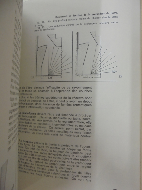
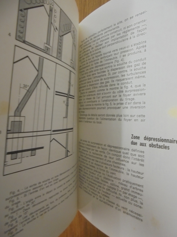
ARCH248C211Massin. In-8. Relié toilé. 113 pp., nombreux schémas noir et blanc in texte. Avec Jaquette.
ARCH249C211Massin. In-8. Relié toilé. 113 pp., nombreux schémas noir et blanc in texte. Avec Jaquette.
Very Good French Original b/w map. Oblong folio. (30 x 34 cm). In French. [MAP of BATTLE of MOHACZ] Bataille de Mohacz entre Louis Roi de Hongrie et Souleman I. le 28 Aôut 1526 (20 Silkide 932). Grave par U. Muschani. Atlas des batailles et sieges pour servir a l'histoire de l'Empire Ottoman, Pl. VIII. From "Nouvel atlas physique, politique et historique de l'Empire ottoman et des États limitrophes. / dressé. par J.-J. Hellert ; revu, corrigé et accompagné d'un commentaire historique, géographique et statistique. par Ge Heck, et L[é]on Plée..." printed in 1843. Engraved. Rare.
Very Good French Original b/w map. Oblong folio. (30 x 34 cm). In French. [MAP of OTTOMAN CRIMEA] Crimee. Gravee par U. Muschani. Shows Crimean peninsula, shores of Black Sea, Azov Sea, Kerkinit Golf, with its old places names. From "Nouvel atlas physique, politique et historique de l'Empire ottoman et des États limitrophes. / dressé. par J.-J. Hellert ; revu, corrigé et accompagné d'un commentaire historique, géographique et statistique. par Ge Heck, et L[é]on Plée..." printed in 1843. Engraved. Rare.
Small white label (covering a price? a name?) on front end paper. No other marks or inscriptions. A very clean very tight copy with bright unmarked kingfisher blue boards and no bumping to corners. Dust jacket not price clipped or marked or torn or creased with extremely minor traces of sunning. Now protected in fully-removable transparent sleeve.
0428100856.Gpaperback. Good. Access codes and supplements are not guaranteed with used items. May be an ex-library book. paperback
Very Good Turkish Paperback. Roy. 8vo. (24 x 17 cm). In Turkish. [xiii], 98 p., numerous b/w plates. Istanbul'da tarihi yapilarda uygulanan temel sistemleri. Base systems of the historical buildings and monuments in Istanbul. Scarce.
Very Good Turkish, Ottoman (1500-1928) Original color map. Folded. Oblong atlas folio. (50 x 60 cm). In Ottoman script. Shows Eastern parts of Anatolia; Siverek, Urfa city and border of Diyarbakir and Adiyaman cities; Siverek; Harput (Kharpout); et alli. Scale: 1/200.000. Hegira: 1333 = Gregorian: 1917. Not description on map-maker. This is one the serie of the Bonn projection maps which are the first map series in modern techniques in Turkey and the Ottoman Empire. This is one the serie of the Bonn projection maps which are the first map series in modern techniques in Turkey and the Ottoman Empire. In order to produce these maps covering Turkish territory, Reconnaissance Branch was incorporated into The Mapping Commission. The maps were produced in the datum based on the latitude and longitude of Ayasofya Mosque in equal area Bonn Projection. The field works for the 123 sheets covering the country were conducted by 76 staff. The production was completed in 18 years starting from east west. Field works continued without stopping except in years 1914 and 1920. This map series called also reconnaissance maps contributed a lot to producing 1:25.000 scale maps. Subasi is cartographer of this map according to Türkezer - Cobanoglu: History of Mapping in Turkey-1:200.000 Scale Maps.
19311196925Düsseldorf, Schwann, 1931. 4to. 12, 378 S., 1 Bl. m. 239 Abb., 16 Taf. (davon 3 gefaltet). Neuer Lwdbd (Vort. u. Titel etwas wellig, 1 Bl. m. kl. hinterlegten Randeinriß).
1903240651Chicago: Iroquois Theatre Thomas J. Noonan 1903 . First edition. Hardcover. Good minus. 8vo 93 pages variant red cloth all edges gilt covers lightly stained lower corner of rear cover a bit "chewed". Scarce <br/><br/>Less than six weeks after Chicago's grandest new theater opened it burned to the ground due to flagrant safety violations and corruption. More than 600 died in America's worst theater disaster. It resulted in new codes requiring outward-opening safety doors. This hardcover book appeared before the opening performance. It relates a history of the theatres in Chicago by Charles E. Nixon; tells why this magnificent venue was built and how with illustrations of the theatre plans and interiors and furnishings. "The Iroquois . will impress even the most superficial observer by its beauty and grandeur . The style architecturally is French renaissance which has a strong suggestion of the classic. designed by architect Benjamin H. Marshall ." Illustrated and with plates of posters and of the builders and equipment suppliers to the theatre. Iroquois Theatre, Thomas J. Noonan hardcover
New English Original bdg. HC. 4to. (33 x 24 cm). In Turkish. 660 p., color and b/w plates. 1000 copies were printed. ISBN: 9786053637995. A comprehensive study on Turkish and Islamic architecture in Diyarbakir city. Medeniyetler mirasi Diyarbakir mimarisi.= Civilisations heritage Diyarbakir architecture.
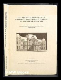
1995424672Tainan Taiwan : Dept. of Architecture National Cheng Kung University 1995. 1st edition. Hardcover. Near fine copy in the original colour-printed boards. Remains particularly well-preserved overall. Physical description; 208p. Notes; Sponsored by Chen Chung Ho Foundation organized by the Dept. of Architecture National Cheng Kung University and held at Kaohsiung and Tainan in March 1995. Tainan, Taiwan : Dept. of Architecture, National Cheng Kung University hardcover
1904R100037964Non Renseigné. 1904. In-12. Broché. Bon état, Couv. convenable, Dos satisfaisant, Intérieur frais. Un peu tachée, bon état.. . . . Classification : 251.32-Edifices
1396274294.Ghardcover. Good. Access codes and supplements are not guaranteed with used items. May be an ex-library book. hardcover
198424031Conseil d’Architecture, d’Urbanisme, et de l’Environnement de la Marne 1984 In-4 broché, 435 pp, importante documentation, plans, relevés, illustrations en noir & blanc. Bon exemplaire.
0265235723.Ghardcover. Good. Access codes and supplements are not guaranteed with used items. May be an ex-library book. hardcover
1331698227.Gpaperback. Good. Access codes and supplements are not guaranteed with used items. May be an ex-library book. paperback
0266214800.Ghardcover. Good. Access codes and supplements are not guaranteed with used items. May be an ex-library book. hardcover
1900250301Chicago: Illinois Theatre 1900. First edition. Hardcover. Good minus. Octavo; 45 xvi pages soiled cream cloth a.e.g. <br/><br/>Less than six weeks after Chicago's grandest new theater the Iroquois opened it burned to the ground due to flagrant safety violations and corruption. More than 600 died in America's worst theater disaster. It resulted in new codes requiring outward-opening safety doors. This hardcover book appeared before the opening performance. It relates a history of the theatres in Chicago by Charles E. Nixon; tells why this magnificent venue was built and how with illustrations of the theatre plans and interiors and furnishings. "The Iroquois . will impress even the most superficial observer by its beauty and grandeur . The style architecturally is French renaissance which has a strong suggestion of the classic. designed by architect Benjamin H. Marshall ." Illustrated and with plates of posters and of the builders and equipment suppliers to the theatre. Illinois Theatre hardcover
1905DEMO006838IPeoria: J. M. Franks & Sons ca.1905. First edition. stapled wrappers. Very Good. many photos. 4to unpaged 34 x 25 cm. grey decorated stapled wraps trifling wrinkling with hint of damp to bottom margin short tear to first leaf. WorldCat cites only two copies. Rare. <br/><br/>"A prosperous modern and thriving city of 80000 population destined to become a city of 125000 within the next ten years." Cover page features decorative motifs and borders with ornate black and orange type. Photomechanical reproductions of photographs of Peoria with accompanying text "The Advantages of Peoria Illinois." Includes images of the court house bird's eye view landscape city hall hotels churches public buildings college buildings scenes of Bradley and Glen Oak parks Illinois river and Soldier's monument. J. M. Franks & Sons unknown
Text is in Japanese. 236 pages with a great many, often several per page, b&w photos taken in Japan very soon after the A-bomb explosions, both of survivors and their injuries and structural damage of all kinds, including close-ups of beams, trees, bridges, railroad tracks, etc. with maps specifying location of the adjacent photos. Many burn victims, many of which are children. Includes worn, folded and torn (1/2 page) 4-page fold-out photo of ground zero and surrounding city to mountains in the distance: totally decimated, a landscape of scorched rubble. Ex-library book with usual marks, stamps, etc. Library binding is solid with bent corners and text/interior is marked on a few pages with script in Japanese -- otherwise clean . A rare historical document. Publication information requires translation.
Very Good Turkish, Ottoman (1500-1928) An extremely rare litho propaganda map published as an extra supplement to the Tercümân-i Hakîkat [i.e. The Translator of Truth] newspaper just before the proclamation of Republic in Turkey in 1923 by Mustafa Kemal Atatürk (1881-1938), showing the front in West Anatolia during the War of Independence (or National Struggle) between 1919-1922 against Greek forces. The upside of the map between the note as title 'Gift to the readers of 'Tercümân-i Hakîkat', Mustafa Kemal Atatürk's portrait among decorated heroic lithographed drawings. In the lower right corner, can be seen legends of the map, scale, and mapmaker's signature. Tercümân-i Hakîkat was a daily newspaper published in Istanbul between 1878-1921 during the Ottoman Empire. Tercüman-i Hakîkat, the most important newspaper published during the reign of Sultan Abdülhamid II, was founded by novelist Ahmed Midhat Efendi, (1844-1912). In the beginning, most of the articles were written by Ahmed Midhat Efendi. It was an encyclopedic newspaper with the aim of inculcating and educating reading habits among the Turks and it played an important role in the training of many famous Ottoman journalists. Its first issue was published on June 26, 1878. After Ahmed Midhat's death in 1913, the newspaper changed owners, and the last issue was published on February 11, 1921. Ibrahim Alaettin Gövsa, (1889-1949), was an Ottoman / Turkish journalist, educator, and intellectual who supported the War of Independence the most. This propaganda map published in Tercümân-i Hakîkat, during the war in 1920 or 1921, is a propaganda tool that calls on the literate people belonging to a certain class, especially those living in Istanbul, to support the war, and aims to spread the word that Turkey is winning the war. Original lithograph map. 50x35,5 cm. In Ottoman script (Turkish with Arabic letters). Scale: 1: 250.000. Occasionally foxing and slight stains on paper, folded traces. Otherwise a very good copy.
Ola SteenIn Pristine Condition. unknown
128p. Illustrated with numerous photographs and architectural plans. Small 4to. Original full cloth backed binding. The Masters of World Architecture Series. ARCH 2
Ranta, HelenaIn Pristine Condition. unknown