Siegfried Hermann:Livre Rare Book
7 586 résultats
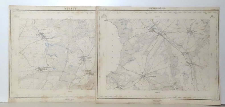
22007351 cartes au format (sauf exception) d'environ 40 x 30 cm. Feuillets de titre et de présentations avec déchirures, certaines cartes en état moyen (rousseurs, déchirures, parfois avec manques), la plus grande partie néanmoins dans un état tout à fait satisfaisant (voir images).
4to (280 x 215 mm), [8], 64pp., plus one leaf of publishers' adverts, 28 mounted photographs (165 x 120 mm) of Nottingham street views, each with caption title in ink on lower margin, orig. green cloth, spine and upper cover decorated in gilt and black with a mounted photographic view of Nottingham Castle, re-cased, some minor fraying to head and foot of spine otherwise a very nice copy. Gernshiem describes a copy with 12 albumen prints and gives a date of 1875. In our copy page 64 notes that "While these sheets are passing through the press, an event of unusual interest has taken place in Nottingham. On Thursday, September 27th, 1877, the Foundation Stone of the new University College was laid." Inscribed on front free-endpaper "Mary Thorpe, with her brothers love and best wishes, January 20th 1882." Gernshiem, 601.
1911MILI2401Wien, Verlag des k. u. k. Militärgeographischen Institutes 1881-1911. Gr.-8°. pro Ausgabe ca. 120 S. mit insg. 323 (teilweise farbigen) Beilagen, HLnbde. der Zeit mit goldener Rückentitelprägung, ODeckel teilweise beigebunden, ausgeschiedene Bibl.-Ex. mit den üblichen Kennzeichnungen, innen papierbedingt etwas gebräunt. Die Mitteilungen erschien 1881 - 1925 in 34 Jahrgängen, damit Ersch. eingestellt.
193719843München, Adreßbuchverlag der Industrie- und Handelskammer, (1937). 88. Ausgabe. 32, 16, 705, 211, 96, 680, 116 SS., 1 photographische s.w. Tafel zeigend Hitler und Mussolini in den Ehrentempeln der Bewegung, - bei den eingeschalteten Reklame-Beilagen ist 1 Karte an der Perforation abgetrennt (ca. 1/2 Blatt), sonst komplett. 4°, rote Halbleinwand der Zeit, Titeldeckel geprägt und mit Pschorr-Bräu-Werbung.
36748Paris. Librairie Orientaliste Paul Geuthner. 1927. Bibliothèque Archéologique et Historique. In-8. Rel demi-Basane rouge. 4 nerfs et pièce de titre au dos. Couverture d'origine conservée. 16 cartes dépliantes. 632 p. Excellent état malgré quelques légères rousseurs sur les tranches et un petit tampon de l'ancien propriétaire sur la page de titre.
in-8, pp. (8), 136 (le pagine 103-104 sono erroneamente poste tra le pp. 120-121), 1 grande carta geografica ripiegata in fine, legatura coeva in p. pergamena. Edizione originale, rara a trovarsi, specie completa della carta geografica in fine. L'opera è utilissima e assai interessante, comprende: la descrizione delle strade e l'indicazione delle vie in cui erano stabilite le stazioni postali, la tavola alfabetica delle strade postali, la disciplina del servizio postale, anche relativamente agli stati esteri, cenni sulle diligenze, sulle vetture privilegiate in corso regolare di posta, ed i prezzi per il trasporto di merci dalla capitale ai capoluoghi di provincia. Infine si trovano le tavole di ragguaglio del ''miglio di Piemonte'' con le altre unità di misura italiane ed estere. Buon esemplare, fresco e ad ampi margini.. Non in Manno-Promis.
1875KART0094Wien, k.k. militär-geografischen Institute (1875). 1 Skelett-Karte, 12 lith.Teilkarten, kol., in Segmente zerschnitten und auf Leinen aufgezog., zus. in modernen Leinenschuber unter Verwendung des Orig. Leder-Einbandrückens, dieser beschabt, eine Karte auf Leinenbezug schwarzfleck., Karte XI doppelt vorha
163046404471s. l. (Paris), , (vers 1630) ; in-8 oblong, demi-basane rose, dos lisse orné de motifs dorés. (Reliure du XIXe siècle). Titre gravé dans un encadrement baroque de rocailles, table gravée, 51 planches numérotées pour ce titre auxquelles on a ajouté 15 autres gravures.Cartes des gouvernements, plans et vues des villes. Les plans de Champagne concernent les principales villes de l’actuelle Champagne, mais aussi les Ardennes et la Lorraine. Ay, Chaalons, Charleville, Chaumont, Clermont, Dormans, Espernay, Langres, Maubert Fontaine, Mery sur Seine, Meszière, Monteclair, Montigny le Roy, Mouzon, Ste Menehould, Troyes, Verdun, Villefranche, Virty le François. Pour chaque gouvernement, une carte de la région, chaque ville est ensuite représentée par un plan et une vue. La table annonce pour la planche 29 un plan de Maubert-Fontaine, elle a été remplacée ici par une vue de Dampierre non numérotée qui n’est pas annoncée dans la table. Les 15 cartes et vues ajoutées sont du même format, certaines, du XVIIe, de la même facture que l’album, semblent être également de Tassin, d’autres sont plus tardives, toutes montrent des vues et plans de villes de Champagne. Certaines planches, en particulier les figues ajoutées, ont été montés sur papier vergé par le relieur du XIXe siècle qui a aussi doublé un marge. De la bibliothèque de Louis Morin, typographe à Troyes (ex-libris du XIXe), ce dernier a noté sur la garde : “Il a été ajouté des vues et plans, ce qui (...) rend le présent recueil des plus intéressants”.
Roy. 8vo., Second and Best Edition, with portrait frontispiece, title in red and black, and 21 plates (one double-page); original buckram gilt, gilt back, bevelled edges, uncut, covers lightly age-marked else a very good, internally spotless copy. King's work, first published in 1879, immediately established itself as the standard popular reference on the ancient New Forest town; local interest generated the inevitable additions and corrections, but the planned second edition, incorporating the numerous addenda, was deferred by the author's death. This best edition, compiled and published by the author's son from his father's meticulous notes, benefits from much new material and many fresh illustrations. This copy was formerly in the library of Professor [Sir] J H Biles, the eminent naval architect [of 'Titanic' Enquiry fame], and bears his elegant blind-embossed art nouveau bookplate (with press-mark in manuscript) on front paste-down. John Harvard Biles (1854-1933) was apprenticed at Portsmouth Dockyard, studied at the Royal School of Naval Architecture and joined the Admiralty in 1877. His talents were quickly recognised and in 1880 (at the age of only 26) he was appointed chief designer to the major shipbuilder J&G Thomson on Clydebank where he created the revolutionary designs for the 'City of Paris' and 'City of New York'. In 1883 he left to join the foundling consultancy established by Sir Edward Reed, where he quickly became a driving force (the consultancy continues to the present day as Sir J H Biles & Co.). In 1891 he was awarded the Chair of Naval Architecture at Glasgow University (then perhaps the most prestigious such appointment in the world) where he devoted himself to teaching and consultancy on a world-wide scale. IN VIEW OF HIS EMINENCE IN THE FIELD OF SHIP DESIGN AND CONSTRUCTION, PROFESSOR BILES WAS AN ASSESSOR IN THE ENQUIRY INTO THE LOSS OF RMS 'TITANIC' AND SUBSEQUENTLY HE SERVED ON THE BOARD OF TRADE ENQUIRY INTO LIFEBOATS AND LIFE-SAVING APPLIANCES WHICH AROSE AS A RESULT OF THE TITANIC LOSS. For his services to the 'Titanic' Enquiry and naval architecture in general, Biles was knighted in 1913
1833SB-06147Stuttgart, J. Scheible's Buchhandlung, 1833. Brauner marmorierter Original-Halblederband mit drei echten Bünden sowie dezenter Prägestruktur. Buchdeckel in schöner mehrfarbiger Marmorierung und mit Lederecken, rot eingefärbter Buchschnitt. 6 Bl., 417 S. Unschätzbare, ungemein präzise Quelle zur Topographie, Demographie und Wirtschaftsstruktur Württembergs im frühen 19. Jahrhundert, zugleich ein Werk zur Orts- und Landesgeschichte. Die im Lexikon enthaltenen Ortsartikel beinhalten unter anderem Angaben zur genauen geographischen Lage, zur jeweiligen Kirchengeschichte, zu ansässigen Behörden, Handwerks- und Gewerbebetrieben, Mühlen und ggf. Industriebetrieben.
176027718Kbhvn., H.H. Godiche, 1760. 4to. Samt. helldrbd. med rig rygforgyldning. Øverste kapitæl slidt. Lettere brugsspor. Skindtitel på ryg. (32),512 pp. samt 14 kobbersyukne plancher. Grundtegningen repareret på bagside med tape, pp. 236-237 med tab af et hjørne. Gl. ejernavne på titebladet, bl.a. M. Nyrop. Her og der med lidt brunpletter. Stort eksemplar på skrivepapir.
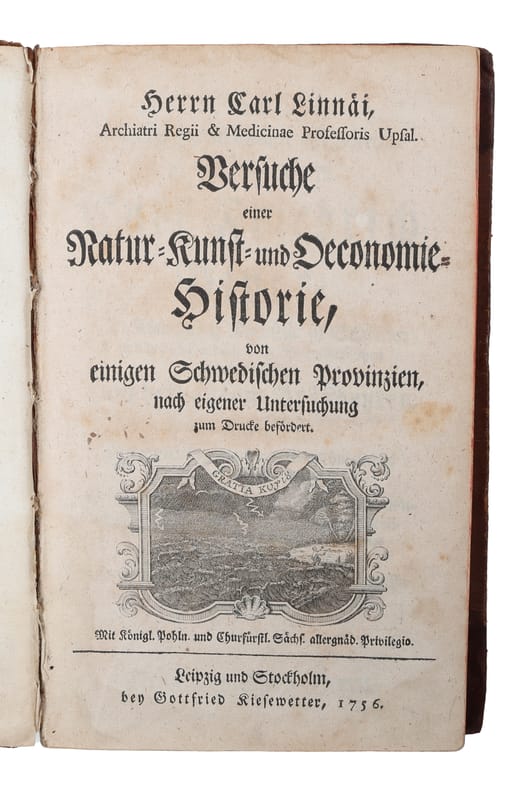
175658141Leipzig und Stockholm, Kiesewetter, 1756. Contemp. full calf. Richly gilt spine. Titlelabel with gilt lettering (partly gone). Spine rubbed. Some leather at lower compartments lacks. (32),336 pp., 2 engraved plates, 1 folded engraved maps. Faint scattered brownspots and occassionally light toning. No halftitle.
185837941Kjöbenhavn, Gad, 1858-64. Indbundet i 7 ensartede samtidige hldrbd. med rig rygforgyldning. Rygge med lettere brugsspor. Rygforgyldningen på første bind en smule afslidt. Teksten er indbundet for sig i 3 bind, og plancherne samlet for sig i 3 bind. 899,1040,307,159,151,44,682,88 pp. Med talrige topografiske illustrationer i form af litograferede foldekort, plancher i litografi og i tonet litografi.
Kbhvn., H.H. Godiche, 1760. 4to. Samt. helldrbd. med rig rygforgyldning. Øverste kapitæl slidt. Lettere brugsspor. Skindtitel på ryg. (32),512 pp. samt 14 kobbersyukne plancher. Grundtegningen repareret på bagside med tape, pp. 236-237 med tab af et hjørne. Gl. ejernavne på titebladet, bl.a. M. Nyrop. Her og der med lidt brunpletter. Stort eksemplar på skrivepapir.
Leipzig und Stockholm, Kiesewetter, 1756. Contemp. full calf. Richly gilt spine. Titlelabel with gilt lettering (partly gone). Spine rubbed. Some leather at lower compartments lacks. (32),336 pp., 2 engraved plates, 1 folded engraved maps. Faint scattered brownspots and occassionally light toning. No halftitle.
Kjöbenhavn, Gad, 1858-64. Indbundet i 7 ensartede samtidige hldrbd. med rig rygforgyldning. Rygge med lettere brugsspor. Rygforgyldningen på første bind en smule afslidt. Teksten er indbundet for sig i 3 bind, og plancherne samlet for sig i 3 bind. 899,1040,307,159,151,44,682,88 pp. Med talrige topografiske illustrationer i form af litograferede foldekort, plancher i litografi og i tonet litografi.
17978549London, Bulmer, 1797. IV, 478 S., 6 Bll. 1 Porträt, 2 mehrfach gefaltete Pläne und 10 (3 doppelblattgr.) Tafeln (alles in Kupferstich). Kl.-4°. Läd. Ldr. der Zeit.
3 vols., roy. 8vo., First Edition, with numerous plates, illustrations and maps throughout; original decorative blue cloth, upper boards and backstrip blocked and lettered in gilt, covers mildly age-marked and scuffed at extremities, a very good, bright, clean copy.
99105aafs.d., vers 1840, pt. in-8vo, (13.5 x 10.5 cm), 15 Aquatintes en noir, avec les feuilles intercalées (serpentes) d’époque, reliure en toile rouge originale. Titre or sur la couverture. Bel exemplaire
139826aafLondon, Printed by J. and C. Adlard, 1827, in-8vo, large engraved folded view ‘Explanation of a View of the city of Geneva... ° + 12 p., later wrappers,
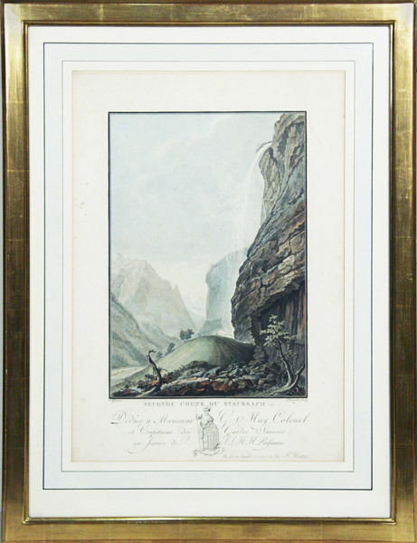
638.1aafs.d., 1838, 40 x 26 cm, Lithographie originale coloriée à la main, 1 feuille.
100737aafAmsterdam, R. Hentzi / Yntema, s.d. 1785, 33x22 cm (Vue), aquatinte tirée en couleurs, Passepartout - Encadrement or. (60x45 cm).
100734aafAmsterdam, R. Hentzi / Yntema, s.d. 1785, 33x22 cm (Vue), aquatinte tirée en couleurs, Passepartout - Encadrement or. (60x45 cm).
139112aafBern, Druck und Verlag der Haller’schen Buchdruckerei, 1850, in-4to, XXI + 1 S. leer + 325 S. + 1 S. Errata ; (Zweite Abt.:) S. 327 bis S. 705 + 1 S. Errata, (das Vorwort deutsch-französisch - Vorsätze leicht leimschattig), Auf Vorsatz hs. „A ma chère fille Netty Durheim / Exlibris Peter E. Obergfell, sehr schöne Ledereinbde d. Zeit, Rücken auf vier Bünden mit goldgeprägten Rückentiteln. Buchdeckel ebenfalls schön goldgeprägt, Goldschnitt.
105733aafBasel, 1545, 29.5x37 cm, das obere und untere Wallis, in 2 Holzschnitt-Blättern, schwache Mittelfaltspuren, klarer Abdruck, 2 Blätter (je 31.5x39.5 cm).