3 508 résultats
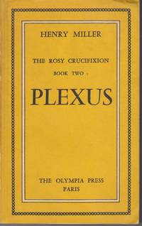
1953232710Paris: Olympia Press 1953. First. paperback. very good-. 2 vols. original printed sienna wrappers worn at edges; corners bumped. Paris: Olympia Press 1953. First English language edition.<br/><br/> No. 208 of two thousand numbered copies. Shifreen & Jackson A83b.<br/><br/> Olympia Press unknown books
1953D14187Paris: Olympia Press 1953. Limited Edition. Hardcover. Very Good. Wraps; complete set of 2 volumes 12mo; pp. 342 348. Number 1893 from a limited edition of 2000 copies. Covers lightly rubbed with a few small spots of soiling here and there. Top corner of Volume I bumped with slight wrinkle throughout text block. Internally nice and clean. <br/><br/> Olympia Press hardcover books
195630829Paris: The Olympia Press. 1956. First Edition; First Printing. Softcover. Wraps very good few pencil figures on stained rear wrap small corner crease a better than it sounds copy. Jackson A83g "Second Olympia Press Edition" first 1-volume edition in English. ; 8vo 8" - 9" tall; 683 pp . The Olympia Press paperback books
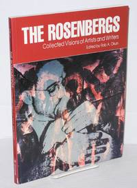
1988126530New York: Universe Books 1988. Oversized Paperback. 160p. 8.5x11 inches essays illustrated with b&w and color art and photographs lightly-worn first edition trade paperback in pictorial wraps. Catalog for the exhibit: Unknown secrets art and the Rosenberg era. Universe Books paperback books
1765WRCAM46139New England 1765. Pen-and-ink on laid paper with the road colored in sepia and with water elements in green with a yellow wash border within the gradients on seventeen of eighteen sheets. Sheet size: 27 1/2 x 214 inches overall if joined. Minor repairs one small blank section in the upper border lacking. Very good. Provenance: Sir Francis Bernard Colonial Governor of Massachusetts 1712-79; by descent to Robert Spencer Bernard Nether Winchendon House Buckinghamshire England. A truly massive road map measuring over seventeen feet from east to west showing the roads across the colony of Massachusetts in great detail. It is one of only a handful of road maps to survive from the colonial era. It was created for Sir Francis Bernard then colonial governor of Massachusetts. <br> <br> In November 1969 noted historian of cartography William P. Cumming discovered in the family home of Sir Francis Bernard "a collection of maps that in purpose and type differed so markedly from the more usual military coastal and general colonial maps of the time that it stands out in both interest and importance. These were domestic maps of a gentleman's estates and the roads to them.Probably Sir Francis's most important contribution to cartography was to have careful surveys made of the roads from Boston.westward to Albany New York on a one-inch to two-thirds-mile scale. It was along part of this Albany to Boston road that the American rebels dragged the heavy cannon captured at Fort Ticonderoga that set up on Dorchester Heights forced General Howe's evacuation of Boston in 1776.No route maps as detailed as these except for two short New Jersey road maps are known for any other section of the eastern seaboard until those of Christopher Colles in 1789" Cumming pp.29-30. <br> <br> The present manuscript map depicts the road across Massachusetts but does not extend as far as Albany. The road divided into miles throughout extends from Boston to Springfield where it splits into two westward routes to Albany: the first a more southerly route via Great Barrington Massachusetts which ends on the present map at a point approximately thirty-three miles from Albany; and the more northerly route which is shown on the map as far as Northampton just past the Connecticut River. The map is done on a very large scale of approximately two-thirds of a mile to the inch with towns rivers mountains residences meetinghouses and numerous taverns identified along the way. Cumming records this map as four separate entries i.e. MP21-24 although with an incorrect sheet count. <br> <br> Comprised of eighteen sheets one narrow blank sheet is missing the top half of the map is comprised of ten narrow sheets varyingly long and short while the bottom half is comprised of eight uniform sheets each measuring 18 1/2 x 26 1/2 inches. The sheets are as follows: <br> <br> 1 Southeast corner of the map blank except wash border. <br> <br> 2 Blank except for wash border with a segment of rhumb line. <br> <br> 3 missing but would clearly be blank except for wash border with section of rhumb line <br> <br> 4 Text reading "Boston to Albany." <br> <br> 5 Text reading "Way to Spr-" with part of the southern road. <br> <br> 6 Text reading "-ingfield" with part of the southern road including Springfield and the Connecticut River. <br> <br> 7 A small sheet containing text reading "and" and part of the southern route. <br> <br> 8 blank except for wash border <br> <br> 9 blank except for wash border <br> <br> 10 Southwest corner of the map blank except for wash border. <br> <br> 11 Northeast corner of the map containing Medford Boston and the route as far as Framingham. <br> <br> 12 Text reading "the road" with the northern route from Sudbury to Westborough. <br> <br> 13 Text reading "from" with the route from Shrewsbury to Leicester. <br> <br> 14 Text reading "by" and "road b-" with the route from Brookfield west to Coy's Hill and the Porpoodock Mountains. <br> <br> 15 Text reading "-y way of Northampton to Albany" showing the route from Belchertown to Northampton including part of the Connecticut River and the Hadley Mountains. <br> <br> 16 Text reading "Gr-" with part of the route showing Blandford. <br> <br> 17 Text reading "-eat Barrington" showing the route from the Farmington River to Tyringham. <br> <br> 18 Northwest corner of the map showing Great Barrington and a bit beyond to the Massachusetts-New York border. <br> <br> Sir Francis Bernard became the colonial governor of Massachusetts in late 1759 shortly after British troops were victorious in the Battle of Quebec. That decisive French and Indian War victory opened a vast region for renewed English settlement and trade thus necessitating the need for more accurate surveys of the roads. The present manuscript map was surveyed and drawn by talented military mapmaker Francis Miller in 1765 for Bernard the details of which are recounted by Bernard in a 1766 letter to Lord Barrington: <br> <br> "I am desired to certify to your Lordship that at the beginning of the Year 1764 Genl Gage at my Request gave Leave to Ensign Francis Miller of the 45th regiment then stationed in Newfoundland to come to Boston to assist me in some Works of Public Surveying which I had undertaken in pursuance of resolutions of the general Assembly & partly by Orders from England. Mr Miller being then at an outpost & not easily relieved did not arrive at Boston till Nov in that Year when the Season for actual Surveying was over. He was employed that Winter & Spring following in protracting the Surveys made that Summer among which was a compleat Route from Fort Pownal on the River Penobscot to Quebec & some other curious explorations of the Eastern parts of New England hitherto unknown to Englishmen: of which elegant Maps drawn by Mr Miller have been transmitted to the Board of Trade. Early in the Last Summer I employed M' Miller having previously informed Genl Gage of the Intention to make an actual Survey from Boston to Albany & back again by another Way being near 200 Miles; & afterwards from Boston to Penobscot being above 200 Miles; by which Means a true Geometrical Line of 400 Miles in length through part of New York & all the habitable part of New-England has been obtained which will afford great Assistance to the Ascertaining the Geography of this Country & its Sea Coast. After this Survey was finished he was employed in protracting the Same & making Drawings thereof which he has done with great Accuracy & Elegance" Bernard to Barrington Jan. 1 1766 quoted in THE BARRINGTON-BERNARD CORRESPONDENCE p.103. <br> <br> This important manuscript map detailing the route from Boston westward towards Albany constitutes among the earliest of American road maps. CUMMING BRITISH MAPS OF COLONIAL AMERICA Chicago: University of Chicago Press 1974 pp.29-30 and Appendix A. THE BARRINGTON-BERNARD CORRESPONDENCE Cambridge: Harvard University 1912. unknown books
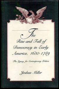
1991005973University Park PA: Pennsylvania State University Press 1991. Book. Near fine condition. Hardcover. Signed by Authors. First Edition. Octavo 8vo. xii 154 pages of text including an index. Hardcover cloth binding. Unclipped dustjacket with minimal shelfwear; protected in archival mylar. Signed and inscribed on front endpaper by author; "For.My first teacher. With appreciation signed Josh.". Pennsylvania State University Press Hardcover books
1940002747Roselle New Jersey: Childhood Interests 1940. First Edition. Very good. Miniature n. d. ca 1940; 2 1/2 x 3; pp. 20; pictorial wraps in blue pink and beige; illustrated with numerous drawings; a faint vertical crease to front wrap else very minor wear; very good to near fine condition. Childhood Interests a New Jersey toy manufacturer if the first half of the 20th century were known for their innovative approach of numbering and grading their "Right-time Toys" in sequence depending on the children's age covering their basic needs for a "balanced development." The book described the combination-wood-and-plastic toys from No. 1 to No. 18 beginning with the Cradle Companion for 3-month-olds through the Rain Rattles the Rhytm Stick etc. to the Hobby Lumber Yard for 7-to-12-year-olds. Not in OCLC not in the trade. Childhood Interests paperback books
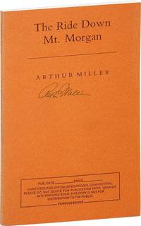
199211309NY: Penguin 1992. Uncorrected proof. 142 pp. Fine in printed orange wrappers. Promotional flyer laid in. NY: Penguin unknown books
199240678New York: Penguin Books 1992. First Edition. Octavo 19.5cm; orange wrappers with titles printed in black on spine and front cover; xvi1422pp. Signed by Miller on the front wrapper. A Fine unread copy. A late one-act play by Miller whose central character is an insurance agent and bigamist who maintains families in New York City and Elmira. Penguin Books unknown books
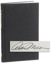
199224113Hastings-on-Hudson NY: C.P. Stephens 1992. First Edition. Limited Issue one of 150 numbered copies signed by the author this being copy no.100. Octavo; full black cloth with titles stamped in gilt on spine; xiv 142pp 6. A Fine copy without dustjacket as issued. A late one-act play by Miller whose central character is an insurance agent and bigamist who maintains families in New York City and Elmira. C.P. Stephens unknown books
199559027London: Warner Chappell Plays 1995. English acting edition. Small 8vo pp. 142. Bound in paper wraps. A fine copy. A play about bigamy etc. Warner Chappell Plays unknown books
199259026Penguin Books 1992. First edition advance uncorrected proof copy. Small 8vo pp. 142. Bound in paper wraps. A fine copy. PR sheet laid in. A play about bigamy etc. Penguin Books unknown books
199258919Hastings-on-Hudson: C. P. Stephens 1992. First Edition # 97 of 150 signed and numbered copies. Small 8vo pp. 142. Bound in cloth spine little dusted a near fine copy without dj as issued. Signed by Arthur Miller. A play about bigamy etc. C. P. Stephens unknown books
199225191Penguin 1992. Unrevised Proofs. Small 8vo pp. 142. Unrevised and unpublished proofs. Signed by Arthur Miller. Orange wraps. Fine copy. Penguin unknown books
1992845No place listed: C.P. Stephens 1992. First Edition First Printing. <br /><br /><b>SIGNED</b> by Arthur Miller on the limitation page one of only 150 copies. There was also a trade edition. A bigamist has an accident and his two wives show up at his hospital bedside. <br /><br />Small 8vo. 14 142 7 pages. Near Fine with front board turned slightly outward. No dust jacket was issued. <b>SCARCE</b>. <br /><br />The Ride Down Mt. Morgan received its world premiere at Wyndham's Theatre London in October 1991 with Tom Conti as Lyman Felt Gemma Jones as Theo and Clare Higgins as Leah. Directed by Michael Blakemore and produced by Robert Fox. C.P. Stephens hardcover books
19921307093Penguin Books 1992. 1st Edition. Soft cover. Fine/No Jacket. Fine in wrappers. Uncorrected Proofs SIGNED on the front cover by the author. Penguin Books unknown books
199627681Williamstown MA: Williamstown Theatre Festival 1996. 4to pages not numbered. Illustrated. A nice copy. Michael Ritchie Producer. Directed by Scott Elliott. Cast included Michael Learned Larry Bryggman F. Murray Abraham. Williamstown Theatre Festival unknown books
1991Embry 191104Stage & Screen 1991. Fine in fine dust jacket in mylar cover. Stage & Screen, 1991. unknown books
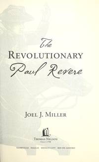
2010182212Thomas Nelson 2010-04-06. Paperback. Good. Clean has a good binding no marks or notations. Thomas Nelson paperback books
197662735New York: New York University Press 1976. First edition. 23 1/2 cm. xxiii 381 pp. Red cloth spine stamped in gilt. Black dust jacket. Very good. Previous owners bookplate on front pastedown. <br/><br/> New York University Press hardcover books
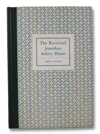
196231987Deerfield: Heritage Foundation 1962. Hardcover. VG. light rubbing to corners. spot soiling to cover endpaper. pencil notations/marginalia throughout though more concentrated to opening & closing chaper. Patterned boards w/ gilt printed green cloth spine. book xiv 153 pp. 34 bw plates. Of 2000 Copies. Heritage Foundation hardcover books
19622006043Heritage Foundation Deerfield / Connecticut Printers Incorporated 1962. Limited Edition. Hard Cover. Fine/No Jacket. Limited edition one of 2000 copies. Lacks glassine jacket. 1962 Hard Cover. xiv 153 pp. Tall 8vo. Green cloth spine over decorated paper-covered boards paper label on front board gilt spine titles. Black & white photographs and illustrations throughout. "Built in 1734 the Ashley House served as the home of Deerfield's 18th-century minister with furnishings of the Connecticut River elite and English ceramics. It is an example of Deerfield's first 18th-century building boom. In the 1730s successful Deerfield farmers enlarged old dwellings and built new ones often with stylish doorways in a distinctive Connecticut Valley style. In the 1750s the Reverend Jonathan Ashley made substantial alterations to his house such as a grand doorway a central hallway staircase and fine paneling. Inside the house visitors see furnishings owned by the Connecticut Valley's 'River Gods' the political-military-mercantile-ministerial elite that governed the towns of western Massachusetts until the American Revolution. Ashley bought cherry and mahogany furniture for his parlors and chambers imported English and Chinese ceramics for tea and punch prints that demonstrated his English allegiance and textiles that gave comfort and color to domestic life. The Ashley House was the first restoration opened to the public by the founders of Historic Deerfield Henry and Helen Geier Flynt in 1948." - Historic Deerfield Heritage Foundation, Deerfield / Connecticut Printers, Incorporated hardcover books
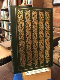
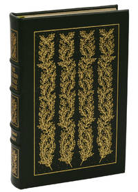
1978194207The Easton Press 1978-01-01. Bonded Leather. Very Good. Full green leather binding with gilt stamped design and page edges. 4 raised bands to the spine. Clean has a good binding no marks or notations. The Easton Press hardcover books
1978140937049Norwalk CT: The Easton Press 1978. Leather. Fine. Collector's edition bound in green genuine leather lettered and edged in gilt silken endpapers. 16 416 pp. Fine. A nice copy. The Easton Press unknown books
200026028London / Louisville: SPCK / Wesminster John Knox Press. 2000. First Edition; First Printing. Hardcover. Fine in near fine dust jacket with lightly sunned spine and old price sticker in place on rear panel. Reading list bound In at rear with a few minor annotations.; 8vo 8" - 9" tall; 335 pp . SPCK / Wesminster John Knox Press hardcover books