Parmentier, Antoine Augustin:Livre Rare Book
497 résultats
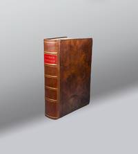
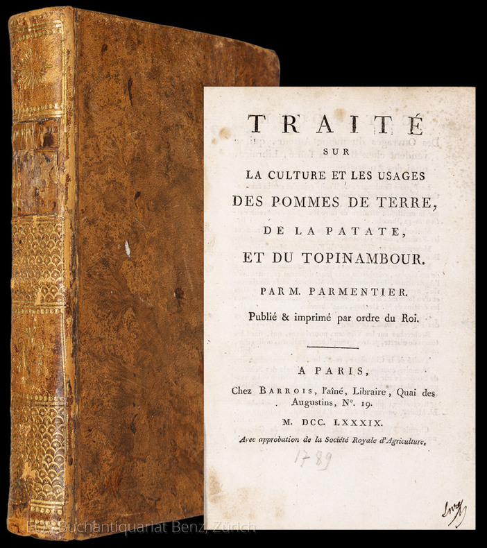
17897184CBParis, Chez Barrois, 1789. VIII, 389 (recte 392). Lederband der Zeit mit reicher Rückenvergoldung.
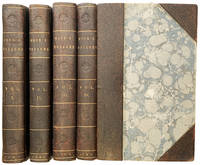
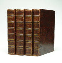
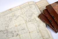
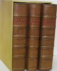
1784AA3327London:: Printed for John Stockdale Scatcherd and Whitaker John Fielding and John Hardy 1784. 1784. Four volumes. 8vo. 196 x 124 mm xii 370; xii 359; xii 400; xii 310 2 blank 60 pp. Large folding map folding map of Hawaii engraved frontispiece portrait of Cook 48 1711164 full-page engravings including folding plate of the death of Cook index list of subscribers. Modern half brown calf over marbled boards gilt-stamped spine titles. Fine. FIRST OCTAVO EDITION of Cook's third voyage to discover a northwest passage linking the Atlantic and Pacific oceans. Abridged and so without all the technical nautical details found in the earlier quarto edition but often preferred by readers because "the work reads more like an adventure" Hill. On board were a number of significant crew members: William Bligh James Burney James Colnett George Vancouver and John Webber as artist to the expedition. The voyage took in Kerguelen Island Tasmania New Zealand and the Cook Tonga and Society Islands sailed north and discovered Christmas Island and the Hawaiian Islands which Cook named the Sandwich Islands. "Cook charted the American west coast from Northern California through the Bering Strait as far north as latitude 70 degrees 44' before he was stopped by pack ice. He returned to Hawaii for the winter and was killed in an unhappy skirmish with the natives over a boat. Charles Clerke took command and after he died six months later the ships returned to England under John Gore. Despite contemporary English hostilities with the United States and France the scientific nature of this expedition caused the various governments to exempt these vessels from capture. This voyage resulted in what Cook judged his most valuable discovery - the Hawaiian Islands" Hill. Beddie 1545; Hill 362; Mitchell "Cook" 1545; Sabin 16251. Printed for John Stockdale, Scatcherd and Whitaker, John Fielding, and John Hardy, 1784. hardcover
1787PHO-2345Paris, Hôtel de Thou 1787-1788. 2 vol in 4°, tome 1, frontispice gravé par Boily d'après Cochin, 65 p, 77 cartes, tome 2, 112 p, tables, 63 cartes, toutes montées sur onglets, relié cartonnage d’attente époque, manque aux dos, dos cassé (T2), quelques cartes brunies, rares piqures. Complet avec dans le premier tome, les cartes de géographie ancienne, celles relative à l’Europe ainsi que les hémisphères traditionnels et obliques, dans ce second tome de l’Atlas, on trouve les parties du Monde hors de l’Europe et la carte des environs de Paris (n°121), pas de cartes 111 et 116 mais deux cartes 117 et une 102 bis.
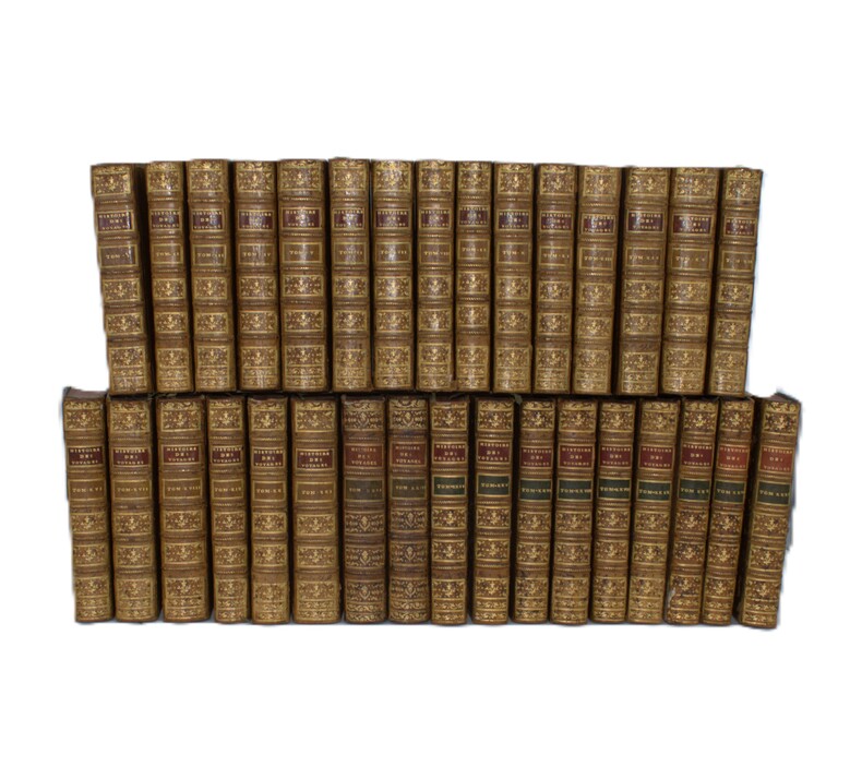
1780PHO-2387Paris, Hôtel de Thou, Laporte, Moutardier, 1780/1801, 32 volumes in-8, basane époque, guirlande sur les plats, dos ornés, pièces de titre rouge et pour les tomes 22 à 32 ; pièces de tomaison vertes, triples filets aux plats, tranches rouges, fleurons légèrement différents pour les tomes 22 et 23. Quelques accidents aux coiffes, quelques épidermures au supplément, légers manques de matières sur quelques tomes, mouillure très claire sur quelques feuillets (2 tomes), le tout sans gravité. Ex-libris du Comte de Farcy de la Villedubois au dos du premier plat. Belle édition de l’Abrégé de l’Histoire des Voyages, elle se compose des 21 premiers volumes de 1780 publiés par La Harpe à l’Hôtel de Thou, des 2 volumes publiés en 1786 consacrés au troisième voyage de Cook et formant les volumes 22 et 23, chez Laporte, et des 9 volumes de suppléments publiés entre 1798 et 1801 par Delpuech-Comeiras et imprimé chez Moutardier. L’illustration est formée de l'atlas complet des 74 (+1 en double) cartes dépliantes des diverses parties du monde, dont la Carte dépliante de l'hémisphère austral montrant les routes des navigateurs les plus célèbres par James Cook, une carte de Tahiti, d'autres du Kamtchatka, du Spitzberg, des îles Antilles, etc, et de 4 cartes pour les tomes 22 à32 ainsi que 101 planches dont certaines dépliantes, les cartes et gravures en très bel état.
17897184CBParis, Chez Barrois, 1789. VIII, 389 (recte 392). Lederband der Zeit mit reicher Rückenvergoldung. + Wichtig: Für unsere Kunden in der EU erfolgt der Versand alle 14 Tage verzollt ab Deutschland / Postbank-Konto in Deutschland vorhanden +, A|B [2 Warenabbildungen]
1779Q34GLTBRN5F<p>W. Strahan ; T. Cadell 2 volume set in uniform contemporary full calf with gilt titles to spine labels - including Vol. I & II. 1779 3rd ed. 4to. 2 volume set. Complete with 64 engraved plates maps and charts. Volume 1: Frontis xl 378pp. 36 plates and charts. Plate 1 Chart of the Southern Hemisphere torn without loss. Volume 2: vi 396pp 27 plates and charts. Bindings rubbed and cracked heraldic bookplate of Benjamin Clay on front free end-papers in each volume. A pleasing set. A heavy set additional postage will be required for tracked orders outside the UK. q34</p> W. Strahan ; T. Cadell hardcover
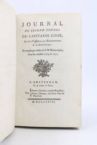
177790280Amsterdam Paris: PissotNyon 1777. Fine. Pissot Nyon Amsterdam Paris 1777 12.5 x 19.5 cm Relié Rare first edition of the French translation of the Journal of the Resolution London 1775 illustrated with a large folding copper-engraved map by E. Dussy issued without legend.Cf. O'Reilly & Reitman 380: ""Traduction de la relation apocryphe de Marra"". See Hill 60.Scattered occasional foxing a few abrasions to the boards.Contemporary full marbled tan sheep spine in five raised bands richly decorated with double gilt compartments gilt fillets to bands partly rubbed red morocco lettering-piece gilt decorative tool at foot of spine gilt rolls to board edges largely rubbed marbled endpapers single gilt fillet to edges corners worn marbled edges.This is an apocryphal account of Cook's second voyage issued anonymously eighteen months before the official edition.The author was John Marra one of the Irish gunners aboard the Resolution; Cook had previously taken him aboard the Endeavour at Batavia during his first voyage.O'Reilly notes that the work contains observations and incidents omitted from the official edition.Conversely Sir Maurice Holmes An Introduction to the Bibliography of Captain James Cook London 1936 and Captain James Cook. A Bibliographical Excursion London 1952 considered it to be a curious compilation.As Marra was incapable of composing any narrative account himself his contribution was therefore confined to factual extracts from his journal; the greater part of the work having been supplied by his editor who expanded the volume with geographical descriptions drawn from accounts of Cook's first voyage and other sources.Copy from the library of Alberto Stradelli with his bookplate mounted on the pastedown. PissotNyon hardcover
1790E00534 of 6 volumes. Volume 1: i-ix-372 pages with 23 plates including frontispiece plate of Cook and 4 folding maps; Volume II lacking; Volume 3: 793-1184 pages with 11 plates including frontispiece of Possession Bay and 5 fold out maps; Volume IV: 1185-1546 pages with 26 plates including frontispiece of Woman Child and Man of Van Diemen's Land and 6 folding maps; Volume V: 1547-1938 pages with 30 plates including frontispiece of A View of Huaheine and 8 folding maps; Volume VI lacking. Octavo 8 1/2" x 5 1/2" bound in original full leather with red labels to spine with gilt lettering. Abridged by George William Anderson. An earlier Large folio edition by Anderson was published earlier. This edition originally issued in 80 weekly parts and also called the Large octavo edition. M K Beddie: 39 First edition of the bound edition.<br /><br />Captain James Cook RN was a British explorer navigator and cartographer ultimately rising to the rank of Captain in the Royal Navy. Cook made detailed maps of Newfoundland prior to making three voyages to the Pacific Ocean during which he achieved the first European contact with the eastern coastline of Australia and the Hawaiian Islands as well as the first recorded circumnavigation of New Zealand. Cook joined the British merchant navy as a teenager and joined the Royal Navy in 1755. He saw action in the Seven Years' War and subsequently surveyed and mapped much of the entrance to the Saint Lawrence River during the siege of Quebec. This helped bring Cook to the attention of the Admiralty and Royal Society. This notice came at a crucial moment both in his personal career and in the direction of British overseas exploration and led to his commission in 1766 as commander of HM Bark Endeavour for the first of three Pacific voyages. Cook charted many areas and recorded several islands and coastlines on European maps for the first time. His achievements can be attributed to a combination of seamanship superior surveying and cartographic skills courage in exploring dangerous locations to confirm the facts for example dipping into the Antarctic Circle repeatedly and exploring around the Great Barrier Reef an ability to lead men in adverse conditions and boldness both with regard to the extent of his explorations and his willingness to exceed the instructions given to him by the Admiralty. Cook was killed in Hawaii in a fight with Hawaiians during his third exploratory voyage in the Pacific in 1779.<br /><br />Condition:<br /><br />Lacks volume II and VI. First signature of volume one loose inner hinges cracked some interior soiling spine ends and corners of leather rubbed some scuffing to leather else a good set. Printed for A Millar, W Law, and R Cater hardcover books
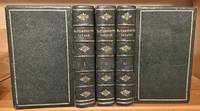
1773250521001Dublin: A. Leathley 1773. 1st Edition. Hardcover. Near Fine. <br /> Cook's Voyages extra illustrated An account of the voyages undertaken by the order of His present Majesty for making discoveries in the Southern hemisphere : and successively performed by Commodore Byron Captain Wallis Captain Carteret and Captain Cook in the Dolphin the Swallow and the Endeavour: drawn up from the journals which were kept by the several commanders and from the papers of Joseph Banks esq.<br /> Overall Condition: VERY GOOD<br /> <br /> IMPORTANCE & SCARCITY<br /> <br /> First Dublin Edition in beautiful fine binding with multiple plates added from a later printing. This is the only Dublin edition I see for sale with ANY illustrations. The first Dublin edition did not have plates in its 3 octavo volumes but rather a fourth Quarto--VERY SCARCE--Atlas volume containing 52 plates. The first Dublin edition was printed at the same time as the first English edition.<br /> <br /> BOOK INFO<br /> <br /> Published by A. Leathley et al. in Dublin in 1773. First Dublin edition first printing. Textually complete in three volumes. Without the VERY SCARCE fourth Atlas Volume of illustrations. Rebound circa 1810 in beautiful dark forest green fine full morocco binding: single ornamental gilt fillet paneling; five gilt-patterned raised spine bands with compartments tooled with gilt emblems and lettering; all edges stained a dark blue-green; gilt dentelles; pale yellow endpapers. Octavo. 8" x 5.25." Each volume collated and complete including original blanks and publisher ads at the end of volume 3. Refreshed endpapers. With six added plates - three foldout and three one-page. <br /> <br /> ABOUT THE AUTHOR/EDITOR <br /> <br /> John Hawkesworth LLD c. 1715 - November 1773 was an English writer and book editor. He was commissioned by the Admiralty to edit Captain James Cook's papers relative to his first voyage. For this work "An Account of the Voyages undertaken" Hawkesworth is said to have received from the publishers the sum of 6000 pounds an unprecedented amount at the time. An Account of the Voyages would go on to become one of the most popular travel books of the eighteenth century. Hawkesworth an eminent London author was chosen by Lord Sandwich and commissioned by the Admiralty to prepare these narratives for publication. He was expected to add polish to the rough narratives of sea men and to present the accounts in a style befitting the status of the voyages as official government expeditions intended to embellish England's prestige as a maritime power. Although the book was a huge success fast becoming a best-seller it was disastrous for its editor. He was publicly attacked on three different counts: by the captains for tampering with the texts of their journals by prudish readers for reprinting descriptions of the sexual freedoms of the South Sea islanders and by devout churchmen for impiety in the general introduction to the work. <br /> <br /> CONDITION REPORT<br /> <br /> Exterior is NEAR FINE for a 215-year-old binding. Square spines firm hinges and joints fairly sharp corners tight pages. Boards are colorful supple glossy and unfaded or soiled. Spine tips unrubbed. Light rubbing to the edges corners and spines. Rubbed boards. Gilt work intact and glossy. Stained edges in great condition. Quite beautiful! <br /> <br /> The Interior is VG Refreshed endpapers. Former owner's bookplate dated April 1810 on front pastedown of each volume. Offsetting from dentelles onto FFEPs and from the inserted plates onto adjacent pages. Embossed stamp of "Fort Frederic Virginia Co. Cavan" on title page and a few other pages of Volume I. No writing damp staining or worming. Pages range from clear and bright white to lightly toned and sometimes a bit darker. Light foxing overall with occasional areas of heavier foxing. Some light signs of handling - a small margin tear or two a few smudges and ink stains a few slightly bent page corner tips. <br /> <br /> Overall the highest graded and most complete copy I see for sale of this uncommon first Dublin edition and in the finest binding. No other copy with plates. A beautiful collectible set. A. Leathley hardcover
176515915Paris, Mondhare, 1765. Ca. 43 cm x 66 cm. Gerahmt.
1786399London: Alex. Hogg at the King's Arms No. 16 Pater-noster-Row 1786. First Edition First State. Full calf. Near fine. The Anderson Edition of Captain Cook's Voyages Round the World published in 1784. Folio 15.25 x 9.75 i title ii blank iii-iv preface 5-650pp 651-653 tables 654-655 "Concluding Remarks by the Editor" and "Contents of this Work" Directions to the Bookbinder 2pp subscribers list. First state with date 1784 appearing on title page. Expertly repaired spine raised bands gilt title over red morocco. Frontispiece portrait of Captain Cook. 150 illustrated copper plates 41 Maps/Elevations 109 Illustrations including large foldout map titled "A General Chart." Plates in near fine condition with only occasional toning. Previous owners inscription on front endpaper. Includes directions to bookbinders and 2pp list of subscribers. Forbes 61. This copy lacks the "Death of Captain Cook" illustration. Beddie 19. This important work is a compilation Captain Cook's three voyages. It also includes voyages by Carteret Anson Drank and others. This version does not include the copy of "The Death of Captain Cook" #27. An attractive copy of this rare folio. Alex. Hogg at the King's Arms, No. 16, Pater-noster-Row unknown books
17785440Paris: Hôtel de Thou 1778. Very Good/Attractive set of the French-language version of Cook's account of his second expedition A Voyage towards the South Pole and Round the World London 1777. This astonishing journey from 1772 to 1775 went around the globe as far south as possible to explore the existence or not of a postulated southern landmass. In the course of the voyage Cooks ships Resolution and Adventure crossed deeply into Antarctic waters ultimately turned back by ice barriers. Zig-zagging through the South Pacific Cooks ships also visited Easter Island the Marquesas Tahiti the Society Islands Niue the Tonga Islands the New Hebrides New Caledonia Norfolk Island Palmerston Island South Sandwich Islands and South Georgia many of which Cook named in the process. This French edition of his report was published close on the heels of the English version in two distinct formats a five-volume quarto and a six-volume octavo with a quarto atlas containing the extraordinary set of 66 engraved plates after William Hodges. The French translator Jean-Baptiste-Antoine Suard incorporated into the text a great deal of material from the rival account of the voyage that Johann Reinhold Forster published under guise of his son Georg based on a draft of Cooks own journal. In English Forsters account was published separately. A fine set. Six volumes octavo 20 cm and atlas volume in quarto 27 cm. Text volumes bound in cat's paw calf; six-panel spines tooled in gilt with red leather title labels lettered in gilt. Marbled endleaves. Minimal wear. Atlas volume bound separately in contemporary speckled calf with black leather title label. 65 copper-engraved plates including double-page folding "Carte de l'Hemisphere Austral" portraits scenes botanical representations plans and other maps. Excellent condition throughout. References: Mitchell Library p. 52; Sabin 16249 4to ed. Hôtel de Thou hardcover books
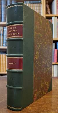
17888608<p><strong>First full-scale biography of Captain Cook</strong></p><p>Small quarto. 10 x 8 inches. Pp. xvi 527 1 ads. Engraved frontis portrait. Nicely rebound in three-quarter dark green leather marbled boards. Matching marbled endpapers. All edges marbled. Light foxing to first few leaves including frontis portrait and title small library stamp on title else a fine clean and crisp copy.</p><p>First edition of the first full-scale English biography of Captain Cook compiled from Admirality sources as well as documents that were in the possession of Sir Joseph Banks. This work was intended to give a well-balanced account of Cook's life from birth to death including his family and early years and the capacities in which he was engaged prior to the famous voyage. Cook discharged several important duties while aboard the <em>Mercury</em> on the St. Lawrence River during the siege of Quebec. The Newfoundland and Labrador surveys are discussed and the three voyages are dealt with in great narrative depth. Kippis includes most of Samwell's narrative of Cook's death at Kealakekue pp. 454-474 and gives accounts of various tributes to Cook memory. Appendix No. 2 consists of "The Morai An Ode" by Miss Helen Maria Williams. Beddie: 32; Hill: 935; Forbes:149 Sabin: 37954.</p> Printed for G. Nicol and G.G.J. and J. Robinson hardcover
1781Embry 151275Printed for E. Newbery London: 1781. Second edition. Occasional light foxing throughout short tear to folding map overall near fine in fine but simple modern binding. Five plates including two folding and one supplied in facsimile. Folding map. Rebound in modern brown morocco spine simple gilt. Folding frontis depicts Cook's death. Printed for E. Newbery, London: 1781. Second edition. unknown books
17881035141788. First Edition. KEATE George. An Account of the Pelew Islands Situated in the Western Part of the Pacific Ocean Composed from the Journals and Communications of Captain Henry Wilson and Some of His Officers Who in August 1783 Were There Shipwrecked in the Antelope a Packet Belonging to the Honourable East India Company. London: G. Nicol 1788. Quarto contemporary full tree calf rebacked in calf-gilt with original red morocco spine label and marbled endpapers preserved. $3500.First edition of this riveting account of a bold and hazardous enterprize with stipple-engraved frontispiece portrait of Captain Henry Wilson folding map of the Palau Islands and 15 superb full-page engraved plates of native portraits the chief his wife and son views and plans weapons and utensils.""The exploring untraversed oceans in spite of every danger that could menace or dismay the discovering multitudes of islands and of people whose existence was not known before and the fame of fixing the geography of the Southern World were the noble fruits of this bold and hazardous enterprize."" ""In August 1783 the Antelope commanded by Henry Wilson of the East India Company's Marines ran on a rock near one of the Pelew Islands Wilson and his crew escaped safely to shore. He and his men were well treated by the natives and in time they managed to build a small vessel from the wreck in which they were able to reach Macao taking with them Prince Lee Boo one of the king's sons. Wilson brought him to England where he was lionized and created a very good impressionhe however unfortunately died of small-pox"" Cox. Following the Prince's death the East India Company dispatched a mission to inform King Abba Thulle and to present him with gifts of European seeds and plants. Keate describes the Palau Islands as ""a rich jewel sparkling on the bosom of the ocean."" Four London editions were published between 1788-89 of which this is the first. Cox II 302-3. Hill 907. Howgego W41. A handsome large copy with binding beautifully restored. unknown
178248142Paris chez Pissot Pre et 1782 In-8, veau brun, dos nerfs orn de roulettes pousses or, filet or sur les coupes; doublures et gardes de papier peigne, tranches lisses rouges (reliure de l'poque).Edition originale de cette premire traduction franaise, illustre en frontispice d'une gravure sur acier reprsentant les indignes tuant le capitaine Cook Owhy-he en fvrier 1779, et comportant une grande carte dpliante galement grave sur acier, retraant la route suivie par Cook en 1776, 1777, 1778, et 1779 lors de son troisime et dernier voyage. Ce rcit du dernier voyage du capitaine Cook au cours duquel il fut tu par des indignes aux les Hawa, fut publi trs discrtement deux ans avant la version officielle par John Rickman, lieutenant de vaisseau bord du Discovery; on y trouve quelques dtails et incidents indits. La traduction est due Jean-Nicolas Dmeunier (1751-1814) dput du tiers tat aux tats gnraux de 1789, puis prsident de l'Assemble nationale constituante. Bel exemplaire en reliure de l'poque. De la bibliothque du comte Nicolas d'Esterhzy (ex-libris armori).
173964769Halberstadt-Leipzig, Christian Friedrich Schopp, 1739. 8°. Mit gest. Frontispiz. 7 Bll., 880 (recte 850) S., Ppbd. d. Zt. m. handschriftl. Rückenschild u. gespränkeltem Farbschnitt.
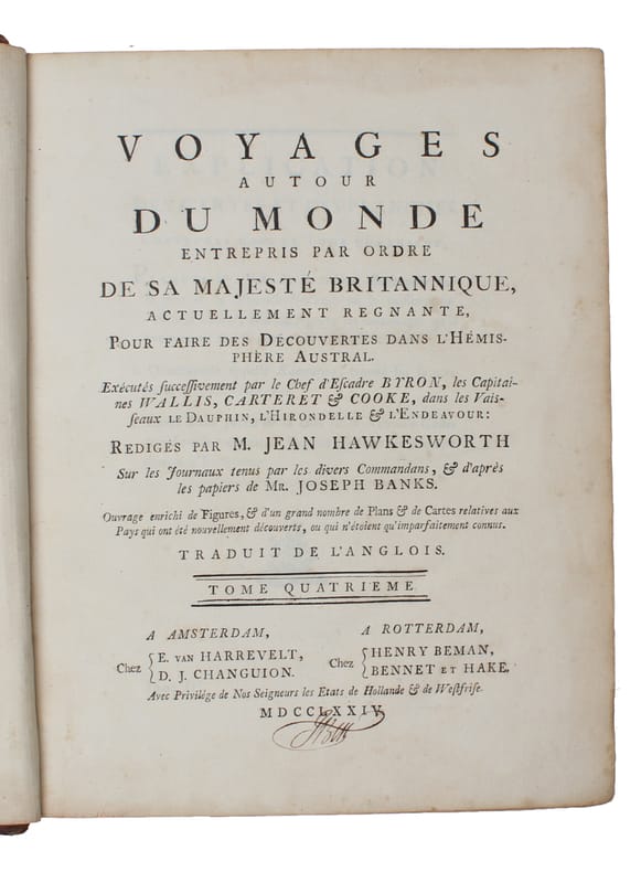
177419257Amsterdam, Rotterdam, E. van Harrevelt, Henry Beman, 1774. 4to. Bound in 4 cont. full mottled calf. 6 raised bands, gilt titlelabels. Backs a little rubbed, some cracking to leather along hinges, but covers not detached. Corners bumped. Ocasionally somewhat brownspotted, a few tears in plates (no loss). A few corners dampstained. With all 4 halftitles. (8),XXXII,388 - (6),536 - (6),394 - VIII,367,(3) pp. and 52 engraved plates, mostly large and folded, among these are 28 folded maps. (all).
177419257Amsterdam Rotterdam E. van Harrevelt Henry Beman 1774. 4to. Bound in 4 cont. full mottled calf. 6 raised bands gilt titlelabels. Backs a little rubbed some cracking to leather along hinges but covers not detached. Corners bumped. Ocasionally somewhat brownspotted a few tears in plates no loss. A few corners dampstained. With all 4 halftitles. 8XXXII388 - 6536 - 6394 - VIII3673 pp. and 52 engraved plates mostly large and folded among these are 28 folded maps. all. <br/><br/><em> First French edition of Cooke's first travel a title-issue identical with the Paris-edition from the same year only with a different title-page and a printed Privilege in Dutch for the Dutch publisher. It is the 4to-edition not one of the 8vo -editions published the same year. - Sabin 30941. </em> hardcover
17765000612London: Printed by W. Bowyer and J. Nichols: for Lockyer Davis in Holbourn Printer to the Royal Society 1776. Small library and release stamps in a few places. Quarto with many folding plates and tables; in very good condition in original calf binding well rebacked. <p><p>This collective publication of Transactions of the Royal Society for 1776 running to altogether 53 articles on a rich variety of subjects includes two original works by James Cook who appeared in print surprisingly little during his illustrious career. The first piece pp. 402-6 is Cook's famous account of the measures taken on the Resolution during the second voyage to combat scurvy in which he discusses the merits of malt "Sour Krout" "portable soup" and citrus fruit. Cook's piece is addressed to the Royal Society's president Sir John Pringle who read it on Cook's behalf to the Society in the absence of Cook himself then just beginning his final voyage. It was awarded the Society's famous Copley medal for 1776.</p> <p>Cook was also responsible for another article in the same year his piece pp. 447-9 on the tides 'in Endeavour River on the East Coast of New Holland'. Yet a third piece in the volume relates to Cook's second voyage William Anderson surgeon on the Resolution contributing "An Account of some Poisonous Fish in the South Seas".</p> </p> . Provenance: John Crerar Library University of Chicago with release stamps; R. David Parsons American collector of voyage books with booklabel; private collection Sydney. Printed by W. Bowyer and J. Nichols: for Lockyer Davis, in Holbourn, Printer to the Royal Society unknown
1774WRCAM15266Paris 1774. Four volumes. ivxvi2xxxii388pp. plus sixteen folding maps and plates; 2536pp. plus sixteen maps and plates mostly folding; 2394pp. plus seventeen maps and plates mostly folding; viii367pp. plus three maps and plates two folding. Quarto. Modern half mottled calf and marbled boards spines gilt leather labels. Some scattered foxing and tanning. Overall very good. The first French edition after the original English edition of the previous year. Hawkesworth was commissioned by the Admiralty to edit this collection of voyages which includes Cook's first voyage to Tahiti to observe the transit of Venus across the sun determine the distance between the sun and the earth and continue Byron's explorations. During this voyage Cook visited Tahiti and made the necessary calculations named and charted the Society Islands explored and surveyed New Zealand and charted the eastern coast of Australia naming it New South Wales finally returning to England in 1771. Other narratives are of Byron's voyage to the Gilbert and Tuamoto Islands Wallace's discovery of Tahiti and Moorea and Carteret's discovery of Pitcairn Island after his separation from Capt. Wallis in a storm. The handsome plates depict the natives landscapes and seascapes and the maps show the routes of the ships and areas charted. An early and important compilation. This French edition is not listed in Hill. Sabin calls for only 361 pages in the fourth volume and states that the French editions "should be accompanied by an Atlas entitled: CARTES ET FIGURES a Paris Chez Saillant et Nyon. M.DCC.LXXIV. 4to." The NUC makes no mention of an atlas but the set cited there is imperfect lacking the third volume. SABIN 30940. hardcover books
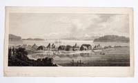
17843611651London 1784. Engraving 253 x 533 mm. to plate mark paper size 290 x 540 mm.; a little light old creasing at right side; in fine condition. <p><p>Rare proof impression of one of the most atmospheric views made by Webber to illustrate Cook's third voyage: the St Peter and Paul ostrog as seen during the expedition's first visit to Avacha Bay.</p> <p>This wonderful panorama of St Peter and St Paul with Cook's ships at anchor in the bay would later appear as plate 74 in the atlas to the official account of the third voyage. Webber's image depicts the small Kamchatkan settlement with its inhabitants fishing in front of their distinctive dwellings all in an untouched landscape with wooded coastline and distant snow-covered mountains. It offers an arcadian vision of the place wildly at variance with what it would become: modern Petropavlovsk-Kamchatsky now a major commercial port and the home of Russia's nuclear submarine fleet. It was at St Peter and St Paul that the battered vessels called in late April 1779 and here that Major Behm agreed to take the news of Cook's death overland to St. Petersburg.</p> <p>This is an early state of the print before letters. The temporary credits here scratched into the plate are differently worded to the final version that would appear in the publication: here there is no caption identifying the view and the image is identified as "Drawn from Nature by J. Webber" and "Engraved by B.T. Pouncy". In the finished version these would be differently expressed as "J. Webber del." and "B.T. Pouncy sc.". The proof engraving is printed on a noticeably different paper and its inking is distinctly finer than the examples of the finished version with which we have compared it. The result is a greater tonal quality.</p> <p>Joppien and Smith discuss the Kamchatkan visit at some length in both text and catalogue volumes of their study of the art of Cook's third voyage. In their description of the related watercolour view now in the Dixson Library in Sydney they note that the original version has probably been lost and that the Dixson watercolour is probably related to the engraving process. </p> <p>This is a desirable and rare version of one of Webber's most successful images from Cook's third voyage. `</p> </p> . unknown
17843712595London: Stockdale Scatcherd and Whitaker Fielding & Hardy 1784. A few spots and stains but a good set. Four volumes octavo with two folding maps and 49 plates in a smart modern binding of polished half calf with gilt labels edges rough-trimmed only with the often discarded half-titles present. <p><p>First octavo edition of the third voyage account with a large chart of the world as discovered by Captain Cook and a finely engraved folding map of the Hawaiian Islands. Intense public interest in the fabulous discoveries of the third voyage and widespread consternation over the death of England's beloved mariner resulted in copies of the quarto edition selling out quickly. The demand prompted two London octavo editions of 1784-1785 including this set printed for John Stockdale and a group of entrepreneurial publishers. The text was abridged omitting some technical and navigation details and as a result reads more like an adventure than the official quarto edition. The list of subscribers is considerable indicating the fervent public interest and a modest price considerably reduced from that of the expensive quarto edition.</p> <p>In addition to the two impressive maps the plates have been re-engraved for the smaller format. Aside from the large chart accompanying the first volume showing the progress of the expedition the two folding plates are noteworthy. The first depicts the death of Cook and was engraved after the original by Dodd. It ignominiously depicts the last moments of the great navigator here shown lying face down and clutching the shore whilst dragged by the calves by a Hawaiian warrior in a tapa cape. The second folding plate is a map of the Hawaiian Islands with a separate chart of Karakakooa Bay marked with soundings details of native villages and areas under cultivation - and the location 'Here Capt. Cook was killed' duly noted.</p> <p>This edition was originally issued in weekly parts with printed wrappers; half-titles for this edition seem to be usually absent though this set includes those for volumes 2 to 4 none is called for in volume 1. The title pages are dated 1784 although the span of publication passed into the following year.</p> </p> . Stockdale, Scatcherd and Whitaker, Fielding, & Hardy unknown
1776138599Upsala: Johan Edman 1776-1787. Hardcover. fine. 1st Swedish Editions. xxviii 308 2 ii 326 6; xx 366 10; xii 618 12 2 pp. Octavo 3 vols. With two copper engraved folding maps Handsome period style matching brown gilt tooled half sheep with speckled papered boards and brown gilt labels housed in a matching slipcase. A fine set. fine Very Rare complete set of all three of Cook's Voyages in Swedish. The First Voyage is a translation from Freville's compilation. The Second and Third Voyages were translated from the official accounts but with editorial notes by an anonymous Finnish editor Second Voyage and Oedmann Third Voyage. The second voyage caused animosity between the editor and Sparrman who condemned the work and is ironically also listed as an author in the book. Du Rietz 1 9 12; Forbes 126 Third Voyage 1776 Johan Edman hardcover
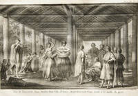
1797269Boston Massachusetts: Thomas and Andrews and D. West 1797. First American Edition. original sheepskin. Good. A complete first US edition set of James Cook's collected works has only come to auction three times in the past 55 years. A significant majority of known sets are held by institutions chiefly in the US. This scarce set is in its original contemporary full sheep binding with original endpapers.<br /> <br /> This set is famous for containing the first American-published illustration of the Pacific Northwest - "A View of the Habitations in Nootka Sound" plate in volume II. <br /> <br /> Condition: VG for an 18th century American publication.<br /> <br /> BOOK INFO<br /> <br /> Published January 1797 in Boston by Thomas & Andrews and D. West. First US collected edition of Captain Cook's voyages and biography. In its original full contemporary sheep with gilt-lettered morocco spine labels. Rebacked with original spine laid down. Two volumes. Duodecimo 12 vo. Collated and complete including blanks and 8 copper engraved plates: Vol. 1: vii 2 10-315 1 pp.; v. 2: 5 6-351 1 pp. Includes the famous "Death of Captain Cook" plate. <br /> <br /> ABOUT CAPTAIN COOK<br /> <br /> Captain James Cook FRS November O.S. 27 October 1728 - February 1779 was a British explorer cartographer and naval officer famous for his three voyages between 1768 and 1779 in the Pacific Ocean and to New Zealand and Australia in particular. He made detailed maps of Newfoundland prior to making three voyages to the Pacific during which he achieved the first recorded European contact with the eastern coastline of Australia and the Hawaiian Islands and the first recorded circumnavigation of New Zealand. In these voyages Cook sailed thousands of miles across largely uncharted areas of the globe. He mapped lands from New Zealand to Hawaii in the Pacific Ocean in greater detail and on a scale not previously charted by Western explorers. He surveyed and named features and recorded islands and coastlines on European maps for the first time. He displayed a combination of seamanship superior surveying and cartographic skills physical courage and an ability to lead men in adverse conditions. During his third voyage in the Pacific Cook encountered the Hawaiian islands in 1779. He was killed while attempting to take hostage the chief of the island of Hawaii during a dispute.<br /> <br /> CONDITION REPORT<br /> <br /> The volumes are in Good or better condition for an 18th century US publication in original binding. Rebacked with original spine laid down. Original blanks and endpapers.<br /> <br /> Exterior: Dryness rubbing and some areas of skinning. Square spines firm hinges and joints tight pages. Some areas of shallow pitting and naturally aged discoloration. Sunned spines. <br /> <br /> Interior: Former owner bookplate on front pastedown of each volume. Small bookstore sticker on front pastedown. Pencil writing on front pastedown of Vol. I. Generally toned pages with offsetting from text block and plates. Some light and sporadic foxing. Six of the plates are a lovely Near Fine with the other two Good or VG with some toning. A few plates appear to have been trimmed by the printer have seen several examples of the same plates with the bottom margin trimmed. Typical handling - some creases smudges ink stains a few marginal tears or marginal paper loss. A few areas with some marginal insect nibbling. Volume I p 97-98 with some insect nibbling along fore-edge affecting several letters of multiple words. Volume II p. 17-18 with three small holes affecting one letter of text. Book in Very Good condition less the latter condition issues. Thomas and Andrews and D. West unknown