SALT, HenryBiblio.com
176 résultats
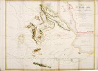
1809547181809-10. A large and detailed map of the coast of Abyssinia: Egypt Ethiopia Somalia and The Red Sea. Copper engraving. Good condition slightly soiled in folder size Later colour. Size: 72.5 x 56 cm. 28½ x 22 inches unknown
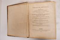
1814184001London England: F.C. And J.Rivington 1814. Hardcover. Good- leather boards detached. boards have considerable edge-wear scuffs & scratches; corners rubbed to boards. spine has considerable rubbing & wear w/ 2inch section missing at edge; spine end missing rubbed & chipped. light to dark speckled foxing throughout w/ higher concentrations on plates/maps. leather boards w/ blind-stamped & gilt tile borders; gilt printed & raised band spine. xi 5 506 pgs & ixxv; plates & maps. all edge marble. Textblock and pages firm. Plates Missing: 2 chart of East Coast of Africa 10 Chart Of Amphilia Bay 12 Chart Of Howakil Bay 13 Portraits and 34 Chart Of Annesley Bay. Tissue-guards are also torn or missing from various plates. Color plates have retained their brightness; text dark and detailed. Complete title ". in which are included an account of the Portuguese settlements on the east coast of Africa visited in the course of the voyage; a concise narrative of late events in Arabia Felix; and some particulars respecting the aboriginal African tribes extending from Mosambique to the borders of Egypt; together with vocabularies of their respective languages. F.C. And J.Rivington hardcover books
1814184001London England: F.C. And J.Rivington 1814. Hardcover. Good- leather boards detached. boards have considerable edge-wear scuffs & scratches; corners rubbed to boards. spine has considerable rubbing & wear w/ 2inch section missing at edge; spine end missing rubbed & chipped. light to dark speckled foxing throughout w/ higher concentrations on plates/maps. leather boards w/ blind-stamped & gilt tile borders; gilt printed & raised band spine. xi 5 506 pgs & ixxv; plates & maps. all edge marble. Textblock and pages firm. Plates Missing: 2 chart of East Coast of Africa 10 Chart Of Amphilia Bay 12 Chart Of Howakil Bay 13 Portraits and 34 Chart Of Annesley Bay. Tissue-guards are also torn or missing from various plates. Color plates have retained their brightness; text dark and detailed. Complete title ". in which are included an account of the Portuguese settlements on the east coast of Africa visited in the course of the voyage; a concise narrative of late events in Arabia Felix; and some particulars respecting the aboriginal African tribes extending from Mosambique to the borders of Egypt; together with vocabularies of their respective languages." F.C. And J.Rivington hardcover
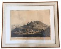
180981318London: William Miller 1809. Very Good. Hand-colored aquatint print now in a modern frame under glass. Image size approximately 61 x 42 cm. This is Plate No. XV from "Twenty-Four Views in St. Helena the Cape India Ceylon Abyssinia and Egypt" which was published in 1809. William Miller unknown
1814009243London: Printed for F. C. and J. Rivington by W. Bulmer and Co. 1814 OVERSIZED. xi 5 506pp lxxv printed on watermarked paper stating "J. Whatman 1810" deckled page edges most pages untrimmed some detached binding tight bound in blind stamped blue cloth with spine sunned occasional foxing. Includes 36 of 37 plates and maps lacking the Chart of Annesley Bay on pg 453. From the personal collection of Dr. Brooks Ryder 1918-1995 graduate of Harvard College Harvard School of Public Health and Tufts Medical School. Known for his Public Health expertise overseas throughout East Africa and Indonesia. Printed for F. C. and J. Rivington by W. Bulmer and Co. hardcover
18972090202122800063Not Available 1897. Soft Cover. Fine. Volume: 1 Not Available paperback
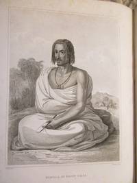
181460635London: Printed for F. C. and J. Rivington by W. Bulmer and Co 1814. First Edition. First printing. Quarto 32cm. Rebound in modern half marbled calf and marbled paper over boards titled in gilt on red leather spine label; modern brown endpapers; iii-xvi506lxxv1pp; 7 maps 5 folding one also hand-colored engraved by A. MacPherson after drawings by J. Outhett 27 plates and two in-text vignettes engraved by C. Heath after drawings by H. Salt and occasional relief diagrams. Errata to p.xvi. Former owner T. Bateman's stamp to title page. Lacking the half-title and the chart of Annesley Bay otherwise complete. A sturdy copy board edges gently rubbed slight dustiness to plate edges very occasional spots of foxing generally bright and fresh: Very Good. <br /> <br /> A handsome account of exploration in Ethiopia including depictions of notable nobles archaeological discoveries and hippopotamus hunting. Salt accompanied George Annesley on a tour of Egypt Ethiopia and India in 1802-06; following that he toured Ethiopia in 1809-1810 "as a quasi-official envoy under Canning's sponsorship marching from the Red Sea coast with an escort of 160 bearers to explore trade and diplomatic links with the Ethiopian emperor Wolde Selassie. Britain fearing a French alliance with Egypt wished to secure a port on the Red Sea. Salt carried out a little archaeology discovering at Aksum three large limestone tablets engraved with ancient Ethiopian inscriptions. Little came of the mission for the government but Salt earned over £1000 for the first edition of this book" HOWGEGO II S6. LOWNDES p.2180. Printed for F. C. and J. Rivington by W. Bulmer and Co unknown
189745502Salt Lake City: The Salt Lake Tribune 1897. First edition. Hardcover. Quarto 28.5 cm Rebound in blue cloth over boards with the original front wrap bound in. With a number of contemporary advertisements. Illustrations throughout. Very good. The extremities are rubbed including the gilt stamped title on the backstrip and there are several light scratches on the front board. There is a 4" closed tear in the top edge of the original front wrap along with a handful of shorter closed tears in the edges a few of which have been backed with tape. The last couple of pages also have small closed tears in the edges. Else the pages are free of tears and marks. Flake 7510. A collection of accounts printed in the Salt Lake Tribune between Monday April 5 1897 - July 24 1847 relating the events that happened on the very same day fifty years earlier during the Mormon trek west in the year of 1847. The Salt Lake Tribune hardcover
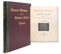
189420183London: Elliot Stock 1894. Limited edition. Hardcover. Fine. Folio. xvi 2771pp. followed by 2pp publisher's catalogue. Illustrated. Blue cloth blocked in gilt on the spine and upper board and in blind on the lower board. Top edge gilt. Patterned end papers.<br /> <p><br /> One of fifty numbered copies of which this is No. 6.<br /> <p><br /> A few spots of very light foxing light wear to the edges and hinges else a very good copy.<br /> <p>. Elliot Stock hardcover
189420183London: Elliot Stock 1894. Limited edition. Hardcover. Fine. Folio. xvi 2771pp. followed by 2pp publisher's catalogue. Illustrated. Blue cloth blocked in gilt on the spine and upper board and in blind on the lower board. Top edge gilt. Patterned end papers. One of fifty numbered copies of which this is No. 6. A few spots of very light foxing light wear to the edges and hinges else a very good copy. Elliot Stock hardcover books
18274729Paris: Chez Bobee et Hingray Treuttel et Wurtz Debure Freres 1827. Hardcover. Very Good. A scarce book; only 300 copies of this French edition were printed. Scattered foxing and toning to contents but in a contemporary armorial French binding leather flaked. 6 folding lithograph plates. <br/><br/> Chez Bobee et Hingray, Treuttel et Wurtz, Debure, Freres hardcover books
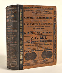
1894WRCAM35120Salt Lake City: R.L. Polk & Co. 1894. 2-952pp. including one chromolithographic advertising plate and 43pp. of advertisements printed on tinted stock. Original black half cloth gilt and boards printed with advertisements. Boards and preliminary leaves detached closed tear in cloth of spine. Plate fold strengthened. Internally fine. Overall very good. An exhaustive directory with numerous illustrated advertisements. The chromolithographic plate advertises "The Orcutt Company Leading Lithographers" and depicts a middle eastern market scene. R.L. Polk & Co. hardcover books
1809P2756London c.1809. Very Good. Image Size : 404x515 mm 15.91x20.28 Inches Platemark Size : Paper Size : 456x559 mm 17.95x22.01 Inches Coloring: Original Hand Coloring Medium: Aquatint Categories: Views Africa Egypt; unknown
180981318London: William Miller 1809. Very Good. Hand-colored aquatint print now in a modern frame under glass. Image size approximately 61 x 42cm. This is Plate No. XV from "Twenty-Four Views in St. Helena the Cape India Ceylon Abyssinia and Egypt" which was published in 1809. <br/><br/> William Miller unknown books
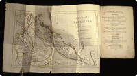
181540671Weimar, Landes=Industrie=Comptoir, 1815. Contemp. hcalf. Gilt. Title-and tomelabel with gilt lettering. Corners a bit bumped, spine slightly rubbed. XVI,480 pp. and 1 folded engraved and handcoloured map, 34x42 cm. ""Charte von Abyssinien...einrich Salt 1809 u. 1810). Scattered brownspots.
181540671Weimar Landes=Industrie=Comptoir 1815. Contemp. hcalf. Gilt. Title-and tomelabel with gilt lettering. Corners a bit bumped spine slightly rubbed. XVI480 pp. and 1 folded engraved and handcoloured map 34x42 cm. "Charte von Abyssinien.einrich Salt 1809 u. 1810. Scattered brownspots. <br/><br/><em>First German edition.Neue Bibliothek der wichtigsten Reisebeschreibungen.hrsg. von F.J. Bertuch Vierter Band. Having also the general titlepage with a stamp. </em> unknown
1814028155London: Printed for F.C. and J. Rivington St. Paul's Church-Yard 1814. executed under the orders of the British government in the years 1809 and 1810; in which are included an account of the Portuguese settlements on the east coast of Africa visited in the course of the voyage; a concise narrative of late events in Arabia felix; and some particulars respecting the aboriginal African tribes extending from Mosambique to the borders of Egypt; together with vocabularies of their respective languages . First Edition. Un volume 33x25 cm di 16-506-LXXV pagine. Con 27 tavole ft incise due vignette incise e sette carte su otto geografiche anche ripiegate fuori testo manca solo la carta di Annesley Bay. In barbe; grandi margini. The plates show views costumes portraits architecture as well as some of the works of art of the region. Gay 2683; Pankhurst 12. Legatura moderna in mezza pelle avana ad angoli piatti con carta marmorizzata dorso a nervi con tassello di titolo e decorazioni dorate. Ottime condizioni. Printed for F.C. and J. Rivington, St. Paul's Church-Yard unknown
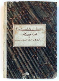
18403417<p><i>Through Russian Waters</i></p><p>RUSSIA - TRADE FORMS. Vice Consolato di Russia. Manifesti cominciando dal 1840. Trapani 1840-49.</p><p>Small folio pp. 196 of pre-printed shipping manifest forms of which 137 completed in ink; contemporary flexible vellum-backed marbled paper boards with ink-lettered label to upper board; corners bumped and spine a little chipped.</p><p>Fine documentation of the maritime trade from the harbour of Trapani in Sicily. The manifest gives bills of lading from January 1840 to March 1849. The pre-printed manifests are completed in ink giving the name of the freight ship and its captain the destination and then details of its freight i.e. type and quantity of merchandise names of senders and recipients.</p><p>Trapani boasts some of Europe's oldest salt marshes and salt extraction has been a major business for centuries which still flourishes to the present day. By the nineteenth century Sicilian sea salt was exported to European countries as far away as Norway and Russia. These shipping manifests document that it was sent to destinations as far afield as Constantinople Abo Stavanger Carlscrona Stockholm Bergen Odessa Reval and Riga.</p><p>Clearly some of the shippers acted on their own account being both captains of the ship and shipper whereas others acted on commission. The shipping routes went through Russian waters which explains the accounts kept by the Russian Vice Consulate.</p>
1809P1903London: William Miller 1809. Very Good. Image Size : 415x590 mm 16.375x23.25 Inches Platemark Size : Paper Size : 480x655 mm 18.875x25.75 Inches Coloring: Original Hand Coloring Medium: Aquatint Categories: Views Africa Egypt William Miller unknown
181619413Philadelphia: M. Carey; Boston: Wells & Lilly pr. by Lydia R. Bailey 1816. 8vo 23.5 cm 9.25". 24 454 pp.; fold. map. illus. <br><br>First U.S. edition and printed by Lydia Bailey following the London first of 1814. Salt a British traveller and Egyptologist first visited Ethiopia in 1805 and returned in 1809 on a diplomatic mission intended to promote ties between the British government and the Emperor of Abyssinia. The Voyage gives Salt's observations of Ethiopian customs manners dress cuisine and music along with the factual details of his diplomatic achievements or lack thereof in terms of concrete agreements followed by an appendix comparing vocabulary words from various languages spoken along "the Coast of Africa from Mosambique to the borders of Egypt with a few others spoken in the Interior of that Continent" p. 395.<br>Â Â Â Â This is an untrimmed copy in original boards with 24 pages of advertising for Carey publications bound in at the front of the volume. The preliminary map engraved by John Bower has hand-colored border lines; this American edition does not call for the plates found in the English first but does include in-text depictions of several "Ethiopic inscriptions. <br>Â Â Â Â <br>Â Â Â Â Shaw & Shoemaker 33864; NSTC 2S3118; Library Company Afro-Americana 9080; Nipps Lydia Bailey 157; Clarkin 932. Publisher's quarter tan paper over light blue papercovered sides; front cover detached and back joint cracked binding spotted paper cracked and split along spine spine label now absent and replaced with hand-inked title spine with later paper shelving label. Front pastedown with institutional bookplate front free endpaper with inked ownership inscription dated 1829. Half-title with portion of outer margin torn away not touching text and laid in. Map lightly foxed with two short tears along folds. Pages age-toned with occasional spots of foxing. M. Carey; Boston: Wells & Lilly (pr. by Lydia R. Bailey) hardcover books
181693629A Paris, chez magimel, 1816, , 2 vol. de texte in-8: [2]-X-[2]-406-[2] pp. et [2]-473-[1] pp. et 1 atlas in-4 oblong: 2 p. et 33 pl, Demi-chagrin bleu postérieur, titres dorés, et un cartonnage papier de l'époque avec titre imprimé au premier plat, Première édition française du second voyage effectué par l'égyptologue et diplomate britannique Henry Salt (1780-1827), avec 1 atlas de 33 planches dessinées par l'auteur, dont 8 cartes dépliantes et 25 portraits, types, vues et inscriptions, l'ensemble gravé par Adam. Chadenat, n°690. Ensemble complet: Les deux volumes de texte ont été reliés à Beyrouth, rue des Capucins, par "O. Tachdjian & Fils". Dos passés, sans la page de titre du second volume de texte. Rousseurs éparses. Quelques salissures et rousseurs marginales aux planches de l'atlas. Couverture rigide
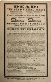
187238915Hartford 1872. Broadside 6" x 9-1/2" text surrounded by mourning border. A few spots Very Good. Illustrations of two steamers. At the bottom: "This is Good for ONE PASSAGE Only. - H.G." Dated at Hartford November 5 1872.<br /> <br /> "Salt River" is 19th century American slang: a losing candidate for office was taking a trip "up Salt River." Tickets for passage "up Salt River" were frequently printed to mock supporters of losing candidates. <br /> This humorous scarce broadside taunts Horace Greeley and other defectors from the Republican Party for their support of Greeley in 1872. "On the overwhelming defeat of the Liberal Republican Party and its candidate Horace Greeley in the presidential election of 1872. Greeley had been nominated at a Liberal Republican convention at Cincinnati in May and at the Democratic National Convention at Baltimore in July 1872" AAS description.<br /> Pall bearers include Charles Sumner and General Banks prominent Republican supporters of Greeley.<br /> OCLC 191231113 2- AAS Middlebury 47090036 1- CT Hist. Soc. as of August 2025. unknown
1891322358London: Sampson Low Marston and Co 1891. First edition no. 7 of 50 copies on Large Paper. xliv 64pp. 1 vols. 4to. Quarter publisher's green morocco and boards. With the bookplate of Leon Gruel famous French binder and Randeria bookplate. Light traces of rubbing. Very good plus. First edition no. 7 of 50 copies on Large Paper. xliv 64pp. 1 vols. 4to. S-K 1103; Mejer 1205 Sampson Low, Marston and Co unknown
1809P2777London: William Miller Albemarle c. 1809. Very good condition. Notes: A superb panoramic scene in South Africa with beautiful original hand-colouring from the early 19th century by Henry Salt and I. Bluck. Image Size : 457x595 mm 17.99x23.43 Inches Platemark Size : 480x647 mm 18.90x25.47 Inches Paper Size : 495x675 mm 19.49x26.57 Inches Coloring: Original Hand Coloring Medium: Aquatint Categories: Views Africa Others; William Miller Albemarle unknown
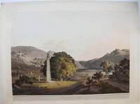
1809P4190London: William Miller c. 1809. Very Good. Notes: A charming view of the Axum Obelisk in Axum Ethiopia during the early 19th century. <br>Henry Salt 1780 – 1827 was an English artist traveller collector of antiquities diplomat and Egyptologist. His is most famous for his paintings and drawings of his travels in Egypt and eastern Africa. Image Size : 455x597 mm 17.91x23.50 Inches Platemark Size : 482x655 mm 18.98x25.79 Inches Paper Size : 544x707 mm 21.42x27.83 Inches Coloring: Original Hand Coloring Medium: Aquatint Categories: Views Africa Others; William Miller unknown