227 résultats
183129035Nelson Ohio 1831. Broadside 7.5" x 34.5" three leaves joined end to end with wax. Manuscript petition written on unlined paper bold calligraphic heading followed by small neat handwriting. Signed by sixty-one petitioners from the Township of Nelson. A dampstain runs through the right edge of the petition light scattered foxing. Very Good. <br/><br/> This is a petition for the Court to provide the village of Garrettsville Ohio with a justice of the peace. Garrettsville was founded in 1804 by Col. John Garrett III and was officially incorporated in 1864. The citizens complain that the township of Nelson had only two justices neither of which was easily accessible to Garrettsville leaving Garrettsville "entirely destitute." The petition is followed by the signatures of sixty-one residents. The Court refused the request. <br/> Among the signers is Elisha Garrett son of Garrettsville's founder; Lyman W. Trask 1809-1863 a physician and editor of the Western Pearl a short-lived literary newspaper of the 1830s; Edwin Atwood who built the Garrettsville Grist-mill with Leman Ferry and the first church with John Garrett; and Abraham Dyson a blacksmith and War of 1812 veteran. Other names include: Willis Hall Robert H. Scott Richard A. Denison Hiram Austin Warren Waste John M. Tilden E.L. Jones Martin McClintock Samuel Fuller Ferriss Couch Henry Gillmore Mylowe Eggleston Joseph Gillmore John Zubull Anson Booth Joseph A. Chapman John Noah by his mark and many more. Brown: HISTORY OF PORTAGE COUNTY OHIO. 1885. unknown books
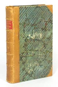
1841104249London: John Richards & Co 1841. 3rd Edition. Hardcover. Very Good. London John Richards & Co. 1841 'Third edition revised and corrected to the present time'. Octavo ii title leaf xviii 476 civ appendix and index pages. Early half tan calf and marbled papered boards with a contrasting leather title-label on the spine; covers a little rubbed and scuffed with the head of both joints slightly cracked but firm; endpapers and adjacent leaves offset mainly from the leather turn-ins; minimal scattered light foxing; early marginal emphases in pencil and rarely in ink in particular to the later sections relating to the institutions and processes of government; related annotations on several pages; overall an excellent copy. Western's apparent aim was to demonstrate the superiority of the English constitution over all other forms of government. In that context the parochial provenance of this copy is hard to beat. The ownership signature of 'J.F. Burton Adelaide 1850' appears at the head of the title page and on the front free endpaper without the place-name. The latter is also signed in pencil 'J.H. Fisher' James Hurtle Fisher around which George Fife Angas has written 'Sept 21 1853. Presented by JHF to G.F. Angas'. The full name of George Fife Angas is also written there in pencil in what we recognize as a later secretarial hand indicating in our experience that the book came originally from Angas's library. Sir James Hurtle Fisher 1790-1875 'was one of the most important pioneers of South Australia': a lawyer he was appointed first Resident Commissioner of South Australia and arrived in the colony on the 'Buffalo' with the Governor's party. He eventually became a leader of the South Australian Bar 'Australian Dictionary of Biography'. Angas needs no introduction; suffice to say the provenance takes some beating. We know little about Burton other than that he was an Adelaide solicitor; he is mentioned as such occasionally in the local newspapers of the day. John Richards & Co hardcover
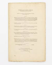
1838131290London: 'Ordered by the House of Commons to be Printed' 1838. Very Good. London 'Ordered by the House of Commons to be Printed' 1838. Foolscap folio 21 1 docket pages with numerous tables. Uncut and sewn as issued; outer pages slightly dusty; light foxing throughout; an excellent copy. Great Britain and Ireland Parliamentary Paper Number 685 of 1838. The bulk of this important paper pages 4-19 is given over to 'Nos. 5 6 7. Copy of a Despatch from Governor Sir James Stirling bearing Date 15 October 1835 forwarding a Memorial from the Inhabitants of Western Australia; together with a Copy of the Answer which has been returned thereto'. It is somewhat more than that. Stirling's covering letter explains that 'The signatures attached to this memorial . belong to about one-third of the adult male population of the settlement and represent also about one third of its property in land and capital. The grievances under which the memorialists consider themselves and their fellow colonists to labour are five in number'. The five grievances are well-aired; all signatories are identified; there are five pages of lists of lands reserved for public purposes individuals or 'Assigned to or Reserved for Civil Naval and Military Officers from commencement of the Colony in June 1829 to 6 October 1835'. The second and third lists provide name rank or situation where applicable number of acres district assigned or reserved - and when and remarks. A sample record for an individual is that pertaining to Robert Ramsay for whom an 'uncertain' number of acres was reserved at Plantagenet on 12 April 1831: 'Master of brig "Britannia". On south shore of Princes Royal Harbour reserved 18 months to form a whaling establishment and then resumed on failure of conditions'. The last four pages in this section contain Lord Glenelg's thoughts on the matter as of 7 March 1837. The limited information relating to the fledgling colony of South Australia occupies only pages 20 and 21. Ferguson 2511. <p>Provenance: the signature 'C.A.S. Hawker' is written in pencil at the head of the first page. Charles Allan Seymour Hawker 1894-1938 politician and pastoralist: his grandfather George Charles Hawker arrived in Adelaide with his brother Charles in September 1840. They settled on land at Bungaree near Clare in December 1841; C.A.S. Hawker he was born there. He was seriously wounded on several occasions at the Western Front losing one eye and 'his legs were in surgical irons to the end of his life'. He was a minister in the Lyons Government from 1932 until he 'was killed on 25 October 1938 when the aircraft "Kyeema" crashed into Mount Dandenong in Victoria. His untimely death was sharply felt. He had been an outstanding and respected figure in the Federal parliament whom some of his own party would have supported as prime minister. John Curtin the Opposition leader believed he had been on the threshold of great achievements' 'Australian Dictionary of Biography'. 'Ordered, by the House of Commons, to be Printed' unknown
18701203290287Cincinnati : Western Tract and Book Society 1870. Hardcover. Very Good. 8vo. Bound in contemporary black cloth. Gilt design on front cover and spine. Good binding and cover. Minimal shelfwear. Clean unmarked pages. Please feel free to view our photographs. <br><br> John Rankin February 5 1793-March 18 1886 was an American Presbyterian minister educator and abolitionist. Upon moving to Ripley Ohio in 1822 he became known as one of Ohio's first and most active conductors on the Underground Railroad. Prominent pre-Civil War abolitionists William Lloyd Garrison Henry Ward Beecher and Harriet Beecher Stowe were influenced by Rankin's writings and work in the anti-slavery movement. When Beecher was asked after the end of the Civil War "Who abolished slavery" she answered "Reverend John Rankin and his sons did. Cincinnati : Western Tract and Book Society hardcover
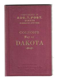
188678130New York: G.W. and C.B. Colton 1886. Hand-colored pre-statehood map published only three years before the Dakota Territory was split into North and South Dakota. Depicts the various counties railroads and townships with relief indicated by hachures.<br />  <br /> The 15 ½†x 12 ½†map folds into the original burgundy cloth-covered boards 3 ¾†x 5 ¾†with gilt and blind stamping. “Compliments off Aug. T. Post Banker 25 Nassau St. New York†is stamped on the front panel. Near fine. Scarce OCLC locates only two holdings: Yale and State Historical Society of North Dakota. G.W. and C.B. Colton unknown
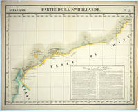
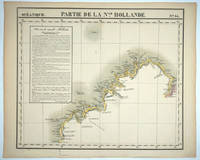
182725576Brussels: P. Vandermaelen 1827. An early map of the Exmouth Western Australia area from the North West Cape to Roebuck Bay. Lithograph with original outline color 15 3/4 x 21". Scale ca. 1:1 650 000. Plate no. 44 Partie de La Nlle. Hollande in vol. 6 Oceanique of Atlas Universal de Geographie Physique Politique Statistique et Mineralogique" by P. Vandermaelen 1827. Tooley 1286; Phillips 749; Bib ID 1553060. P. Vandermaelen unknown
182725575Brussels: P. Vandermaelen 1827. Maps. Very good condition. An early map of the Broome & the Kimberly Western Australia area from P. Cantheaume to Cambridge Gulf including the Lacepede Islands. Broome is at the bottom of the Dampier Peninsula called "C. Boileau." Lithograph with original outline color 25 x 21.5". Plate no. 35 Partie de La Nlle. Hollande in vol. 6 Oceanique of Atlas Universal de Geographie Physique Politique Statistique et Mineralogique" by P. Vandermaelen 1827. Tooley 1282; Phillips 749; Bib ID 30855. P. Vandermaelen unknown
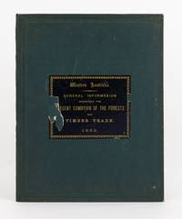
1882138714Perth: Richard Pether Government Printer 1882. First Edition. Hardcover. Very Good. Perth Richard Pether Government Printer 1882 and London L. Reeve & Co. 1879. Large quarto 28 pages last blank with several tables plus 2 tinted lithographs and 2 colour maps one folding 490 × 370 mm; and viii 30 pages plus 21 plates including 17 full-page uncoloured lithographs of eucalypts after drawings by R. Austen. Pebble-grain dark green cloth with a large title-label printed in gilt on black paper on the front cover; minor loss to the label removing two letters of one word; cloth a little marked with light wear to the extremities; small section 25 mm of the leading edge of the rear cover a little abraded; endpaper hinges neatly reinforced; light tidemarks to two small sections of the endpapers with a little foxing confined mainly to the inner surfaces of the free endpapers and the adjacent pages; one tear to the folding map expertly sealed; minimal loss to silverfish to the bottom margin of the small map; mild signs of age and use; a very good copy. The balance of the first title is 'with some remarks and suggestions on future conservation and management of the timber areas from various authorities. With a reprint of the regulations and laws in force for the renting or leasing of timbered lands'. <p>The introduction to the combined work compiled under the direction of Malcolm Fraser the WA Surveyor General has this to say: 'In compliance with your instructions and so far as the information and means at my command allowed I have collected in a general way such information about our timber Forests as was available to me and I have endeavoured to weave this together somewhat in a connected form. <p>By including the valuable Report on the Forest Resources of Western Australia by Baron Ferd. von Mueller it will be brought more prominently before the public than it has hitherto been. the drawings give a very fair idea of the character of the Jarrah and Karri forests'. Richard Pether, Government Printer hardcover
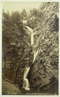
189040232n.p. 1890. Not bound. Overall quite good but some creasing tears fading a few remounted. 12 sheets. Size varies from 4 1/4 x 7 1/2 inches to 13 x 10 inches. 42 albumen and silver prints mounted on large card stock some tipped in some remounted. Images of San Francisco Yosemite Pikes Peak Grand Canyon as well as the Chicago World's Fair of 1893 some captioned in plate or in manuscript. unknown
189040232n.p. 1890. Not bound. Overall quite good but some creasing tears fading a few remounted. 12 sheets. Size varies from 4 1/4 x 7 1/2 inches to 13 x 10 inches. 42 albumen and silver prints mounted on large card stock some tipped in some remounted. Images of San Francisco Yosemite Pikes Peak Grand Canyon as well as the Chicago World's Fair of 1893 some captioned in plate or in manuscript. unknown books
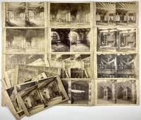
18881964Sioux City Ia.: James H. Hamilton 1888. Very good. Twenty stereoviews on printed mounts one duplicative. Some light soiling and wear one card lightly creased affecting image. Some slight fading to several photos. A group of twenty stereocards depicting the Corn Palace of 1888 taken by James H. Hamilton the official photographer for the Corn Palace festival that year. The Corn Palace at Sioux City was the world's first founded in conjunction with a citywide harvest festival in the fall of 1887. The festival and the palace were such a success drawing nearly 140000 visitors to Sioux City that the founders decided to repeat their efforts for a further four years. Each year the Corn Palace was rebuilt from scratch the framed timber structure coated with grain from top to bottom. The Corn Palace of 1888 drew approximately 350000 people and advertised "toilet rooms and conveniences for ladies and gentlemen".<br/><br/>James H. Hamilton worked as a photographer in Sioux City from the mid-1860s through the 1890s. He photographed many notable figures and scenes in the region including the Corn Palace serving as the event's official photographer in 1888. He also worked in partnership at different points with photographers Franklin Hoyt and John Kodylek. The views present here primarily depict the interior of the Corn Palace showcasing its various rooms which include features such as fireplaces and gas lighting. James H. Hamilton unknown books
1875006209Maine: Original Manuscript Book 1875 1875-1876. Being the records of the Western Union Telegraph Company with the stubs recording dates who the message was addressed to and the message sent. Includes Oct. 6 1875: To Capt. Henry Rice in Hampden / Will you be here today / shipper anxious to unload off / answer. Nov. 3 1875: To Perkins & Job / Best offer Brick and Lumber / fifty five per thousand gold. To JS Emery in Boston: Close Banks / spruce boards from wharf Palmer's Mill / Fall River / three dollars / no danger of ice / answer. To Boardman Bros: T. Field will board at Bangor for Providence / three dollars. May 16 1876: J. S. Emery / Cannot offer anything today / Mills not at work / river high. May 26 1876 / To Capt.Wm McKay in Camden / Do not know of any one that will buy today. June 28 1876 / to A. R. Buck / Can sell your ice for fifty / delivered weighed in New York / responsible parties. This being a partial sampling of entries. Bound in half cloth and paper over boards with binding and hinges tight. Paper on covers show some chips and peeling. 5-1/4 inches tall by 3-1/8 inches wide. Original Manuscript Book hardcover
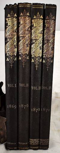
18692301180062Engineers Manufacturers Publishing Co; Western & Company 1869. First Edition. Hardcover. Like New. The Dawn of Computing and communications technology: Industrial Arts: A four year run of this rare magazine in particularly fine condition 4 volumes containing 48 monthly issues printed 1869-1872. 35 cm. Bound in publisher's brown cloth with gilt lettering and decoration. Exceptionally clean and white pages. iv 380; iv 380; iv 288 12; 2 iv 288 8 pages. Lovely illustrations numerous ads. <br> The 1869 issue has a cover article on the invention of the telephone six years before Alexander Graham Bell's famous call to Mr. Watson. "This invention may in its present state have no direct practical application . . . but who can say that it does not contain the germ of a new method of working the telegraph" page 129. The August 1870 issue discusses "Calculating by Machinery" with an illustration of "the Swedish calculating machine at Albany N.Y." page 225. Lomazow 768. Engineers Manufacturers Publishing Co; Western & Company hardcover
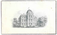
186510246Boston: the hotel 1865. Menu printed on silk 30 x 10.5 cm. one leaf printed verso only. Illustrated with an engraving of vignettes of freight transport via ship and train. WITH: Printed envelope 8 x 13 cm. with an engraving. A handsome menu printed on silk for a banquet celebrating the Boards of Trade of the Western Cities given by the City of Boston at the Revere Hotel. Revere House was one of the city's leading hotels hosting guests that included Charles Dickens Jenny Lind and Walt Whitman. Daniel Webster addressed audience from the steps of the portico. The engraving on the envelope depicts the hotel from across Boston's Bowdoin Square. The hotel has had an additional structure added to the previously flat roof. The bill of fare for the Western Boards of Trade included Green Turtle Soup Baked Shad in a Wine Sauce Leg of Southshore Mutton in Caper Sauce Duffield's Ham Pate de Foie and much more. In remarkably fine condition with only the slightest fraying to the edges of the silk. The envelope with an engraving of the Boston's City Hall has some light soil but is near fine. the hotel hardcover
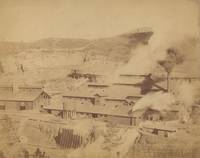
1890List2450Deadwood: H.R. Locke 1890. Albumen photographs measuring 9 x 7 inches on larger mounts. Very good contrast some chips and wear to mounts. Very Good. A group of four photographs by Henry Robinson Locke who operated a studio in Deadwood South Dakota in the early statehood years. He photographed the Black Hills region. This collection of four photographs shows a gold mill in Deadwood a cyanide mill in Deadwood and two views of Lead City which was the home of the Homestake Mining Company during the period and continued to be a center for natural resource extraction for several decades following the initial Gold Rush period of the 1870s which brought the first wave of Euro-American settlers to the area. H.R. Locke unknown
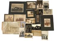
1880194771880. Western Americana Cowboy photograph archive documenting armed riders ranch labor rodeo culture and frontier mobility across the American West between the 1880s and 1920s. Images capture working cowboys on horseback cattle branding scenes and interactions with Native American families during the late frontier period when cattle ranching and horse culture formed the backbone of Western rural economies. These photographs provide visual documentation of occupational practices such as branding long distance riding and mounted travel through difficult terrain during the closing decades of the open range era and the early twentieth century transition toward modern ranching systems.<br /> <br /> Archive of twenty original photographs in multiple photographic formats including tintypes albumen prints and silver gelatin photographs. Images date approximately from the 1880s through the 1920s and depict cowboys riding horses working cattle participating in rodeo competitions and traveling across rugged Western landscapes. Several photographs show armed riders carrying pistols or rifles including one large albumen print showing a mounted cowboy with a rifle across his lap. One photograph depicts cowboys branding livestock with a caption reading "Brother Manzer Branding his Cow." A real photo postcard dated circa 1910 shows several cowboys on horseback crossing a large river with water rising to the horses' necks. Another image shows a cowboy with a Native American family wearing traditional clothing in rocky badlands terrain. Photographs illustrate the working environment and material culture of Western cattle operations including ranch yards feed lots and livery stables. Rodeo imagery reflects the transformation of working ranch skills into organized public competitions during the early twentieth century. Image sizes vary. Overall minor wear consistent with age. Very good condition. A cohesive visual record of cowboy labor frontier mobility and Western ranching culture across four decades of the American West. unknown
189962494San Francisco CA: Pacific States Telephone Companies 1899. 8vo. 4 vi 2 vii-viii 494 pp. w/ supplemental pp. at front printed on pink-tinted paper leaf of Chinese Telephone Exchange customers & businesses in Chinese facing English text & Oregon sections pp. 361-416 also printed on pink-tinted paper. Beige-gray buckram lettering & borders in red & black on front cover map of Washington Oregon & California on back cover depicting long distance lines of 21000 miles of copper wire some soiling thumbing to covers original jute braid at head of spine still intact ex-lib markings on title & spine a couple stamps still a VG- copy. First edition thus with supplements of this pioneering telephone directory for the Pacific States Telephone Companies which in 1900 became the Pacific States Telephone and Telegraph Co. and managed the West coast operations of the national AT&T or Bell system. Based out of their Richadson-inspired Romanesque building in San Francisco on Steiner Street the PSTC later PT&T had grown quickly from less than 1000 subscribers in 1891 to nearly 50000 by 1899 with 36541 in California 4177 in Oregon and 7156 in Washington State and this directory includes the very scarce leaf of the Idaho subscribers as well typically lacking. The first long distance telephone conversation held between San Francisco and Los Angeles was in 1894 and the company encouraged residences to obtain their own lines at 5¢ per day. While telephone rates in California varied from 10¢ to 50¢ those in Oregon Washington & Idaho were far higher with Zone Z no time limit running up to $ 1.00 per 3 minute use. Of particular interest is the list of subscribers in 1899 seven years prior to the 1906 Earthquake & Fire of Chinese subscribers in English and Chinese for the Chinese American Telephone Exchange. Founded in Chinatown originally in 1887 a public telephone pay station was installed in the Occidental Newspaper in 1891 and in 1894 a small switchboard was set up with Chinese-American telephone operators. John Sabin d. 1906 and Louis Glass would both later feature prominently in the trials and public hearings held in the Progressive Era to stamp out “The System†of graft and bribery in San Francisco. Worldcat locates 4 copies w/ 492 pp. Nat. Hist. Mus. LA CA NV State Lib. Sacto Pub. Lib. Yale very incomplete & damaged. Pacific States Telephone Companies, hardcover
18951422Various locations in Iowa 1895. Very good. 149 albumen photographs on twenty cardstock leaves images measuring 4 x 5 inches. Oblong quarto. Original black cloth cover gilt; leaves laid in formerly string-tied. Light wear and soiling to cloth evidence of slight dampstaining to lower edge of binding and later leaves. Internal numbering sequence indicates first sixteen images lacking. Images generally clean some minor fading; one photograph partially removed and effaced. Wonderful photo album of images documenting late-19th century Iowa assembled by an unidentified young man with a clear passion for both amateur photography and the area's rivers. Internal evidence suggests he was a student at the University of Iowa possibly pursuing a course of study in the geological sciences. Each image is numbered captioned and dated in a tidy hand usually identifying location and any interesting features. The images span a full year from April 1894 to July 1895 ending with a self portrait.<br/><br/>There are two series of eighty-three images the first sixteen of which are not present. The first of these focuses on the area around Iowa City documenting explorations along the Iowa River. Captioned images include: "21 -- Looking across Iowa River - University buildings in the distance. May 3 '94"; "25 -- Looking up Iowa River from Iowa Ave. Bridge. - Water Works in the distance. May 26 '94"; "46 -- Children at play - Iowa River. May 12 '94". There are images of a baseball game between the University and Luther College views of lime kilns and images of natural specimens. Several photographs chart the "Great Hail Storm at Iowa City" on May 5 1894 with images of golfball-size hail and the damage done to the windows of buildings around town. There are also photos of the author's roommate and some of the activities they got up to including catching snakes and hunting. The roommate Bartsch appears to have been studying natural sciences and one photograph shows him seated at his desk "Blowing Bird Eggs."<br/><br/>The second series has a manuscript title of "Oneota Expedition" and documents a trip by boat from Decorah Iowa on the Upper Iowa River and down the Mississippi as far as Muscatine several miles below Davenport. The trip began on June 18 1895 and lasted through July 26th. Scenes along the river include "6. Women wading the river - w. of Decorah June 19 '95"; "14 -- Dragging our boat in the Oneota. June 24 '95" which shows a flat-bottomed boat laden with supplies being both pushed and pulled by a man at either end; a series of views taken from Oneota Bluff near New Albin on the Minnesota border; "37 -- Winnebago Indian Camp - Iowa Slough July 6 '95"; numerous lovely images of camping along the river and river towns as seen from the water; "77 -- Beds of Montpeliar Sandstone at water's edge - Below Montpeliar Ia. - Bartsch & 'Fitz' hunting fossils. July 23 '95." An interesting album full of wonderful and meticulously documented views of the Iowa River as seen through the eyes of a 19th-century university student. unknown books
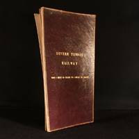
1890948F10London: Not Stated c1890 . Leather. Good. 17.5" by 9.5". Anonymous. An annotated and hand coloured lithograph map of the Severn Tunnel Railway belonging to the office of the Great Western Railway's Chief Engineer's Office. A vanishingly scarce lithograph map of the Severn Tunnel a tunnel linking South Gloucestershire to Monmouthshire built under the estuary of the River Severn and reaching a length of 4 miles 628 yards or 7012 m.Large portions of the map have been partially hand coloured with extensive annotations in both pencil and ink.With several stamps reading both 'Great Western Railway Chief Engineers Office Paddington' and 'To Be Returned to Chief Engineer's Plan Office G. W. R. Paddington' to both the recto and verso of the map.During the period of the tunnel railway's construction Chief Engineers of GWR included Joseph Armstrong William Dean and George Armstrong.The map is divided into fourteen plates mounted on linen and folding concertina style bound in morocco boards. The front board reads 'Severn Tunnel Railway: From 54 Miles 60 Chains to 7 Miles 50 Chains'.The majority of the pencil annotations detail the owner's and acreage of the pieces of land the railway runs through with the local Parishes of different sections of the railway also detailed. Further annotations include measurements and depths reference numbers for deeds and details of freeholds.A fascinating and very scarce map with a clear association to GWR the company responsible for constructing the tunnel offering insight into the land surrounding the tunnel. In the original limp morocco covered boards. Light rubbing to boards. Internally map mounted on linen and folding concertina style. Map significantly age toned with handling marks throughout. Large portion of map hand coloured with extensive pencil and ink annotations. Stamps throughout to both the recto and verso of the map. Good Not Stated hardcover
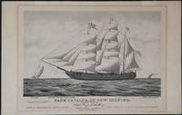
187623907Boston: Forbes Lith. Mfg. Co. 1876. First edition. This scarce tinted lithograph was issued to commemorate the escape of Irish political prisoners from Fremantle W.A. on April 17th 1876. The Fenians are shown rowing towards the bark which is under full sail. The Catalpa is flying a flag with the initials "J T R" - for John T Richardson the ship's agent. A pennant with the letter C the Fenian flag and the American flag are also flying. <br /> <br /> The police boat is in hot pursuit and the British steamship "Georgette" is steaming in from a distance. Among the Fenians freed in this effort was John Boyle O'Reilly who became a leading citizen in Boston and was later to edit the 'Boston Pilot'. <br /> <br /> Captain George Anthony an American whaling captain out of New Bedford Massachusetts recruited a crew for this mission and set sail for Western Australia where two Fenian agents John Breslin and Tom Desmond had already established themselves with aliases. With several delays the day for the escape was set for the 17th of April when most of the convict garrison was distracted by watching the Perth Yacht Club regatta.<br /> <br /> Captain Anthony who refused to surrender the escaped prisoners to the British later sold his story to Zephaniah W. Pease who published the account in 'The Catalpa Expedition'. See also Laubenstein 'The Emerald Whaler'.<br /> <br /> On its arrival in New York in August of 1876 the Catalpa was met with great crowds; jubilant celebrations were held in the US and Ireland.<br /> <br /> 17 x 13" on paper 22 x 14 1/4". For information on the artist E. N. Russell see Blasdale Artists of New Bedford pp 160-161; Kendall Prints 28; Ingalls 318. OCLC: 191908718 1 copy at the Boston Athenaeum. Trove 45254 at the Australian National Maritime Museum; and 57714676 at the State Library of Western Australia. Professionally deacidified. In very good condition. <br /> <br /> A rare print important for its depiction of an important Western Australian colonial event. Forbes Lith. Mfg. Co. unknown
184625916Paris: French Admiralty chart 1846. Very rare early map of the south west coast of Western Australia just 17 years after the founding of the colony. The map covers much of the Western Australian coast from the Dampier Archipelago in the north Broome Exmouth Gulf Shark Bay Perth Geographe Bay Cape Leeuwin Albany all the way to Port Lincoln in South Australia. To our knowledge the only copy held in an Australian institution is at the State Library of Western Australia. It is not recorded in the collection of National Library of Australia collection nor other Australian institutions.<br /> <br /> It is very interesting for the early inland detail. The areas around Perth and Fremantle are shown extending inland to Beverley York Bejoording Toodjoy and Northam on the Swan River with the Swan Avon & Moore Rivers.<br /> <br /> There are 4 insets: Plan de la entree de la Riviere Cygnes Swan River et de l'Ile Rottnest J. L. Stokes; Plan de Port Grey nomme aussi Baie Champion Captain Wickham Plan du Havre Peel dans la Baie Warnbro Lieut. J. S. Roe Plan de la Baie Warnbro J.S. Roe. Coastal features include Baie de l'Esperence; Houtmann's Abrolhos; Albany north east of Albany a mountain described as "Montagne escarpee visible a 10 lieues"; Golfe Exmouth with a prominent Cape Nord Ouest. Depth soundings are taken all around the coast. <br /> <br /> Daussy maps are rare. The State Library of Western Australia holds two. Their copy of this map bears the "Prix deux francs" lower right; with an applied printed chart sellers label from P. Sauvat Bordeaux below the rule on the lower right. They also hold the following: "Carte des mers Australes partie comprise entre les méridiens du Cap de Bonne Espérance et du Port du Roi Georges" cartographic material / dressée par M. Daussy Ingénieur Hydrographe en Chef ; gravé par Jacobs ; écrit par J.M. Hacq. MAPR0000018. This map is recorded as Tooley 1470 and Libraries Australia ID 23501679 which calls it "Rare". <br /> <br /> Centered below the margin - Ecrit de J. M. Hacq Grave par Jacobs lower left Noo. 1111 in upper right margin. Printed area 34.5 x 23.25" with very large margins 40 1/4 x 27 1/2". Backed with tissue on the center fold and margin edges supporting some small closed tears. <br /> <br /> In magnificent condition overall. An extremely rare map especially in this condition. French Admiralty chart unknown
1872WRCAM29311Various places 1872. Twelve cards each 17 x 13 inches a.e.g. with manuscript captions in lower margins. Images are 9 x 6 1/2 inches except the two oval images of San Francisco. Some minor soiling on cards some images slightly faded. Very good. Archivally matted protected with a mylar sheet. An excellent collection of views quite early for Hawaii and New Zealand. The four views of Honolulu include one wide view of the town a view of a side street with a church steeple in the background the Pali mountain pass and the harbor with several large vessels at anchor. In New Zealand the Supreme Court building in Christchurch and the city of Littleton are displayed. The San Francisco images include the Palace Hotel and the famous Cliff House. Of particular interest are the three views of the Central Pacific Railway. The sections of the track include Capestown the Palisade and Summit Station each with fresh evidence of the line's recent completion. Also in the collection is one image of a railroad along the banks of Salt Lake and three wide views of Salt Lake City one with the Mormon tabernacle completed in 1871 prominently featured. An attractive collection of views each quite displayable. unknown books
1897WRCAM56506Various locations in Oregon California and Colorado 1897. Seventy-nine printing out paper photographic prints each image 6 x 8 inches on 9 1/2 x 11 1/4 inch medium weight sheets all but two captioned in the negative. Minor surface wear to a handful of prints several with minor emulsion chipping to edges some curling to prints. Overall very good or better condition. An extraordinary collection of large handsomely-produced photographic prints documenting the exploits of a group of travelers who set out by train through Oregon California and Colorado in 1897. The photographs which are skillfully composed and indicative of an experienced photographer picture a wide variety of both urban and rural settings along the Pacific Coast and in Colorado showing a mixture of horse-drawn and cable and street cars but nary an automobile and constitute a unique and evocative time capsule for numerous locations in the American West in the final few years of the 19th century. <br> <br> The first image features a large group of women and children posed outside a railroad car with the image captioned "The R&W 97 Transcontinental Party." In fact two of the images reference the party as "R&W" which likely refers to the company or family who participated in the railway excursion. The travelers were apparently well-to-do by their dress and by the variety of notable high-end hotels they visited. The selection of photographs here was likely hand-picked by one of the members of the excursion after the journey was completed. <br> <br> The preponderance of the images document locations in California. These include two different views of Mount Shasta scenes in Yosemite Park sites in Santa Cruz and several images each in and around San Francisco Santa Cruz and Los Angeles. The Yosemite Park pictures show members of the group taking a horse-drawn carriage through a redwood tree and other Yosemite landmarks are captioned "Yosemite from Inspiration Point" "Bridal Veil Falls" "Two Brothers of the Yosemite" "Trail to Glacier Pt." "A fallen Monarch of the Yosemite" the famous downed redwood tree and "Wawona Point." <br> <br> The San Francisco images include Stanford University two images a view of Stanford's Tomb in Menlo Park the driveway to the Crocker residence a striking image of downtown focused on the Spreckels Building the San Francisco City Hall building the "Courtyard of the Palace Hotel" Golden Gate Park a spectacular view across the ocean from Golden Gate Park the entrance to Sutro Park and the esplanade in Sutro Park. <br> <br> Images in Santa Cruz depict the residence of Major Frank McLaughlin known as the Golden Gate Villa an elevated view of the beach at Santa Cruz a scene of several travelers in a horse-drawn carriage captioned "Our four in hand on the cliff drive Santa Cruz Cal." and three striking views of the cliffs including two featuring the "Natural Bridge" Cliff at Santa Cruz. <br> <br> The Los Angeles area is well represented in the photographs which picture the downtown courthouse a downtown street scene showing the Van Nuys Hotel the year it opened a view down Spring Street West Lake Park East Side Park four images including the entrance an orange grove in Riverside picturing one of the travelers Magnolia Avenue in Riverside an "Orange grower's home" in Riverside a pair of horses pulling a streetcar labeled "Riverside & Arlington Ry." before the line was electrified in 1899 and an interesting street scene in downtown Riverside. <br> <br> Other sites in California comprise the Hotel Coronado four pictures including an unusual view of the "Drive to the Entrance" of the hotel Coronado Beach two views the "Ruins of Capistrano" the remnants of the mission church the train depot at Fresno a residence in San Jose the "View from Mt. Hamilton" near San Jose and the road to the hedge maze at the Hotel Del Monte in Monterey. <br> <br> The Colorado pictures include a breathtaking elevated view of a snowy Denver taken from the top of the capitol building. Other Colorado scenes include a view of New Castle from the train Glenwood Springs an image of horse-drawn carriages crossing a bridge over the river in Glenwood Springs and two images capturing the incline tram up the Royal Gorge near Canon City. The collection also includes a handful of images in Portland Oregon. These feature the Portland wharf three separate shots of the Portland Hotel the "Residence of Dr. McKenzie" and a horse- drawn carriage ride on City Park Drive. <br> <br> Eight of the more intriguing images in the collection were taken while aboard the traveling party's moving railroad car and picture the vast landscape of the American West in California Colorado and Nevada. The captions for these read "From Top of Mountain near Scisco" "We pass through Eagle Cañon" "Leaving Leadvill sic behind us" "Some Colorado Scenery" "On the Rio Grande Western" and "Princeton Harvard & Yale" a distant view of the three mountains named for those Ivy League schools in the "Collegiate Peaks" region of the Rocky Mountains. One image likely in Colorado but with location unidentified is captioned "Mountains rising thousands of feet all around." There are even a couple of images taken from the train while passing briefly through Nevada including one of the "Humboldt Desert." <br> <br> In addition to the aforementioned image picturing the women and children of the "R&W 97 Transcontinental Party" there are a handful of images focused on other various members. One is captioned "The R&W 97 Philharmonic Symposium" and features six men standing on a railroad handcar with musical instruments. The words and music to "Sweet Rosy O'Grady" have been written into the photographic negative at center along with a humorous musical quatrain at right referencing one of the traveling party. This latter bit reads "The Director General Russ Couldn't play with us with us He was not allowed to toot So he kept time with His Boot." Additional pictures of the group feature them dining inside an unnamed restaurant posed in front of a giant redwood near Santa Cruz and sitting on chairs in a semi-circle in Sutro Park. The latter photograph is captioned "The Russo Hershian Family will now perform." The collection is rounded out with a striking photograph of a woman in a white dress posing for the camera against a white wall which is captioned "Miss Lethbridge." <br> <br> Though the subjects of the traveling party in these pictures are ultimately unknown to us their journey is emblematic of an entire generation's fascination with the railroad and the American West. In addition these large and impressive prints which capture both the urban development of California Oregon and Colorado along with the majesty of the rural settings in these states document their travels in an unusually rich and deluxe format. <br> <br> A unique and rich collection of western photographs produced in the last few years of the 19th century. unknown books
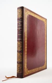
1822ST20877London: Printed for R. Ackermann 1822. First English Edition. 300 x 235 mm. 11 3/4 x 9 1/2". xvi 325 1 pp.Translated by Frederic Shoberl. <br/> Imposing contemporary crimson straight-grain morocco gilt covers with filigree frame with densely massed scrolling fleurons raised bands spine gilt in compartments with radiating viny scrolls surrounded by leaves and annular dots marbled endleaves all edges gilt. WITH 13 HAND-COLORED PLATES in etching and aquatint many after Japanese artworks one folding. Bookplate removed from front flyleaf. Bookseller's ticket of J. L. Thompson & Co Kobe Japan on front pastedown. Abbey Travel 557; Tooley 489; Martin Hardie "English Coloured Books" pp. 113-14. See also E. F. Strange "Japanese Illustration" pp. xxiii-xxiv. Spine and fore-edge of upper board slightly darkened a few minute flakes to lowest spine compartment but the binding extremely well preserved with very lustrous boards. Final 10 leaves slightly creased one repaired marginal tear but still A FINE COPY INTERNALLY exceptionally bright smooth and entirely fresh and clean.<br/> <br/> This generously proportioned production illustrated with 13 vibrant colored plates is a rare European account of Japan during the period in which the country was "closed" to the west offered here in its first English edition. Originally published in French in 1820 "Illustrations of Japan" is comprised of a history and description of the Tokugawa shogunate which Titsingh had translated from the Japanese plus Titsingh's own observations on the language customs and ceremonies of the Japanese people. The present English edition is accompanied by plates in etching and aquatint enhanced with hand coloring. Our author Dutch diplomat Isaac Titsingh 1745-1812 spent 14 years in Nagasaki for the Dutch East India company and between 1779-84 he served as trade director-cum-ambassador travelling to Edo now Tokyo for audiences with the shogun and other high officials in the shogunate. Unlike most of his Western contemporaries Titsingh was open-minded and curious about the people he encountered engaging with their art and culture; in fact art historian and Victoria & Albert Museum keeper Edward F. Strange tells us that Titsingh is the earliest known European collector of Japanese prints of which a number appear in the present volume. Our publisher Rudolph Ackermann 1764-1834 made his living issuing sumptuously illustrated books such as the present volume and was an early adopter of color aquatint and lithography technologies; Hardie writes that he was "the great presiding genius before whose magic wand so many pictorial books sprang into existence." In very attractive period morocco this is a particularly appealing copy of the work free of the foxing and offsetting that often plague copies of this and other large-format color illustrated books. Printed for R. Ackermann unknown
1891BB009<p> CHINA: Propaganda against Western Missionaries<br /></p><p>The Cause of the Riots in the Yangtse Valley. A "Complete Picture Gallery" by CHOU HAN. Hankow China 1891. With 32 full=page woodblock plates printed in color. Oblong 4to original printed wrappers sewn spine soiling minor repairs.</p><p>The author Chou Han is described by the translator Griffith John 1831-1912 as 'a gentleman of high official rank Taotai in Hunan' and was part of an orchestrated propaganda campaign aimed at discouraging Western Christian missionaries from working and traveling in China. This volume was perhaps his most significant and horrific attack on western culture managing a "reptile press" in Hunan creating unrest and distrust amongst the Chinese people see John's "A Voice from China" 1907 p. 220. Chou Han himself is probably represented in plates IX XIII XXVI and XXIX; the images are virulently anti-foreigner and specifically anti-Christian. John translated and circulated the present work to draw attention to the British authorities of the problems faced by missionaries in Asia. </p><p>Very Rare. ONLY 3 COPIES CAN BE TRACED AT AUCTION IN THE PAST 40 YEARS ABPC & RBH. </p><br /> paperback books