4 240 résultats
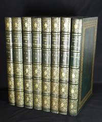
186929221London: by the author printed by Richard and John E. Taylor 1840-_ 1869. First edition. A FINE COPY OF GOULD'S MOST IMPORTANT WORK which was issued in 41 parts over 30 years and occupied more than half of his career. In the original publishers' full morocco gilt stamped binding.<br /> <br /> Provenance: Presented to the Right Reverend Mathew Blagden Hale by the members of the Church of England and other Denominations of Christians of Western Australia Perth October 28th 1876. With large presentation label printed in gold dated in each volume. Mathew Blagden Hale 1811-1895 was the first Bishop of Western Australia and founder of Hale School.<br /> <br /> Gould started work on the Birds of Australia in 1837 but ceased this effort when he found he did not have enough material to work from in England. He and his family departed for Australia where his wife had two brothers and remained there for 18 months collecting new specimens in New South Wales and Tasmania. John Gilbert was sent to collect specimens from Western Australia Queensland and South Australia. As Gould had introductions to the explorers working at the time he also received contributions of specimens from Sturt and Grey. As a result of this intensive effort 300 new species were claimed by Gould. <br /> <br /> AUSTRALIAN EXPLORERS' CONTRIBUTION TO GOULD'S BIRDS OF AUSTRALIA<br /> <br /> In May 1838 Gould his wife Elizabeth John Gilbert their zoological collector one of their sons a nephew & two servants sailed for Australia. On their 27 montsh stay in the Colonies they received assistance from all sides ~ the Colonial Governors and most importantly the early explorers of Australia's interior.<br /> <br /> In Tasmania the Goulds were looked after by the Governor Sir John Franklin of later Arctic fame and Lady Franklin who were greatly interested in the flora and fauna of the country. Gould and Gilbert explored much of Tasmania and the Bass Strait islands. <br /> <br /> In February 1839 John Gilbert departed for an eleven month stay in the Swan River Colony. Gilbert made further explorations to the Northern Territory with Ludwig Leichhardt but during Leichhardt's overland expedition in 1845 from Brisbane to Port Essington was tragically killed by aboriginals. Book - Journal of an Overland Expedition in Australia. 1847.<br /> <br /> In June of 1839 Gould began a journey with Captain Charles Sturt from Adelaide to "the Murray Scrubs" the Mallee returning to Adelaide in July from where he visited Kangaroo Island before returning to Hobart. Books- Two Expeditions into the Interior of Southern Australia. 1833 & Narrative of an Expedition into Central Australia. 1849.<br /> <br /> Contributions of specimens & information came from all quarters. George French Angas contributed eggs and information about the Yellow- eared Black Cockatoo. Book- South Australia Illustrated one of the great Australian topographical view books. In the course of his hydrographical voyage on the H.M.S. Rattlesnake John MacGillivray contributed information about the Great Palm Cockatoo. Book- Narrative of the Voyage of H.M.S. Rattlesnake commanded by the late Captain Owen Stanley. 1852 Cape York area. T.L. Mitchell surveyor general of New South Wales supplied descriptions of the Leadbeater's Cockatoo commonly known as the "Major Mitchell". Books- Three Expeditions into the Interior of Eastern Australia.1838 & Journal of an Expedition into the Interior of Tropical Australia.1848. <br /> <br /> The last voyage of the "Beagle" was in Australian waters from 1837 to 1843. In 1841 Capt. Wickham suffering ill-health was relieved of his command by Lieut. John Lort Stokes Book - Discoveries in Australia; with an account of the Coasts and Rivers explored and surveyed during the Voyage of H.M.S. Beagle In the Years 1837- 1843. 1846. The task of the expedition was to survey those parts of the northern coast of Australia not already charted by Flinders or King. Accompanying them on this trip was the young lieutenant George Grey whose duty it was to explore the land in Australia's northwest with a view to establishing a permanent settlement there. Book - Journals of Two Expeditions of Discovery in North-West and Western Australia. 1841 The scientific appendices in volume two of Grey's "Journals" include one on birds by John Gould ~ " Mr. Gould kindly forwarded the following enumeration of the species which have come under his notice as inhabiting that part of the country Western Australia." There follows a 7 pp listing of birds of W.A. "Officers of the Beagle" are credited by Gould's "Handbook to the Birds of Australia" as supplying information on the Rose-breasted Cockatoo. <br /> <br /> To conclude the history of Australia's inland exploration is inextricably bound up with Gould's masterwork The Birds of Australia. It was an extremely fertile and productive time in Australia ~ Sturt Mitchell & Angas in eastern & southern Australia; Leichhardt MacGillivray Stokes & Grey in the north & west. Reading the letter-press that accompanies each color plate of Gould's Birds bears witness to the combined efforts of Gould and the explorers and settlers of Australia ~ Gould constantly refers to specimens and information on the birds' customs and habitat sent to him by various explorers. Many times this spirit of cooperation overflows into the naming of the bird itself. Gould was the touchstone who pulled together the contributions of Australia's explorers into the foundation work on Australia's ornithology. This combined with Gould's work with Darwin interpreting the specimens from the famous "Beagle" voyages takes Gould's Birds of Australia out of a strictly natural history realm and places it firmly alongside the great scientific discovery expeditions of the 19th century.<br /> <br /> GOULD'S CONTRIBUTION TO DARWIN'S THEORY OF EVOLUTION<br /> <br /> Before the Goulds' plans for the work on the Birds of Australia came to fruition John Gould became involved in a co-operative project with another scholar - Charles Darwin. In October 1836 Darwin returned to England from his 5 year circumnavigation on the H.M.S. Beagle on which John Lort Stokes served for 18 years- rising from midshipman in 1825 to commander in 1841. Darwin needed expert help in the description & identification of the preserved birds insects rocks shells & insects for his production of the Zoology of the Voyages of H.M.S. Beagle. Darwin had heard of Gould's books from Thomas Campbell Eyton a naturalist friend from Cambridge days who had bought Gould's Toucan prints. They were expensive he wrote but of good value as he had since been offered a higher price! Through the Zoological Society where Gould had established his reputation as a premier taxidermist Darwin initially made contact with Gould about a special Rhea seen during his travels in Northern Patagonia. This Rhea was an ostrich of dark mottled color with shorter legs than the Common Rhea. Conrad Martens the artist on the Beagle expedition shot one for food and it was cooked and eaten before Darwin realized that it was a less-known species. Fortunately the head neck feathers & skin had been preserved and were sent to the Zoological Society where it was put together and a nearly perfect specimen made for display. Gould classified the Rhea as a new species "Rhea Darwinii". <br /> <br /> The third volume of the "Zoology of the Voyage of the H.M.S. Beagle" contained fifty bird plates which was advertised by Darwin as "taken from sketches made by Mr. Gould himself and executed on stone by Mrs. Gould". When Gould & Darwin were examining the birds brought from the Galapagos Islands they were fascinated by a group of about thirteen finches of the same species which had curiously different-sized beaks. These modifications occurred on different islands and it was the investigation of this and other scientific data accumulated over a long period that led to Darwin's theories of evolution by adaptation formulated many years later. Frank Sulloway Harvard University 1982 has investigated Gould's part in Darwin's theory of evolution and shows that Gould astutely realised the basic peculiarities of these birds thus paving the way for Darwin's first notes on the "Transmutation of Species". Gould presented descriptions of the Galapagos finches and mockingbird specimens at the Zoological Society in January 1837. However he was unable to finish his work for Darwin. Due to the rush before the Goulds' departure to Australia parts of his manuscript were left unresolved and the work was completed by George Robert Gray of the British Museum.<br /> <br /> As Gould only published 250 sets of "The Birds of Australia" the number of complete copies which could possibly come on the market is significantly diminished by many factors ~ the work was issued in parts and not all copies were bound which would contribute to their demise over time. Many of the sets that survive are in institutional hands and unlikely to come onto the market. Over the last 20 years at least 10 copies have been "broken up" and sold as plates. This loss of a number of complete sets will certainly lead to a complete and undisturbed Gould attracting a premium by virtue of its increasing scarcity. <br /> <br /> 8 imperial folio volumes including supplement 2 pp list of subscribers 681 hand-colored lithograph plates including 3 double-page by John and Elizabeth Gould or by Gould and H.C. Richter. Printed by Hullmandel and Walton. Occasional minor spotting. Uniformly bound in publisher's green period full green morocco sides with gilt borders spines gilt in 6 compartments gilt edge by Clyde. The books are presently in the UK. <br /> <br /> Nissen IVB 370; Anker 174 and 179; Fine Bird Books p. 78; Wood p. 365; Zimmer pp 255-6 and 259; Sauer 9 and 18; Ferguson 4773 & 10032a. <br /> <br /> Bibliography: Lambourne Maureen Wm. McEvoy & Dr. Gordon Sauer. "John Gould - BIRD MAN" London 1987 Wantrup Jonathan "Australian Rare Books 1788-1900" Sydney 1987. by the author, printed by Richard and John E. Taylor, (1840-_ unknown
1837ABC_46027London Calcutta etc.: various publishers 1837. Half calf with marbled sides and lettering in gold on spine or cloth with marbled sides and a spine label. 8vo. Some illustrated with plates and maps. 107 volumes many containing multiple articles. Handsomely bound extraordinary collection of important scientific journal articles by 19th and 20th century Western explorers of Afghanistan Central Asia China the Himalayas India including Assam Bengal Kashmir and Punjab Karakoram Pakistan including Sindh and Tibet with content covering anthropology archaeology exploration geography geology glaciology history language and grammar mountaineering and politics. At the time these were the far outskirts of the world for Western science where a lot was yet to be learned. Often the maps in these journals are the first modern maps of such regions and findings were the first to be scientifically published.Generally in very good condition.Please inquire for a full list of contents. various publishers, hardcover
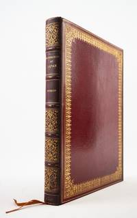
1822ST20877London: Printed for R. Ackermann 1822. First English Edition. 300 x 235 mm. 11 3/4 x 9 1/2". xvi 325 1 pp.Translated by Frederic Shoberl. <br/> Imposing contemporary crimson straight-grain morocco gilt covers with filigree frame with densely massed scrolling fleurons raised bands spine gilt in compartments with radiating viny scrolls surrounded by leaves and annular dots marbled endleaves all edges gilt. WITH 13 HAND-COLORED PLATES in etching and aquatint many after Japanese artworks one folding. Bookplate removed from front flyleaf. Bookseller's ticket of J. L. Thompson & Co Kobe Japan on front pastedown. Abbey Travel 557; Tooley 489; Martin Hardie "English Coloured Books" pp. 113-14. See also E. F. Strange "Japanese Illustration" pp. xxiii-xxiv. Spine and fore-edge of upper board slightly darkened a few minute flakes to lowest spine compartment but the binding extremely well preserved with very lustrous boards. Final 10 leaves slightly creased one repaired marginal tear but still A FINE COPY INTERNALLY exceptionally bright smooth and entirely fresh and clean.<br/> <br/> This generously proportioned production illustrated with 13 vibrant colored plates is a rare European account of Japan during the period in which the country was "closed" to the west offered here in its first English edition. Originally published in French in 1820 "Illustrations of Japan" is comprised of a history and description of the Tokugawa shogunate which Titsingh had translated from the Japanese plus Titsingh's own observations on the language customs and ceremonies of the Japanese people. The present English edition is accompanied by plates in etching and aquatint enhanced with hand coloring. Our author Dutch diplomat Isaac Titsingh 1745-1812 spent 14 years in Nagasaki for the Dutch East India company and between 1779-84 he served as trade director-cum-ambassador travelling to Edo now Tokyo for audiences with the shogun and other high officials in the shogunate. Unlike most of his Western contemporaries Titsingh was open-minded and curious about the people he encountered engaging with their art and culture; in fact art historian and Victoria & Albert Museum keeper Edward F. Strange tells us that Titsingh is the earliest known European collector of Japanese prints of which a number appear in the present volume. Our publisher Rudolph Ackermann 1764-1834 made his living issuing sumptuously illustrated books such as the present volume and was an early adopter of color aquatint and lithography technologies; Hardie writes that he was "the great presiding genius before whose magic wand so many pictorial books sprang into existence." In very attractive period morocco this is a particularly appealing copy of the work free of the foxing and offsetting that often plague copies of this and other large-format color illustrated books. Printed for R. Ackermann unknown
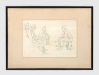
19421366441942. Original artwork from the Western Desert executed by Rommel's Kriegsmaler Wilhelm Wessel Three fine studies by Wilhelm Wessel Rommel's war artist Kriegsmaler executed in the field while serving as an officer with the Afrikakorps. Wessel 1904-1971 studied briefly with Kandinsky at the Bauhaus and then with Kurt Schwitters in Berlin. In 1924 he began a four-year journey through Turkey Greece Palestine and Egypt. From 1927 to 1931 studied Sumerian and Byzantine archaeology at the University of Berlin at the same time studying under expressionist painter Karl Hofer whose work was later branded as degenerate by the Nazis and included in their entartete kunst exhibition. Between 1931 and 1939 he taught art in Berlin and Westphalia. He served throughout the Second World War in France Russia North Africa and Italy initially as an officer with a Panzergrenadier regiment. In 1941 he was severely wounded during the opening of Operation Barbarossa and after recuperating joined Rommel in North Africa as a Kriegsmaler. His book Mit Rommel in der Wüste With Rommel in the Desert was published at Essen in 1943. At the conclusion of hostilities he was briefly a prisoner of war before resuming his career as an artist. "As a promoter of abstract art Wessel organized the first post-war German art exhibition at the Stedelijk Museum in Amsterdam. and took part in a number of group exhibitions" from Venice to Tokyo and "had solo exhibitions in Berlin Wüppertal Wiesbaden Vienna Stuttgart Munich Paris and elsewhere" Benezit. He was the first chairman of the West German Artists' Federation and as such sponsored an early exhibition of American art in Düsseldorf in 1956. Some of his war prints were loaned to NATO in Brussels. Provenance: acquired in 1975 from the artist's widow Irmgard Wessel-Zumloh 1907-1980 herself an accomplished artist by an American army veteran J. William Keithan Jr. 1925-2010. Keithan served with the 42nd "Rainbow" Division and after the war had a long career as an executive with the Westin Hotel chain in charge of the design and construction of over 50 hotels around the world. He has provided a 3-page typed account of the acquisition of this group in which he says: "We talked of many things. Of how General Rommel and Wessel were good friends and how after World War II Frau Rommel and son Manfred were frequently visitors to her home in Iserlohn. She was adamant in her refusal to sell or contribute any of Wessel's work to the German people or the German government". Together with a substantial album comprising 39 photographs of Wessel's war images acquired from the Canadian War Museum and Archives of New Zealand. Auction records for Wessel's post-war work are plentiful but we have not found a single example of any of his original war art appearing at auction or being otherwise offered for sale. Charcoal pastel and pencil drawings. The group comprises: a Original black-and-white charcoal drawing on pale grey paper signed "Wih. Wessel 42" measuring 460 x 590 mm; inscribed lower left corner in pencil "Hinter den Stützpunkten bei Eluel El-Aggara" "Behind the bases at Eluel El-Aggara"; Al 'Aqqarah Libya lies some 100 km west of Tobruk. An attractive and atmospheric evocation of the Libyan desert at dusk: against a low horizon a column of German lorries negotiates hills and scrubby terrain plumes of smoke billow in the distance. Reproduced in Mit Rommel in der Wüste colour plate 15. b Original coloured pastel drawing unsigned and untitled; image: 330 x 465 mm mounted overall: 500 x 620 mm. A striking image of a desert dawn patrol by three German armoured vehicles two Sd. Kfz. 222 scout cars and a Sd. Kfz. 231 armoured car their wheels kicking up sand; the low horizon line rising sun and big sky with flaring white cloud make for a most dramatic picture. Not reproduced in Mit Rommel in der Wüste and presumably unpublished. c Original pencil drawing signed "Wessel 42" entitled "German Soldiers Talking" inscribed in pencil on mount; image: 235 x 350 mm mounted framed and glazed overall: 410 x 570 mm. Label on verso noting its purchase from Wessel's widow in 1975. Reproduced as a half-page illustration in Mit Rommel in der Wüste p. 45. All pieces in excellent condition. unknown
19069347London 1906. Edwardian station map approx 40 x 60 inches this example 101 x 150.5 cm printed in colours some restoration with small areas of loss along the folds made good blank verso. Un-titled undated and without a printer this exceptionally scarce early poster was created for display in stations but establishing which ones presents a challenge. We can date it with reasonable confidence to 1906 or perhaps a fraction earlier. Our map predates the western extension of the Central London Railway to Wood Lane which opened for the Franco-British Exhibition in 1908. Angel is still shown as the terminus of the City & South London Railway but the western extension to Euston which opened in May 1907 is under construction. The use of a green border appears to be a nod to the successful series of green-bordered UERL Underground Group maps but as those were introduced in 1907 it might be the other way around. Another unusual design feature is the two tone shading in line colours of the names of interchange stations such as The Bank. The Bakerloo Line which opened in March 1906 appears to be shown as a thin dotted black line but as it was owned by the rival UERL its use for dating purposes cannot be guaranteed: this is most emphatically not a UERL map. Just three underground lines are highlighted none of which was under the UERL umbrella in 1906: The Central London Railway the City & South London Railway and the Great Northern & City Railway the first two purchased by the UERL and the latter by the Metropolitan Railway all in 1913. Two mainline companies are featured: the Great Northern Railway with its terminus at Finsbury Park and the Great Western Railway which served Paddington. Of these two the GWR is far more prominent with an inset showing the route to Reading. The map promotes travel across London using the highlighted routes at the expense of all others including the UERL: all are razor thin black and unobtrusive with no further differentiation between underground mainline and suburban services and seemingly haphazard naming of stations. It seems likely that our map was a joint response by three of the independent underground railway companies to the growing power of the UERL possibly in co-operation with the GWR and was created for display in any of their stations. We have been unable to locate another example. Map unknown
20172081502111904155Tianjin ancient books 2017. Soft Cover. Fine. The book is in fine condition. Tianjin ancient books paperback
190662652St. Louis MO: Holt St. Louis Streets Dept. 1906. Forty-four of 46 original linen-backed panoramic silver gelatin photographs comprised of 116 approx. 8 x 10 in. images divided into 2-4 panel panoramic photographs w/ captions neatly written w/in negatives at lower fore-edge annotations in red & black ink occasional pencil notes sectional numbers on versos edgewear & rubbing some lifting to fore-edges of some of the images creasing soot soiling to versos minor over-exposure to some images still a VG archive. This historic archive of panoramic photographs meticulously document the now largely disappeared and built-over River des Peres in a Ruscha-like manner and if pasted end-to-end would span nearly 100 feet. Capturing the River des Peres Valley which still meandered at the beginning of the 20th-Century along the Western boundaries of St. Louis MO and reveal a fast-growing Western city industrializing and appropriating the marshy lowlands farms and rural areas into factories breweries and railroad routes. Eleven of the images wind through Forest Park where much of the river had been channeled in 1904 through wooden sewers and culverts in order to cut down on the stench and prepare the park for the 1904 St. Louis World’s Fair. Holt 1866-1925 was renowned for his excessive photographic documentation leading groups of city engineers armed with large format cameras shooting on glass plate negatives recording the sprawling activities of the burgeoning St. Louis community in the Progressive Era. As evidenced by this meticulously shot archive of panoramic images Holt and his team document from the Mouth of River des Peres looking North with railroad bridge in right foreground and steamers in the river alongside the banks. The images continue along the River des Peres capturing the brewery next to the Railroad and between Broadway & Alabama Ave.; the sprawling unidentified factory on Webster; and also demarcating where the City Limits Stones were set and what numbers. A four-panel panoramic photo denotes the Saints Peter & Paul Cemetery on Gravois Avenue followed by others indicating different distances from Gravois Road bridges and houses along the road a road grading and roadbuilding team West of Gravois and then recording the rural lowland areas Southwest of Gravois and then towards Echelberger Street. About halfway through the series the images begin capturing more industrial and suburban development including the St. Louis & San Francisco Railroad Line Frisco RR telephone poles along Fyler Ave. Frisco RR stone station on Fyler with nearby culvert; the Hirsch Rolling Mill Co. complex with railcars labeled and carrying steel and railroad bridge in the distance. The photos show the River des Peres winding around revealing the Clifton Heights in the background; between Knox and Sulpher Ave. with Fire Engine House in the right foreground and many different railroad company cars including those for the Cotton Belt Line the Chicago Peoria & St. Louis RR the Missouri Kansas & Texas RR; and many for the Frisco RR. Several photos shot by Holt and his team May 10 1906 capture the sprawling Laclede Fire Brick Manufacturing Co. complex the Frisco RR Arch Bridge and even a Birds-Eye view. Other photos approaching Forest Park also depict the Police Headquarters Stables the Forest Park Highlands and once in the Park a group of boys playing baseball in the lower foreground. The final three-panel panoramic photo was taken looking West with Delmar Blvd. on the right and the Frisco RR trestle in the middle foreground Delmar Garden in the background and center field filled with the trestle stretching over the River des Peres. Unsurprisingly this cataloguer could find no similar partial or extant collection of images and the original negatives appear to have probably been dumped by St. Louis City Hall housecleaning around 1950 when they offloaded the thousands of photos shot by the Holt for the Street Department. The historically invaluable images were all sold at an auction comprising three 13 foot high stacks of negatives nearly all of them on glass. Purchased originally by Swekosky the collection was lent to Dick Lemen of Moline IL who cleaned printed and enlarged the photos purchased them and later donated the remnants of what he preserved to the St. Louis Mercantile Library. These photographs capture a Western waterway almost entirely displaced with nearly all of its original route completely rebuilt as it was engineered to operate as the backbone of the St. Louis sewer system and almost completely underground with just a few sections near the mouth with a channel and paved bans. In 1904 the Forest Park section was covered in a “large wooden box†to prevent visitors to the World’s Fair from breathing the unhealthy stench and after a 1915 flood backed up sewers killed 11 people in flooding and destroyed over 1000 homes chief engineer Horner was ordered to prepare a plan to completely control and build over the River des Peres. It still carries storm water and sewage in separate pipes and now that the channel has almost no direct source from the Mississippi River and all of the lowland meadows wetlands and areas that existed at the beginning of the 20th Century have been entirely paved over there largely remains no water to supply the river itself. Some of the River at the site of the former Carondelet Coke Plant has been largely remediated and a short piece connected to the Mississippi Greenway near River City Casino. See: Kelly Moffitt Salvaged Photographs from the St. Louis Street Department circa 1900-1930 Catalogued in New Book St. Louis on the Air St. Louis Public Radio Aug. 2 2017; Enter Dick Lemen Dr. William G. Swekosky The collection Grows Unwieldy Lafayette Square Archives 2020; Michael Allen The Harnessed Channel: How the River Des Peres Became a Sewer Preservation Research Office Nov. 27 2010; Chris Naffziger Reconnecting with the Roots of River des Peres in St. Louis Terrain Magazine 2022. Holt, [St. Louis Streets Dept.], unknown
16702080502106917709Not Available 1670. Soft Cover. Fine. The book is in fine condition. Not Available paperback
42856London : s.n. 1835. Quarto 250 x 200 mm 3 pp; printed on letterpress; fourth side docketed 'Mission to Western Australia' and with Webster Collection stamp with number 2621 in ms.; original vertical and horizontal folds some toning else very well preserved. The foundation document for the Western Australian Missionary Society recording the resolution for its establishment made on 30 September 1835. The document also gives details of Honorary Secretary Captain F. C. Irwin's proposal for an Appeal to raise funds for the sending of missionaries to the Swan River colony and for their maintenance there which includes the observation that 'the Natives of the country who are still in the lowest state of barbarism continue in the grossest heathen darkness without a single Christian teacher of any denomination among them.' Ferguson 2070 Very rare. Trove locates only three copies in Australian collections NLA; SNSW; SLWA which represent two different printings: the SLWA and Mitchell Library copies have the variant '10s.' for 'Ten Shillings' in the last line on the first page. Note: The NLA copy is fully digitised and may be viewed at the following link: https://catalogue.nla.gov.au/catalog/2914171 Provenance: Private collection Australia; ex Maggs Bros. London c.1978; ex Webster Collection. Kenneth Athol Webster 1906-1967 was a New Zealand-born dealer and collector in manuscripts books paintings and ethnographic artefacts relating to the Pacific. In the two decades after World War Two he built one of the largest and most important collections of this type of material ever assembled. unknown
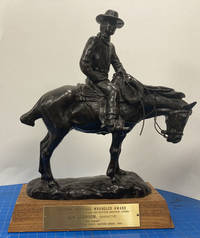
50746Oklahoma City: National Cowboy & Western Heritage Museum 1985. 1985. BRONZE WRANGLER AWARD. Wrangler bronze 13" x 9 1/2" x 4 3/4" overall on a 1 3/4" wood base complete with a 1 3/4" x 5 1/2" brass plague. The bronze is signed by "R. Muno" and weighs almost ten pounds. The brass plague is inscribed: "Western Heritage Wrangler Award / National Cowboy Hall Of Fame and Western Heritage Center / Ben Johnson Narrator / 'THE DREAM' / Outstanding Special Short Feature Award 1985." The Bronze Wrangler is an award presented annually by the National Cowboy & Western Heritage Museum at the Western Heritage Awards to honor the top works in Western music film television and literature. Provenance: Ben Johnson estate. Francis Benjamin Johnson Jr. June 13 1918 - April 8 1996 was an American film and television actor stuntman and world-champion rodeo cowboy. Tall and laconic Johnson brought authenticity to many roles in Westerns with his droll manner and expert horsemanship. The son of a rancher Johnson arrived in Hollywood to deliver a consignment of horses for a film. He did stunt-double work for several years before breaking into acting with the help of John Ford. An elegiac portrayal of a former cowboy theater owner in the 1950s coming-of-age drama The Last Picture Show won Johnson the 1971 Academy Award BAFTA Award and Golden Globe Award for Best Supporting Actor. Johnson also operated a horse-breeding ranch throughout his career. Although he said he had succeeded by sticking to what he knew shrewd real estate investments made Johnson worth an estimated $100 million by his later years. He was an actor from 1939 until 1996 and is the only true cowboy to have won an Academy Award. The film The Dream was directed by Joe Pytka born November 4 1938 an American film television commercial and music video director born in Pittsburgh Pennsylvania. He holds the record for the most nominations for the Directors Guild of America Award for Outstanding Directing - Commercials. Pytka gets a call from a new agency in Minneapolis to do a short film for U.S. West a telephone company and the idea was a 'teaser' film of cowboys saddling their horses at predawn. The art director was Pat Burnham and the writer was Bill Miller. Pytka asks whether or not they have the account. Told no simply the current assignment Pytka says "Let's do something big!" Pytka had been filming Busch Beer commercials for a number of years and was familiar with locations and cowboys. He also knew that the number of convincing cowboy actors in Hollywood was extremely limited. He needed to get away from Los Angeles where he knew a great cowboy that had a great hat. "Cowboys are defined by their hats and boots . The thing should be realistic. Real cowboys. Real horses . There are horses and there are horses. For example a cowboy wouldn't be caught dead on a paint horse." The short film was shot mostly in Monument Valley with a select few real cowboys as that is their home. Most amazing to Pytka was how the cowboys and their horses are completely as one. The film was shot and almost everything done in a single day. By some stroke of good fortune the agency has gotten the great cowboy actor Ben Johnson to record the narration. In the session Johnson remarked that we'd gotten some real cowboys there a huge compliment since he was a real wrangler before he discovered that he could make more money in Hollywood than in Oklahoma. National Cowboy & Western Heritage Museum, 1985. unknown
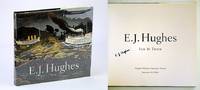
2002547H0222Canada: Douglas & McIntyre / Vancouver Art Gallery. Fine in Fine dust jacket. 2002. First Printing. Hardcover. 1550548999 . Signed by E.J. Hughes upon title page. 226 pages. Index of works. Chronology. Selected bibliography. Oblong 11" x 12". "Lavishly illustrated with 100 full colour and 25 black-and-white reproductions of prints drawings and paintings this is the first full-scale volume to honour the artistic life and work of E.J. Hughes from the start of his long career in the 1930s to the present. His unique talent for depicting the landscape in a way that both he and viewers believe it should be rather than the way it actually is enables us to experience and understand place and nature in new and deeper ways." - from dust jacket. Clean bright and unmarked with very light wear. Dust jacket now preserved in glossy new archival-grade Brodart. A marvelous gift for any devotee of E.J. Hughes and his magnificent art.; 4to - over 9¾" - 12" tall; E.J. Hughes British Columbia Canadian Artists Painters Landscape Painting Vancouver Island Signed; Signed by Authors . Douglas & McIntyre / Vancouver Art Gallery hardcover
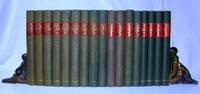
1937617G1246Victoria British Columbia: The Archives of British Columbia/British Columbia Historical Association. Good. 1937. First Edition. Hardcover. Seventeen volumes individually and uniformly bound in green cloth with with red labels and gilt lettering upon backstrips. Index in each volume. Fold-out maps. Black and white plates. Includes all issues from 1937 through 1945 and 1947 through 1954. Bindings tight. Unmarked. Moderate wear. A magnificent repository of early British Columbia history. Very heavy. Special shipping considerations may apply.; 8vo - over 7¾" - 9¾" tall; British Columbia Quarterly History . The Archives of British Columbia/British Columbia Historical Association hardcover
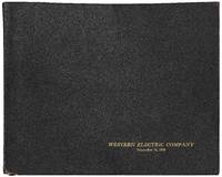
1928545041Cicero Illionis 1928. Hardcover. Very Good. Oblong folio 12 ½" x 10. A handsome presentation album consisting of three letterpress leaves followed by 27 gelatin silver prints neatly mounted on the rectos of thick card leaves each with a letterpress caption printed underneath. All but the first print measure 8" x 10". Screw-bound in flexible leather covers lettered in gold on the front cover. Head and tail of spine are torn the cardboard leaves are slightly bowed very good or better.<br /> <br /> The album was prepared "upon the occasion of a visit of city officials and business men of Baltimore to the Hawthorne Works of the Western Electric Company." It contains crisp professional views mostly of the Hawthorne factory complex at Cicero Illinois as well as a few views of other parts of the Company's operations such as the plant in Kearny New Jersey and the distribution houses in New York and Kansas City. Among the many visually striking views are "A three and one-half acre" interior the "Reel Yard operating by Floodlight" throngs of employees at a "Hawthorne-Club Open-Air Dance" and a final view of employees leaving the complex under a dramatic sunset "After the day's work."<br /> <br /> At the peak of its operations from 1905 through 1983 the Hawthorne Works employed upwards of 45000 people in the production of radio systems radar and telephone equipment and related consumer goods. Located in a suburb of Chicago the complex also gained notoriety for the term "Hawthorne effect" which "refers to the type of reactivity in which individuals modify an aspect of their behavior in response to their awareness of being observed."<br /> <br /> An early scarce promotional album dating from the heyday of Western Electric during the roaring twenties. hardcover
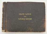
19103375Numerous locations including New Mexico Arizona California but mostly British Columbia 1910. About very good. Forty-six leaves illustrated with 232 photographs between 3.25 x 5.5 inches including forty small panoramic images measuring around 3.5 x 12 inches some manuscript annotations some images captioned in the negative. Oblong folio. Contemporary pebbled leather stamped in gilt "Grand Canyon and Canadian Rockies" on the front cover formerly string tied but binding and leaves now loose. One image roughly removed from the album minor chipping to some leaves but otherwise minor wear. An unusual and wholly engrossing collection of western American vernacular photography titled in manuscript on the first page "Views taken by M.H. Fussell of trip taken by Sarah E. Fussell and himself to Los Angeles to attend Amer. Med. Asso. On return trip via Canadian Rockies camping at Emerald Lake near Field Canada as seen by pictures." The author of this inscription was Dr. Milton Howard Fussell 1855-1921 longtime Philadelphia physician and instructor of clinical medicine at the University of Pennsylvania who was the head of the Medical Ward at Episcopal Hospital until shortly before his death. Dr. Fussell must have also had a passion for photography as the present photographs were apparently taken by him along the course of his trip to the west coast with many of the pictures displaying Dr. Fussell's captions in the negative. A few of the captions are written backwards adding to the amateur character of Dr. Fussell's otherwise well-composed pictures.<br /> <br /> While on the way to California Dr. Fussell's photographs begin in Chicago with a couple of small panoramas of Lincoln Park but the scene swiftly shifts to the American West with images of Native Americans among them shots of "Indian children" and an "Indian Village" a "Pueblo at Laguna" numerous shots of New Mexico Las Vegas Raton and Albuquerque several small panoramic scenes of the majestic Grand Canyon and more. During their visit to the Grand Canyon Dr. and Mrs. Fussell took the chance to snap portraits of each other under which the annotation reads "The climbers. It took 12 hours to make the trip up & down. Hot!!!" On the way to California Dr. Fussell also took a couple of images of Kansas and Nevada before proceeding to snap about a half dozen pictures of the Sacramento Valley.<br /> <br /> The photographs from this point forward constituting the majority of the pictures in the album concentrate on the latter half of Dr. and Mrs. Fussell's expedition to British Columbia and the Canadian Rockies. After visiting Victoria and Vancouver the Fussells stayed at Camp Crusoe on Emerald Lake. This portion of their trip includes a few more images of the travelers themselves including a shot of Sarah with a large dead black bear. In addition to several small panoramas of Emerald Lake Dr. Fussell captures scenes of the natural wonders of British Columbia such as Mt. Burgess Mt. Wapta Bow Valley Yoho River Emerald Glacier Valley of Ten Peaks Kicking Horse Canyon Bow River Lake Louise Moraine Lake Mirror Lake Fraser River and more. The last few leaves feature other scenes in British Columbia and elsewhere with a street scene in Banff a view of the "Prairie Town of Suscatchewan B.C." a handful of pictures featuring the Sierra Nevadas and several photos captioned "Over the Coast Range" taken from a train.<br /> <br /> A unique photographic record of a West Coast excursion taken by a notable Philadelphian and his wife in the early 20th century. unknown
184625916Paris: French Admiralty chart 1846. Very rare early map of the south west coast of Western Australia just 17 years after the founding of the colony. The map covers much of the Western Australian coast from the Dampier Archipelago in the north Broome Exmouth Gulf Shark Bay Perth Geographe Bay Cape Leeuwin Albany all the way to Port Lincoln in South Australia. To our knowledge the only copy held in an Australian institution is at the State Library of Western Australia. It is not recorded in the collection of National Library of Australia collection nor other Australian institutions.<br /> <br /> It is very interesting for the early inland detail. The areas around Perth and Fremantle are shown extending inland to Beverley York Bejoording Toodjoy and Northam on the Swan River with the Swan Avon & Moore Rivers.<br /> <br /> There are 4 insets: Plan de la entree de la Riviere Cygnes Swan River et de l'Ile Rottnest J. L. Stokes; Plan de Port Grey nomme aussi Baie Champion Captain Wickham Plan du Havre Peel dans la Baie Warnbro Lieut. J. S. Roe Plan de la Baie Warnbro J.S. Roe. Coastal features include Baie de l'Esperence; Houtmann's Abrolhos; Albany north east of Albany a mountain described as "Montagne escarpee visible a 10 lieues"; Golfe Exmouth with a prominent Cape Nord Ouest. Depth soundings are taken all around the coast. <br /> <br /> Daussy maps are rare. The State Library of Western Australia holds two. Their copy of this map bears the "Prix deux francs" lower right; with an applied printed chart sellers label from P. Sauvat Bordeaux below the rule on the lower right. They also hold the following: "Carte des mers Australes partie comprise entre les méridiens du Cap de Bonne Espérance et du Port du Roi Georges" cartographic material / dressée par M. Daussy Ingénieur Hydrographe en Chef ; gravé par Jacobs ; écrit par J.M. Hacq. MAPR0000018. This map is recorded as Tooley 1470 and Libraries Australia ID 23501679 which calls it "Rare". <br /> <br /> Centered below the margin - Ecrit de J. M. Hacq Grave par Jacobs lower left Noo. 1111 in upper right margin. Printed area 34.5 x 23.25" with very large margins 40 1/4 x 27 1/2". Backed with tissue on the center fold and margin edges supporting some small closed tears. <br /> <br /> In magnificent condition overall. An extremely rare map especially in this condition. French Admiralty chart unknown
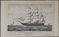
187623907Boston: Forbes Lith. Mfg. Co. 1876. First edition. This scarce tinted lithograph was issued to commemorate the escape of Irish political prisoners from Fremantle W.A. on April 17th 1876. The Fenians are shown rowing towards the bark which is under full sail. The Catalpa is flying a flag with the initials "J T R" - for John T Richardson the ship's agent. A pennant with the letter C the Fenian flag and the American flag are also flying. <br /> <br /> The police boat is in hot pursuit and the British steamship "Georgette" is steaming in from a distance. Among the Fenians freed in this effort was John Boyle O'Reilly who became a leading citizen in Boston and was later to edit the 'Boston Pilot'. <br /> <br /> Captain George Anthony an American whaling captain out of New Bedford Massachusetts recruited a crew for this mission and set sail for Western Australia where two Fenian agents John Breslin and Tom Desmond had already established themselves with aliases. With several delays the day for the escape was set for the 17th of April when most of the convict garrison was distracted by watching the Perth Yacht Club regatta.<br /> <br /> Captain Anthony who refused to surrender the escaped prisoners to the British later sold his story to Zephaniah W. Pease who published the account in 'The Catalpa Expedition'. See also Laubenstein 'The Emerald Whaler'.<br /> <br /> On its arrival in New York in August of 1876 the Catalpa was met with great crowds; jubilant celebrations were held in the US and Ireland.<br /> <br /> 17 x 13" on paper 22 x 14 1/4". For information on the artist E. N. Russell see Blasdale Artists of New Bedford pp 160-161; Kendall Prints 28; Ingalls 318. OCLC: 191908718 1 copy at the Boston Athenaeum. Trove 45254 at the Australian National Maritime Museum; and 57714676 at the State Library of Western Australia. Professionally deacidified. In very good condition. <br /> <br /> A rare print important for its depiction of an important Western Australian colonial event. Forbes Lith. Mfg. Co. unknown
44211<p>Japan and Western Medicine. Oranda jin Geka ryoji no zu Dutch Surgery in Nagasaki. Original pen ink and watercolor drawing on light brown-toned silk with 4 vertical lines of Japanese characters in the upper left corner. Japan: late 18th or early 19th century. 483 x 363 mm. mounted as a scroll at a modern date on light grey silk backed with paper with a half-round hanging rail with braided ribbon attached at the top and a suspension bar at the foot measuring 914 x 443 mm. overall; preserved in a custom-made wooden box. A few tiny pinholes in upper corners of image but fine with the coloring fresh and bright.</p> <p> This striking image showing an amputation carried out by a Dutch surgeon in Japan was most likely painted in the late eighteenth or early nineteenth century during Japan's self-imposed period of national isolation. The hand-painted image is related but by no means identical to a Nagasaki woodblock print titled "Surgery by a Dutch Physician" one of many popular souvenir prints depicting scenes unique to Nagasaki which at the time was the sole point of contact between Japan and the outside world. See our reproduction of the print. It may be that our scroll is the original of the image; however it is also possible that both hand-painted and woodcut versions of the image were produced simultaneously.</p> <p> Western surgery came to Japan in the sixteenth and seventeenth centuries via the Portuguese who in 1543 became the first Europeans to make direct contact with Japan and the Dutch who became the only European nation allowed to trade with Japan after Japan's expulsion of the Portuguese in 1639. Surgeons attached to the Dutch East India Company established practices at the island of Dejima in Nagasaki Bay which led to the formation of several Japanese schools of surgery based on European methods. "This aspect of Western medicine known as K m -ry geka or 'Surgery of the Red-Haired' has had a profound effect on the development of surgical practice in Japan" Van Gulik p. 37. Van Gulik "Dutch surgery in Japan" in Red-Hair Medicine: Dutch-Japanese Medical Relations ed. Beukers et al. pp. 37-50. </p> <p>. unknown
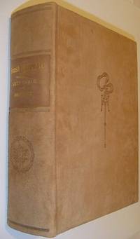
1913559a9589British Columbia: British Columbia Historical Association 1913. Book. Fine. Hardcover. Signed by Authors. First Edition. Folio - over 12" - 15" tall. Unread. As new. Number 216 of limited edition of 350 copies. Signed by co-author R.E. Gosnell. "Few publications if any of similar size and excellence have been produced in Canada." - From Editor's Foreword. Part I includes 210 pages and eighteen chapters which constitute "a survey of events from the earliest times down to the Union of the Crown Colony of British Columbia with the Dominion of Canada." Part II is "a history mainly political and economic of the Province since Confederation up to the present time." Part I is preceded and followed by dozens of tissue-protected black and white portraits of individuals influential in the early history of the province complete with their brief biographies upon the tissue. Part II comprises eighteen chapters over 226 pages plus 5 pages of addenda followed by dozens of tissue protected portraits of "some of the men conspicuous as present day factors in development." Top edge gilt. Gilt lettering upon backstrip. Marbled endpapers. Exceptionally clean bright and unmarked with zero wear. Brown suede exterior appears as fresh as the day it was applied over 100 years ago. This majestic fourteen pound tome measures 13" x 10.5" x 4". A magnificent acquisition for any serious collector of British Columbia history. A better copy will not be found. Lowther 1607 Hale 2523 Edwards & Lort 3177 Strathern 495. British Columbia Historical Association Hardcover
19053538Copper River Valley Ak 1905. Very good. Forty-five printing-out paper photographs between 3.25 x 3.25 and 4 x 6 inches plus three real photo postcards. Minor wear a few creases occasional light soiling. A unique collection of almost fifty images capturing scenes in and around Copper Center in the Copper River Valley of Alaska in the years after gold was first found there in 1898. The images document pioneers panning for gold running dog sled teams posed in front of early wooden buildings in a bleak snow-covered landscape and more as well as capturing shots of a riverside mill a wooden bridge scenery on the Copper River and the majesty of the surrounding forests. A handful of the images capture pioneer women and children posed for the camera in winter clothing worn to combat the bitter Alaskan winters. One image pictures three men and two dogs standing outside the Hotel Holman an early Copper Center roadhouse that began in a tent but was opened in a wooden structure in 1899; the present image captures the post-1899 wooden structure. The Holman Hotel was established in July 1898 by Copper Center's first resident Andrew Holman in order to provide shelter for prospectors on their way to the Klondike gold fields. Copper Center is located northeast of Anchorage and served as a brief but important way station for gold prospectors in southeastern Alaska; one image here apparently pictures the early riverside settlement or is perhaps an early view of Anchorage. A rare view of Alaskan life in an uncommonly-seen settlement during the first decade of the 20th century. unknown
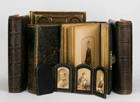
100720The photographs cartes de visite and cabinet cards depict Annie Griffith Roberts her first husband Dr James Hawkins her second husband Dr Edward Bruce Robertson and Oriana one of the children of the second marriage. The Robertsons came to Australia in 1887; Oriana married into the Moodie family of 'Wando Dale' Coleraine Victoria. Of primary importance are the approximately 50 portraits featuring prominent members of pioneering Western District pastoral families: the Camerons of 'Dunan'; the Edgars of Pine Hills; the Gardiners of Nangwary; the McConochies of Konongwootong; and the Trangmars of Burswood. The photographs are contained in five full-leather quarto albums and an attractive arch-topped six-panel folding panoramic frame for cartes de visite in full morocco. 6 items. unknown
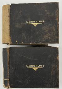
19235280Various locations in the American Southwest and West 1923. About very good. Two oblong folio photograph albums bound in brown pebbled leather each titled in gilt on front cover "WANDERLUST" containing a total of 266 full-page vernacular and professional photographs. First albums: 146 leaves illustrated with 128 full-page landscape photographs each around 6 x 8 inches or slightly larger and occasional manuscript or hand-fashioned sectional title pages and maps. Second volume: 148 leaves illustrated with 138 photographs and occasional manuscript or hand-fashioned sectional title pages. All contents mounted one per page to recto of each leaf. Spines perished but holding strong boards worn scuffed and soiled. Contents noticeably curled with minor to moderate dust-soiling throughout. A studio photograph of a young man is laid-in to the first album likely the compiler of the albums but sadly unidentified. An elaborately-produced pair of vernacular photograph albums documenting an epic cross-country train excursion in 1923 by a well-to-do but anonymous traveler from New York comprised of over 260 full-page photographs. The photographs are a mixture of silver gelatin images printing out paper prints handcolored photographs and a handful of cyanotypes. Most of the images appear to be taken by the traveler en route but some images may have been bought along the way. The images largely picture the landscape or architecture seen along the way with a healthy number of images showing the railroad and the railcars themselves with many images taken at train depots. The occasional manuscript sectional title pages denote the regions of travel as the compiler moved west to California and then eventually back east towards home.<br /> <br /> The first album begins with a manuscript title leaf quoting the text of Gerald Gould's poem "Wanderlust" supplemented by two small drawings and two thumbnail photographs. A map on the second leaf traces the voyage from New York down through the American South and Southwest to California and back to New York through Arizona Colorado and the Midwest. Thereafter the album is comprised mostly of full-page photographs grouped together by location with anywhere from a few to several images per section. The first section in the first album shows the first major stop on the trip -- Washington D.C. and Mount Vernon; this section contains photographs of the Capitol the Lincoln Monument other D.C. buildings and several on the grounds of George Washington's home at Mount Vernon. The album then includes sections featuring New Orleans six photographs; the route between New Orleans and El Paso five images including the train depot at Langtry Texas; El Paso five shots featuring the city and street views; Juarez Mexico eight shots mostly either street scenes or a bullfight; "Thru New Mexico and Arizona" four images; The Apache Trail in Arizona nineteen shots mostly desert landscapes but with some buildings along the trail; and onward through the Carriso Gorge seven photos to California beginning at Coronado Beach eight photographs. The remainder of the first album features California locations namely San Diego sixteen images mostly missions; Pasadena ten photos mostly featuring gardens; Catalina Island eight shots of the island scenery or the bay; Los Angeles eight views in Santa Monica Venice and Ocean Park; and ending with fourteen images featuring missions and other notable structures in Santa Barbara.<br /> <br /> The second volume picks up the excursion in Del Monte California featuring fifteen scenes in Carmel by the Sea and Monterey. The photographic journey of California then continues to Santa Cruz and the Big Trees five shots; San Francisco eleven views around the city and in the Japanese gardens; Mt. Tamalpais a dozen shots of elevated vistas big trees and forests; Yosemite National Park twenty park views; Mariposa Big Trees seven shots; and ends with the Glenwood Mission Inn in Riverside twenty-two images of the hotel grounds and other local scenery and missions around Riverside. The remainder of the album features photographs from the Grand Canyon in Arizona twenty-six images mostly landscapes but with a few featuring Native American ceremonies and Colorado Springs twenty landscapes and other views of the city surrounding desert Pikes Peak and so forth. Concerned mostly with scenery of the American South Southwest and West Coast the compiler did not see fit to record photographs of the remainder of his trip back home to New York. In addition to the information contained in the photographs here the elaborate materiality custom matching albums with matching gilt titles to the front board handcrafted sectional title pages the hand-drawn and traced map and the nature of the organization of the albums arranged in the order of travel from east to west and back east again speaks volumes about the importance the compiler placed on the trip.<br /> <br /> Substantially documented western travel albums are growing rare in the market and the present example is one of the most carefully-assembled examples we have ever seen. unknown
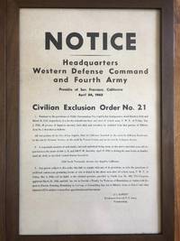
1942222721942. Japanese InternmentWWII Framed original broadside issued April 24 1942 by the Western Defense Command enforcing Executive Order 9066 by the compulsory removal of Japanese Americans from a designated district of Los Angeles. The broadside directs "all persons of Japanese ancestry both alien and non-alien" to present themselves for relocation initiating their forced transfer to government custody. This document dates to the first phase of the federal mass incarceration program that uprooted more than 120000 Japanese Americans approximately two-thirds of whom were United States citizens.<br /> <br /> Civilian Exclusion Order No. 41 Large format broadside framed. Western Defense Command and Fourth Army. San Francisco: U.S. Army April 24 1942. The notice mandates that a "responsible member of each family and each individual living alone" report to a designated Civil Control Station between April 25 and April 26 1942 and warns that failure to comply would result in criminal penalties under Public Law No. 503 and possible immediate apprehension. The text specifies the geographic boundaries of the exclusion zone within Los Angeles and outlines the administrative procedure for removal including reporting instructions and compliance requirements. The exceptionally fast pace of mass incarceration is especially evident here as the poster issued April 24 commands representatives to report immediately over the following two days for instruction and mandates all Japanese and Japanese-Americans be vacated from the area by May 1 the following week. During this period immigrants and citizens alike were suddenly ripped from their homes schools and jobs forced to say good-bye to neighbors loved ones and pets and pack whatever belongings were permitted by the U.S. government for internment of an indeterminate length of time.<br /> <br /> Posted publicly in affected neighborhoods across California Oregon and Washington exclusion orders such as this were a key part of the first phase of Japanese American mass incarceration. They introduced military command into neighborhood-level enforcement and a suspension of civil liberties for the West Coast Japanese immigrant population. The order is dated less than five months after the attack on Pearl Harbor when the U.S. was rapidly expanding federal emergency powers on the home front parallel to increasing involvement in WWII abroad. Exhibiting some damage including folds creases pinholes and several small tears at edges with a some in the center many have been repaired with acid-free archival tape en verso. No loss to paper. Overall good condition. A rare and historically significant artifact of wartime racial profiling and a sobering reminder of the fragility of constitutional protections during times of crisis. unknown
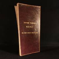
1890948F10London: Not Stated c1890 . Leather. Good. 17.5" by 9.5". Anonymous. An annotated and hand coloured lithograph map of the Severn Tunnel Railway belonging to the office of the Great Western Railway's Chief Engineer's Office. A vanishingly scarce lithograph map of the Severn Tunnel a tunnel linking South Gloucestershire to Monmouthshire built under the estuary of the River Severn and reaching a length of 4 miles 628 yards or 7012 m.Large portions of the map have been partially hand coloured with extensive annotations in both pencil and ink.With several stamps reading both 'Great Western Railway Chief Engineers Office Paddington' and 'To Be Returned to Chief Engineer's Plan Office G. W. R. Paddington' to both the recto and verso of the map.During the period of the tunnel railway's construction Chief Engineers of GWR included Joseph Armstrong William Dean and George Armstrong.The map is divided into fourteen plates mounted on linen and folding concertina style bound in morocco boards. The front board reads 'Severn Tunnel Railway: From 54 Miles 60 Chains to 7 Miles 50 Chains'.The majority of the pencil annotations detail the owner's and acreage of the pieces of land the railway runs through with the local Parishes of different sections of the railway also detailed. Further annotations include measurements and depths reference numbers for deeds and details of freeholds.A fascinating and very scarce map with a clear association to GWR the company responsible for constructing the tunnel offering insight into the land surrounding the tunnel. In the original limp morocco covered boards. Light rubbing to boards. Internally map mounted on linen and folding concertina style. Map significantly age toned with handling marks throughout. Large portion of map hand coloured with extensive pencil and ink annotations. Stamps throughout to both the recto and verso of the map. Good Not Stated hardcover
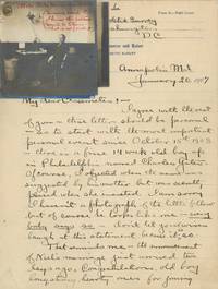
1940List3440United States France and Germany 1940. Approximately 469 total items. Fifty-nine pieces of loose correspondence one with four photographs affixed. In large letter album approximately 199 pieces of written material: 118 pieces of incoming correspondence twenty-one drafts of outgoing correspondence and sixty other. 139 photographs: nine cabinet cards thirty-three smaller mounted or framed photos eleven CDVs or tintypes nineteen in small photo album sixty-six loose photographs and one real photo postcard. Eight pieces of loose miscellaneous written material totaling sixty-four pages; nine forms applications etc; forty-five clippings generally affixed to notebook pages; and ten pieces of unsorted ephemera. Written material generally dating from about 1891–1928. Photographic material and ephemera generally dating from about 1870s or earlier to 1943. Letter album with covers detached and damage to edges of paper very good plus; other material generally excellent. Overall very good to excellent. Charles Colt Yates 1868–1944 was born in Binghamton New York. He received a BS in Physics and an MS in Civil Engineering from the Case School of Applied Science now Case Western Reserve University before joining the US Coast and Geodetic Survey in 1892. Yates’ work with the USC&GS took him around the US and abroad; his work included observing the earth’s surface density in Hawaii; surveying Lake Pontchartrain the Alaska–Yukon border and the Aleutian Islands; surveying and ship-building in the Philippines and Hong Kong; and surveying the oyster bars in Maryland and Delaware.<br /> <br /> Offered here is a large collection of photographic and written material belonging to Yates. The photographs are almost entirely family shots. Subjects are generally identified verso by their initials and include Yates; his grandparents James Dennison Colt and Abigail Weber; his parents Walter Lloyd Yates and Charlotte Colt; and especially his brother Alonzo Colt Yates sister-in-law Elizabeth Deming and their children Evelyn and Lloyd Deming Yates.<br /> <br /> The written material relates to Yates’ work and includes incoming correspondence particularly work assignments sent by the Survey’s various superintendents; Yates’ drafts of outgoing correspondence; field expense forms—providing a look at the more quotidian activities of the Survey’s researchers—and departmental circulars; resumes and applications; notes and article drafts; and newspaper clippings. The latter generally relate to either the 1916 controversy around Woodrow Wilson’s scientific appointments particularly of E. Lester Jones or to the 1916 and 1928 Merchant Marine Acts. The merchant marine issue preoccupied Yates as several of his letters and articles concern the subject; other of his articles are an 1898 “Report on the Establishment of a Self Registering Tide Gauge at Morehead City N.C†and a 1914 report on oceanography.<br /> <br /> Early in his career Yates apparently wanted out of the Survey writing to several different people seeking a teaching position and explaining that his “desire to become a teacher and ultimately a professor is so great that I am willing to make a considerable sacrifice†in terms of pay July 16 1896. Of course there would have been upsides to leaving the Survey as working conditions at the time were far from ritzy; for instance fellow officer Alex S. Christie wrote of the employee at the Sandy Hook tidal station in New Jersey:<br /> <br /> “Where now located on the west side of this sand spit the observer is completely isolated and threatens to resign. He has no love for nature and no resources within himself. I could be very happy there.†July 26 1892<br /> <br /> Similarly Superintendent William Ward Duffield attempted to convince Yates that the conditions on the Alaska-Yukon boundary survey were more tolerable than he might think:<br /> <br /> “It might pertinently be added here that the American Transportation and Trading Company has a number of stations on the Yukon and carries a large stock of goods including drugs etc. at points near the boundary. The country is better supplied with means of existence and communication than was supposed sometime ago.†February 29 1896<br /> <br /> As references for a teaching position Yates offered his Case classmate and highly decorated electrical engineer Comfort Avery Adams then at Harvard and Case president Cady Staley. Yates corresponded occasionally with Staley including helping him with research by among other things giving him honest advice on the use of a theodolite:<br /> <br /> “From a personal experience: to approach a Vertical Circle without ever having seen one and having had it explained by a textbook is not only awkward but an embarrassing experience and perhaps even a disastrous experience when the proper approach of the level correction is reached.†February 24 1897<br /> <br /> Another Case affiliate with whom Yates corresponded was Albert A. Michelson then at the University of Chicago. Michelson is best known for the 1887 Michelson-Morley experiment a test of the speed of light performed at Case with Edward W. Morley and the assistance of Comfort Adams then a student. Yates had sent Michelson an observation of some kind—though he did not save the draft of this outgoing letter—and Michelson responds with several pages of reasoning:<br /> <br /> “I scarcely think it likely that refraction is the cause of the color observed – but even if this were the case it would not help matters much. The angle subtended by the spectrum could certainly not be less than 10†if a consistent color could be appreciated . Nevertheless I would recommend that the color phenomenon be carefully observed and recorded – for it may throw light on other matters of importance – even tho not of immediate practical use.†March 8 1896<br /> <br /> Yates also kept up with his Case classmates; several letter drafts in the archive are addressed “dear Classmates†and seem to be part of a semi-regular correspondence where the former classmates would update each other on their careers and lives though only Yates’ outgoing mail is represented. Yates writes a particularly interesting letter to his classmates describing his time in the Philippines and Hong Kong the surveying of which had become part of the USC&GS’s duties after the US assumed control of the territory:<br /> <br /> “I was just leaving for a surveying cruise along the south west coast of Samar Island the island General ‘Jakey’ Smith and brother officers made so famous by their approved ‘water cure’ and other ancient methods of obtaining information from the natives. We had an excellent Thanksgiving’s dinner in Jakey’s former residence the ‘bungalow’ at Tacloban and although many of his officers were still there I feel quite certain that water was not mentioned but their liquid method of obtaining information was probably even more effective. No doubt the natives of Samar are well subdued at least we judged so from the fact that when they saw any of our boats put off from the ship they immediately abandoned house and home to the old and crippled. Apparently Americans are to be trusted in reference to these two classes. Disappearing streaks of red skirts indicating retreating females were sometimes seen but our male ‘little brown brother’ was rarely discovered even on a run. This was quite a change from our previous experiences in other parts of the Philippines which had not received the benefit of the same intimate contact with our methods of civilization. In fact we were usually accompanied along the beach by a swarm of men women and children of all sizes and ages who though always polite and gentle were a nuisance sometimes through unintentionally getting in the way of our work.†October 15 1903<br /> <br /> The “water cure†was a form of torture similar to waterboarding often used by American soldiers during the Philippine-American War. General Smith was infamous not for use of the “water cure†but for his orders during the Pacification of Samar to execute everyone over age ten and turn the island into a “howling wildernessâ€; during the campaign several thousand civilians were killed.<br /> Later Yates explained to his classmates that he had had a nervous breakdown while stationed in Asia following the death of his only child at five months old and was sent home January 20 1907. He was assigned to survey oyster fields for the Maryland Shell Fish Commission which he described as “surrounded by politicians as our work seems to be the political issue of the Stateâ€.<br /> <br /> In fact at this time Yates seems to have become more interested in politics especially the Merchant Marine acts mentioned earlier. He sent out his article titled “By-products and Relative Values of a Merchant Marine†to several potential publishers and also corresponded with Congressmen regarding the act including Jesse D. Price of Maryland Frank P. Woods of Iowa and Joshua W. Alexander of Missouri. He wrote to the latter who was the 1916 act’s sponsor:<br /> <br /> “If you succeed in passing the Bill you will deserve oceans of credit and even if you fail you will have gained the sincere admiration of those who have studied the subject and know the great aggregate of vested shipping interests both foreign and domestic which are fighting you so hard because they fear the results to their personal interest of the founding of a real American Marine which would be brought about by the passage of your Bill.†May 16 1916<br /> <br /> Yates was also interested in the 1928 Act which concerned shipbuilding—having built ships for the Survey in Hong Kong and Wisconsin—and wrote an article that year giving suggestions for it. Otherwise the more recent contents of the archive are mainly ephemera of Yates’ brother diplomat Alonzo Colt Yates 1864–1950 including an ID card and passport.<br /> <br /> Overall a unique collection of an employee of the US government’s first and for a long time only scientific agency the archive provides a look at the agency’s activities at home and across the globe. It also provides some history of the early days of the Case School of Applied Science especially the activities of early alumni and faculty. unknown
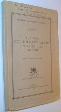
1914724a7836Victoria BC: Government of British Columbia B.C. 1914. Book. Good. Paperback. First Edition. 8vo - over 7¾" - 9¾" tall. 69 pages. Complete with 8 protected map plates. Signed and inscribed by E.O.S. Scholefield Archivist of British Columbia atop front cover. Pages 3-4 constitute a letter of submittal by Mr. Scholefield to the Honourable Henry Esson Young Provincial Secretary. This work "represents the first bulletin of the British Columbia Provincial Archives Department." - page 3. "Vindicates the contention of Captain Vancouver that his ships were the first to complete the navigation of the inner channels which separate Vancouver Island from the British Columbia mainland." - M. Menzies. Errata neatly affixed to verso of Map List. Map plate V loose but present. Rough cut edges. Contents clean unmarked and lightly toned. Short openings to bottom edges of beige card covers. Strathern 399. Government of British Columbia (B.C.) Paperback