蔣淑均編著 - SHUJUN, Jiang (Compilation)Livre Rare Book

8 931 résultats
19956001995 - broché - People's Fine Arts Publishing House - Imprimé par Beijing Meitong Printing Factory - Troisième impression : 1995 - Wu YICAI (Rédacteur en chef) - In-8 (18,5 x 13 cm) broché, couverture à rabats - Très nombreuses illustrations en noir et blanc - ISBN : 9787102000992 - ENGLISH : People’s Fine Arts Publishing House – Printed by Beijing Meitong Printing Factory – Third printing: 1995 – Wu Yicai (Editor-in-chief) – Octavo (18.5 × 13 cm), paperback with flaps – Very numerous black-and-white illustrations - 中文:人民美术出版社出版 - 西洋素描百图 - 蒋淑均编著 - 北京美通印刷厂印刷 - 1986年6月第一版,1995年第三次印刷 - 责任编辑:吴依才 - 18开(18.5 × 13厘米)平装,带折页封面 - 大量黑白插图
New English Paperback. Pbo. 16mo. (16 x 10 cm). In English. 179, [1] p., color ills. Trekking routes in Düzce.
Very Good English Original bdg. HC. Oblong large 8vo. (18 x 24 cm). In English and Turkish. 72 p. Safranbolu. A new era in Safranbolu.= Safranbolu. Safranbolu'da yeni bir zaman. Photos by Çelik Gülersoy, Aytekin Kus, Metin Kaya Yandas, Bülent Erutku, Akadur Tölegen.
18990009259Warszawa: G. Centnerszwer 1899. First edition. Good. . 12mo; 70 67 77 54 pages quarter leather black cloth; bookplate and rubber stamp of the Biblioteki Polskiej South Bend IN. <br/><br/>The only copy on OCLC is in Poland. Sedlaczek's work concerns the 1410 Battle of Tannenberg Grunwald. Bound with SYN KMIECY by Teresa Jadwigi / Jadwiga Teresa Papi. Warszawa 1897 Fiction. First published Chicago 1892. Bound with Zorjana E. W WALCE Z PHOANCAMI. Warszawa 1900. 1st Ed. OCLC lists only 1927 edition. Bound with SPRAWA O WOZ CZYLI. By Wiktor Olszewski. Warszawa 1901. This edition not cited on OCLC however OCLC credits a 1913 edition to Mieczyslaw. Brzezinski . G. Centnerszwer hardcover
1997633h1682Duncan B.C.: IWA Canada Local 1-80. Very Good. 1997. First Edition. Paperback. "This special anniversary book is to acknowledge and pay tribute to all those pictured on the following pages for their contributions dedication and determination in building our local union." - Inside front cover. 88 pages. Wonderful sepia-tone reproductions of archival photos on nearly every page complete with informative descriptions of the hard work performed by this local and its members over the decades. Clean bright and unmarked with negligible wear. Gift quality. Truly a feast for the eyes and mind of anyone interested in the history of Vancouver Island logging. ; 4to . IWA Canada Local 1-80 paperback
in-8°, 306 pp., photos n&b, broche, couverture illustree à rabats. Bel exemplaire [NV-17][NAN-2] First french edition.
Book is in excellent condition. Binding is solid and square, covers have sharp corners, exterior shows very light wear only, text/interior is clean and free of marking of any kind. 134 pages with a few b&w illustrations.
Book is in excellent condition. Binding is solid and square, covers have sharp corners, exterior shows no blemishes, text/interior is clean and free of marking of any kind. Great author photo on back.
19719396CBMünchen, Moewig Verlag, 1971. 8°, ca. 325 S., farbig illustr. original Hefte, Erstausgaben Nummer 1 minimal berieben und Einbanddeckel an unterer Kante mit ca. 2mm Anriss, Nummer 4 auf Rückdeckel mit einem ca. 2cm rundem Loch, sonst schöne, saubere Exemplare (vo2gla)
199124001Stroud: Alan Sutton. Fine in Near Fine dust jacket. 1991. Hardcover. 0862998387 . Illustrated. First edition thus. Fine in an about fine dust jacket. . Alan Sutton hardcover books
128 pages. Features: Combining Eastern and Western Techniques; Creating Personally Significant Images; Discovering the Creative Possibilities of Synthetic Paper; An Alternative to the Conventiaonal Painting Excursion; Watercolor Societies; Maurice Brazil Prendergast's Pivotal Watercolors; The Color Red - Part One; The Color Red - Part Two - replacing fugitive reds; Tangling with the Cyclops; Creating Icons on Paper; Floral Painting; Achieving Detailed Realism with Gouache; Telling Tales; Wildlife in Color; Composing with Stripes. Average wear. Prior owner's name atop page 3. A sound reference copy. Magazine
2003100135432PUF 2003 496 pages 15x2 8x21cm. 2003. Broché. 496 pages.
in-8°, 276 pages, ill. hors texte N&B, broche, couverture illustree- 9782868044365 Bel exemplaire. [CA31-2]
1960243676München AWA-Verlag E.F. Flatau & Co. ca., 1960. Leinen
1930X1829Berlin, Verlag von Th. Knaur Nachf., o,J 1930. Ganzleinen, 8°, 318 S., aus dem Amerikanischen von Paul Baudisch
RARITA’ CARTOGRAFICA Sconosciuta piccola carta geografica con imprint di Giacomo Zatta e data 1794, appartenente a un non documentato atlante in miniatura dal titolo “Atlante tascabile per le dame”, suddiviso in tre tomi, stampati “IN VENETIA Presso G. Zatta”, senza data ma circa 1795. Si tratta di carte da visita – con un apposito spazio bianco dove apporre il proprio nome – dove compare l’imprint o di Pietro Zancon (accompagnato dalla data 1794) o di Giacomo Zatta (con data 1794 o 1795), che, come si legge sul frontespizio, risulta l’editore dell’opera. Possiamo ipotizzare che la serie, iniziata da Zancon fu poi terminata dallo Zatta. Sulla carta dell’Italia – presumibilmente la prima tavola dell’opera – compare stampato il nome di Chiara Minelli Rota, nobildonna veneziana che sposò Antonio Rota nel 1794; tutte le restanti 65 carte recano lo spazio bianco privo di nome. In precedenza, le carte erano note solo attraverso una serie, priva di imprint editoriale, venduta 21 anni fa (1999) dall’Antiquariaat Haas di Bedburg Hau; parlando con Stephan Haas, la serie, priva di titolo e dati editoriali si componeva di 70 mappe. Le carte furono vendute separatamente sotto il nome di G. Bonatti, firma dell’incisore che si trova nella carta della Francia. In seguito, le tavole furono attribuite a Pietro Zaricen da Geoffrey King (cfr. Miniature Antique Maps, p. 181). Il nome dello Zaricen viene dedotto dalla carta della contea del Roussillon, che reca l’iscrizione “Venezia 1794 App.o P. Zancon”, letto erroneamente come Zaricen. Lajos Szantai include la carta dell’Ungheria nella sua cartobibliografia, traducendo il nome dell’autore in Zancen (cfr. Atlas Hungaricus 1528-1850). Sempre King, che non menziona nessuna carta firmata da Zatta, sostiene che “About the turn of the century a signed card of the first edition, with a map of the province of Roussillon in the south of France, was seen at an Ephemera Society Fair in London”. Questo esemplare sembrerebbe oggi quello conservato alla Yale University Library [1978 351], che lo descrive composto da 70 carte geografiche. Non sappiamo se sia il numero totale delle mappe, e l’assenza di un indice o dell’elenco non consente di stabilire l’esatto numero delle carte che lo compongono. http://hdl.handle.net/10079/bibid/3611852Confrontando le carte erroneamente attribuite allo Zaricen ci si accorge che la lastra è abrasa in corrispondenza della firma di Zancon o Zatta. Molto scarse sono le notizie sulle carte che possiamo ora definire “ex Zaricen”. Jason Hubbard nella sua bibliografia recente sulle carte del Giappone raffigura la carta priva dell’imprint “App.o G. Zatta” attribuendola - sulla base delle informazioni bibliografiche finora note – a Giuseppe Bonatti e Pietro Zaricen: “This is one of the 70-odd geographical cards, printed on one side only, acquired by the Haas brothers in 1999. The cards cover countries around the world and include detailed map of Italian provinces. The card with the map of France carries the inscription: G. Bonatti fece; and it is presumed that Bonatti engraved all of them although this is questioned by King” (cfr. J. Hubbard, Japoniae Insulae, n. 124). Il nostro esemplare della carta della Francia, che reca l’imprint “Venezia 1794, App.o P. Zancon” reca in basso a destra la firma di Bonatti sopra menzionata. Dunque, l’unica differenza tra questa serie di sconosciute carte sembra essere la presenza degli imprint editoriali di Zancon e Zatta, accompagnati dalla data 1794 o 1795. Giuseppe Bonatti è menzionato da V. Valerio nella qualità di incisore cresciuto alla scuola Remondini di Bassano, autore di alcune carte per l’atlante di Pazzini Carli (Siena, 1788-1800) e per l’Atlante Geografico di Carlo Antonio Barbiellini (Milano, 1807). Dal 1809 in poi lavorò come incisore per il Deposito della Guerra di Milano (cfr. V. Valerio, Cartografi Veneti, p. 153). Pietro Zancon era, assieme ... A GREAT RARITY Unknown small map with imprint by Giacomo Zatta and date 1794, belonging to an undocumented miniature atlas entitled “Atlante tascabile per le dame” (Pocket Atlas for ladies), divided into three volumes, printed "IN VENETIA Presso G. Zatta", undated but about 1795. A rare set of visiting cards published in Italy features pretty little maps of all parts of the world - with a special white space where to put your name - where the imprint appears or of Pietro Zancon (accompanied by the date 1794) or Giacomo Zatta (with the date 1794 or 1795), who, as can be read on the title page, is the publisher of the whole Atlas. We can speculate that the series, started by Zancon was later terminated by Zatta. On the map of Italy is printed - presumably the first map of the work - the name of Chiara Minelli Rota, Venetian noblewoman who married Antonio Rota in 1794; all remaining 65 maps bear the blank space without names. Previously, the maps were known only through a series, without editorial imprint, sold 21 years ago (1999) by the Antiquariaat Haas of Bedburg Hau; speaking with Stephan Haas, the series, without title and printing details, consisted of 70 maps. The maps were sold separately under the name of G. Bonatti, the engraver's signature found on the map of France. Later, the plates were attributed to Pietro Zaricen by Geoffrey King (see Miniature Antique Maps, p. 181). The name of Zaricen is derived from the Roussillon county map, which bears the inscription "Venice 1794 App.o P. Zancon", incorrectly read as Zaricen. Lajos Szantai includes the map of Hungary in his cartobibliography, translating the author's name into Zancen (see Atlas Hungaricus 1528-1850). Always King, who does not mention any map signed by Zatta, said: "About the turn of the century a signed card of the first edition, with a map of the province of Roussillon in the south of France, was seen at an Ephemera Society Fair in London ". This copy would seem to be the one preserved in the Yale University Library [call number 1978 351], which describes it as being composed of 70 maps. We do not know if it is the total number of maps, and the absence of an index or list does not allow to establish the exact number of maps. http://hdl.handle.net/10079/bibid/3611852 Comparing the maps erroneously attributed to Zaricen one realizes that the plate is erased in correspondence with the signature of Zancon or Zatta. There are very little information on the maps, that we can now define as "ex Zaricen". Jason Hubbard in his recent bibliography on the maps of Japan depicts the map without the imprint "App.o G. Zatta" attributing it - on the basis of the bibliographic information so far known - to Giuseppe Bonatti and Pietro Zaricen: “This is one of the 70-odd geographical cards, printed on one side only, acquired by the Haas brothers in 1999. The cards cover countries around the world and include detailed map of Italian provinces. The card with the map of France carries the inscription: G. Bonatti fece; and it is presumed that Bonatti engraved all of them although this is questioned by King” (cf. J. Hubbard, Japoniae Insulae, n. 124). Our copy of the map of France, which bears the imprint "Venice 1794, App.o P. Zancon", also shows the signature of Bonatti mentioned at the bottom right. Therefore, the only difference between this series of unknown maps seems to be the presence of the addresses of Zancon and Zatta, accompanied by the date 1794 or 1795. Giuseppe Bonatti is mentioned by V. Valerio as an engraver raised at the Remondini school in Bassano, author of some maps for the atlas of Pazzini Carli (Siena, 1788-1800) and for the geographical atlas of Carlo Antonio Barbiellini (Milan, 1807). From 1809 onwards he worked as an engraver for the Milan Deposito della Guerra (see V. Valerio, Cartografi Veneti, p. 153). Pietro Zancon was, together with the most famous brother Gaetano, a native engraver of Bassano del Grappa, who grew up at the Remondini prin...
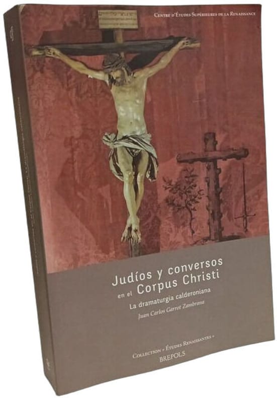
2014100144026Brepols Publishers 2014 489 pages 4x23x16cm. 2014. Broché. 489 pages.
Book is in excellent condition with very light wear to covers only. Binding is solid and square, covers have sharp corners, exterior shows no blemishes, text/interior is clean and free of marking of any kind.
Book shows shelf wear to covers, some marks on back cover. Binding is solid and square, covers have sharp corners,, text/interior is clean and free of marking of any kind except for three pages with paragraph markings. 277 pages, concerns the true story of the subject, an Austrian peasant who refused to fight in Hitler's war because he believed that the Nazi movement was anti-Christian. Because of his stand he was beheaded by the Germans in 1943.
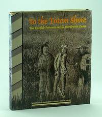
1986664G3774Spain: Ediciones El Viso 1986. Book. Illus. by Blassi Jaume; Sota Santiago De La. Good. Hardcover. First Edition. 4to - over 9¾" - 12" tall. 240 pages. Bibliography. Index of names. Index of geographical references. Handsome reproductions of historic maps and illustrations. Printed upon glossy stock. Chapters include: Galleons Pirates Pearls and Fantastic Straits - California XVIIth Century; Russian French British and American Incursions into "The Spanish Lake"; The Spanish Presence on the Northwest Coast - Sea-going Expeditions 1774-1793; Spanish Cartographic Surveys of the Northwest Coast in the XVIIIth Century - The Corps of Naval Steersmen; The Culture of the Indians of the Northwest Coast; Faces in the Forest - Mozino's Noticias de Nutka; A Personal View of the Northwest Coast - The journal of Tomas de Suria 1791; Nootka - the Crisis of 1789. Fore-edge of front free endpaper rumpled othwerwise book clean and unmarked with light wear. Average wear to dust jacket which is now preserved in glossy new archival-grade Brodart. A sound copy of this handsome and very informative work. Ediciones El Viso Hardcover
Fine English Paperback., Fine., 21 x 15 cm, 221 p. "Oryantalizm elestirel kisa tarihi., YÜCEL BULUT, Haz: Hulusi Ersoy, Yönelis Yayinlari, Istanbul, 2002"
Very Good Turkish, Ottoman (1500-1928) In modern cloth. Cr. 8vo.. (19 x 13 cm). In Ottoman script. 82, [2] p. Hegira-Hijri: 1313 = Gregorian: 1897. Yusuf Ziya Bey was an Ottoman / Turkish statesman from Yozgat city who lived in the late 19th and early 20th centuries. He descended from Çapanoghuls (Çapanogullari principality in Anatolia) which was Yozgat city's deep-rooted dynasty. He wrote the impressions in verse he described in detail on the places he visited in the cities of Yozgat, Kirsehir, Kastamonu city, Küre Mountains and Inebolu etc. with their architectural monuments and important figures who lived in those places. Extremely rare. First Edtion. Printed in Adana city. Özege 10332.
201355207Paramount, 2013. 6413944 DVD DVD
19572092902137305128Yoshikawakobunkan 1957. Soft Cover. Fine. Size: 30cm Yoshikawakobunkan paperback
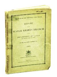
1914644H3358Victoria B.C.: Province of British Columbia Water Rights Branch 1914. Book. Fair. Paperback. First Edition. 4to - over 9¾" - 12" tall. 194 pages. Index. Many black and white photographic plates plus graphs charts fold-outs and maps. Provides detailed provincial river flow benchmarks which constitute an invaluable historical reference in light of modern climate change and water supply concerns. Above-average wear. Spine taped. Binding intact. Name atop front cover. A sound reference copy. Province of British Columbia, Water Rights Branch Paperback