8 407 résultats
184850600New York:: Sherman and Smith 1848. publisher's decorated red cloth stamped in gold. Old owner's signature at head of title; D.C. bookseller's ticket; a few minor fold separations to map; very attractive. 16mo. Large folded map 26 x 21-1/2" with boundaries hand outlined in color. Howes S-614. Wheat #568. Sherman and Smith, hardcover
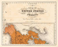
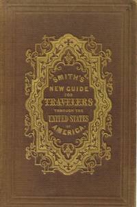
18508913New York 1850. Hardcover. Very Good. 21 ¾ x 26 inches. Lithograph with original hand color; some fold reinforcements with some mended losses at intersections very good condition. A delicately beautiful map of mid-19th century United States with extensive transportation-related content. Four of the work's five inset maps focus on rail lines and canals in specific parts of the country. The large inset of the western United States at bottom right completes the picture of the country that is not shown in the main map. Thus all of Texas is shown on the map and the California Territory is depicted as stretching as far east as the Texas border. The map generally is very well detailed and shows stage roads in addition to railroads and canals. It has a beautifully rendered floral border in which are fine scenic vistas including of Niagara Falls and a harbor scene with ship that is powered by both steam and sail. Published in A New Guide for Travelers.80 pp excellent in original binding included but separate. Modelski Railroad Maps no. 8. hardcover
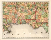
185524693Kassel: Theodor Fischer 1855-60. Other. In excellent condition. 370 by 470mm 14 by 18 inches. 370 by 470mm 14 by 18 inches. Lithograph original color in outline by Smith J. Calvin published 1855-60 by Theodor Fischer Kassel. Image size: 370 by 470mm 14 by 18 inches. From Smith's multi-sheet Special-Karte one of the most detailed and accurate mid-19th-century maps of the United States. John Calvin J. Calvin Smith c.18091890 was an American surveyor geographer and engraver active in New York City from the 1840s. Working with partners including George Sherman under the Sherman & Smith imprint 18401853 and later in association with J.H. Colton Smith produced some of the most accurate and widely used general-purpose maps of the United States of his era. His maps appeared in government publications military surveys and commercial atlases and his multi-sheet Special-Karte der Vereinigten Staaten published in a German-language edition brought American cartographic standards to European audiences. Despite his prolific output and importance to American cartographic history much of Smith's personal biography remains obscure.This antique map of Alabama Florida No: 14 was published in 1855-60 by Theodor Fischer Kassel 370 by 470mm 14 by 18 inches. It is printed as a lithograph original color in outline. The map documents the region with careful attention to rivers settlements roads and political boundaries reflecting the geographical knowledge available at the time of publication and offering an invaluable primary source for historians and collectors of North American antique cartography. In excellent condition. Theodor Fischer unknown
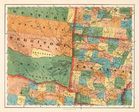
185524689Kassel: Theodor Fischer 1855-60. Other. In excellent condition. 375 by 467mm 14 by 18 inches. 375 by 467mm 14 by 18 inches. Lithograph original color in outline by Smith J. Calvin published 1855-60 by Theodor Fischer Kassel. Image size: 375 by 467mm 14 by 18 inches. From Smith's multi-sheet Special-Karte one of the most detailed and accurate mid-19th-century maps of the United States. John Calvin J. Calvin Smith c.18091890 was an American surveyor geographer and engraver active in New York City from the 1840s. Working with partners including George Sherman under the Sherman & Smith imprint 18401853 and later in association with J.H. Colton Smith produced some of the most accurate and widely used general-purpose maps of the United States of his era. His maps appeared in government publications military surveys and commercial atlases and his multi-sheet Special-Karte der Vereinigten Staaten published in a German-language edition brought American cartographic standards to European audiences. Despite his prolific output and importance to American cartographic history much of Smith's personal biography remains obscure.This very detailed map shows Arcansas Parts of Missouri Texas and the western Territory. In excellent condition. Theodor Fischer unknown
186676445Boston:: E. P. Dutton & Co. 1866. folding into 12mo gilt-lettered boards as issued. Several sections of New York State have been outlined in thick felt-tip type pen; otherwise fine. . Image approx. 25 x 26 inches. Tinted map with inset views of Niagara Falls The Notch White Mountains Falls of the Montmorenci View from Mount Holyoke and ships at sea. . E. P. Dutton & Co., hardcover
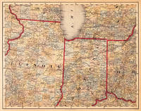
185524685Kassel: Theodor Fischer 1855-60. Other. In excellent condition. 370 by 470mm 14 by 18 inches. 370 by 470mm 14 by 18 inches. Lithograph original color in outline by Smith J. Calvin published 1855-60 by Theodor Fischer Kassel. Image size: 370 by 470mm 14 by 18 inches. From Smith's multi-sheet Special-Karte one of the most detailed and accurate mid-19th-century maps of the United States. John Calvin J. Calvin Smith c.18091890 was an American surveyor geographer and engraver active in New York City from the 1840s. Working with partners including George Sherman under the Sherman & Smith imprint 18401853 and later in association with J.H. Colton Smith produced some of the most accurate and widely used general-purpose maps of the United States of his era. His maps appeared in government publications military surveys and commercial atlases and his multi-sheet Special-Karte der Vereinigten Staaten published in a German-language edition brought American cartographic standards to European audiences. Despite his prolific output and importance to American cartographic history much of Smith's personal biography remains obscure.This antique map of Illinois Indiana No: 6 was published in 1855-60 by Theodor Fischer Kassel 370 by 470mm 14 by 18 inches. It is printed as a lithograph original color in outline. The map documents the region with careful attention to rivers settlements roads and political boundaries reflecting the geographical knowledge available at the time of publication and offering an invaluable primary source for historians and collectors of North American antique cartography. In excellent condition. Theodor Fischer unknown
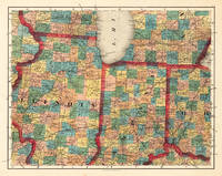
184520544Cassel: Th. Fischer 1845. Other. In very good to excellent condition. A few small marginal mended tears at the blank bottom not affecting the image of the map and a few minor marginal pin holes. 373 by 479mm 14 by 18 inches. 373 by 479mm 14 by 18 inches. Lithograph original color in outline by Smith J. Calvin published 1845 by Th. Fischer Cassel. Image size: 373 by 479mm 14 by 18 inches. From Smith's multi-sheet Special-Karte one of the most detailed and accurate mid-19th-century maps of the United States. John Calvin J. Calvin Smith c.18091890 was an American surveyor geographer and engraver active in New York City from the 1840s. Working with partners including George Sherman under the Sherman & Smith imprint 18401853 and later in association with J.H. Colton Smith produced some of the most accurate and widely used general-purpose maps of the United States of his era. His maps appeared in government publications military surveys and commercial atlases and his multi-sheet Special-Karte der Vereinigten Staaten published in a German-language edition brought American cartographic standards to European audiences. Despite his prolific output and importance to American cartographic history much of Smith's personal biography remains obscure.This decorative map shows Illinois Indiana and a part of Ohio. Further the southern part of Lake Michigan is shown. Inside the map are many place names rivers lakes etc. engraved. The various counties are colored in wash and explicitly detailed named. In very good to excellent condition. A few small marginal mended tears at the blank bottom not affecting the image of the map and a few minor marginal pin holes. Th. Fischer unknown
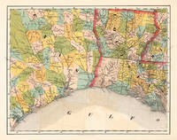
185524692Kassel: Theodor Fischer 1855-60. Other. 370 by 470mm 14 by 18 inches. 370 by 470mm 14 by 18 inches. Lithograph original color in outline by Smith J. Calvin published 1855-60 by Theodor Fischer Kassel. Image size: 370 by 470mm 14 by 18 inches. From Smith's multi-sheet Special-Karte one of the most detailed and accurate mid-19th-century maps of the United States. John Calvin J. Calvin Smith c.18091890 was an American surveyor geographer and engraver active in New York City from the 1840s. Working with partners including George Sherman under the Sherman & Smith imprint 18401853 and later in association with J.H. Colton Smith produced some of the most accurate and widely used general-purpose maps of the United States of his era. His maps appeared in government publications military surveys and commercial atlases and his multi-sheet Special-Karte der Vereinigten Staaten published in a German-language edition brought American cartographic standards to European audiences. Despite his prolific output and importance to American cartographic history much of Smith's personal biography remains obscure.This antique map of Louisiana Texas No: 13 was published in 1855-60 by Theodor Fischer Kassel 370 by 470mm 14 by 18 inches. It is printed as a lithograph original color in outline. The map documents the region with careful attention to rivers settlements roads and political boundaries reflecting the geographical knowledge available at the time of publication and offering an invaluable primary source for historians and collectors of North American antique cartography. 370 by 470mm 14 by 18 inches. Theodor Fischer unknown
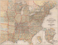
185524691Kassel: Theodor Fischer 1855-60. Other. In excellent condition. 372 by 468mm 14 by 18 inches. 372 by 468mm 14 by 18 inches. Lithograph original color in outline by Smith J. Calvin published 1855-60 by Theodor Fischer Kassel. Image size: 372 by 468mm 14 by 18 inches. From Smith's multi-sheet Special-Karte one of the most detailed and accurate mid-19th-century maps of the United States. John Calvin J. Calvin Smith c.18091890 was an American surveyor geographer and engraver active in New York City from the 1840s. Working with partners including George Sherman under the Sherman & Smith imprint 18401853 and later in association with J.H. Colton Smith produced some of the most accurate and widely used general-purpose maps of the United States of his era. His maps appeared in government publications military surveys and commercial atlases and his multi-sheet Special-Karte der Vereinigten Staaten published in a German-language edition brought American cartographic standards to European audiences. Despite his prolific output and importance to American cartographic history much of Smith's personal biography remains obscure.This antique map of Map of the United States of America No: 12 was published in 1855-60 by Theodor Fischer Kassel 372 by 468mm 14 by 18 inches. It is printed as a lithograph original color in outline. The map documents the region with careful attention to rivers settlements roads and political boundaries reflecting the geographical knowledge available at the time of publication and offering an invaluable primary source for historians and collectors of North American antique cartography. In excellent condition. Theodor Fischer unknown
18486386New York: Published by J. Disturnell 1848. Engraved on steel by Sherman & Smith. Full period color 19 x 23-1/2" folding into gilt stamped brown cloth covers. Two insets: The St. Lawrence River from the New York State Line to Quebec; and City of New York with Part of Brooklyn and Williamsburgh. This is a finely engraved and detailed general map of the State of New York. Canals are shown in blue and railroads in orange. Docketed on verso in blue pencil: "Jay Fiske Fort Plain N.Y." and "Map of New York State/ Fiske". Phillips p. 513; not in Rumsey. Published by J. Disturnell unknown
1848011489New York: Sherman & Smith. Good. 1848. Hardcover. An early guide to travel in the United States missing the map. Brown blind embossed cloth boards with gilt imprint. Light rubbing of board faces and corners. Adhesive mark on rear pastedown where map was tipped in. Foxed pages with dampstained corners and a few tears on first pages. The tables give mileages and routes for everywhere you'd want to go in the United States including from St. Louis Missouri to Astoria Oregon or the newly acquired Santa Fe. ; 5 3/4" x 3 3/4"; 79 pp . Sherman & Smith hardcover
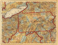
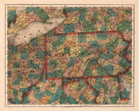
184519691Cassel: Th. Fischer 1845. Other. In very good condition. A few small marginal mended tears at the blank bottom verso old backed not affecting the image of the map and a few minor marginal pin holes. 373 by 476mm 14 by 18 inches. 373 by 476mm 14 by 18 inches. Lithograph hand-colored in outline by Smith J. Calvin published 1845 by Th. Fischer Cassel. Image size: 373 by 476mm 14 by 18 inches. From Smith's multi-sheet Special-Karte one of the most detailed and accurate mid-19th-century maps of the United States. John Calvin J. Calvin Smith c.18091890 was an American surveyor geographer and engraver active in New York City from the 1840s. Working with partners including George Sherman under the Sherman & Smith imprint 18401853 and later in association with J.H. Colton Smith produced some of the most accurate and widely used general-purpose maps of the United States of his era. His maps appeared in government publications military surveys and commercial atlases and his multi-sheet Special-Karte der Vereinigten Staaten published in a German-language edition brought American cartographic standards to European audiences. Despite his prolific output and importance to American cartographic history much of Smith's personal biography remains obscure.This antique map shows prominent in its centre the state of Pennsylvania with its neighboring states New York Ohio Delaware Maryland and Virginia. Inside the map are many place names rivers lakes mountains railroads etc. Many counties are named and finely hand colored in wash. A detailed map of this part of the Eastern United States by the famous 19th century mapmaker and cartographer Calvin Smith. In very good condition. A few small marginal mended tears at the blank bottom verso old backed not affecting the image of the map and a few minor marginal pin holes. Th. Fischer unknown
185524687Kassel: Theodor Fischer 1855-60. Other. In excellent condition. 374 by 470mm 14 by 18 inches. 374 by 470mm 14 by 18 inches. Lithograph original color in outline by Smith J. Calvin published 1855-60 by Theodor Fischer Kassel. Image size: 374 by 470mm 14 by 18 inches. From Smith's multi-sheet Special-Karte one of the most detailed and accurate mid-19th-century maps of the United States. John Calvin J. Calvin Smith c.18091890 was an American surveyor geographer and engraver active in New York City from the 1840s. Working with partners including George Sherman under the Sherman & Smith imprint 18401853 and later in association with J.H. Colton Smith produced some of the most accurate and widely used general-purpose maps of the United States of his era. His maps appeared in government publications military surveys and commercial atlases and his multi-sheet Special-Karte der Vereinigten Staaten published in a German-language edition brought American cartographic standards to European audiences. Despite his prolific output and importance to American cartographic history much of Smith's personal biography remains obscure.This antique map of Pennsylvania No:7 was published in 1855-60 by Theodor Fischer Kassel 374 by 470mm 14 by 18 inches. It is printed as a lithograph original color in outline. The map documents the region with careful attention to rivers settlements roads and political boundaries reflecting the geographical knowledge available at the time of publication and offering an invaluable primary source for historians and collectors of North American antique cartography. In excellent condition. Theodor Fischer unknown
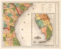
185524684Kassel: Theodor Fischer 1855-60. Other. In excellent condition. 370 by 470mm 14 by 18 inches. Lithograph original color in outline by Smith J. Calvin published 1855-60 by Theodor Fischer Kassel. Image size: 370 by 470mm 14 by 18 inches. From Smith's multi-sheet Special-Karte one of the most detailed and accurate mid-19th-century maps of the United States. John Calvin J. Calvin Smith c.18091890 was an American surveyor geographer and engraver active in New York City from the 1840s. Working with partners including George Sherman under the Sherman & Smith imprint 18401853 and later in association with J.H. Colton Smith produced some of the most accurate and widely used general-purpose maps of the United States of his era. His maps appeared in government publications military surveys and commercial atlases and his multi-sheet Special-Karte der Vereinigten Staaten published in a German-language edition brought American cartographic standards to European audiences. Despite his prolific output and importance to American cartographic history much of Smith's personal biography remains obscure.This antique map of Southern Part of Florida No: 15 was published in 1855-60 by Theodor Fischer Kassel 370 by 470mm 14 by 18 inches. It is printed as a lithograph original color in outline. The map documents the region with careful attention to rivers settlements roads and political boundaries reflecting the geographical knowledge available at the time of publication and offering an invaluable primary source for historians and collectors of North American antique cartography. In excellent condition. Theodor Fischer unknown
184520600Kassel: Theodor Fischer 1845. Other. Throughout all maps in excellent condition. Protected in their original cover as published. Our illustration shows all 16 folded maps digital joint together to a large wall map 56 1/2 x 72 inches. 1440 by 1840mm 56 by 72 inches. 1440 by 1840mm 56 by 72 inches. Lithograph color by Smith J. Calvin published 1845 by Theodor Fischer Kassel. Image size: 1440 by 1840mm 56 by 72 inches. From Smith's multi-sheet Special-Karte one of the most detailed and accurate mid-19th-century maps of the United States. John Calvin J. Calvin Smith c.18091890 was an American surveyor geographer and engraver active in New York City from the 1840s. Working with partners including George Sherman under the Sherman & Smith imprint 18401853 and later in association with J.H. Colton Smith produced some of the most accurate and widely used general-purpose maps of the United States of his era. His maps appeared in government publications military surveys and commercial atlases and his multi-sheet Special-Karte der Vereinigten Staaten published in a German-language edition brought American cartographic standards to European audiences. Despite his prolific output and importance to American cartographic history much of Smith's personal biography remains obscure.This is the rare German edition printed in lithograph of Calvin Smiths large wall map of the United States of America. Complete with all 16 folded maps to join together to a large map of the United States including a general map of the US. A splendid detailed map showing nicely the adjacenting Indian territories in the West further the map is showing detailed a larger part of Texas the gulf of Mexico and Florida. The general key map of the entire United States is extending towards the Western territories with California and Oregon as well New Mexico and the Indian territories. Throughout all maps in excellent condition. Protected in their original cover as published. Our illustration shows all 16 folded maps digital joint together to a large wall map 56 1/2 x 72 inches. 1440 by 1840mm 56 by 72 inches. Theodor Fischer unknown
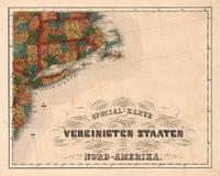
185524688Kassel: Theodor Fischer 1855-60. Other. In excellent condition. 375 by 473mm 14 by 18 inches. 375 by 473mm 14 by 18 inches. Lithograph original color in outline by Smith J. Calvin published 1855-60 by Theodor Fischer Kassel. Image size: 375 by 473mm 14 by 18 inches. From Smith's multi-sheet Special-Karte one of the most detailed and accurate mid-19th-century maps of the United States. John Calvin J. Calvin Smith c.18091890 was an American surveyor geographer and engraver active in New York City from the 1840s. Working with partners including George Sherman under the Sherman & Smith imprint 18401853 and later in association with J.H. Colton Smith produced some of the most accurate and widely used general-purpose maps of the United States of his era. His maps appeared in government publications military surveys and commercial atlases and his multi-sheet Special-Karte der Vereinigten Staaten published in a German-language edition brought American cartographic standards to European audiences. Despite his prolific output and importance to American cartographic history much of Smith's personal biography remains obscure.This antique map of Special-Karte der Vereinigten Staaten von Nord-Amerika No: 8 was published in 1855-60 by Theodor Fischer Kassel 375 by 473mm 14 by 18 inches. It is printed as a lithograph original color in outline. The map documents the region with careful attention to rivers settlements roads and political boundaries reflecting the geographical knowledge available at the time of publication and offering an invaluable primary source for historians and collectors of North American antique cartography. In excellent condition. Theodor Fischer unknown
1850008430New York: Sherman & Smith 1850 Book. Very Good. Hardcover. 16mo - over 5¾ - 6¾" tall. 16mo. 6x3¾ inches Pp. 2 advts 233 234 blank. Steel-engraved frontis wood-engraved title vignette 123 wood-engraved illustrations interspersed throughout the text large folding hand-colored engraved map 21½ x 27 inches. Publisher's light green cloth gilt lettering and design on front cover and spine blind stamped on rear cover. Light wear to spine ends and corners bookplate on inner cover. Light foxing to engraved frontis plate a few tiny breaks at some fold junctions of map 3 inch split to center of one fold. A very good copy and with the exception noted the map in very nice condition. New York: Sherman & Smith 1850. First published in 1846 and reprinted with the same collation in 1847 '48 '49 and 1850. Rare in any of the early printings. The large folding map with contemporary hand-coloring in outline is titled "A New Map for Travelers through the United States of America showing the Rail Roads Canals & Stage Roads. With the Distances. Published by Sherman & Smith. New York 1850" entered 1846. The important map was first published in the 1846 edition and then updated for the editions of 1848 1849 and this edition 1850. This fine map includes engraved pictorial vignettes and 4 inset maps. The insets include "Rail Road Route from New York to Philadelphia" "Rail Roads between the cities of New York Boston and Albany" "Rail Road and Canal Routes from Albany to Buffalo" and "Oregon Northern California Santa Fe etc." The latter inset first published in the 1846 edition is important for showing regions before the Mexican War. The map extends as far west as central Texas. Howes I: S-614; Howes II: 622; Sabin: 82928; see Wheat Mapping the Transmississippi West volume 3: p. 267. . Sherman & Smith hardcover
1347321101.Ghardcover. Good. Access codes and supplements are not guaranteed with used items. May be an ex-library book. hardcover
184871260New York:: Sherman & Smith 1848. publisher's gilt-lettered cloth. A beautiful clean unworn copy. 16mo. Embellished with 125 highly finished Engravings. Accompanied by a Large and Accurate Map by J. Calvin Smith. The folding"New Map Through the United States of America Showing the Railroads Canals & Stage Routes" measures approx. 21 x 26 inches and includes inset maps of Oregon & California New York etc. . Sherman & Smith, hardcover
1839397071New York: Published by J.H. Colton 1839. Hardcover. Near Fine. First edition. 12mo. 180pp. Large folding map. Gray-green cloth gilt. Scattered foxing throughout modest rubbing on the boards a solid very good copy with a small stain on the map otherwise in nice near fine condition. Howes S615. Published by J.H. Colton hardcover
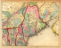
184514251Cassel: Th. Fischer 1845. Other. In very good condition. A few small marginal mended tears at the blank margins verso old backed not affecting the image of the map. 370 by 475mm 14 by 18 inches. 370 by 475mm 14 by 18 inches. Lithograph hand-colored in outline by Smith J. Calvin published 1845 by Th. Fischer Cassel. Image size: 370 by 475mm 14 by 18 inches. From Smith's multi-sheet Special-Karte one of the most detailed and accurate mid-19th-century maps of the United States. John Calvin J. Calvin Smith c.18091890 was an American surveyor geographer and engraver active in New York City from the 1840s. Working with partners including George Sherman under the Sherman & Smith imprint 18401853 and later in association with J.H. Colton Smith produced some of the most accurate and widely used general-purpose maps of the United States of his era. His maps appeared in government publications military surveys and commercial atlases and his multi-sheet Special-Karte der Vereinigten Staaten published in a German-language edition brought American cartographic standards to European audiences. Despite his prolific output and importance to American cartographic history much of Smith's personal biography remains obscure.This antique map shows prominent in its centre the state of Maine with its neighboring states Vermont New Hampshire and New Brunswick. The map extends from Salisbury in the south towards New Brunswick and the neighboring Nova Scotia. Inside the map are many place names rivers lakes mountains railroads etc. Many counties are named and finely hand colored in wash. A detailed map of this part of the Northeastern United States by the famous 19th century mapmaker and cartographer Calvin Smith. In very good condition. A few small marginal mended tears at the blank margins verso old backed not affecting the image of the map. Th. Fischer unknown
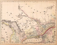
184520539Cassel: Th. Fischer 1845. Other. In very good to excellent condition. A few small marginal mended tears at the blank bottom not affecting the image of the map and a few minor marginal pin holes. 373 by 479mm 14 by 18 inches. Lithograph original color in outline by Smith J. Calvin published 1845 by Th. Fischer Cassel. Image size: 373 by 479mm 14 by 18 inches. From Smith's multi-sheet Special-Karte one of the most detailed and accurate mid-19th-century maps of the United States. John Calvin J. Calvin Smith c.18091890 was an American surveyor geographer and engraver active in New York City from the 1840s. Working with partners including George Sherman under the Sherman & Smith imprint 18401853 and later in association with J.H. Colton Smith produced some of the most accurate and widely used general-purpose maps of the United States of his era. His maps appeared in government publications military surveys and commercial atlases and his multi-sheet Special-Karte der Vereinigten Staaten published in a German-language edition brought American cartographic standards to European audiences. Despite his prolific output and importance to American cartographic history much of Smith's personal biography remains obscure.This decorative map shows the region from West Canada Ottawa River towards East Canada. Detailed information on the map on Lake Ontario the Georgian Bay Nipissing Lake Temiscaming Lake and the Ottawa River. Inside the map are many place names rivers lakes etc. engraved. As well names on Indian tribes are given. In very good to excellent condition. A few small marginal mended tears at the blank bottom not affecting the image of the map and a few minor marginal pin holes. Th. Fischer unknown
0830412476.Ghardcover. Good. Access codes and supplements are not guaranteed with used items. May be an ex-library book. hardcover
SONG9004192492Brill 0000-00-00. First Edition. hardcover. Used: Good. 6.50x0.75x9.50. Buy with confidence. Excellent Customer Service & Return policy. Brill hardcover
2007__9004156453Brill Academic Pub 2007. Paperback. New. 312 pages. 9.25x6.50x0.75 inches. Brill Academic Pub paperback