987 résultats
184253946Providence: No Publisher. Very Good. 1842. Hardcover. Providence: 1842 original binding front board missing rear board loose. Foxing 160 pages contents good. . No Publisher hardcover books
184255774Providence: published for the purchaser 1842. First edition 12mo pp. 160; original black cloth-backed printed paper-covered boards; very good. Chapter I verse 1: "Now it came to pass that Harrison was dead and Tyler was made President in his stead over all the United States of America." "This curious book relates to the dissensions among various religious denominations in Rhode Island. It is written in scriptural language and divided into chapters and verses." Not in American Imprints; Bartlett p. 6; Sabin 148 authorship unattributed; Sabin 55932 later editions with Norwood the attributed author. <br/><br/> published for the purchaser hardcover books
2016UNUSFIN00LNWYale University Press 2016. Fine. Nussbaum Abraham M. The Finest Traditions of My Calling: One Physician's Search for the Renewal of Medicine. New Haven CT: Yale University Press 2016. 302pp. Indexed. 8vo. Paperback. Book condition: Very good with light soiling. Yale University Press paperback books
1883290160Philadelphia: J. B. Lippincott & Co 1883. First Edition. Hard Cover. Good binding. Previous owner's name on the front board and front flyleaf. Slight dusty odor. Binding is cocked with red stain on the front board some rubbing and shefwear to the edges joints and corners. Brown cloth with black decorations and gilt lettering. Good binding. J. B. Lippincott & Co unknown books
2006S8098Oxford:: Oxford University Press 2006. 2006. 8vo. xxii 353 pp. Plates index. Quarter cloth boards dust-jacket. NEW. FIRST EDITION. Pais offers an illuminating portrait of another eminent colleague J. Robert Oppenheimer one of the most charismatic and enigmatic figures of modern physics. It is Abraham Pais's final work completed after his death by Robert P. Crease an acclaimed historian of science in his own right. ISBN13: 9780195166736 Oxford University Press, 2006. hardcover books
2006S7789Oxford:: Oxford University Press 2006. 2006. 8vo. xxii 353 pp. Plates index. Quarter cloth boards dust-jacket. NEW. FIRST EDITION. Pais offers an illuminating portrait of another eminent colleague J. Robert Oppenheimer one of the most charismatic and enigmatic figures of modern physics. It is Abraham Pais's final work completed after his death by Robert P. Crease an acclaimed historian of science in his own right. ISBN: 9780195166736 Oxford University Press, 2006. hardcover books
2006S8373Oxford:: Oxford University Press 2006. 2006. 8vo. xxii 353 pp. Photos index. Boards dust-jacket. NEW. FIRST EDITION. Illuminating biography of the charismatic physicist who worked on the first atomic bomb at Los Alamos. This work reevaluates the events of Oppenheimer's life. ISBN: 0195166736. Oxford University Press, 2006. hardcover books
1967S5322Offprint from:: Physics Today Vol. 20 No. 10 October 1967. 1967. 285 x 210 mm. 4to. Pages 42-48. Entire offprint: 34-53 pp. Illus. Pictorial wrappers. Fine. This offprint from Physics Today contains a twenty-page "Memorial to Oppenheimer" with contributions by Robert Serber Victor F. Weisskopf Abraham Pais and Glenn T. Seaborg and includes an Oppenheimer bibliography. Physics Today, Vol. 20, No. 10, October 1967. unknown books
1967S5321Offprint from:: Physics Today Vol. 20 No. 10 October 1967. 1967. 285 x 210 mm. 4to. Pages 42-48. Entire offprint: 34-53 pp. Illus. Pictorial wrappers. Fine. This offprint from Physics Today contains a twenty-page "Memorial to Oppenheimer" with contributions by Robert Serber Victor F. Weisskopf Abraham Pais and Glenn T. Seaborg and includes an Oppenheimer bibliography. Physics Today, Vol. 20, No. 10, October 1967. unknown books
1612219257Abraham Ortelius 1612. unbound. very good. Map. Engraving with hand coloring. Image measures 14" x 19.25".<br/><br/> This stunning 1612 map by Abraham Ortelius depicts the Western Hemisphere. At the time it was issued the coastal areas of the New World had been fairly well explored and Europeans were just beginning settlement and colonization. It is notable for depicting Spanish and Portuguese colonies in high detail for these powers were notoriously protective of their geographical surveys.<br><br>This is the first state of the third plate engraved for Ortelius's landmark map of the New World. It is distinguished from the first two plates by the lack of the bulge to the southwest coast of South America. Several other cartographic enhancements are apparent on closer inspections.<br><br>The Solomon Islands are depicted here for the first time since their discovery in 1568 by Alvaro de Mendana. The map identifies several places previously unpublished due to political reasons. These were provided to Ortelius by Haklyut on the basis of recent explorations. The nomenclature in California is also included.<br><br>Perhaps the most notable enhancements on the east coast is the Indian name Wingandkoa and an inlet just above possibly the first depiction of the Chesapeake Bay on a printed map reflecting early English efforts at Colonization in the Outer Banks of the Carolinas. <br><br> Based on Gerard Mercators 1569 World Map this map includes an abundance of cartographic speculation representing the knowledge of the region during the time. The kingdom of Quivira the supposed ancient city of gold in North America. Conquistador Francisco Vázquez de Coronado searched for Quivira for several years to finally find it was no more than American Indian settlement of farming people. Terro del Fueggo first reached by Magellan is here shown to be part of the large speculated continent of Terra Australis that extends westward with the annotation "The southern of Magellanican land as yet unknown".<br><br>Other interesting annotations throughout include "Somewhere here there are islands which according to some have gold" and Patagonia shows a notation that suggests its inhabitants were giants.<br><br>The waters are ornamented with illustrations of ships and a sea monster. In earlier plates the ships are different. A large title cartouche is included in the bottom left. Another scale cartouche appears in the top left. Published in the 1612 or 1608 edition the map is identical in both editions of Ortelius' famous "Theatrum Orbis Terrarum" which is historically considered the first modern atlas. Based on the text on verso only 300 copies of this particular edition were ever printed van der Broecke 11. <br><br> Italian text on verso. Minor chipping to edges. Full original margins. Minor wear along original centerfold. <br><br> Abraham Ortelius 1527--1598 a Flemish cartographer and geographer is widely regarded as one of the important and influential cartographers in history. He is known for his "Theatrum Orbis Terrarum" which was the first modern atlas.<br/><br/> Abraham Ortelius unknown books
159037978np 1590. Image area 19 1/2 x 13 1/2 inches in 28 x 23 inch mat. Single crease down center with one 1/2 inch spot worn through otherwise a nice handsome map. Image area 19 1/2 x 13 1/2 inches in 28 x 23 inch mat. Abraham Ortelius 1527-1598 was a Flemish geographer of German origin. His major work Theatrum Orbis Terrarum 1570 with later revisions and addenda was the first modern atlas. It was based on contemporary charts and maps and contained a collection of plates engraved by Franz Hagenberg in a uniform size and format. The Theatrum preceded the first Atlas of Ortelius' good friend Gerardus Mercator. In fact popular and sentimental legend has it that Mercator delayed publication of his own work so that his younger friend's would appear first. although this simply is not true Mercator wasn't ready the legendary cartographer did compliment Ortelius for the "care and elegance" he put into his "Theatrum. unknown books
1612406876Antwerp 1612. Tape reinforcements along edge on verso without show-through and not affecting image a few foxmarks overall in very good condition with good color. Hand colored engraved map 12 5/8 x 9 7/8 inches image 16 1/2 x 10 5/8 inches sheet. Crossed arrows watermark. A fine map from Ortelius's atlas showing Lake Constance the Danube and Rhine. Bounded by the Lech Odenwald Alsace and Chur in Switzerland. <br/><br/> unknown books
1587239611Antwerp: Abraham Ortelius 1587. unbound. Map. Uncolored engraving. Image measures 14" x 19.5".<br/><br/> These two maps on one sheet detail areas of western Mexico above and the Greater Antilles below. Ortelius created them from information compiled by other mapmakers such as Mercator Guttierez and Alsons de Sata Cruz. These sources allowed him to include a wealth of detailed information that is mostly if not entirely accurate. Above the map of western Mexico shows the area around Culiacan and the Spanish settlement of Villa S. Michaels which was notable in the period for its silver mines. It begins at the Yucatan and extends through the Cayman Magnus and the Caymanes. The map below illustrates the Greater Antilles including Cuba Hispaniola Jamaica St. Jois Insula St. Johns the Bahamas Virgin Islands and the Windward Islands all in impressive detail. The section of South Florida also shows suggestion of the Florida Keys which was uncommon for these period. A notable error is that the Tropic of Cancer is labelled as the Tropic of Capricorn. A highly decorative note with strapwork and foliage fills the acific Ocean to the left of Mexico and provides information about the upper map. The lower map also has a framed cartouche with birds perched atop it. Two ship illustrations float in the choppy seas around the islands. The map is a first state from the 1587 French edition of Ortelius's "Theatrum Orbis Terrarum." It is in good condition with no chips or tears. Stain at the center seam in the lower margin not affecting the image some overall stains. French text on verso. Abraham Ortelius 1527--1598 a Flemish cartographer and geographer is widely regarded as one of the important and influential cartographers in history. He is known for his "Theatrum Orbis Terrarum" which was the first modern atlas. This map is an uncommon uncolored example of this wonderful map by Ortelius.<br/><br/> Abraham Ortelius unknown books
1603299083Antwerp: Abraham Ortelius 1603. unbound. Map. Engraving with hand coloring Image measures 14" x 18 3/4". Staining toning and chips to margins but otherwise is good condition.<br/><br/> Friuli is the northeast Italian region bordering Austria Slovenia and the Adriatic Sea. It's home to the sharp-peaked Dolomite Mountains and vineyards producing white wines. Ortelius' 1603 edition extends from Venice north to the Italian Alps and east to Trieste and Istria. Lovely depiction of Venice floating on several islands. Abraham Ortelius 1527--1598 a Flemish cartographer and geographer is widely regarded as one of the important and influential cartographers in history. He is known for his "Theatrum Orbis Terrarum" which was the first modern atlas. Van Den Broecke 119<br/><br/> Abraham Ortelius unknown books
1603299305Antwerp: Abraham Ortelius 1603. unbound. Map. Engraving with beautiful original hand color. Image measures 14" x 18 3/4". Staining and toning repair to margins but otherwise is good condition.<br/><br/> Old color example of this lovely map of 16th c. France by Ortelius. Abraham Ortelius 1527-1598 a Flemish cartographer and geographer is widely regarded as one of the important and influential cartographers in history. He is known for his "Theatrum Orbis Terrarum" which was the first modern atlas. Van den Broecke #34<br/><br/> Abraham Ortelius unknown books
1592273298Antwerp: Abraham Ortelius 1592. unbound. Map. Uncolored engraving. Sheet measures 16" x 21".<br/><br/> This beautiful 1588 map by Abraham Ortelius depicts Holland or the Netherlands in exceptional detail. The map covers the regions near the Wadden Sea roughly covering modern day provinces of North Holland South Holland and Utrecht. The map centered on Amsterdam is oriented with north to the left. Topographical and geographical features such as mountains and cities are beautifully rendered in profile.<br><br>The waters surrounding the region are shown with waves and include several illustrations of ships throughout. This is the first state of the map with later states showing a stippled sea rather than waves. Includes a large strapwork title cartouche scale of miles with a divider in the lower left. The Royal coat of arms is presented in the top left. The map also includes a 16-point compass rose.<br><br>Ortelius based this map on the work of Jacob van Daventer. Published in the 1588 edition of Ortelius' famous "Theatrum Orbis Terrarum" which is historically considered the first modern atlas. Based on the text on verso only 300 copies of this particular edition were ever printed van der Broecke 79.<br><br>The map is in good condition with minor wear along the original centerfold. Minor foxing at places. Original plate mark is visible. Latin text on verso.<br><br> Abraham Ortelius 1527--1598 a Flemish cartographer and geographer is widely regarded as one of the important and influential cartographers in history. He is known for his "Theatrum Orbis Terrarum" which was the first modern atlas. Hard to find in black and white.<br/><br/> Abraham Ortelius unknown books
1603299306Antwerp: Abraham Ortelius 1603. unbound. Map. Engraving with beautiful original hand color. Image measures 14" x 18 3/4". Light staining and toning but otherwise is good condition.<br/><br/> A representation of some islands in the Mediterranean Sea. Abraham Ortelius 1527-1598 a Flemish cartographer and geographer is widely regarded as one of the important and influential cartographers in history. He is known for his "Theatrum Orbis Terrarum" which was the first modern atlas. Van den Broecke #141<br/><br/> Abraham Ortelius unknown books
1584299318Antwerp: Abraham Ortelius 1584. unbound. Map. Engraving. Image measures 14" x 18 3/4". Light staining and toning on right margin but otherwise is good condition.<br/><br/> A representation of some islands in the Mediterranean Sea. Abraham Ortelius 1527-1598 a Flemish cartographer and geographer is widely regarded as one of the important and influential cartographers in history. He is known for his "Theatrum Orbis Terrarum" which was the first modern atlas. Van den Broecke #141<br/><br/> Abraham Ortelius unknown books
1595223506Antwerp: Philippe Galle 1595. unbound. very good. Miniature map. Uncolored engraving. Image measures 3 1/8" x 4.25".<br/><br/> Great miniature map of Ischia off the coast of Naples detailing the volcanic landscape. From the 1595 pocket edition of Ortelius' "Theatrum Orbis Terrarum" or "Epitome" with text by Pieter Heyns. With Latin text on verso. Small tear and chip to upper right light staining to lower margin.<br/><br/> Philippe Galle unknown books
15846753Antwerp: Ortelius 1584. Map on thick paper measuring 8.75 x 7 in 22.25 x 17.75 cm in the image. Taken from the Theatrum orbis terrarum of Ortelius. One of the earliest maps of the kingdom of Huasteca or Guasteca present-day Tamaulipas originally printed on a single sheet with two other maps of Florida and Peru but here presented by itself alone. This is hand-colored with titles in Latin and ornate title cartouche. Very good. <br/><br/> Ortelius unknown books
1601208175Antwerp: Ortelius Abraham 1601. unbound. very good. Map. Engraving with hand coloring. Image measures 15.5" x 20.25".<br/><br/> Lovely map of the Namur region of Belgium. Includes a compass rose and a cartouche incorporating the Belgian coat of arms. From the 1601 Latin edition of Ortelius' "Theatrum Orbis Terrarum" the first modern Atlas. Margins have been cropped some chipping and tears along margins. Stain to top center margin and also to lower left and right of image.<br/><br/> Ortelius, Abraham unknown books
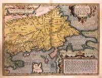
1592272534Antwerp: Abraham Ortelius 1592. unbound. Map. Engraving with hand color. Image measures 14" x 18 3/4".<br/><br/> This beautiful 1592 map by Abraham Ortelius depicts the Balkan Peninsula or the Balkans extending from The Sea of Marmara Istanbul and the Bosporus Strait westward to Macedonia including Bulgaria. Portions of the Black Sea and the Thrakikon Pelagos are also shown. Topographical and geographical features such as mountains forests and cities are beautifully rendered in profile.<br><br>Ortelius based this map on the 1560 South-East Europe map by Gastaldi and on on information from numerous ancient sources specifically Herodotus Plinius Strabo Appianus Virgilius Plutarchus and Sidonius. A beautifully engraved title cartouche adorns the top left of the map. Two additional cartouches containing text are also included in the top and bottom right.<br><br>This map was published in the 1592 edition of Ortelius's famous "Theatrum Orbis Terrarum" which is historically considered the first modern atlas. Based on the Latin text on verso only 525 copies of this particular atlas were ever printed van der Broecke 214. The map is in good condition with minor wear and toning along the original centerfold. Light stain in lower left margin. Minor foxing with Latin text on verso.<br><br>Abraham Ortelius 1527--1598 a Flemish cartographer and geographer is widely regarded as one of the important and influential cartographers in history. He is known for his "Theatrum Orbis Terrarum" which was the first modern atlas. Van den Broecke #214<br/><br/> Abraham Ortelius unknown books
1655216782Venice: Giovanni Turrini 1655. unbound. very good. Miniature map. Uncolored engraving. Image measures 2 7/8" x 4". 1655.<br/><br/> This miniature map of Persia belongs to a period of great cartographic interest in the early-to-mid 17th century. Conscious of the great popularity of Abraham Ortelius's miniature atlas which the famous cartographer first published in 1577 Giovanni Turrini produced a now-rare Italian version of the atlas "Il Teatro del Mondo" in which this map was included. It includes the region between the Caspian Sea in the north and the Persian Gulf and Arabian Sea in the south. Cities are labeled and rivers and forts are drawn with great care. The map is in very good condition with no chips or tears and light staining to edges. Foredges inked in red and Italian text on verso. Giovanni Turrini was an Italian publisher based in Venice. Scarce.<br/><br/> Giovanni Turrini unknown books
1603213571Antwerp: Ortelius Abraham 1603. unbound. very good. Map. Engraving with original hand coloring. Image measures 13" x 18.25".<br/><br/> Fine antique map of Perugia and Lake Trasimeno in central Italy in the Umbria region. Today the region is known it's foraged truffles and red wine. From 1603 edition "Theatrum Orbis Terrarum". Minor chipping to edges. Light stain near top centerfold. Full original margins. Abraham Ortelius 1527--1598 a Flemish cartographer and geographer is widely regarded as one of the important and influential cartographers in history. He is known for his "Theatrum Orbis Terrarum" which was the first modern atlas.<br/><br/> Ortelius, Abraham unknown books
1603299062Antwerp: Abraham Ortelius 1603. unbound. Map. Engraving with hand coloring Image measures 14" x 18 3/4". Staining toning and chips to margins but otherwise is good condition.<br/><br/> Beautiful early map of Provence and part of Languedoc from the Rhone river to Monaco. Strap work cartouche and scale with two ships complete the design. Abraham Ortelius 1527--1598 a Flemish cartographer and geographer is widely regarded as one of the important and influential cartographers in history. He is known for his "Theatrum Orbis Terrarum" which was the first modern atlas. Van Den Broecke 47<br/><br/> Abraham Ortelius unknown books