285 résultats
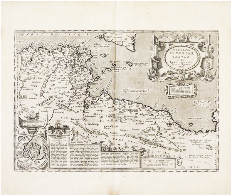
16247957Antwerp: Plantin-Moretus 1624. Copper engraving 36 x 46 cms modern hand colour Latin text on verso. The Dalmatian coast in antiquity. Our example was published by Balthasar Moretus at the Plantin Press in the final edition of the Parergon. Ortelius's Theatrum Orbis Terrarum is generally considered the first modern atlas of the world originally published in 1570. Ortelius gathered and selected the best available cartographic knowledge and presented it in a single volume duly credited and finely engraved in a consistent style with explanatory text. The Theatrum was very decorative and hugely popular amongst the wealthy and educated running into over forty editions in Latin and the major European languages. For Ortelius himself however his accompanying atlas of ancient geography the Parergon was a "personal work" Koeman. He seems to have regarded himself first and foremost as an antiquary and rather than copying other people's maps he drew the originals himself; they were subsequently engraved for him by the master engraver Jan Wierix. The results have to be evaluated as the most outstanding engravings depicting the wide-spread interest in classical geography in the 16th century Koeman. Koeman Atlantes Neerlandici Ort 46. Van den Broecke 203.1 Map Plantin-Moretus unknown
1603213571Antwerp: Ortelius Abraham 1603. unbound. very good. Map. Engraving with original hand coloring. Image measures 13" x 18.25".<br/> <br/> Fine antique map of Perugia and Lake Trasimeno in central Italy in the Umbria region. Today the region is known it's foraged truffles and red wine. From 1603 edition "Theatrum Orbis Terrarum". Minor chipping to edges. Light stain near top centerfold. Full original margins. Abraham Ortelius 1527--1598 a Flemish cartographer and geographer is widely regarded as one of the important and influential cartographers in history. He is known for his "Theatrum Orbis Terrarum" which was the first modern atlas.<br/> <br/> Ortelius, Abraham unknown
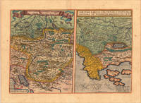
161213928Antwerp: Juan Baptist Vrients 1612. Other. In excellent condition. 340 by 500mm 13 by 19 inches. Original copper engraving published 1612 in the famous Vrients-edition of the Theatrum Orbis Terrarum. Finely hand-coloured in wash and outline. Two maps on one doublepage plate each one of them showing a title cartouche at the top centre. Villages and towns are shown as miniature views as well mountains and rivers are shown. The both maps are engraved after Wolfgang Lazius. This example is in very decorative colours and in excellent condition however the hand colour is probably done by a later hand. On the full sheet as published. The detailled map on the Duchy of Tirol is mainly showing South Tirol with the area Insbruck Trient the Lago de Garda towards Verona in the South. The other map is showing the area Carniola Istria and the so called "Windisch Mark". Ortelius was born on 14 April 1527 in the city of Antwerp which was then in the Habsburg Netherlands modern-day Belgium. The Orthellius family were originally from Augsburg a Free imperial city of the Holy Roman Empire. In 1535 the family had fallen under suspicion of Protestantism. Following the death of Ortelius's father his uncle Jacobus van Meteren returned from religious exile in England to take care of Ortelius. Abraham remained close to his cousin Emanuel van Meteren who would later moved to London. In 1575 he was appointed geographer to the king of Spain Philip II on the recommendation of Arias Montanus who vouched for his orthodoxy. He travelled extensively in Europe and is specifically known to have traveled throughout the Seventeen Provinces; in southern western northern and eastern Germany e.g. 1560 15751576; France 15591560; England and Ireland 1576; and Italy 1578 and perhaps twice or thrice between 1550 and 1558. Beginning as a map-engraver in 1547 he entered the Antwerp Guild of Saint Luke as an illuminator of maps. He supplemented his income trading in books prints and maps and his journeys included yearly visits to the Frankfurt book and print fair where he met Gerardus Mercator in 1554. In 1560 however when travelling with Mercator to Trier Lorraine and Poitiers he seems to have been attracted largely by Mercator's influence towards the career of a scientific geographer. Wikipedia Broe. 116 Juan Baptist Vrients unknown
1606m1300Antwerp: Published in "Theatrum Orbis Terrarum" c. 1606. Copperplate engraving. Old colour some darkening along c/f otherwise very good. 14" x 19-1/2. Based on Gastaldi's double sheet map. Shows Romania Bulgaria and western Turkey. Impressive oversized cartouche. Ortelius was one of the great Flemish cartographers of the 16th Century and produced what is considered to be the first modern world atlas. Van den Broecke 159 Published in "Theatrum Orbis Terrarum",
1603228104Antwerp: Abraham Ortelius 1603. unbound. very good. Map. Engraving with original hand coloring. Image measures 13.25" x 18.25".<br/> <br/> Beautifully colored map of Croatia. Shows place names topographical and geographical features a compass rose and a ship in the Adriatic. Latin text on verso. From "Theatrum Orbis Terrarum". Light scattered stains to margins and cartouche. Minor abrasion to upper right. A few small chips and tears to edges. Abraham Ortelius 1527--1598 a Flemish cartographer and geographer is widely regarded as one of the important and influential cartographers in history. He is known for his "Theatrum Orbis Terrarum" which was the first modern atlas. Van den Broecke 145<br/> <br/> Abraham Ortelius unknown
16028879Amsterdam c. 1602. Copper engraving 8 x 11 cm engraved by Philip Galle black and white English text on the verso. Two English printers dipped a toe in the vernacular atlas market at approximately the same time with pocket editions of the Ortelius atlas: These two little books were the earliest world atlases to be published in England and the earliest world atlases with English text R.A. Skelton "Bibliographical Note" in Abraham Ortelius The Theatre of the Whole World. Amsterdam 1968. Both are now extremely rare and they use different series of maps: Shawe used the maps by Arsenius Norton used the older series by Philip Galle. Shawe's epitome was certainly published before the death of Elizabeth I in March 1603; Norton's is dedicated to Mr. Richard Gargrave who was knighted by King James in 1603 so his atlas was published in early 1603 or before. It is generally dated to 1602 although the date 1601 has also been suggested. They were in any case published competitively within months of each other. Shawe published no further atlases Norton published the full-size folio Ortelius Theatrum in 1606. Koeman III Ort 62. Map unknown
16018877Antwerp Johann Baptist Vrients 1601. Copper engraving 7.5 x 11 cms black and white Latin text on verso. Sicily from the second series of maps engraved by Philip Galle for the Epitome the pocket atlas version of Ortelius Theatrum. Koeman Atlantes Neerlandici Ort 58 Map unknown
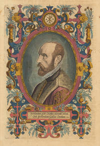
161230060Antwerp: Vrients 1612. Other. In exellent condition. 318 by 209mm 12 by 8 inches. Original antique copper engraving later hand colored. Latin text edition. This is the beautiful hand colored portrait of Abraham Ortelius as frontispiece to his "Theatrum Orbis". Engraved by Phillipe Galle. Ortelius was born on 14 April 1527 in the city of Antwerp which was then in the Habsburg Netherlands modern-day Belgium. The Orthellius family were originally from Augsburg a Free imperial city of the Holy Roman Empire. In 1535 the family had fallen under suspicion of Protestantism. Following the death of Ortelius's father his uncle Jacobus van Meteren returned from religious exile in England to take care of Ortelius. Abraham remained close to his cousin Emanuel van Meteren who would later moved to London. In 1575 he was appointed geographer to the king of Spain Philip II on the recommendation of Arias Montanus who vouched for his orthodoxy. He travelled extensively in Europe and is specifically known to have traveled throughout the Seventeen Provinces; in southern western northern and eastern Germany e.g. 1560 15751576; France 15591560; England and Ireland 1576; and Italy 1578 and perhaps twice or thrice between 1550 and 1558. Beginning as a map-engraver in 1547 he entered the Antwerp Guild of Saint Luke as an illuminator of maps. He supplemented his income trading in books prints and maps and his journeys included yearly visits to the Frankfurt book and print fair where he met Gerardus Mercator in 1554. In 1560 however when travelling with Mercator to Trier Lorraine and Poitiers he seems to have been attracted largely by Mercator's influence towards the career of a scientific geographer. Wikipedia Vrients unknown
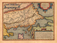
162421830Antwerp: Balthasar Moretus 1624. Other. A very good example in excellent condition. 360 by 480mm 14 by 19 inches. Original copper engraving published 1624 in the famous historical Atlas Parergon Latin text-edition by Abraham Ortelius. Finely hand colored in wash and outline. Fine and early historical map on Thracia. The area on this map covers mainly Thracia in Northern Greece and parts of Romania. The map is ornated with three cartouches in the upper left corner the title cartouche on the lower and upper right side we find text cartouches. Villages and towns are shown as miniature views. Ortelius was born on 14 April 1527 in the city of Antwerp which was then in the Habsburg Netherlands modern-day Belgium. The Orthellius family were originally from Augsburg a Free imperial city of the Holy Roman Empire. In 1535 the family had fallen under suspicion of Protestantism. Following the death of Ortelius's father his uncle Jacobus van Meteren returned from religious exile in England to take care of Ortelius. Abraham remained close to his cousin Emanuel van Meteren who would later moved to London. In 1575 he was appointed geographer to the king of Spain Philip II on the recommendation of Arias Montanus who vouched for his orthodoxy. He travelled extensively in Europe and is specifically known to have traveled throughout the Seventeen Provinces; in southern western northern and eastern Germany e.g. 1560 15751576; France 15591560; England and Ireland 1576; and Italy 1578 and perhaps twice or thrice between 1550 and 1558. Beginning as a map-engraver in 1547 he entered the Antwerp Guild of Saint Luke as an illuminator of maps. He supplemented his income trading in books prints and maps and his journeys included yearly visits to the Frankfurt book and print fair where he met Gerardus Mercator in 1554. In 1560 however when travelling with Mercator to Trier Lorraine and Poitiers he seems to have been attracted largely by Mercator's influence towards the career of a scientific geographer. Wikipedia Koe. Ort. 46; Balthasar Moretus unknown
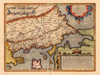
162416765Antwerp: Balthasar Moretus 1624. Other. A very good example in excellent condition. 360 by 480mm 14 by 19 inches. Original antique copper engraving published 1624 in the famous historical Atlas Parergon Latin text-edition by Abraham Ortelius. Finely hand colored in wash and outline. Fine and early historical map on Thracia. The area on this map covers mainly Thracia in Northern Greece and parts of Romania. The map is ornated with three cartouches in the upper left corner the title cartouche on the lower and upper right side we find text cartouches. Villages and towns are shown as miniature views. Ortelius was born on 14 April 1527 in the city of Antwerp which was then in the Habsburg Netherlands modern-day Belgium. The Orthellius family were originally from Augsburg a Free imperial city of the Holy Roman Empire. In 1535 the family had fallen under suspicion of Protestantism. Following the death of Ortelius's father his uncle Jacobus van Meteren returned from religious exile in England to take care of Ortelius. Abraham remained close to his cousin Emanuel van Meteren who would later moved to London. In 1575 he was appointed geographer to the king of Spain Philip II on the recommendation of Arias Montanus who vouched for his orthodoxy. He travelled extensively in Europe and is specifically known to have traveled throughout the Seventeen Provinces; in southern western northern and eastern Germany e.g. 1560 15751576; France 15591560; England and Ireland 1576; and Italy 1578 and perhaps twice or thrice between 1550 and 1558. Beginning as a map-engraver in 1547 he entered the Antwerp Guild of Saint Luke as an illuminator of maps. He supplemented his income trading in books prints and maps and his journeys included yearly visits to the Frankfurt book and print fair where he met Gerardus Mercator in 1554. In 1560 however when travelling with Mercator to Trier Lorraine and Poitiers he seems to have been attracted largely by Mercator's influence towards the career of a scientific geographer. Wikipedia Koe. Ort. 46; Balthasar Moretus unknown
16247932Antwerp: Plantin-Moretus 1624. Copper engraving 36 x 48 cms modern hand colour Latin text on verso. Ancient Thrace extending from Macedonia to Byzantium following the cartography of Gastaldi supplemented by information from classical sources including Herodotus Strabo and Pliny. Our example was published by Balthasar Moretus at the Plantin Press in the final edition of the Parergon. Ortelius's Theatrum Orbis Terrarum is generally considered the first modern atlas of the world originally published in 1570. Ortelius gathered and selected the best available cartographic knowledge and presented it in a single volume duly credited and finely engraved in a consistent style with explanatory text. The Theatrum was very decorative and hugely popular amongst the wealthy and educated running into over forty editions in Latin and the major European languages. For Ortelius himself however his accompanying atlas of ancient geography the Parergon was a "personal work" Koeman. He seems to have regarded himself first and foremost as an antiquary and rather than copying other people's maps he drew the originals himself; they were subsequently engraved for him by the master engraver Jan Wierix. The results have to be evaluated as the most outstanding engravings depicting the wide-spread interest in classical geography in the 16th century Koeman. Koeman Atlantes Neerlandici Ort 46. Van den Broecke 214.2 Map Plantin-Moretus unknown
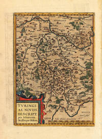
160315462Antwerpen 1603. Other. In excellent condition. 295 by 210mm 11 by 8 inches. Hand-Colored Original Copperplate Engraving by Abraham Ortelius depicting Thüringen. Published Antwerpen 1603. Sheet: 295 by 210mm 11 by 8 inches. A fine and original hand-colored example of Ortelius's celebrated cartographic work documenting this region of Germany with the precision and decorative artistry characteristic of the 16000s. Abraham Ortelius 1527-1598 was a Flemish cartographer and geographer from Antwerp widely regarded as the creator of the first modern atlas. His landmark publication Theatrum Orbis Terrarum 1570 set the standard for atlas-making for the next century presenting uniform copper-engraved maps with scholarly commentary. By Ortelius's death the Theatrum had appeared in 25 editions in seven languages. In 1575 King Philip II of Spain appointed him Royal Geographer. His maps engraved with extraordinary precision are among the most sought-after in antique cartography held in collections including the Plantin-Moretus Museum in Antwerp the Library of Congress and the British Library.This original copperplate engraving with original hand coloring depicts the region of Thüringen published in Antwerpen 1603. The map features a decorative Baroque cartouche containing the title inscription. A distance scale is incorporated within the cartouche or alongside it. The map records the political and geographic boundaries of the region as understood in 1603 offering a fascinating window into the history of German territorial organization. Sheet measures 295 by 210mm 11 by 8 inches. In good condition overall with minor signs of age appropriate for a 17th-century engraving. Ready to frame. Koeman Ort. 30; Broe. 96. unknown
16018878Antwerp Johann Baptist Vrients 1601. Copper engraving 8.3 x 12.4 cms black and white Latin text on verso. The Kingdom of Naples from the second series of maps engraved by Philip Galle for the Epitome the pocket atlas version of Ortelius Theatrum. Koeman Atlantes Neerlandici Ort 58 Map unknown
1601299086Antwerp: Abraham Ortelius 1601. unbound. Map. Engraving with beautiful original hand color. Image measures 14" x 18 3/4". Staining and toning to margins repair to lower centerfold but otherwise is good condition.<br/> <br/> Old color example of this lovely map of Valencia by Ortelius. The map extends from Murcia and Orihuella to the Cenia River and extending inland to include Aragon and Castilla. North is oriented to the right. Includes a beautifully designed strapwork cartouche and two large sailing vessels. Latin text verso. Abraham Ortelius 1527-1598 a Flemish cartographer and geographer is widely regarded as one of the important and influential cartographers in history. He is known for his "Theatrum Orbis Terrarum" which was the first modern atlas. Van den Broecke #30<br/> <br/> Abraham Ortelius unknown
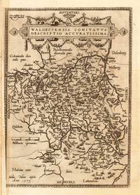
160811191Antwerpen: Juan B. Vrients 1608-12. In sehr gutem Erhaltungszustand. 31.3 x 223 cm 12.25 x 875 inches. Hand-Colored Original Copperplate Engraving by Abraham Ortelius depicting Waldeccensis Comitatus Descriptio Accuratissima. Published Antwerpen Juan B. Vrients 1608. Sheet: 31.3 x 223 cm 12.25 x 875 inches. A fine and original hand-colored example of Ortelius's celebrated cartographic work documenting this region of Germany with the precision and decorative artistry characteristic of the 16000s. Abraham Ortelius 1527-1598 was a Flemish cartographer and geographer from Antwerp widely regarded as the creator of the first modern atlas. His landmark publication Theatrum Orbis Terrarum 1570 set the standard for atlas-making for the next century presenting uniform copper-engraved maps with scholarly commentary. By Ortelius's death the Theatrum had appeared in 25 editions in seven languages. In 1575 King Philip II of Spain appointed him Royal Geographer. His maps engraved with extraordinary precision are among the most sought-after in antique cartography held in collections including the Plantin-Moretus Museum in Antwerp the Library of Congress and the British Library.This original copperplate engraving with original hand coloring depicts the region of Waldeccensis Comitatus Descriptio Accuratissima published in Antwerpen Juan B. Vrients 1608-12. The map records the political and geographic boundaries of the region as understood in 1608-12 offering a fascinating window into the history of German territorial organization. Sheet measures 31.3 x 223 cm 12.25 x 875 inches. In good condition overall with minor signs of age appropriate for a 17th-century engraving. Minor defects: centerfold as issued. Ready to frame. Broe. 98b; Juan B. Vrients unknown
16018057Antwerp Johann Baptist Vrients 1601. Copper engraving 8 x 11 cms recent hand-colour waterstaining in upper margin Latin text on verso. Zara and Sebinico on the Croatian coast from the second series of maps engraved for the Epitome by Philip Galle. Koeman Ort 58 Map unknown
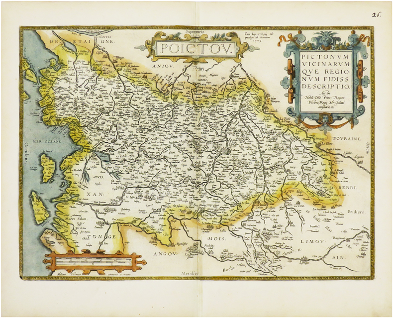
1612LBW-6675Anvers, 1579 [1612]. 360 x 504 mm.
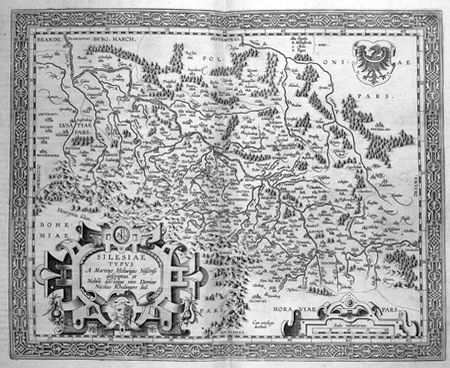
1603LBW02528[Anvers, 1603]. 344 x 420 mm.
1608LBW01b3a[Anvers, 1608]. 335 x 486 mm.
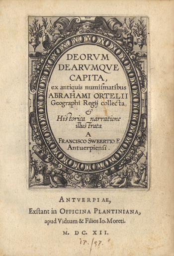
161216230Anvers, Plantin, les fils de Joannes Moretus (Typis Roberti Bruneau), 1612 ; petit in-4 ; vélin, titre manuscrit, plats décorés, à froid, à la Duseuil, avec un double fleuron en coins (reliure de l’époque) ; (136) pp. non chiffrées, titre et 59 planches gravés sur cuivre : portraits ou profils des dieux et déesses chacun dans un riche décor à l’ancienne (*, A-Q 4).
1667D14109Venice: Scipion Banca 1667. Hardcover. Very Good. Early-20th century vellum lettering hand-painted in black and red on spine very pretty; 8vo 131x92mm. Include half-title title with vignette 108 engraved maps. Vellum a little dust-smudged else fine. D7 torn and repaired; gathering I and K transposed; trimmed a bit close at inner margin. Provenance: Francesco Baranelli di Sinigaglia early ownership signature on half-title; discreet gilt-lettered bookseller's label on front paste-down "C. E. Rappaport Libri Rara Roma." <br/><br/>Third Italian edition of a so-called Epitome Theatrum the desirable "pocket" version of Ortelius's Theatrum Orbis Terrarum. Enormously popular this version of Ortelius's atlas was primarily used by travelers students and others for whom the folio edition would be inconvenient. Copies were eagerly sought and usually received considerable wear. The atlas was published by varying printers and engravers through to the 18th-century. Koeman III Ort 71. Scipion Banca hardcover books
1612219257Abraham Ortelius 1612. unbound. very good. Map. Engraving with hand coloring. Image measures 14" x 19.25".<br/><br/> This stunning 1612 map by Abraham Ortelius depicts the Western Hemisphere. At the time it was issued the coastal areas of the New World had been fairly well explored and Europeans were just beginning settlement and colonization. It is notable for depicting Spanish and Portuguese colonies in high detail for these powers were notoriously protective of their geographical surveys.<br><br>This is the first state of the third plate engraved for Ortelius's landmark map of the New World. It is distinguished from the first two plates by the lack of the bulge to the southwest coast of South America. Several other cartographic enhancements are apparent on closer inspections.<br><br>The Solomon Islands are depicted here for the first time since their discovery in 1568 by Alvaro de Mendana. The map identifies several places previously unpublished due to political reasons. These were provided to Ortelius by Haklyut on the basis of recent explorations. The nomenclature in California is also included.<br><br>Perhaps the most notable enhancements on the east coast is the Indian name Wingandkoa and an inlet just above possibly the first depiction of the Chesapeake Bay on a printed map reflecting early English efforts at Colonization in the Outer Banks of the Carolinas. <br><br> Based on Gerard Mercators 1569 World Map this map includes an abundance of cartographic speculation representing the knowledge of the region during the time. The kingdom of Quivira the supposed ancient city of gold in North America. Conquistador Francisco Vázquez de Coronado searched for Quivira for several years to finally find it was no more than American Indian settlement of farming people. Terro del Fueggo first reached by Magellan is here shown to be part of the large speculated continent of Terra Australis that extends westward with the annotation "The southern of Magellanican land as yet unknown".<br><br>Other interesting annotations throughout include "Somewhere here there are islands which according to some have gold" and Patagonia shows a notation that suggests its inhabitants were giants.<br><br>The waters are ornamented with illustrations of ships and a sea monster. In earlier plates the ships are different. A large title cartouche is included in the bottom left. Another scale cartouche appears in the top left. Published in the 1612 or 1608 edition the map is identical in both editions of Ortelius' famous "Theatrum Orbis Terrarum" which is historically considered the first modern atlas. Based on the text on verso only 300 copies of this particular edition were ever printed van der Broecke 11. <br><br> Italian text on verso. Minor chipping to edges. Full original margins. Minor wear along original centerfold. <br><br> Abraham Ortelius 1527--1598 a Flemish cartographer and geographer is widely regarded as one of the important and influential cartographers in history. He is known for his "Theatrum Orbis Terrarum" which was the first modern atlas.<br/><br/> Abraham Ortelius unknown books
1612406876Antwerp 1612. Tape reinforcements along edge on verso without show-through and not affecting image a few foxmarks overall in very good condition with good color. Hand colored engraved map 12 5/8 x 9 7/8 inches image 16 1/2 x 10 5/8 inches sheet. Crossed arrows watermark. A fine map from Ortelius's atlas showing Lake Constance the Danube and Rhine. Bounded by the Lech Odenwald Alsace and Chur in Switzerland. <br/><br/> unknown books
1603299083Antwerp: Abraham Ortelius 1603. unbound. Map. Engraving with hand coloring Image measures 14" x 18 3/4". Staining toning and chips to margins but otherwise is good condition.<br/><br/> Friuli is the northeast Italian region bordering Austria Slovenia and the Adriatic Sea. It's home to the sharp-peaked Dolomite Mountains and vineyards producing white wines. Ortelius' 1603 edition extends from Venice north to the Italian Alps and east to Trieste and Istria. Lovely depiction of Venice floating on several islands. Abraham Ortelius 1527--1598 a Flemish cartographer and geographer is widely regarded as one of the important and influential cartographers in history. He is known for his "Theatrum Orbis Terrarum" which was the first modern atlas. Van Den Broecke 119<br/><br/> Abraham Ortelius unknown books
1603299305Antwerp: Abraham Ortelius 1603. unbound. Map. Engraving with beautiful original hand color. Image measures 14" x 18 3/4". Staining and toning repair to margins but otherwise is good condition.<br/><br/> Old color example of this lovely map of 16th c. France by Ortelius. Abraham Ortelius 1527-1598 a Flemish cartographer and geographer is widely regarded as one of the important and influential cartographers in history. He is known for his "Theatrum Orbis Terrarum" which was the first modern atlas. Van den Broecke #34<br/><br/> Abraham Ortelius unknown books