Marco Polo Travel PublishingBiblio.com

4 023 résultats
3829770308.Gmap. Good. Access codes and supplements are not guaranteed with used items. May be an ex-library book. unknown
1876316443Macmillan London 1876. Magazine. Very Good. 40 pages. See picture for details of contents. A complete weekly issue without original wrappers. Size: Folio approx A4 size. Category: Nature Journal; Special Interest. This item may require more postage than the rates shown for delivery outside the UK. If extra postage is required we will contact you before processing your order and you will be given the details and option to decline the extra cost. Macmillan unknown
20071-1594741778Quirk Books 2007. Paperback. New. 224 pages. 5.75x4.75x0.75 inches. Quirk Books paperback
1709175Hardcover. Very Good. A collection of articles in Dutch language from several issues of Nederlandsch-Indie Oud & Nieuw bound in blue cloth boards gilt lettering on spine. There are tabbed separator pages between the four sections: 1. THAILAND; 36 pages including 29 full page photographic plates many of Thai and Khmer Buddha heads together with relevant book reviews and articles from 1923 1924 and Jan. 1930 issues. 2. CAMBODIA; 26 pages including 11 full page and 7 half page plates a substantial article on Angkor Wat additional article on Angkor Thom with plan June 1926 3. CHINA; 108 pages of articles numerous black & white line and photographic illustrations including 17 full page plates - 8 superb ones of T'ang and Sung Buddha heads. Also sections on Chinese jade ceramics bronzes and sculpture from the Nov. 1928 Dec. 1925 issues. 4. JAPAN: 22 pages including 7 full page photographic plates on masks painting ceramics history of the Dutch in Japan. A very interesting and desirable collection of articles. <br/><br/> hardcover
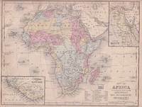
1869176603Philadelphia.: E. H. Butler. circa1869. Lithographed map with original hand-colour 21.2 x 27.6 cm two inset maps of Liberia and Sierra Leone; and Egypt showing the Suez Canal text and engravings for an unrelated entry on the verso; margins dusty top edge worn with small edge tears one affecting the border and marginal chip but in good condition. Detailed map of Africa before the escalation of colonial acquisition in the 1880s. . (E. H. Butler). unknown
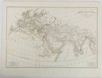
1820177230Paris. circa1820. Engraved map with original outline hand-colour 21.1 x 31.5cm original folds a few spots and a little creased but in very good condition. Latin map of the Ancient world encompassing Europe India Arabia the Middle East and North Africa by the French cartographer Jean Baptiste Poirson 1761-1831 finely engraved. . unknown
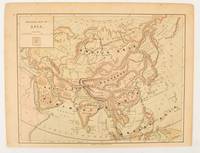
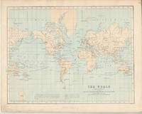
1875174830New York.: Harper & Brothers. 1875. Map printed in colour polar projection 21 x 27.1 cm marginal spotting and toning small edge tears to the inner margin but in god condition. Prepared for "Harper's School Geography" first published by Harper & Brothers in 1875. The map shows physical features mountains steppes plains rivers and deserts etc. together with sources of primary production: whale fisheries furs coffe tea minerals etc.The verso of the map with references and attractive line engravings part of the entry for Netherlands and Belgium. . Harper & Brothers. unknown
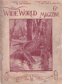
1907216093London.: George Newnes Limited. First Edition. July1907. Decorated covers black & white illustrations throughout some soiling to covers head & tail of spine chipped and a repair to the lower corner still a clean and firm copy. 24 x 18cm. This issue's contents include: A Beetle Hunter in the Amazon; Across Unknown Bhutan - II; A Tragedy of Solitude; Kangaroo Farming; From India to England Overland - I; The Boy Who Ran Away; With a Survey Party in the Field; On Board the "Luciline"; A Maori "Canoe Poi"; The Lost Explorers; A High Climb in Himalaya; The Eye of the King; Our Cruise on the Friesland Meers and more. . George Newnes, Limited. unknown
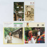
1970161824Japan.: various. Late 1970s - Early1980s. Four pamphlets relating to travel in Korea aimed at Japanese travellers in the late 70s/early 80s. All in good condition. Text in Japanese. Small collection of travel ephemera collected by a Polish Australian woman living in Kobe in the lates 70s/early 80s. A fascinating snapshot of travel to Korea aimed at Japanese travellers. Titles are: <br> <br>韓国: 魅力のトリップ. Charming Trip to Korea. <br>女性のための韓国. Travelling to Korea for Women. <br>韓国: 魅力のトリップ. Charming Trip to Korea. <br>韓国: 観光情報. Korea: Tourist Information. <br> <br>Text in Japanese. . various. unknown
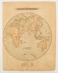
1875175128Harper & Brothers. 1875. Spherical map printed in colour 21.3 x 21.2 cm with shaded key to elevation and ocean currents unrelated text on the verso paper toned and margins soiled bottom edge ragged small sealed to to the inner margin but in sound condition. Map showing the five continents of Asia Africa Antarctica Europe and Australia. Published by Harper & Brothers for inclusion in their "School Geography". Plateau of Tibet very prominently marked. Gobi Desert and Plateau of Mongolia also marked India described as Hindostan Indo-China includes Thailand. . Harper & Brothers. unknown
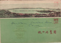
1962160933杭州.Hangzhou.: 浙江人民出版社.Zhejiang renmin chu ban she. 2nd Edition 3rd Printing. 1962. Folding colour tourist brochure for Hangzhou. One side shows large map of Hangzhou the other 5 more detailed maps chops and previous owner's annotations upper cover small hole at one fold some light wear and browning good. Text in both traditional and simplified Chinese. Sheet size 53.9 x 38.3cm folded size 13.5 x 19.2cm. <br> <br>One side includes a legend an inset showing tourist spots surrounding Hangzhou a table shows lists of Hangzhou's hospitality industry e.g. hotels cinemas swimming pools restaurants department stores etc. The other side includes five individual tourist maps: Viewing Fish at Flower Pond 花港觀魚 Lingyin Temple 靈隱 Hangzhou Bus Map 杭州市公交路线图 Lonely Mountain 孤山 Dreaming of the Tiger Spring 虎跑. . 浙江人民出版社.[Zhejiang renmin chu ban she]. unknown
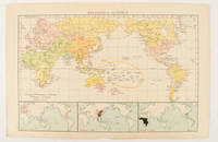
1895175135London.: Times Atlas of the World. 1895. Map printed in colour 23.2 x 35.9 cm. two edges gilt with three inset maps key to religions outlined in colour bottom margin chipped edges browned a few silverfish abrasions affecting the verso but in good condition. . (Times Atlas of the World) unknown
1897034390London: T. Fisher Unwin Ltd 1897. 323pp. Or green cloth. Small area of surface insect damage to fore-edge of front cover slight rippling of cloth rubbed at spine moderate to heavy foxing within. . Colonial Edition. Hard Cover. Very Good. 8vo. T. Fisher Unwin Ltd Hardcover
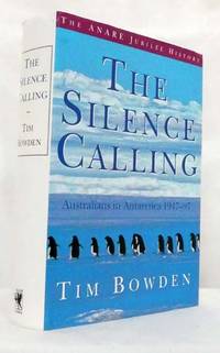
1997BIB320143Sydney: Allen & Unwin. 1997. Small Quarto Size approx 17.5cm x 24cm. Near Fine condition in Very Good Dustjacket. DJ protected in our purpose-made clear archival plastic sleeve. Illustrated with Colour and Black & White Photographs. Previous owner's name to dedication page. Flat signed by author on title page. A nice copy. This is a heavy book and will cost more to ship internationally. Please contact us for a precise quote for your part of the world. Robust professional packaging and tracking provided for all parcels. 593 pages. A fascinating and often moving account the book traces the development of ANARE from first settlement up to the present day looking at the people the exploration discovery and Australia's contribution to scientific research. . 1st Edition. Hardback. Allen & Unwin hardcover
1998050354Barcelona: Lunwerg Editores 1998. HEAVY. 298pp num col and bw ills. Or black cloth in jacket. Very slight edge wear to jacket light bump to one corner. Bilingual text in Spanish and English. Cultural and artistic history of the Road to Santiago one of the older pilgramages in Europe. First Edition. Hard Cover. Fine/Fine. Illus. by Lobato Zurxo. photog. Folio. Lunwerg Editores Hardcover
1982054545Melbourne: Richard Griffin 1982. HEAVY. This first edition consisted of 1500 copies. Unpaginated c164pp illustrated with paintings in colour and b/w glossary pictorial end-paper maps. Decorative cloth boards in jacket which is lightly edge-worn and faded at spine and bottom light even toning to page edges. Loosely inserted invitation to an exhibition of the author's Bungle Bungle Range paintings and sculptures as well as funeral memorium booklet. SIGNED Hodge and inscribed To Hugh an old friend- hope you enjoy this patrol up a lazy river- XHodge on reverse of front free endpaper.The life and art of the people of the Sepik River of Papua New Guinea. Signed & Inscribed by the Artist. First Edition. Hard Cover. Very Good/Good. Folio. Richard Griffin Hardcover
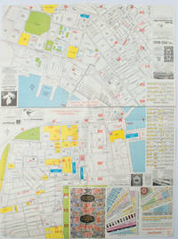
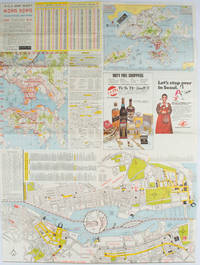
1977161880Hong Kong.: A-O-A Ltd. June/July1977. Coloured tourist maps of Hong Kong printed both sides on a sheet folded. One general area map of Hong Kong and three detailed street maps featuring Kowloon Peninsula Tsimshatsui and Central District. Generally in very good condition text in traditional Chinese English and Japanese. Sheet measures 58.2 x 43cm. The tourist maps include currency rate tourist advice advertisements for foreign and local brands and shops e.g. A-O-A Gambling Handbook for Macau Duty Free shopping centres Chinese Arts & Crafts centres acupuncture clinic etc. The maps of Central and TST have the names of many hotels businesses post offices etc marked on them. . A-O-A Ltd. unknown
1976161881Hong Kong.: Walter K. Hoffman. January/February1976. Coloured tourist map brochure of maps of Hong Kong printed both sides six maps in total folded. Brochure also includes advertisements currency rates. Minor tears along folds otherwise in good condition. Text in traditional Chinese English and Japanese. Sheet measures 58.2 x 43.4cm. Sheet includes 6 individual maps: Map of British Crown Colony of Hong Kong Map of the Urban Area with routes for public transportation Map of Tsimshatsui large scale street map Map of Central District large scale street map Map of Wanchai large scale street map Map of Causeway Bay large scale street map Map of Portuguese Overseas Province of Macau. On the maps of Central and TST the names of many businesses hotels etc are marked. . Walter K. Hoffman. unknown
1874174897London.: Virtue & Co. circa1874. Printed colour map 18.4 x 24.1 cm edge wear marginal spotting and on the verso but the map in very good condition. Unusual map showing time differences east and west of Greenwich before the atomic clock and well before satellites! The explanatory text notes aso that: "The space comprehended between the meridiens of 120 & 160 E. is repeated in order to show the relative position of England to Australia both eastward and westward." . Virtue & Co. unknown
1974051846Kuala Lumpur Malaysia: Oxford University Press 1974. xvii 273 250pp. Blue cloth in jacket. Prev owner name to front free endpaper minor toning to spine small hole to jacket lower front 3cm tear and associated crease at bottom rear near spine 5cm tear top rear spine fold. Originally published in 2 volumes in 1885. An account of the Malay states in the 1870s by the wife of a minor government colonial official posted in an undeveloped region. Her somewhat unflattering account is in contrast to Isabella Bird's Golden Chernovese of 1883- this explained by their very different experiences of the region. Bird a respected writer received with kindness and courtesy Innes as the wife of a minor official in constant conflict with his superiors. First Thus. Hard Cover. Very Good/Very Good. 8vo. Oxford University Press Hardcover
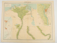
192047836London.: The Times. 1920. Map printed in colour 47 x 59.5 cm sheet showing cultivated land in green and desert in cream five insets: Port Said Suez Environs of Cairo and two showing continuations of the Nile; original fold two small edge tears but in very good condition. Attractive large map prepared as plate 79 from "The Times Survey Atlas and Gazeteer of the World". . The Times. unknown
1993051074Mansfield Centre CT: Martino Publishing 1993. Volume 2 only of 2. Title continues: the Eastern Part of Java. vii 362pp folding map 12 bw ills. Green cloth no jacket as issued. As new. No date but c1993. Limited edition of 250 copies of which this #18. Facsimile of the original edition of 1847. Limited Facsimile Edition. Hard Cover. Fine/None as Issued. 8vo. Martino Publishing Hardcover
1976053249Arorangi Cook Islands: Cook Islands Library & Museum 1976. 102pp bibliographyline drawings. Red pictorial card with red cloth tape spine. Tiny bump to bottom corner. Second Edition Revised & Augmented. Soft Cover. Very Good. 4to. Cook Islands Library & Museum Paperback
20005310London: The Hakluyt Society 2000. xv 139 pages. Colour frontispiece one b/w illustration and seven maps. Appendices bibliography and indices. Original blue cloth with gilt decoration on upper board and gilt titling on the spine. Volume 5 in The Hakluyt Society's Third Series. "The present edition offers for the first time an English translation of those parts of Van den Broecke's original manuscript which describe the four trading voyages he made to Africa in the early seventeenth century. His manuscript is an important historical source because he was among the earliest of Europeans to describe in detail the communities he encountered in West Africa and Central Africa and the sophisticated commercial strategies of Dutch merchants then trading on the Atlantic coast of Africa" dustwrapper blurb. First Edition. Hard Cover. Fine/Fine. The Hakluyt Society Hardcover
1913050954London: T. Fisher Unwin Ltd 1913. 319pp bw ills. Oictorial green cloth no jacket. Cloth flecked. Pages untrimmed and in some places roughly separated resulting in marginal tears and chips. Overall a quite pleasing copy. Includes chapters on prospecting on the gem fields opal sugar Aborigines and Christmas Ilsand as well as the obvious gold and pearl material. Second Impression. Hard Cover. Good Plus/No Jacket. 8vo. T. Fisher Unwin Ltd Hardcover