NAPOLEON ,JOMARD,MONGELivre Rare Book
5 649 résultats
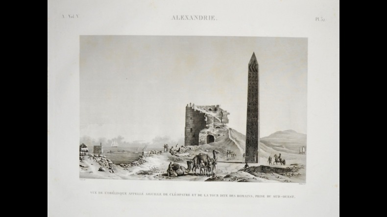
1820PHO-372TEXTE Paris, Panckoucke, 1820-1829. 24 tomes en 26 vol. de texte , in-8 Manquent : T 1-6-10-14-18 (3ème part) et 19 Un des monuments de l'Imprimerie Française et de l'archéologie mondiale, réalisé sous la direction de Vivant Denon et l'impulsion de Kléber après la Campagne d'Égypte. Broché. ATLAS Paris, Panckoucke, 1820-1829. 11 volumes IN PLANO, demi-basane havane ép., dos lisses ornés. Reliures usées, frottés. Qqs rousseurs par endroits. Ces 11 volumes d'atlas renferment au total 848 planches réparties : ANTIQUITÉS: 5 Volumes ,tome I, 91 planches; tome II, 85 planches ; tome III, 55 planches ; tome IV, 62 planches ; tome V, 82 planches + 16 planches pour la pierre de Rosette (2 par feuille) + 2 planches non numérotées. ÉTAT MODERNE : 2 volumes , 96 planches en numérotation continue + 31 planches + 11 planches (A-K) + 13 planches (AA-NN, pas de planche JJ) + 10 planches (a-k, pas de planche j). GÉOGRAPHIE : 1 volume : tableau d'assemblage, alphabet puis 47 planches (cartes sur double page) HISTOIRE NATURELLE : 3 volumes : tome I, 62 planches ,tome II, 105 planches ,tome II bis, tableau général des planches (volant en format plus petit) + 62 planches + 15 planches.
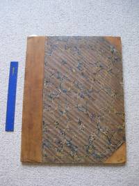
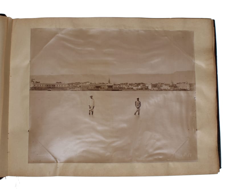
1872602831870-1872. Folio-oblong (395 x 320 mm). Original brown half calf, recased - the original cloth (with gilt lettering to the front) has been expertly mounted on to the new boards, and most of the original gilt leather spine has been preserved over a perfectly matching new lovely brown half calf. ""Tordenskjold / 1870 - 1873"" in gilt lettering, partly worn of, to front board. End-papers renewed. 71 albumen print in various sizes and by various photographers (see below) mounted on 59 contemporary white cardboard leaves (measuring 370 x 310 mm), all re-hinged. The album was water-damaged at some point, but has been expertly and neatly restored and appears in overall very good condition with good tones. 1, Oval photo of Tordenskjold (205 x 60mm) 2, Photo of Tordenskjold (190 x 143 mm) 3, Crew aboard Tordenskjold (200 x 14 mm) 4, Crew aboard Tordenskjold (157 x 128 mm) 5, Crew and equipment aboard Tordenskjold (228 x 176 mm) 6, Naval officers about Tordenskjold (167 x 130 mm). 7, 8 small photos of various places on one plate (274 x 190 mm) 8, The harbor of Port Said. By Hippolyte Arnoux (247 x 190mm) 9, Muddigging machines in the channel of Port Said. By Hippolyte Arnoux. (245 x 190mm) 10, Port Said. By Hippolyte Arnoux. 11, Malta (262 x 207 mm) 12, Two photos of Malta (each measuring 134 x 120 mm) 13, Two photos of Gibraltar (Each measuring 148 x 114) 14, Deep Water Bay, Hong Kong (194 x 130 mm). 15, Two photos depicting telegraph-house and ships in Deep Water Bay (each measuring 150 x 112) 16, Boat with people. By Felice Beato, coloured (294 x 235 mm) 17, House next to river. By John Thomson, December 1870 (278 x 225 mm) 17, Seamen’s hospital in Hong Kong. (261 x 190 mm) 18, Hong Kong. (270 x 195 mm) 19, Hong Kong, by Floyd (270 x 192 mm) 20, Hong Kong, by Floyd (240 x 190 mm) 21, Two photos of sites in Hong Kong (each measuring 165 x 127 mm) 22, Five Sikhs in Hong Kong (215 x 244 mm) 23, Group of women in Hong Kong, (326 x 215 mm) 24, Two photos of Hong Kong harbour, one photo depicting “Cella” (182 x 105" 130 x 98 mm) 25, Villa at Canton. (264 x 190 mm) 26, Pagode in Xuexiu Park, Guangdong. By William Pryor Floyd. (195 x 246 mm) 27, Boats in Canton. William Pryor Floyd,(270 x 223 mm) 28, Pou-Ting-Qua’s Garden, Canton. By John Thomson. (289 x 230 mm) 29, Fields in Canton. (205 x 155 mm) 30, Houses in Canton. (267 x 210 mm) 31, Canton harbor. By John Thomson. (245 x 202 mm) 32, Boat on the Canton river. (274 x 204 mm) 33, Wall around Canton. (260 x 200 mm). 34, Boats in Canton (293 x 225) 35, Telegraphstation in Woosung. (150 x 110 mm) 36, Boats in Foochow. (287 x 232 mm) 37, Temple in Foochow. By John Thomson (190 x 237 mm) 38, Pagode in Foochow. Presumably by John Thomson. (287 x 220 mm). 39, Tomb of Fou Tcheou. By John Thomson. (290 x 225 mm). 40, Temple in Shanghai. (237 x 188 mm). 41, Shanghai. (232 x 176 mm) 42, Chaochow bridge, Kwangtung. By John Thomson. (266 x 204 mm). 43. Panorama of Nagasaki consisting of two photos. (371 x142 mm) 44, Two photos of Nagasaki. Felice Beato. (Each measuring 169 x 119 mm). 45, Two photos from Nagasaki. Presumably by Felice Beato. (Each measuring 165 x 118 mm) 46, Two photos from Nagasaki. Presumably by Felice Beato. (Each measuring 165 x 118 mm) 47, Temple in Nagasaki. Presumably by Felice Beato. (169 x 118 mm). 48, Photo of Japanese woman in kimono. By Felice Beato. (205 x 255 mm). 49, Two photos of officers in house in Yokohama. (162 x 125 mm). 50, The Abbot and Monks of Kushan Monastery. By John Thomson. (287 x 204 mm). 51, Wooden structure, presumably Nagasaki. Presumably by Felice Beato. (270 x 208 mm) 52, Pagode, presumably Nagasaki. Presumably by Felice Beato. (234 x 185 mm) 53, Cityscape with lake, presumably Nagasaki. Presumably by Felice Beato.. (280 x 228 mm). 54, Two photos, cemetery and stairs to temple. By Felice Beato. (Each measuring 168 x 118 mm). 55, People standing outside house, presumably Hong Kong. By John Thomson. (185 x 155 mm) 56, Guangzhou Great Norh Gate, Canton. By John Thomson (245 x 156 mm). 57, Two photos, one of the building of a telegraph station (presumably in Wladivostok) and a view of Wladivostok from the sea (154 x 123 130 x 99 mm). 58, Seascape of two ships. (130 x 140 mm). 59, Ship laying for anchor. (170 x 123 mm)
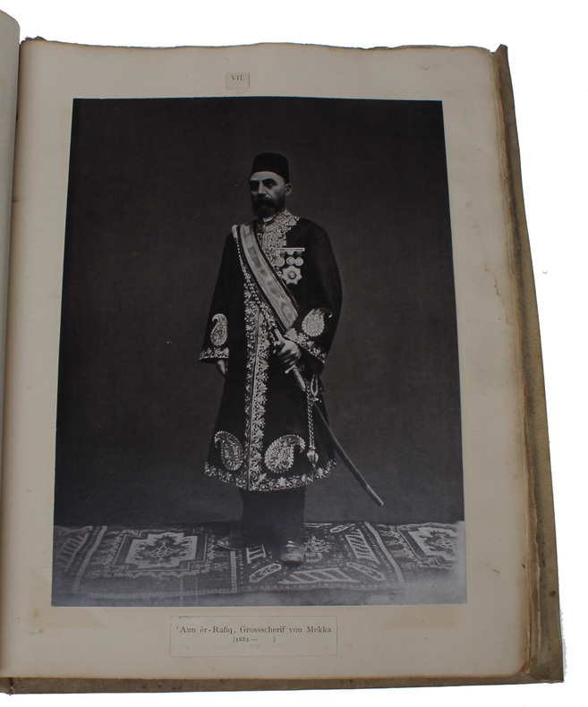
188859963Haag, Nijhoff, 1888-1889. Text-volumes in lex-8vo, two volumes, identically bound in near contemporary burgundy half cloth with the original printed front wrappers preserved an pasted on to front boards. the original printed paper spine labels have also been preserved an pasted on to spines. Wear to capitals, corners, and hinges. Blindstamped library imprint to top of front boards (Colonial Office Library). Bound with both half-titles. The half-title of vol. 1 mounted, as is the title-page of vol. 2. Stamps to title-pages (Arab Boreau Cairo and Colonial office Library). Otherwise a clean and fine copy with no noteworthy flaws. XXIII, (1), 228, (2) pp. + 3 genealogical tables and 2 folded maps + XVIII, 397, (1) pp. The atlas volume consists of the printed table of contents and all 65 photographs and lithographs inserted into a 19th century full vellum photograph album with sturdy leaves. The album itself has some wear, but is sturdy, robust and crarming. It artistically shows the craftmanship of the stiching by displaying parts of the sewing cords on leather onlays on the spine. Leather ties. In all, there are 75 illustrations, consisting in four chromolithographic plates, 6 tones lithographic plates (one double-page and folded) and 65 original photographs of varying sizes. Some are full-page, some are mounted four to a page, and some that have originally been four (and in one case three) to a page have here been individually mounted on a leaf each. Although taken out and mounted in to the present album, all numberings (I to XL) have been preserved, as have the titles of the pictures. Generally in very good condition, although one lithograph has a closed tear.
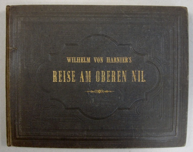
18667682Extrêmement rare ouvrage d'exploration au Nil. L'ouvrage comporte 27 planches lithographiées en couleurs, 1 carte sur double page, et un titre également lithographié. Bel exemplaire, dans sa reliure d'origine. 7 copies recenssées au World Cat. Petites salissures au plat inférieur de la reliure; Faibles rousseurs en marges des estampes. Pleine toile noire d'éditeur; titre doré en long au dos et sur le plat supérieur. Étiquette d'un libraire de St Petersburg. Bon Darmstadt & Leipzig Eduar Zernin 1866 1 volume oblong 25,5 x 33 cm.
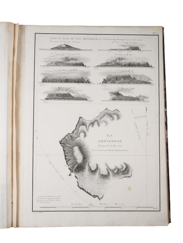
180754627Paris, 1807 (atlas) - 1808 (text). 2 large 4to + 1 folio. All three volumes bound in contemporary half calf with gilding to spines - text volumes uniform. TEXT: Volume 1 with a split front hinge, but block still tight. A patch of paper missing from back board. Both volumes with some edge wear and bumped corners. Old paper labels to inside of front boards, and a stamp to half-titles and title-pages. A bit of brownspotting, but mostly marginal. Overall, most text-leaves are clean and bright. The plates in vol. 1 have some, mostly marginal, brownspotting. Both volumes with wide margins. Some of the text is printed on blue-ish paper. (4), LVI, 704 pp. & 32 folded engraved plates + (4), VIII, 691 pp. & 1 folded plate. Many tables with astronomical observations. In all 33 folded plates. ATLAS: Wear to extremities and bumped corners. Inner front hinge re-enforced. Top right blank corner of title-page repaired, far from affecting text. A stamp to title-page. A bit of brownspotting, mostly marginal. The last ab. 10 maps with a damp stain in the middle. The reast are very nice and bright. 4 (title-page + contents-leaf) pp. & 39 maps and charts, 29 of which are double-page. Fully complete with all 33 folded plates in the text-volumes and all 39 maps and charts in the atlas-volume. A contemporary handwritten note to the title-page of the atlas stating that THE COPY WAS GIVEN TO ADMIRAL VAN DOCKUM AT THE ORDER OF NAPOLEON I. (""à Mr. le Conte-Admiral Joost Van Dockum,/ par ordre de Sm l'Empereur Napoléon 1e."")
189889785Ernest Leroux Augustin Challamel | Paris 1898-1919 | 22.3 x 28.5 cm pour les 10 volumes de texte & 22,8 x 33,3 cm pour l'atlas | 11 volumes de texte reliés + 1 atlas relié + 1 carte dans une chemise-étui
18194504053Guam 1819. In fine original condition. Original ink drawing 310 x 245 mm. fully signed and dated framed. <p><p>Jacques Arago artist on board Freycinet's Uranie during the French circumnavigation of 1817-20 drew this intimate portrait of Brother Ciriaco the curé in Agana the capital of Guam during the visit there of the Uranie expedition between March and June 1819. This is a charming and unusual portrait of a figure who likely expected to be taken more seriously: the cleric is shown in his "at home" attire his petit negligé smoking. His relaxed stance dressed in a vest and daringly striped leggings is further enriched by the addition of the most delicate slippers. </p> <p>Arago 1790-1855 was not only the most accomplished of the artists who made the voyage aboard the Uranie but was one of the most intriguing of the early travellers. The wonders of the long expedition stayed with him for the rest of his life and he continued writing and drawing about the Pacific right up until he lost his sight. In 1822 he published his own well-regarded account of the voyage Promenade Autour du Monde which was published in an English version in 1823. Over the ensuing decades he wrote more differing versions of this interesting account. </p> <p>The Freycinet expedition stayed for a long time in Agana where they were well received by the Spanish Governor Don Jose Medinilla. Agana modern Hagåtña is the capital of Guam and thus the westernmost state or territorial city of the United States despite its modern population numbering only about a thousand.</p> <p>As several of the Uranie crew had recently died from dysentery Louis de Freycinet took this opportunity to rest his men for several months. Here in the Marianas the Spanish missionaries were both powerful and respected and the sailors were required to attend holy week services. Arago was particularly known for his lively and arresting images of the people he encountered with a distinct preference for the unusual or the grotesque. Whether the priest knew that Arago was drawing him at this intimate moment is not known but it seems more likely that Arago captured this image surreptitiously and certainly the satirical tone of the caption - with its reference to the curé and his informal attire - suggests that this delightful vision of the priest off his guard was not meant to be shared. </p> <p>Although unpublished though fully signed and dated the drawing remained in the archives of Louis de Freycinet and his descendants which perhaps indicates that it was at least considered for publication in the massive official account of the voyage.</p> <p>---</p> <p>Arago's textual description</p> <p>In his own books Arago writes at some length various versions and editions including Voyage autour du Monde Paris 1840 vol. II pp. 141-5 and more briefly in his English version Narrative of a Voyage Round the World in the Uranie. commanded by Captain Freycinet. London 1823 pp. 248-50 about the primitive state of religion in the Marianas and the notably pragmatic approach to questions of morality in Agana. He singles out the curé Brother Ciriaco:</p> <p>"Nowhere perhaps is there so much and so little religion as at Guam. The women bestow their favours for a rosary. The men do not blush to offer you a sister or some other of their relations and will immediately after prostrate themselves at the foot of the altar. In the churches the two sexes are separate; and if you see few girls without a veil you also see few men gaze at them. In church the people behave like Christians; in the city and in the country like savages.</p> <p>"Here as in Spain the husbands are very jealous of their wives; lovers of their mistresses: but these excepted you may pay your court if you please to their sisters and friends; what is it to them What is not appropriated to themselves is no concern of theirs: and you will find men shameless enough to offer you as soon as you enter their houses one of their relations for fear you should cast an eye on their wives. At the same time you may be assured that if you please the wife you will not long sigh in vain.</p> <p>"We should be astonished at the prodigious number of processions and religious ceremonies with which the people are amused at Guam if we were not aware that the zeal of devotees and even the carelessness of the indifferent are beneficial to the church and particularly to the priest who takes advantage of every thing. Collections are made at the houses; requisitions are ordered; and there are few of the inhabitants who can escape that sort of tax. Such as have no money of which there is very little in the settlement provide fruit vegetables and meat to fill the stores of the priest who probably distributes a considerable portion among the poor. . . But I saw no poor at Guam!</p> <p>"I imagined the processions would cease when Lent was over and that the people would have a few days respite. By no means: they went on more sedulously than ever: and all things considered these poor people to whom the church prescribes rest or prohibits labour half the week are not so much to blame for devoting three-fourths of their lives to idleness. Is it not even from excess of zeal that the land is so neglected I cannot tell but I fear I was too severe in my first conjectures. Let me be more circumspect in future.</p> <p>.</p> <p>"It is truly painful to see a people who might so easily be guided aright given-up to the darkness in which they are enveloped and even in the present day adopting with blind confidence the absurd narratives of pretended daily miracles with which they are amused every hour of the day. Our learned Abbé de Quelen whose paternal cares are not confined to the instruction of the crew with whom he has made so long a voyage has had many conversations with the priest of Agagna; and he is convinced that the poor man can scarcely instruct his flock in the simplest lessons of the catechism as he is himself ignorant of the fundamental principles of our religion. As to Latin which he told us he had studied from his earliest infancy under the ablest professors at Manilla our chaplain who speaks it with the greatest fluency could scarcely make him understand a few words by turning and varying his phrases: and for my own part I am convinced that as long as such pastors as friar Ciriaco are sent to the Marianne islands religion will be little honoured there and the morals of the people will not be in the slightest degree improved".</p> </p> . Provenance: Until the 1960s in Freycinet family ownership subsequently in a private collection. unknown
18261980<p>John Murray London 1826. First Edition. Marbled boards Quarter bound leather. Very Good Condition/No Dust Jacket. Signed by Author. 1st Edition Association Copy SIGNED BY AUTHOR: WINTER SKETCHES IN LAPLAND Or Illustrations of a journey from Alten on the shores of the Polar Sea in 69 degrees 55 minutes North Lat. through Norwegian Russian and Swedish Lapland to Tornea at the extremity of the Gulf of Bothnia. Intended to exhibit a complete view of the mode of travelling with Rein Deer the most striking incidents that occurred during the journey and the general character of the winter scenery of Lapland. 2nd Title page in French. "With Capt Brookes comps" written is his own hand on title page and a SIGNED letter from Arthur de Capell Brooke to Barry tipped onto verso of front cover. Bookplate of Arthur Hugh Smith Barry Marbury Hall tipped onto verso front cover. A set of 24 tinted lithographs believed to be printed on China paper. The sketches are by Brooke drawn on stone by Harding but the figures and animals are by Dighton. "This work was published in two editions 1826 and 1827 by J. Murray and J. Rodwell respectively. The plates came in three different fashions. Black and white tinted and hand colored." Beautiful images of the winter and its people in the far north. Elephant Folio Half leather binding on marbled boards foxing on some pages paper residues stuck to marbled end papers but overall a in very good condition considering the book is nearly 200 years old. Rare. TRAVELS THROUGH SWEDEN NORWAY AND FINMARK TO THE NORTH CAPE IN THE SUMMER OF 1820. London: Rodwell and Martin1823. 1st Edition: xvi 435 pages illustrated 22 plates of which 2 in colour a lemming and a red coral and a b/w map of Stockholm. In addition 11 vignettes paper tipped-in in the text. Boards detached but text block still solid pencil annotations in margins Ex NSL Library Library bookplate on verso front board library binding and covers in poor condition. Discrete NSL library stamps on plates pages age toned some foxing odd stain but overall very clean condition. Sir Arthur de Capell Brooke 2nd Baronet born in Northamptonshire 22 June 1791 to 6 December 1858 was a British baronet and travel writer Fellow of the Royal Society 1823 and co-establisher of the Raleigh Club 1827. A classic travel narrative illustrated with beautiful lithographic plates depicting winter scenes and the general life in the north including how to travel with reindeers. The author is immersed in the mythology of the polar winter and its inhabitants humans as well as animals. The plates captures the feel of the landscape and its people in a quite facinating way. PLEASE NOTE: Very heavy book which will incur extra postage and insurance. Please contact us for a quote. Sir Arthur de Capell Brooke 2nd Baronet born in Northamptonshire 22 June 1791 – 6 December 1858 was a British baronet and travel writer Fellow of the Royal Society 1823 and co-establisher of the Raleigh Club 1827. Arthur Hugh Smith Barry was the first Baron Barrymore. PLEASE NOTE: This book will incur extra postage and insurance charges. Please contact us for a quote. Size: Large Folio bigger than A3. Quantity Available: 1. Shipped Weight: Under 5 kilogram. Category: Arctic & Antarctic; 19th century; Exploration. Signed by Author. Pictures of this item not already displayed here available upon request. Inventory No: 1980. . This book is extra heavy and may involve extra shipping charges to some countries.</p> John Murray hardcover
183089604s. d. [1830] | 19 x 24.6 cm | Relié
188060316Egypt, ca. 1870ies. Folio-oblong (365 x 280 mm). 146 albumen prints mounted verso and recto on 73 ff. Bound in contemporary half cloth. With traces of paper-label to inner margin of front board. Label of the stationery shop ""Maison Martinet, Albert Hautecoeur, bd des Capucines, 12, Paris"" pasted on to upper outer corner of pasted down front end-paper. Paper creased and some leaves symetrically perforated, not affecting photos. Two photos with tears and a few photos partly detached from paper. Some photos are slightly discoloured and toned but are in general in good condition.
181912884Boston: Sylvester T. Goss. Good with no dust jacket. 1819. First Edition; First Printing. Hardcover. The only xlib mark is an embossed stamp on the title page. The covers three-quarter leather are worn at the edges with both covers only heald on by a couple of the binding strings. The title page is torn horizontally with no loss of paper. Stains on the rear endpaper with staining at the top of the last few pages. The balance of the contents are very good with moderate foxing browning & wear. What can I say it is an old book which has been read. With all that if you are looking for it you know how scarce it is. ; Ex-Library; 12mo 7" - 7½" tall; 240 pages . Sylvester T. Goss hardcover
180960270Paris, Dentu, 1809. 8vo & Folio. Four text-volumes and one atlas-volume. Text-volumes uniformly bound (by Harry Larsen) uncut with contemporary blue blank wrappers in recent half calf with gilt lettering to spines. A stamp to title-page in all volumes. With repaired worm-tracts throughout, primarily affecting margins, but with occassional loss of text, otherwise internally clean. LX, 389 (4), 562 + three folding tables (4), 479" (4), 380 pp.Atlas-volume in contemporary half calf with gilt lettering to spine. Worm-tract to inner margin and light margin brownpostting. 25 numbered plates: An engraved portrait of the author, 5 detailed folded maps, 7 plates depicting animals, 8 city plans and views, including a double page plan and view of Buenos Aires, and four bird plates. A complete set.
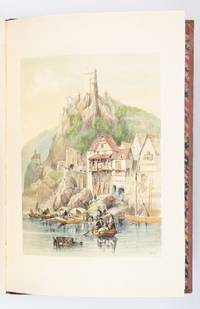
1838ST19413London: Hodgson & Clark 1838. FIRST EDITION. 560 x 380 mm. 22 x 15". 1 p.l. lithograph dedication and table of contents 1 leaf ads. <br/> Apparently unrestored publisher's red quarter morocco over pink watered silk boards flat spine gilt titling on front cover and spine marbled endpapers. WITH 30 VERY FINE SCENIC COLOR LITHOGRAPHS lithograph title and 29 views on 25 plates by T. S. Boys W. Gauci A. Picken and L. Haghe all with original thick tissue guards. Abbey Travel 32; Hardie "English Coloured Books" p. 247. ◆Covers a little soiled and with minor evidence of insect activity corners rather bumped but the original binding without major problems and still surprisingly solid for such a large picture book. Faint stains to free endpapers a few additional trivial defects but VERY FINE INTERNALLY THE PLATES ESPECIALLY CLEAN AND FRESH WITH CONSISTENTLY BRIGHT COLORING.<br/> <br/> Composed of idyllic renderings of views along the great Belgian and German rivers noted in the title the picturesque illustrations in this book are the work of Clarkson Frederick Stanfield 1793-1867 a self-taught artist and close friend of Charles Dickens who began his career as a scenic painter for dramatic productions. In addition to the dramatic landscapes castles and ruins depicted here the artist also paints a picture of daily life in the region by illustrating in great detail the activities of peasants laborers and other common folk who lived and worked in the area. Indeed the stories suggested by the characters' interactions--for example a group of women taking a break from their labors to gossip two lovers stealing a quiet moment on a hillside a solitary old woman selling her meager supply of fresh vegetables on the road--are as enchanting as the landscapes themselves. The theatrical qualities of these plates are perhaps no surprise given the artist's background in stagecraft. Stanfield worked his way up from volunteering for amateur theater productions to a paid position at Drury Lane in London's fashionable Covent Garden district. During his 12-year tenure with that theater as DNB tells us "he achieved a legendary reputation as a creator of romantic landscape scenery. . . . Stanfield's work especially 'taught pit and gallery to admire landscape art and the boxes to become connoisseurs' according to his friend W. M. Thackeray." Even after Stanfield left Drury Lane to focus on his paintings and published works the artist continued to paint scenery for Dickens and even supplied illustrations for some of his works of fiction including the "Christmas Books." DNB notes that upon Stanfield's death Dickens wrote "a moving editorial tribute . . . which described him as 'the soul of frankness generosity and simplicity. The most genial the most affectionate . . . and the most lovable of men.'" Intact copies of the present work are quite scarce in the marketplace. Hodgson & Clark unknown
1838021038London: T. McLean D.& P. Colnaghi and John F. Lewis 1838. 1838. Book. Illus. by John F. Lewis. Near Fine. Hardcover. First Edition. Folio approx. 55 x 36.5cm. Complete with all Lithographic plates as called for; tinted frontispiece tinted title-vignette further 27 tinted views on 25 leaves all by Lewis after Coke Smyth. A very clean bright copy. Finely bound in modern brown morocco to style with gilt lettering to the spine and gilt bands to the top and bottom of the spine. Contents clean and tight new light brown endpapers in keeping with the new binding two blank leaves to the front and rear all pages have been professionally cleaned and restored by a paper conservator minimal and unobtrusive water staining remains to some pages and plates mostly confined to the margins and blank areas most plates unaffected new archival paper guards to all plates no inscriptions. A fine complete copy beautifully rebound. References -. Abbey Travel II 394; Atabey 722; Blackmer 1015; Contominas 413; RIBA 1886. T. McLean, D.& P. Colnaghi and John F. Lewis [1838]. Hardcover
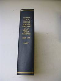
18214388John Murray London 1821. First Edition. Hardcover rebound in cloth. Very Good Condition/No Dust Jacket. 1st Edition SIGNED by the Author Parry and also the Purser of The Helca: Full Title - Journal of a Second Voyage for the Discovery of a North-West Passage from the Atlantic to the Pacific Performed in the Years 1821-22-23 in His Majesty's Ships Fury and Hecla under the Orders of Captain William Edward Parry R. N. F. R. S. and Commander of the Expedition. Rebound marbled page edges xxx 571 pages eratta 4 fold-out charts and 4 numbered fold-out panoramas "Appearances of Lands" bound at rear 31 plates inc. frontis 5 of which are maps. Following this volume the 1821 North Georgia Gazette and Winter Chronicle is bound in. SIGNED by the Author to W H Hooper Purser on the Hecla "Wm H Hooper Esq with the Author's Kind Regards on the title page. This book was later gifted and signed by W H Hooper on the fly leaf "J.P. Welsford Esq with the affectionate Regards of Wm H Hooper" also The North Georgia Gazette and Winter Chronicle is also signed on the title page "S L Hodges - from her friend W H Hooper Purser of the Hecla in - Expedition - now of the -1821" Unfortunately the pages of the gazette have been cut down to fit with the volume and as such part of this signature and inscription is missing. Charts and panoramas poorly folded in the past some foxing age toning wrinkling of pages as to be expected. "Through the long arctic winter Parry did everything possible to keep his crew occupied. There was constant activity plays were acted at the 'Royal Arctic Theatre' and Sabine edited a periodical journal The North Georgia Gazette and Winter Chronicle" . This periodical was afterwards published by John Murray and is bound in with this journal. ON THE FIRST VOYAGE Parry was given command of the Hecla and Griper for his first expedition of 1819. Parry sailed up Baffin Bay and through Lancaster Sound and Barrow Strait to the south side of Melville Island encountering much less heavy ice than anticipated. The expedition over-wintered at Winter Harbour on the south side of Melville Island. Freeze-up delayed Parry until August of 1820 but he was still able to continue west to Dundas Peninsula and south to Banks Island before turning to head home to England. Parry's voyage was to be recognized as one of the most important in the history of Arctic exploration. He proved that Lancaster Sound opened a passage to the west he charted a vast area of the unknown Arctic and proved that it was possible to spend the winter north of the Arctic Circle without being in grave danger. He was also the first to reach 110 degrees west longitude which earned him and his crew a cash reward of £5000. AB 13145. The Journal based on Parry's reports appeared in 1821 after the rights had been bought by the publisher John Murray for the stunning amount of a 1000 guineas. In the same year this second corrected edition was published followed by German Dutch and French translations. ON THE SECOND VOYAGE " Sent by the Admiralty to search for a passage along the west coast of Foxe Basin Parry sailed north of Southampton Island instead of south the route preferred by previous navigators and thus became the first to sail through Frozen Strait and confirmed Middleton's discovery of Repulse Bay. In late Aug. having found no passage through Repulse Bay he explored the coast northward sailing as far as Ross Bay. In Feb. 1822 Eskimos visited the ships' winter quarters on Winter Island and spent much of the winter in the expedition's company enabling Parry and his men to make detailed observations on their customs and language. After leaving their winter quarters they explored farther north equiped with Eskimo maps ESKIMAUX CHART No 1 No 2 & No 3 facing p. 197 198 and 252 and found the entrance to Fury and Hecla Strait. Ice prevented their passing through it but overland journeys confirmed that it led westward to a sea. Parry returned to winter quarters and attempted to sail through Fury and Hecla Strait the following summer. Unsuccessful in this attempt and fearing scurvy he then returned home. Sabin 58864. This is the first UK edition. Quantity Available: 1. Shipped Weight: Under 5 kilogram. Category: Arctic & Antarctic; Exploration. Pictures of this item not already displayed here available upon request. Inventory No: 4388. . This book is extra heavy and may involve extra shipping charges to some countries. John Murray hardcover
18866348127 vol. in-8 cartonnage pleine percaline vert, nom de la "Fondation Thiers" au dos en queue, Ministère de l'Instruction Publique et des Beaux-Arts, Comité des Travaux historiques et scientifiques, Ernest Leroux éditeur, puis Imprimerie Nationale, Année 1886, 382 pp. et 11 planches hors texte (dont cartes ethnographiques en couleurs de la Tunisie), parfois dépliantes ; 1887, 350 pp. et 11 planches hors texte, parfois dépliantes (dont nombreuses illustrant les "Principes de la Fortification antique depuis les temps préhistoriques jusqu'au Croisades", par le Lieutenant-Colonel G. de La Noë) ; 1888, 448 pp. 9 planches hors texte, parfois dépliantes (dont Oppidum du Mont-Beuvray par Bulliot, Densité de la Population dans le SE de la France, en couleurs, par Victor Turquan, Péninsule Malaise en couleurs, etc.) ; 1889, 334 pp. et 9 planches hors texte, souvent dépliantes (dont Embouchure la Loire, Saint-Nazaire, Kairouan, Fortifications romaines, etc...) ; 1890, 487 pp. et 6 planches hors texte, parfois dépliantes (dont Carte de l'Ile Formose au XVIIIe siècle, Carte de la Province de Touraine en 1766 par Chauvigné, Carte en couleurs du Tonkin, avec "Pays Montagneux inexploré occupé par les Pirates", "Carte du Pays des Mans-Tiens" par le Lieutenant Massy, Itinéraire de Catat et Maistre à Madagascar, etc...) ; 1891, 526 pp. et 12 planches hors texte, parfois dépliantes (dont "Le Darvaz et le Karatéguine", Carte des connaissances géographiques des Portugais en Indonésie vers 1519, Carte en couleurs du Véron (Touraine) avant 1789 par Chauvigné, Cartes anthropologiques en couleurs de la Khoumirie, etc...) ; 1892, 441 pp. et 7 planches hors texte, parfois dépliantes (dont Carte du Territoire de Hami, Extraite du K'in-ting Sin-Kiang tche-lio (Livre III), Carte de la Région du Thé d'après les itinéraires de la Mission Pavie, etc...) ; 1893, 449 pp. et 14 planches hors texte, parfois dépliantes (dont Nho-Quanphanphudo Région de Hoa-Lu dressée par G. Dumoutier, etc.) ; 1894, 464 pp. et 6 planches hors texte, parfois dépliantes (dont Detailed hydrographic and topographic Chart of the Itasca State Park by Browser, Itinéraires en Mongolie orientale par Bretschneider, Carte de la Brenne avant 1789 par Chauvigné, Copie d'une carte manuscrite de la Guiane dresée par les Jésuites en 1741 communiquée par M. Buache en 1787, Esquisse inédite de la Guyane par M. Buache, etc.) ; 1895, 499 pp. et 12 planches hors texte, parfois dépliantes (dont Itinéraire de Fes à Oudjda suive an 1891 par H. de La Martinière, Carte chinoise du Si-Yu ou Asie Centrale pour accompagner le Mémoire intitulé Récit officiel de la Conquête du Turkestan par les Chinois 1758-1760, Carte de Pho-Hien, Plan de la Forêt d'Arties au XVe siècle, etc...) ; 1896, 415 pp. et 25 planches hors texte, parfois dépliantes (dont fac-similé complet d'un Portulan annamite du XVe siècle par G. Dumoutier, en 24 cartes) ; 1897, 519-11 pp. et 8 planches hors texte, parfois dépliantes (dont Ile de Cayenne et ses environs d'après Bellin, Mappemonde Syriaque, Somal Harrar et Pays Gallas par Alfred Bardey, Carte du Territoire russe administré par la Chine, Itinéraire dans le Quang-Binh au Nord de Dong-Hoï, etc....) ; 1898, 420 pp. et 6 planches hors texte, parfois dépliantes (dont Carcasses flottantes de 1866 à 1893, Itinéraire dans le Quang-Binh au Nord de Dong-Hoï, Itinéraire dans le Quang-Tri, etc...) ; 1899, 505 pp. et 1 grande carte dépliante (El-Yemen et Partie de l'Hadramaut Arabie Méridionale dressés par Alfred Bardey...) ; 1900, 369 pp. et 2 planches dépliantes ; 1901, 423 pp. et planches dans le texte ; 1902, 423 pp. et planches dans le texte ; 1903, 539 pp. et 5 planches hors texte, dont une dépliante ; 1904, 491 pp. et 5 planches hors texte dont une dépliante ; 1905, 496 pp. et 6 planches hors texte, parfois dépliantes ou doubles (dont Schéma des Principales Migrations au Congo Français, etc...) ; 1906, 432 pp. et 3 planches hors texte (dont Distribution géographique des Races sur la Côte occidentale d'Afrique, de la Gambie à la Mellacorée) ; 1907, 497 pp. avec 1 planche dans le texte et 4 planches hors texte, parfois dépliantes ; 1908, 452 pp. avec 3 cartes sur une planche dépliante ; 1909, 420 pp. et 23 planches hors texte (dont reproduction d'un "Atlas inconnu de la dernière expédition de Drake, vues prises de son bord) ; 1910, 446 pp. et 3 planches hors texte ; 1911, 462 pp. avec 6 planches hors texte (dont mappemonde de Ripoll) ; 1912, 520 pp. avec 4 et 22 planches hors texte
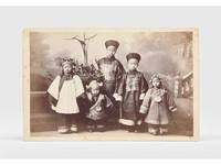
1885179195New York: G. W. Pach & Brothers c.1885. A landmark moment in the history of teaching Chinese A rare photograph of the first instructor of Chinese at Harvard a well-known example of travel against the west-to-east grain. Ko brought with him from China the books that would form the basis of the Harvard-Yenching library. We can trace only a handful of these cabinet cards in commerce. In the late 1870s Harvard decided to offer Chinese classes to prepare undergraduates for lucrative but demanding careers in the Chinese customs service. After the university raised $8750 to finance a lectureship Harvard graduates in China including Edward Drew and H. B. Morse searched for a suitable candidate settling on Drew's former Chinese tutor from Ningbo. Ko 1838-1882 also romanized as Ge Kunhua arrived at Harvard in September 1879 taking as his first student George Lane Pope Professor of Latin in return for Lane teaching him English. "The few remaining photographs of Ko reveal a dignified middle-aged man in the long high-necked heavy garments of a scholar-official of the Qing dynasty" Harvard Magazine. Ko remained in Cambridge until his sudden death from pneumonia in 1882 following which Harvard paid for his family's return to China. His appointment was far ahead of its time: the university did not restore Chinese to the curriculum for another four decades. Ko was accompanied to the US by his six children five of whom are shown in the second cabinet card although only the names of the sons Ge Zhong and Ge Shu are known. Drew helped pay for the pair's education following their father's death. The Pach brothers established their first studio in New York in the 1860s. Between 1877 and 1890 they traded from 841 Broadway. Both cabinet cards give this main address and the Pach satellite locations including Cambridge and New Haven. In 1895 a fire destroyed the firm's entire stock of negatives. 2 albumen prints c.150 x 100 mm and inverse on card mounts 163 x 106 mm verso with yellow surface-paper printed with Pach mark. Light foxing to images image of children slightly faded: very good. "Ko K'un-hua: Brief life of Harvard's first Chinese instructor: 1838-1882" Harvard Magazine 2008; Ye Tian "From Greek/Latin to Chinese" in Deborah L. Morowski & Lynn M. Burlbaw eds Reflections on People Policy and Practices in Curriculum History 2024. unknown
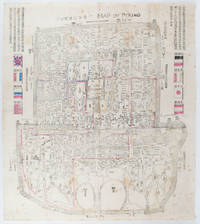
1900169765Circa1900. Large illustrated map of Beijing showing the city in the period following the invasion of the military forces of the Eight National Alliance old folds scale not given. Some scattered light foxing particularly at edges short closed tear at fold lower edge neat non acidic tape repair short section upper edge wear along folds and a couple of small unobtrusive holes with minor image loss. Blocks of text in traditional Chinese right and left upper sections stating each nation's occupied zone Japanese text title accompanies the English title along the upper section of the map. 63.7 x 56.9cm. Very good overall. A rare and significant large Japanese woodblock map of Peking Beijing issued just after the suppression of the Boxer Rebellion. Centred on the Forbidden City the map depicts Peking following the multinational suppression of the Boxer Rebellion or Yihetuan Movement of 1900. The map was issued to illustrate the areas of occupation associated with each of the powers in the Eight Nation Alliance. <br> <br>The map gives measurements of the city walls detailed names of streets and buildings and the boundaries of the inner and outer city including the forbidden city are shown with demarcation lines in pink yellow and blue. The hand coloured eight national flags of the occupation powers are featured at the right and left. <br> <br>This map is essentially a later edition of 京城内外首善全圖 a map of Beijing issued by the Qing for administrative purposes in the mid-19th century. The Japanese seized the wood blocks during the suppression of the Rebellion and subsequently pulled new impressions overprinting them additional details including flags and demarcations of areas of the city held by members of the Alliance. Versions are known in French German Japanese and as with the present example English. An attractive map of great historical interest. . unknown
182689870Jean-Jacques LEFÈVRE | Paris 1826-1831 | 13.3 x 22.3 cm | 21 volumes reliés
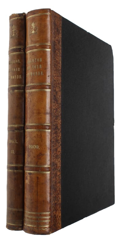
186053639Paris, L. Hachette et Cie, 1860-1914. 4to. Bound in 88 uniform contemporary half calf bindings with 5 raised bands (except for two volumes in half cloth). (Each year up to 1894 in 2 parts, 1895-1914 each year in one volume). Some top of spines with wear, some traces of use, otherwise a fine set. Profusely illustrated with large wood-cuts (full-page, half-page and smaller) and maps.
1820STLD0065London, Ackermann 1820. Fol., XOV, 178 S., mit 24 altkolor. Aquatintaradierungen nach Aquarellen von Christian Georg SCHÜTZ d. J., gestochen v. T. Sutherland u. D. Havell sowie zweifach gefalt., grenzkolor. Kupferstich-Karte, zeitgenöss. Lederbd. m. Rückenvergldg. u. Blindpräg., goldgepr. Bordüre sowie Kantenvergoldg., dreiseitig marmor. Schnitt, Ecken u. Kanten berieben, vord. Außengelenk eingerissen, der Buchblock vollkommen stabil, Papier wie stets leicht gebr., unser Expl. nur vereinzelt an den Rändern stockfleckig. Abbey, Travel 217; Graesse III, 59; Thieme/Becker 30/31. Erste englische Ausgabe, zugleich erste illustrierte Ausgabe des 1819 in Wiesbaden erschienenen Werkes. Die prachtvollen Aquatintas mit romantischen Rheinansichten für Reisende aus dem englischen Hochadel schmücken "das wohl berühmteste Prachtwerk der beginnenden Rheinromantik" (vgl. Schmitt, Die illustr. Rhein-Beschreibungen). Die Tafeln zeigen Mainz, Biberich, Johannesberg, Bingen, Boppard, Braubach, Fürstenberg, Bacharach, Oberwesel, Koblenz, Liebenstein, Hammerstein, Köln, u. a. - Christian Georg Schütz d. J. (1758-1823), Neffe des berühmten Malers Christian Georg Schütz d. Ä. Anfangs orientierte er sich nach dem Vorbild seines Onkels an der idealisierten Rheinlandschaft, entwickelte seinen Stil aber weiter zur Darstellung der romantischen Landschaft des 19. Jahrhunderts. Berühmt wurde er als Maler, Radierer und Zeichner von Landschaftsmotiven und Stadtansichten. Er hatte großen Einfluss auf die Anfang des 19. Jahrhunderts stark anwachsende, englische illustrierte Reiseliteratur. Viele seiner Arbeiten wurden in illustrierten Reisebeschreibungen abgebildet. Er selbst bereiste den Rhein mehrmals, 1818-1819 enstanden im Auftrag des Diplomaten u. Verlegers Johann Isaak Frhr. v. Gerning (1767-1837) die 24 Aquarelle als Illustrationsvorlagen zu dessen Rheinwerk.
182251185London, Printed for John Hearne by J.F. Dove, 1822. Folio. (41 x 33 cm.). Fine later hmorocco, raised bands, gilt spine, titlelabels with gilt lettering. (4),36 pp. and 36 fine handcoloured aquatint-plates. Broad-margined. Very light browning to a few leaves. A few insignificant marginal brownspots. A fine copy.
183819490London: Henry Colburn Publisher. Near Fine. 1838. First Edition. Hardcover. Bound in very attractive decorated leather. Gilt devices etc. Light rubbing to the edges and spine ends. Nice inscription on the fep dated 1851. The binding appears to be contemporary. All the gilt on the spine is nice bright and fresh. ; 8vo 8" - 9" tall; 436443 pages . Henry Colburn, Publisher hardcover
183688741Charpentier | Paris 1836 | 13.2 x 21 cm | 4volumes reliés
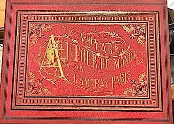
188315515Noblet Paris 1883 1 vol. Grand in-4 oblong (27 x 36,5 cm) de 2 ff.n.ch. 8 pp., 25 feuillets non chiffrés sous serpentes. Pleine percaline rouge de l'époque, dos lisse avec titre doré, premier plat orné d'un décor doré, gardes moirées, tranches dorées (reliure éditeur).