39 475 résultats
Suite of 13 (out of 16) large copper-engraved plates (each measuring 505 x 864 mm approx.), laid down on slightly larger sheets with painted brown borders, with a printed poem in Chinese within each plate (based on Qianlong Emperor’s own personal commentary on the battles). Later morocco-backed and cornered marbled boards, cloth ties. Chinese issue, following the Paris printing of 1755-59. The “Battle Copper Prints” are a series of prints from copper engravings dating from the second half of the 18th century. They were commissioned by the Qianlong Emperor of the Qing dynasty, who ruled from 1735 to 1796. They depict his 1772-76 military campaigns, led by General A-Kuei, against the Jinchuan tribes in China’s inner provinces and along the country’s frontiers in the ethnically Tibetan mountain regions of Szechuan. The master illustrations for the engravings were large paintings executed by European missionary artists employed at that time at the court in Beijing. They included the Jesuits Giuseppe Castiglione (1688-1766), Jean-Denis Attiret (1702-68), and Ignaz Sichelbarth (1708-80), as well as the Augustinian missionary Giovanni Damasceno Sallusti (d. 1781). The engravings of the first set of 16 paintings were not produced in China but in Paris, at that time home to the best European artisans working in this technique. The Emperor even decreed that the work must emulate the style of the Augsburg engraver Georg Philipp Rugendas (1666-1742), whose work he knew. Small-scale copies of the paintings by Castiglione and his Beijing colleagues were sent to Paris to be transferred onto copperplates, printed, and then sent back to China, along with the plates and prints. Later sets of engravings were executed in Beijing by Chinese apprentices of the Jesuits and differ markedly in style and elaborateness from those of the Paris series. - In the history of Chinese art, copper-print engraving remained an episode. Qianlong's "Battle Copper Prints" were just one of the means the Manchu emperor employed to document his campaigns of military expansion and suppression of regional unrest. They served to glorify his rule and to exert ideological control over Chinese historiography. Seen in their political context, they represent a distinct and exceptional pictorial genre and are telling examples of the self-dramatization of imperial state power. Later campaigns of Qianlong which were similarly commemorated include Taiwan (1786-88), Annam or Vietnam (1788), Gurkhas invasion of Tiber (1790), and Yunnan, Guizhou and Hunan (1795-1796). - The striking plates comprising this set appear to be examples of the Chinese versions printed later, with Chinese text within the plates and technical and stylistic differences which differ greatly from the earlier Paris "westernized" versions executed under the supervision of the accomplished Charles-Nicolas Cochin (1715-90). Such a large complement from this suite of sixteen from the Chinese printing is extremely rare: while copies of the earlier Paris printing have appeared on the market (a complete set sold at Christie’s Paris, on 29 Oct. 2012), we have been unable to trace a comparable copy of the Chinese issue. The Getty Research Institute owns a suite depicting one of Qianlong’s last print commissions, produced nearly 30 years after the first series, the "Ping ding Kuoerke zhan tu" ("Pictures of the Campaigns against the Gurkhas"), which likewise stands out as a highly unusual example of Chinese images executed with European graphic techniques. The Getty’s suite is the only complete set in American public collections of this later work. The Taipei Palace Museum has a complete set of this series with the Chinese text apparently of the same issue. - In perfect condition. From the collection of Jean R. Perrette. Shiqu Baoji, Imperial Catalogue. Chuang Chi-fa, Taipei Palace Museum - Ten Military Campaigns of Qianlong Emperor. W. Fuchs, in: Monumenta Serica, 4 (1939-40), p. 122. Paul Pelliot, "Les 'Conquêtes de l'Empereur de la Chine'", in: Toung pao 20 (1921), pp. 183-274. S. L. Shaw, Imperial printing, p. 22. Takata Tokio, "Qianlong Emperor's Copperplate Engravings of the 'Conquest of Western Regions'", in: The Memoirs of the Tokyo Bunko 70 (2012).
3 parts in 2 volumes. Elephant folio (527 x 650 cm). With richly engraved allegorical frontispiece by Jan van Vianen, large engraving of a sailing ship on title, full-page engraved plate of scales, full-page engraved view of an admiral's ship and series of 18 numbered full-page views of ships, 12 full-page plates of flags, double-page engraved chart of the world, and 29 double-page engraved charts of the coasts of Europe; beautiful engraved frontispiece by Romeyn de Hooghe, large engraving of a sailing ship on title and 9 full-page and double-page charts of the coasts of the English Channel, including a splendid large folding chart of the coasts of the Mediterranean with a large number of views and plans of the Mediterranean towns in the borders by Romeyn de Hooghe in the second part; and engraved coat-of-arms of Amsterdam on title, full-page engraved plate of the winds, and 34 mostly double-page engraved charts of the coasts outside Europe, of Africa, Asia, and America in the third part, all engravings, including the vignettes on titles, the plates of scales and the winds, all magnificently coloured and heightened in gold throughout by a strictly contemporary hand. Contemporary richly gilt marbled calf. First edition of the undoubtedly most beautiful and most spectacular sea-atlas of the 17th century, a complete and unusually well-preserved copy with noble provenance: the engravings in publisher’s colour and heightened in gold, bound in decorative publisher’s gilt marbled-leather bindings. "The 'Neptune François' and its second part 'Cartes Marines à l’usage du Roy de la Grande Bretagne' was the most expensive sea-atlas ever published in Amsterdam in the 17th century. Its charts are larger and more lavishly decorated than those of any preceding book of this kind. For the engraving and etching Mortier had recruited the most qualified artists … In 1700, Mortier brought out a third volume with charts of the outer-European waters, of French origin edited by N. P. d’Ablancourt: 'Suite de Neptune François'. Apart from the first volume which had a second edition in 1703, none of the atlases was republished. This magnificent work was intended more as a show-piece than something to be used by the pilots at sea" (Koeman). The second part was engraved by Romeyn de Hooghe, the prolific late Dutch Baroque painter: "This volume is usually bound together with the first part, the 'Neptune François'. It only contains nine large charts, but this small number represents the most spectacular type of maritime cartography ever produced in 17th century Amsterdam" (Koeman). - In addition to the charts called for by the table of contents, part one has a fine world map (Shirley 559). The 3 plates of ships listed at the beginning of the table will be found in part 3, which thus has 19 plates of ships instead of the 18 called for by the table and the 12 (!) mentioned by Koeman. Hardly any browning or foxing; a few light creases to gutters. As usual the copper green colouring in volume one has turned into a brownish hue and caused acidic damage to a few small sections of six maps. From a southern German castle library with small 18th century bookplate pasted to verso of both engraved titles; old shelfmark pencilled to inside of covers. Bindings only slightly worn. Extremely rare: the last comparable copy on the market was the Wardington copy, sold at Sotheby's in 2006 (lot 318), where it commanded £209,600 (also boasting a noble German provenance, colouring and binding like ours). Koeman M. Mor 3, 6 & 8. Cf. Pastoureau, Neptune Ba. Phillips Atlases 517.
Hand-coloured photograph of the Fra Mauro mappamundi, ca. 223 x 223 cm. A life-sized, hand-coloured photograph of the famous world map made around 1450 by Fra Mauro, the greatest medieval map of the world: an astonishing accomplishment of art history, cartography, and photography. In its day one of the largest photos ever made, the "Naya Fra Mauro" belongs to a class of colossal early photographs that includes Eadweard Muybridge's 13-sheet panorama of San Francisco (1878) and George R. Lawrence's photograph of the Alton Limited on an 8 × 4.5-foot glass plate (1899). It also appears to be the first large-format map produced with photography. - Fra Mauro's map is "considered the greatest memorial of medieval cartography" (Almagià). Containing hundreds of detailed illustrations and some 3000 descriptive texts, it was the most detailed representation of the world so far produced. It remains one of the most important works in the history of cartography, marking the end of Bible-based geography in Europe and the new embrace of more scientific methods which placed accuracy ahead of religious or traditional beliefs. Strikingly, it is oriented with south at the top, recalling the Arab tradition and more specifically al-Idrisi's famous 12th century world map, copies of which Fra Mauro may have known: Europe is shown at the bottom, and Africa and Asia dominate the image, with Arabia (not Jerusalem) at the centre. Fra Mauro incorporated "the discoveries of Marco Polo and the Portuguese", also showing "many countries later known, which the learned monk doubtless shaped after ideas gathered from the oral narratives of occasional travellers" (Müller). Much of the map's novel information was lost to early modern cartographers when printed Ptolemy atlases proliferated in the final decades of the 15th century, replacing the manuscript mappamundi tradition. - Today the original Fra Mauro Map, drawn on vellum, is held by the Biblioteca Nazionale Marciana in Venice and shown at the Museo Correr. An impressive manuscript facsimile, now in the British Library, was prepared in 1804 by the British antiquarian William Frazer; a large engraving was made in Paris in 1849, and in 1869 the Venetian bookseller Münster produced the first photographic reproduction, albeit at a much smaller scale, measuring a mere 62 × 68 cm. Carlo Naya's monumental Fra Mauro photograph renders the map in its full original size. Although it is mentioned in a number of books on early Italian photography, it was always extremely rare: the only photographic copies of the map ever to have surfaced in the trade were that of Münster (lot 1581 at the 1884 sale of the library of Henry C. Murphy, U.S. ambassador to the Netherlands under Lincoln) and the more common four-print photofacsimile published in 1879 by Ongania (E. P. Goldschmidt, London 1930: cat. 22, lot 32). By contrast, Naya's magnum opus was never sold except through his own concern. The Royal Geographical Society was presented with a specimen in 1873 (the gift of John Benjamin Heath, once Governor of the Bank of England), and the British Library holds another, as does the Marciana (all uncoloured). A very fragile and faded example, cut into 16 sheets and backed onto modern board, is kept at the National Library of Wales, Aberystwyth. - Carlo Naya (1816-82) was an Italian photographer known for his fine views of Venice. He settled there in 1856, opening a photo studio that catered to Grand Tourists who wished to take home mementoes of the city's spectacular art and architecture. His "mappa mundi" photograph was prepared around 1871 under the supervision of the Venice-based English historical scholar Rawdon Brown (1806-83), a friend of Ruskin's. Naya exhibited his photograph at the 1873 World's Fair in Vienna, winning a medal for it. In the 1880s the Nayas were still advertising the map, the pride of the company, as a "fac-simile of the Planisphere of Fra Mauro A.D. 1459, the largest photograph hitherto made (a square 7 Ft. 4 inch)". It was priced at a stupendous 200 francs. After Naya's death, his studio was continued by his wife, then by her second husband, for three and a half decades. - Provenance: the reverse has ink stamps of the publisher Osvaldo Böhm, who bought most of Naya's archive when the family closed the shop in 1918. Later in the collection of Dr. Edward Luther Stevenson (1858-1944), one of the most important scholars of early cartography active at the end of the 19th and the first half of the 20th century. Stevenson was responsible for numerous carto-bibliographic books, including the first translation of Ptolemy into English, as well as a series of impressive facsimile maps. Stevenson, who viewed reproductions as integral to the study of early cartography, committed himself to building an unparalleled collection of photographs of early maps and globes. Much of his collection was donated to Yale University after his death, but the present item comes from a large corpus of photos, manuscripts, and related material retained by the family. A. Müller, Venice. Her Art-Treasures and Historical Associations. A Guide to the City (Venice 1873), p. 113. I. Zannier, Venice: the Naya Collection (Venice, 1981). P. Becchetti, Fotografi e Fotografia in Italia 1839-1880 (Roma 1978), p. 124. R. Almagià, Monumenta cartographica vaticana, vol. 1 (Città del Vaticano, 1944). P. Falchetta, Storia del Mappamondo di Fra' Mauro (Rimini, 2016).
Lithographed wall map, 260 x 132 cm. 4 conjoined sheets mounted on canvas. Rolled. Original-size facsimile of the manuscript nautical "mappemonde" executed by Pierre Desceliers in 1546, lithographed by the cartographer Eugène Rembielinski (1814-80). - Commissioned by King Francis I for his son (who would be crowned Henry II in 1547), Desceliers' "Dauphin map" or "royal world chart" is one of the most famous of the first half of the 16th century: hand-drawn and illuminated on vellum, it vividly illustrates the discoveries made during the six decades following the discovery of the Cape of Good Hope by Bartolomeu Dias in 1488. It was compiled from information that Desceliers had obtained from the other Dieppe geographers, from the shipowner Jean Ango, and the explorer Jacques Cartier. - Remarkably, the map has a dual orientation: north of the equator, the text and illustrations are reversed, suggesting that the map was in fact meant to be laid flat rather than wall-mounted so that it could be read from all sides. Thus, the vast majority of the earth's land mass, and almost all of the better-known parts of the world, is labelled as if the map were oriented with south at the top, recalling the Arab tradition exemplified by al-Idrisi's famous 12th century map. In charting the Arabian Peninsula and the Gulf specifically, "the cartographers of Dieppe in northern France seem to have had direct access during the 1540s to relatively reliable Portuguese prototypes" (Couto et al., Historical Atlas of the Persian Gulf [Brepols 2006], p. 114), even if they appear to have had difficulty reading all the place names. - To the south of Borneo, Desceliers included not only an island labelled "Java Petite", but also, immediately adjacent, a vast mass of land named "Java la Grande" - an uncannily good representation of the northern coastline of Australia, albeit far north of its true location, which merges into the Great Southern Continent that itself stretches into Antarctica ("Non du tout descouverte"), extending as far as the Strait of Magellan. Probably drawing on Marco Polo as well as Portuguese portolans of various scales, Desceliers' representation "sums up everything cartographers knew about Australia in the mid 16th century" (Tooley, Landmarks of Mapmaking, p. 245). - In the tradition of French Renaissance portolans, the map is remarkable for the wealth of its illustrations. The seas are decorated with compass roses, ships and sea monsters, while the land is adorned with a multitude of scenes and representations of fantastic animals. It is framed in the northern hemisphere by a border decorated with the heads of men with long beards, and cherubim and human skulls in the southern hemisphere, representing the winds and cardinal points. In many parts of the world, Desceliers drew indigenous peoples with great precision, such as the Hottentots in South Africa and the Native Americans of North America. - In the 16th century, it was in Normandy that the most richly illustrated portolans were designed. Pierre Desceliers (1487-1574) is perhaps the most famous representative of the Dieppe school of mapmaking, and he is considered the father of French hydrography and cartography. Only two of his maps have survived. His manuscript world map from 1546 is now kept in the library of John Rylands University in Manchester (French MS 1*). The facsimile lithographed by Rembielinski in 1852 is rare: we have only found two copies in public collections, one at the BnF, the other at the National Library of Australia. - Uniformly browned throughout; several old gaps and breaks professionally repaired. OCLC 494994160. C. Hofmann et al. (eds.), L'Âge d'or des cartes marines. Exhibition catalogue of the Bibliothèque nationale de France (Paris, 2012), pp. 166f.
17875001042London: Alexander Shaw 1787. Quarto eight pages printed text followed by original blank leaves separating the 36 actual cloth specimens several full page as well as many smaller; original calf binding neatly lettered and decorated spine. <p><p>This rare and exotic publication of original Pacific artefacts is the most remarkable of the whole Cook canon: with a brief but significant letterpress introduction it mainly consists of actual specimens of eighteenth-century tapa cloth collected in the Pacific islands particularly Hawaii Tahiti and Tonga. </p> <p>In modern times the publication has become one of the great rarities of eighteenth-century Pacific exploration. This is an example of the first issue of the book with the strictly contemporary bookplate of Sir Corbet D'Avenant 1752-1823 Baronet of Stoke and Adderley. Donald Kerrr speculates in his census that D'Avenant was likely an original subscriber on first publication. </p> <p>Published only a few years after the return of the ships from Cook's third voyage it is not recorded how many of the cloth-books were prepared and up until the recent detective work of Erica Ryan at the NLA very little was known about the publisher Alexander Shaw either. However the limited supplies of the actual cloth must have dictated a very small edition - the most recent census of known copies by Donald Kerr stood at the tiny figure of 66 recently revised by us to 68 of which 57 were held by international libraries. This count of course includes the later issues of the book which continued to be sold often with dramatically varying contents as late as 1806. </p> <p>There has in effect never been a standard collation of the book - the fascinating dedication addressed to an unnamed "Sir" is genuinely vague on numbers - not least because it is obvious that Shaw was simultaneously selling individual samples and "fine specimens of the tree with the bark" at his shop in the Strand. </p> <p>Indeed as Forbes shows in some detail in the Hawaiian National Biography and others including Ian Morrison Maryanne Larkin Erica Ryan and Donald Kerr have all confirmed in more detail no two copies of the work are identical meaning that a precise collation is needed every time. Thus while 39 different samples are listed in Shaw's introductory list and "40" are mentioned at another point in the dedication many copies have quite different collations not least because the Jamaican sample perhaps the most surprising addition was apparently dropped in the course of publication. </p> <p>In short the present example has a total of 36 separate samples including particularly fine full-page examples of many of the more famous sheets. Almost none of the sheets have been particularly affected by the late-Georgian and Victorian practice of clipping: it is well-known that many collectors constructed what have become known as 'snippet books' of the Cook tapa cloths by cutting pieces from copies of Shaw's volume and pasting them into separate books or albums. </p> <p>As a result of this clipping habit copies of the original Shaw book survive in various states of completeness sometimes with only very small fragments of the once full-page specimens remaining. In this copy with its original blank leaves in place it is quite clear that the specimens have essentially retained their original shape with only four or perhaps five showing evidence of very minor clipping as can be shown from the ancient offsetting onto the adjoining blanks. </p> <p>The production of this book reflects the genuine curiosity aroused by tapa a fascination that drove competition between collectors of 'artificial curiosities' and generated an active market for the sheets brought home by Cook's men. The preface of the book contains descriptions of bark cloth manufacture by Cook Anderson Forster and an anonymous officer titled 'one of the navigators' and is followed by the list of the specimens compiled by Shaw. The list is indeed rich in fascinating details; for example we learn that the various uses of the tapa: 'wore sic by the people in the rainy season' or 'used at the human sacrifice'. Some of the notes in the list are longer and doubtless arise from tales told by the mariners who collected the tapa in the first place as boasted on the title page. </p> <p>Each island group used designs unique to its culture and the interest of Europeans in this material equalled the passion aroused by the extraordinary wood-carvings and exotic shells brought back by Cook. </p> <p>The Shaw Catalogue is of great significance as a repository of unique original tapa but it also speaks of the time when Cook's sailors were spreading their stories of the alluring South Seas while drawing-room chatter throughout the land luxuriated in descriptions of the new exotic. The publication forms a tangible link between these narratives the indigenous cultures of the South Pacific and Hawaiian islands the myriad personal and trading relationships that developed between the islanders and mariners and the genteel world of gentleman collectors and their cabinets of curiosities.</p> </p> . Provenance: Norton J. Whitmont collection; Kelton Foundation Los Angeles; original owner Sir Corbet D'Avenant 1752-1823 Baronet of Stoke and Adderley with armorial bookplate. Corbet d'Avenant was the son of Anne Corbet daughter of Sir Robert Corbet c.1670-1740 4th Bt of Stoke upon Tern. Upon the death of Anne's brother rector of Adderley from 1735 Sir Henry Corbet the seventh baronet on 7 May 1750 the baronetcy became extinct and the family estates passed to his nephew Corbet D'Avenant who assumed the name of Corbet and was created a baronet on 27 June 1786. Upon his death on 31 March 1823 the second baronetcy also became extinct. Alexander Shaw unknown
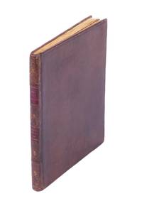
Folio. Bound in 9 uniform magnificent late 19th century full green morocco bindings with gilt centrepieces, gilt lines to edges of boards and gilt line-frames to inside of boards. All edges gilt and all volumes signed W. Pratt. A lovely set, exquisitely and uniformly bound, magnificently restored in the most gentle and respectful of manners, of the entire original run of De Bry's "Great American Voyages" (supplied by extra variant copies of volumes IV and VIII), the magnificent work that is responsible for shaping the European image of the New World, inventing it in the minds of the masses. Presenting a broad view of European conquests in America and the first contact with the American Indians, De Bry's Great American Voyages represents the first attempt to introduce in Europe - and on a large scale - a pictorial image of the New World as a whole. With it, the first iconography of the American Indian had been created, and most Europeans glimpsed for the first time the wonders of the New World in the illustrations present here. For more than a century, the European view of the New World was dominated by the present work. Theodor de Bry himself published the first six parts (in German and Latin simultaneously), and after his death, his widow and his two sons issued the three following parts. "It appears that they intended to stop there" (Sabin III, 20). However, 17 years later, Johann Theodor decided to publish another three volumes (1619-24). These are not present here. The present set is a mix of the German and Latin volumes (which appeared simultaneously), and as always in a mix of editions and issues. Due to the great scarcity as well as the complex bibliographical nature of "The Great American Voyages", no sets of this great work are said to be alike. They are always made up of different languages, editions, and issues, and there is said to be no such thing as a "complete set". Copies of sets are almost always in very poor condition. - With the book plate of John Jay Paul (dated 1913 and 1914) to each volume, and each volume with a tipped-in manuscript note describing issue points and/or the main restoration work (one dated 1919). - Gentle washing, pressing, and a few restorations; some maps neatly mounted, 2 maps supplied in facsimile (being the map in both copies of vol. VIII, which is not always present and thus technically not lacking), and a few leaves supposedly supplied from other copies. Occasional slight cropping. All in all a very handsome and well preserved copy.
Printed on vellum (ca. 80 x 98 cm) from one large copperplate engraving, partly coloured by a contemporary hand. The "West-Indische Paskaert" engraved by Pieter Goos, in its rare first state, a nautical chart prepared for the Dutch West India Company (WIC) as an aid to crossing the Atlantic Ocean to the trading regions of the Americas and visiting trading posts in Africa. It shows parts of the east coast of North America, both coasts of South America, Mediterranean Europe and the west coast of Africa. Many "West-Indische Paskaerten", as these navigational charts were called, were reprinted over and over from new states of the copperplates. For more than a century Dutch and foreign seafarers profited from their use on transatlantic journeys. The great cartographer Willem Jansz. Blaeu (1571-1638) published the first "West-Indische Paskaert" around 1630 using manuscript charts and other documents of the Atlantic and its coasts, including information provided by the Dutch WIC navigators who sailed these routes. Being one of the first practical uses of the Mercator projection, Blaeu's small-scale nautical chart was the first useful chart for crossing the Atlantic Ocean, making it easier to plot a straight line course for long distances on one map. Around 1660 Pieter Goos engraved four large navigation charts on new copperplates, including the plate for his present "West-Indische Paskaert". The present copy shows the plate in its first state, the only copperplate that Goos actually engraved himself. - Pieter Goos (ca. 1616-75) was a Dutch cartographer, engraver and printer and publisher of maps and atlases, whose father Abraham Goos (ca. 1590-1643) published many globes and maps together with Jodocus Hondius and Johannes Janssonius. He was especially known for his sea charts and his "Zee-atlas ofte water-wereld" (first edition 1666), one of the best maritime atlases of its time. Goos's "West-Indische Paskaert" in its present first state is of the utmost rarity: 8 other copies are known, of which only 4 on vellum. - The "West-Indische Paskaert" remained one of the Dutch West India Company's most important nautical charts for decades, with several important map printers and publishers producing editions from various plates that went through numerous states. The present nautical chart therefore not only bears beautiful witness to the golden age of Dutch maritime history, exploration and cartography; it is also a very rare vellum copy showing the first state of the copperplate engraved by Goos himself. The map has been professionally restored, with the tears along the edges repaired and the brittle parts reinforced with Japanese paper, and the map is mounted on museum-quality preservation corrugated board which in turn is mounted on museum-quality honeycomb board. Somewhat faded, with a water stain in the left part, some smaller stains, the foot a little frayed (hardly affecting the map) and a little dust-soiled, but overall in good condition. Burden II, 442 (misdated ca. 1674); Schilder & Kok, Goos 4.1 (8 copies, incl. 2 on paper, 1 missing, 1 incomplete); cf Schilder, Monumenta, 63 (other states), 63.4 (the 1675 Blaeu-Goos state); for the use of nautical charts: Koeman, "17e eeuwse Hollandse bijdragen in de kartering van de Amerikaanse kusten", in: Caert thresoor 1 (1982), pp. 50-51; Schilder & Van Egmond, "Maritime cartography in the Low Countries during the Renaissance", in: The history of cartography, volume 3: cartography in the European Renaissance (2007), pp. 1425-1426.
A total of 1,618 topographic maps, colour printed, ca. 45 x 51.5 cm. Constant ratio linear horizontal scale. In Russian (Cyrillic). The Soviet Union's 1:200,000 General Staff map quadrangles showing China: from the Russian series of maps produced during the Cold War, based on high-quality satellite imagery, but usually also ground reconnaissance. While there are a few lacunae in the north and south, western and central China as well as the east coast including Taiwan are well-covered, ranging as far as Vladivostok. Assembled continuously, the quadrangles would form an enormous map spanning roughly 27 x 34 metres!. - Products of a massive, clandestine cartographic project begun under Stalin and ultimately encompassing the entire globe, the Soviet General Staff maps are today noted for their extreme precision. Indeed, even in post-Soviet times they provide the most reliable mapping for many remoter parts of the world: "Soviet-era military maps were so good that when the United States first invaded Afghanistan in late 2001, American pilots relied on old Russian maps of Afghanistan. For almost a month after the United States began a bombing campaign to help oust the Taliban government, American pilots were guided by Russian maps dating back to the Soviet occupation of Afghanistan in the 1980s" (Davies/Kent, p. xi). - Although the details of the cartographic programme evolved over the decades, its overall system and plan remained remarkably constant. "The basic quadrangle is the 1:1,000,000 sheet spanning 4° latitude by 6° longitude [...] Each 1:1,000,000 sheet is [...] subdivided into 36 1:200,000 sheets in a six-by-six grid [... They] normally contain on the reverse side a detailed written description of the districts (towns, communications, topography, geology, hydrology, vegetation, and climate) together with a geological sketch map" (ibid., p. 19-21). "Printing such large-format plans in so many colors with near-perfect print registration itself testifies to the skill of the printers in the military map printing factories across the former Soviet Union. The quality of printing reflects the level of training and the reliability of humidity-control equipment and the electricity supply at the time" (ibid., p. 6f.). - Somewhat curled at the sides, including the odd edge flaw, but altogether very well preserved. Cf. J. Davies / A. J. Kent, The Red Atlas (Chicago/London, 2017).
Imperial folio (365 x 550 mm). (6), 96 pp. Letterpress title-page printed in red and black with engraved vignette; Renard's dedication leaf to King George I has engraved headpiece and initial. With additional engraved title-page in original hand colour, engraved portrait frontispiece of George I, and 28 (1 folding) double-page-sized, numbered maps in original hand colour, as well as 4 folding plates on fortification (mounted as 2). Contemporary mottled full calf on 8 raised bands with giltstamped spine label to prettily gilt spine (showing small armillary spheres in the panels); leading edges gilt. Edges sprinkled red and green. Rare first Renard edition: a splendid example of the publisher's best work. The exceedingly pretty maritime maps are adapted from de Wit's plates, which in their turn had been derived from those of Van Keulen, and must have been fairly obsolete by the time Renard republished them, even with the alterations he carried out. Renard also replaced de Wit's name in the cartouches by his own. - Contents: two-hemisphere world map, supersized maps of Europe (printed from two plates, showing a bear hunt), map of the poles, maritime maps of Novaya Zemlya (with a polar bear hunt), Finland and Lapland, Norway (drying stockfish), the Baltic Sea (with beehives), Denmark and Frisia, the North Seath with Great Britain, the English Channel between Kent and Flanders, the Channel with the Thames estuary (showing a commercial mill), Biscaya (with a naval battle), the Iberian Peninsula, the Mediterranean in two partial maps, the Black Sea and Crimea, the coasts of Africa in 3 maps (with Neptune), the Indian Ocean in two partial maps, the Pacific (with a portrait of Magellan above Neptune's chariot), Central America (hunting crocodiles), Tierra del Fuego, Brazil, the Atlantic with Newfoundland and parts of the coasts of North and South America, the Caribbean, Labrador, and Hudson Bay. At the end are the four uncoloured instructional plates on fortification, assembled as two folding plates (each measuring ca. 70 x 100 cm). - All maps in excellent impressions with the publisher's original hand colour and emphasized coastlines. The cartouches were not coloured, leaving the fine engraved illustrations unimpaired by coating paint. - A wide-margined atlas with the maps numbered in the lower right corner by a contemporary hand throughout. Text and maps clean and nearly spotless; a few repaired paper defects in the text. A small stamp has been erased from the verso of the engraved title; a small rebacked hole in the letterpress title-page. Some tears to the folds professionally repaired, including a larger broken area in the the folding map of Europe, near the Iberian Peninsula, caused by the green paint. The massive binding is somewhat rubbed along hinges and extremeties; minimal chafing to covers, but in all very appealingly preserved. Koeman IV, Ren 1.
Large folio (ca. 460 x 645 mm). 2 vols. (2), IV, 50 pp. (2), 51-100 pp. Chromolithographed dedication heightened with gold and 50 chromolithographed plates after Simpson mounted on thin card. Contemporary half morocco with gilt rules. All edges gilt. A fine set of Simpson's views of India, monumental even in the reduced form in which the financial circumstances of the times forced the publisher to recast the work, originally planned to comprise five times the present scope. - Famed for his pictures of the Crimean war theatre, Simpson was commissioned to illustrate a work on India that was to rival David Roberts's "Holy Land". He arrived in Calcutta in 1859 and joined the party of the Governor-General, Lord Canning, on a tour of the area where the mutiny had taken place. Over three years he visited much of the subcontinent, including the Himalayas, Kashmir, Ceylon, Tibet and its Buddhist temples, and upon his return submitted 250 watercolours to his publishers. However, in the wake of the Panic of 1866, the wealthy English patrons and subscribers on whom Day & Son had banked shrunk away from so costly an undertaking, and the publisher - already under pressure since cheaper wood engravings had turned chromolithographs into a luxury - issued a series of merely 50 chromolithographed plates. Simpson's original watercolours, much to the artist's chagrin, were ultimately sold off as bankrupt stock. The work remains a magnificent achievement, presenting a detailed and wide-ranging representation of India immediately after the Sepoy Rebellion. - Light spotting to tissue guards; some plates lightly soiled in the margins with very occasional fraying to edges. Bindings professionally repaired and sympathetically rebacked with the original spine laid back. Removed from the Library of the Birmingham Assay Office, one of the four assay offices in the United Kingdom, with their inconspicuous library stamp to the flyleaves. Very rare: we have traced only three other copies of this work at auction in nearly 50 years. Cf. Pheroza Godrej & P. Rohatgi, Scenic Splendours: India Through the Printed Image (London 1989), pp. 98f.
LCS-17282"The scarcest and most valuable of the large atlas folios of South African illustration... a most magnificent work." (Mendelssohn). S.l.n.d. [London, 1804-06]. 2 tomes réunis en 1 volume in-folio de : I/ 1 titre frontispice, (5) ff. de texte et 15 planches en couleurs à pleine page ; II/ 1 frontispice, (5) ff. de texte et 15 planches en couleurs à pleine page. Soit au total, 2 titres à pleine page à l’aquatinte et 30 planches en couleur à pleine page. Planches 1 et 29 légèrement piquées. Demi-maroquin vert à coins, dos à nerfs orné de filets et fleurons dorés, tranches dorées. Qq. frottements, dos refait au XIXe siècle. Reliure de l‘époque.
Folio (220 x 330 cm). 3 works in 1 volume. (6), 428, 349, (16); (1), 121, (4) pp. Title-page printed in red and black. With a richly engraved allegorical frontispiece representing Africa, a large folding engraved map of Africa (445 x 560 cm), 14 double-page engraved maps of parts of Africa and the adjacent islands, 27 double-page and 1 larger folding engraved plates and views, and 55 half-page engraved views, plans, illustrations of costumes, animals, plants, etc. in the text. All illustrations hand-coloured by a contemporary hand. Contemporary vellum at a later date with elaborate blind-tooled decorations, including oriental portraits. With 2 decorated brass clasps, signed B-I. First impression of the second, much enlarged Dutch edition of Dapper's famous description of Africa. Olfert Dapper (1636-89) was celebrated by his contemporaries for his descriptions of faraway lands. He began his writing career with a description of Amsterdam, where he spent his whole life. His description of the entire continent of Africa and its islands was first published in 1668, which was still early in his career. It is now accepted as his best work and was translated into German and English in 1670, and into French in 1686. The present second edition was thoroughly revised. - Dapper's attention was drawn mainly to the Islamic North of Africa, and he gives extensive descriptions of the area between Morocco and Egypt (with a magnificent illustration of pyramids) and the Ethiopian Empire (Abyssinia). He maps the whole of Africa, Egypt and Ethiopia including the Arabian Peninsula as far as the Gulf and the Red Sea. He includes an impressive double-page plate with a view of a Hajj caravan from Cairo to Mecca. - Of special interest are the book's abundant, exact and finely executed illustrations - especially as they are here coloured by a contemporary hand, a highly unusual feature for this work. The illustrations include engraved maps of the states, provinces, and towns, engraved plates and a large number of engravings in the text representing the residents, the lesser-known plants and animals. - Dapper's interdisciplinary approach was innovative. He compiled his description of Africa from various sources, including unpublished Dutch reports and eye-witness accounts, most of them now lost or scarce, which lends this early work on Africa an enduring historical value. - Faded manuscript title on spine. Covers and spine slightly rubbed, clasps reattached, new ties. Otherwise in very good condition. Cox I, 361. Gay, L'Afrique, 219. Mendelssohn I, 413f. Tiele 298.
Large folio (500 x 560 mm). Book 1: (4), 30 pp., with engraved vignette of navigational instrument on printed title-page; double-page-sized engraved plate (facsimile of the Patent), 28 engraved plates including 24 volvelles: 21 with 29 moveable parts and 3 with strings. Book 2: 24 pp., 9 engraved plates with 6 volvelles (and 9 moveable parts), lacking the 15 engraved maps. Book 3: 25, (1) pp., 6 engraved plates. Book 4: 12 pp, 14 engraved plates (7 of which are double-page-sized). Book 5: 26 pp., 89 engraved plates, 36 with volvelles (with 61 moveable parts, another loose, and 5 strings), 4 double-page-sized. Without Book 6 (containing the Sea Charts). In all, 146 engraved plates, of which 66 show one or more volvelles, with 100 moveable parts. Full contemporary calf, ornate gilt spine with original red calf gilt title label. Includes Dudley's maritime map of the Indian Ocean, with the east of the Arabian Peninsula. Second (and arguably best) edition of Dudley’s landmark work on shipbuilding, nautical and astronomical instruments and navigation, all profusely illustrated with engravings. Book 1 deals with longitude; book 2 covers the errors which can be made when drawing sea-charts; book 3 deals with military and naval manoeuvres and exercise; book 4 describes the method of designing and building ships, on which this present work is the first scientific publication; book 5 is devoted to the art of navigation. Book 6, which is not present here, contains the sea atlas. The "Arcano del Mare (secrets of the sea) ... is an encyclopedia of everything connected with the sea from shipbuilding to navigation to cartography. This volume contains the text and volvelles for the sections devoted to navigation. It has been said that this volume is to the history of precision instruments of the seventeenth century what Peter Apian’s Astronomicum Caesareum was to the sixteenth" (Tomash & Williams). - The engraver employed for the immense task was Antonio Francesco Lucini, born in Florence in 1605. Lucini states in this second edition of 1661 that he worked for twelve years in a small Tuscan village, using 5,000 pounds of copper to make the plates. They represent the finest of Italian capabilities, the clarity of the engraving presenting an uncluttered image. Even the florid italic calligraphy, while fulfilling a purpose, is of the highest standard. - This is an example of the first volume only, containing books 1-5 of 6 but lacking the 15 general maps. The Library of Congress possesses a similar volume, and Phillips describes in detail the differing collations of Books 1-5. "The remainder of the work consists of writings to explain navigation, latitude and longitude, winds, tides, military and naval warfare, naval architecture, and instruments. Dudley illustrates his constructions and supplies working models with volvelles and pointers which can be moved for calculations [...] Up to about 1946, the Specola Museum in Florence possessed working wooden models of the instruments devised by Dudley. Unfortunately they were unwittingly destroyed in a building's incinerator during a fuel shortage" (Dilke). - Bookplate of the Institution of Naval Architects, Scott Library collection, recording presentation of the book by Mr. R. E. Scott, July 1930, on front pastedown. Hinges restored preserving original spine. Generally in very good condition. Phillips 3428. Shirley, M.Dud-1b. Dilke, "Sir Robert Dudley's contribution to cartography", in: The Map Collector 19 (June 1982), pp. 10-14. The A. E. Nordenskiöld Collection 70. Tomash & Williams D69.
Folio (340 × 535 mm). Letterpress title-page printed in red and black with an engraved map of the northern hemisphere in a polar projection, engraved frontispiece with a globe and a dozen allegorical figures (with a decorated cartouche at the foot giving the title in Latin), engraved portrait of Homann by Johann Wilhelm Winter after Johannes Kenckel, and 98 engraved maps (93 double-page, 1 larger folding in 2 sheets and 4 half-page together on a double-page plate), many with further inset maps and/or views, all with decorated cartouches, often with pictorial decoration or coats of arms; and 3 double-page engraved tables of topographic data. With the engraved title-page and all maps and tables (except for the small north polar projection on the letterpress title-page) coloured by an 18th-century hand, the maps in part or in outline. Gold-tooled red morocco (ca. 1800?) in a neo-classical style, from the workshop of or in the style of Georg Friedrich Krauss (Vienna). The Lord Wardington copy of the last edition (1737 with later substitutions by the publisher, probably issued ca. 1762) of Germany's most famous 18th-century world atlas in an exceptionally fine binding, commissioned in Vienna around 1800, and with the frontispiece and all maps coloured by an 18th-century hand. After a 40-page introduction and descriptions by Johann Gabriel Doppelmayr, the atlas contains a celestial chart in 2 hemispheres (with pictorial constellations) surrounded by 6 smaller cosmological diagrams; a Copernican solar system; a world map in eastern and western hemispheres plus 4 smaller projections (2 polar and 2 centred on Europe and the South Pacific); the usual maps of the continents and numerous regions in Europe (including postal maps and maps of river valleys); but also maps of the Black Sea and surroundings (including one with the whole of Turkey); Egypt; the Persian (Iranian) Empire; the Ottoman Empire with the Arabian peninsula and the Gulf; China; Mexico, the Caribbean and most of what is now the United States; and 4 half-page maps of British colonies in America (together on a double-page plate). From the collection of Christopher Henry Beaumont Pease, Lord Wardington (1924-2005), Sotheby's 18 Oct. 2005, lot 193. Some maps are bound out of order (5 groups in reverse order, giving 1-51, 62-52, 72-63, 82-73, 92-83, 100-93, plus 30 & 31 interchanged). Without maps 17 and 22 (Orleans and Lyonnais, but with a 1762 map of the latter with a part of the former), 5 maps very slightly shaved at the head or foot (just touching the outside of the border or the top of the lettering above the border at the head, but with no significant loss), a small tear repaired in the letterpress title-page, some edges slightly frayed, but still in very good condition. An outstanding example of Homann's great atlas in an extraordinary binding. Shirley, pp. 542-565. Tooley, Dictionary of map makers, p. 308. For the author cf. NDB.
Large folio. 4 vols. 110 ff., 74 blanks. With 218 collotype photograph views and portraits on 96 plates. Illustrated original cloth. All edges gilt. First edition of this monumental photographic work, recording the diversity of Chinese culture during the late 19th century in a wealth of views, portraits, and public scenes. The Scottish photographer John Thomson (1837-1921), a pioneer of photojournalism, was one of the first photographers to travel to the Far East, documenting the people, landscapes and artifacts of eastern cultures. After settling in Hong Kong in 1868 and establishing a studio there, Thomson spent four years travelling throughout China: he saw the southern trading port of Canton, the cities of Beijing and Shanghai, and the Great Wall, venturing deep into central China. He visited the Fukien region in 1870/71, travelling up the Min River by boat and proceeding to Amoy and Swatow. On the island of Formosa he visited the capital, Taiwanfu, before journeying on to the aboriginal villages on the west plains of the island. Three months were spent travelling 3000 miles up the Yangtze River to Hupeh and Szechuan. Thomson's travels in China were often perilous, as he visited remote, almost unpopulated regions far inland. Most of the people he encountered had never seen a westerner or camera before. Thomson had to transport a bulky wooden camera, many large, fragile glass plates, and potentially explosive chemicals. He photographed in a wide variety of conditions and often had to improvise because chemicals were difficult to acquire. His subject matter varied enormously: from humble beggars and street people to Mandarins, Princes and senior government officials; from remote monasteries to Imperial palaces; from simple rural villages to magnificent landscapes. - Many of the plates have German captions carefully pencilled in. Bindings professionally restored at extremeties, spines rebacked. Removed from the Geographical Institute of the University of Vienna, with their library stamp throughout and deaccession stamp to title-pages. A fine set. A copy recently sold at Sotheby's (London, 9 May 2017, lot 128) commanded £93,750. Gernsheim 288f. OCLC 3384592.
1648ABC_50157Amsterdam: printed by Adriaen Hermansz. Roest for Joost Hartgers 1648. Contemporary blind-tooled vellum with the manuscript title on the spine remnants of ties. 4to. With an engraved general title page for the whole collection a typographical general title page with a woodcut illustration of ships at sea each part of the collection has its own title page in some cases two with a woodcut illustration the majority the same as on the general title page. Further with 11 folding woodcut illustrations several woodcut tailpieces and woodcut decorated initials throughout. 13 works in 1 volume. Comprising:1 VEER Gerrit. Verhael van de eerste schip-vaert der Hollandische ende Zeeusche schepen door 't Way-gat by noorden Noorwegen Moscovien ende Tartarien om na de coninckrijcken Cathay ende China. Met drie schepen uyt Texel gezeylt in den jare 1594. Hier achter is by-ghevoeght de beschrijvinghe van de landen Siberia Samoyeda ende Tingoesa. Seer vreemt en vermaackelijk om lesen.Amsterdam Joost Hartgers 1648.2 HOUTMAN Cornelis. Eerste schip-vaert der Hollanders naer Oost-Indien met vier schepen onder 't beleydt van Cornelis Houtman uyt Texel t' zeyl ghegaen anno 1595.Amsterdam Joost Hartgers 1648.3 NECK Jacob van en Wybrand van WARWIJCK. Waerachtigh verhael van de schip-vaert op Oost-Indien ghedaen by de acht schepen onder den Heer Admirael Jacob van Neck en de Vice-Admirael Wybrand van Warwijck van Amsterdam gezeylt in den jare 1598. Hier achter is aen-ghevoeght de voyagie van Sebald de Weert naer de Strate Magalanes.Amsterdam Joost Hartgers 1648.4 NOORT Olivier van and Jacob van NECK. Wonderlijcke voyagie by de Hollanders gedaen door de Strate Magalanes ende voorts den gantschen kloot des aertbodems om met vier schepen: onder den Admirael Olivier van Noort uytghevaren anno 1598. Hier achter is by-gevoeght de tweede voyagie van Jacob van Neck naer Oost-Indien.Amsterdam Joost Hartgers 1648.5 SPILBERGEN Joris van and Steven vander HAGEN. Historis journael van de voyage gedaen met 3 schepen uyt Zeelant naer d'Oost-Indien onder het beleyt van den Commandeur Joris van Spilbergen sijn eerste reyse. Inden jare 1601 1602 1603 1604. Als meede beschryvinge vande tweede voyage ghedaen met 12 schepen na d'Oost-Indien onder den Admirael Steven vander Hagen.Amsterdam Joost Hartgers 1648.6 MATELIEF Cornelis. Journael ende historische verhael van de treffelijcke reyse ghedaen naer Oost-Indien ende China met elf schepen. Door den manhaften Admirael Cornelis Matelief de Jonge. Uyt-ghevaren in den jare 1605. En wat haer in de volghende jaren 1606 1607 ende 1608 weder-varen is. Een seer vreemde en wonderlijcke reyse.Amsterdam Joost Hartgers 1648.7 BROECKE Pieter van den. Wonderlijcke historische ende journaelsche aenteyckeningh van 't ghene Pieter van den Broecke op sijne reysen soo van Cabo Verde Angola Gunea Oost-Indien: waer in hem soo in schip-breuck als in 't door-reysen van 't landt seer veel vreemde dingen ontmoet zijn soo van religie manieren zeeden en huys-houdingen der volckeren: en andere eyghenschappen der landen en kusten die sy bezeylt hebben.Amsterdam Joost Hartgers 1648.8 SPILBERGEN Joris van. Oost- en West-Indische voyagie door de Strate Magallanes naer de Moluques met ses schepen onder den commandeur Joris Spilbergen .Including: SCHOUTEN Willem Cornelisz. and Jacob le MAIRE. Journael ofte beschrijvinge van de wonderlijcke reyse ghedaen door Willem Cornelisz. Schouten van Hoorn. In de jaren 1615 1616 1617. Hoe hy bezuyden de Straet Magellanes eenen nieuwen doorganck gevonden heeft streckende tot in de Zuyd-Zee met de verklaringe van de vreemde natien volcken landen en avonturen die sy gesien ende haer wedervaren zijn. Hier is nog achter by-gevoeght eenighe zee-vragen ende antwoorden wijnde seer nut ende geheel dienstigh alle schippers stirmans ende zeevarende maets.Amsterdam Joost Hartgers 1648.9 HEREMITE Jacques l' and Gheen Huygen SCHAPENHAM. Journael vande Nassausche vloot ofte beschrijvingh van de voyagie om den gantschen aert-kloot gedaen met elf schepen: onder 't beleydt van den Admirael Jaques l'Heremite ende Vice-Admirael Gheen Huygen Schapenham inde jaren 1623 1624 1625 en 1626. Noch is hier by gevoegt een beschrijvinge vande regeeringe van Peru door Pedro de Madriga geboren tot Lima. Als mede een verhael van Pedro Fernandez de Quir aengaende de ontdeckinge van 't onbekent Austrialia sijn grooten rijckdom ende vruchtbaerheyt. Oock mede eenige discoursen de Oost-Indische vaert en de coopmanschap betreffende.Amsterdam Joost Hartgers 1648.10 BONTEKOE Willem Ysbrantsz. Journael ofte gedenckwaerdige beschrijvinge van de Oost-Indische reyse van Willem Ysbrantsz. Bontekoe van Hoorn. Begrijpende veel wonderlijcke en ghevaerlijcke saecken hem daer in weder-varen. Begonnen den 18. December 1618 en vol-eynd den 16. November 1625 .Including: RAVEN Dirck Albertsz. Journael ofte beschrijvinge van de reyse ghedaen by den Commandeur Dirck Albertsz. Raven na Spitsberghen in den jare 1639 ten dienste vande E. Heeren Bewindt-hebbers van de Groenlandtsche Compagnie tot Hoorn. Waer in verhaelt wort sijn droevige schip-breucke sijn ellende op 't wrack en sijn blijde verlossinghe. Met noch eenige gedenckweerdige geschiedenissen. Alles waerdigh om te lesen."Sardam Willem Willemsz. 1648." = Amsterdam Joost Hartgers 1648.11 PELSAERT François and Jeremias van VLIET. Ongeluckige voyagie van 't schip Batavia nae Oost-Indien. Uytgevaren onder den E. Francois Pelsaert: ggebleven op de Abrolhos van Frederick Houtman op de hooghte van 28 1/2 graet by zuyden de linie aequinoctiael. Vervatende 't veronghelucken des chips en de grouwelijcke moorderyen onder 't scheeps-volck op 't eylandt Bataviaes Kerckhof; nevens de straffe der hantdadighers in den jare 1628 en 1629. Nevens een treur-bly-eynde ongheluck des compagnies dienaers in 't jaer 1636 weder-varen in 't Konincklijcke Hof van Siam in de Stad Judia onder den E. Jeremias van Vliet. En de groote tyrannye van Abas Koninck van Persien anno 1645 begaen aen sijn grootste heeren des rijcks in sijn konincklijck hof tot Espahan.Amsterdam Joost Hartgers 1648.12 TWIST Johan van. Generale beschrijvinge van Indien. Ende in 't besonder kort verhael van de regering ceremonien handel vruchten en geleghentheydt van 't Koninckrijck van Gusuratten staende onder de beheerschinghe van den groot-machtighen Koninck Cajahan: anders genaemt den grooten Mogor. Uyt verscheyden autheuren ende eyghen onder-vindinge vergadert ende byeen ghestelt .Amsterdam Joost Hartgers 1648.13 CARON François. Beschrijvinge van het machtigh coninckrijcke Japan. Vervattende den aert ende eygenschappen van 't landt manieren der volckeren als mede hare grouwelijcke wreedtheydt teghen de Roomsche Christenen .Including:- GYSBERTSZ. Reyer. Historie der martelaren die in Japan om de Roomsche Catholijcke religie schrickelijcke ende onoverdragelijcke pijnen gheleeden hebben ofte ghedoodt zijn.- KRAMMER Coenraad. Verhael van de groote pracht die daer gescheidt ende gebruyckt is op den feest ghehouden in de stadt van Meaco alwaer den Dayro zijn Keyserlijcke Majesteyt van Japan quam besoecken voor ghevallen op den 20 october 1626. Beschreven door Coenraet Krammer als doen wegen de vereenighde geoctroyeerde Oost-Indische Compagnie deser vrye Nederlanden en den gemelde Keyserl. Majesteyt ghecommitteert die sulckx alles sefs! gesien heeft.- Translaet van een Japansche brief van Siragemondonne burgemeester in Nangasacqui aen den Gouverneur Generael &c. door den Opper-Koopman Jan van Elzerach overgesonden dato den 28 October 1642.- CAMPEN Leonart. Kort verhael van 't profijt dienst ende nuttigheydt dat de Oost-Indische vereenighde Nederlandtsche Compagni in Japan soude genieten by so verre sy den Chineesen handel bequaemen.- SCHOUTEN Joost. Beschrijvinghe van de regeeringe macht religie costuymen traffijcquen ende andere remercquable saken des Coninghrijcx Siam. Gestelt inden jare 1636 .Amsterdam Joost Hartgers 1648. First edition an exceptionally rare collection of Dutch Voyages to the East Indies here housed in its contemporary binding and with the complete complement of engraved views and maps. These early voyages of discovery and expeditions in the late 16th and early 17th centuries laid the foundation for the Dutch expansion and successful trading activities in the Far East and the establishing of the Dutch seaborne empire. This collection of voyages brought together by the Amsterdam publisher Joost Hartgers in 1648 ranks among the best albeit not the earliest collections printed in the first half of the 17th century. This collection contains amongst many important travels the journals of Bontekoe & Raven and Pelsaert ads 10 and 11 on Australia.All parts have separate title pages and individual pagination and could be sold separately which is why it is extraordinary to find them together. Copies complete with the preliminaries frontispiece general title introduction and index are very rare. A proposed second part remained unpublished.The binding is slightly soiled some manuscript inscriptions on the front pastedown and recto of the first flyleaf occasional marginal manuscript annotations. The typographical general title page has been restored along the fore-edge slightly affecting the woodcut illustration very slightly browned throughout occasionally slightly foxed occasional marginal water stains. Otherwise in very good condition.l Cox I p. 30; Landwehr VOC 251; STCN 089914589 6 copies incl. 2 incomplete; Tiele 1179; Tiele Mem. pp. 7-8; cf. Boxer Dutch merchants and mariners in Asia 1602-1795 1988. [printed by Adriaen Hermansz. Roest for] Joost Hartgers, hardcover
Folio (210 x 340 mm). (12), 136 (instead of 138) ff. With one engraved folded map, one engraved folded view and 138 woodcut illustrations in the text (including 15 views). Contemporary full vellum with ms. spine title. A very rare and extraordinarily interesting volume published as a series of bi-weekly news sheets in the wake of the 1683 siege of Vienna, consisting of single sheets, each with a title ("Türckis. Estats- und Krieges-Bericht") and number, a woodcut on the recto, and from no. 76 onward a date (26 May through 22 Dec. 1684). This series of more than 130 large woodcuts by Melchior Lorck, the Danish draughtsman who only recently was hailed as "one of the sixteenth century's most original artists" and to whose life and work the publication of a five-volume monograph by E. Fischer (cf. below) paid ample tribute, provides us with the hitherto most extensive western-commissioned visual record of Ottoman society and Islamic culture in general. It is here published for the first time with the accompanying text written by the artist himself during two extended stays in Constantinople. Only two copies recorded at auction, the last one being incomplete, with three leaves missing, and heavily restored with the title-page and map partly supplied in facsimile (Christie's London, 13 July 2016, lot 188, £74,500). - The editor is suggested to have been E. W. Happel, an active miscellaneous writer of the period best known for his "Thesaurus exoticorum". In the introduction he states that the aim of the publication was to present a report on Turkish society, customs, beliefs, manners, as well as fortifications and recent battles. The work is prefaced by an account of the Battle of Vienna, including an engraved map showing the territories between Vienna and Constantinople and an engraved view depicting the siege. Lorck's illustrations fall into several groups: first, those of people and things, consisting of pictures of natives of different parts of the Ottoman Empire, different grades of person and trades, with a few plates of horses or things (no. 87: a Tartar covered wagon; no. 92: reproductions of Turkish coins). Then comes a group of views of towns, Damascus, Smyrna (93-98), portraits of lady sultans (99-104), followed by some more individual types (including a dervish), then views of the great mosques of Contantinople, including the Hagia Sophia and the Sultan Ahmed Mosque (113-122), then more pictures of animals (horses, including an Arab horse, camels), individuals and things such as Turkish standards (123-136). The accompanying text describes each image in some detail and is printed across the page. It is followed (printed in a smaller type and in two columns) by contemporary news dated from 2 September to 24 December 1684. - A complete, continuous run of the first 136 issues of these news sheets as issued from 1683 onwards and jointly re-issued with a general title-page and prefatory matter in 1685; the final, double page issue (no. 137, titled "Das Türkische Kirchen-Gemählde") was obviously never bound with this set. Variously browned; slight worming to pastedown, flyleaf and title-page. Old ownership of Friedrich Engl of Wagrain on title-page; later ownership "Seiffenburg" to flyleaf. Latterly in the library of the Viennese collector Werner Habel (1939-2015) with his ownership stamp. An excellent, genuine copy in its original binding, especially in comparison with the few copies traceable in libraries and the two recorded at auction. Erik Fischer, Melchior Lorck (2009), vol. III, passim. Atabey (Sotheby's cat.) 1594. Sturminger 2635. VD 17, 23:231261H. Not in Blackmer, Kábdebo, or Koc.
LCS-17940De la bibliothèque princière du Liechtenstein. Lyon, Melchior et Gaspard Trechsel, 1535. In-folio de 149 pp., (4) pp., (180) pp. avec 49 cartes sur double-page et 1 à pleine page, (75) pp., f. d’errata remonté, pt. trou p. 101. Maroquin rouge, double filet et roulette dorés encadrant les plats, fleuron doré à la grenade au centre et aux angles, dos orné de même restauré, gardes bleues, tranches dorées. Reliure du XVIIIe siècle. 390 x 270 mm.
LCS-17897694 forts volumes in-folio de: I/ (2) ff., viii, Lii, iii pp., (1) p., 592 pp., 7 plans à pleine page, 18 cartes dépliantes ; II/ (2) ff., iv pp., 725 pp., (1) p., 8 pl. dépliantes, 1 plan et 1 pl. à pl. à pleine-page; III/ (2) ff., iv pp., 564 pp., (4) pp., 2 plans à pleine page, 1 page de musique, 2 pl. dépliantes; IV/ (2) ff., ii p, 520 pp., 25 cartes dépliantes, minime galerie de vers ds. la marge bl. inf. de 20 ff. sans atteinte au texte, pte. déch. à 1 carte sans manque. Plein veau porphyre, triple filet d’encadrement à froid sur les plats, dos à nerfs ornés de fleurons dorés, pièces de titre et de tomaison de maroquin rouge et vert, tranches rouges, un mors partiellement fendu. Reliure de l’époque. 417 x 275 mm.
1579104091S.l., 1574 1579 Deux parties en un volume in-folio 37,5 x 26,5 cm, plein veau blond, dos à nerfs, caissons ornés rel. XVIII, 99 planches doubles sur onglet [sur 118] de vues et plans avec texte au verso : 62 de vue & plan unique, 37 multiples, en tout 180 cités figurées. Planches chiffrées, disposition non suivie, 8 planches de premier volume sont reportées à la fin du second. Trois planches sont passablement colorisées San Sébastien,Grenade et Antequera ; les personnages seuls sont colorisés sur 37 autres planches, la plupart d’une seule teinte. Quelques petites décharges. Sans les titres, privilèges, préfaces et tables. 7 ff. d’index du premier vol. sur 13 avec lacunes et déchirure importante du dernier ff. La plupart des planches présentent de petits effrangements, quelques rares brunissures marginales et une déchirure à la charnière en pied, sans manques, d’importance variable : généralement moins de 5 cm, plus d’un tiers de la planche pour 14 d’entre elles. Quelques restaurations marginales et onglets renforcés. Quelques surcharges aux versos blancs. Petites déchirures sans manques, la plupart marginales,à 13 planches ; huit planches défectueuses déchirures importantes avec manques : Vienne ; Milan ; Orléans Bourges; Avignon; Metz; Limbourg; Haarlem; Moscou. Fortes taches brunes sur deux planches Grenade et San Sébastien. Reliure défraîchie, accrocs important en tête, coupes et coins usés. En l’état.
Oblong Imperial folio (35 x 48.5 cm). A series of 24 numbered engraved views (plate size 27 x 43 cm; image size 24 x 41 cm) of the conquests of the Qianlong Emperor of China in what became Xinjiang province in western China, advancing to the area around the modern Chinese-Kazakhstan border, and the celebrations that followed in Beijing and elsewhere. With reproductions of the engraved explanation of the views, both in the earlier state covering views 1-16 and the later state covering views 1-24. Loose prints in folders in a modern archival box. A fine complete series of 24 large and meticulously engraved views of the western conquests by the Qianlong Emperor (1711-1799), the favourite grandson of the Kangxi Emperor in the Manchu Qing dynasty, who ruled China officially from 1735 to 1796. In the latter year he took the title of Emperor Emeritus, though in fact he held the reins of power to his death in 1799. The first series of 16 views illustrates events from 1754 to 1760, the first and most important of what the Chinese termed Qianlong's ten great military campaigns. From his base in Beijing, he took the Chinese army across the Gobi desert and into the Dzungar Khanate, where he decimated the Zunghars, a nomadic western Mongol people, and made the region into Xinjiang province, establishing the western border of China as we now know it. Hundreds of thousands of Zunghars were killed and most of the few that survived fled to what is now Kazakhstan. The campaign also greatly increased Chinese influence over Mongolia and Tibet. It largely established Chinese control of the highly influential Dalai Lama and set the stage for the suppression of the Turkic-speaking Islamic peoples in the southern part of the province, also covered in the present series. The views give very detailed images of the battles, with large numbers of foot soldiers and cavalry, often with the Chinese troops using Western long guns (as well as cannons) against the Zunghars' bows and arrows. It shows the troops, clothing, arms, camps and fortifications of both sides, and the use of camels and other beasts of burden, all in the spectacular mountainous landscapes of the region. The last three plates of the original sixteen show the presentation of Islamic prisoners to the Emperor, and celebrations of the victory. - The Qianlong Emperor had close relations with Europe and brought several missionaries into his court, mostly Jesuits. In 1765 he ordered the production of a series of 16 European copperplate prints commemorating the campaign against the Zunghars, drawn by the leading European artists in China: the Milanese Jesuit Giuseppe Castiglione (1688-1766), then the most famous European painter in China, the Roman Augustinian Jean Damascène (Sallusti), the Roman Jesuit Jean Denis Attiret (1702-1768) and the Bohemian Jesuit Ignaz Sichelbart (1708- 1780). The first edition was engraved on enormous plates under the direction of Charles-Nicolas Cochin in Paris in the years 1769 to 1774, but few of his prints ever reached China and it was decided to have the present new edition of the same views produced at a more practical scale. It was engraved in Paris from 1783 to 1785 by Isidore Stanislas Helman, who published it together with Nicolas Ponce. This edition was a great success. While the original series comprised 16 views, Helman added two supplementary series to his edition, each with four views, resulting in a total of 24. The first supplement (1786) shows the ceremonial breaking of new ground with an ox-drawn plough and three views that could be assembled to form one panoramic view of the Emperor's procession through Beijing. The second supplement (1788) shows the Emperor's various celebrations, mostly in honour of his ancestors. - An engraved plate of text was produced to accompany Cochin's first edition of the first 16 views, giving a brief explanation of each view. Helman appears to have acquired the plate and added descriptions of the 8 supplemental plates, though those for the original 16 were not updated, so that they still give the names of the earlier engravers, even though the imprint at the foot of the description for the panoramic view (plates 18-20) names Helman and Ponce. This plate of text is present here in a later printing on wove paper without a watermark. Most of the views are on a laid paper stock watermarked: dovecote = "T DUPVY F|AUVERGNE 1742", that in views 1-16 similar to Heawood 1234 (London, 1784). - In fine condition. A rare and remarkable series of views made for the Qianlong Emperor, mostly showing his conquests in western China.
Paris, 1807-1816 (Historique) & 1815 + 1812 (Navigation & Geographie). 4to & folio. Three text-volumes in 4to and three atlas, two in small folios, one (Navigation & Géographie) in elephant folio. All bound in nice contemporary brown half calfs with gilt spines. The first four (i.e. Historique-section) are uniform. The Navigation & Géographie-part with some brownspotting, the text-voume has been re-enforced at front hinge and corners and extremities are worn. There's a repaired tear to one of the maps. The Historique-section is generally very nice, clean, and fresh. Vil. I of the atlas has a torn lower back hinge, but no loss. A very nice set in strictly contemporaru bindings, with the tissue-guards, and FULLY COMPLETE WITH ALL 40 ETHNOLOGICAL AND ZOOLOGICAL PLATES, MOSTLY COLOURED, ALL 46 MAPS, BOTH TABLES, AND THE FRONTISPIECE PORTRAIT. Historique: Text: XXXI, (1), 471 pp. + engraved frontispiece-portrait + two folded tables (4), XV, (1), 496, (2, -errata), III (contents) pp. Atlas: (vol. I, plates:) (6) pp. + 40 plates (numbered 2-41 NB. plate I of the the map-volume constitutes also nr. I of the plate-volume - as always (see also Ferguson) ) " (vol. II, maps:) 6 pp. + 14 maps, two of which are folded.Navigation & Géographie: Text: XVI, 576, (2, -errata) pp. Atlas: (2) ff. + 32 maps, 25 of which are double-page, 7 single.
Small 4to. (14), 646 [but: 648], (10) pp. With engraved title page by Wolfgang Kilian and an engraved folding plan. 19th-century tanned half sheepskin, gold-tooled spine, marbled sides. First edition of "the most influential description of China to appear during the first half of the 17th century" (Hanotiau). Ricci (1552-1610), an Italian Jesuit missionary, arrived in China in 1582. Adopting Chinese dress and learning the language, he succeeded where other missionaries had failed. He served in Nanchang, Nanking, and received permission to establish a missionary post in Beijing in 1610. During these years, he kept a journal which presented the history of Jesuit mission in China from its beginning in 1582 to 1610, the year of his death. This manuscript was translated from the Italian into Latin by Ricci's successor Trigault (1577-1628), who tried to elicit support for the mission in China. Trigault, however, changed many passages of Ricci's journal and augmented it with information based on several Portuguese reports. "The resulting volume contains not only a history of the Jesuit mission but also includes a wealth of information about China in the chapters describing Chinese geography, people, laws, government, religion, learning, commerce and the like" (Hanotiau). - The title-page, engraved by Wolfgang Kilian, gives the title on a cloth hanging in a portico, flanked by the figures of St Francis Xavier and Matteo Ricci, and with a small map of China, Korea, Japan and Formosa, with the Great Wall depicted, at the foot. - With library and de-accession stamps. Engraved title-page trimmed down and mounted on browned leaf; some thumbing on the few first and last pages and some minor foxing thoughout, not affecting the text, otherwise in very good condition. The Perrette copy sold at Christie's New York in April 2016 commanded US$68,750 (lot 183). Cordier (Sinica) 809. De Backer/Sommervogel VIII, 239. Lust 836. Morrison II, 466. Streit V, 2094. Howgego I, R40 & T66. Cf. Hanotiau 14 (2nd French edition).
Folio (339 x 225 mm). 2 parts in one volume. (12), 843, (112) pp. (4), 282, (8) pp. Title printed in red and black with engraved vignette showing arms of Louis XIII, initials. Double-column text in Greek and Latin. Contemporary citron morocco gilt, boards of gilt fillets enclosing a semé of fleurs-de-lys, alternating with the kings crowned monogram, enclosing arms of Louis XIII (variant of Olivier 2493, fer 1). Spine in 7 compartments, the second with gilt-lettered title, others filled with the same semé. All edges gilt. Enlarged and corrected second edition ("much more accurate and splendid than the first", says Dibdin) of Strabo’s "Geography", one of the earliest and most important scientific treatises of historical geography. Contains the Greek text beside Xylander's Latin translation, with commentaries by Frédéric Morel and Isaac Casaubon. Together with the works of Ptolemy and Solinus, Strabo's "Geography" constitutes the first attempt at a unified treatise of geographical knowledge. Strabo had visited Egypt and sailed up the Nile in 25 BC. Even in the introductory chapters, the author provides important details on the Arabian Peninsula: "Adjoining the Ethiopians, a needy and nomad race, is Arabia: one part of which is distinguished above all other lands by the title of Felix [i.e., Hedjaz and Nejd-ed-Ared], and the other, though not dignified by that name, is both generally believed and also said to be pre-eminently blessed. Though Homer knew of Arabia Felix, at that time it was by no means wealthy, but a wild country, the inhabitants of which dwelt for the most part in tents. It is only a small district which produces the aromatics from which the whole territory afterwards received its name, owing to the rarity of the commodity amongst us, and the value set upon it. That the Arabians are now flourishing and wealthy is due to their vast and extended trade" (bk. 1, p. 39); "Arabia Felix is bounded by the entire Arabian and Persian Gulfs, together with all the country of the tent-dwellers and the Sheikh-governed tribes. [...] Beside the ocean the country is tolerably fitted for habitation of man, but not so the centre of the country: this for the most part is barren, rugged sand desert. The same applies to the country of the Troglodytic Arabians and the part occupied by the fish-eating tribes" (bk. 2, p. 130f.). Furthermore, books 15 and 16 are devoted entirely to the Orient (bk. 16 is on Arabia in particular), while the final book 17 discusses Egypt and Libya. - The personal copy of Louis XIII, King of France (1601-43), magnificently bound for him with his arms and monogram. Later in the Jesuit College, Paris (inscription on title page); in 1624 awarded to the scholar Robert Roussel, College de Clermont, Jesuit College of Paris, as a prize for eloquence in Greek (inscription on preliminary blank). A faint, unidentified stamp on the title page; stamp of the Bibliothèque Publique of Alençon on J2 and final leaf. - Slight edge defect to upper margin of QQq3, affecting a few letters of the headline. A few marginal abrasions to the binding's edges professionally repaired. Brunet V, 554. Graesse VII, 604. Schweiger I, 303. Hoffmann III, 454. Dibdin II, 433. Moss II, 620f. Ebert 21809.
YTB-99Paris, Imprimerie Royale, 1778. 2 volumes in-4 de : I/ (4)-389-(1)-XIX-(3), 28 pl. h.t. dont 26 dépliantes ; II/ (8)-500-XXXI pages, 3 très grandes cartes dépliantes sur vélin fort : Antilles, Mer du Nord, Océan Atlantique. Maroquin rouge, plats ornés de la dentelle du Louvre, d’une roulette fleurdelysée et des armoiries dorées du marquis de Sartine, lieutenant-général de la Ville de Paris, dos à nerfs richement orné, pièces de titre et de tomaison en maroquin vert, filets or sur les coupes, roulette intérieure, tranches dorées. Reliure armoriée de l’époque. 255 x 190 mm. Edition originale de la relation complète de la plus importante expédition scientifique de l’époque relative à l’astronomie nautique et à l’hydrographie. Sabin, 98960 ; Leclerc, Bibliotheca Americana, 598. First edition. PRECIEUX, REMARQUABLE ET SUPERBE EXEMPLAIRE IMPRIME SUR PAPIER DE HOLLANDE ET RELIE EN MAROQUIN ROUGE ORNE DE LA CELEBRE DENTELLE DU LOUVRE ET DES ARMOIRIES DOREES DE GABRIEL DE SARTINE. Antoine-Raymond-Jean-Gualbert-Gabriel de Sartine, comte d'Alby, né le 12 juillet 1729 à Barcelone. Il devint conseiller au Châtelet (1752), puis lieutenant-criminel au même siège (1755), maître des requêtes (1759), lieutenant-général de police (1er décembre 1759). Ce fut un policier remarquable et un administrateur habile qui organisa le service des pompiers, du nettoyage des rues et de leur éclairage. Nommé conseiller d’Etat en 1767, il quitta la police pour devenir secrétaire d'Etat au ministère de la marine le 24 août 1774, puis ministre de la marine de 1775 à 1780. Il mourut le 1er septembre 1801 en Espagne, à Tarragone où il s'était réfugié après la prise de la Bastille. Il avait épousé le 9 Juillet 1757 Marie-Anne Hardy du Plessis. Lettré et bibliophile émérite, il avait rassemblé une très importante collection de livres et de plaquettes sur l'histoire de Paris, qu'il faisait revêtir de magnifiques reliures.