( SCIPION L'AFRICAIN) - SERAN de LA TOUR ( Abbé).Livre Rare Book

228 résultats
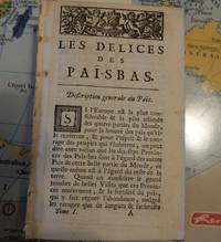
175271931752 A Paris, Chez Didot, quai des Augustins, au-dessus de la rue Pavée, à la Bible d'or, 1752 ; in-12°, plein veau brun marbré de l' époque, dos à nerfs orné de caissons de filets dorés et petits fers dorés, titre doré sur étiquette de maroquin vieux-rouge, tranches marbrées; XLIV, 496pp. et 2 planches dépliantes hors texte ( Plan de la Batille de Zalma, d'après Lebas et Carte de la partie méridionale de la Grèce par Bellin 1739);
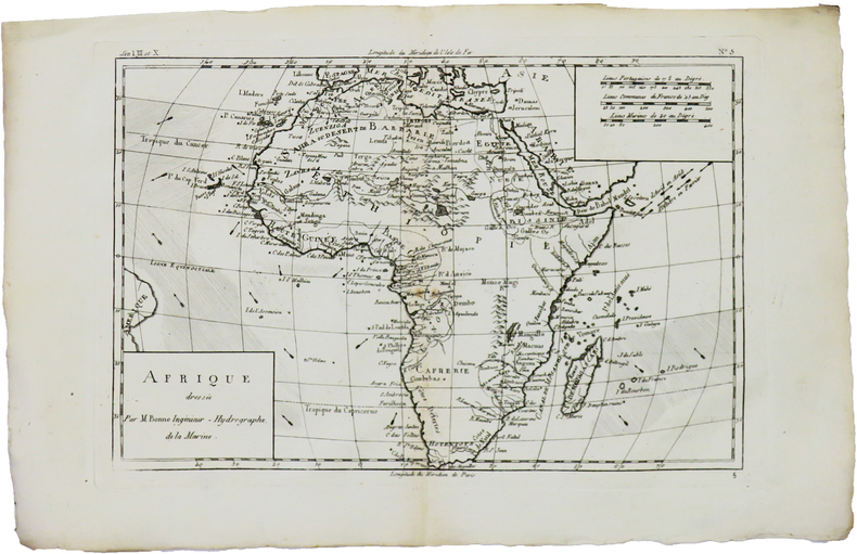
1780LBW-5942[1780]. 213 x 314 mm.
17531942Stadler: 9x15 cm 1753. Gebunden. 9x15 cm unknown
176981347Liege: Basompiere 1769. Gebunden. Basompiere unknown
173080287Buttenheim 1730. kart. unknown
1779796351779: Publicatum Jussu Senatur 1779. Publicatum Jussu Senatur unknown
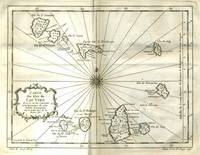
177521529Paris 1775. Very good condition. Detailed copper engraved map of the Cape Verde Islands off the west coast of Africa and the present day country of Senegal. Map extends from Isle de St. Antoine down to Isle de St. Yago sic. Additional islands named include St. Vincent Ste Lucie I. Branca Isle de S. Nicolas Isle de Sal Isle de Bonavista Isle de St. Philippe ou de Fuego Isle de St. Jean ou Brava and Isle de May. From Prevost's "L'Histoire Generale des Voyages".<br /> <br /> Bellin 1703 - 1772 one of the most noted French mapmakers of the 18th century was named the hydrographer chief cartographer to the French Navy and later the Official Hydrographer to the French King.<br /> <br /> Ornate compass rose at center of map with rhumb lines. 11 1/4 x 9" with ample margins. Strong impression very clean. unknown
177916346Rostock: Christian Mueller 1779. kart. Christian Mueller unknown
177528984Dusseldorpii: Stahl 1775. Gebunden. Stahl unknown
179329042Rostock: Koppensche Buchhandlung 1793. Gebunden. Koppensche Buchhandlung unknown
178579604Dusseldorpii: Francisci Friderici Stahl 1785. Gebunden. Francisci Friderici Stahl unknown
1701902414AGAmsterdam:, Sebastian Petzold, 1701. Kupferstich 26 x 15,5 cm (hoch), Blattgröße 33,5 x 20,5 cm.
179989239Gotha: Beckerischen 1799. Gebunden. Beckerischen unknown
177888996Muenchen 1778. Gebunden mit Schutzumschlag. unknown
1730910872CGLeiden:, [um 1730]. Kupferstich 21 x 42 cm, Blattgröße 39 x 49 cm.
17699308Bln, Voß, 1767/1769. Zwölfter und dreizehnter Teil in 2 Bänden: Geschichte der Afrikaner: 3. und 4 Teil: von den "westlichen Afrikanern" und "Afrikanische Insulaner". Aus dem Französischen (von Friedrich Wilhelm Zachariaeß) und mit einigen Anmerkungen versehen. Mit einigen Holzschnittvignetten. Kl. 8°. 8,448/8,488,2 S. Neue, leicht unterschiedliche Halblederbände auf Bünden mit montiertem altem Rückenschildchen, Deckel mit Marmorpapierbezug. Farbschnitt. Teil 12: Rücken gering berieben. Jeweils mit Name auf Titel, gelegentlich etwas gebräunt und stockfleckig. [2 Warenabbildungen]
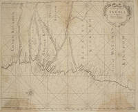
17611386<p>London: : From "The English Pilot: Part V" Sixth edition. Mount and Page 1761. 16-3/4" x 20-1/2"- 42.5 x 52 cm. Copper engraved map with hand colouring. Light overall browning with darker areas to corners generally good . An interesting coastal chart engraved by Francis Lamb showing rhumb lines from the Congo to Mount Negro in Mataman now Namibia.</p> From "The English Pilot: Part V" Sixth edition. Mount and Page,
1791797751791. unknown
17921308789Tübingen, J. Fr. Heerbrandt, 1791 - 1792. 4 Bl., 327, (1) S.; 2 Bl., 360 (von 364) S. Neuer Hlwdbd (fliegender Vorsatz m. Exlibris-Stempel, stellenweise gering braunfleckig, Tl 2 ohne die S. 361 - 364).
1793115022Göttingen: bey Vandenhoek & Ruprecht, 1793. 19,5 x 13 cm ; Halbleder
1799689081799 London, Crosby and Letterman, 1799, in 8° relié plein veau brun, dos lisse orné, XVI-218 pages ; reliure frottée, un mors fendu, coiffe de tête usée, deux coins émoussés, petit travail de vers marginal.
1790129845Chez Leroy, Libraire, Paris, 1790. 1 Bll., 403 S., 6 Taf. ; 20,5 x 13 cm ; Leder.
1790151435Lausanne, Mourer, 1790. 1 Bl., 290 S. Pp. d. Zt. m. Rückenaufkl. Einbd. beschabt u. bestoßen.St. verso Tit. Gebräunt, teils etwas fleckig. Ohne Tafeln.
177521527Paris 1775. Very good condition. Detailed copper engraved map of the east coast of Africa from the Saudi Arabia coast and the Red Sea down to Zanzibar. Many coastal cities and rivers named; the countries and regions named include: Costes d'Hasbach Zeila Ajan Muji Munni and Zanjibar sic. From Prevost's "L'Histoire Generale des Voyages".<br /> <br /> Bellin 1703 - 1772 one of the most noted French mapmakers of the 18th century was named the hydrographer chief cartographer to the French Navy and later the Official Hydrographer to the French King.<br /> <br /> With compass rose. Folding 8 x 10 1/8" with ample margins. Strong impression very clean. unknown