4 079 résultats
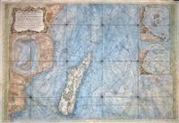
176777030Paris 1767. Originalt kobberstikk med ny hÃ¥ndkolorering. Størrelse : 86 cm X 59 cm.Original copper engraving with new hand-colouring. Size : 86 X 59 cm. Fransk. <br/><br/><em>Jacques-Nicolas Bellin 1703-1772 “Hydrographe du Roiâ€. Noe slitt ved ytterkantene og i plateranden. Et stort og dekorativt kart.Some wear at the outer edges and on the edge of the plate. A large and decorative map. </em> unknown
165676600Paris 1656. 4to. Samtidig mykt helpergamentbind. 100 s. 2 s. annonser. Med 18 dobbeltsidige grensekolorerte kart. 4to. Contemporary limp vellum. Unpaginated. 100 pp. In addition two pages of advertisements. 18 engraved double page maps. Boundaries coloured. Chez l’Autheur. Fransk. <br/><br/><em>Noen få sider med små rifter affiserer ikke teksten eller kartene. Noe gulnet i ytterkantene.A few pages with small tears not affecting text nor maps. Some browning to extremities. Nicolas Sanson d’Abbeville 1600-1667 “considered by many to be the founder of the French school of cartography†Tooley. </em> hardcover
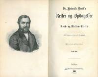
186057821Kjøbenhavn 1860. Leks8vo. Samtidig skinnryggbind med svakt opphøyde ryggbånd og enkel ryggforgylling. 500 434 s. Illustrert. Med foldet kart bak i bind II. Fr. Wøldikes Forlagsboghandel Dansk. <br/><br/><em>Ryggen svakt bleket. </em> unknown
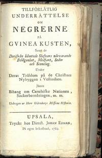
178476151Upsala 1784. Liten 8vo. Nyere skinnryggbind med tittelfelt i vinrødt skinn. Marmorerte dekler. Ubeskåret. 187 5 s. Tryckt hos Direct. Johan Edman Svensk. <br/><br/><em>Sjelden. Mangler sidene 1-14 55-66 og 105-112. </em> unknown
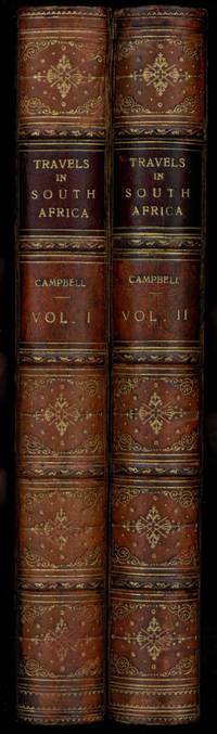
182269767London 1822. 8vo. 1800-talls vinrøde helskinnbind med rik ryggforgylling svakt opphøyde ryggbånd tittelfelter i mørkerødt skinn enkel strekdekor på deklene bindenes snitt dekorert i gull. viii xii 322 2 ; 2 384 s. Med et kolorert foldet kart samt 13 håndkolorerte akvatinter. Alle plansjene dublert med lerrett. Printed for the Society. Published and sold by Francis Westley Engelsk. <br/><br/><em>Tooley s. 123. Ex libris. Materien noe gulnet. </em> unknown
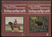
191276464Leipzig 1912. Leks8vo. Dekorerte originalbind. X 324 ; X 398 s. Illustrert med foldekarter og plansjer utenom pagineringen.Royal 8vo. Publishers decorated cloth. X 324 ; X 398 pp. Illustrated throughout with folding maps and plates. F. A. Brockhaus. Tysk. <br/><br/><em>Meget pent sett. Very nice set. </em> hardcover
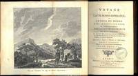
178769765Paris 1787. 8vo. Samtidige skinnryggbind med enkel ryggforgylling og tittelfelter i lysebrunt skinn. Marmoerte dekler. Foldet kobberstukket frontispiece xxxii 388 ; 4 366 ; 4 363 s. Med II VII VI kobberstukne plansjer hvorav de fleste er foldet. Chez Buisson Libraire Fransk. <br/><br/><em>Mangler foldekartet. </em> unknown
1824376899South Afrca 1824. Folio. Very Good a few margin tears 1 closed 2 with holes from seal generally sound some with postmarks. Folio. Report of Arrivals in Simons Bay Cape of Good Hope.which is l on the shores of Simon's Bay in False Bay on the eastern side of the Cape Peninsula. For more than two centuries it has been a naval base and harbour first for the British Royal Navy and now the South African Navy. The town is named after Simon van der Stel an early governor of the Cape Colony.<br /> 4 documents. 1823-24. Each SIGNED BY RICHARD WEATHERLEY HARBOR MASTER <br /> <br /> Report of Arrivals and Departures.Algoa Bay. Port Elizabeth. Eastern Cape SA 6 documents to Captain Francis Evatt important Commandant of Fort Frederick at Port Elizabeth. Each document signed by Evatt. 1824. unknown
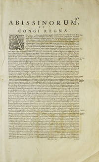
1638263796Amsterdam 1638. Copper engraved map colored in outline letterpress text on verso Abissinourm et Congi Regna Folios 352-353. 1 vols. Folio map 345 x 495 mm. Outline color. Small repairs to Nubia along old fold chiefly infill of blank areas. Very good. Copper engraved map colored in outline letterpress text on verso Abissinourm et Congi Regna Folios 352-353. 1 vols. Folio map 345 x 495 mm. Hand-colored map from the 1638 edition of the Mercator-Hondius Atlas. <br /> <br /> Includes frequent references to Amazons and locates "populi Antropophagi" just north of the Congo and Tritons and Sirens in Lake Victoria. Describes Nubia as "olim Christianam" and locates famous biblical queens of the time of Solomon along the banks of the Nile river. May locate the kingdom of Prester John on top of Amara Mons in the center of the map.<br /> <br /> A beautifully hand-colored map in excellent condition. Koeman I 8720:1A unknown
159040297N.p. 1590. Image area 19-1/2" x 12-7/8" in 28" x 23" mat. 1 vols. Imperfectly colored along crease down center small and unobtrusive dampstain in one corner. Still a nice piece. Image area 19-1/2" x 12-7/8" in 28" x 23" mat. 1 vols. Abraham Ortelius 1527-98 was a Flemish geographer of German origin. His major work Theatrum Orbis Terrarum 1570 with later revisions and addendums was the first modern atlas. It was based on contemporary charts and maps and contained a collection of plates engraved by Frans Hagenberg in a uniform size and format. The Theatrum preceded the first atlas of Ortelius' good friend Gerardus Mercator. In fact popular sentimental legend has it that Mercator delayed publication of his own work so that his younger friend's would appear first. Although this simply isn't true Mercator wasn't ready the legendary cartographer did complement Ortelius for the "care and elegance" he had put into the Theatrum. unknown
190775557N.p.: N.p. 1907-1912. This officer was on the rise apparently as he was constantly moved from camp to camp. The album contains 214 original silver gelatin photographs. When he started the officer was based in India and up until photograph 154 all of the pictures are of sights in India Ceylon Mauritius and Rangoon. Thankfully very few of these are family portraits as the officer seemed to delight in the local people and terrain. He is next situated in Pretoria at King's Hill Harrismith. He seemed to have a relaxing time there mainly lounging around the army camp and a very nice one at that Robert's Heights. It was founded around 1905 by the British Army and called Robert's Heights after Field Marshal Lord Roberts. There are numerous captains and generals named in the album but we could not discern the photographer's name but we do know he was a avid golfer. While in Ceylon he took photographs of many of the greens at that course. He did this again in South Africa. There are also numerous photographs of the whole brigade in formation and on exercises. Included but not bound in are eight large photographs 11 1/2 x 9 1/4 inches mainly of military formations. Also included are five medium sized 8 1/2 x 6 1/2 inches photographs and these are of a more domestic nature. Most of the photographs in the album are 4 3/4 x 3 3/4 inches and the vast majority of them are captioned. All housed in the original album of half red roan over red cloth. A few photographs loose from their stubs but hanging in there front joint split but the album still holding together. Really an essay could be written about this album but the cataloger ran out of time. N.p. hardcover
191075327Johannesburg: Central News Agency 1910. The first of the periodical is; South African Union and Pageant Souvenir with Which is Amalgamated The Argus Christmas Number 1910. Argus; Capetown 1910. Folio. 104 pp. plus the 12-page Pageant predominantly photographic illustrations. Original illustrated publisher's wrappers. Staples have rusted and a few pages are dog-eared but a complete sturdy and clean copy.The second is;United South African Xmas Annual. Johannesburgh: Central New Agency 1910. Folio. 64 pp. plus 16 pp. of ads. Profusely illustrated with photographic illustrations. Wrappers appear to be missing and a large portion sits loose in the periodical a photographic section front and back leaves with mild foxing. Despite these faults a very good copy as the text is present in its entiretyRacial segregation and white supremacy had become central aspects of South African policy long before official apartheid began. It began with South Africa's autonomy from Britain. In 1910 the Union of South Africa was created as a self-governing dominion with the unification of the Cape the Natal the Transvaal and the Orange River colonies. The South Africa Act 1910 enfranchised white people giving them complete political control over all other racial groups while removing the right of black people to sit in parliament. The controversial 1913 Land Act passed three years after South Africa gained its independence marked the beginning of territorial segregation by forcing black Africans to live in reserves and making it illegal for them to work as sharecroppers. Opponents of the Land Act formed the South African National Native Congress which would later become the African National Congress ANC. Both of these periodicals are extremely enthusiastic about the new Union and aside from publishing numerous fascinating photographs most of the articles are positively hyperbolic about the furute. Central News Agency unknown
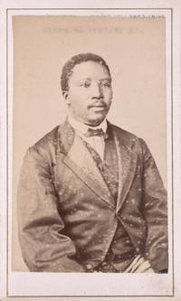
1870351805Paris 1870. Ink inscription on verso. Spotting in the image the image mounted upside down on the mount. Ink inscription on verso. unknown
a50705Paris 1989 Club du Sahel. In French. 4to. 198pp. wraps. A few institution and dicard stamps on fore-edges inside wraps and on front and rear blanks. Good section of rear wrap torn off. paperback
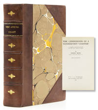
1927318085London: Witherby 1927. First edition. Illus. 280pp. 8vo. Bound in modern three quarter mottled calf and marbled boards Fine. First edition. Illus. 280pp. 8vo. Witherby unknown
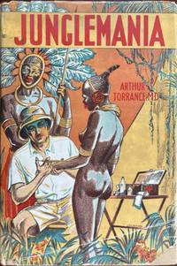
193359072New York: The Macaulay Co. 1933. 8vo. 310 pp. Illustrated title numerous photo plates. Beige publisher’s cloth brown lettering & palm tree front cover edgewear & rubbing to lower fore-edge occasional light toning w/ d.j. salacious cover art by Guischard of the good doctor injecting comely nude African maiden on front cover photo of “author†on spine minor dustsoiling creasing and minor chipping to lower right corner front cover still VG/VG- copy. First American edition of this very popular work in the United States published simultaneously in the UK as Junglemania: Exploring the Jungles for Science.“ The memoir was allegedly based on the author’s medical expeditions in Central Africa and Borneo at the behest of the Royal Society of Tropical medicine. However the rousing tale of adventure and lure of the jungle was quickly pulled in the UK due to many plagiarized passages from Owen Rutter’s 1924 novel set in Borneo “Passion Fruit.†The photographs also generated controversy as they mostly appeared to reproduce the popular RPPC’s sold to tourists in Borneo and the Royal Society of Tropical Medicine denied ever dispatching him even though he had been accepted as a member. Dr. Torrance was not to keep himself out of trouble as he was later arrested for murdering his third wife in Mexico while on honeymoon -- with a thermos flask. See: Emilie Taylor-Pirie Empire Under the Microscope: Parasitology and the British Literary Imagination 1885-1935 2022 pp. 85-90. The Macaulay Co., hardcover
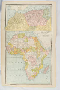
1894177068Chicago.: Geo. F. Cram. 1894. Chromolithographed maps 54.3 x 34.1 cm sheet central fold a few small edge tears and marginal age toning but in very good condition. Detailed maps prepared for George F. Cram's 1894 "Standard American Atlas": one of the first American firms to publish a world atlas. Maps of Oceania and South Africa printed on the verso. . Geo. F. Cram. unknown
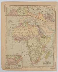
1877177229New York.: Ivison Blakeman Taylor & Co. circa1877. Printed colour map 27.5 x 21.7 cm large inset of Northern Africa and a smaller of Southern Africa two small edge tears lower corner neatly strengthened the sheet toned but the map in good condition unrelated text printed on the verso. Map of Africa as a whole before the Imperial race for colonies in the 1880s with interesting insets of Northern and Southern Africa. . Ivison, Blakeman, Taylor & Co. unknown
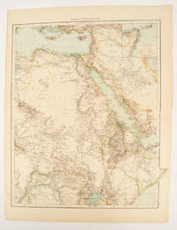
1895175108London.: Times Atlas of the World. 1895. Double-page folding map printed in colour 46.5 x 36.5 cm. edges gilt central fold with an inset map of Somaliland Somalia and the island of Sokotra key to European possessions outlined in colour small edge fold tears affecting the margin only and two other small edge tears slight toning at the edgaes but in very good condition. Attractive and detailed map prepared for the first edition of "The Times Atlas of the World". . (Times Atlas of the World). unknown
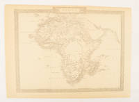
1880174956London.: The London Printing and Publishing Company. Circa1880s. Printed map 24 x 32.1 cm decorative border two original vertical folds paper toned mainly at the edges inner margin of the sheet ragged but in good order. A late edition of the map used for the well-known Tallis map this without the characteristic vignettes and on thinner paper. . The London Printing and Publishing Company. unknown
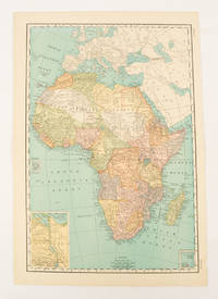
1899174902New York.: Rand McNally & Co. 1899. Printed colour map 36.3 x 24.3 cm inset map of the Suez Canal and two smaller insets of the Cardagos Crayos Islands Mascarene Islands and Cape Verde Islands central fold and on the verso a printed panel listing the countries in Africa with their territorial governance area and population lower corner creased at the outer margin but in very good condition. An interesting late nineteenth-century map noting colonial governance. . Rand, McNally & Co. unknown
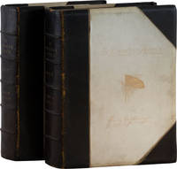
189061099London: Sampson Low Marston Searle and Rivington 1890. First Edition. Signed limited Demy Quarto Edition de Luxe. #230 of 250 copies printed. Quarto 30cm. Two volumes half-bound in black morocco and vellum stamped in gilt on front and spines. top edges gilt; plain endpapers; I: iixvi5291pp; II: iixvi472pp; 2 photogravure frontispieces 6 etchings 2 large color folding maps backed in linen 1 color folding map 1 color diagram 36 chine collé relief plates numerous in-text relief illustrations and a facsimile of a leaf from Stanley's original notebook. Untrimmed. Signed by author on limitation leaf; each etching signed in pencil by the artist G. Montbard. A sturdy set rubbed with minor external dustsoil red stains to front board of vol. 2 as though transferred from another book internally with occasional browning to edges plate supports browned and foxed otherwise clean: around Very Good. <br /> <br /> Stanley's account of the 1886-1889 expedition he led to rescue Emin Pasha Governor of the Egyptian province of Equatoria after his administration was overwhelmed during the Mahdist War. The expedition passed through the Belgian Congo including a grueling five-month passage through the Ituri rain forest the darkness of which inspired this book's title. Eventually they reached Emin persuaded him to leave and made their way to the eastern cost. In Darkest Africa was published soon after the conclusion of the expedition initially to great acclaim. But as more information emerged from other participants detailing high levels of death and brutality in the expedition Stanley 's reputation suffered considerably. HOWGEGO IV S60. Sampson Low, Marston, Searle, and Rivington unknown
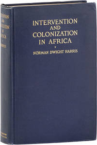
191461056Boston: Houghton Mifflin 1914. First Edition. First edition. Octavo 21cm. Blue cloth stamped in gilt; xx384pp; six color maps one double-page frontispiece and black and white maps. Bright and sound with faint rubbing to edges internally clean: Very Good. World Diplomacy vol. I. Harris was at this time a professor of European Diplomatic History at Northwestern. Houghton Mifflin unknown
192861109Oxford: Clarendon Press 1928. First Edition. First printing. Octavo 23cm. Red cloth titled in gilt; plain endpapers; viii2862pp; color frontispiece 4 color plates 10 black and white plates folding map. Sound but rubbed spine-sunned and lightly cocked: Very Good. <br /> <br /> Dr. John Kirk was the botanist and medical officer on Livingstone's Zambezi expedition 1858-63. Coupland's history was based on Kirk's journals which would be published thirty years later. 61109. Clarendon Press unknown
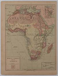
1877176015New York.: Harper & Brothers. circa1877. Chromolithographed map with outlne handcolour 27.1 x 21 cm major towns marked with a red cross relief by hachures ocean currents marked two inset maps of the Suez canal and Mascarene Island two very small marginal edge tears not affecting the map slight toning unrelated text on the verso prepared for "Harper's School Geography" in very good condition Interesting map of Africa before the escalation of the European race for colonial possessions from 1880. The map shows: the European possessions of the Cape Colony Transvaal Republic Orange River Republic and Natal; regions of the continent as fertile belts and desert belts; and indicates agricultural and other production such as palm oil ivory skins and cattle. Major cities are shown with important trade centers highlighted with a red cross. Prepared for US students in "Harper's School Geography" longitude is shown from the Greenwich prime meridian at the head of the map and from the Washington prime meridian at the foot. A small outline map of Ohio is included for relative scale. . Harper & Brothers. unknown