[Consociazione Turistica Italiana]Biblio.com
4 079 résultats
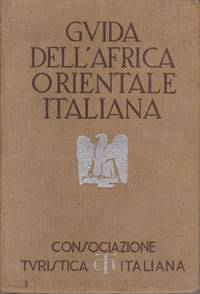
193820507Milano: Consociazione Turistica Italiana. 1938. First Edition. Hardcover. Very Good. Large fold-out map at front. The guide in Italian for the then Italian colonies in Africa: Eritrea Amara Harar Addis Abeba Galla & Sidama Somalia. "Con 15 carte Geografiche 16 piante di centri abitati 10 piante di edifici schizzi e stemmi"; Guida D'Italia Della Consociazione Turistica Italiana; 12mo - 7" to 7½" tall; 640 pages . Consociazione Turistica Italiana hardcover
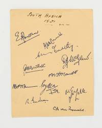
66275There are eleven signatures: Rowan presumably when captain Endean Chubb McCarthy McGlew McLean Mann Mansell Melle Waite and van Ryneveld. Slight corner creases well away from the signatures; in excellent condition. unknown
177521527Paris 1775. Very good condition. Detailed copper engraved map of the east coast of Africa from the Saudi Arabia coast and the Red Sea down to Zanzibar. Many coastal cities and rivers named; the countries and regions named include: Costes d'Hasbach Zeila Ajan Muji Munni and Zanjibar sic. From Prevost's "L'Histoire Generale des Voyages".<br /> <br /> Bellin 1703 - 1772 one of the most noted French mapmakers of the 18th century was named the hydrographer chief cartographer to the French Navy and later the Official Hydrographer to the French King.<br /> <br /> With compass rose. Folding 8 x 10 1/8" with ample margins. Strong impression very clean. unknown
193861372Oxford: Clarendon Press 1938. First Edition. Octavo 23cm. Maroon cloth titled on spine; plain endpapers; viii584pp; two folding maps at rear. Sound and straight spine rubbed and slightly faded minor rubbing to edges: generally Very Good. 61372. Clarendon Press unknown
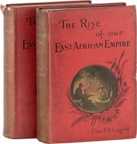
189361413Edinburgh: William Blackwood and Sons 1893. First Edition. First printing. Octavo 23cm. Two volumes in red cloth stamped in black and yellow; blue coated endpapers; xx5631pp; x682pp; 54 b/w plates 9 color maps two in pockets on pastedowns several in-text illustrations. Sound but externally rubbed and dustsoiled spines darkened rear hinge partially cracked occasional internal dustsoil: around Very Good.<br /> <br /> Lugard worked for the Imperial British East Africa Company and became Military Administrator of Uganda from 1890-92. Later on he became Governor of Nigeria. "Seeking to recover his health after a stint in Burma Lugard traveled to Mozambique and Uganda to fight the slave trade. He relates numerous adventures in the hinterlands around Lake Nyassa with recollections of battles and survival in the tropics including vivid descriptions of the terrain and peoples.His contributions in East Africa played heavily in Uganda becoming part of the greater British Empire." CZECH p.100. 61413. William Blackwood and Sons unknown
191958762Washington D.C. National Geographic Society 1919. Oblong 4to. 11 x 9 in. 24 leaves printed on thick glossy paper stock w/ photo & colour illustrations on recto of each leaf slight shelfwear rubbing still NF set preserved in original printed envelope with instructional information and stamp “Sahara Life†on recto minor creasing edgewear former ownership ink markings. First edition of this scarce set of plates designed for geography classroom use following World War I filled with text by Burrall 1883-1960 to increase geographical literacy of children as well as promote the ideas of preparing American youths to assume the role of a “World Power.†This set focuses on an Arab bedouin tribe and a young woman named Machla featuring photographs by Lehnert & Landrock and Bougalt including desert life Tunisia and concluding with view of Timbuktu in Mali. Worldcat ostensibly locates 5 surviving Sahara Life in Africa portfolios at least 2 are microfilm copies; See: Katie Good Bring the World to the Child: Technologies of Global Citizenship in American Education 2020 pp. 44-47 227-228. National Geographic Society, unknown
191958761Washington D.C.: National Geographic Society 1919. Two parts in one. Oblong 4to. 11 x 9 in. 24; 24 leaves printed on thick gloss paper stock with photo illustrations & colour illustrations on recto of each leaf minor thumbing very slight soiling still VG set preserved in original printed envelope with instructional information and stamp “Indian and African†on recto minor creasing edgewear ink marks on verso. First edition of these scarce sets of plates designed for geography classroom use following World War I filled with text by Burrall 1883-1960 to increase geographical literacy of children as well as promote the ideas of preparing American youths to assume the role of a “World Power.†These plates feature images of images and text detailing Flathead Indians of Montana with photos by C.J. Blanchard; Ojibwa & Chippewa Indians with photo by Roland Reed; Pueblo & Hopi Indians in Arizona & New Mexico with photos and colour plates by Vroman and Franklin Price Knott; as well as Hulita Mexican-Indian woman grinding tortillas with photo by Winfield Scott. Peruvian Indians are included as well with photos by Hiram Bingham and the intrepid Harriet Chalmers Adams. The sort of Amerocentric views are also reinforced in these education sets by the “Negro in Africa†section emphasizing people of colour as exotic wearing ear plugs sporting tattoos tribal markings amidst apes giraffes Hippos and hunting elephants. Worldcat ostensibly locates 5 surviving Indian & Negro in Africa portfolios at least 2 are microfilm copies; See: Katie Good Bring the World to the Child: Technologies of Global Citizenship in American Education 2020 pp. 44-47 227-228. National Geographic Society, unknown
196713235London: Frank Cass and Company Ltd 1967. Hardcover. Very Good. Facsimile reprint of second edition 1802. vii 9-287 pp. Red cloth boards are slightly faded and dust soiled; top edge also dust soiled. Binding tight and square contents clean. Frank Cass and Company, Ltd hardcover
178334326Holland: Not Atributed. Very Good with no dust jacket. 1783. First Edition. Hardcover. 8vo 8" - 9" tall; . 43221pp pages; Africa: Ou Tableau Historique et Politique de LÉtat Originaire de la Colonie du Cap de Bonne-Esperance Comparé avec LÉtat Actuel de Cette Colonie. Modern half faux leather & cloth. Contents VG indeed. French language. Worldcat finds but two copies- scarce. . Not Atributed hardcover
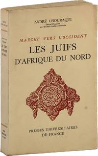
195287670Paris: Presses Universitaires de France 1952. First Edition. Octavo. Printed card wrappers softcover as issued; 398pp; three folding maps in color. Aging and hand-soil to wrappers; very mild toning to text; a sound Very Good copy overall. Text entirely in French. Presses Universitaires de France unknown
1830176607London.: Robert Jennings. 1830. Engraved map 11.5 x 14.3 cm showing route of European explorers faint added outline colour in an early hand and manuscript note to the verso in the same ink edges age-toned but in very good condition. Detailed pre-colonial map of Africa "Regions Unexplored" marked and "no fresh water to be found" on the west coast. An early manuscript inscription on the verso refers to Lander's ."wanderings of Clapperton" the Scottish naval officer and explorer. Richard Lander had returned with Hugh Clapperton's journal following his death and the account was published in the same year as Fenner's "Pocket Atlas of Modern & Ancient Geography" for which this map was prepared. . (Robert Jennings) unknown
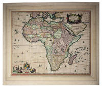
1680I24G435YONN5Amsterdam: Nicolas Visscher 1680. In passepartout 56 x 66 cm. Engraved double-page map image size: 43.5 x 54 cm; leaf size: 51 x 60 cm coloured by a contemporary hand. With title in a decorated cartouche on the top right flanked by two Africans and two putti and dedication to Gerardus Schaap in a decorated cartouche on the bottom left with Schaaps coat of arms on top and flanked by mythical figures. Further illustrated with small ships and African animals including lions monkeys rhinoceros and ostriches. Second state of Visscher's engraved map of Africa with the privilege added to the bottom right. It shows the whole continent of Africa the southern Mediterranean coast and a substantial part of the Arabian Peninsula. Primarily the coastline is accurately depicted with great detail to the South African coastline in particular - the interior of Africa was not accurately mapped until the 19th century. This map was based on Willem Blaeu's map of 1608 and used in atlases by the Visscher family up to 1696.With the centrefold strengthened at the back; paper browned and with a few small smudges but the colouring still bright.l Koeman Vis 86; V.d. Krogt & De Groot 35:04 first state; Norwich Africa 55. Nicolas Visscher, unknown
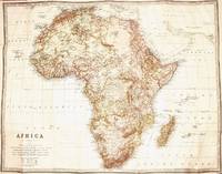
1901101234Edinburgh: W. and A.K. Johnston 1901. First Edition. Hardcover. Very Good. Edinburgh W. and A.K. Johnston 1901. A chromolithographic map printed surface 725 × 930 mm mounted in one piece on linen folded into 32 panels to octavo size and cased in cloth boards; a large folding table of 'The Possessions of the European Powers in Africa' giving the population and area of the various territories with how and when they were acquired is bound with it as issued Publisher's gilt-lettered cloth case with the map and table mounted on opposite pastedowns; case flecked and sunned with a small ink stain on the front cover a tiny puncture on the spine and lacking the paper lining on the inside surface of the spine; the map is in excellent condition save for a few short and unobtrusive splits to some folds. Scale: 1:11800800. The title is given simply as 'Africa' in the cartouche. No mention is made of the war in South Africa. W. and A.K. Johnston hardcover
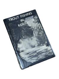
19508975Nairobi Kenya: Printed in E. Africa by W. Boyd & Co 1950. First edition. 18x13cm 64pp. Illustrated ads photos fold out map attached at rear. Staple bound in illustrated wrappers. Old tape reinforcement to spine edges rubbed owner's name to front cover. Upper corners stained else clean internally and very good. <br /> <br /> Very scarce mid-century publication a guide for English and American sportsmen seeking angling opportunities in Kenya Colony. Brown and Rainbow Trout eggs were introduced into the rivers by colonists around 1905. The sport was a popular pastime for the colonists and tourist fishing in the region continues to thrive today. The three color map at rear shows the Kenya Highlands with principle trout rivers roads and railways.<br /> <br /> OCLC cites a single holding at the University of California. Printed in E. Africa by W. Boyd & Co unknown
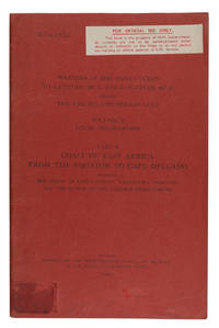
1940ABC_46347London: Meteorological Office Air Ministry 1940. Original publisher's printed red wrappers. 8vo. With map frontispiece and several illustrations and tables in the text. First edition of a rare climatological study originating from a series of meteorological handbooks of the Indian Ocean issued by the British government between 1940 and 1944. The three-volume series comprising a total of 12 parts was prepared by the Meteorologial Office Air Ministry in cooperation with the Naval Meteorological Branch Admiralty London; it was reprinted for the U.S. Navy as late as 1980. The ESSA Technical Memorandum of 1969 mentions another reprint in 1945.The present volume is the last of nine parts of volume II covering the climate of the East African coast from the equator to Cape Delgado discussing tropical cyclones and depressions winds visibility clouds rain and hail temperature humidity and other meteorological events. The frontispiece shows a map of the relevant area; additional diagrams illustrate surface winds and higher winds as well as the amount of clouds and rainfall. The tables show the general climate in Mombasa Tanga Zanzibar Dar es Salaam Kilwa and Lindi as well as the monthly frequency of wind direction and force at sea and in the upper air and the visibility at coastal stations.Library shelfmark in pencil as well as a mounted blank loaning sheet to final blank page. 7 combinations of letters and digits in black felt pen to lower cover. Traces of a shelfmark label and a cancelled inscription to front cover. Not a single copy in auction records.l U.S. Department of Commerce ESSA Technical Memorandum EDSTM10 A Note on Climatology of Thailand and Southeast Asia 164 19; WorldCat 1181290135. Meteorological Office, Air Ministry, unknown
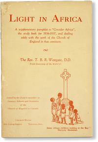
193648166Toronto: Joint Committee on Summer Schools and Institutes of the Church of England in Canada 1936. First Edition. 12mo. Pictorial card wrappers printed in red; 48pp; illus. Mild cover soil else Very Good. Errata slip attached before first page of text; ink ownership stamp "Property of M.S.C.C. Library" inside front cover. Survey of the Church's missionary activities across the African continent. Photographic text illustrations throughout. Rare; no other copies noted in commerce and not separately catalogued in OCLC March 2020. Joint Committee on Summer Schools and Institutes of the Church of England in Canada unknown
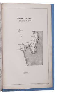
1884KC3E5IO24NK1London 1884. Folio. Eyre and Spottiswoode Modern blue paper wrappers. With a folding map in ad 1 and a full-page map in ad 3. 3 works in 1 volume. X 60; 13 1; X 75 1 blank pp. Ad 1: Official publication presented to the British Houses of Parliament containing correspondence concerning the German settlement at Angra Pequena or Lüderitz Namibia. The correspondence starts with four letters written in 1880 the first letter including a translation of a German article expressing the German interest in the region. The following letters and telegrams were written in 1883 and 1884 starting with letters from July 1883 asking whether the rumours that a German trading company has bought Angra Pequena harbour are true. The land had indeed been bought by Adolf Lüderitz 1834-1886 who founded a trading post at Angra Pequena and renamed it Lüderitz. The majority of the following letters discuss the British attitude towards Germany and the new settlement including evidence of British claim and authority in the area and orders to send gunboats to the bay. The folding map shows a large part of Namibia's coast line.Ad 2: Official publication presented to the British Houses of Parliament containing a letter by the Earl of Derby Colonial Secretary concerning Lüderitz with four appendices including letters and statements from 1867 and 1868. It becomes clear that Britain doesn't have a solid claim on the territory.Ad 3: Official publication presented to the British Houses of Parliament containing further correspondence concerning Lüderitz from July to November 1884. Some letters deal with the official statement of the German government to treat Lüderitz as a German protectorate: German South West Africa; others with the exact boundaries of the territories belonging to Germany Portugal and Britain.With a small tear along the fold of the map a few small spots some margins slightly frayed. Overall in very good condition. unknown
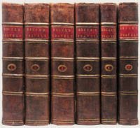
179033833Edinburgh: J. Ruthven for G.GJ. and J. Robinson et al and Printed by George Ramsay and Company for Archibald Constable and Company 1790; 1808. 6 volumes. The First Edition Edinburgh imprint sometimes called “the best edition†Cox with the First Edition of Murray's fine and important work on Bruce. Engraved title vignettes in all volumes. Vol. I with illustrated header on the dedication to the King and with 53 very finely engraved plates and maps and charts including 3 very large folding maps. The Murray volume with an additional 22 engraved plates including a portrait frontispiece of Bruce and two large folding maps at the end of the volume. A total of 75 plates and 5 large folding maps. 4to 300 x 240 mm. with the half-titles in vols. !-!V very handsomely bound in very handsome contemporary half polished calf over marbled paper covered boards. The spines with raised bands are gilt ruled and decorated with gilt lettering on red morocco labels original endleaves end-leaves and with a fine antique engraved armorial plate. Early ownership inscription to title-page and a fine early armorial bookplate. The Bruce lxxxv 535; viii 718; viii 759; viii 695; xiv 230 3 large folding maps index errata pp. The Murray xiii 5044 ads. pp 22 engraved plates and maps. A fine and desirable set in scarce contemporary bindings the paper fresh and clean and the text-blocks as solid as could be the bindings are very handsome withminor evidence of use or age at the extremities a bit of tenderness to the hinges of a few volumes but these are still sturdy and strong and the folding maps are in excellent condition. HIGHLY IMPORTANT EARLY EXPLORATION INTO AFRICA AND A RARE EDITION IN FULL CONTEMPORARY CALF WITH ORIGINAL SPINE PANELS AND WITHOUT REPAIRS. A cornerstone to any collection of Africana this is one of the earliest and greatest illustrated works on the seminal discoveries to be made on the continent over A hundred year period. This set with the added murray volume rarely encountered in matching binding as here.<br> With time on his hands and at the urging of a friend Bruce composed this account of his travels on the African continent including comments on the history and religion of Egypt an account of Indian trade a history of Abyssinia and other such material. Although Bruce would not be confused with "a great scholar or a judicious critic. few books of equal compass are equally entertaining; and few such monuments exist of the energy and enterprise of a single traveller" DNB. "The result of his travels was a very great enrichment of the knowledge of geography and ethnography" Cox II p. 389.<br> Bruce was one of the earliest westerners to search for the source of the Nile. In November of 1770 he reached the source of the Blue Nile and though he acknowledged that the White Nile was the larger stream he claimed that the Blue Nile was the Nile of the ancients and that he was thus the discoverer of its source.<br> The account of his travels was written twelve years after his journey and without reference to his journals which gave critics grounds for disbelief but the substantial accuracy of the book has since been amply demonstrated.<br> James Bruce traveled to Egypt in 1768 accompanied by the Italian artist Luigi Balugani. They spent five years in Upper Egypt Abyssinia and in the exploration of the Nile. With the exception of the French surgeon Poncet no European had visited Abyssinia in over 150 years so Bruce's account was of unique importance in providing valuable information on the region to Europeans. The plates based on his own and Balugani's drawings include maps botanical and zoological specimens antiquities artifacts and plans of monuments.<br> A cornerstone to any collection of Africana this is one of the earliest and greatest illustrated works on the seminal discoveries to be made on the continent over a hundred year period. J. Ruthven for G.GJ. and J. Robinson et al and Printed by George Ramsay and Company, for Archibald Constable and Company hardcover
186161059London: Richard Bentley 1861. First Edition. First printing. Octavo 22cm. Contemporary red calf tooled in gilt all edges marbled; marbled endpapers; xvi6311pp; 2 color litho plates 2 black and white litho plates 9 intaglio plates and additional relief illustrations and maps. Inscribed to Alfred Henry Hudson from Joseph D. Gill 1864; bookplate of A. H. Hudson. Binder's stamp of H. & C. Treacher Brighton. Front board detached spine leather dry and cracking but textblock tight and mostly clean with a few spots of foxing and browning to tissue guards: Good. <br /> <br /> Davis 1812-1882 was a Christian convert who worked as a missionary in Tunis during the 1840s; from 1856-58 he was employed by the British Museum to work on archaeological digs at Tunis and Utica. These digs uncovered major Roman mosaics some of which are illustrated in color in this work. Richard Bentley unknown
182660784London: John Murray 1826. First Edition. First printing. Quarto 28cm. Later nineteenth-century grey calf gilt and blind rolls around outer perimeter of boards tooled in gilt on spine titled on red leather spine label all edges marbled; marbled endpapers; xlviii33552691pp; frontispiece large folding map 1 hand-colored print 35 black and white engravings a few in-text wood engravings. Bookplate of traveler and classical scholar John Bacon Sawrey Morritt Esq. of Rokeby Park. A sound copy joints expertly conserved with green cloth lightly rubbed lower half dampstained throughout some leaves with visible tidelines some merely rippled otherwise bright and unfoxed: complete and Good. <br /> <br /> Extensively illustrated account of the Bornu Mission an expedition to find the source of the Niger in the kingdom of Bornu now Nigeria. Denham the leader of the expedition was "disastrous.pushy self-important and malicious" ODNB. The party traveled from Murzuk to Lake Chad through the Sahara Desert along a route reportedly scattered with skeletons. After the explorers' return to London Denham published this account of the journey "in which he suppressed as much as possible all mention of his companions and took the credit for some of their discoveries" ODNB. He was widely applauded and his account has been described as "the most interesting and important work yet published on the subject of African researches" Lowndes. Meanwhile his maligned colleague Clapperton returned to Africa where he soon died of dysentery. LOWNDES p. 629. Cf. WORK pp. 21 31. HOWGEGO C33 & D18. John Murray unknown
194262235Washington D.C.: n.p. ca. 1942. 4to. 2 147 1 leaves typescript mimeograph on onion-skin paper. With 34 copy photos and silver print run-off paper diagrams folding charts from the original all either mounted or bound within the report. Contemporary black Accopress split-pin slide binder rounded corners creasing to first few leaves of onion skin paper minor rusting to the slide Acco fastener still VG- copy. First edition thus of this English translation of Pontecorvo’s 1937 original “Il Problema dell’acqua†on the scarcity of Water the ongoing efforts to increase supplies of the vital resource in North Africa especially to advance economic and military development. Prepared after the Italian invasion of North Africa prior to World War II when in the aftermath of the Second Italo-Ethiopian War Mussolini’s government controlled Libya and Italian Somaliland Eritrea and the occupied Ethiopian Empire were merged into Italian East Africa. The study focuses on ancient aquifers precipitation methods of discovering untapped water geophysical characteristics of North Africa and inally developing wells cisterns aqueducts and tapping atmospheric water with wind traps. This translation prepared during World War II possibly for reference use by US Army Corps of Engineers and construction battalion units during the Allied North Africa Campaigns from 1940-May 1943. No similar copies in Worldcat. n.p., unknown
190529174Syracuse NY: Wesleyan Methodist Publishing Co. 1905. 16 b&w split back post cards of the Methodist mission in Sierra Leone. Featured are: Brother John Ayres Pa Bokari Masumbo Mision House DEnnis Kinney Helen Richey Mr. Clarke Sisters Marie Stephens and Hattie Crosby. Stephens served as a missionary from Nov. 1901 to Feb. 1904.<br /> <br /> Wesleyan Methodist Missions to Sierra Leone Africa began in 1811. 16 post cards unused vgc. Wesleyan Methodist Publishing Co. unknown
187559369London and Newcastle: Adam & Co. n.d. 1875. 4to pp. viii 632; lithograph frontispiece and title page color map plus 22 tinted lithographs on 20 sheets; publisher's quarter brown morocco stamped in gilt on spine; front free endpaper miscreased occasional foxing modest wear; generally very good and sound. The book went through numerous editions in several formats with different paginations and different series of illustrations. Adam & Co., n.d. unknown
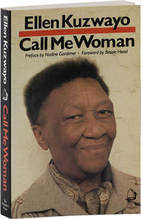
198561999London: The Women's Press 1985. Reprint. 12mo 20cm. Pictorial paperback; xxii266pp; black and white illustrations. Inscribed by the author on the first page: "To Anne Wyne: Let this chain of friendship remain strong" and dated 1987. Lightly rubbed else Near Fine. Autobiography of Ellen Kuzwayo 1914-2006 South African women's rights activist and politician. 61999. The Women's Press unknown
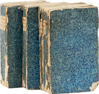
174361213Amsterdam: Jean Catuffe 1743. Third French edition. 12mo 18.5cm. Three volumes in blue pastepaper wraps with manuscript titles on plain paper spine labels; I: xxiv4282pp; II: xvi162pp; III: xx320pp; 5 folding maps and 25 line engravings one folding. Untrimmed and unbeaten. Cracks to paper over spine on vols II and III significant cracks to spine on vol. I wrappers lightly rubbed at edges with small abrasion on front wrapper of vol. I dampstaining to about 16 leaves in vol. III else clean: Very Good. <br /> <br /> Peter Kolbe 1675-1726 was an astronomer who traveled to the Cape of Good Hope in modern-day South Africa for astronomical research from 1704 to 1713. In 1719 he published this seminal work on natural history the Khoekhoen people and Dutch settlers in South Africa. The work became highly popular and was translated into multiple languages; this is the third edition in French. See MENDELSSOHN pp842-845 for the first edition and other translations. Jean Catuffe unknown