145 résultats
177521531Paris 1775. Very good condition. Detailed copper engraved map of the west coast of Africa from Gabon "ou Pongo" down to Cap Negro in Benguela modern day Angola. Many coastal and interior cities and rivers named with various kingdoms marked. From Prevost's "L'Histoire Generale des Voyages".<br /> <br /> Bellin 1703 - 1772 one of the most noted French mapmakers of the 18th century was named the hydrographer chief cartographer to the French Navy and later the Official Hydrographer to the French King.<br /> <br /> Folding 12 1/4 x 10" with ample margins. Strong impression very clean. unknown
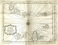
177521529Paris 1775. Very good condition. Detailed copper engraved map of the Cape Verde Islands off the west coast of Africa and the present day country of Senegal. Map extends from Isle de St. Antoine down to Isle de St. Yago sic. Additional islands named include St. Vincent Ste Lucie I. Branca Isle de S. Nicolas Isle de Sal Isle de Bonavista Isle de St. Philippe ou de Fuego Isle de St. Jean ou Brava and Isle de May. From Prevost's "L'Histoire Generale des Voyages".<br /> <br /> Bellin 1703 - 1772 one of the most noted French mapmakers of the 18th century was named the hydrographer chief cartographer to the French Navy and later the Official Hydrographer to the French King.<br /> <br /> Ornate compass rose at center of map with rhumb lines. 11 1/4 x 9" with ample margins. Strong impression very clean. unknown
17649609AB[Paris], [1764]. Blattgröße/Plattengröße: ca. 23 x 31,5 cm. Grenzkolorierter Kupferstich. Am Plattenrand beschnitten. Mit Mittelknick. Recueil De Cartes Et Plans Des Quatre Parties Du Monde.
178981634[Amsterdam / Paris, Maradan, 1789]. Bildgröße 8 x 13,5 cm, Blattgröße 10 x 15 cm. Unter Passepartout.
178981620[Amsterdam / Paris, Maradan, 1789]. Bildgröße 8,5 x 14 cm, Blattgröße 10,5 x 17 cm. Unter Passepartout.
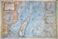
176777030Paris 1767. Originalt kobberstikk med ny hÃ¥ndkolorering. Størrelse : 86 cm X 59 cm.Original copper engraving with new hand-colouring. Size : 86 X 59 cm. Fransk. <br/><br/><em>Jacques-Nicolas Bellin 1703-1772 “Hydrographe du Roiâ€. Noe slitt ved ytterkantene og i plateranden. Et stort og dekorativt kart.Some wear at the outer edges and on the edge of the plate. A large and decorative map. </em> unknown
1792100309ABParis, Plassan, 1792. Tafelband. 26 x 20,5 cm. Mit gestoch. Titelvign. u. zahlr. Abb. auf 80 (von 88) doppelblattgr., teils mehrfach gefalt. Kupfertafeln (davon 4 mehrf. gefalt. Kupferkarten). 2 Bll. Marmor. Halblederbd. der Zeit m. goldgeprägt. Rt. - Es fehlen die Tafeln Nr. 53 bis 58, Nr. 75 u. Nr. 88. - 1 Karte m. kl. hinterlegtem Einriss, Karten u. 2 Tafeln m. leichtem Feuchtigkeitsrand, sonst gutes Ex.
178438202London: G. Nicoll and T. Cadell 1784. Map. Near Fine. Plate 36 from the atlas volume of Cook James; A Voyage to the Pacific Ocean: Undertaken by the Command of His Majesty for Making Discoveries in the Northern Hemisphere published by G. Nicoll and T. Cadell; London 1784. Writing engraved by T. Harmer. Wagner; Cartography of the Northwest Coast of America 696. Map printed border to border measures 15.25 x 26.5 inches plate impression 16.75 x 27.25 inches sheet 21.5 x 30 inches. An exceptionally nice uncolored copy. Request a higher resolution photograph if required. <br/> <br/> G. Nicoll and T. Cadell unknown
175881348Barcelona: Jolis 1758. kart. Jolis unknown
175479689Parisiis: Garnier 1754. Gebunden Leder. Garnier unknown
177521525Paris 1775. Very good condition. Detailed hand colored copper engraved map of the west coast of Africa from Gibraltar and Tanger down to the Canary Islands and Cape Verde Islands and Gambia. Many coastal cities and rivers named. From Prevost's "L'Histoire Generale des Voyages".<br /> <br /> Bellin 1703 - 1772 one of the most noted French mapmakers of the 18th century was named the hydrographer chief cartographer to the French Navy and later the Official Hydrographer to the French King.<br /> <br /> With compass rose. Folding 8 1/4 x 10" with ample margins. Strong impression very clean. unknown
17649778AB[Paris], [1764]. Blattgröße: ca. 24,5 x 19,3 cm. Plattengröße: ca. 22,5 x 37 cm. Grenzkolorierter Kupferstich auf Bütten. Schöner kräftiger Druck, frischer Kolorit. Knapp am Plattenrand beschnitten. Mit einem Mittelfalz. Recueil De Cartes Et Plans Des Quatre Parties Du Monde.
17672105170283xbvkLeipzig, Offizin Gleditsch, 1767. Titelblatt mit allegorischer Holzschnittvignette (geflügeltes Pferd 'Pegasus' im Flug), Widmungs blatt 'Commilitonibus humanissimis'; 188 Seiten, (4) S. 'Index'. - Original-Halbledereinband der Zeit über 5 erhabene Bünde mit floraler Rückenvergoldung und goldgeprägtem Titel auf rotem Rückenschild mit Goldrand, grau-schwarz marmorierten Buchdeckeln und Lederecken, Rundum-Rotschnitt und prachtvoll farbig-marmorierten Vorsätzen; 8vo.(ca. 20,5 x 12 cm).
1799201023Johann Chistian Hermann Frankfurt am Main 1799. Hardcover zweite Auflage erster Band Erster Band vier Teile Bücher genannt. Mit Originalseiten. Umschlag ist liebevoll neu gefasst. Bindung tadellos. Kanten intakt Rücken intakt. Papier innen nachgedunkelt kaum bis keine Flecken. Alte Eintragungen im Vor- und Nachsatz sind erhalten. Johann Chistian Hermann, Frankfurt am Main, hardcover
175588960Paris: Jean Herissant 1755. kart. Jean Herissant unknown
1730910872CGLeiden:, [um 1730]. Kupferstich 21 x 42 cm, Blattgröße 39 x 49 cm.
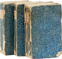
174361213Amsterdam: Jean Catuffe 1743. Third French edition. 12mo 18.5cm. Three volumes in blue pastepaper wraps with manuscript titles on plain paper spine labels; I: xxiv4282pp; II: xvi162pp; III: xx320pp; 5 folding maps and 25 line engravings one folding. Untrimmed and unbeaten. Cracks to paper over spine on vols II and III significant cracks to spine on vol. I wrappers lightly rubbed at edges with small abrasion on front wrapper of vol. I dampstaining to about 16 leaves in vol. III else clean: Very Good. <br /> <br /> Peter Kolbe 1675-1726 was an astronomer who traveled to the Cape of Good Hope in modern-day South Africa for astronomical research from 1704 to 1713. In 1719 he published this seminal work on natural history the Khoekhoen people and Dutch settlers in South Africa. The work became highly popular and was translated into multiple languages; this is the third edition in French. See MENDELSSOHN pp842-845 for the first edition and other translations. Jean Catuffe unknown
1742402361Amsterdam, Cartuffe, 1742. M. 5 (teils gef.) Kpfr.-Ktn. u. 25 (1 gef.) Kpfr.-Taf. Ldrbde. d. Zt. m. Rtit. Leicht beschabt. Ecken u. Kanten etwas bestoßen.
173479645criticum: chronologicum 1734. chronologicum unknown
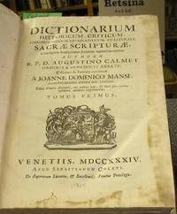
17342036Venetiis: S. Coleti 1734. Gebunden. S. Coleti unknown
178279693Nuernberg: Grattenauer 1782. Gebunden. Grattenauer unknown
1773797741773. unknown
1773796181773. unknown
174386373Coelln: ColonixGussen 1743. Gebunden. ColonixGussen unknown
1790170056Berlin, Vossische Buchhandlung, 1790. M. 7 (st. 12) Kpfr.-Taf. XII, 428 S. Schlichte Br. d. Zt. m. Rsign. Papierbezug am Rücken nicht mehr vorhanden. Umschl. angeschmutzt u. fleckig. Gebräunt, teils fleckig. Teils etwas eselsohrig. St. verso Tit. (Magazin von merkwürd. neuen Reisebeschreib. 2).