FORBIN (Louis Nicolas Philippe Auguste, comte de).Livre Rare Book
1 898 résultats
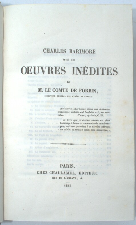
1819PHO-1484Paris, Challamel et Imprimerie Royale, Delaunay libraire,1843 et 1819, 1 vol.in 8*, 298pp. et 460 pp., une planche dépliante in fine, relié demi chagrin vert, dos à nerfs avec auteur et titre.
502 p., très nombreuses fig. et planches, n/b et couleurs, in- et hors-texte. 28 contributions relatives à l'Italie antique. Sudies in the History of Art. Vol. 43. Center for Advanced Study in the Visual Arts. Symposium Papers XXIII. (3 kilos); Inv. 15012.
315 p., 16 Pl. N.B. Non coupé. Inv. 18043.
2012Q-1892588293Great Texas Line Press 2012-03-25. Paperback. New. New. In shrink wrap. Looks like an interesting title! Great Texas Line Press paperback
196343915Alexandria, 1855-1963. Zus. 91 S., 8°. u. 4°.
8576570955.Gpaperback. Good. Access codes and supplements are not guaranteed with used items. May be an ex-library book. paperback
20121355386PN. New. 2012. Soft Cover. Date is original print. This is a reprint edition. . PN paperback
0359902561.Gpaperback. Good. Access codes and supplements are not guaranteed with used items. May be an ex-library book. paperback
1366536614.Gpaperback. Good. Access codes and supplements are not guaranteed with used items. May be an ex-library book. paperback
1544542690.Ghardcover. Good. Access codes and supplements are not guaranteed with used items. May be an ex-library book. hardcover
Very Good Turkish Original manuscript map of Alexandria Port and its immediate hinterland. Folio. (33 x 41 cm). In Turkish (Modern). Folded. No scale. The manuscript shows Alexandria Port and the Palace of the King Farouk of Egypt, customs shores, ports and harbors, locations of the British ships, radio station, location of SS Ramlah, strait, Great Pass (?), waterfront for the lumber ships, sea current zones and probably entrance and exit routes etc. A very detailed map, decorated with ships. Some repairs with tape, tears, foxing and stains. Overall a good copy.
Very Good Turkish, Ottoman (1500-1928) Original color map on cloth. Folded. Wrinkled on paper. Stains on cloth. 12 sheets on paper. Oblong atlas folio. (50 x 60 cm). In Ottoman script.[MAP of ALEXANDRETTA] Iskenderun - Tayakadin. It shows villages and settlements in Tayakadin of Iskenderiye. Scale: 1/25.000. Hegira: 1329 = Gregorian: 1913. This is one the serie of the Bonn projection maps which are the first map series in modern techniques in Turkey and the Ottoman Empire. In order to produce these maps covering Turkish territory, Reconnaissance Branch was incorporated into The Mapping Commission. The maps were produced in the datum based on the latitude and longitude of Ayasofya Mosque in equal area Bonn Projection. The field works for the 123 sheets covering the country were conducted by 76 staff. The production was completed in 18 years starting from east west. Field works continued without stopping except in years 1914 and 1920. This map series called also reconnaissance maps contributed a lot to producing 1:25.000 scale maps. Not description on map-maker. A very detailed map. Extremely rare.
Very Good Turkish, Ottoman (1500-1928) Original color map. Folded. Atlas folio. (82 x 57 cm). In Ottoman script. Scale: 1/400000. A clean copy. Including Azerbaijan, Dagestan, Mahaçkala, Tbilisi, Yerevan, Darband, et alli. A fine map of Caucasus and shores of Caspian Sea. Extremely rare.
Very Good Turkish, Ottoman (1500-1928) Original color map. Folded. Oblong atlas folio. (50 x 60 cm). In Ottoman script. Shows Southeastern parts of Asia Minor and Syria; Siverek, Sard (Iraq) and Ras Al-Ayn (Rasulayn - Resualyn) in Syria. Hegira: 1333 = Gregorian: 1917. Not description on map-maker. Scale: 1: 200.000. This is one the serie of the Bonn projection maps which are the first map series in modern techniques in Turkey and the Ottoman Empire. In order to produce these maps covering Turkish territory, Reconnaissance Branch was incorporated into The Mapping Commission. The maps were produced in the datum based on the latitude and longitude of Ayasofya Mosque in equal area Bonn Projection. The field works for the 123 sheets covering the country were conducted by 76 staff. The production was completed in 18 years starting from east west. Field works continued without stopping except in years 1914 and 1920. This map series called also reconnaissance maps contributed a lot to producing 1:25.000 scale maps. According to Türkezer & Çobanoglu: History of Mapping in Turkey-1:200.000 Scale Maps, last cartographer of Diyarbakir regio is M. Sait Malatyali. No his biographic material and info in 'Savaslarda Haritacilar'. Rare.
Very Good Turkish, Ottoman (1500-1928) Extremely rare huge chromo-lithograph map in 24 sheets mounted on canvas, showing a large zone including Midyat (Mardin), Mosul, Mt. Cilo (Resko-Buzul) on the southeast; Kahta (Adiyaman), Munzur Mt., Divrigi (Sivas) on the west; the Black Sea on north and Turkish borders to Armenia, Azerbaijan on the east, and to Russia on the northeast. In addition shows in separate little portions, roads, mountains and hills, lakes, and telegraph and post ways and borders in that zone. Not in any libraries and any collection. An attractive map with its huge size and decorative surface. Several toponyms are underlined in red ink. Otherwise a very good example. Original folded map mounted on canvas. 118x112 cm. In Ottoman script (Turkish with Arabic letters). Scale: 1/630.000.
Very Good Turkish, Ottoman (1500-1928) Original color map. Folded. Oblong atlas folio. (50 x 60 cm). In Ottoman script. Shows Eastern and Southeastern parts of Anatolia; Maras, Elbistan, Birecik and Kilis areas. Hegira: 1333 = Gregorian: 1917. Not description on map-maker.
Very Good Turkish, Ottoman (1500-1928) Original color map. Folded. Oblong atlas folio. (50 x 60 cm). In Ottoman script. [MAP of EAST ANATOLIA and ARTVIN] Oltu, Artvin, Ispir, Hasankale. Shows Artvin, Ispir, Hasankale and Kars city. Scale: 1/200.000. This is one the serie of the Bonn projection maps which are the first map series in modern techniques in Turkey and the Ottoman Empire. In order to produce these maps covering Turkish territory, Reconnaissance Branch was incorporated into The Mapping Commission. The maps were produced in the datum based on the latitude and longitude of Ayasofya Mosque in equal area Bonn Projection. The field works for the 123 sheets covering the country were conducted by 76 staff. The production was completed in 18 years starting from east west. Field works continued without stopping except in years 1914 and 1920. This map series called also reconnaissance maps contributed a lot to producing 1:25.000 scale maps. Hegira: 1332 = Gregorian: 1916. Not description on map-maker.
Very Good Turkish, Ottoman (1500-1928) Original color map. Folded. Oblong atlas folio. (50 x 60 cm). In Ottoman script. [MAP of EAST ANATOLIA] Hozat, Dersim. Shows Eastern parts of Anatolia; Dersim-Horat and border of Erzincan city; Divrigi; Harput (Kharpout); Kilis; and Munzur Mountains, et alli. Scale: 1/200.000. Hegira: 1330 = Gregorian: 1914. Not description on map-maker.
Very Good Turkish, Ottoman (1500-1928) Original color map. Folded. Oblong atlas folio. (50 x 60 cm). In Ottoman script. [MAP of EAST ANATOLIA] Malatya - Divrigi, Mancinik, Adiyaman, Harput. Shows Malatya, Adiyaman and Kharpout region; Firat River (Euphrates), Yazi Düzü, Erguvan etc. Scale: 1/200.000. This is one the serie of the Bonn projection maps which are the first map series in modern techniques in Turkey and the Ottoman Empire. In order to produce these maps covering Turkish territory, Reconnaissance Branch was incorporated into The Mapping Commission. The maps were produced in the datum based on the latitude and longitude of Ayasofya Mosque in equal area Bonn Projection. The field works for the 123 sheets covering the country were conducted by 76 staff. The production was completed in 18 years starting from east west. Field works continued without stopping except in years 1914 and 1920. This map series called also reconnaissance maps contributed a lot to producing 1:25.000 scale maps. Hegira: 1332 = Gregorian: 1916. Not description on map-maker. According to Türkezer & Çobanoglu: History of Mapping in Turkey-1:200.000 Scale Maps, cartographer of this map is Kambay, Cemal.
Very Good Turkish, Ottoman (1500-1928) Original color map. Folded. Oblong atlas folio. (50 x 60 cm). In Ottoman script. Shows Eastern parts of Anatolia; Siverek, Urfa city and border of Diyarbakir and Adiyaman cities; Siverek; Harput (Kharpout); et alli. Scale: 1/200.000. Hegira: 1333 = Gregorian: 1917. Not description on map-maker. This is one the serie of the Bonn projection maps which are the first map series in modern techniques in Turkey and the Ottoman Empire. This is one the serie of the Bonn projection maps which are the first map series in modern techniques in Turkey and the Ottoman Empire. In order to produce these maps covering Turkish territory, Reconnaissance Branch was incorporated into The Mapping Commission. The maps were produced in the datum based on the latitude and longitude of Ayasofya Mosque in equal area Bonn Projection. The field works for the 123 sheets covering the country were conducted by 76 staff. The production was completed in 18 years starting from east west. Field works continued without stopping except in years 1914 and 1920. This map series called also reconnaissance maps contributed a lot to producing 1:25.000 scale maps. Subasi is cartographer of this map according to Türkezer - Cobanoglu: History of Mapping in Turkey-1:200.000 Scale Maps.
Good Turkish, Ottoman (1500-1928) Original color map. Folded. Tears in margins. Slightly stained. Otherwise a good copy. Oblong atlas folio. (50 x 60 cm). In Ottoman script. [MAP of EAST BLACK SEA] Artvin, Rize, Oltu. Shows Artvin and Georgian borders, Rize (Rizeon - Rizunda - Rizini) and Oltu cities and regions. Scale: 1/200.000. Hegira: 1330 = Gregorian: 1914. This is one the serie of the Bonn projection maps which are the first map series in modern techniques in Turkey and the Ottoman Empire. In order to produce these maps covering Turkish territory, Reconnaissance Branch was incorporated into The Mapping Commission. The maps were produced in the datum based on the latitude and longitude of Ayasofya Mosque in equal area Bonn Projection. The field works for the 123 sheets covering the country were conducted by 76 staff. The production was completed in 18 years starting from east west. Field works continued without stopping except in years 1914 and 1920. This map series called also reconnaissance maps contributed a lot to producing 1:25.000 scale maps. Not description on map-maker. Extremely rare.
Very Good Turkish, Ottoman (1500-1928) Original color map. Folded. Oblong atlas folio. (50 x 60 cm). In Ottoman script. [MAP of EAST BLACK SEA] Trabzon, Giresun, Erzincan, Ispir. Shows Trebizond, Cerasonte, Erzingan (Eriza), Suspiritis (Sper) of Erzurum (Erzeron city); mostly Black Sea shores of Trabzon and Giresun. . Scale: 1/200.000. This is one the serie of the Bonn projection maps which are the first map series in modern techniques in Turkey and the Ottoman Empire. In order to produce these maps covering Turkish territory, Reconnaissance Branch was incorporated into The Mapping Commission. The maps were produced in the datum based on the latitude and longitude of Ayasofya Mosque in equal area Bonn Projection. The field works for the 123 sheets covering the country were conducted by 76 staff. The production was completed in 18 years starting from east west. Field works continued without stopping except in years 1914 and 1920. This map series called also reconnaissance maps contributed a lot to producing 1:25.000 scale maps. Hegira: 1336 = Gregorian: 1920. Not description on map-maker. Extremely rare.
Very Good French Original engraved b/w map. Folded. A little foxing. Otherwise very good and clean copy. Folio. (40 x 27 cm). In French. From 'Voyage Egypte et en Syrie.; pendant les années 1783, 1784 et 1785, suivi de considérations sur la guerre des russes et des turks, publiées en 1788 et 1789, Vol. 1 (Egypt chapter). At north, Mer Mediterranee, Syrie,, Alexandrie, Delta, et alli. Also shows Desert d'Arabie, Desert d'Afrique; with El Tih ou Desert de l'Egarement, Bahr ou Mer de Qolzoumm, Mer Rouge, Ancien Thebes, et alli.
Very Good Turkish, Ottoman (1500-1928) Original chromolithograph folded map. Oblong atlas folio. (49 x 65 cm). In Ottoman script. Repaired with a band in the contemporary period from its backside. Set including 4 sheets. Other sheets are Basrah, Bagdad, and Qut al-Amare. This is the first sheet including 'Samawah'. Rare. Scale is 1/500.000. Samawah city was settled by the Arab tribe of Banu Quda'a around the 3rd century AD. It is built on both sides of the Euphrates river; there are four bridges in the center of town for crossing between the two sides. The west bank of the city contains the commercial heart of the city and includes the old town and the Jewish quarter, Agd al Yahood. The west bank is the site of the covered market Suq Al Masgoof, which dates to the Ottoman period. The area surrounding the market is the old city with its Byzantine maze of crowded markets and streets. The eastern side of the city including 'Qushla' has a more modern feel and contains a number of estates of apartment blocks built during the 1970s and 1980s, As Samawah Stadium, which is home to the local Muthanna football team Samawa FC, as well as technical colleges and the polytechnic. There too is Al Qushla, the historic "Ottoman Barracks". The most famous attraction of Samawah in the ruins of the ancient Sumerian city of Uruk which dates to 4000 BC. This was the largest city in Sumer, extending over 2 km2. Uruk was not only the largest conurbation of the first urban civilization on earth, but it is also the place where the first written script was discovered, the oldest dating back to 3300 BC. The palm groves of Samawah: Samawah is built on both sides of the Euphrates and is surrounded by hundreds of palm groves that give it a tropical feel, especially in the southern and northern suburbs. These groves provide cool respite from the scorching heat of Mesopotamia and were the inspiration for the famous Iraqi folk song "The Palm of Samawah".
Very Good Turkish, Ottoman (1500-1928) Original color map on cloth. Folded. Oblong atlas folio. (50 x 60 cm). In Ottoman script. Shows Konya city and around, Alaiye at south. Not description on map-maker. Scale: 1: 200.000. This is one the serie of the Bonn projection maps which are the first map series in modern techniques in Turkey and the Ottoman Empire. In order to produce these maps covering Turkish territory, Reconnaissance Branch was incorporated into The Mapping Commission. The maps were produced in the datum based on the latitude and longitude of Ayasofya Mosque in equal area Bonn Projection. The field works for the 123 sheets covering the country were conducted by 76 staff. The production was completed in 18 years starting from east west. Field works continued without stopping except in years 1914 and 1920. This map series called also reconnaissance maps contributed a lot to producing 1:25.000 scale maps. Rare.