BRUTTI Lorenzo, PAINI Anna (dir.)MareMagnum

858 résultats
Lingua italiana, Meltemi, Ricerche, 2002, 258 pp., brossura editore, buono stato.
In 8° piccolo, br. edit. ill. a colori, pp. 32. Dalla pubblicazione "Biblioteca illustrata dei Viaggi intorno al mondo per terra e per mare", buon es. con num.se ill. fotografiche n.t.
8vo., First Edition, with coloured portrait frontispiece and maps; original Society binding of navy cloth, upper board blocked with sailing vessel in gilt, gilt back, a near fine copy in unclipped dustwrapper. Hakluyt Society, Third Series, No. 5.
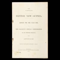
34049At head of title: 1890. Queensland. Brisbane : James C. Beal Government Printer 1890. Foolscap folio 330 mm string bound pp 168 with 3 lithographed plates including profile of the Victor Emanuel Range and tribal designs and 6 large folding maps at rear; Appendix X Native Dialects 117-168 contains several important vocabularies of indigenous languages; outer leaves with light foxing and browning some foxing to versos of the maps but a very good complete example of this substantial and significant report. Scarce. unknown
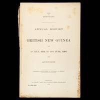
33711At head of title: 1888. Queensland. Brisbane : James C. Beal Government Printer 1888. Foolscap folio 330 mm disbound pp 49 2 13; some foxing at extremities otherwise very good. Scarce. unknown
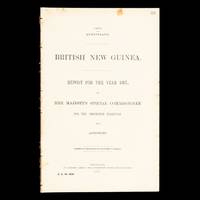
34048At head of title: 1889. Queensland. Brisbane : James C. Beal Government Printer 1889. Foolscap folio 330 mm staple bound pp 39 with a large folding colour map at rear; front with rust marks around the staples and some very light foxing otherwise very good. Scarce. unknown
Mappa dettagliata del 1760 circa del geografo francese Brion de la Tour che mostra la costa occidentale dell'Africa dal Gabon alla Namibia. La mappa contine numerosi dettagli e annotazioni riguardanti recenti esplorazioni. Autore: Brion de La Tour (1743-1803) Data: 1760 circa Tecnica: incisione su rame Dimensione foglio: 25,5x37 cm Dimensione dell'incisione: 25x36 cm Condizioni: buone. Piegatura verticale Very beautiful detailed map of 1760 circa by the French geographer Brion de la Tour featuring the west coast of Africa from the Gabon to Namibia. The map is filled with details and notations concerning recent explorations. Author: Brion de La Tour (1743-1803) Date: 1760 circa Technique: etching on copper Leaf Dimension: 25,5x37 cm (10x14.6 inches) Engraving Dimension: 25x36 cm (9.8x14.2 inches) Conditions: Very good conditions. Vertical foldings.
Pages 177-272, plus 16 pages of great ads. Features: The Blue Bandits - Part 1 - Elusive thieves operate in the Franco-Italian villages on either side of the frontier in the French department of the Hautes Alpes and the Italian district of Monte Viso; How I Lost My Christmas Dinner - hilarious story of a Christmas spent with the Maori adherents of self-styled "prophet" Rua - article with photos; On Foot Through South America - Part 2 - photo-illustrated account of Harry A. Franck's visit to Quito and his tramp through Ecuador; The Last Voyage of H.M.S. "Drake" - a vivid glimpse of the perils of convoy work and the "price of Admiralty"; ; The Trials of a Naturalist's Wife - Part 1; My Two Years' Captivity Among the Turks - Part 1of Airman Capt. T.W.White's adventures and daring escape; The Moonshiners - what happened when the author stumbled into a camp of Tennessee moonshiners; Photo of thousands of snakes at breeding time in the Klamath Falls, Oregon area; The Wonderland of the Arctic - description of a trip to Danish Greenland, with photos; In Quest of Cannibals - Part 3 - exploration and adventure in unknown New Guinea; Photo of German "Death Clock" constructed primarily of skulls and other bones; Two Balloonatics - an exciting balloon adventure from just before the war (WWI); Treasure Island - great photo-illustrated article about the remote South Pacific island of Nauru; The Mad Millionaire - how vast wealth came unexpectedly to a poor Mexican Indian, and the tragedy that ensued; The Sacred Mountain - photo-illustrated account of a picturesque Tibetan pilgrimage; The Resurrection of "Red" Wilson - an exciting story of the old days in the south-west, when the Apaches were still a terror in the land; Photo of a lakatoi (lakatois) New Guinea boat. Somewhat above-average wear. Unmarked. A worthy copy of this great vintage issue. Book
1891703441891 Lecène, Oudin et Cie Editeurs, 1891, 1 volume in-8 de 239 pages, cartonnage avec dos muet (restauré).
1939169794Zürich, Büchergilde Gutenberg, 1939. Mit zahlreichen fotografischen Abbildungen. 311 S. Illustrierter Or.-Lwd.; tlw. verblasst u. stockfleckig. - Guinea. [4 Warenabbildungen]
19393369Büchergilde Gutenberg, Zürich 1939. 311 S. mit zahlr. Abbildungen. Gr.-8°. Leinen. Leichte Gebrsp. Typographie und Buchgestaltung von Richard Paul Lohse.
18858aafZürich, Büchergilde, 1945, gr. in-8°, 292 S., ill. mit fotogr. Abb., Original-Leinenband.
223496Genève, Slatkine, 1978 in-8, [6]-VII-230 pp., 2 cartes dépliantes in fine, bradel sky-vertex blond, titre sur la 1ere de couv. (reliure de l'éditeur).
98823aafLondon, Frank Cass & Co., 1967, lg. in-8vo, XXI + 577 p., illustrated, small legacy stamp ‘Guggisberg’, original publisher’s green pictorial clothbound. Very good to fine copy.
19368011936 broché petit in-octavo (paperback in-octavo), dos et couverture crèmes imprimés (white spine and cover printed), tranches non rognées (edges no smooth), illustration : 1 carte en couleurs repliée in fine en bon état (folding map in colours at rear in good condition), 312 pages, 1936 à Paris Librairie Plon - Les Petits-Fils de Plon et Nourrit - Imprimeurs-Editeurs,
68156Paris, éd. Plon, octobre 1936, EDITION ORIGINALE sur papier ordinaire, in-12, br., 314 pp., 1 carte dépliable avec tracés en rouge, bibliographie, table des matières, Voyage en Afrique à travers le Sénégal, le Soudan, le Niger, la Côte d'Ivoire et la Guinée. Pas courant et bien complet de la planche. Bon état du papier uniformément jauni et avec la couverture légèrement défraîchie
177127424Paris Lattré 1771 2 cartes anciennes colorées d'époque en vert , rouge et jaune, cartouche non coloré, gravée par Arrivet. Format total : 50 centimètres de haut par 39 centimètres de large, 1771 Paris Lattré Editeur,
178018808genève pellet 1780 -in-4 une carte ancienne gravée sur cuivre (Copper etching) en noir par André, gravée par Arrivet. Format : 31 x 20,5 cm, pour illustrer l'uvre de l'Abbé Guillaume-Thomas Raynal intitulée "l'Histoire philosophique et Politique des Etablissemens et du Commerce des Européens dans les Deux Indes", pli central horizontal normal venant d'un atlas( horizontal centerfold), 1780 Genève Pellet Editeur,
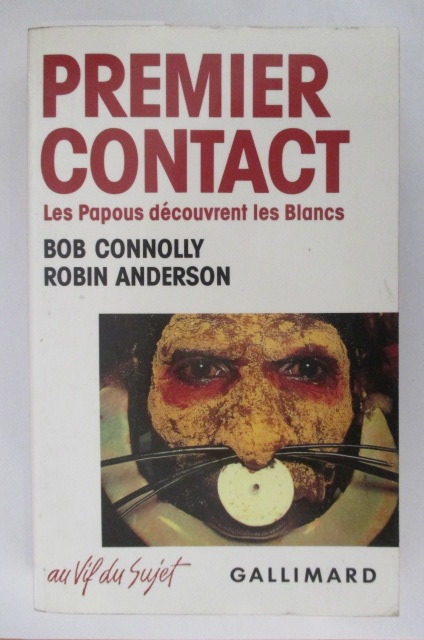
SCH080c1901989 / 277 pages. Broché Editions Gallimard
Lausanne Librairie Payot 1946, In-8 broché de 277 pages. Jolie couverture illustrée. Parfait état.
5814LAUSANNE, Librairie Payot, 1946, broché, 14,5x23 cm, 277 pages. 32 illustrations en hors texte et 1 carte dépliante
19469996536Payot Lausanne Librairie Payot 1946, In-8 broché de 277 pages. Jolie couverture illustrée. Parfait état.
1946251081946 Lausanne, Payot, 1946, in 8° broché, 279 pages ; couverture illustrée en couleurs (petits accrocs au dos).
In 8°, t.t. edit. con sovracc. ill. (strappetti e minime mancanze), pp. 213,(3), con num. fot. b/n f.t.; copia molto buona. (L065)
trad. di Ettore Capriolo tela edit. con sovrac. ill., sguardie figurate, piccole rotture in sovrac.