Jeroen B GuineeBiblio.com

858 résultats
788368like new. unknown
ria9781402005572_inpPaperback. New. New Book; Fast Shipping from UK; Not signed; Not First Edition; Environmental policy aims at the transition to sustainable production and consumption. This is taking place in different ways and at different levels. In cases where businesses are continuously active to improve the environmental perfor paperback
1996Alibris.0026790Department of Agriculture and Livestock Papua New Guinea. 1996. Trade paperback. Good. back cover and pages 107-135 have a crease. 135 p. Department of Agriculture and Livestock, Papua New Guinea paperback
1371607Nancy: Imprimerie Georges Thomas, 1936 in-4, 144 pages, 128 figures, 2 cartes se dépliant (une au 1:1.000.000è et une au 1:500.000è, cette dernière en couleurs). Broché. Envoi de l'auteur illustré d'un dessin humoristique. Bel exemplaire.
20182933162Lima.: La Plaza. 2018. Paperback. Good. 20 cm. 283 p. Encuadernación en tapa blanda de editorial ilustrada. ISBN: 6124742811 Literatura.82 82 La Plaza. paperback
1963116840Lausanne, Editions Rencontre, 1963, pt in-4°, 222 pp, texte sur 2 colonnes, 48 pl. de photos hors texte, illustrations et gravures anciennes dans le texte, carte, reliure cartonnée illustrée de l'éditeur, soulignures stylo, bon état (Coll. Atlas des Voyages)
8221Lausanne, Editions Rencontre 1963, 270x170mm, 222pages, cartonnage de l’éditeur.
1963134595Couverture rigide. Cartonnage de l'éditeur. 222 pages.
4773Carte (42 x 31,5 cm hors marges) des côtes du golfe de Guinée (c. 1780) gravée sur cuivre. Frontières, côtes et encadrement réhaussés. Dimensions totales : 510 mm x 360 mm. Dimensions hors marges : 420 mm x 315 mm.Bel état. Papier légèrement jauni,quelques très légères rousseurs au dos et menus défauts.Tirage de l'époque.Rare.
ORD-5151Paris. Editions Maritimes et Coloniales. 1953. In-8 (156 x 230mm) broché, couverture illustrée d'un dessin de Monique CRAS, 94, (1) pages, 4 cartes et 8 planches photo hors texte. Couverture un peu frottée, dernière page réparée mais bon exemplaire.
9076Lausanne, Editions Rencontres, 1963. Coll. "L'Atlas des Voyages". In-8 cartonné, couv. ill., 223 p. Planches h.-t. Illustrations in-t. Très bon état.
19812570Berlin: Berliner Handpresse 1981. 40 S., 27x27 cm, OHLn.
4954reliure éditeur - 17,5x27 - 222 pp - 1963 - éditions RENCONTRE, Lausanne.Collection " ATLAS DES VOYAGES, RENCONTRE" dirigée par Charles-Henri FAVROD.Nombreuses illustrations dans et hors texte.
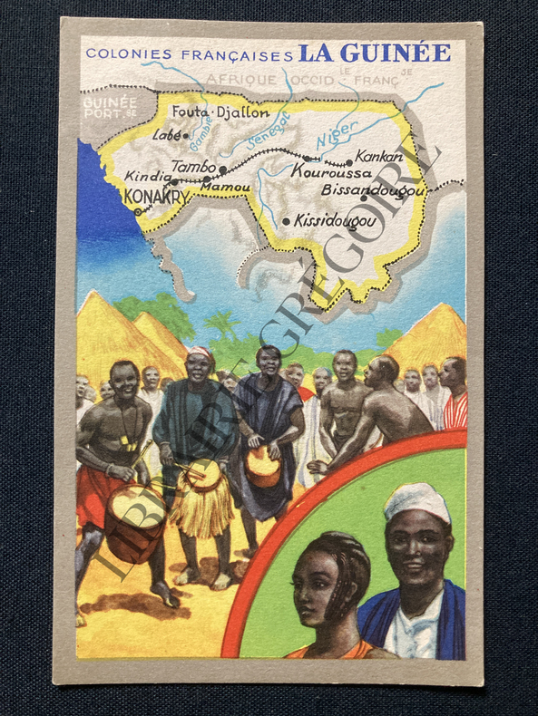
1907R100037591Non Renseigné. 1907. In-12. Broché. Bon état, Couv. convenable, Dos satisfaisant, Intérieur frais. Bon état. . . . Classification : 233-Colonies
ABE-17106714142829 CM X 14 CM-SANS DATE-(CPP2)
Carta geografica della Nuova Guinea inserita nell'opera "Atlas sive Cosmographicae Meditationes de Fabrica Mundi et fabricati figura..." edita da Jan Cloppenburgh. Piccoli restauri ai margini
TiTOLO: “Guinea” tratto dal Nieuwen Atlas Amstelodami, Sumptibus Joannis Janssonii 1650 circa Dimensioni del foglio: 488 x 595 mm. Dimensioni dell'incisione: 386 x 506 mm. Tecnica: incisione su rame Condizioni generali: Eccellenti rare fioriture. Meravigliosa mappa della Guinea di grandi dimensioni acquarellata a mano tratta dall'Atlante "Nieuwen Atlas" [translation: The New Atlas], di Jan Jansson, pubblicata ad Amsterdam nel 1650 circa. La mappa mostra l'odierna Guinea, Sierra Leone, Liberia, Costa D'Avorio, Ghana, Burkina Faso, Togo, Benin, Nigeria e Camerun. Orientata a 90 gradi a sinistra cosi che la Guinea è in orizzontale. Titolo decorato con elaborato cartiglio e illustrazioni di flora e fauna secondo l'interpretazione europea. Descrizione completa della Guinea in lingua latina al verso. Jan Jansson, celebre cartografo, appartenente ad una lunga stirpe di stampatori attivi a partire dal XVII secolo. Si stabilirono prima ad Arnhem poi ad Amsterdam. Furono stampatori di mappe, di libri e librai. Title: “Guinea” from Nieuwen Atlas Amstelodami, Sumptibus Joannis Janssonii 1650 circa Sheet size: 19.21 x 23.42 in; 488 x 595 mm. Plate area: 15.2 x 19.9 in; 386 x 506 mm. Technique: Copper engraving Overall condition: Excellent condition, with light foxing. A wonderful larg scale hand-colored map of Guinea, from one of the great early 17th-century Atlas "Nieuwen Atlas" [translation: The New Atlas], by Jan Jansson, published in Amsterdam in 1650 circa.<BR><BR>The map shows what is now Guinea, Sierra Leone, Liberia, Cotre d’Ivoire, Ghana, Burkina Faso, Togo, Benin, Nigeria and Cameroon. Oriented 90 degrees to the left so that the Guinea is horizontal. Elaborately decorated title and decoration cartouches and illustrations of European interpretations of african flora and fauna. Complete description of Guinea in latin language in the verso. Jan Jansson was part of an influential family of map publishers from the Netherland throughout the 17th century and beyond. They were based in Arnhem than in Amsterdam. They were printers, publishers and booksellers. Overall Condition: Excellent
Cartonnage de l'?diteur. 222 pages.
1980Alibris.0017499S.l. : Library University of Papua New Guinea. 1980. Trade paperback. Fair. No dust jacket as issued. Ex-library. ex-library strip along spine partly removed and partly coming off unaffecting binding label on back cover stamps on title page stamps on table of contents stamps & label on last blank page unmarked text. 142p. Library, University of Papua New Guinea paperback
1957022260The Mission Press, Techny, Illinois 1957. Flexibler Einband Tadellos
2004Alibris.0031118The Bible Society of Papua New Guinea. 2004. 2nd ed. Trade paperback. Fine. 652 p. The Bible Society of Papua New Guinea paperback
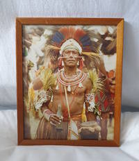
19812236591981. Colour photograph on matte paper 25 x 20cm; 27.5 x 22cm framed and glazed good condition. . unknown
Carta geografica in litografia, antica ed originale del 1878, di mm 240x340 (il foglio) con coloritura confinale coeva. Stampata dalla calco-litografia di B. Marchisio & Figli ed inserita nell'opera a cura del Cavaliere Celestino Peroglio raffigurante il Golfo di Guinea. Leggero foxing