599 résultats
179718040ABNuremberg, 1797. 16,5 : 10,5 cm. VIII, pages 203 - 524. Contemporary boards, edges gilt.
177189551771 carte ancienne colorée d'époque en vert , rouge et jaune, cartouche non coloré, gravée par Arrivet. Format total : 50 centimètres de haut par 39 centimètres de large, 1771 Paris Lattré Editeur,
177189581771 carte ancienne colorée d'époque en vert , rouge et jaune, cartouche non coloré, gravée par Arrivet. Format total : 50 centimètres de haut par 39 centimètres de large, 1771 Paris Lattré Editeur,
1766Tir3431766 Planche seule - dimensions 38 x 29 cm - planche aquarellée - Quelques micro déchirures eu bordures - Le pli du milieu existant déjà sera donc envoyée pliée en deux .
1779153311779 trace de pliure carte 250 x 285 mm. P. 1779
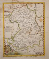
17807883London c. 1780. Copper engraving 23 x 18 cms recent hand colour printed on paper stock with a blue tint blank verso. This map was first issued in The London Magazine which between 1747 and 1754 published a complete set of English county maps by Thomas Kitchin. The maps were subsequently published as a pocket atlas and reissued as a set by Alexander Hogg in Boswell's Antiquities of England & Wales. Map unknown
17506860London c.1750. Copper engraving 17 x 23 cms recent hand colour slight spotting blank verso; published in the London Magazine. Map unknown
1790303114Londini, M. Ritchie & J. Sammells, 1790. 1 Titelblatt, 422 Seiten MIT dem Frontispiz Caesars und den Karten "Tabula Geographica" und "Gallia Vetus" und "Pontis figura trans Rhenum ". Index rerum memorabilium . Originallederbände mit vergoldeten Rückentiteln und Goldfileten. Ganzgoldschnitt. 24 cm
17500009001London England Britain UK. Good. 1750. Vellum. On offer is an exemplary and rare Latin copy of the Thirty-Nine Articles of Religion the defining statements of doctrines and practices of the Church of England and one of the most important religious documents of history. While the Articles themselves were formulated in the mid-1500s this particular book dates back to c.1700. The Articles were issued in both Latin and English. The entirety of this book is written in Latin. There is a vellum cover still fully intact though there are small tears at the ends and discoloration due to age. Written on the front cover and continued on the back are a table of contents for all 39 articles. They begin with I. De Fide in sacrosanctam Trinitatem. and ending with XXIX. De Christiani Juramento. The writing is still extremely clear. Smudging or discoloration of the text throughout the entire book is non-existent. The book is roughly 160 pages long. It has been sewed together using a 3-hole pamphlet stitching. There are also some anomalies throughout. Many pages contain tiny pieces of paper sewn in that have extra writing on them. One of them reads Christ a true sacrifice vide Eph: 20 which translates to Christs sacrifice see: Ephesians: 20. Another reads vide Art: XXI. Prop: V. These little notes seem to be addendums and cross-references that the owner most probably put in himself. While most pages are fully filled with text a few pages are mostly blank with some writing on the top De sexta propositione and a blank space under which the owner meant to continue writing but did not. History: When Henry VIII broke with the Roman Catholic Church and was excommunicated in 1538 he formed a new Church of England which would be headed by the monarch himself rather than the pope. The Thirty-nine Articles of Religion were initiated by the Convocation of 1563 under the direction of Matthew Parker the Archbishop of Canterbury. The articles pulled back from some of the more extreme Calvinist thinking and created the peculiar English reformed doctrine. Adherence to the Articles was made a legal requirement by the English Parliament in 1571 and incorporated into the Anglican Book of Common Prayer. Although not the end of the struggle between Catholic and Protestant monarchs and citizens the book helped to standardize the English language and was to have a lasting effect on religion in the United Kingdom and elsewhere through its wide use. ; Manuscript; 8vo - over 7¾" - 9¾" tall; KEYWORDS: HISTORY OF THIRTY-NINE ARTICLES OF RELIGION 39 ARTICLES XXXIX ARTICLES ANGLICAN CHURCH CHURCH OF ENGLAND LATIN BOOK HENRY VIII THOMAS CRANMER EXCOMMUNICATION NON VERNACULAR RELIGION RELIGIOUS DOCUMENT PROTESTANT REFORMATION UNITED . hardcover
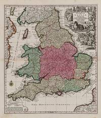
1740200029AG1740. Augsburg Seutter c.1740. Original hand-coloured engraving. Plate Size: 48.6 cm x 56.7 cm. Sheet Size: 54 cm x 62.1 cm. Original map. In very good condition. Some minor browning evident with the slightest traces of staining to outer margins. Tape repairs to reinforced reverse. Moreland and Bannister 1983: Tooley 1979. A very detailed and interesting map of England and Wales. To the north lies Scotland while offshore parts of Ireland and France are seen. Rivers headlands towns and cities are identified and relief shown pictorially. Divides England into pre-Norman Conquest: The Kingdome of West Saxons The Kingd. Of South Saxons The Kingd. Of Kent The Kingd. of East Saxons The Kingdom of East Angles The Kingdom of Mercie The Princedome of Wales and the Kingdome of Northumberland. Shows major cities and regions such as Surrey Cornwall Dorsetshire Wiltshire Somersetshire Essex Suffolk Warwikshire London Hartfordshire Denbighshire Shorpshire Yorkshire Cumberland Cambridge and Darbyshire. Includes the British Channel to the south and the Irish Sea or St. George's Channel to the west. In the top right of the map a large allegorical title cartouche represents the wealth of Britain - illustrating the sciences trade and industry agriculture and maritime activity throughout the realm. In the opposite corner a smaller cartouche shows map symbols and three scale bars. A compass rose guards the mouth of the Bristol channel. Matthäus Seutter 1678-1757 was one of the most important and prolific German map publishers of the 18th century. Matthaus Seutter the elder first published his "Atlas Geographicus" in 1720 and added to the contents in subsequent editions under the title "Atlas Novus". He was succeeded in his business by his son Georg Matthaus Seutter and after his death his son Albrecht Carl inherited but died early in 1762. Matthaus' widow then sold the business to her sons-in-law Tobias Conrad Lotter and Johann Michael Probst who eventually left it to M.A. Lotter Matthaus' grandson. Wikipedia unknown
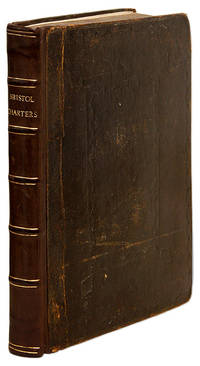
1736698131736. Bristol: Sold by Felix Farley 1736. Quarto. Bristol: Sold by Felix Farley 1736. Quarto. The City Charters and Geographical Boundaries of Bristol England Bristol England. Bristol. The City Charters. Containing the Original Institution of Mayors Recorders Sheriffs Town-Clerks And All Other Officers Whatsoever. As also of a Common-Council And the Ancient Laws and Customs of the City. Diligently Compar'd with And Corrected According to the Latin Originals. To which are Added The Bounds of the City By Land With the Exact Distances from Stone to Stone All Round the City. Bristol: Sold by Felix Farley 1736. 297 15 pp. A few errors in pagination text complete. Copperplate frontispiece. Final advertisement leaf. Quarto 9-1/2" x 7-1/2". Contemporary paneled calf gilt spine with raised bands and lettering piece joints and head of spine reinforced gilt tooling to board edges. Light rubbing and a few minor scratches stains and scuffs to boards moderate rubbing to board edges small chip to lettering piece corners bumped and somewhat worn hinges starting. Light toning to text slightly heavier in places light foxing to a few leaves. $500. Only edition. Includes details on the recently completed 1736 survey indicated by the exact location of some 74 boundary stones on the Gloucestershire side and of 29 on the Somersetshire side. One example: "Stone 1. On the bank of the River of Avon near a limekiln on the East and a sluice on the West call'd Woodwell's-Lake standeth the first stone." This is indeed the only edition; a copy at the Ransom Center at the University of Texas Austin with a suggested date of "1735" must surely be a mistake. OCLC locates 12 copies in North America 3 in law libraries Harvard University of Minnesota University of Pennsylvania. English Short-Title Catalogue T143949. unknown books
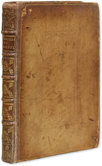
1736694771736. Bristol: Sold by Felix Farley 1736. Quarto. Bristol: Sold by Felix Farley 1736. Quarto. The City Charters and Geographical Boundaries of Bristol England Bristol England. Bristol. The City Charters. Containing the Original Institution of Mayors Recorders Sheriffs Town-Clerks And All Other Officers Whatsoever. As also of a Common-Council And the Ancient Laws and Customs of the City. Diligently Compar'd with And Corrected According to the Latin Originals. To which are Added The Bounds of the City By Land With the Exact Distances from Stone to Stone All Round the City. Bristol: Sold by Felix Farley 1736. 297 15 pp. A few errors in pagination text complete. Copperplate frontispiece. Final advertisement leaf. Quarto 9-1/2" x 7-1/2". Contemporary paneled calf rebacked in period style lettering piece and gilt-edged raised bands to spine endpapers renewed. Moderate rubbing to boards and board edges corners bumped and somewhat worn. Moderate toning a few leaves somewhat darker occasional light foxing to margins minor worming to margins in a few places with no loss to text early owner signature of Marmaduke Coules to recto of frontispiece. $500. Only edition. Includes details on the recently completed 1736 survey indicated by the exact location of some 74 boundary stones on the Gloucestershire side and of 29 on the Somersetshire side. One example: "Stone 1. On the bank of the River of Avon near a limekiln on the East and a sluice on the West call'd Woodwell's-Lake standeth the first stone." This is indeed the only edition; a copy at the Ransom Center at the University of Texas Austin with a suggested date of "1735" must surely be a mistake. OCLC locates 12 copies in North America 3 in law libraries Harvard University of Minnesota University of Pennsylvania. English Short-Title Catalogue T143949. unknown books
177512940ABAltenburg, Richter 1775. 3 Bände. [1] Bl., VI S., [11] Bll., 398; 490; 568 S., [3] Bll. (Korrigenda und 2 Bl. Verlagsanzeigen). Pappbände der Zeit mit rotem Rückenschild. Stärker berieben, Ecken bestoßen. Stempel (whdt). 2 Exlibris am Spiegel. Name am Titel. Durchgehend gebräunt. Im 2. Band fehlen 5 Bll.: C1, C2, C7, C8 und D1 (S. 33-36, 45-50). 1
179350746BBLeipzig, bei August Lebrecht Reinike., 1793. 8°. Titel, 222 S., 203 S. Leicht späterer Bibliothekspappband mit handschriftlichem Rückentitel. Zwei Theile (in 1 Band).
179350746BBZwei Theile (in 1 Band). Leipzig, bei August Lebrecht Reinike. 1793. 8°. Titel, 222 S., 203 S. Leicht späterer Bibliothekspappband mit handschriftlichem Rückentitel.
1717IYC44885London: J. Sturt 1717. hardback. The Pryce family copy of the BCP with records of family baptisms on 2nd fep from 1770 to 1781. Very good contemporary leather binding with gilt decoerations front and back and on with ribbed spine; marbled pastedowns with owners emblem and label on front paste down. Pages good and print very clear. Beautiful copy. 8vo 230 x 150 / 9"" x 6"". Book of Common Prayer and Administration of the Sacramanets under King George 1717 beautifully illustrated throughout. J. Sturt hardcover
178256526BBLondon, Printed for Rivingtons, T. Payne, L. Davis, T.Longman, G.Robinson u.a., 1782. 8°. LII, 496 S.; 2 n.n. Bl., 446 S. Geglättete Kalblederbände der Zeit mit roten und grünen Titel- und Bandschilder in Gold und reicher Rückenvergoldung. 2 vol. [2 Warenabbildungen]
178256526BB2 vol. London, Printed for Rivingtons, T. Payne, L. Davis, T.Longman, G.Robinson u.a. 1782. 8°. LII, 496 S.; 2 n.n. Bl., 446 S. Geglättete Kalblederbände der Zeit mit roten und grünen Titel- und Bandschilder in Gold und reicher Rückenvergoldung.
179498426HBLeipzig:, Dykische Buchhandlung, 1794. 128, 126 Seiten, 1 Bl. Verlagsanzeigen, 112 Seiten, Buntpapierbroschur der Zeit, 11,5 cm. [2 Warenabbildungen]
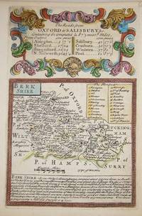
17207875London c. 1720. Copper engraving 18 x 12 cms recent hand-colour b/w strip-maps on verso. Map unknown
17206052London c. 1720. Copper engraving 18 x 12 cms recent hand-colour b/w strip-maps on verso. Map unknown
17207874London c. 1720. Copper engraving 18 x 12 cms recent hand-colour b/w strip-maps on verso. Map unknown
179413380ABGöttingen, 1794. 33,5 : 24,5 cm Contemporary half cloth.-
1798014463Paris Chez Hyacinthe Langlois, libraire 1798 Demi-reliure à coins