BOATE (Gerard).Livre Rare Book
6 228 résultats
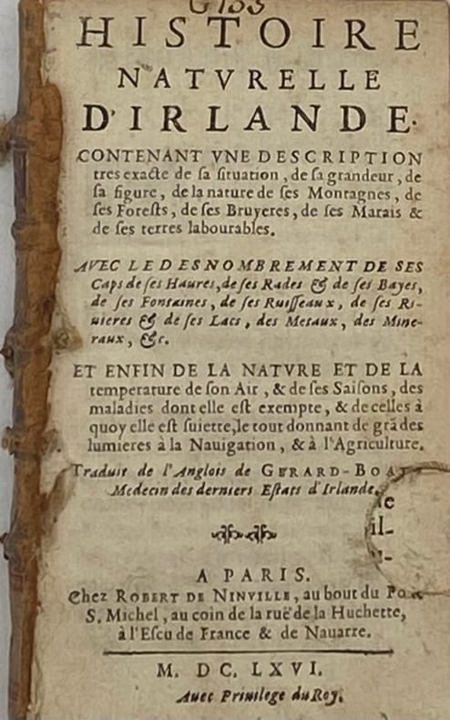
229505Paris, Robert de Ninville, 1666 in-12, [4] ff. n. ch. (titre, préface, privilège), 334 pp., [2] ff. n. ch. de table des chapitres, dérelié, tranches rouges. Petit manque de papier au f. de titre, avec perte de lettre (cachet découpé).
ria9781591589020_inpPaperback. New. New Book; Fast Shipping from UK; Not signed; Not First Edition; N/A paperback
B9781591589020Paperback / softback. New. Utilizing primary sources from the Library of Congress website this unique classroom resource presents ready-to-use lesson plans analysis tools and rubrics based on Abraham Lincoln and his era. paperback
tavole in bianco e nero fuori testo
193854578ABLondon; Toronto, William Heinemann, 1938. 8° (20x13), 264 p., enpager maps, publisher's hardbound green cloth with silver title on spine, 1. ed. sl brownd, tight and clean,
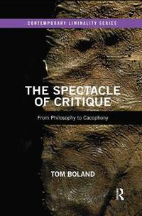
ria9780367479046_inpPaperback / softback. New. New Book; Fast Shipping from UK; Not signed; Not First Edition; Far from being the preserve of a few elite thinkers critique increasingly dominates public life in modernity leading to a cacophony of accusation and denunciation around all political issues. The technique of unmasking power or paperback
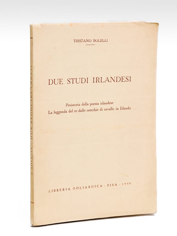
1950629981 vol. in-8 br., Libreria Goliardica, Pisa, 1950, 100 pp.
Signed 'Dermot Bolger' to title page. No other marks or inscriptions. A very clean very tight copy with bright unmarked boards, slightly tanned, slightly dusty page edges and no bumping to corners. Dust jacket not price clipped or marked or torn or creased with slight rubbing to upper edge. 388pp. A young woman's search for truth in a sea of moral ambiguity, where she can be certain of nothing, least of all her own feelings. Set in London and Ireland.
2432Hazan / Association Française d' Action Artistique , 1996. Grand in-8° carré. Broché. Couverture illustrée. Illustrations en noir et en couleurs in et hors texte . 126 pages. Ouvrage présenté et coordonné par Pascal Bonafoux . Sommaire : Dorothy Walker : L' Art irlandais au XXe siècle - Liam Kelly : L' Art en Irlande du nord - Luke Gibbons : L' Art et l' inimaginable - C. Mac Giolla Leith : De la nature (poésie) à la (multi) culture - Willie Doherty et Nigel Rolfe au Musée d' Art Moderne de la Ville de Paris - James Coleman au Centre Georges Pompidou - 18 artistes irlandais à l' Ecole nationale supérieure des Beaux-Arts de Paris - Artistes en résidence . Guide des galeries, musées et institutions consacrés aux arts en Irlande . Bon état.
(Firenze, IGM, 1966) stralcio con copertina posticcia muta, pp. 761/796 con numerosissime illustrazioni in nero e a colori. - !! ATTENZIONE !!: Con il termine estratto (o stralcio) intendiamo riferirci ad un fascicolo contenente un articolo di rivista, sia che esso sia stato stampato a parte utilizzando la stessa composizione sia che provenga direttamente da una rivista. Le pagine sono indicate come "da/a", ad esempio: 229/231 significa che il testo è composto da tre pagine. Quando la rivista di provenienza non viene indicata é perchè ci è sconosciuta. - !! ATTENTION !!: : NOT A BOOK : “estratto” or “stralcio” means simply a few pages, original nonetheless, printed in a magazine. Pages are indicated as in "from” “to", for example: 229/231 means the text comprises three pages (229, 230 and 231). If the magazine that contained the pages is not mentioned, it is because it is unknown to us.
Carta geografica in litografia, antica ed originale del 1878, di mm 240x340 (il foglio) con coloritura coeva. Stampata dalla calco-litografia di B. Marchisio & Figli ed inserita nell'opera a cura del Cavaliere Celestino Peroglio raffigurante il Regno Unito e Irlanda
186661921London: Longmans Green Reader And. Good; Spine Cover Mostly Gone and Worn; Written in Latin. 1866. Hardbound. 443 pages . Longmans, Green, Reader, And hardcover
Carta geografica tratta dal “Atlas encyclopédique, contenant la géographie ancienne et quelques cartes sur la géographie du Moyen Âge, la géographie moderne, et les cartes relatives à la géographie physique” di Rigobert Bonne e Nicolas Desmarest, edito a Parigi nel 1787-88, "Par M. Bonne, Ingénieur-Hydrographe de la Marine, et par M. Desmarest, de L'Académie Royale des Sciences".Il Bonne è stato uno tra i cartografi francesi più influenti del settecento, tanto da venir scelto quale successore di Jacques Nicolas Bellin al Depot de la Marine come idrografo di Sua Altezza Reale Luigi XVI.L'Atlas Encyclopédique, opera che il Bonne portò a termine con l'ausilio di Nicholas Desmarest, costituisce il suo lavoro di maggior fama.Incisione in rame, in buono stato di conservazione. Map taken from the “Atlas encyclopédique, contenant la géographie ancienne et quelques cartes sur la géographie du Moyen Âge, la géographie moderne, et les cartes relatives à la géographie physique” by R. Bonnè and Nicolas Desmarest, printed in Paris "Par M. Bonne, Ingénieur-Hydrographe de la Marine, et par M. Desmarest, de L'Académie Royale des Sciences", 1787-88.Bonne was one of the most influential French cartographers of the eighteenth century, so much so that he was chosen as the successor of Jacques Nicolas Bellin to the Depot de la Marine as a hydrograph of His Royal Highness Louis XVI.The Atlas Encyclopédique, that Bonne completed with the help of Nicholas Desmarest, constitutes his most famous work.Copperplate, in good conditions.
Carta geografica della Scozia ratta dal "Atlas Moderne ou Collection De Cartes Sur toutes les parties du Globe Terrestre par Plusieurs Auteurs " curato da Giovanni Antonio Rizzi Zannoni ed edito a Parigi da Jean Lattré per la prima volta nel 1762, e successivamnete stampato con l'aggiunta di numerose carte di altri cartografi, fino alla fine del secolo. Incisione in rame, coloritura coeva, in buono stato di conservazione. A beautiful example of Rigobert Bonne's 1771 decorative map of Scotland. Covers All of Scotland including the Shetland, Orkney and Hebrides Islands. Divided by county. A decorative baroque title cartouche appears in the upper left quadrant. Published in the Atlas Moderne ou Collection de Cartes sur Toutes les Parties du Globe Terrestre by Jean Lattré.Etching with original hand colour, in good condition.
Carta geografica, antica ed originale, raffigurante i territori di Inghilterra, Irlanda e Scozia. Piega centrale editoriale.Rigobert Bonne (1727-1795) fu uno dei più importanti cartografi del tardo XVIII secolo. Nel 1773 succedette a Jacques Bellin come cartografo reale in Francia.
Carta geografica, antica ed originale, raffigurante il territorio dell'Irlanda. Piega centrale editoriale. Rigobert Bonne (1727-1795) fu uno dei più importanti cartografi del tardo XVIII secolo. Nel 1773 succedette a Jacques Bellin come cartografo reale in Francia.
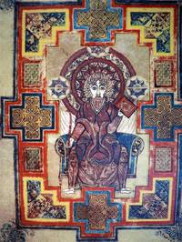
199618599Ireland: Trinity College Dublin. Fine with no dust jacket. 1996. Limited Edition. Print. A unique opportunity has allowed the release of a very small number of artists proofs of this exclusive and unique set of prints taken directly from the Book of Kells and with full authority of Trinity College Dublin. The prints comprise the Chiro page St John and The amazing Four Evangelist. This set of serigraph silk screen prints were hand-printed in thirty colours on conservation quality thick weave paper by a master printer. Each print has a hand embossed seal highlighting the print title and the edition name. The set of prints took six months to proof and three months to edition and the images shown just cannot reflect the stunning vibrancy and depth of these prints. The edition was originally sold at the price of over $5000! We have a very small supply of these prints. Images available on request. In brown cloth attractive presentation folder. ; 18" x 13" . Trinity College, Dublin unknown
199618598Ireland: Trinity College Dublin. Fine with no dust jacket. 1996. Limited Edition. Print. A unique opportunity has allowed the release of a very small number of artists proofs of this exclusive and unique set of prints taken directly from the Book of Kells and with full authority of Trinity College Dublin. The prints comprise the Chiro page St John and The amazing Four Evangelist. This set of serigraph silk screen prints were hand-printed in thirty colours on conservation quality thick weave paper by a master printer. Each print has a hand embossed seal highlighting the print title and the edition name. The set of prints took six months to proof and three months to edition and the images shown just cannot reflect the stunning vibrancy and depth of these prints. The edition was originally sold at the price of over $5000! We have a very small supply of these prints. Images available on request. ; 18" x 13" . Trinity College, Dublin unknown
19964423Ireland: Trinity College Dublin. Fine with no dust jacket. 1996. Limited Edition. Print. A unique opportunity has allowed the release of a very small number of artists proofs of this exclusive and unique set of prints taken directly from the Book of Kells and with full authority of Trinity College Dublin. The prints comprise the Chiro page St John and The amazing Four Evangelist. This set of serigraph silk screen prints were hand-printed in thirty colours on conservation quality thick weave paper by a master printer. Each print has a hand embossed seal highlighting the print title and the edition name. The set of prints took six months to proof and three months to edition and the images shown just cannot reflect the stunning vibrancy and depth of these prints. The edition was originally sold at the price of over $5000! Each set is presented in a folder which can be personally monogrammed in a leather block if so wished. These prints would be perfect in a boardroom domestic setting or even your favorite Irish pub! Each print measures 24.5 62cm high by 19 48.2cm wide. We have a very small supply of these prints. Images available on request. ; 18" x 13" . Trinity College, Dublin unknown
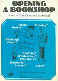
18-2585London: Booksellers Association of Great Britain & Ireland 1979. 8vo. 12 pp. Very Good. Soft Cover. Printed pictorial paper wraps. Staple binding. Pages fine. London: Booksellers Association of Great Britain & Ireland, 1979. paperback
Carta geografica tratta dal raro "Atlante Geografico" dell'abate Bartolomeo Borghi (1750-1821), cartografo, incisore ed editore che tra l'altro pubblicò l'atlante del Pazzini Carli in Siena. Incisione in rame, coloritura coeva dei contorni, in ottimo stato di conservazione. A rare map from "Atlante Geografico" of priest Bartolomeo Borghi. Copperplate with original outline colour, in very good condition. Bartolomeo Borghi(1750-1821) was an italian cartographer, engraver and publisher (editor of Atlante Geografico by Pazzini Carli, Siena 1788/1800).
(Milano), Mondadori, (1934), in-16, br., pp. 303. Con ill. in b.n. f.t. e nota bibliografica. ("I libri verdi" - Drammi e segreti della storia N. 3).
In-16 gr., tutta tela, tassello al dorso, conservata brossura originale, pp. 303, con numerose tavole in bianco e nero fuori testo. Buono stato (good copy).<br> Mario Borsa notevolissimo giornalista del Corriere della Sera, scrisse alcune monografie storiche di grande valore. Questa su Roger Casement relativa a un fosco dramma irlandese del 1914-1916 è tra le più interessanti.
illustrazioni
In 8°, br. edit. con sovrac. ill. (tracce d'uso, strappetti e piccole mancanze), pp. 303,(1), con num. fot. b.n. in tavv. f.t.; coll. "I libri verdi. Drammi e segreti della storia 3"; prima ed., volume in condizioni molto buone.