CARR JohnMareMagnum

6 226 résultats
CARR John. L'Etranger en Irlande, ou voyage dans les parties méridionales et occidentales de cette isle, dans l'année 1805. Traduit de l'anglais par M. Keralio-Robert. Paris, Léopold Collin, 1809. Due volumi in 8vo; pp.VIII,2n.nn.,413; cc.2n.nn.,pp.401. Sei tavole spieghevoli all'acquatinta. Bazzana coeva, titolo e fregi in oro ai dorsi.
3090dans les parties méridionales et occidentales de cette Isle, dans l'année 1805. (tome 1). Paris. Collin. 1809. In-8 (20x13). VIII-(1)-413 pages. Demi-basane prune de l'époque, dos lisse orné de filets et fleurons dorés.
1996R67739Turnhout, Brepols 1996 lxvii + 131pp., 25cm., in the series "Corpus Christianorum Series Latina" volume CVIII-E (108e), publisher's hardcover binding in orange cloth with gilt lettering, ISBN 2-503-50510-7, [introduction in Spanish, text in Latin], very good condition, R67739
lxvii + 131pp., 25cm., in the series "Corpus Christianorum. Series latina" vol.108e, editor's cloth with gilt lettering, VG, ISBN 2-503-50510-7, [introduction in Spanish, text in Latin]
275pp. 24 cm. Hardcover Very good condition good Signed by the author for Jim
197 p. Hardcover Fine condition very good d.j. good
195796433London, Macmillan & Co, 1957-1959, in-8°, 176-180-176-176 pp, 98 gravures et cartes, index, reliure toile verte éditeur, qqs rares marques au crayon dans les marges, état correct. Book I. From the Earliest Times to the Norman Invasion (1169). Book II. From the Norman Invasion to the flight of the Earls (1607). Book III. From the Earls to the act of Union (1800). Book IV. From the act of Union (1800).
AN EXCEPTIONAL COPY, WITH TWO UNIQUE AND IMPORTANT LETTERS CITED IN THE STANDARD OLYMPIA PRESS BIBLIOGRAPHY. One of 2,000 copies of the first British edition. (Actually this "British edition" was created by taking 2,000 copies of the first American (Grove Press) edition to England, putting a sticker over the imprint, and issuing a new dustjacket.) LAID IN ARE TWO EXTREMELY IMPORTANT TYPED LETTERS SIGNED--ABOUT 1,000 WORDS--FROM THE EDITOR, SINGLETON-GATES, on his letterhead, to a correspondent in Nothern Rhodesia (later Zambia) (!). In these unpublished letters, written during the 1960s, Singleton-Gates describes his feelings towards Casement. He also describes, in passionate terms, the fascinating circumstances surrounding the publication of these scandalous diaries, and the numerous obstacles he faced, including copyright and censorship issues. He furthermore explains his various other projects relating to Casement, none of which came to fruition. It is fair to say that these letters shed considerable light on the limits of press freedoms in Britain during the late 50s and 60s, as well as on the way Casement's heirs felt about his legacy. THESE LETTERS ARE CITED--and briefly excerpted--on pp. 60-61 of Patrick Kearney's bibliography, The Paris Olympia Press (Liverpool, Liverpool University Press, 2007). Also laid in are numerous newspaper clippings from 1959 and 1960, all relating to the publication. 4to. Publisher's cloth. Fine and bright, in a very good price-clipped dj.
174p. Hardcover Very good condition good
- EDIZIONE ORIGINALE, COLORITURA COEVA -Due mappe dl'Irlanda, dell'area occidentale e orientale, che mostrano nel dettaglio le quattro province in cui la Repubblica è divisa: Munster, Leinster, Connacht e Ulster. tratte dal "Nuovo Atlante Geografico Universale delineato sulle ultime osservazioni", edito a Roma dal 1792 fino al 1801, opera che la Calcografia Camerale commissionò al Cassini al fine di sostituire l’ormai obsoleto "Mercurio Geografico".Giovanni Maria Cassini, Chierico Regolare Somasco fu geografo e cartografo, ma anche intagliatore di architetture e prospettive - uno dei migliori discepoli di Giovanni Battista Piranesi - Cassini fu uno degli ultimi sferografi italiani del Settecento ed i suoi globi ebbero una notevole diffusione, come pure questo "Nuovo Atlante Geografico".Incisione in rame, coloritura coeva dei contorni, leggere bruniture, per il resto in ottimo stato di conservazione.L'Atlante del Cassini fu ristampato dalla Calcografia Camerale nel primo quarto del XIX secolo, prima del 1839. Solo gli esemplari di prima edizione come questo sono stampati su carta vergata coeva e sono colorati a mano in epoca. Le tirature del XIX secolo sono già su carta meccanica, priva di vergelle, e generalmente in bianco e nero. FIRST EDITION, CONTEMPORARY OUTLINE COLOUR -The Italian painter and engraver, Giovanni Maria Cassini, produced these two attractive maps of Ireland divided into four provinces: Connacht, Leinster, Munster and Ulster. as part of his epic three-volume atlas. Published in: Nuovo atlante geografico universale delineato sulle ultime osservazioni. Roma, Calcografia camerale, 1792-1801.Cassini was geographer and cartographer but he was also good at engraving architectural items and perspectives – he was one of the best disciples Giovanni Battista Piranesi had. Moreover, Cassini was one of the last artists to engrave spheres in the XVIII century and his globes were quite famous and widespread, and realized the most important Italian Atlas of the XVIII century; his maps always bear a cartouche, extremely rich in colours and details. Copperplate with fine original hand colour, some foxing, otherwise in very good condition.
- EDIZIONE ORIGINALE, COLORITURA COEVA -Due mappe della Scozia, divise nell'area settentrionale e meridionale, che mostrano nel dettaglio le contee in cui il territorio è diviso. Tratte dal "Nuovo Atlante Geografico Universale delineato sulle ultime osservazioni", edito a Roma dal 1792 fino al 1801, opera che la Calcografia Camerale commissionò al Cassini al fine di sostituire l’ormai obsoleto "Mercurio Geografico".Giovanni Maria Cassini, Chierico Regolare Somasco fu geografo e cartografo, ma anche intagliatore di architetture e prospettive - uno dei migliori discepoli di Giovanni Battista Piranesi - Cassini fu uno degli ultimi sferografi italiani del Settecento ed i suoi globi ebbero una notevole diffusione, come pure questo "Nuovo Atlante Geografico".Incisione in rame, coloritura coeva dei contorni, leggere bruniture, per il resto in ottimo stato di conservazione.L'Atlante del Cassini fu ristampato dalla Calcografia Camerale nel primo quarto del XIX secolo, prima del 1839. Solo gli esemplari di prima edizione come questo sono stampati su carta vergata coeva e sono colorati a mano in epoca. Le tirature del XIX secolo sono già su carta meccanica, priva di vergelle, e generalmente in bianco e nero. FIRST EDITION, CONTEMPORARY OUTLINE COLOUR -The Italian painter and engraver, Giovanni Maria Cassini, produced these two attractive and detailed maps of Scotland divided into counties. Published in: Nuovo atlante geografico universale delineato sulle ultime osservazioni. Roma, Calcografia camerale, 1792-1801.Cassini was geographer and cartographer but he was also good at engraving architectural items and perspectives – he was one of the best disciples Giovanni Battista Piranesi had. Moreover, Cassini was one of the last artists to engrave spheres in the XVIII century and his globes were quite famous and widespread, and realized the most important Italian Atlas of the XVIII century; his maps always bear a cartouche, extremely rich in colours and details. Copperplate with fine original hand colour, some foxing, otherwise in very good condition.
- EDIZIONE ORIGINALE, COLORITURA COEVA -Due dettagliate mappe dell'Inghilterra, divise nell'area settentrionale e meridionale, tratte dal "Nuovo Atlante Geografico Universale delineato sulle ultime osservazioni", edito a Roma dal 1792 fino al 1801, opera che la Calcografia Camerale commissionò al Cassini al fine di sostituire l’ormai obsoleto "Mercurio Geografico".Giovanni Maria Cassini, Chierico Regolare Somasco fu geografo e cartografo, ma anche intagliatore di architetture e prospettive - uno dei migliori discepoli di Giovanni Battista Piranesi - Cassini fu uno degli ultimi sferografi italiani del Settecento ed i suoi globi ebbero una notevole diffusione, come pure questo "Nuovo Atlante Geografico".Incisione in rame, coloritura coeva dei contorni, leggere bruniture, per il resto in ottimo stato di conservazione.L'Atlante del Cassini fu ristampato dalla Calcografia Camerale nel primo quarto del XIX secolo, prima del 1839. Solo gli esemplari di prima edizione come questo sono stampati su carta vergata coeva e sono colorati a mano in epoca. Le tirature del XIX secolo sono già su carta meccanica, priva di vergelle, e generalmente in bianco e nero. FIRST EDITION, CONTEMPORARY OUTLINE COLOUR -The Italian painter and engraver, Giovanni Maria Cassini, produced these two attractive and detailed maps of England divided in Northern and Southern part.Published in: Nuovo atlante geografico universale delineato sulle ultime osservazioni. Roma, Calcografia camerale, 1792-1801.Cassini was geographer and cartographer but he was also good at engraving architectural items and perspectives – he was one of the best disciples Giovanni Battista Piranesi had. Moreover, Cassini was one of the last artists to engrave spheres in the XVIII century and his globes were quite famous and widespread, and realized the most important Italian Atlas of the XVIII century; his maps always bear a cartouche, extremely rich in colours and details. Copperplate with fine original hand colour, some foxing, otherwise in very good condition.
EDIZIONE ORIGINALE, COLORITURA COEVA -Bella e decorativa carta geografica dell'antica Britannia, tratta dal "Nuovo Atlante Geografico Universale delineato sulle ultime osservazioni", edito a Roma dal 1792 fino al 1801, opera che la Calcografia Camerale commissionò al Cassini al fine di sostituire l’ormai obsoleto "Mercurio Geografico".Giovanni Maria Cassini, Chierico Regolare Somasco fu geografo e cartografo, ma anche intagliatore di architetture e prospettive - uno dei migliori discepoli di Giovanni Battista Piranesi - Cassini fu uno degli ultimi sferografi italiani del Settecento ed i suoi globi ebbero una notevole diffusione, come pure questo "Nuovo Atlante Geografico".Incisione in rame, coloritura coeva dei contorni, leggere bruniture, per il resto in ottimo stato di conservazione.L'Atlante del Cassini fu ristampato dalla Calcografia Camerale nel primo quarto del XIX secolo, prima del 1839. Solo gli esemplari di prima edizione come questo sono stampati su carta vergata coeva e sono colorati a mano in epoca. Le tirature del XIX secolo sono già su carta meccanica, priva di vergelle, e generalmente in bianco e nero. FIRST EDITION, CONTEMPORARY OUTLINE COLOUR -Decorative map of the British Isles during the time of the Roman Empire, published by Cassini in 1799,Britain is shown divided according to their ancient boundaries with the names of the tribes marked in each region, also shown are cities and towns called according to their old names.Includes a decorative title cartouche depicting Neptune in a shell chariot urging on his team of hippocamps.The Italian painter and engraver, Giovanni Maria Cassini, produced this decorative map of the British Isles during the time of the Roman Empire. Britain is shown divided according to their ancient boundaries with the names of the tribes marked in each region, also shown are cities and towns called according to their old names.Published in: Nuovo atlante geografico universale delineato sulle ultime osservazioni. Roma, Calcografia camerale, 1792-1801.Cassini was geographer and cartographer but he was also good at engraving architectural items and perspectives – he was one of the best disciples Giovanni Battista Piranesi had. Moreover, Cassini was one of the last artists to engrave spheres in the XVIII century and his globes were quite famous and widespread, and realized the most important Italian Atlas of the XVIII century; his maps always bear a cartouche, extremely rich in colours and details. Copperplate with fine original hand colour, some foxing, otherwise in very good condition.
EDIZIONE ORIGINALE, COLORITURA COEVA -Bella e accurata mappa della Gran Bretagna che comprende tutte le isole, anche quelle minori - Shetland, Orcadi, Ebridi, Isola di Man, Isole Normanne ecc.- che formano la regione. Tratta dal "Nuovo Atlante Geografico Universale delineato sulle ultime osservazioni", edito a Roma dal 1792 fino al 1801, opera che la Calcografia Camerale commissionò al Cassini al fine di sostituire l’ormai obsoleto "Mercurio Geografico".Giovanni Maria Cassini, Chierico Regolare Somasco fu geografo e cartografo, ma anche intagliatore di architetture e prospettive - uno dei migliori discepoli di Giovanni Battista Piranesi - Cassini fu uno degli ultimi sferografi italiani del Settecento ed i suoi globi ebbero una notevole diffusione, come pure questo "Nuovo Atlante Geografico".Incisione in rame, coloritura coeva dei contorni, leggere bruniture, per il resto in ottimo stato di conservazione.L'Atlante del Cassini fu ristampato dalla Calcografia Camerale nel primo quarto del XIX secolo, prima del 1839. Solo gli esemplari di prima edizione come questo sono stampati su carta vergata coeva e sono colorati a mano in epoca. Le tirature del XIX secolo sono già su carta meccanica, priva di vergelle, e generalmente in bianco e nero. - FIRST EDITION, CONTEMPORARY OUTLINE COLOUR -The Italian painter and engraver, Giovanni Maria Cassini, produced this detailed map of United Kingdom.Published in: Nuovo atlante geografico universale delineato sulle ultime osservazioni. Roma, Calcografia camerale, 1792-1801.Cassini was geographer and cartographer but he was also good at engraving architectural items and perspectives – he was one of the best disciples Giovanni Battista Piranesi had. Moreover, Cassini was one of the last artists to engrave spheres in the XVIII century and his globes were quite famous and widespread, and realized the most important Italian Atlas of the XVIII century; his maps always bear a cartouche, extremely rich in colours and details. Copperplate with fine original hand colour, some foxing, otherwise in very good condition.
Carta geografica, in due fogli, raffigurante i territori dell'Irlanda. Il primo foglio con le province di Connaught e Munster. Il secondo con le province di Ulster e Leinster.L'incisione è caratterizzata da una gradevole acquerellatura confinale coeva. Alcune macchie nel margine sinistro di ogni foglio che non compromettono il generale buono stato di conservazione. La carta si trova inserita nel secondo volume dell'opera "Nuovo Atlante Geografico Universale delineato sulle ultime osservazioni" pubblicato nel 1792, che venne commissionato al Cassini dalla Calcografia Camerale di Roma. Successivamente vennero pubblicati il secondo ed il terzo volume rispettivamente nel 1797 e nel 1801.
Carta geografica raffigurante Inghilterra ed Irlanda. Leggere macchie nel margine che non compromettono il buono stato di conservazione generale. Incisione originale in coloritura coeva inserita nel III volume, in prima edizione, dell’opera "Nuovo Atlante Geografico Universale delineato sulle ultime osservazioni", edita a Roma nel 1792. Successivamente vennero pubblicati il secondo volume nel 1797 ed in fine il terzo nel 1801. L’opera fu commissionata al Cassini dalla Calcografia Camerale di Roma.
6105PARIS, Mercure de France - 1970 - in-8 - broché - couverture illustrée - 214 pages + table - bon exemplaire
PARIS, Mercure de France - 1970 - in-8 - broché - couverture illustrée - 214 pages + table - bon exemplaire
188053788- Une feuille 19 x 28 cm. Rousseurs.
in 16°, bross. edit. ill.
1020871229.Ghardcover. Good. Access codes and supplements are not guaranteed with used items. May be an ex-library book. hardcover
0331527804.Ghardcover. Good. Access codes and supplements are not guaranteed with used items. May be an ex-library book. hardcover
0332952053.Ghardcover. Good. Access codes and supplements are not guaranteed with used items. May be an ex-library book. hardcover
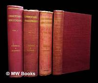
1932455961Dublin : Published for the Irish Manuscripts Commission by the Stationery Office 1932. First Edition. Hardcover. Very good copies all in the original red cloth with gilt-blocked titles to spine. Some faint scuffs to covers; spine bands and panel edges slightly rubbed as with age. Light foxing or reader autograph to some endpapers with text blocks otherwise tight bright and clean. Remains a well-preserved set overall. Physical description; 4 volumes ; 25 cm. Contents; v.1. Usque ad adventum in Hiberniam exc. nuntil apostolici. -- v.3. An. 1648. -- v.4. Ann. 1649-1651. -- v.5. Ann. 1652-1666. Notes; This collection lacks v.2 and v.6. This series published 1932-1949. Caption title: De haersis anglicanae in Iberniam intrusione et progressu et de bello catholico ad annum 1641 caepto exindeque per aliquot annos gesto commentarius. Each vol. has also special title page. The original manuscript is in the Biblioteca Trivulziana in Milan. This text published from a manuscript copy in Dublin which belonged to Sir John T. Gilbert. Subjects; Catholic Church in Ireland - History - 17th century Ireland - History - 1625-1649 Ireland - Church history - 17th century. Dublin : Published for the Irish Manuscripts Commission by the Stationery Office hardcover
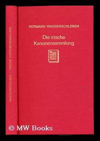
1966233984Aalen : Scientia 1966. Second Edition. Hardcover. Near fine copy in the original title-blocked pictorial cloth. Slightest suggestion only of dust-dulling to the spine bands and panel edges. Remains particularly well-preserved overall; tight bright clean and strong. Edition; Neudruck der 2. Aufl. Leipzig 1885. Physical description; lxxvi 243 p. ; 23 cm. Subjects; Ecclesiastical law - Ireland. Canon law. Aalen : Scientia hardcover