Samuel IrelandBiblio.com
6 228 résultats
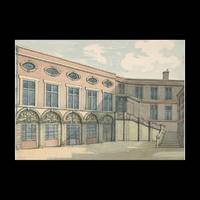
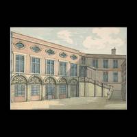
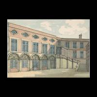
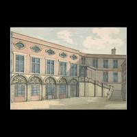
655075Contentum Ltd. Loose sheet. New. High-quality art print based on an original work from the Ycba. Created in the 18th century between 1794 and 1800. Professionally printed on premium fine-art paper Photo Rag Bright White in size A2. The artwork is printed with a white border museum-style presentation. Contentum Ltd. unknown
655074Contentum Ltd. Loose sheet. New. High-quality art print based on an original work from the Ycba. Created in the 18th century between 1794 and 1800. Professionally printed on premium fine-art paper Museum Etching museum quality in size A3. The artwork is printed with a white border museum-style presentation. Contentum Ltd. unknown
655076Contentum Ltd. Loose sheet. New. High-quality art print based on an original work from the Ycba. Created in the 18th century between 1794 and 1800. Professionally printed on premium fine-art paper Photo Rag 308 premium quality in size A2. The artwork is printed with a white border museum-style presentation. Contentum Ltd. unknown
655077Contentum Ltd. Loose sheet. New. High-quality art print based on an original work from the Ycba. Created in the 18th century between 1794 and 1800. Professionally printed on premium fine-art paper Museum Etching museum quality in size A2. The artwork is printed with a white border museum-style presentation. Contentum Ltd. unknown
Octavo; xii, 260 p ; 22 cm. National characteristics, Irish, in literature; Drama -- Technique.
0265868963.Ghardcover. Good. Access codes and supplements are not guaranteed with used items. May be an ex-library book. hardcover
Size: 8vo - over 7¾" - 9¾" tall eng
[Storia-Politica-Gran Bretagna] (cm. 24,5) cartonato edit. con sovracoperta.--pp. 530 + 1 tav f.t. a colori che rappresenta la Scozia,Irlanda del Nord, Inghilterra e Galles. Con appendici, index e bibliografia. Varie illustrazioni e tavole nel testo. E' una pubblicazione annuale che riporta la situazione economica, politica, sociale, cambiamenti legislativi ecc.Ottimo esemplare Libro
Piccola carta geografica di Irlanda e Regno Unito
Decorativa carta geografica delle Isole Britanniche, riferita al tempo degli antichi Romani.La carta, per la prima volta pubblicata da Ortelius nel suo Parergon del 1595, è basta su informazioni geografiche fornite dalla carta murale delle Isole Britanniche di Mercator (1564) e sugli aggiornamenti forniti da Saxton (1579). Le notizie storiche sono invece derivanti dalle fonti classiche quali Plinio, Tacito, Appiano e Strabone. Tratta dal Parergon, il primo atlante storico mai pubblicato. Fu inizialmente concepito da Ortelius come appendice del suo Theatrum Orbis Terrarum ma visto il notevole successo di queste carte storiche divenne in seguito un lavoro indipendente e rimase la fonte principale di tutti i lavori simili per tutto il XVII secolo. Come sottolinea Koeman “il Parergon deve essere considerato come lavoro personale di Ortelius. Per quest'opera, infatti, diversamente dal Theatrum, non copiò le mappe di altri cartografi, ma ne disegnò lui stesso di nuove ed originali…prese luoghi, regioni e territori delle civiltà classiche illustrandone e spiegandone la storia, una materia molto vicina al suo cuore. Le mappe e le lastre del Parergon devono essere valutate come le più importanti incisioni che rappresentano il diffuso interesse per la geografia classica nel XVI secolo”. Il Theatrum Orbis Terrarum e che è considerato il primo vero “atlante” moderno. L’opera fu pubblicata in 7 lingue e 36 edizioni, per il quale – nel 1570 - Ortelius ottenne il privilegio, ovvero una sorta di diritto d'autore che impediva ad altri cartografi di pubblicare i propri lavori. Il Theatrum rappresentava il lavoro più avanzato del lavoro della descrizione cartografica. L’Ortelius vi raccolse il sapere geografico e cartografico del suo tempo, proponendo in 147 spettacolari tavole incise l’immagine più fedele del mondo allora conosciuto e, in alcune straordinarie “carte storiche”, regioni e itinerari tratti dalla letteratura, dalla mitologia, dalla tradizione. Esemplare tratto dall'edizione latina del 1619. Incisione in rame, finemente colorata a mano, in ottimo stato di conservazione. Decorative and rare map of the British Isles in Roman times. The map was first published in the 1595 edition of Ortelius' atlas. The map was made based upon modern information from Mercator's 1564 map of the British Isles, improved by a new outline from Saxton's 1579 map (Meurer p. 197, Karrow 56/16, p. 387-388)nd ancient knowledge from Diodorus, Siculus, Plinius, Appianus, Tacitus, Cæsar and Strabo. The map is filled with ancient place names, Hadrian's Wall, and Wall of Pius (mislabeled Severi Imp. Murus).Richly embellished with three large strapwork cartouches and several sailing vessels. Map taken from the Parergon, the first historical atlas ever published. It was initially conceived by Ortelius as an appendix to his Theatrum Orbis Terrarum, but given the considerable success of these historical maps it later became an independent work and remained the main source of all similar works throughout the seventeenth century. Koeman wrote: "This atlas of ancient geography must be regarded as a personal work of Ortelius. For this work he did not, as in the Theatrum, copy other people's maps but drew the originals himself... He took many places and regions from the lands of classical civilization to illustrate and clarify their history, a subject very close to his heart... The maps and plates of the Parergon have to be evaluated as the most outstanding engravings depicting the wide-spread interest in classical geography in the 16th century." The Theatrum Orbis Terrarum, which is considered the first true modern "Atlas". The work was published in 7 languages and 36 editions, for which - in 1570 - Ortelius obtained the privilege, a kind of copyright that prevented other cartographers from publishing his works. The Theatrum represented the most advanced work of cartographic description. Ortelius collected in it the geographical and cartographic knowledge of his time, proposing in 147 spectacular engraved plates the most faithful image of the world then known and, in some extraordinary "historical maps", regions and routes taken from literature, mythology, tradition. Latin editon of 1619. Copperplate with fine hand colouring, very good condition. Van den Broecke #192; Shirley, R.W. (BI to 1650) 186, pl.42.
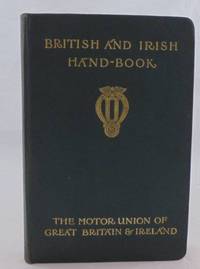
452764John Ouseley. Hardcover. Good. THERE ARE NO TARIFFS OR CUSTOMS DUTIES ON BOOKS. The British and Irish Handbook was an early 20th-century publication by the Motor Union of Great Britain and Ireland a pivotal organization formed in 1901 to support motorists. These handbooks often found in vintage editions from roughly 1905 to the 1910s provided vital motoring information including hotel listings repair shops and regulations. Cloth-covered boards with gilt lettering. Tanning on the end papers. Otherwise in very good condition throughout. Copyright © John Ouseley John Ouseley hardcover
ga2534Maunsel & Company Cartonné In-12 (13 x 19,2 cm), cartonné toilé, 76 pages, sans date, texte en anglais ; dos bruni, frottements aux coiffes, mors et coins, quelques marques d'usure sur les plats, par ailleurs assez bon état général. Livraison a domicile (La Poste) ou en Mondial Relay sur simple demande.
11303Office of Public Works Dublin 22 November 1879. Broadside two pages folio fold mark two small closed tears mainly good. It comprises recto details of 'facilities and advantages in obtaining loans under the Land Improvement Acts.' And verso a schedule of the unions in the Counties Donegal to Sligo with the handwriten addition of Mallow and Kanturk. Note: The "Irish National Land League was founded at the Imperial Hotel in Castlebar the County town of Mayo on 21 October 1879." b No copy traced. Office of Public Works, Dublin, 22 November 1879. unknown
189 p. Hardcover Very good condition good
1822ZB1174825Brooklyn: 1822. 8 pp. original plain paper wrappers covers moderately soiled else good; the committee's recommendations as how best to combat public filth and stink. - If you are reading this this item is actually physically in our stock and ready for shipment once ordered. We are not bookjackers. Buyer is responsible for any additional duties taxes or fees required by recipient's country. [Brooklyn:] unknown
1413732313.Gpaperback. Good. Access codes and supplements are not guaranteed with used items. May be an ex-library book. paperback
1962132151Hollywood: Paramount Pictures 1962. Two vintage black-and-white still photographs from the UK release of the 1962 US film. <br/><br/>A relatively unknown low-budget jungle film the only film credit for director Jack Warner Jr. son of the then-head of Warner Bros. Studios. <br/><br/>8 x 10 inches. Very Good plus with one with pinholes at the corners one with a short closed tear. Paramount Pictures unknown books
198454075Couverture souple. Brochure de 48 pages.
198438801Buena Vista County Historical Society 1984. Hardcover. Near Fine/No Jacket. Near fine unmarked copy. Brown leather with pictorial cover. Light creasing to bottom of SP due to the books thickness. No dust jacket. <br/> <br/> Buena Vista County Historical Society hardcover
1860590748.Ghardcover. Good. Access codes and supplements are not guaranteed with used items. May be an ex-library book. hardcover
57417914-20Stationery Office Dublin. Used - Very Good. Former library copy. Pages intact with possible writing/highlighting. Binding strong with minor wear. Dust jackets/supplements may not be included. Includes library markings. Stock photo provided. Product includes identifying sticker. Better World Books: Buy Books. Do Good. Stationery Office Dublin unknown
437038Royal Institute of the Architects of Ireland. Paperback. Fair. THERE ARE NO TARIFFS OR CUSTOMS DUTIES ON BOOKS. Book from an exhibition by the Royal Institute of Architects of Ireland of contemporary Irish architecture they put on in Paris. The text is written in both French and English. Royal Institute of the Architects of Ireland paperback
1965LFA-126718901Tome CXXIII - 1965 - 3 : 100 pages, format 180 x 230 mm, illustré, broché, publié en 1965, bon état
2015x-1138861464Willan Pub 2015. Paperback. New. reprint edition. 208 pages. 8.75x6.00x0.50 inches. Willan Pub paperback
2005x-1843921219Willan Pub 2005. Hardcover. New. 208 pages. 9.75x6.75x0.75 inches. Willan Pub hardcover