PORTUGAL — JOSE Ier.Livre Rare Book

9 219 résultats
1773LBW-7642Lisboa, Regia Officina Typografica, 1773. In-4 de 4 pp., broché.
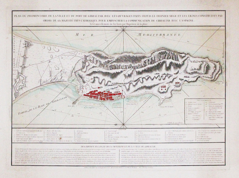
1780LBW-3315Paris, Lattré, [circa 1780]. 400 x 550 mm.
175643158En Europe, Aux dépens de la Compagnie, 1756. In-12 de XI-(1)-542-(2) pp.Supplément aux réflexions sur le désastre de Lisbonne avec un journal des phénomènes depuis le 1er novembre 1755, et des remarques sur la playe des sauterelles annoncée par St Jean. Sans lieu, 1757. In-12 de (2)-LXII-216 pp.Les deux pièces reliées en 1 vol. in-12, veau marbré, dos lisse orné, pièce de titre en maroquin rouge, filet à froid d'encadrement sur les plats, tranches marbrées (reliure de l'époque).
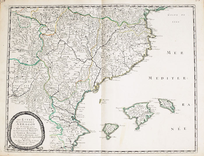
1652LBW-2301Paris, Pierre Mariette, 1652. 532 x 410 mm.
1663LBW-9481663 417 x 378 mm.
Carta geografica della Spagna e del Portogallo, raffigurante le divisioni in reami e principati con confini in coloritura coeva. Al lato sx. tre vignette raffiguranti la pianta e un prospetto della città di Barcellona e la Baia di Gibilterra. In calce un'altra vignetta, raffigura il golfo di Cadice. La carta è arricchita da un bel cartiglio. Pieghe editoriali
RARITA’ CARTOGRAFICA Sconosciuta piccola carta geografica con imprint di Pietro Zancon e data 1794, appartenente a un non documentato atlante in miniatura dal titolo “Atlante tascabile per le dame”, suddiviso in tre tomi, stampati “IN VENETIA Presso G. Zatta”, senza data ma circa 1795. Si tratta di carte da visita – con un apposito spazio bianco dove apporre il proprio nome – dove compare l’imprint o di Pietro Zancon (accompagnato dalla data 1794) o di Giacomo Zatta (con data 1794 o 1795), che, come si legge sul frontespizio, risulta l’editore dell’opera. Possiamo ipotizzare che la serie, iniziata da Zancon fu poi terminata dallo Zatta. Sulla carta dell’Italia – presumibilmente la prima tavola dell’opera – compare stampato il nome di Chiara Minelli Rota, nobildonna veneziana che sposò Antonio Rota nel 1794; tutte le restanti 65 carte recano lo spazio bianco privo di nome. In precedenza, le carte erano note solo attraverso una serie, priva di imprint editoriale, venduta 21 anni fa (1999) dall’Antiquariaat Haas di Bedburg Hau; parlando con Stephan Haas, la serie, priva di titolo e dati editoriali si componeva di 70 mappe. Le carte furono vendute separatamente sotto il nome di G. Bonatti, firma dell’incisore che si trova nella carta della Francia. In seguito, le tavole furono attribuite a Pietro Zaricen da Geoffrey King (cfr. Miniature Antique Maps, p. 181). Il nome dello Zaricen viene dedotto dalla carta della contea del Roussillon, che reca l’iscrizione “Venezia 1794 App.o P. Zancon”, letto erroneamente come Zaricen. Lajos Szantai include la carta dell’Ungheria nella sua cartobibliografia, traducendo il nome dell’autore in Zancen (cfr. Atlas Hungaricus 1528-1850). Sempre King, che non menziona nessuna carta firmata da Zatta, sostiene che “About the turn of the century a signed card of the first edition, with a map of the province of Roussillon in the south of France, was seen at an Ephemera Society Fair in London”. Questo esemplare sembrerebbe oggi quello conservato alla Yale University Library [1978 351], che lo descrive composto da 70 carte geografiche. Non sappiamo se sia il numero totale delle mappe, e l’assenza di un indice o dell’elenco non consente di stabilire l’esatto numero delle carte che lo compongono. http://hdl.handle.net/10079/bibid/3611852Confrontando le carte erroneamente attribuite allo Zaricen ci si accorge che la lastra è abrasa in corrispondenza della firma di Zancon o Zatta. Molto scarse sono le notizie sulle carte che possiamo ora definire “ex Zaricen”. Jason Hubbard nella sua bibliografia recente sulle carte del Giappone raffigura la carta priva dell’imprint “App.o G. Zatta” attribuendola - sulla base delle informazioni bibliografiche finora note – a Giuseppe Bonatti e Pietro Zaricen: “This is one of the 70-odd geographical cards, printed on one side only, acquired by the Haas brothers in 1999. The cards cover countries around the world and include detailed map of Italian provinces. The card with the map of France carries the inscription: G. Bonatti fece; and it is presumed that Bonatti engraved all of them although this is questioned by King” (cfr. J. Hubbard, Japoniae Insulae, n. 124). Il nostro esemplare della carta della Francia, che reca l’imprint “Venezia 1794, App.o P. Zancon” reca in basso a destra la firma di Bonatti sopra menzionata. Dunque, l’unica differenza tra questa serie di sconosciute carte sembra essere la presenza degli imprint editoriali di Zancon e Zatta, accompagnati dalla data 1794 o 1795. Giuseppe Bonatti è menzionato da V. Valerio nella qualità di incisore cresciuto alla scuola Remondini di Bassano, autore di alcune carte per l’atlante di Pazzini Carli (Siena, 1788-1800) e per l’Atlante Geografico di Carlo Antonio Barbiellini (Milano, 1807). Dal 1809 in poi lavorò come incisore per il Deposito della Guerra di Milano (cfr. V. Valerio, Cartografi Veneti, p. 153). Pietro Zancon era, assieme al ... A GREAT RARITY Unknown small map with imprint by Pietro Zancon and date 1794, belonging to an undocumented miniature atlas entitled “Atlante tascabile per le dame” (Pocket Atlas for ladies), divided into three volumes, printed "IN VENETIA Presso G. Zatta", undated but about 1795. A rare set of visiting cards published in Italy features pretty little maps of all parts of the world - with a special white space where to put your name - where the imprint appears or of Pietro Zancon (accompanied by the date 1794) or Giacomo Zatta (with the date 1794 or 1795), who, as can be read on the title page, is the publisher of the whole Atlas. We can speculate that the series, started by Zancon was later terminated by Zatta. On the map of Italy is printed - presumably the first map of the work - the name of Chiara Minelli Rota, Venetian noblewoman who married Antonio Rota in 1794; all remaining 65 maps bear the blank space without names. Previously, the maps were known only through a series, without editorial imprint, sold 21 years ago (1999) by the Antiquariaat Haas of Bedburg Hau; speaking with Stephan Haas, the series, without title and printing details, consisted of 70 maps. The maps were sold separately under the name of G. Bonatti, the engraver's signature found on the map of France. Later, the plates were attributed to Pietro Zaricen by Geoffrey King (see Miniature Antique Maps, p. 181). The name of Zaricen is derived from the Roussillon county map, which bears the inscription "Venice 1794 App.o P. Zancon", incorrectly read as Zaricen. Lajos Szantai includes the map of Hungary in his cartobibliography, translating the author's name into Zancen (see Atlas Hungaricus 1528-1850). Always King, who does not mention any map signed by Zatta, said: "About the turn of the century a signed card of the first edition, with a map of the province of Roussillon in the south of France, was seen at an Ephemera Society Fair in London ". This copy would seem to be the one preserved in the Yale University Library [call number 1978 351], which describes it as being composed of 70 maps. We do not know if it is the total number of maps, and the absence of an index or list does not allow to establish the exact number of maps. http://hdl.handle.net/10079/bibid/3611852 Comparing the maps erroneously attributed to Zaricen one realizes that the plate is erased in correspondence with the signature of Zancon or Zatta. There are very little information on the maps, that we can now define as "ex Zaricen". Jason Hubbard in his recent bibliography on the maps of Japan depicts the map without the imprint "App.o G. Zatta" attributing it - on the basis of the bibliographic information so far known - to Giuseppe Bonatti and Pietro Zaricen: “This is one of the 70-odd geographical cards, printed on one side only, acquired by the Haas brothers in 1999. The cards cover countries around the world and include detailed map of Italian provinces. The card with the map of France carries the inscription: G. Bonatti fece; and it is presumed that Bonatti engraved all of them although this is questioned by King” (cf. J. Hubbard, Japoniae Insulae, n. 124). Our copy of the map of France, which bears the imprint "Venice 1794, App.o P. Zancon", also shows the signature of Bonatti mentioned at the bottom right. Therefore, the only difference between this series of unknown maps seems to be the presence of the addresses of Zancon and Zatta, accompanied by the date 1794 or 1795. Giuseppe Bonatti is mentioned by V. Valerio as an engraver raised at the Remondini school in Bassano, author of some maps for the atlas of Pazzini Carli (Siena, 1788-1800) and for the geographical atlas of Carlo Antonio Barbiellini (Milan, 1807). From 1809 onwards he worked as an engraver for the Milan Deposito della Guerra (see V. Valerio, Cartografi Veneti, p. 153). Pietro Zancon was, together with the most famous brother Gaetano, a native engraver of Bassano del Grappa, who grew up at the Remondini prin...
364 pages. Extensive index. Over 5,000 entries. "...An attempt to bring under bibliographical control a wide range of published materials pertaining to the Jewish presence in Spain and Portugal from antiquity to the present day." - Introduction. Clean and bright with light wear. Binding tight. Usual library markings. A sound copy of this excellent reference. Book
184110734Stuttgart und Tübingen, Cotta, 1841. 3 Bde. VI, 366; VI, 439; VI, 469 S. Kl.-8°. Lwd. der Zeit mit Rückentitel (Rücken mit kl. Bibliotheksschildchen, gering bestoßen).
9254è quibusque probatissimis scriptoribus per Adream Eborensem luisitanum selectorum, tomus posterior. Adiecto duplici indice, uno locorum communium, altero propriorum nominum, rerùmque memoria dignarum locupletissimo. In 12 plein cuir fauve raciné, pièce de titre cuir noir, fers, nom de ville et date en pied, dorés. Roulette dorée sur coupes, filet à froid encadrant les plats. Titre XIII 667 pages, 1 page d’errata, 32 pages, Index copiosissimus omnium nomina, quorum Exempla in hoc volumine referuntur,complectens. Tranches rouges Lugduni Apud Theobaldum Paganum 1557.Petits manques aux coiffes, intérieur en très bon état, sans rousseurs, ni autres marques, ou pliures, pas de feuillets déboité. Très bon exemplaire en première édition. Fort rare.
Delineata sulla scia della più grande veduta di Jeremias Wolff, l’opera offre quaranta riferimenti topografici. Il Leopold, era un modesto incisore ed editore di Augsburg; la sua serie di vedute di città, da cui questa incisione è tratta, venne pubblicata con pochissima tiratura, rendendo quindi le opere particolarmente rare. Incisione in rame, in ottimo stato di conservazione. In the wake of Jeremias Wolff’s bigger view, this work presents many topographical references. Leopold was a modest engraver and publisher in Augsburg; the series of city views, from which this one is taken, has been published in a very limited circulation, which means these works are very rare. Copperplate, in excellent condition.
74917aafLisbonne, Impr. de l'Académie royale des Sciences, in-4to, demi-toile (bibl.).
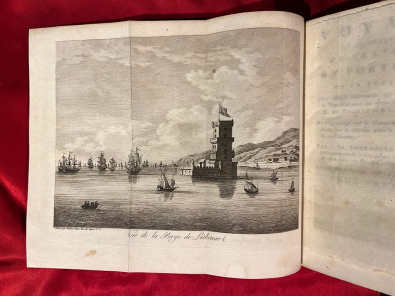
179720333Paris, F. Buisson, an VI de la république [1797]. 2 volumes in-8 de [4]-VIII-268 et [4]-260 pages, plein veau raciné brun, dos lisses ornés de filets, roulettes et fleurons dorés, pièces de titre et tomaison havane, filet doré sur les coupes.
19534068BB2 Bde. Lissabon, Guimarães & C.a Editores, 1953. 8°. (1) Bl., 316 (1) S., (2) Bl.; (1) Bl., 342 S., (2) Bl. Privater Halblederbde. mit verg. Fileten auf Decken u. Rücken. "Portugal contemporâneo".
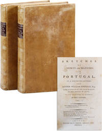
178743440London: T. Vernor 1787. First Edition. Two octavo volumes 21.25cm; 20th c. tan calf with titles stamped in gilt on spines; marbled endpapers; vi4242; iv4244pp. Armorial bookplate of Thomas Tyndall to front pastedowns with contemporary ink signature of Jeremiah Quin to preliminary leaf in both volumes; mild scattered foxing to preliminary and terminal leaves occasional light thumb-soil to margins else clean and sound; light wear to lower board edges with a few rubbed spots to covers; Near Fine. Detailed history of Portuguese social customs written by the author "late a Captain of the Irish Brigade in the service of Spain" in a series of letters to his brother in London. T. Vernor unknown books
185719030Paris, Jules Tardieu - Bruxelles, E. Guyot et Stapleaux Fils & Charles Tanera 1857 In-8 relié 27,5 cm. Bon état d’occasion.
17480Dans une même reliure début 19ème en demi-cuir, 6 textes présentés en page de garde de façon manuscrite- Les Prussiens dénoncés à l'Europe par une Société de Témoins et de Victimes, de leur invasion dans la Province de Hollande. Paris 1789. 107 pages. -Relation fidèle et détaillée de la dernière campagne de Buonaparte terminée par la bataille de Mont-Saint-Jean dite de Waterloo. Paris 1815. 1 carte dépliante en couleurs. 69p. - Général de division J.H Bécaysferrand : Précis de la Défense de Valenciennes. Paris 1805. 78p -Mémoire du Duc de Rovigo sur la Mort de Pichegru du capitaine Wright, de M.Bathurst. Paris 1825. 72p. -Explications au sujet de la Commission Militaire instituée en l'An XII, pour juger le Duc D'Enghien. 15p. -Léonard Gallois : Trois mois au Portugal en 1822. Lettres. Paris 1822. 93p. Etat correct.Demi-reliure d'époque aux mors supérieurs ouverts.Coins émoussés.Ex-libris du Baron de Neuflize.
Rara tavola, probabilmente una carta d'occasione nata per documentare l'evento bellico, dedicata al Dodicesimo assedio di Gibilterra.L'evento ebbe luogo nel corso della guerra di successione spagnola, dal settembre del 1704 al maggio del 1705, presso la Rocca di Gibilterra. Esso fece seguito alla presa dell'agosto del 1704 del villaggio fortificato di Gibilterra, all'estremità sud della Spagna, da una forza navale anglo-olandese guidata da sir George Rooke e dal principe Giorgio d'Assia-Darmstadt. I membri della Grande Alleanza, il Sacro Romano Impero, l'Inghilterra, i Paesi Bassi, la Spagna pro-Asburgo, il Portogallo ed il Ducato di Savoia, si erano alleati per prevenire l'unificazione del trono spagnolo con quello francese supportando il pretendente asburgico, l'arciduca Carlo d'Austria come Carlo III di Spagna. Il candidato rivale, il borbonico Filippo, duca d'Angiò noto come Filippo V di Spagna tra i suoi sostenitori, aveva per patrono ed alleato Luigi XIV di Francia.Il foglio viene probabilmente stampato a Madrid.Acquaforte, leggere mancanze nel testo in basso dovute a foro di tarlo, tracce di colla la verso, per il resto in buono stato di conservazione. Rare Spanish broadsheet dedicated to the Twelfth siege of Gibraltar.The Twelfth Siege of Gibraltar was fought between September 1704 and May 1705 during the War of the Spanish Succession. It followed the capture in August 1704 of the fortified town of Gibraltar, at the southern tip of Spain, by an Anglo–Dutch naval force led by Sir George Rooke and Prince George of Hesse-Darmstadt. The members of the Grand Alliance, Holy Roman Empire, England, the Netherlands, Pro-Habsburg Spain, Portugal and the Savoy, had allied to prevent the unification of the French and Spanish thrones by supporting the claim of the Habsburg pretender Archduke Charles VI of Austria as Charles III of Spain. They were opposed by the rival claimant, the Bourbon Philip, Duke of Anjou, ruling as Philip V of Spain, and his patron and ally, Louis XIV of France.The sheet is probably printed in Madrid.Etching, slight lacks in the text below due to wormhole, traces of glue on the reverse side, otherwise in good condition.
Rarissima carta topografica della Provincia della Castiglia Nuova, istituita nel 1588 dalla Congregazione spagnola dell'Ordine dei Carmelitani Scalzi e intitolata allo Spirito Santo la cui immagine, in forma di colomba, sormonta il cartiglio con il titolo. La mappa venne pubblicata nell'opera Provinciarum et Conventuum Fratum, ac monalium Discalceatorum Ordinis B Virginis Mariae de monte Carmelo Congregationis Hispaniae Corographica Topographica, et Chronologica Descriptio" edita a Roma nel 1739. Sulla carta i gradi delle sedi - patriarcale, arcivescovile, episcopale - sono indicati per mezzo di conventi (riconoscibili perché sormontati dalla croce) di grandezza diversa, il cui significato è chiarito sul secondo frontespizio dell'opera.Margini graduati, scala espressa in leghe spagnole - Scala Leucarum Hispaniae (40 miglia =4,5 cm); l'orografia è rappresentata con il disegno delle montagne dal profilo ombreggiato; è riportata anche l'idrografia, con l'indicazione dei nomi dei corsi d'acqua. Nel margine inferiore, due rubriche, una numerica e l'altra alfabetica, con i riferimenti rispettivamente ai Conventi dei Frati (Conventus Fratrum) e a quelli monache carmelitane (conventus Monalium).A destra, un piccolo cartiglio con una veduta di Roma, dove aveva sede il procuratore generale dell'Ordine.Incisione in rame, completa dei margini bianchi, in ottimo stato di conservazione. A very rare map of Castile, with Carmelite convents, engraved by Domenico Franceschini.The map shows the province established in 1588 by the Spanish Congregation of the Order of Discalced Carmelites and dedicated to The Holy Spitit, whose image surmounts the cartouche with the title.The map is part of the work Provinciarum et Conventuum Fratum, ac monalium Discalceatorum Ordinis B Virginis Mariae de monte Carmelo Congregationis Hispaniae Corographica Topographica, et Chronologica Descriptio" edited in Rome in 1739.Graduated borders, scale in the Spanish miles - Scala Leucarum Hispaniae (40 miles = 4.5 cm), the topography is represented with the design of the mountains from the shaded profile; It is also reported the hydrography, indicating the names of the waterways.In the lower margin, alphabetical and numerical legends respectively, with the references to the Convents of Friars (Conventus Fratrum) and those Carmelite nuns (conventus monalium).Copperplate, with margins, a small wormhole in the upper margins, otherwise perfect condition.
Rarissima carta topografica della Provincia di Murcia, istituita nel 1713 dalla Congregazione spagnola dell'Ordine dei Carmelitani Scalzi e intitolata a S. Anna, la cui immagine sormonta il cartiglio con il titolo. La mappa venne pubblicata nell'opera Provinciarum et Conventuum Fratum, ac monalium Discalceatorum Ordinis B Virginis Mariae de monte Carmelo Congregationis Hispaniae Corographica Topographica, et Chronologica Descriptio" edita a Roma nel 1739. Sulla carta i gradi delle sedi - patriarcale, arcivescovile, episcopale - sono indicati per mezzo di conventi (riconoscibili perché sormontati dalla croce) di grandezza diversa, il cui significato è chiarito sul secondo frontespizio dell'opera.Margini graduati, scala espressa in leghe spagnole - Scala Leucarum Hispaniae (40 miglia =4,5 cm); l'orografia è rappresentata con il disegno delle montagne dal profilo ombreggiato; è riportata anche l'idrografia, con l'indicazione dei nomi dei corsi d'acqua. Nel margine inferiore, due rubriche, una numerica e l'altra alfabetica, con i riferimenti rispettivamente ai Conventi dei Frati (Conventus Fratrum) e a quelli monache carmelitane (conventus Monalium).Incisione in rame, completa dei margini bianchi, in ottimo stato di conservazione. A very rare map of central area of Murcia, with Carmelite convents, engraved by Domenico Franceschini.The map shows the province established in 1713 by the Spanish Congregation of the Order of Discalced Carmelites and dedicated to Sant 'Anna, whose image surmounts the cartouche with the title.The map is part of the work Provinciarum et Conventuum Fratum, ac monalium Discalceatorum Ordinis B Virginis Mariae de monte Carmelo Congregationis Hispaniae Corographica Topographica, et Chronologica Descriptio" edited in Rome in 1739.Graduated borders, scale in the Spanish miles - Scala Leucarum Hispaniae (40 miles = 4.5 cm), the topography is represented with the design of the mountains from the shaded profile; It is also reported the hydrography, indicating the names of the waterways.In the lower margin, alphabetical and numerical legends respectively, with the references to the Convents of Friars (Conventus Fratrum) and those Carmelite nuns (conventus monalium).Copperplate, with margins, a small wormhole in the upper margins, otherwise perfect condition.
Rarissima carta topografica della Provincia di Navarra, istituita nel 1706 dalla Congregazione spagnola dell'Ordine dei Carmelitani Scalzi e intitolata a S. Giovanni, la cui immagine sormonta il cartiglio con il titolo. La mappa venne pubblicata nell'opera Provinciarum et Conventuum Fratum, ac monalium Discalceatorum Ordinis B Virginis Mariae de monte Carmelo Congregationis Hispaniae Corographica Topographica, et Chronologica Descriptio" edita a Roma nel 1739. Sulla carta i gradi delle sedi - patriarcale, arcivescovile, episcopale - sono indicati per mezzo di conventi (riconoscibili perché sormontati dalla croce) di grandezza diversa, il cui significato è chiarito sul secondo frontespizio dell'opera.Margini graduati, scala espressa in leghe spagnole - Scala Leucarum Hispaniae (40 miglia =4,5 cm); l'orografia è rappresentata con il disegno delle montagne dal profilo ombreggiato; è riportata anche l'idrografia, con l'indicazione dei nomi dei corsi d'acqua. Nel margine inferiore, due rubriche, una numerica e l'altra alfabetica, con i riferimenti rispettivamente ai Conventi dei Frati (Conventus Fratrum) e a quelli monache carmelitane (conventus Monalium).Incisione in rame, completa dei margini bianchi, in ottimo stato di conservazione. A very rare map of central area of Navarra, with Carmelite convents, engraved by Domenico Franceschini.The map shows the province established in 1706 by the Spanish Congregation of the Order of Discalced Carmelites and dedicated to St. John, whose image surmounts the cartouche with the title.The map is part of the work Provinciarum et Conventuum Fratum, ac monalium Discalceatorum Ordinis B Virginis Mariae de monte Carmelo Congregationis Hispaniae Corographica Topographica, et Chronologica Descriptio" edited in Rome in 1739.Graduated borders, scale in the Spanish miles - Scala Leucarum Hispaniae (40 miles = 4.5 cm), the topography is represented with the design of the mountains from the shaded profile; It is also reported the hydrography, indicating the names of the waterways.In the lower margin, alphabetical and numerical legends respectively, with the references to the Convents of Friars (Conventus Fratrum) and those Carmelite nuns (conventus monalium).Copperplate, with margins, a small wormhole in the upper margins, otherwise perfect condition.
67115, Galerie Lelong & Co., 2010 hardcovers, dusjackets,1716 pages, 6 vols. Illustrations col. & bw ill. Text; English, *NEW!!!! .
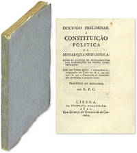
1820564021820. A Profound Influence in Spain Portugal and Latin America Arguelles Augustin de 1776-1844. Discurso Preliminar a Constituicao Politica de Monarquia Hespanhola: Onde se Expoem os Fundamentos das Disposicoes da Mesma Constituicao. Lido nas Cortes Geraes E Extraordinarias Congregadas em Cadis em 1811 Nas Sessoes em Que a Commissao da Constituicao Apresentou o Projecto Desta. Traduzido do Hespanhol por R.F.C. Lisbon: Na Typografia Rollandiana 1820. 157 2 pp. Octavo 6-1/4" x 4-1/4". Original plain paper wrappers untrimmed edges signatures unopened. Some wear to spine ends internally fresh. $650. First edition in Portuguese. Influential in Spain and Portugal this essay on the Spanish constitution of 1812 was also a profound influence in Latin America. It was first delivered in 1811 before the Cortes that brought constitutional monarchy to Spain. This translation was prepared on the occasion of the revolution at Porto on August 24 1820 that overthrew the regency and paved the way for the parliamentary deliberations that resulted in the Portuguese constitution of 1822. It also helped to inspire the Latin American independence movements of the 1820s. The identity of "R.F.C." is unknown. Arguelles was a Spanish statesman and diplomat. OCLC locates 2 copies at Harvard Law School and the University of Kansas. Another copy located at the National Library of Portugal. unknown books
1377610Lisbon: Jorge Welsh Research and Publishing,, 2017 in-4, 360 pages, 280 illustrations en couleurs, 5 illustrations en n/b. Broché, bon état d'occasion. Tirage limité à 500 exemplaires. Ce catalogue illustre 69 objets des 16e au 19e siècles, d'Afrique, d'Inde, de Sri Lanka, de Chine et du Japon produits pour le marché européen et transportés en occident par les navires portugais.
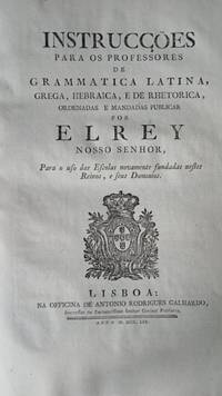
GD103<p>Alvará contendo instruções para reforma do ensino. Reforma do ensino de Marquês de Pombal. Importandte documento contendo reformas no sistema de ensino visando reduzir a influência dos jesuístas. Ano 1759. 18 páginas. Completo e em excelente estado. Impressão original com marcas d ´água. Documento foi periciado por aquivo público e foi constatada sua autenticidade e que sua origem não provém de nenhum arquivo público. Coleção Graphos Arte.</p><p>Decree containing instructions for educational reform. Education reform by the Marquis of Pombal. Important document containing reforms in the educational system aimed at reducing the influence of the Jesuits. Year 1759. 18 pages. Complete and in excellent condition. Original print with watermarks. Document was examined by public archives and its authenticity was confirmed and that its origin does not come from any public archive. Graphos Arte Collection.</p>