JONES John T.Livre Rare Book

9 209 résultats
1832RO80106381ANSELIN. 1832. In-8. Relié demi-cuir. Bon état, Couv. convenable, Dos satisfaisant, Quelques rousseurs. Rare et très bel ouvrage de 261 pages. 3 planches dépliantes, de cartes gravées en noir et blanc. Tranche en-tête dorée. Titre et filets dorés sur demi-maroquin vert. Etiquette de code sur la coiffe en-tête et tampons de bibliothèque sur la page de titre et dans quelques marges.. . . . Classification Dewey : 946-Espagne, Portugal
1900b2c2st067xbvkNo publisher mentioned, probably 1900. 25 creme-coloured cardboards with singleside mounted consecutively numbered original stereo-photographs with captions in French, in a 1-2 cm frame with floral decoration; ca. 9 x 18,5 cm (cardboards) / 8 x 15 cm (photographs).
GD110<p>Prediche del Padre Antonio Vieira della Compagnia di Giesu. Dette estampate in Lingua Portoghese Tradotte nell Italiana dal P. Annibale Adami della medesima Compagnia.Padre Antonio Vieira PRIMEIRA EDIÇÃO. Venetzia Nicolo Pezzana 1684. 434 páginas. Dimensões 24x17cm. Primeira edição dos Sermões - alguns deles inclusive escritos em italiano pelo próprio Vieira. Eu experimento com você uma paixão totalmente diversa e já temo hoje a dor que serei obrigada a suportar quando você partir de Roma escreveu Cristina numa carta de 1674 cinco anos após a chegada de Vieira à capital italiana Coleção Graphos Arte.</p><p>Predictions of Father Antonio Vieira of the Giesu Society. These printed in Portuguese translated into Italian by Father Annibale Adami of the same Society. Father Antonio Vieira FIRST EDITION. Venetzia Nicolo Pezzana 1684. 434 pages. Dimensions 24x17cm. First edition of the Sermons - some of them even written in Italian by Vieira himself. I experience a totally different passion for you and I already fear today the pain that I will be forced to endure when you leave Rome wrote Cristina in a letter from 1674 five years after Vieira's arrival in the Italian capital Graphos Arte Collection.</p>
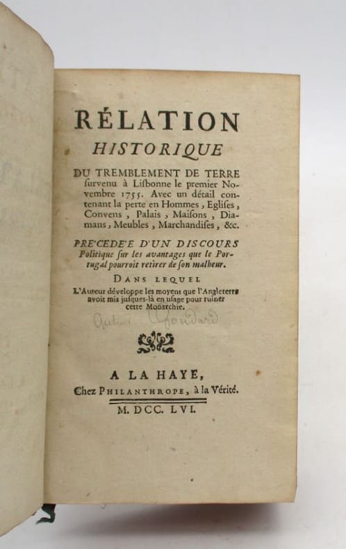
22104La Haye, chez Philanthrope, 1756. In-12, X-216 pp., basane marbrée havane, dos à nerfs orné de caissons dorés, tranches rouges (petits manques et épidermures, 2 mors fendus, rares rousseurs, une pâle mouillure sans atteinte).
055929Sans Lieu, ni Date ( vers 1877 ) imprimerie de Poissy 1877 grand in 8 (27x18) 1 volume reliure plein chagrin maroquiné marron de l'époque, dos à nerfs soulignés de filets dorés, fine dentelle dorée intérieure, plats ornés d'un encadrement de triple filets dorés, 16 pages. Ex-don en lettres dorées sur le plat supérieur: A Mr. ANTONIO MARIA FONTES PERREIRA DE MELLO PRÉSIDENT DU CONSEIL DES MINISTRES. António Maria de Fontes Pereira de Melo, Lisbonne 1819 - 1887, important homme politique portugais de la seconde moitié du XIXe siècle, président du conseil des ministres du gouvernement portugais de 1871 à 1879. De toute rareté. Très bel exemplaire à provenance, très finement relié à l'époque ( Photographies sur demande / We can send pictures of this book on simple request )
1831007516London, Henry Colburn and Richard Bentley, 1831. vii, 432; viiii, 408 S. Dekorative Halblederbände der Zeit. Sir Arthur Baronet de Capell Brooke (1791-1858) wurde vor allem durch die Schilderungen seiner Skandinavienreisen bekannt. Seine ausführliche Beschreibung Marokkos wird durch Ansichten von Tanger, Tétouan und dem Atlas-Gebirge geschmückt. Das vordere Innengelenk von Band 1 angeplatzt, sonst jedoch noch gut erhaltenes, gering stockfleckiges Exemplar mit nur leichten Gebrauchsspuren.
Rarissima carta topografica della Provincia di Portogallo, istituita nel 1588 dalla Congregazione spagnola dell'Ordine dei Carmelitani Scalzi e intitolata a S. Filippo apostolo, la cui immagine sormonta il cartiglio con il titolo. La mappa venne pubblicata nell'opera Provinciarum et Conventuum Fratum, ac monalium Discalceatorum Ordinis B Virginis Mariae de monte Carmelo Congregationis Hispaniae Corographica Topographica, et Chronologica Descriptio" edita a Roma nel 1739. Sulla carta i gradi delle sedi - patriarcale, arcivescovile, episcopale - sono indicati per mezzo di conventi (riconoscibili perché sormontati dalla croce) di grandezza diversa, il cui significato è chiarito sul secondo frontespizio dell'opera.Margini graduati, scala espressa in leghe spagnole - Scala Leucarum Hispaniae (40 miglia =4,5 cm); l'orografia è rappresentata con il disegno delle montagne dal profilo ombreggiato; è riportata anche l'idrografia, con l'indicazione dei nomi dei corsi d'acqua. Nel margine inferiore, due rubriche, una numerica e l'altra alfabetica, con i riferimenti rispettivamente ai Conventi dei Frati (Conventus Fratrum) e a quelli monache carmelitane (conventus Monalium).Due piccoli cartigli con il Brasile e il Regno del Congo.Incisione in rame, completa dei margini bianchi, in ottimo stato di conservazione. A very rare map of Portugal, with Carmelite convents, engraved by Domenico Franceschini.The map shows the province established in 1588 by the Spanish Congregation of the Order of Discalced Carmelites and dedicated to St. Philip, whose image surmounts the cartouche with the title.The map is part of the work Provinciarum et Conventuum Fratum, ac monalium Discalceatorum Ordinis B Virginis Mariae de monte Carmelo Congregationis Hispaniae Corographica Topographica, et Chronologica Descriptio" edited in Rome in 1739.Graduated borders, scale in the Spanish miles - Scala Leucarum Hispaniae (40 miles = 4.5 cm), the topography is represented with the design of the mountains from the shaded profile; It is also reported the hydrography, indicating the names of the waterways.In the lower margin, alphabetical and numerical legends respectively, with the references to the Convents of Friars (Conventus Fratrum) and those Carmelite nuns (conventus monalium).Copperplate, with margins, a small wormhole in the upper margins, otherwise perfect condition.
REL217M2 tomes en 1 volume. Tome 4 : 1807 / 532 pages. Tome 4 : 1807 / 192 pages. Relié au format : 10,5 x 18 cm. Editions Lévy.
Carta tratta dalla rara raccolta di carte geografiche denominata Atlante Geografico, prima stesura delle opera dell’abate Bartolomeo Borghi, pubblicata in Siena dal Pazzini Carli. Molte delle carte, datate tra il 1788 ed il 1800, sono incise da Agostino Costa e poi successivamente inserite nell’opera Atlante generale dell'ab. Bartolommeo Borghi, pubblicato a Firenze nel 1819.Bartolomeo Borghi, che Vermiglioli (Biografia degli scrittori perugini, 1829) definisce "uno dei migliori geografi dell'Europa", nacque nel 1750 a Monte del Lago, piccola frazione del comune di Magione, in provincia di Perugia, sulle rive del Trasimeno. Ordinato sacerdote nel 1774, trascorse i primi anni del suo mandato nel paese natale, poi a Magione e quindi a Sorbello (Cortona).Appassionato studioso di geografia, applicò dapprima le sue conoscenze all'analisi delle terre a lui più familiari: nel 1770 scrisse Descrizione geografica, fisica e naturale del Lago Trasimeno (che sarà tuttavia data alle stampe per la prima volta solo nel 1821), e nel 1791 pubblicò negli atti dell'Accademia etrusca di Cortona una Dissertazione sopra l'antica geografia dell'Etruria, Umbria e Piceno, arricchendo entrambe le opere di una carta delle regioni descritte. Intanto la sua fama di cartografo, oltre che di geografo, cresceva, tanto da fargli ottenere le nomine a membro delle Accademie Cortonese e Reale di Firenze, e procurargli l'incarico, da parte di Pietro Leopoldo, di delineare la carta del catasto pubblico di Cortona e del contado di Castiglione.Nello stesso tempo gli orizzonti geografici della sua attività si allargavano sensibilmente, e se nell'Atlante Novissimo, illustrato ed accresciuto sulle osservazioni, e scoperte fatte dai più celebri e più recenti cartografi di Antonio Zatta (Venezia 1779-1785) il suo contributo fu ancora legato all'area toscana, nell'Atlante geografico che si pubblicò a Siena da Pazzini Carli tra il 1798 ed il 1800 il Borghi tracciò la maggior parte delle carte e spaziò dalle province del Sud-Est dell'Inghilterra, al Regno di Danimarca, alla Romania.Una sorta di prova generale, quest'ultima, della sua opera più importante, quell'Atlante generale dell'ab. Bartolommeo Borghi, pubblicato a Firenze nel 1819. L'Atlante, corredato da brevi descrizioni storiche, politiche, civili e naturali che introducono le carte relative ai territori afferenti a ciascun Impero o Regno illustrato, rispecchia il nuovo assetto geo-politico attuato dal Congresso di Vienna. Incisione in rame, in buone condizioni. Map taken form the very rare Atlante Geografico, the first draft of the abbot Bartolomeo Borghi, published in Siena by Pazzini Carli. Many of the mapss, dated between 1788 and 1800, are engraved by Agostino Costa and then later incorporated in the work of AB Atlante Generale di Bartolomeo Borghi, published in Florence in 1819.Bartolomeo Borghi, who Vermiglioli (Biography of writers Perugini, 1829) calls "one of the best geographers of Europe", was born in 1750 in Monte del Lago, a small fraction of the town of Mansfield, in the province of Perugia, on the shores of Lake Trasimeno. Ordained in 1774, spent the first years of his term in his hometown, then to Mansfield and then Sorbello (Cortona).A passionate student of geography, first applied his knowledge to the analysis of land more familiar to him: he wrote in 1770 Description geographical, physical and natural Lake Trasimeno (which will however be given to the press for the first time only in 1821), and 1791 published in the Proceedings of Etruscan Cortona a dissertation on the geography of ancient Etruria, Umbria and Piceno, enriching both the works of a map of the regions described. Meanwhile, his fame as a cartographer, as well as a geographer, was growing, so that he get the nomination as a member of the Royal Academies of Florence and Cortona, and give him the job, by Pietro Leopoldo, to outline the paper's public land Cortona and the county of Castiglione.At the same time the geographical horizons of its activities widened considerably, and if in the Atlas Novissimo, illustrated and amplified the observations and discoveries made by the most recent and most famous cartographer Antonio Zatta (Venice 1779-1785) his contribution was still related area of Tuscany, in the Atlas geographic monthly published in Siena by Pazzini Carli between 1798 and 1800 the villages drew most of the cards and spaced from the provinces of South-East of England, the Kingdom of Denmark, Romania.A sort of dress rehearsal, the latter, his most important work, quell'Atlante General of AB. Bartolomeo Borghi, published in Florence in 1819. The Atlas, accompanied by brief descriptions of historical, political, civil and natural to introduce the papers relating to the territories belonging to each United Empire or illustrated, reflects the new geo-political structure implemented by the Congress of Vienna.
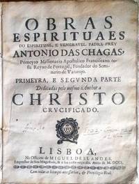
GD109<p>Obras Espirituaes do Espiritual e Venerável Padre Frey António das Chagas - Primeyro Missionario Apostolico Franciscano neste Reyno de Portugal Fundador do Seminario de Varatojo. Miguel Deslandes. Lisboa. Ano 1701. A 1ª edição foi publicada em 1688 a 2ª em 1700 a 3ª em 1701 e conheceu mais uma edição a 5ª em 1762. Obra-prima da prosa espiritual e mística do século XVII de um dos maiores escritores da literatura portuguesa. Segundo Maria de Lourdes Belchior Pontes são necessários muitos mais estudos para compreender o autor: As Obras espirituais embora não representem quando ao estilo o autêntico Frei António das Chagas representam-no fielmente quanto à doutrina. Impressão original com marcas d ´água. Documento foi periciado por aquivo público e foi constatada sua autenticidade e que sua origem não provém de nenhum arquivo público. Coleção Graphos Arte.</p><p>Spiritual Works of the Spiritual and Venerable Father Frey António das Chagas - First Franciscan Apostolic Missionary in this Kingdom of Portugal Founder of the Seminary of Varatojo. Miguel Deslandes. Lisbon. Year 1701. The 1st edition was published in 1688 the 2nd in 1700 the 3rd in 1701 and there was another edition the 5th in 1762. A masterpiece of 17th century spiritual and mystical prose by one of the greatest writers in Portuguese literature. According to Maria de Lourdes Belchior Pontes many more studies are necessary to understand the author: The Spiritual Works although they do not represent in terms of style the authentic Frei Antônio das Chagas represent him faithfully in terms of doctrine. Original print with watermarks. The document was examined by a public archive and its authenticity was confirmed and that its origin does not come from any public archive. Graphos Art Collection.</p>
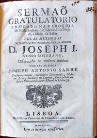
GD99<p>Sermão gratulatorio prégado na paroquia de Nossa Senhora da Conceição da Praya da Cidade de Bahia pelas melhoras do muito alto poderoso Rey e Senhor D. Joseph I. Joseph Antonio Sarre. Editor: Lisboa Na Officina Patriarchal de Francisco Luiz Ameno 1764. PRIMEIRA E ÚNICA EDIÇÃO. Com privilégio Real. Documento de grande importância para a história do Brasil e extremamente raro em sua versão original. Impressão original com marcas d ´água. Documento foi periciado por aquivo público e foi constatada sua autenticidade e que sua origem não provém de nenhum arquivo público. Coleção Graphos Arte.</p><p>Sermon of gratitude preached in the parish of Our Lady of the Conception of Praya in the city of Bahia for the recovery of the most high and powerful King and Lord D. Joseph I. Joseph Antonio Sarre. Publisher: Lisbon In the Patriarchal Office of Francisco Luiz Ameno 1764. FIRST AND ONLY EDITION. With royal privilege. Document of great importance for the history of Brazil and extremely rare in its original version. Original print with watermarks. Document was examined by public archive and its authenticity was confirmed and that its origin does not come from any public archive. Graphos Arte Collection.</p>
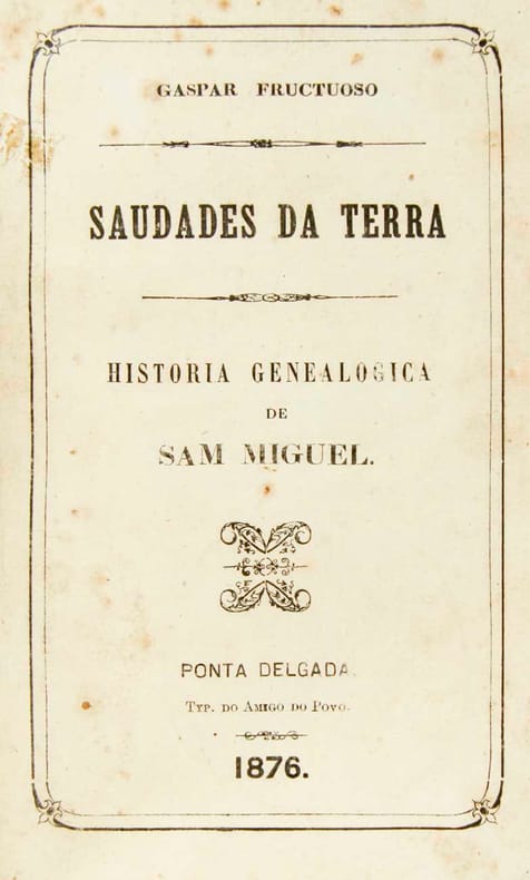
71166aafPonta Delgada, Tip. do Diario dos Açores, 1924 -26 - 31, lg. in-8vo, In all 5 volumes, 1) H.-Leather, spine richly gilt. (1 vol.). / full leather, spines richly gilt, gilt lines on book covers, untrimmed, orig. wrappers bound in.
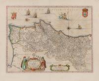
1640200017AG1640. Amsterdam Guiljelmum et Joannem Blaeu 1640. Original hand-coloured engraving. Plate Size: 49.6 cm x 38.1 cm. Sheet Size: 58 cm x 47 cm. Original map. Very good condition. Map orientated with north facing to the right. Some very minor traces of spotting near edges. Signs of foxing in top right corner of map. Minor chip and tear near lower left corner of sheet. Centre fold as issued. Latin text on reverse. Koeman II 6300 "Parte septentrional do Reyno de Portugal". By N. Sanson with P. Mariette 1678; onde Coll. P. 104. Border with longitudinal and latitudinal information. A richly detailed and very interesting map showing the Kingdom of Portugal and the Algarves. Relief shown pictorially with rivers mountains and major and minor settlements depicted through keys. The kingdoms of the Algarves and Portugal are delineated - as are other internal political sub-divisions. The major urban centres are highlighted with red colouring. In the lower part of the map a decorative title cartouche is accompanied by two elaborately dressed scholars performing navigational exercises with their sextant and cross-staff: their gazes directed to the armillary sphere. Another cartouche encases a dual scale. Off the coast 4 naval vessels are pictured illustrating the rich maritime history and naval power of Portugal. Amid the ships a trident-wielding Neptune is depicted astride a Renaissance-style dolphin. The coat-of arms of the Kingdom of Portugal and the Algarves are pictured in the map's top right and left corners respectively. Two ornamental orientation keys can also be seen just off the coast. Fernando Alvares Seco c.1561-85 was a Portuguese mathematician and cartographer who made the first known map of Portugal. It was engraved by Sebastiano del Re and published in Rome in 1561. Abraham Ortelius 1527-98 later reprinted the map in his Theatrum Orbis Terrarum Theater of the world which was first published in May 1570. World Digital Library unknown
Madrid, Diego Díaz de la C arrera, 1639, 29,5 x 21 cm., dos hojas. (Relación de las fiestas realizadas en Lisboa con motivo del cumpleaños de Felipe IV, las personalidades que asistieron con ropa de gala, banquete y desfile militar. Hemos localizado ejemplares de esta obra en la Biblioteca Nacional, Hemeroteca Municipal de Madrid, Universitat Ramon Llull de Barcelona y en la Biblioteca Borja de Sant Cugat del Vallés).
181314663London, Sherwood, Neely and Jones, 1813. 4°. VIII, V, 310 Seiten. Restaurierter Halbleder d. Zt. (etwas fleckig u. berieben).
16923253FBNürnberg, Verlag Johannes Hofmann, 1692. 16°. 13,5 x 8 cm. [5] Blatt, 302 [recte 312] Seiten. Frontispiz und 24 Tafeln. Einband der Zeit aus Holzdeckeln mit farbigem Kamm-Marmorpaper.
Un volume con il primo intero anno della più importante rivista portoghese di metà 800, diretta da Antonio Felician o Castilho. I primi numeri, dall'ottobre 1841, portano il titolo di Revista Universal Lisbonense, jornal dos intereses physicos, moraes e letterarios: pagine 1-170, con testo riquadrato e fregi agli angoli. Dal 1842 il titolo, più semplice, è Revista Universal, e la paginazione è 1-572, fino al n. 48 del settembre 1942. Legatura coeva in mezza pelle, con dorso a nervi e titolo dorato. - L'importanza della rivista nel panorama della letteratura e del gusto romantico in Portogallo è largamente conosciuta.
177516390Lausanne, Grasset, 1775. XVI, 304 SS., marmorierte Vorsätze Ganzleder der Zeit mit Rck.-schild, 8°
176019587A Amsterdam, chez M. [Marc] Michel Rey, 1760 et 1761. 3 vol. au format pt in-12 (163 x 104 mm) de 138, 48 pp. , f. n.fol., 275 pp. et 2 ff. n.fol. ; 1 f. n.fol., 241 pp. et 2 ff. n.fol. ; 108, 239 pp. et 4 ff. n.fol. Reliures uniformes de l'époque de plein veau glacé et marbré blond, plats jansénistes, dos à nerfs ornés de filets gras à froid, roulette dorée sur les nerfs, doubles caissons d'encadrement dorés, larges fleurons dorés, pièces de titre de maroquin acajou, pièces de tomaison de maroquin anthracite, titre doré, tomaison dorés, palette dorée en queue, dentelle dorée sur les coupes, toutes tranches rouges.
055941Lisboa ( Lisbonne ) Na Typographia Bollandiana 1822 in 8 (19x13) 1 volume broché, couverture muette de l'époque, 3 feuillets liminaires non chiffrés, 157 pages, non rogné, étiquette ex-libris. . Tercra ediçao Correcta, e accrescentada com hum Indice Geral dos Jogos. Très rare. Envoi signé de l'auteur?? Maïroal ?: à Elisa Archer, administradora dos jogos de prendas. Bel exemplaire ( Photographies sur demande / We can send pictures of this book on simple request )
Lisboa, na Officina Real Deslandesiana, 1711. 4to.; 8 hs., 264 pp. Encuadernación en piel marbreada, de la época, fatigada, con pérdidas de piel en lomera y planos.
Mappa rara di Spagna e Portogallo, pubblicata da Perre Husson all'Aia (Den Haag), che identifica una serie di battaglie significative combattute durante la guerra di successione spagnola.Esemplare del secondo stato, pubblicato da Rainer & Joshua Ottens, Amsterdam intorno al 1750.La mappa include una serie di battaglie, tra cui una rappresentazione grafica della battaglia navale di Velez-Malaga (24 agosto 1704), la più grande battaglia navale combattuta durante la guerra di successione spagnola, insieme a una rappresentazione di una più grande battaglia navale al largo la costa catalana, rappresentante dell'assedio di Barcellona da parte degli inglesi sotto il conte di Peterborough. Altre battaglie notate includono la Baia di Vigo (23 ottobre 1702) e l'assedio di Gibilterra (24 luglio 1704).Il dettaglio nella mappa è eccellente, inclusa una rappresentazione delle strade in tutta la penisola iberica.La mappa comprende 16 stemmi, montati su un cartiglio elegantemente inciso.Incisione in rame, bella coloritura coeva, in ottimo stato di conservazione. Rare map of Spain and Portugal, published by Perre Husson in the Hague (Den Haag), identifying a number of the significant battles fought duing the war of Spanish Succession.Example of the second state, published by Rainer & Joshua Ottens, Amsterdam circa 1750.The map includes a number of battles, including a graphic depiction of the naval Battle of Velez-Malaga (August 24, 1704), the largest naval battle fought during the War of the Spanish Succession, along with a representation of a larger naval battle off the Catalan Coast, representative of the Siege of Barcelona by the British under the Earl of Peterborough. Other battles noted include the Bay of Vigo (October 23, 1702) and the Siege of Gibraltar (July 24, 1704).The detail in the map is excellent, including a depiction of the roads throughout the Iberian Peninsula.The map includes 16 coats of arms, mounted on an elegantly engraved cartouche. A fine example of this rare and highly detailed map.Copperpalte with fine original colour, very good condition.
Carta geografica della Spagna e del Portogallo, raffigurante le divisioni in reami e principati con confini in coloritura coeva. La carta è arricchita da due bei cartigli. Piega centrale editoriale, altre pieghe
99212Paris, Levrault, Schoell et Cie, Libraires, AN XII-1803, 3 volumes in-8 de 200x125 mm environ, tome 1 : xvj-431 pages, 1 f. d'errata, tome 2 : iv-395 pages, tome 3 : vij-337 pages, demi basane noire, titres et tomaisons dorés sur dos lisses, ornés de filets et frises dorés, gardes de couleurs. Edition originale de la traduction française, sans la grande carte dépliante du Royame de Portugal (comme souvent). Des rousseurs (tome 2), sinon bon état.
8705Madrid, 1778. Deux feuilles de 82 x 72 cm pliées et toilées.