SERVICE HYDROGRAPHIQUE DE LA MARINE.Livre Rare Book
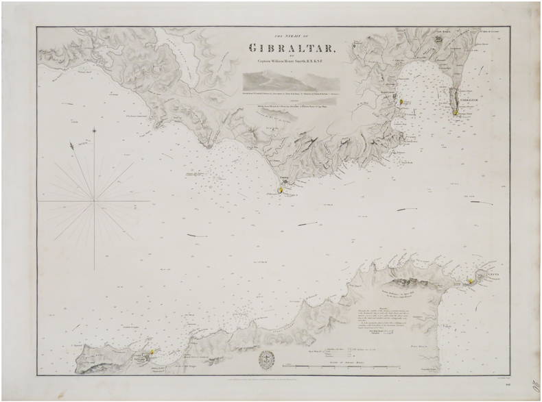
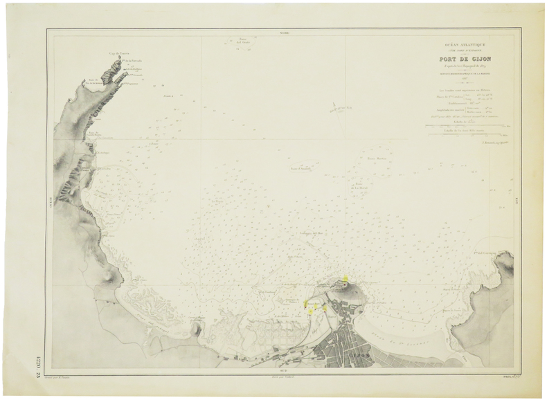
[GIJÓN] Port de Gijón.
1887LBW-5712Service Hydrographique de la Marine, 1887. 319 x 432 mm.
Librairie Le Bail · Paris, France200,00 €
9 219 résultats
1375921Lisbonne: Imprimerie Lisbonense, 1839 in-8, 116 pages. Broché, couv. de relai muette, non coupé, bon état. Edition originale.
1377597Lisboa: Imprensa Nacionam, 1903 in-4, xii-274 pages, nombreuses illustrations dans le texte et 17 planches hors texte (certaines en couleurs, certaines se dépliant. Bibliographie, index. Reliure moderne en basane bleue, les plats étant divisés en 2 bandes verticales de basane bleue et blanche, dos lisse orné de filets dorés, le premier plat est orné d'une plaque émaillée avec les armes du Portugal, tête dorée, couvertures conservées, très bel exemplaire (rel. Carlos Guerreiro). EDITION ORIGINALE de cette monographie sur le palais royal de Cintra (Sintra).
19038120BBLausanne, Bridel, 1903. Gross-8°. XLVI, 390 S., 1 Titelportrait in Heliogravüre, 7 (1 doppelblattgross) Tafeln in Heliogravüre, 1 gefaltete genealogische Tafel der Familie Saussure. Marmorierter Hldrbd. der Zeit mit goldgeprägtem Rückenschildchen. OBroschur eingebunden.
1887LBW-5712Service Hydrographique de la Marine, 1887. 319 x 432 mm.
1833LBW-8936London, Hydrographical Office of the Admiralty, 1833. 445 x 592 mm.
Carta geografica della penisola iberica in 4 fogli
1800KART0161Paris, um 1800. Plattengröße:45x34 cm, Blattgröße: 56,8x43,4 cm; verstärkter Mittelfalz, No. 108 im linken Plattenrand, in der Mitte im unt. Plattenrand: Longitude du Meridien de Paris; sauberes, dekoratives Blatt.
- le carte edite dal Depot de la Marine -Per contrastare lo strapotere navale della flotta inglese re Luigi XIV comprese la necessita di dotare le sue navi di carte nautiche in grado di renderle competitive con la marina antagonista. Un primo tentativo si ebbe con il Neptune Francais del 1693, ma solo agli inizi del diciottesimo secolo iniziò una grande campagna di rilievo delle coste del Mediterraneo e di altri mari, che portò alla realizzazione di numerose mappe, raccolte nel Dépot des Cartes et Planes de la Marine del 1720. Tuttavia il fondatore dell’idrografia francese può essere considerato a tutti gli effetti Jacques Nicolas Bellin (1703-1772) che per oltre cinquant’anni fu al servizio della Marina quale ingegnere e cartografo, tanto che gli venne assegnato il titolo quale primo “Ingegnere Idrografo della Marina” e quindi addirittura quello di “Idrografo Reale”. Durante il suo servizio gli furono commissionati i rilievi delle coste francesi prima e successivamente quelle di praticamente tutto il mondo conosciuto. La sua produzione fu immensa e le sue carte nautiche, di grande qualità, apparvero in più edizioni fino oltre la fine del diciottesimo secolo. Questo grande fondo cartografico diede vita alla produzione ed alla vendita di carte navali, prima basate su quelle del Bellin, successivamente ampliate e migliorate da altri ingegneri di marina, sia francesi che non. Le carte nautiche venivano vendute separatamente e recavano tutte l’inconfondibile timbro con l’ancora e le corone (quando regnava la monarchia) del Depot Generale de la Marine. Raccolte delle stesse carte venivano invece pubblicate sotto il nome di Neptune Francois, monumentale opera che ebbe numerosissime ristampe fino alla metà del secolo successivo. Il seguente gruppo di carte è tratto da un volume denominato Neptune de la Méditerranée, riguardante il Mediterraneo. Dove possibile sono indicati il nome del cartografo, spesso un capitano di vascello, e la data della carta. Incisioni in rame, in eccellente stato di conservazione, salvo controindicazioni.Carta nautica del golfo di Gibilterra, ridotta da quella disegnata nel 1786 dal celebre idrografo spagnolo Vicent Tofino de San Miguel (1732-95). To fight against the powerful English fleet, king Louis XIV decided to endow his ships with nautical charts that could enable them to compete with the enemy. The Neptune Francais, in 1693, can be considered a first attempt, but it was only at the beginning of the Eighteenth century that a campaign of study of the Mediterranean coasts and sea was started, leading to the realization of maps, collected in the Dépot des Cartes et Planes de la Marine in 1720. Nevertheless, the real founder of French hydrography can be considered Jacques Nicolas Bellin (1703-1772), who served for more than fifty years the navy as engineer and cartographer, which win him first the title of "Hydrographer Engineer of the Navy" and then of "Royal Hydrographer". His first commitment was to study the French coasts fisrt, and then of the whole world. His production was massive and his nautical charts, due also to their quality, were published in many edition until the end of the XVIII century. This allowance led to the production and the selling of sea charts, at first based on those from Bellin, then developed by other navy engineers. The sea charts were sold separately, all bearing the stamp with the anchor and the crowns of the Depot Generale de la Marine. Collections of the same charts have been published under the name of Neptune Francois, a monumental work which has been reissued many times until the half of the following century. The following group of charts is taken from a volume entitled Neptune de la Méditerranée, about the Mediterranean sea. Where possible, there is the name of the cartographer, very often the captain of the ship, and the date of the chart.
- le carte edite dal Depot de la Marine -Per contrastare lo strapotere navale della flotta inglese re Luigi XIV comprese la necessita di dotare le sue navi di carte nautiche in grado di renderle competitive con la marina antagonista. Un primo tentativo si ebbe con il Neptune Francais del 1693, ma solo agli inizi del diciottesimo secolo iniziò una grande campagna di rilievo delle coste del Mediterraneo e di altri mari, che portò alla realizzazione di numerose mappe, raccolte nel Dépot des Cartes et Planes de la Marine del 1720. Tuttavia il fondatore dell’idrografia francese può essere considerato a tutti gli effetti Jacques Nicolas Bellin (1703-1772) che per oltre cinquant’anni fu al servizio della Marina quale ingegnere e cartografo, tanto che gli venne assegnato il titolo quale primo “Ingegnere Idrografo della Marina” e quindi addirittura quello di “Idrografo Reale”. Durante il suo servizio gli furono commissionati i rilievi delle coste francesi prima e successivamente quelle di praticamente tutto il mondo conosciuto. La sua produzione fu immensa e le sue carte nautiche, di grande qualità, apparvero in più edizioni fino oltre la fine del diciottesimo secolo. Questo grande fondo cartografico diede vita alla produzione ed alla vendita di carte navali, prima basate su quelle del Bellin, successivamente ampliate e migliorate da altri ingegneri di marina, sia francesi che non. Le carte nautiche venivano vendute separatamente e recavano tutte l’inconfondibile timbro con l’ancora e le corone (quando regnava la monarchia) del Depot Generale de la Marine. Raccolte delle stesse carte venivano invece pubblicate sotto il nome di Neptune Francois, monumentale opera che ebbe numerosissime ristampe fino alla metà del secolo successivo. Il seguente gruppo di carte è tratto da un volume denominato Neptune de la Méditerranée, riguardante il Mediterraneo. Dove possibile sono indicati il nome del cartografo, spesso un capitano di vascello, e la data della carta. Incisioni in rame, in eccellente stato di conservazione, salvo controindicazioni.Grande carta nautica dello stretto di Gibilterra, raffigurante le coste spagnole da Cadice a Gibilterra e quelle del Marocco da Arzille a Punta Cala Mazari. To fight against the powerful English fleet, king Louis XIV decided to endow his ships with nautical charts that could enable them to compete with the enemy. The Neptune Francais, in 1693, can be considered a first attempt, but it was only at the beginning of the Eighteenth century that a campaign of study of the Mediterranean coasts and sea was started, leading to the realization of maps, collected in the Dépot des Cartes et Planes de la Marine in 1720. Nevertheless, the real founder of French hydrography can be considered Jacques Nicolas Bellin (1703-1772), who served for more than fifty years the navy as engineer and cartographer, which win him first the title of "Hydrographer Engineer of the Navy" and then of "Royal Hydrographer". His first commitment was to study the French coasts fisrt, and then of the whole world. His production was massive and his nautical charts, due also to their quality, were published in many edition until the end of the XVIII century. This allowance led to the production and the selling of sea charts, at first based on those from Bellin, then developed by other navy engineers. The sea charts were sold separately, all bearing the stamp with the anchor and the crowns of the Depot Generale de la Marine. Collections of the same charts have been published under the name of Neptune Francois, a monumental work which has been reissued many times until the half of the following century. The following group of charts is taken from a volume entitled Neptune de la Méditerranée, about the Mediterranean sea. Where possible, there is the name of the cartographer, very often the captain of the ship, and the date of the chart.
- le carte edite dal Depot de la Marine -Per contrastare lo strapotere navale della flotta inglese re Luigi XIV comprese la necessita di dotare le sue navi di carte nautiche in grado di renderle competitive con la marina antagonista. Un primo tentativo si ebbe con il Neptune Francais del 1693, ma solo agli inizi del diciottesimo secolo iniziò una grande campagna di rilievo delle coste del Mediterraneo e di altri mari, che portò alla realizzazione di numerose mappe, raccolte nel Dépot des Cartes et Planes de la Marine del 1720. Tuttavia il fondatore dell’idrografia francese può essere considerato a tutti gli effetti Jacques Nicolas Bellin (1703-1772) che per oltre cinquant’anni fu al servizio della Marina quale ingegnere e cartografo, tanto che gli venne assegnato il titolo quale primo “Ingegnere Idrografo della Marina” e quindi addirittura quello di “Idrografo Reale”. Durante il suo servizio gli furono commissionati i rilievi delle coste francesi prima e successivamente quelle di praticamente tutto il mondo conosciuto. La sua produzione fu immensa e le sue carte nautiche, di grande qualità, apparvero in più edizioni fino oltre la fine del diciottesimo secolo. Questo grande fondo cartografico diede vita alla produzione ed alla vendita di carte navali, prima basate su quelle del Bellin, successivamente ampliate e migliorate da altri ingegneri di marina, sia francesi che non. Le carte nautiche venivano vendute separatamente e recavano tutte l’inconfondibile timbro con l’ancora e le corone (quando regnava la monarchia) del Depot Generale de la Marine. Raccolte delle stesse carte venivano invece pubblicate sotto il nome di Neptune Francois, monumentale opera che ebbe numerosissime ristampe fino alla metà del secolo successivo. Il seguente gruppo di carte è tratto da un volume denominato Neptune de la Méditerranée, riguardante il Mediterraneo. Dove possibile sono indicati il nome del cartografo, spesso un capitano di vascello, e la data della carta. Incisioni in rame, in eccellente stato di conservazione, salvo controindicazioni.Carta nautica della città spagnola sulla Costa Blanca, ridotta sulla base di quella realizzata dal Tofino nel 1788. To fight against the powerful English fleet, king Louis XIV decided to endow his ships with nautical charts that could enable them to compete with the enemy. The Neptune Francais, in 1693, can be considered a first attempt, but it was only at the beginning of the Eighteenth century that a campaign of study of the Mediterranean coasts and sea was started, leading to the realization of maps, collected in the Dépot des Cartes et Planes de la Marine in 1720. Nevertheless, the real founder of French hydrography can be considered Jacques Nicolas Bellin (1703-1772), who served for more than fifty years the navy as engineer and cartographer, which win him first the title of "Hydrographer Engineer of the Navy" and then of "Royal Hydrographer". His first commitment was to study the French coasts fisrt, and then of the whole world. His production was massive and his nautical charts, due also to their quality, were published in many edition until the end of the XVIII century. This allowance led to the production and the selling of sea charts, at first based on those from Bellin, then developed by other navy engineers. The sea charts were sold separately, all bearing the stamp with the anchor and the crowns of the Depot Generale de la Marine. Collections of the same charts have been published under the name of Neptune Francois, a monumental work which has been reissued many times until the half of the following century. The following group of charts is taken from a volume entitled Neptune de la Méditerranée, about the Mediterranean sea. Where possible, there is the name of the cartographer, very often the captain of the ship, and the date of the chart. Sea chart of the Spanish city on the Costa Blanca, based onl Tofino's example of 1788.
188933502ABBerlin, Wasmuth, 1889-1892. 2°, 74 Textseiten mit zahlreichen s/w-Illustrationen sowie insgesamt 120 etwas stärkere Pappseiten mit s/w-Abbildungen (wenige doppelblattgroße auch farbig), in den dicken original Pappmappen mit rotem Leinenrückenstreifen, [2 Warenabbildungen] Erstausgabe die sehr großen Klapp-Mappen stellenw. etwas fleckig/altersspurig, bei der ersten Mappe der Leinenrücken teilw. etwas angeplatzt, auch einige Blätter altersfleckig, insg. aber guter Zustand in den raren original Lieferungs-Mappen
Carta geografica tratta dall’Atlante novissimo, illustrato ed accresciuto sulle osservazioni e scoperte fatte dai più celebri e più recenti geografi. Stampato in quattro volumi da Antonio Zatta tra il 1779 ed il 1785. Atlante fra i più belli e completi mai pubblicati in Italia nel XVIII secolo, l'opera più famosa dello Zatta. L’Atlante Novissimo, come si specifica anche nel titolo, è “accresciuto sulle osservazioni scoperte fatte dai più celebri e più recenti geografi”. Tra le novità più significative vi è la comparsa delle nuove isole scoperte nell'Oceano Pacifico da James Cook e la prima carta italiana della Nuova Zelanda. Le illustrazioni furono ideate e disegnate dai suoi collaboratori Giovanni Marco Pitteri, Anton Friedrich Busching, Pietro Antonio Novelli ed incise da Giuliano Zuliani. Il primo tomo dell’atlante è introdotto da un breve saggio di geografia generale dove l’autore definisce in modo sintetico e preciso gli elementi che compongono i reticoli eclittico ed equatoriale usati nelle tavole. Interessante la sezione dove si sofferma a descrivere il fenomeno della precessione degli equinozi e quello della variazione ciclica dell'obliquità dell'eclittica. Acquaforte, stampata su carta vergata coeva, coloritura coeva dei contorni, in buone condizioni. Map from the Atlante novissimo, illustrato ed accresciuto sulle osservazioni e scoperte fatte dai più celebri e più recenti geografi. Printed in four volumes by Antonio Zatta between 1779 and 1785. Atlas among the most beautiful and complete ever published in Italy in the eighteenth century, the most famous work of Zatta. The Atlante Novissimo, as also specified in the title, is “increased on the observations made by the most famous and most recent geographers”. Among the most significant innovations there is the appearance of the new islands discovered in the Pacific Ocean by James Cook and the first Italian map of New Zealand. The illustrations were designed and drawn by his collaborators Giovanni Marco Pitteri, Anton Friedrich Busching, Pietro Antonio Novelli and engraved by Giuliano Zuliani. The first volume of the atlas is introduced by a brief essay of general geography where the author defines in a concise and precise way the elements that make up the ecliptic and equatorial grids used in the tables. Interesting is the section where he pauses to describe the phenomenon of precession of the equinoxes and the cyclical variation of the obliquity of the ecliptic. Etching, printed on contemporary laid paper, contemporary outline coloring, in good condition.
Numerous black and white photographs. "...Framed with the object of producing an account of the great contest now in progress, which shall be at once popular and authoritative... An account written by men of great experience in political, military, and naval matters... Will contain a great deal of first-hand material which will be really valuable to historians of the future." - From Preface. Contents: Chapter CXLVI - The Intervention of Portugal, Why Portugal joined the Allies. Average wear. Unmarked. Binding intact. Magazine
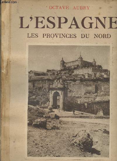
1930R240082699B.ARTHAUD. 1930. In-Folio. Broché. Etat d'usage, Coins frottés, Dos satisfaisant, Intérieur acceptable. 195 pages - ouvrage recouvert d'un plastique transparent - couverture à 3 rabats - illustration en noir et blanc contre collée sur le 1er plat - ouvrage orné de 257 héliogravures dans et hors texte - tâches brunes en début d'ouvrage - 2 photos disponibles.. . . . Classification Dewey : 946-Espagne, Portugal
R240159071B. Arthaud. 1936 - 37. In-4. Broché. Etat d'usage, Couv. légèrement passée, Dos abîmé, Papier jauni. 191 + 160 pages - nombreuses photos en noir et blanc dans et hors texte. Plats contrepliés en trois rabats. Petite annotation au crayon de papier en page de garde du 1er volume. Scotch sur le dos sur 1er volume, dos manquant sur le 2nd volume.. . . . Classification Dewey : 946-Espagne, Portugal
RO80101736CAZALS P. et DENTU E.. Non daté. In-8. Broché. Etat d'usage, Couv. défraîchie, Dos satisfaisant, Intérieur acceptable. 474 pages. Quelques accrocs sur les bords de couverture. Dos renforcé par une bande, avec étiquette de code de bibliothèque sur la coiffe en-tête. Tampons de bibliothèque sur la page de titre et dans quelques marges.. . . . Classification Dewey : 946-Espagne, Portugal
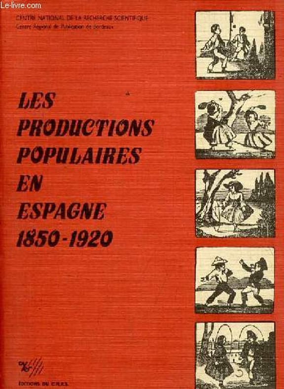
1986R100083786Editions du CNRS. 1986. In-8. Broché. Bon état, Couv. convenable, Dos satisfaisant, Intérieur frais. 372 pages - texte en français et en espagnol.. . . . Classification Dewey : 946-Espagne, Portugal
1839RO40202857Rey et Gravier - A. Pougin, Paris. 1839. In-8. Broché. Etat d'usage, Couv. défraîchie, Dos abîmé, Quelques rousseurs. 413 pages pour le tome I et 415 pages pour le tome II. Gravures en noir et blanc en frontispices (portraits). Tome II illustré de 4 fac-similés en noir et blanc sur planches dépliables hors texte. Etiquettes de code sur les dos. Tampons et annotations de bibliothèque sur les 1ers plats et en pages de titre.. . . . Classification Dewey : 946-Espagne, Portugal
Rey et Gravier - A. Pougin, Paris. 1839. In-8 Carré. Broché. Etat d'usage. Couv. défraîchie. Dos abîmé. Quelques rousseurs. 413 pages pour le tome I et 415 pages pour le tome II. Gravures en noir et blanc en frontispices (portraits). Tome II illustré de 4 fac-similés en noir et blanc sur planches dépliables hors texte. Etiquettes de code sur les dos. Tampons et annotations de bibliothèque sur les 1ers plats et en pages de titre. Avec portraits et fac-similés.
1965RO20160781SKIRA. 1965. In-4. Relié toilé. Etat d'usage, Couv. convenable, Dos satisfaisant, Intérieur frais. 2 TOMES: 248 + XVIII + 242 pages - nombreuses copie de reproduction en noir et blanc et en couleurs contre-collée dans et hors texte + carte en noir et blanc hors texte - petit tampon sur la page de titre - jaquette abimée.. Avec Jaquette. . . Classification Dewey : 946-Espagne, Portugal
1694RO80011861COLOMYEZ G.L. / FOUCHAC & BELY. 1694. In-12. Relié plein cuir. Etat d'usage, Couv. légèrement passée, Mors fendus, Intérieur frais. 448 pages. Quelques bandeaux illustrés. Relié plein cuir marron. Caissons dorés sur le dos à 5 nerfs. Coiffe en pied légèrement abîmée.. . . . Classification Dewey : 946-Espagne, Portugal
RO20186006"OCCITANIA. NON DATE. In-8. Broché. Bon état, Couv. convenable, Dos frotté, Intérieur frais. 120 pages - nombreux dessins en noir et blanc hors texte - plats illustrés - 1 dechirure sur le 2eme plat + ""guide pratique ""Occitania"" aux iles Baleares de 36 pages augmentées de 2 cartes en noir et blanc dans et hors texte et de nombreux encarts publicitaires en noir et blanc dans et hors texte.. . . . Classification Dewey : 946-Espagne, Portugal"
1877RO40111585Alfred Mame & Fils, Tours. 1877. In-4. Cartonnage d'éditeurs. Etat d'usage, Couv. légèrement passée, Dos abîmé, Quelques rousseurs. 352 pages. Gravure en noir et blanc en frontispice. Illustré de gravures en noir et blanc hors texte. Dos très frotté et mors fendus. Bords des plats frottés.. . . . Classification Dewey : 946-Espagne, Portugal
Alfred Mame & Fils, Tours. 1877. In-4 Carré. Cartonnage d'éditeurs. Etat d'usage. Couv. légèrement passée. Dos abîmé. Quelques rousseurs. 352 pages. Gravure en noir et blanc en frontispice. Illustré de gravures en noir et blanc hors texte. Dos très frotté et mors fendus. Bords des plats frottés. 4e édition. Orné de 4 gravures d'après M. Gustave Doré. Entrée en Espagne. Conseils aux voyageurs. D'Irun à Burgos. Les Basques. Burgos. Le Cid. Valladolid. Les chants populaires. Les ordres religieux. La statuaire espagnole. Disposition des églises en Espagne. Un pèlerin de St-Jacques. La Galice. Le plateau de Castille. Tolède. La mort en Espagne...
1838RO40202905Leleux, Paris. 1838. In-8. Broché. Etat d'usage, Couv. légèrement passée, Dos abîmé, Non coupé. 474 pages. Etiquette de code sur le dos. Tampons et annotations de bibliothèque sur le 1er plat et en page de titre. Signature de l'auteur en page de garde (certification).. . . . Classification Dewey : 946-Espagne, Portugal