Strahlheim, CarlAntiquariat.de

9 219 résultats
183641474Frankfurt, Comptoir für Literatur und Kunst 1836. 230) S. Mit 1 gest. Frontispiz und 42 gestochene Tafeln / Kupfern, gebundene Ausgabe, Halbleder, Rückenleder oben mit Fehlstück
Carta geografica della Spagna antica. Piega centrale editoriale e alcune pieghe al lato sinistro
Carta geografica tratta dall’Atlante novissimo, illustrato ed accresciuto sulle osservazioni e scoperte fatte dai più celebri e più recenti geografi. Stampato in quattro volumi da Antonio Zatta tra il 1779 ed il 1785. Atlante fra i più belli e completi mai pubblicati in Italia nel XVIII secolo, l'opera più famosa dello Zatta. L’Atlante Novissimo, come si specifica anche nel titolo, è “accresciuto sulle osservazioni scoperte fatte dai più celebri e più recenti geografi”. Tra le novità più significative vi è la comparsa delle nuove isole scoperte nell'Oceano Pacifico da James Cook e la prima carta italiana della Nuova Zelanda. Le illustrazioni furono ideate e disegnate dai suoi collaboratori Giovanni Marco Pitteri, Anton Friedrich Busching, Pietro Antonio Novelli ed incise da Giuliano Zuliani. Il primo tomo dell’atlante è introdotto da un breve saggio di geografia generale dove l’autore definisce in modo sintetico e preciso gli elementi che compongono i reticoli eclittico ed equatoriale usati nelle tavole. Interessante la sezione dove si sofferma a descrivere il fenomeno della precessione degli equinozi e quello della variazione ciclica dell'obliquità dell'eclittica. Acquaforte, stampata su carta vergata coeva, coloritura coeva dei contorni, in buone condizioni. Map from the Atlante novissimo, illustrato ed accresciuto sulle osservazioni e scoperte fatte dai più celebri e più recenti geografi. Printed in four volumes by Antonio Zatta between 1779 and 1785. Atlas among the most beautiful and complete ever published in Italy in the eighteenth century, the most famous work of Zatta. The Atlante Novissimo, as also specified in the title, is “increased on the observations made by the most famous and most recent geographers”. Among the most significant innovations there is the appearance of the new islands discovered in the Pacific Ocean by James Cook and the first Italian map of New Zealand. The illustrations were designed and drawn by his collaborators Giovanni Marco Pitteri, Anton Friedrich Busching, Pietro Antonio Novelli and engraved by Giuliano Zuliani. The first volume of the atlas is introduced by a brief essay of general geography where the author defines in a concise and precise way the elements that make up the ecliptic and equatorial grids used in the tables. Interesting is the section where he pauses to describe the phenomenon of precession of the equinoxes and the cyclical variation of the obliquity of the ecliptic. Etching, printed on contemporary laid paper, contemporary outline coloring, in good condition.
1818RO30380824Chez Treuttel et Wûrtz. 1818. In-8. Broché. Etat passable, Livré sans Couverture, Dos satisfaisant, Mouillures. L+493 pages + 555 pages + 497 pages + 498 pages - gravure en noir et blanc en frontispice du tome 1 - manque 2 pages en fin du tome 4 - mouillures et moisissures à l'intérieur des ouvrages, sur les tranches sans réelle conséquence sur la lecture, principalement dans le tome 4 - couverture muette.. . . . Classification Dewey : 946-Espagne, Portugal
1846R300319337Delsol. 1846. In-4. Relié demi-cuir. Etat d'usage, Couv. légèrement passée, Dos frotté, Quelques rousseurs. 387 pages - nombreuses gravures sur acier hors texte et en frontispice, sous serpente - lettrines et culs-de-lampe illustrés. Texte sur deux colonnes. Coins frottés. Dos cuir, reliure romantique, titre, auteur et motifs dorés. Coiffes frottées.. . . . Classification Dewey : 946-Espagne, Portugal
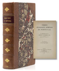
Folio, [iv],xlpp., with the H.P. Kraus bookplate, 46 plates, cont. quarter roan, spine rubbed, marbled sides. The marks of 93 different Spanish and Portuguese printers are included in this study. An alphabetical list of printers' and publishers' names refers the reader to biographical sketch in which each name appears. Information presented includes the dates during which a printer was active, cities in which he worked, and associates with whom he worked. Clear prints of marks are provided, as are the title, author, date and city of publication, and size of book(s) in which each mark appears, as well as citations to other scholarly resources. The index of printers' and publishers' names is comprehensive, guiding users of this work to both the main entry on a printer or publisher as well as to entries in which the name is mentioned, which makes this a useful book for researching the interactions between various printers.
Madrid, en la Imprenta Real, 1790. Tres volúmenes en 4to. menor (I-II) y 8vo.(III); frontispicio y lámina, CIII-290 pp. + 309 pp. + 416 pp., Con 24 láminas grabadas en cobre por Muntaner, Brieva, Fabregat y Gamborino sobre dibujos de Manuel de la Cruz y Maella; más un mapa plegado, dibujado por Juan de la Cruz. Encuadernación, no uniforme, de la época en piel.
Lisboa, Typographia Universal de Thomaz Quintino Antunes, Impressor da Casa Real, 1876. 4to.; XII-215 pp., con 41 ilustraciones entre el texto y dos láminas plegadas, aparte, con aspectos gráficos para el buen herraje. Encuadernación en media piel, de la época.
A series of papers connected to a controversy in 1997 over changes in the board of Trustees, and in 2004 over changes in the seating plan of the Synagogue which would have allowed both women and men to sit on the main floor, changing a tradition that dates back to the consecration of the original synagogue building on Mill Street in 1730. Extensively researched reports submitted by a congregant on the history of the rituals around seating at Shearith Israel, and the importance of continuity of their traditions. He argues that this change would move the service away from its unique Western Sephardic style, and closer to that of Modern Orthodoxy, an Ashkenazi movement. Also included are various papers connected to celebrations and special events at the Synagogue, and brochures on the buildings history, legacy and capital campaign. Some papers are folded. 24 items. Very good condition. (SEF-35-21)
Mappa delle antiche province di Minho, Beira Baixa, Trás-os-Montes e Alto Douro, del nord del Portogallo, di Antonio Zatta. Sono raffigurati città, villaggi, foreste, montagne e fiumi di queste regioni. Un cartiglio con titolo illustrato si trova nell'angolo in basso a destra di ciascuna mappa. Carta geografica tratta dall’Atlante novissimo, illustrato ed accresciuto sulle osservazioni e scoperte fatte dai più celebri e più recenti geografi. Stampato in quattro volumi da Antonio Zatta tra il 1779 ed il 1785. Atlante fra i più belli e completi mai pubblicati in Italia nel XVIII secolo, l'opera più famosa dello Zatta. L’Atlante Novissimo, come si specifica anche nel titolo, è “accresciuto sulle osservazioni scoperte fatte dai più celebri e più recenti geografi”. Tra le novità più significative vi è la comparsa delle nuove isole scoperte nell'Oceano Pacifico da James Cook e la prima carta italiana della Nuova Zelanda. Le illustrazioni furono ideate e disegnate dai suoi collaboratori Giovanni Marco Pitteri, Anton Friedrich Busching, Pietro Antonio Novelli ed incise da Giuliano Zuliani. Il primo tomo dell’atlante è introdotto da un breve saggio di geografia generale dove l’autore definisce in modo sintetico e preciso gli elementi che compongono i reticoli eclittico ed equatoriale usati nelle tavole. Interessante la sezione dove si sofferma a descrivere il fenomeno della precessione degli equinozi e quello della variazione ciclica dell'obliquità dell'eclittica. Acquaforte, stampata su carta vergata coeva, coloritura coeva dei contorni, in buone condizioni. Map of the provinces of Minho, Biera, Tras-os-Montes e Alto Duoro and Beira, of northern Portugal, by Antonio Zatta. Towns, villages, forests, mountains and rivers of these regions are depicted. An illustrated title cartouche is at the bottom right corner of each map. Map from the Atlante novissimo, illustrato ed accresciuto sulle osservazioni e scoperte fatte dai più celebri e più recenti geografi. Printed in four volumes by Antonio Zatta between 1779 and 1785. Atlas among the most beautiful and complete ever published in Italy in the eighteenth century, the most famous work of Zatta. The Atlante Novissimo, as also specified in the title, is “increased on the observations made by the most famous and most recent geographers”. Among the most significant innovations there is the appearance of the new islands discovered in the Pacific Ocean by James Cook and the first Italian map of New Zealand. The illustrations were designed and drawn by his collaborators Giovanni Marco Pitteri, Anton Friedrich Busching, Pietro Antonio Novelli and engraved by Giuliano Zuliani. The first volume of the atlas is introduced by a brief essay of general geography where the author defines in a concise and precise way the elements that make up the ecliptic and equatorial grids used in the tables. Interesting is the section where he pauses to describe the phenomenon of precession of the equinoxes and the cyclical variation of the obliquity of the ecliptic. Etching, printed on contemporary laid paper, contemporary outline coloring, in good condition.
Mappa delle regioni dell'Algarve e dell'Alentejo del Portogallo sud-occidentale. La città di Lisbona è raffigurata lungo la costa occidentale e sono presenti altre città, villaggi, foreste, montagne e fiumi di questa zona del Portogallo. Un cartiglio illustrato con titolo nell'angolo in alto a destra. Carta geografica tratta dall’Atlante novissimo, illustrato ed accresciuto sulle osservazioni e scoperte fatte dai più celebri e più recenti geografi. Stampato in quattro volumi da Antonio Zatta tra il 1779 ed il 1785. Atlante fra i più belli e completi mai pubblicati in Italia nel XVIII secolo, l'opera più famosa dello Zatta. L’Atlante Novissimo, come si specifica anche nel titolo, è “accresciuto sulle osservazioni scoperte fatte dai più celebri e più recenti geografi”. Tra le novità più significative vi è la comparsa delle nuove isole scoperte nell'Oceano Pacifico da James Cook e la prima carta italiana della Nuova Zelanda. Le illustrazioni furono ideate e disegnate dai suoi collaboratori Giovanni Marco Pitteri, Anton Friedrich Busching, Pietro Antonio Novelli ed incise da Giuliano Zuliani. Il primo tomo dell’atlante è introdotto da un breve saggio di geografia generale dove l’autore definisce in modo sintetico e preciso gli elementi che compongono i reticoli eclittico ed equatoriale usati nelle tavole. Interessante la sezione dove si sofferma a descrivere il fenomeno della precessione degli equinozi e quello della variazione ciclica dell'obliquità dell'eclittica. Acquaforte, stampata su carta vergata coeva, coloritura coeva dei contorni, in buone condizioni. Map of the regions of Algarve and Alentejo of Southwestern Portugal. The city of Lisbon is depicted along the western coast, as are the other towns, villages, forests, mountains and rivers of this area of Portugal. An illustrated title cartouche is at the top right corner. Map from the Atlante novissimo, illustrato ed accresciuto sulle osservazioni e scoperte fatte dai più celebri e più recenti geografi. Printed in four volumes by Antonio Zatta between 1779 and 1785. Atlas among the most beautiful and complete ever published in Italy in the eighteenth century, the most famous work of Zatta. The Atlante Novissimo, as also specified in the title, is “increased on the observations made by the most famous and most recent geographers”. Among the most significant innovations there is the appearance of the new islands discovered in the Pacific Ocean by James Cook and the first Italian map of New Zealand. The illustrations were designed and drawn by his collaborators Giovanni Marco Pitteri, Anton Friedrich Busching, Pietro Antonio Novelli and engraved by Giuliano Zuliani. The first volume of the atlas is introduced by a brief essay of general geography where the author defines in a concise and precise way the elements that make up the ecliptic and equatorial grids used in the tables. Interesting is the section where he pauses to describe the phenomenon of precession of the equinoxes and the cyclical variation of the obliquity of the ecliptic. Etching, printed on contemporary laid paper, contemporary outline coloring, in good condition.
Carta geografica tratta dall’Atlante novissimo, illustrato ed accresciuto sulle osservazioni e scoperte fatte dai più celebri e più recenti geografi. Stampato in quattro volumi da Antonio Zatta tra il 1779 ed il 1785. Atlante fra i più belli e completi mai pubblicati in Italia nel XVIII secolo, l'opera più famosa dello Zatta. L’Atlante Novissimo, come si specifica anche nel titolo, è “accresciuto sulle osservazioni scoperte fatte dai più celebri e più recenti geografi”. Tra le novità più significative vi è la comparsa delle nuove isole scoperte nell'Oceano Pacifico da James Cook e la prima carta italiana della Nuova Zelanda. Le illustrazioni furono ideate e disegnate dai suoi collaboratori Giovanni Marco Pitteri, Anton Friedrich Busching, Pietro Antonio Novelli ed incise da Giuliano Zuliani. Il primo tomo dell’atlante è introdotto da un breve saggio di geografia generale dove l’autore definisce in modo sintetico e preciso gli elementi che compongono i reticoli eclittico ed equatoriale usati nelle tavole. Interessante la sezione dove si sofferma a descrivere il fenomeno della precessione degli equinozi e quello della variazione ciclica dell'obliquità dell'eclittica. Acquaforte, stampata su carta vergata coeva, coloritura coeva dei contorni, in buone condizioni. Map from the Atlante novissimo, illustrato ed accresciuto sulle osservazioni e scoperte fatte dai più celebri e più recenti geografi. Printed in four volumes by Antonio Zatta between 1779 and 1785. Atlas among the most beautiful and complete ever published in Italy in the eighteenth century, the most famous work of Zatta. The Atlante Novissimo, as also specified in the title, is “increased on the observations made by the most famous and most recent geographers”. Among the most significant innovations there is the appearance of the new islands discovered in the Pacific Ocean by James Cook and the first Italian map of New Zealand. The illustrations were designed and drawn by his collaborators Giovanni Marco Pitteri, Anton Friedrich Busching, Pietro Antonio Novelli and engraved by Giuliano Zuliani. The first volume of the atlas is introduced by a brief essay of general geography where the author defines in a concise and precise way the elements that make up the ecliptic and equatorial grids used in the tables. Interesting is the section where he pauses to describe the phenomenon of precession of the equinoxes and the cyclical variation of the obliquity of the ecliptic. Etching, printed on contemporary laid paper, contemporary outline coloring, in good condition.
29295Lausanne, Editions du Verseau 1978, 260x370mm, broché. Tirage à 300 exemplaires numérotés, signés par l’artiste et le préfacier, n° 173. Dédicace et carte de voeux de l’artiste et une planche volante signée. Très bel exemplaire.
2026x-1350410268Bloomsbury Publishing Plc 2026. Hardcover. New. 188 pages. 6.14x0.50x9.21 inches. Bloomsbury Publishing Plc hardcover
25566‘Lisbon 16 March 1811’. He receives the briefest of obituaries in the Gentleman's Magazine July 1840: 'May 10. At Exeter aged 81 Col. Thomas Abernethie K.H. on the retired list of the Royal Marines.' 3pp 4to. Bifolium. On aged and discoloured paper with the usual damage to the second leaf from the breaking of the seal. Addressed on reverse of second leaf with postmark to ‘Messrs Cox & Son / 20 Bartletts Buildings / Holborn / London’. Signed ‘Thos. Abernethie’ and docketed ‘Maj: Abernethie / 16 March 1811’. Begins: ‘Gentlemen / I have requested a Cap. Falcon of the Navy to purchase for me a Qr cask of Madeira - should he and to draw upon you per the Amt. which you will please to honor -’. He continues: ‘Lord Wellington is in full pursuit of the French - but I scarcely think he will follow them further than the confines of Portugal - should they escape thither - we have no certain intelligence of the Armies till we receive it in an official shape from England - Cap. Cox is well - we rode together yesterday to see the palace of Queluse sic about 8 miles from Lisbon - a very charming spot -’. ‘Lisbon 16 March 1811’. unknown
189133568ABZürich, Orell Füssli & Co., 1891. Klein-8°. 114 S. mit gefaltetem Plan von Funchal, einer Farbtafel (Flaggen), dem Theater-Sitzplan u. einer mehrfach gef. Karte der Insel. Original-Leinenband. Leicht gebräunt, Vorsätze papierbedingt stärker. Einband stark abgegriffen, berieben u. bestossen.
Madrid, Establecimiento Tipográfico de Don Francisco de Paula Mellado, 1859. Dos tomos en 4to.menor; X-490 pp. + 692 pp. Encuadernación en media piel, de la época.
1824176886Librairie d'Education d'A. Eymery Paris, A la Librairie d'Education d'A. Eymery, 1824. In-12 reliépleine basane brune, dos lisse très orné de fers entralacs dorés, pièce de titre rouge. Plat armorié "Pension de S.A.R. M. La Dauphine", tranches marbrées, gardes de papier marbré, 519 pages, bien complet des 6 gravures hors texte. Contient, en outre, des notices exactes sur leurs conquêtes, leur religion, moeurs, arts, usages, des anecdotes curieuses et intéressantes, des traits divers d'héroïsme, de courage, de grandeur d'âme etc. Petits frottements à la reliure sans aucune gravité, corps de l'ouvrage en bon état.
1899317025London: Simpson LOw Marston & Company Limited St. Dunstan's House 1899. First edition. With a Sketch map from the author's drawing. Illustrated. 394pp. 8vo. Bound in modern three quarters brown morocco maroon label. Fine. First edition. With a Sketch map from the author's drawing. Illustrated. 394pp. 8vo. Simpson LOw, Marston & Company Limited St. Dunstan's House unknown
1969004138London: Hutchinson & Co 1969. Hardcover. Very Good /very good. 8vo. xxvi 426 pp. Bound in full blue cloth title in gilt on green background on spine in illustrated dust jacket. Black and white maps and illustrations. Includes glossary bibliography and index. History of Human Society series. Very Good or better bumping to lower corners of binding else clean and tight in Very Good dust jacket with hard creasing to flaps minor wear to extremities. <br/><br/> Hutchinson & Co hardcover
1899317025London: Simpson LOw Marston & Company Limited St. Dunstan's House 1899. First edition. With a Sketch map from the author's drawing. Illustrated. 394pp. 8vo. Bound in modern three quarters brown morocco maroon label. Fine. First edition. With a Sketch map from the author's drawing. Illustrated. 394pp. 8vo. Simpson LOw, Marston & Company Limited St. Dunstan's House unknown books
1998043410Ottawa: The Royal Canadian Military Institute Heritage Society 1998. Hardcover with dust jacket second 2000 printing xvi 418 8 pages including black-and-white illustrations; ---three line gift inscription by the author dated by her "Feb 10 2001" with her "Best wishes" followed by her signature in full on free front endpaper;---very gently read if at all but tight in binding not a trace of shelf or reading wear very clean and unmarked throughout pages fresh and white glossy navy blue covers gleaming front cover and spine gilt lettering and decoration as bright and clear as new. See also our listings for Paul Addison's Time to Kill: The Soldier's Experience of War in the West 1939-1945 and for The Voice of War: The Second World War Told By Those Who Fought It edited by James Owen. Signed by Author. Hard Cover. Fine/Fine. The Royal Canadian Military Institute Heritage Society Hardcover
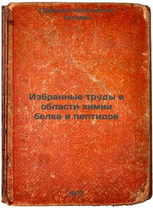
7649492Short description: In Russian. Poroshin, Konstantin Titovich. Selected papers in protein and peptide chemistry. Dushanbe: Donish, 1977. You are welcome to reach out to us for a detailed description of the copies currently available. Delivery of this book may take longer than usual including extended processing and pre-shipping time, no expedited shipping is available. Please advise us if you have a set date or a deadline to receive your order.SKU7649492
7649493Short description: In Russian. Portugal Victor Mikhailovich. Conversations about ASU. Moscow: Mol Guards 1977. The image is provided for reference only. It may reflect condition of one of the available copies or only help in identifying the edition. Please feel free to contact us for a detailed description of the copies available. SKU7649493 unknown
198612310H80963Polanco Mexico: Centro Cultural/Arte Contemporáneo Mexico. Very Good. Soft cover. 1986. Centro Cultural/Arte Contemporáneo (Mexico) paperback