95 résultats
185125105Paris Imprimerie de Schiller aîné 1851 in-8 dérelié
189920570P., Librairie Cerf, 1899, in-4°, 664 pp, une carte dépliante in-fine, biblio, reliure pleine percaline grise, dos lisse orné d'un fleuron et d'un double filet doré en queue, titres dorés, couv. conservée (rel. de l'époque), bon état. Manque le dernier cahier (fin de la table des matières)
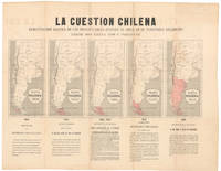
1878NL-02415<p><strong>Argentinian propaganda map of Chile's advance into Patagonia.</strong></p><p>This is an anonymous and undated propaganda map prepared by Argentina's Foreign Ministry for dissemination among potential allies on the American continents. It regards the conflict known as the "East Patagonia Tierra del Fuego and Strait of Magellan dispute" or "Patagonia Question" which was a territorial dispute between Chile and Argentina during most of the 19th century for more context see section below.</p><p>The sheet centers on five maps which are distinguished only by the varying size of the swathe of red that is meant to outline Chile's encroachment into Argentine Patagonia. The expansion process began in 1843 with only a few small islands and tiny peninsulas in the western part of the Strait of Magellan but by 1847 Chile was claiming the entire Strait as its own. The expansion continues in three subsequent phases each documented with its own map until 1876 when the territory in dispute consists of virtually all of Patagonia or the southern half of Argentina. Each of the intermediary stages in the quintet of displayed maps is dated and the territories in question are highlighted in red. Under each phase are noted the years in question as well as a brief explanation of the particulars of each phase of the expansionall of it from an Argentine perspective of course.</p><p>The Argentinian Foreign Ministry designed the map as a means of visualizing what Argentina considered the ongoing encroachment by Chile on Argentine territory. The broadsheet highlighted the blatant nature of Chilean territorial claims.</p><p>Because of this background and purpose the sheet was only distributed in limited circles making it a rarity today. The only institutional example of this map in the United States was presented to the US Minister to Argentina Thomas Ogden Osborn by the Argentine Minister of Foreign Affairs to serve precisely the purpose for which it was designed. The United States did indeed get involved and played a key role in the ensuing treaty negotiations 1879-1881.</p><p><strong>Census</strong></p><p>This sheet is rare likely because it was never produced in large quantities to begin with. There is only a single example of this sheet in US institutions. This document is located in the National Archives NAID: 5675669 and is the same sheet that Thomas Ogden Osborn sent to US Secretary of State William M. Evarts in 1880 following his role as US mediator in the negotiations for the 1881 Boundary Treaty that ended the conflict.</p><p>The only other institutional example we have been able to identify is held in the <em>Biblioteca Nacional de España</em> OCLC no. 431564806.</p><p><strong>Context is Everything</strong></p><p><em>The Strait of Magellan dispute and the "Patagonia Question" 18421881</em></p><p>The "Patagonia Question" was a nineteenth-century sovereignty dispute between Chile and Argentina over the southernmost lands of South America i.e. East Patagonia the Isla Grande de Tierra del Fuego and the strategically vital Strait of Magellan. Its roots lay in the messy inheritance of Spanish colonial jurisdictions and centuries of imprecise royal decrees that left overlapping claims along the entire Andean-to-Atlantic sweep. Both countries gradually sought to translate old legal claims into an effective national occupation: Chile concentrated on the Pacific channels and the Strait. At the same time Argentina pushed settlement eastward across the pampas and into Chubut.</p><p>Tensions hardened during the mid-1800s. Chile's deliberate occupation of the Strait of Magellan symbolized by the 1843 expedition that founded Fuerte Bulnes and formally took possession of the strait alarmed Buenos Aires and was the source of repeated diplomatic protests. Argentina in turn fostered new settlements established informal alliances with indigenous leaders and ensured a significant naval presence to assert influence on the Atlantic coast. By the 1870s both states were populating adjacent zones and commissioning maps and legal arguments to buttress their claims. This map is one such example from the Argentine side.</p><p>The trigger for a negotiated containment and ultimately a resolution of the conflict came in December 1878 when Chile and Argentina signed the FierroSarratea agreement. This was an interim pact that postponed a final delimitation and established arbitration procedures to avoid a fully fledged armed conflict. Chile quickly ratified the agreement but Argentina's Congress never gave its final approval causing it to collapse as a comprehensive settlement. The outbreak of the War of the Pacific 18791884 in which Chile fought Peru and Bolivia made rapid de-escalation with Argentina diplomatically urgent. Chile wished to avoid a second front. At the same time Argentina was engaged in the "Conquest of the Desert" on its southern frontier pushing it to resolve this old conflict as well.</p><p>The crisis was finally resolved by the <em>Boundary Treaty of 23 July 1881</em>. The treaty adopted a practical formula: north to the 52°S parallel the boundary would follow the highest Andes watershed; south of 52°S the agreement recognized Chilean sovereignty over the Strait of Magellan and assigned islands and Tierra del Fuego between the two states according to specified meridians and channels. Crucially the treaty neutralized the Strait of Magellan and guaranteed free navigation to all nations; a provision that allowed international passage through the strait and prevented any single power from controlling it.</p><p>US involvement in the dispute was modest. Washington did not act as an official guarantor or principal mediator in the 1881 settlement. However diplomatic records and dispatches confirm that the situation was under close observation and US diplomats regularly reported to their superiors on the crisis's development and its regional implications especially for shipping routes. Formal third-party arbitration and boundary adjudications were carried out by various state actors notably Britain or by various bilateral protocols. In short the U.S. was an interested observer rather than a decisive actor in both the dispute and its resolution.</p><p>The conflict illustrates how colonial legal ambiguities competing settlement policies and the strategic value of a single waterway combined to produce a long fraught boundary contest. The 1881 Boundary Treaty negotiated under the shadow of other regional wars and mediated by pragmatism rather than legality integrated competing claims into a workable frontier and ensured the neutrality of the Strait of Magellan for international shipping.</p><p>Condition Description</p><p>Good. Wear and toning along fold lines.</p> Foreign Ministry of Argentina
188517991Mendoza, Tip. Bazar Madrileno, 1885. 4°. Con muchas tablas, en parte plegadas. VII, 226 p. Media encuadernación de tela. Tres estampillas a la portada. La portada y escasas páginas con puntos de oxido.
1845124894P., Heois, 1845 in-12, 144 pp, un portrait gravé sur bois du colonel Thébaut, de la Légion française, en frontispice, documents in fine, broché, dos recollé, qqs pages salies, bon état, envoi a.s. au 1er plat
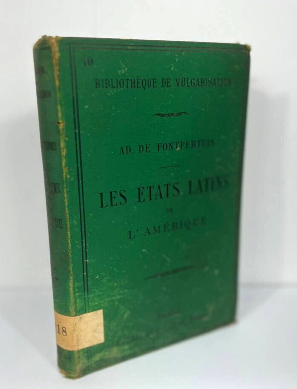
18820477Paris, A. Degorge-Cadot, 1882. Seule et unique édition. Un volume in-12 de 18 x 12 cm pour (vi) 313 pp. Relié pleine toile vert bouteille éditeur. Double encadrement sur les plats, décorations sur le plat de couverture et au dos, monogramme de l'éditeur au plat arrière. Ancien livre de bibliothèque avec une étiquette assez ancienne en queue. Tampons habituels aux premières pages. Rousseurs éparses. Ce livre relève un réel défi : condenser l'histoire de tous les États au sud des États-Unis en un seul petit livre. Si l'Introduction se contente de comparer la colonisation anglo-saxonne à la colonisation espagnole, qui s'est démarquée par son "absolutisme" et sa volonté d'isoler ses colonies du reste du monde "au profit exclusif de la métropole", en ignorant le Portugal et sa très vaste colonie, le livre consacre ensuite pas moins de trois chapitres au Brésil avant de repasser à l'isthme central, à la "Nouvelle-Grenade" et même à Cuba.
1825235711825 Paris, Firmin Didot père & fils, 1825. First Edition Deux volumes in-8 reliure de l'époque 397 pp., [1] ff. + 413 pp.(dont jugements de l'époque) coiffes arrachées ou émoussées, qq. rousseurs claires aux 2 tomes, neanmoins agréable exemplaire. Edition originale de cette traduction que Brunet juge plus fidèle que celles qui l'ont précédé. Etiquettes ex-libris moderne. Réf. bibliographiques : Brunet I, 1518.
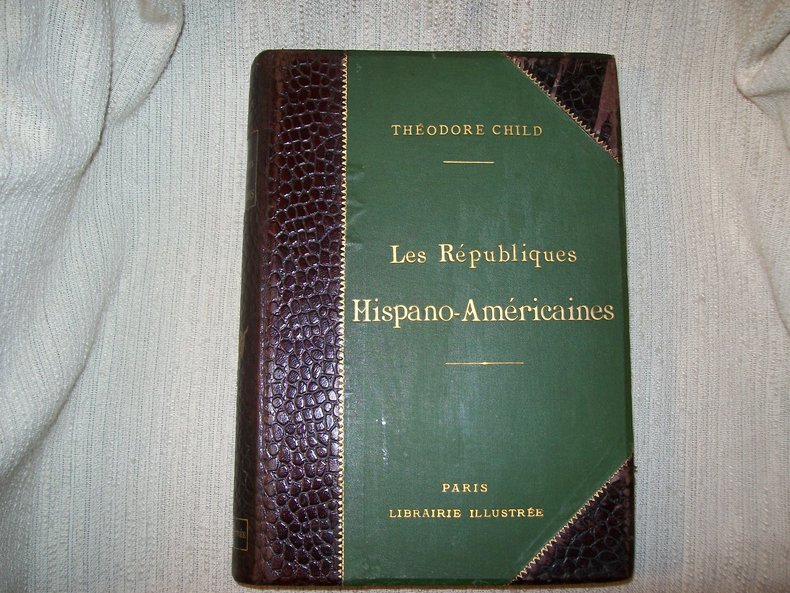
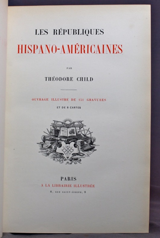
1891GITg211Paris A la Librairie Illustrée sans date (1891). Grand in-8 480pp. Reliure de l'éditeur en demi basane maroquinée acajou à coins, dos lisse orné d'un grand fleuron doré, plats de percaline verte, titre doré sur le 1er, tête dorée. Orné de 151 illustrations dont 20 hors texte comprises dans la pagination et 8 cartes (2 d'entre elles à pleine page). Epidermures sur le cuir de 2 coins, intérieur frais bien complet, reliure solide. Bel exemplaire malgré le défaut signalé.
189115492Paris, à la librairie illustrée, sans date [1891]. In-4 de [4]-480 pages, demi-chagrin vert empire, dos à nerfs orné de fleurons dorés, couvertures conservées.
1864GITd056Paris Victor Masson et Fils 1864. In-8 VIII 502pp. Demi chagrin rouge, dos à nerfs, reliure postérieure. Orné de 80 figures dans le texte. Bel exemplaire.
1865ABE-14801497848668 PAGES-18,5 CM X 29 CM-UN EPISODE DU TREMBLEMENT DE TERRE DE MENDOZA (AMERIQUE DU SUD), SUR 2 PAGES, GRAVURE "LA VILLE DE MENDOZA AVANT LE TREMBLEMENT DE TERRE DE 1861-DESSIN DE LANCELOT, D'APRES UN DESSIN ENVOYE PAR M. ERNEST CHARTON"-LE CHACAL ET LE RENARD FABLE ARABE-REPRODUCTION ARTIFICIELLE DES MATIERES ORGANIQUES (FIN), 2P, BERTHELOT-TOMBEAU DE LOUIS DE BREZE, DANS LA CATHEDRALE DE ROUEN, GRAVURE PLEINE PAGE-CAUSERIES HYGIENIQUES (SUITE) LES CRIS DES ENFANTS-ARMES ET PROJECTILES INCENDIAIRES EMPLOYES PAR LES ARABES AU TREIZIEME ET AU QUATORZIEME SIECLE, 4 FIGURES
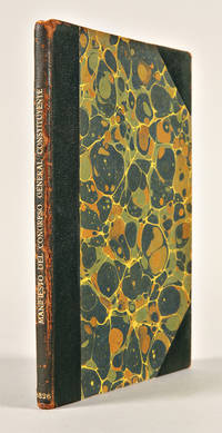
1826WRCAM37321Buenos Aires: Imprenta Argentina 1826. 12pp. Small quarto. 20th-century three-quarter morocco over marbled boards spine gilt. Edges and spine lightly worn upper outer joint moderately worn. Contemporary number inscription in top margin of first page of text. Lower right corners of first two leaves chipped. Moderate age-toning and foxing. A good copy. An extremely rare tract concerning the development of the Argentine constitution in the early republican period of that nation. In April 1819 a constitution was approved establishing a congress with two legislative branches and an elected chief executive. Due to the local political situation however that constitution was not fully enacted. A new constitution promoting a centralized system of government was eventually drafted in 1826. This manifesto of the government's constitutional commission presented to the Argentine representatives reviews various aspects of the 1819 Constitution and proposes changes to be effected in the new document. <br> <br> An extremely rare publication concerned with the early constitutional period in Argentina. OCLC locates only a single copy in the national Library of Chile. PALAU 148972. OCLC 55255075. Imprenta Argentina hardcover books
1817WRCAM37245Buenos Aires: Imprenta de la Independencia 1817. 11pp. with vignette on titlepage and official coat of arms on first page of text. Quarto. Half calf and marbled boards neatly rebacked. Two-page note regarding this publication by previous owner dated December 3 1966 on front free endpaper and front fly leaf. Contemporary ownership inscription on first page of text partially over coat of arms. Scattered foxing. A very good copy. A scarce manifesto issued by the Congress of the United Provinces of Rio de la Plata during the latter part of the independence period in the region. The work serves as a justification for pursuing independence from Spain with much detail regarding injurious Spanish policies in the region. Dated October 25 1817 and signed in print at the end by Dr. Pedro Ignacio de Castro y Barros Palau notes the text was actually written by Dr. Pedro Medrano. A reply to this independence manifesto written by "un Americano del Sud" was published the following year by the Imprenta Real. OCLC 14930003 55265288. PALAU 148893. ZINNY 1817:24. Imprenta de la Independencia hardcover books
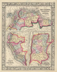
186046866New York: S. Augustus Mitchell Jr. 1860. Folio 12¼" X 15¼" image area 10½" X 13½". Hand colored. Near fine. Quite faint age toning. Bold bright and lovely map of these half dozen South American countries from the 1864 edition of "Mitchell's New General Atlas Containing Maps of the Various Countries of the World Plans of Cities Etc." Upper third contains "Map of New Granada Venezuela and Guiana" lower left third contains "Map of Peru and Equador" and lower right third contains "Map of the Argentine Confederation." Today "New Granada" consists of Colombia and Panama. Wonderfully delicately colored with fine decorative border. S. Augustus Mitchell, Jr. unknown
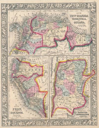
186046956New York: S. Augustus Mitchell Jr. 1860. Folio 12¼" X 15¼" image area 10½" X 13½". Hand colored. Very good. Mild age toning and bit of faint soiling. Quite nice map of these half dozen South American countries from the 1864 edition of "Mitchell's New General Atlas Containing Maps of the Various Countries of the World Plans of Cities Etc." Upper third contains "Map of New Granada Venezuela and Guiana" lower left third contains "Map of Peru and Equador" and lower right third contains "Map of the Argentine Confederation." Today "New Granada" consists of Colombia and Panama. Wonderfully delicately colored with fine decorative border. S. Augustus Mitchell, Jr. unknown
182846402055London, Longman, Rees, 1828 ; 2 vol. in-8, demi-veau brun, nerfs, filet doré. (Laurenchet). XXII pp., 390 pp. - VII pp., (1 p.); 460 pp. - Portrait du Général Miller et 8 cartes dépliantes rehaussées de couleurs.ÉDITION ORIGINALE. “A most interesting description of the war of independence of the Spanish colonies.” - Sabin 49028 - Quarterly Review, XXXVII, 448. Édition préparée par le frère du Gal. Miller, d’après les lettres, journaux et collections du Général.Concerne l’Argentine, le Chili et le Pérou. Rousseurs sur plusieurs ff. et sur les planches. - Palau, 169989.-Exemplaire bien relié, dans le style de l’époque.
1823WRCAM46583Buenos Aires 1823. 4pp. Folio. Minor wear to top edge. Very good plus. In this message to Congress Rivadavia Interior Secretary and Garcia Treasury Secretary announce the recognition of Argentine independence by the United States and discuss relations with other South American countries. They also report to Congress on the condition of internal security and defense the treasury taxes debt medical sciences etc. Rivadavia later served as the first president of the Provinces of Rio de la Plata from 1826-27. Rare with one copy in OCLC at the British Library. unknown books
1830RES39L166Paris D'Eymery Fruger 1830 2 Tomes en 2 volumes - In12 - plein veau d'époque - dos orné - pièces de titres - 572 & 354 pages - 8 gravures sur acier dans les 2 tomes - peu de rousseurs .
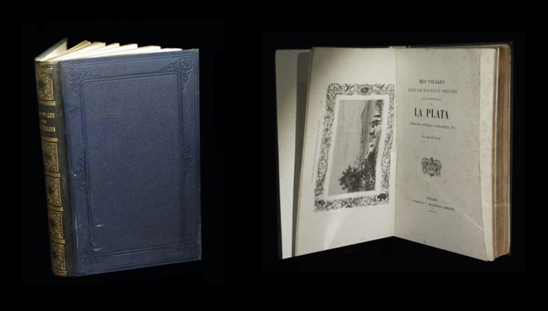
186127699Tours, Ad [Alfred] Mame et Cie, 1861. Un vol. au format in-4 (271 x 178 mm) de 1 f. bl., 2 ff. n.fol., 1 frontispice n.fol., 348 pp. et 1 f. bl. Reliure de l'époque de demi-chagrin maroquiné marine, quadruples filets gras et maigres à froid encadrant les plats, larges fleurons romantiques à froid, dos lisse orné de doubles filets maigres dorés, filets gras dorés, caissons d'encadrement gras et maigres dorés, important décor fleuronné doré, titre doré, tranches dorées.
186150053Tours, A. Mame et Cie, Imprimeurs-Libraires 1861 In-8, cartonnage d’éditeur pleine percaline bleu marine, plats ornés d’un décor romantique doré, dos lisse orné de fers romantiques dorés, tranches dorées, frontispice, 3 gravures à pleine page hors-texte. Coiffes et coins très légèrement émoussés, ornements du dos ternis. Bel exemplaire.
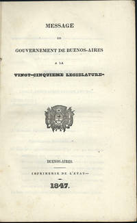
1847WRCAM46587Buenos Aires 1847. 89pp. Plain paper wrappers stitched as issued. Minor soiling and wear. Very good plus. Message given to the Argentine legislature by the executive branch; it is signed in type at the end by Juan M. de Rosas Felipe Rana and Manuel Insiarte. De Rosas served as dictator and ruler of Argentina from 1835-1852 during the tumultuous years of civil war following independence. Only one copy in OCLC at the National Library of Chile. unknown books
18199961Washington: Printed by E. de Krafft 1819. First edition. 8vo 147 1pp. Five folding tables. Bound in later plain paper wrappers with ms. title on front cover. Some browning to title else clean and very good. <br /> <br /> Very scarce house document which includes the report of two important surveys by Theodorick Bland 1776-1846 on Chile and Argentina. Bland was selected by President Monroe for a special diplomatic mission the South American Commission of 1817-1818. Several in the commission provided reports but most were strictly concerned with political military and commercial matters. These Bland's were different in that they were more fleshed out and provided more discussion on geography and agriculture. <br /> <br /> Sabin 5869. Printed by E. de Krafft unknown
189228675La Plata presses du Musée 1892 in-4 dérelié
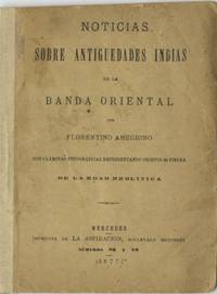
187751035Mercedes Argentina: Imprenta de la Aspiracion 1877. First edition. 8vo. 80 1 pp. Pamphlet with new paper spine. Upper edge unevenly trimmed. Title page is reinforced on the blank verso with paper as is the rear wrapper with soiling to the title page. Modest chipping at the edges of a few leaves of the text with no loss more so to the blank rear wrapper. The 3 full-page albumen photographs have a narrow tonal range as would be expected and each has a blank tissue guard. A good copy. The 3 photographic plates by P. Annaratone illustrate 23 stone tools from the Neolithic period found in the Eastern Band a territory located east of the Uruguay River and north of the RÃÂo de la Plata on the Atlantic coast of South America. Roberto Ferrari an authority on Argentine books illustrated with original photographs cites this pamphlet as a primary example possibly the first indigenous Argentine work to be illustrated with mounted photographs Ferrari clearly states that this work was published in Mercedes in the state of Buenos Aires 100 kilometers west of the city of Buenos Aires and not to be confused with the city of Mercedes in what is now Uruguay. OCLC locates only 2 copies both at the British Library. <br/><br/> Imprenta de la Aspiracion unknown books