Lada-Mocarski, ValerianAntiquariat.de

477 résultats
196988443DBNew Haven; London:, Yale, 1969. vii, 567 Seiten, OLnbd., illustrierter OU., 28 x 20 cm.
1996mon0004127505St Herman Pr 1/1/1996 12:00:01 AM. paperback. Good. 0.4000 8.2000 5.2000. St Herman Pr paperback
192952116Los Angeles: Press of Schwabacher-Frey Company 1929. 1929. First edition. 11 1/4" x 8 1/2" in simulated leather and embossed pictorial boards with color vignette of Big Bear Valley stamped on front cover and with gilt lettering and woodcraft borders. Sewn with gold silk braid at spine. Decorative endpapers with slot on front pastedown for ownership certificate not present but tipped-in design for Cambria Pines cabin design with floor plans. Color illustrated vignette title. Color text illustrations. Photo illustrations. Decorative borders. Pictorial map by Graysons of Los Angeles. Color illustrated calendar dial with borders on final leaf preserving the original glassine flyleaves. A beautifully produced brochure detailing the amenities for both members and investors in the Peter Pan Woodland Club. Harry Kiener formed the Big Bear Land & Water Company to develop mountain properties in the east valley area of Big Bear City in 1925. In 1927 he contracted with Los Angles truck-body builder Guy Maltby to build a wooden power boat to be used on Big Bear Lake. While delivering the boat Maltby became fascinated with the project and formed the Bear Valley Milling and Lumber Company to build the Peter Pan Lodge along with over 600 surrounding homes in Big Bear City. This lodge was massive with five stories and included a golf course landscaping tennis courts swimming pool movie theater and for nearly two decades was used for parties dances and even Hollywood films. Sadly it burned to the ground on June 18 1948 and even though the smaller Peter Pan Lodge building was moved to the site it never recaptured the spirit and elegance of the original resort. Light soiling to bottom corners of pages along with faint tears to upper fore-edge of free front end paper and with slight creasing and with faint pencil annotations on front pastedown. Very good. Press of Schwabacher-Frey Company, 1929. hardcover
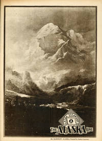
192952115Seattle: North Pacific Gravure Co. 1929. 1929. First edition. 11 1/4" x 8 1/4" in pictorial wrappers printed in brown ink. Mt. McKinley ink on front wrapper and map of Alaska showing Golden Belt Line and Copper River-Keystone Canyon Line on rear wrapper. 32pp. Foreword. Illustrations. Photo illustrations and photo plates for the Alaska Line steamships. Photographs include steamships scenic landscapes Native American crafts interior and exterior views of the S.S. Yukon S.S. Alaska and the S.S. Aleutian cabin rooms dining saloon and shipboard activities as well as birds-eye views over Ketchikan Wrangell Juneau Cordova ay Kennecott etc. Tiny crease to top edge of corner and with minimal shelf wear. Very good plus. North Pacific Gravure Co., 1929. unknown
193663872New York NY: Robert Speller Publishing Corp. 1936. 8vo. 233 1 pp. Blue-green pictorial cloth illustrated in silver on front cover lettering on spine slight sunning to fore-edges minor shelfwear ownership markings on endpapers w/ d.j. vivid Art Deco cover art by Irving Politzer slight edgewear dustsoiling very slight chipping head of spine still a VG/VG copy w/ Ye College Book Shoppe lending library markings & pricing on ffep. managed at the time by Burton Marsh and Howell Wood. First edition stated of McCracken’s very scarce early novel set against the backdrop of Alaskan romance fortune hunting divorce and adventure apparently inspired by the popularity of frozen north fiction from James Oliver Curwood and intended to gain an audience in Hollywood. McCracken 1894-1983 was the longtime associate editor of Field & Stream noted Arctic explorer during the 1920’s hunting for remnants of the prehistoric land bridge between Siberia and Alaska successful film maker winning the 1935 Exhibitor Prize for his 1935 “The Land of Evangeline†and later the first director of the Buffalo Bill Historical Center in Cody WY. Robert Speller Publishing Corp., hardcover
192773741Juneau: Alaska Magazine Inc. 1927. First edition and no relation to the current Alaska Magazine. Five issues all published; Jan.-May 1927. Octavo. Continuously paginated. 282 pp. Well illustrated from photographs. In addition there are at least 50 pages of ads for local businesses in Alaska in in the fifth issue there is a folding map/directory of the businesses in Juneau. Publisher's pictorial wrappers. The whole bound in contemporary half brown pigskin over brown cloth gilt spine lettering. An excellent copy of this short-lived yet very erudite magazine.Edited by John Edward Meals this was Alaska's first attempt at an historically based magazine. Contains among many others the following contributions: The Creation of Denali Mount McKinley by Yako the Athabascam Adam by Alaska bibliographer James Wickersham; Ivan Veniaminov Innocent Metropolitan of Moscow and Kolomna by Rev. A. P. Kashevaroff; The Forests of Alaska as a Basis for Permanent Development by B. F. Heintzleman; An Alaskan Dog Derby by Micael Saxland.The editor's father Andrew Jackson Meals invented the Ditch Witcha construction tool still in use by contractors today. Andrew and his friend George Hazelett donated 350 acres to the city of Valdez so that the city could be rebuilt after the 1964 earthquake decimated the town. Alaska Magazine Inc. hardcover
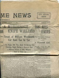
190141698Nome: The Nome News 1901. 1901. ALASKA CRIME. First edition. 15" x 22" newsprint 4 pp. printed in six columns. The newspaper is printed semi-weekly and this issue is dated August 17 1901. This newspaper is quite content-rich compared to most small papers of the era with considerable space devoted to original local news content. Problems of violence and frontier justice dominate this issue. A large headline on the front page blares "A Murderous Knife Wielded" and describes a fight over a woman in which one man's head was nearly severed. Another lengthy story reports that a gang of 65 masked men attacked a camp on Glacier Creek at three o'clock in the morning--leading to thirteen arrests and one man hospitalized with a gunshot would--all the result of a disputed mining claim the history of the dispute is recounted in the article. A separate editorial reacts to these events with a call for martial law at the camp concluding "A man may kill another in the heat of passion for principle and be justified but the man who deliberately plans to jeopardize life for gold over which there is a clouded title is a murder to all intents and purposes and deserves the fate of a murderer." Another article reports that Judge James Wickersham spent a day in Nome on his way to Unalaska where he will preside over two murder trials and that he is concerned about finding enough competent jurors. And yet another reports that 54 members of the Nome Bar Association have sent a signed petition to President McKinley requesting that he remove District Judge Arthur H. Noyes on the grounds that he "is vacillating and dilatory weak and partial negligent careless and absolutely incompetent" and that "the interposition of a fearless honest and competent judge is urgently required at Nome to prevent further riot and bloodshed to preserve law and order and to protect life liberty and property." The story of yet another murder also gold-related appears on the paper's last page where we also find the usual classified and display advertising. Several creases from folding and a small area of loss at the center shaped like a small triangle that affects all pages and measures 1/2" x 1/2" x 1." Good clean copy. The Nome News, 1901. unknown
195573867Washington DC: Geological Survey 1955. Very large color wall map of Alaska on original rollers. 1 map on two sheets measuring 4 feet 3 inches by 5 feet 7 inches. Inset map of the Aleutian Islands. Scale 1:1584000.1 inch=25 miles. A remarkably attractive map in unexpectedly nice condition. Geological Survey unknown
19334914Seattle & Aboard S.S. Aleutian 1933. About very good. 31pp. total. A few staples and other metal fastenings. Light wear and toning. An interesting group of promotional and shipboard material produced for an Alaska cruise undertaken by members of the Seattle Chamber of Commerce in June 1933. Material present here includes two issues of the shipboard newspaper "Midnight Sun" daily itineraries authored by the captain of the S.S. Aleutian a series of three pre-cruise bulletins distributed by the "excursion committee" of the Seattle Chamber an extensive fact sheet about Alaska from the same and a promotional pamphlet for the 1933 Season of the Alaska Steamship Company under whose auspices the tour was occurring. The itineraries are quite detailed and cover the the northbound portion of the journey from Seattle to Seward. The newspapers are also very interesting and provide a complete passenger manifest as well as a mix of national news President Roosevelt signing the National Industrial Recovery Act e.g. and local interest baseball scores from the Pacific Coast League. Together these typescript documents provide a good deal of information concerning the cruise and form a cogent narrative of this "business-friendship tour" and of Alaska tourism during the Depression. unknown
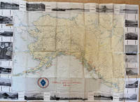
193463926Seattle WA: The Alaska Line Alaska Steamship Co. Farwest Lithograph & Printing Co. 1934. One large oblong atlas folio pictorial map sized 29.5 x 22 in. beautiful original lithograph cover very minor dustsoiling and slight creasing to fore-edges a NF copy. First edition of this splendid pictorial map featuring pictograph cartoons reminiscent of John Held’s Jazz Age artwork as well as Ruth Taylor White and her sister Della Taylor Hoss. The Alaska Line which had benefited from a near monopoly of passenger and freight service to Alaska after the Merchant Marine Act of 1920 brags about their accommodations service easy access and tours to many scenic areas in and around “America’s last frontier.†Later printings have an altered colour scheme from this one featuring Alaska in gold and the Yukon and British Columbia Canada in pink. Camy 1904-1958 was a California artist and illustrator who specialized in commercial graphic advertising for Dole Pineapple Signal Gasoline and the Alaska Line. He produced very few pictographic maps. The Alaska Line, Alaska Steamship Co., Farwest Lithograph & Printing Co., unknown
191656549Washington D.C. & Juneau A.T.: Superintendent of Documents U.S. Surveyor General’s Office 1916. Oblong Atlas Folio. 24 x 19 in. 14 colour maps 1 large folding 17.25 x 41.5 in. Printed softcovers stapled and paper reinforcement at gutter margin some minor toning & soiling to fore-edges edgewear to spine minor scuffing and a couple removed label ghosting still VG- bright copy. First edition of this remarkably scarce plat map atlas for the Matanuska coal fields and township sites surveyed by Walker & McDaniel during their surveys following those on the Kenai Peninsula. By 1912 with the act establishing Alaska as a U.S. Territory and in 1914 the authorization to construct an Alaska Railroad there became an increased need and demand for coal. The Matanuska mines located about 45 miles northeast of Anchorage first began production in 1916 and would stay in continuous production through both World War I and World War II and well into the 20th Century re-opening again in the 21st Century. Not only do these maps show available government lease sites for coal mines but also available Township sites for homesteaders as required by the original Homestead Acts of 1866 and the 1916 Act for Alaska requiring surveys and resurveys to accurately determine boundaries of unsold railroad lands and identify their boundaries. Worldcat locates 2 copies Anchorage Museum & Univ. of Calgary; See: Catalogue of the Public Documents of the Sixty-Fourth Congress Index Vol. 13 1922 p. 74; C. Albert White A History of the Rectangular Survey System 1983 p. 189. Superintendent of Documents, U.S. Surveyor General’s Office, paperback
19108119CHadley/Alaska., [around 1910-1920]. Three different formats. Thirteen photographs. Original photographs, black-white. Mostly full-page format, without a framing. With commentaries at the back sides (Swedish Language). Photographs with some minor crinkles at corners and little rubbing. Partly a bit faded at the edges but mostly still with good contrasts. Paper is a bit bent. Appropriate to its age and origin still in good condition.
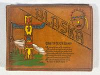
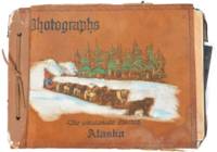
1943217811943. Civilian construction labor photo album documenting on the Alaska-Canada Military Highway during World War II one of the largest emergency infrastructure projects undertaken in North America during the war. The material records wartime military logistics federal civilian contracting and frontier transportation construction through photographs official permits military certifications and worker inscriptions connected to the rapid building of the ALCAN Highway in 1942-1943. Compiled by civilian laborer Paul Cecil Pemble an employee of Ferguson-Diell Construction Company the album connects private contractors federal agencies and the U.S. Army Corps of Engineers to the construction of a strategic military supply route linking the contiguous United States to Alaska following Japan's Aleutian Islands campaign. The archive provides primary-source evidence for wartime infrastructure mobilization civilian labor under military authority and the logistical expansion of defense systems in the North American Arctic frontier.<br /> <br /> Oblong string-tied photo album in original painted suede leather covers titled Alaska - Where the North Begins with embossed and hand-colored totemic decoration. Contains approximately 66 silver gelatin photographs ranging in size from approximately 4.5 x 3.25 inches to 10 x 8 inches alongside multiple official documents licenses permits correspondence and autograph pages. Included documents identify Paul Cecil Pemble as a civilian heavy equipment operator employed on the Alaska Highway project. These include a Public Roads Administration license issued under the Federal Works Agency dated June 29 1943; a U.S. Army Corps of Engineers certification dated August 4 1943 signed by First Lieutenant Colin L. Park authorizing operation of trucks tractors and wheeled scrapers; and an Alcan Military Highway Command permit dated August 19 1943 authorizing travel on the restricted military roadway. A typed letter from Tok Junction dated October 8 1943 confirms the extension of Pemble's Selective Service deferment due to essential wartime labor. Several opening pages titled "Memory Leaves" contain approximately sixty signatures and inscriptions from fellow workers many identifying hometowns in Iowa and including humorous remarks and nicknames such as "Cook" "Butch" and "Alaska Thunderbolt." The photographs extensively document construction activity and camp life including bulldozers graders cranes timber bridge scaffolding military truck convoys wrecked vehicles stranded in ditches muddy roadbeds and large encampments of prefabricated structures. Multiple images show men constructing river crossings operating machinery and posing in work clothes beside heavy equipment. Additional photographs depict interior bunkhouses mess hall scenes with workers gathered around tables and a large group portrait of more than fifty civilian laborers posed before a treeline. Wildlife and recreation also appear throughout the album including black bears scavenging through refuse fishing scenes with large catches displayed by workers dogs resting beside snowy roads and Pemble's trailer quarters attached to the back of a truck. The final pages include panoramic camp views and directional signpost photographs listing construction companies and distances to Fairbanks Whitehorse and multiple contractor camps along the route.<br /> <br /> The album records the logistical effort required to construct the Alaska Highway across remote and environmentally severe terrain during wartime emergency conditions. Built in response to fears of Japanese expansion into Alaska and the North Pacific the highway became a critical military supply corridor linking airfields fuel depots transport infrastructure and defense installations across Alaska and western Canada. The album focuses on civilian laborers operating within military-controlled systems including contract workers represented through photographs permits deferment documents and personal inscriptions. The combination of photographs permits deferment documents and personal inscriptions records daily life labor conditions and federal wartime administration on the ALCAN project. Photographs mounted cleanly to black paper leaves with corner tabs; occasional light creasing and minor wear to several prints. Leather covers lightly rubbed but structurally sound and visually bright. Overall very good condition. A documentary archive of civilian wartime labor and military infrastructure construction during one of the most ambitious engineering projects of the Second World War. unknown
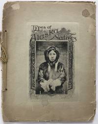
19051676Brooklyn: The Albertype Co 1905. Good. Twelve albertypes mounted on 12 leaves. Original pictorial wrappers string-tied. Wrappers chipped and worn at edges spine heavily; lightly soiled. Leaves brittle corners chipped with mounted images clean and crisp. Pictorial work with mounted images of Alaskan natives taken by the photography firm of Winter & Pond in Juneau. Lloyd Valentine Winter 1866-1945 and Edwin Percy Pond 1872-1943 arrived in Juneau in 1893 establishing a curio and photography shop there. By 1896 they were advertising a catalog of photographs for sale. They documented the local natives the Klondike Gold Rush and life in Alaska producing many popular images of the region. The company existed for over fifty years operating under original ownership until 1945 and finally closing in 1956. <br/><br/>The images here are all of local native tribes including several of the Tlingit people. The front cover image is "Eskimo Girl" and shows a young woman in a fur parka and mittens with a tattoo on her chin. Other images are: "Old Tlingit Woman"; "Native Basket Weavers"; "Old Tlingit Indian"; "Takon Indian Doctor" which shows a medicine man standing and brandishing rattles; "Old Tlingit Women"; "Schwatka a Yukon Guide"; "Chilkat Chiefs in Dancing Costume"; "Old Auk Indian"; "Potlatch Dancers" depicting a large group of dancers in native dress outside; "Auk Indian Doctor"; "Native Curio Sellers" which shows two young women wrapped in furs seated behind baskets of their wares; and "Old Eskimo Woman."<br/><br/>The Albertype Company of Brooklyn produced many such handsome viewbooks and the present work is in line with their style and quality of publication. We locate copies in OCLC at fewer than ten institutions. The Albertype Co unknown books
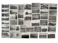
1945191491945. Unidentified compiler photograph album of United States Army troops stationed near Seward Alaska circa 1945 documenting military life and operations in a strategic northern deployment during the closing period of World War II. The material provides primary visual evidence of troop activity infrastructure development and social life within a remote military environment supporting research into wartime logistics soldier experience and the role of Alaska in U.S. military defense during the conflict.<br /> <br /> Photograph album containing 58 black and white silver gelatin prints most measuring approximately 3.5 x 6 inches depicting soldiers engaged in both formal and informal activities. Images include groups of men standing at attention with rifles constructing wooden buildings in rugged terrain and participating in daily routines within camp settings. A series of photographs documents a dance event for troops featuring a jazz band with music stands marked "153" alongside an emblem suggesting a possible connection to the 153rd Infantry Regiment which was stationed in Alaska during the period. Additional images show steamships including the S.S. Baranof S.S. Alaska S.S. Denali and S.S. Columbia navigating the Inside Passage and areas near Taku Glacier indicating transportation and supply routes. The album also contains a "memory leaves" section with handwritten notes and addresses from fellow servicemen reflecting interpersonal networks and efforts to maintain contact beyond deployment.<br /> <br /> 58 photographs mounted in an album with decorated leather covers featuring a hand-painted image of Alaskan sled dogs titled "The Malamute Limited." During World War II Alaska served as a critical military zone due to its geographic proximity to the Pacific theater with troop deployments focused on defense infrastructure and logistics in challenging environmental conditions. This album captures both operational and social dimensions of that presence including labor recreation and movement through the region. Light handling wear to album and photographs contents well-preserved; overall very good condition. A cohesive and detailed visual record of U.S. Army life in wartime Alaska. unknown
1914List520Nome: Lomen Brothers 1914. Silver gelatin print 6 1/2 x 9 1/2 inches. Fine. Women's baseball evolved alongside men's leagues beginning in the 1860s with many teams and leagues appearing throughout the following decades often playing indoors and often unrecorded in the annals of baseball history. Women's baseball was particularly popular in Minnesota and parts of the Midwest in the early part of the twentieth century. This photograph bears evidence as to the game's migration to Alaska Territory where long winters would have been particularly conducive to an indoor league. This photograph by the Nome Alaska firm Lomen Brothers shows the champion team of the Ladies Indoor Baseball League in Nome. We find no record in contemporary newspapers or anywhere else of the league. The Nome Brothers were a well-known photographic firm who migrated from Minnesota to Alaska at the height of the Nome Gold Rush in 1903. By 1909 at the end of the gold rush the population of Nome declined substantially to 2500 from 20000 just a few years earlier. This photograph shows interesting documentation of Nome post-rush and also of the spread of women's sports through migrant populations. We find one other example in the Fred Henton collection at the Anchorage Museum at Rasmuson Center. A fine example. Lomen Brothers unknown books
1939286138Seattle: Farwest Lithograph and Printing Co 1939. Map. Color Lithograph. 21" x 28".<br/> <br/> This beautifully colored map of Alaska and the Gulf of Alaska shows the Alaskan boat lines from Seattle and was first drawn by Edward Camy for the Alaska Steamship Company in 1934. A great pictographic map includes an inset showing the Alaska Railways route from Seward to Fairbanks and the Richardson Automobile Highway. The bottom of the map shows a series of cartoons of events on the ship. In good condition a great example of Alaska.<br/> <br/> Farwest Lithograph and Printing Co unknown
1939286138Seattle: Farwest Lithograph and Printing Co 1939. Map. Color Lithograph. 21" x 28".<br/><br/> This beautifully colored map of Alaska and the Gulf of Alaska shows the Alaskan boat lines from Seattle and was first drawn by Edward Camy for the Alaska Steamship Company in 1934. A great pictographic map includes an inset showing the Alaska Railways route from Seward to Fairbanks and the Richardson Automobile Highway. The bottom of the map shows a series of cartoons of events on the ship. In good condition a great example of Alaska.<br/><br/> Farwest Lithograph and Printing Co unknown books
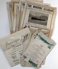
19341007At sea 1934. Very good. Five issues of The Morning Alaskan each 4pp. Also four leaves of manuscript four mimeo news sheets two passenger lists thirteen menus and related material. Light wear and chipping to edges of newsletters and news sheets heavier to news sheets. Light wear overall. A nice archive of ephemera collected during a voyage from Seattle to Alaska aboard the S.S. Alaska. Founded in 1894 the Alaska Steamship Company ran cargo and passenger service to Alaska from Seattle through the mid-1950s at which point it became a freight-only company until its demise in 1971. The materials here likely saved from a voyage in June 1934 provide a glimpse into Alaskan cruise tourism during the height of the Great Depression. There are four daily mimeo "news sheets" titled "Sense and Nonsense" which are filled with one-liner inside jokes about the goings-on about the ship: "Mr Sullivan his own is still holding against all comers and how!!" and "Who was the boyfriend in Ketchikan Rose The flowers at least were beautiful." Additionally thirteen menus for breakfast lunch and dinner meals. The shipboard newspaper The Morning Alaskan features ads and a vignette of the ship on the first page followed by a mixture of news and tidbits from locales across the globe. One issue includes news about the dock strike in San Francisco the reappearance of a missing Japanese Vice Consul in Shanghai and sports news. It was a fairly sophisticated production presumably with the first page pre-printed and then the interior mimeographed aboard ship. The manuscript leaves contain brief notes about the voyage. Upon leaving Seattle on June 13 the author made the following notes providing an insight into the other passengers on the ship: "Six mo. truce made. First boat in 6 mo. why Eng. boats no help to Alaskans. Heavy cargo interesting loading - autos personal Bride soldiers lecturer natives Alaskans going home prospectors old men going back missionaries teachers natives contractors for school projects "nails counted." Orchestra steward. News Daily - ship personals sight seeing paper. Food number of meals & type." He notes stops at Juneau and Hawkes Inlet: "Juneau again. Hawkes Inlet at 9:30 p.m. light. Beautiful. Private homes at most canneries Gov. visiting Hawkes Inlet came on board." Though brief his notes do provide interesting details about the voyage. Notably this archive also highlights possible Chinese migration to Alaska perhaps for the cannery industry based on the passenger lists. The northbound passenger list from Seattle to Skagway on June 14 lists eighty roundtrip passengers as well as 107 passengers with destinations at various ports along the way such as Ketchikan Wrangell Petersburg Juneau and Skagway. It also lists among the passengers sixty "Orientals" and forty-six passengers traveling "Oriental Steerage." At Hawk Inlet thirty-one "Orientals" disembarked -- no white passengers -- twenty-nine of them traveling steerage. An interesting group of ephemera made even more interesting by the addition of the Asian-American component in the passenger lists. unknown books
19303726Juneau Ak.: Winter & Pond 1930. Good. Panoramic photograph 10 x 34.5 inches. A few heavy creases a handful of short closed tears minor surface soiling and rubbing. An early-20th century panoramic image showing the development of the Alaskan capital city of Juneau produced by prolific local studio Winter & Pond. The image features the downtown portion of Juneau complete with paved streets telephone and electrical wires and hundreds of houses set between nearby Mount Juneau and the Gastineau Channel. <br /> <br /> "Lloyd Winter and Percy Pond preserved the legacy of Alaska's past through their photographs taken over a period of 50 years. The studios of Winter and Pond Company in Juneau Alaska provided local residents and visitors with a rich perspective of Alaska that is now considered a unique reflection of the state in the early 20th century. During the company's existence Alaska expanded mining fishing and resource development into profitable ventures that transformed it from a frontier district to a thriving territory of the United States. The portraits that Winter and Pond produced show the diversity of Alaska's people through the years from the gold rush of the Klondike in 1898 to the end of the mining operations in the Juneau Gold Belt District during the 1940s" - Alaska State Library's Historical Note for the Winter and Pond Collection. <br /> <br /> OCLC reports a few different Winter & Pond views of Juneau from 1909 to 1928 with the present example likely dating from a bit later but nonetheless rare. Winter & Pond unknown
1942218151942. Photograph archive circa 1920s-1944 documenting the construction of the Alaska Highway and related military infrastructure during World War II. The material records wartime military logistics and infrastructure development through photographs of road construction engineering operations heavy machinery and military transport routes in Alaska and western Canada during the war. The photographs include terrain modification machinery deployment bridge construction and coordinated labor by military and civilian crews working under wartime conditions.<br /> <br /> Archive comprises 30 black-and-white photographs including approximately 21 captioned images issued by the Public Roads Administration and War Information Board dating from circa 1942-1944 alongside 10 earlier vernacular snapshots from the 1920s-1930s. Sizes range from approximately 2.5 x 1.5 inches to 5.5 x 3.5 inches. Official photographs depict graded roadways cutting through mountainous and forested terrain heavy machinery including tractors and graders clearing timber and earth and crews working in challenging conditions such as permafrost excavation. Several images show pontoon bridges early roadbeds and military vehicles including jeeps and convoys positioned along newly constructed routes. Captions reference wartime labor and engineering activity. Vernacular photographs depict earlier regional life including individuals traveling by sled posing with fish working in sawmills and operating equipment. Additional scenes include a Chinese barber shaving a client and frontier couples posed outdoors with handwritten verso captions referencing locations such as Juneau and Valdez.<br /> <br /> The photographs record the rapid development of the Alaska Highway following the strategic urgency created by World War II particularly after the attack on Pearl Harbor and military concerns in the Aleutian region. Official photographs focus on wartime infrastructure projects while the vernacular photographs record prewar labor and daily life in Alaska and the Yukon. The archive includes military construction transportation systems sawmill labor travel and regional commercial activity before and during wartime expansion. Light curling and handling wear to vernacular photographs; minor edge wear and occasional markings to official prints; overall very good condition. A visual archive of wartime engineering and northern frontier life during a period of military expansion. unknown
1945215781945. AArchive of 64 original black-and-white photographs documenting American military operations and engineering activities in the Aleutian Islands during World War II. Photographs measure approximately 4.5" x 3.5" and provide an extensive visual record of one of the most remote and environmentally challenging theaters of the war. The images chronicle the daily work of U.S. Army personnel and Army Engineers stationed across the Aleutian chain where military forces confronted not only the threat of enemy action but also some of the harshest conditions faced by American troops anywhere during the conflict. Soldiers appear throughout the archive wearing cold-weather gear field jackets heavy boots and M1 steel helmets while working patrolling and constructing infrastructure amid windswept volcanic landscapes.<br /> <br /> A significant portion of the collection documents the enormous logistical effort required to sustain military operations in the islands. Engineers are shown surveying terrain operating equipment cutting and processing timber and building facilities essential to maintaining isolated military outposts. Several striking photographs depict large timber-log chutes descending steep hillsides toward the shoreline apparently designed to move heavy equipment and supplies through terrain where conventional transportation proved difficult. Other images record lumber operations construction projects and the continual adaptation of military infrastructure to the rugged environment. The archive also contains numerous panoramic views of the Aleutian landscape itself. Snow-covered mountains barren volcanic ridges isolated coastlines glacial valleys and treeless tundra dominate many photographs illustrating why the campaign became as much a battle against geography and weather as against enemy forces. The Aleutian chain stretching deep into the North Pacific and containing dozens of active and dormant volcanoes represented one of the most isolated regions under American military control during the war.<br /> <br /> Naval and maritime operations are likewise represented. Several photographs show transport and supply vessels anchored offshore or approaching remote coastal installations highlighting the dependence of Aleutian bases upon sea-borne logistics. Military camps consisting of Quonset huts and tent encampments appear throughout the collection while one particularly notable image captures an aircraft flying above a military installation underscoring the importance of aerial reconnaissance and patrol operations in protecting the northern approaches to Alaska. Although often overshadowed by campaigns in Europe and the Central Pacific the Aleutian campaign held considerable strategic importance. Following the Japanese occupation of Attu and Kiska in 1942 American forces undertook a costly effort to secure the islands and maintain control of the northern Pacific. These photographs document the infrastructure manpower and determination required to operate in a theater where extreme weather isolation and difficult terrain shaped every aspect of military life. A substantial and visually compelling archive documenting the engineering logistical and environmental realities of America's northernmost front during World War II. Photographs remain in very good condition with minor surface wear and occasional light creasing. unknown
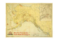
191737386Chicago: Poole Bros. 1917. 1917. ALASKA. First edition. A full-color folded map of Alaska showing both the coastal and seagoing routes that leave from Seattle to Alaska by the Alaska Steamship Company. Points of interest are indicated in red and include the Klondike Region Fairbanks Gold Placers Mt. McKinley National Park Kennecott Copper Mines etc. In the upper right corner is an 11" x 8" inset black & white map of the Copper River & Northwestern RY. and the Alaska Railroad showing Copper River Region in Alaska Prince William Sound the Richardson Automobile Highway Mt. McKinley National Park and Government Telegraph Line and Tributary Territory. Map has a few tears at folds some soiling to the map's surface and general wear from handling and use. Overall a good map of Alaska. Poole Bros., 1917. unknown
1966233371966. Cook Inlet offshore drilling photo archive of 57 chromogenic color photographs documenting the transport assembly and field operation of oil platform equipment in Alaska in 1966 including derrick sections drill pipe draw works components service trucks staging yards flare fire and rig floor assembly during the period when offshore construction expanded rapidly across the basin between 1964 and 1968. Alaska's first offshore platform was erected in Cook Inlet in 1964 exploration drilling peaked in 1966 and the photographs place the group within the short formative period when Cook Inlet became the proving ground for Alaska's offshore petroleum industry. The photographs record named individuals large platform components drill pipe derrick sections service trucks and specialized machinery moving from yard to worksite and from transport into operation.<br /> <br /> Photo archive of 57 chromogenic color photographs Kodacolor snapshot prints ranging from 3.5 x 3.5 to 3.5 x 4.5 inches Cook Inlet Alaska 1966. The derrick and draw works sections are hauled on heavy trucks across dirt roads rig components unloaded in open staging yards drill pipe rising within the derrick structure and crews in hard hats and work clothes working at the base of drilling machinery. Several photographs isolate specific stages of petroleum work rather than completed structures including a float identified on the verso as "Flatt & Doghouse" a "Tool box & work area on float" machinery captioned "Unloading Draworks from our truck #103 to Gary Bobs Road truck" pipe identified as "13000 ft pipe in deric" and repeated views of muddy haul roads flare fire active equipment and rig floor assembly from both elevated and ground level vantage points. The versos preserve contemporaneous functional captions and named personnel including "Front view with Jerry Blackwood driving" "Little Red & Ramdro discussing plans" "Putting Deric on the floor" "two trucking the Deric" "Bottom 1/2 of the Deric. This is the way we haul it" and "My truck hauling top 1/2 deric pulled over for the day too muddy to proceed to location" giving the archive unusual specificity at the level of individual labor and task sequence. A yard sign for Canadian Superior places part of the group within the corporate landscape of Cook Inlet petroleum development.<br /> <br /> Cook Inlet's offshore fields were the first large scale petroleum infrastructure projects in Alaska waters and the photographs preserve the hauling stages yard transfer pipe handling rig erection truck transport and field conditions through which the basin moved from exploration into sustained production. Named workers truck numbers hauling stages yard transfer pipe handling rig erection and field conditions place the group within the daily labor structure of offshore oil development rather than in finished platform views alone. The seller's Spurr attribution merits caution since later platform compendia place Platform Spurr in Trading Bay in 1968 but that discrepancy does not alter the archive's value as a 1966 record of Cook Inlet drilling logistics and offshore construction practice. Front surfaces show scattered paper residue or adhesion from prior storage with light wear minor discoloration and ordinary handling marks. Overall good condition. A 1966 Cook Inlet drilling archive centered on truck haulage derrick assembly pipe handling named workers and offshore construction logistics during the basin's first major oil boom. unknown
1917List1730Chicago: Poole Brothers 1917. Folding map measuring 38 ½ x 26 ¾ inches. Tape repairs to verso some tears at folds and edges still bring and attractive good to very good overall with excellent restoration potential. A map of the canneries in Alaska British Columbia and Washington operated by the Deming and Gould Company who were influential in the growth of the Alaskan salmon trade. The map’s date of printing 1917 suggests that perhaps it was related to the war effort as salmon demand increased during this period. The Demings based in Chicago were influential in the growth of the salmon trade in Alaska and the Pacific Northwest founding Pacific American Fisheries Inc. in 1899 and continuing in various iterations until their sale of the firm in 1934 due to president E.B. Deming’s ailing health. The map shows seventeen different canneries several on the Alaska peninsula and the one in Bellingham. We find no record of this imprint only a later and small version held at the University of Washington. Poole Brothers unknown