Copper smelter town / Hadley (Alaska).Biblio.com
469 résultats
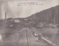
19108119C1910. Hadley/Alaska. around 1910-1920. Three different formats. Thirteen photographs. Original photographs black-white. Mostly full-page format without a framing. With commentaries at the back sides Swedish Language. Photographs with some minor crinkles at corners and little rubbing. Partly a bit faded at the edges but mostly still with good contrasts. Paper is a bit bent. Appropriate to its age and origin still in good condition. The thirteen photographs include different views on the former copper smelting town Hadley at the Prince of Wales Island Alaska US. In Hadley once the mined copper ores have been melted and processed later the extracted copper was shipped to other places. The photographs exist in three different formats: a small one ca. 164 x 215 cm a middle size ca. 191 x 241 cm and a bigger format ca. 20 x 252 cm. The black-white photographs still own their contrast although a few of them are fading a little bit at the edges. The thirteen photographs give us very different perspectives on this historical place: smelter buildings seen from the near and distanced overviews from a ship. Detailled views on the pier with rails on a building in construction in snow on a ship at the pier and on a cleared piece of land probably for new buildings. One photograph is even showing one of the ships for travelling called "Marion". A main overview owns a small stamp and note at the front: "Alaska Smelting & Refining Co. / General View Smelter Buildings". Most of the photographs own commentaries on the back sides in swedish language. Some with two or three lines a few with ten lines of text Please see the given fotografic examples. The photographs very probably have been made by a swedish engineer working at Hadley. There has been copper mining and extracting in Sweden long before Alaska became a part of the US. One photograph shows two little girls with blond hair staying in the wood. It seems to be a family portrait maybe they have been the daughters of this swedish man. There is also an envelope newer one by Svenska Handelsbanken with the handwritten swedish title: "Fotografier fran Hadley Alaska". Very rare historical material from Alaska in the first two decades of the 20th century! unknown
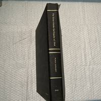
1970016271Washington D.C.: National Academy of Sciences 1970. First Edition First Impression. . Cloth Bound Boards. Near Fine. 1970 First Edition first impression. Size large quarto a heavy book 510 pages. Black textured cloth covered boards with gilt titles to the front cover and spine. Front paste-down and end-paper printed with a Map of Alaska and also the bordering part of Canada pinpointing the site of the Epicenter of the Earthquake on the map. Condition very good-near fine slight rub to corners and spine ends else fine contents very clean throughout. From the Library of Nicholas Ambraseys. Nicholas Neocles Ambraseys FICE FREng 1929-2012 was a Greek engineering seismologist. He was emeritus professor of Engineering Seismology and Senior Research Fellow at Imperial College London. For many years Ambraseys was considered as the leading figure and absolute authority in earthquake engineering and seismology in Europe. Size: 4to - over 9¾" - 12" tall <br/> <br/> National Academy of Sciences hardcover
0365648973.Gpaperback. Good. Access codes and supplements are not guaranteed with used items. May be an ex-library book. paperback
0332888886.Ghardcover. Good. Access codes and supplements are not guaranteed with used items. May be an ex-library book. hardcover
1979917Unalaska Alaska: Unalaska City School 1979. First printing. Card Covers. pp. 148. 4to. measuring 28 cm. Black and white illustrations maps photographs. Illustrated red stiff card covers. A unique school yearbook arranged by the students of Unalaska City School and rich with stories and photographs of staff and students with many of the local Indigenous Eskimo/Inuit students at work study and play. From the introduction: "Cuttlefish Three presents an account of the Jesse Lee Home at Unalaska during the early years of this Century. The Home was a Methodist mission that became famed for the quality of its students -- Dr. P. Gordon Gould Mr. Simeon Oliver Mr. Benny Bensen to name a few. Although the Home was first opened in 1890 and operated continuously until its move to Seward in 1924 'Home on the Bering' concentrates on the years 1911 to 1915. These are the years covered by the bulk of our material the scrapbooks compiled by Clara Cook." Neat ink inscription to the verso of the title page by a former student recalling her own memories while attending the venerable school else no detectable flaws with contents bright clean and unmarked with tight sound binding; fine. OCLC #: 12152169. At time of cataloguing this title does not appear amongst the holdings at Peel BAC/LAC. <br/><br/> Unalaska City School unknown
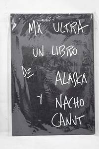
20162712919Madrid.: Caniche. 2016. Hardcover. Good. 30 cm. 80 80 p. il. Encuadernación en tapa dura de editorial ilustrada. Canut Ignacio 1957-. Texto manuscrito Olvido Gara. Recoge las fotografías de Nacho Canut y los comentarios manuscritos de Alaska a las mismas. Textos e imágenes en dos volúmenes independientes unidos por la cubierta posterior. México. Obras ilustradas. Libros ilustrados. Gara Olvido. 1963- . ISBN: 9788494516115 Fotografía. Canut Ignacio 77 Canut Ignacio 77 Descripción geográfico-histórica de un territorio una localidad. 721/727 908721/727 908 Caniche. hardcover
2004Q-088240587xAlaska Northwest Books 2004-05-01. Paperback. New. In shrink wrap. Looks like an interesting title! Alaska Northwest Books paperback
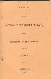
189832865Washington: Government Printing Office 1898. 1898. First edition. 8vo. Salmon-colored printed wrappers 49 pp. map. Large portion of the report deals with more effectually carrying out the law prohibiting the sale of intoxicating liquors in Alaska. Mention is made of a tribe on the Admiralty Island known as the "Hoochinoos" who used to smuggle to the soldiers at Sitka a beverage known as "hoochinoo" and "hooch." "Hooch" was made from a mash of black molasses imported from the Hawaiian Islands. Smuggling and the control of smugglers is of great concern to the law as well as effectively enforcing the laws to protect both saloon keepers and the citizens. The governor further reports on criminal and penal laws land laws population taxable property agricultural development stock raising reindeer fur seals sea otters mining etc. Disasters are included in the report with the mention of the schooner Lady Jane Grey that went down off Cape Flattery with only a few saved. A map of the longitudinal section of workings of the Alaska/Mexican Gold Mine is also present. A fine clean copy. WICKERSHAM 227. Government Printing Office, 1898. unknown
1513261207.Ghardcover. Good. Access codes and supplements are not guaranteed with used items. May be an ex-library book. hardcover
199241004Seattle WA: University of Washington Press. NF. 1992. Paperback. Paperback in Near Fine condition. . 11 X 8.40 X 0.50 inches. 176 pages. Previous owners bookplate. . Quick Shipping All Books Mailed in Boxes Free Tracking Provided . University of Washington Press paperback
2023BN194805Elsevier - Health Sciences Division 2023. 2023. Softcover. Core Curriculum for Maternal-Newborn Nursing <br/><br/>Core Curriculum for Maternal-Newborn Nursing AWHONN Jill PhD WHNP RN Professor Nursing Graduate Program Chairperson University of Alaska Anchorage Janke Brenda J PhD RN CNS Assistant Professor Emory University Nell Hodgson Woodru Elsevier - Health Sciences Division paperback
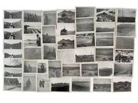
1945215781945. AArchive of 64 original black-and-white photographs documenting American military operations and engineering activities in the Aleutian Islands during World War II. Photographs measure approximately 4.5" x 3.5" and provide an extensive visual record of one of the most remote and environmentally challenging theaters of the war. The images chronicle the daily work of U.S. Army personnel and Army Engineers stationed across the Aleutian chain where military forces confronted not only the threat of enemy action but also some of the harshest conditions faced by American troops anywhere during the conflict. Soldiers appear throughout the archive wearing cold-weather gear field jackets heavy boots and M1 steel helmets while working patrolling and constructing infrastructure amid windswept volcanic landscapes.<br /> <br /> A significant portion of the collection documents the enormous logistical effort required to sustain military operations in the islands. Engineers are shown surveying terrain operating equipment cutting and processing timber and building facilities essential to maintaining isolated military outposts. Several striking photographs depict large timber-log chutes descending steep hillsides toward the shoreline apparently designed to move heavy equipment and supplies through terrain where conventional transportation proved difficult. Other images record lumber operations construction projects and the continual adaptation of military infrastructure to the rugged environment. The archive also contains numerous panoramic views of the Aleutian landscape itself. Snow-covered mountains barren volcanic ridges isolated coastlines glacial valleys and treeless tundra dominate many photographs illustrating why the campaign became as much a battle against geography and weather as against enemy forces. The Aleutian chain stretching deep into the North Pacific and containing dozens of active and dormant volcanoes represented one of the most isolated regions under American military control during the war.<br /> <br /> Naval and maritime operations are likewise represented. Several photographs show transport and supply vessels anchored offshore or approaching remote coastal installations highlighting the dependence of Aleutian bases upon sea-borne logistics. Military camps consisting of Quonset huts and tent encampments appear throughout the collection while one particularly notable image captures an aircraft flying above a military installation underscoring the importance of aerial reconnaissance and patrol operations in protecting the northern approaches to Alaska. Although often overshadowed by campaigns in Europe and the Central Pacific the Aleutian campaign held considerable strategic importance. Following the Japanese occupation of Attu and Kiska in 1942 American forces undertook a costly effort to secure the islands and maintain control of the northern Pacific. These photographs document the infrastructure manpower and determination required to operate in a theater where extreme weather isolation and difficult terrain shaped every aspect of military life. A substantial and visually compelling archive documenting the engineering logistical and environmental realities of America's northernmost front during World War II. Photographs remain in very good condition with minor surface wear and occasional light creasing. unknown
1938076478.Gpaperback. Good. Access codes and supplements are not guaranteed with used items. May be an ex-library book. paperback
1530507456.Gpaperback. Good. Access codes and supplements are not guaranteed with used items. May be an ex-library book. paperback
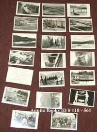
1941118561c1941-1949. Softcover. near fine. Complete set of 20 different real photo postcards: 18 from photos one cartoon facsimile and one map with route indicated. Cards printed on AZO post card photo paper. near fine 8 postcards printed "Permission Wartime Information Board" being numbers 1 2 3 4 14 15 1 6 and 17 9 postcards printed by "Permission of Public Roads Administrations" being numbers 5 6 7 8 9 10 11 12; no. 18 by the Canadian Post Card Co. Toronto Uncle Sam shaking hands across the border with a Mountie; and nos. 19 and 20 by "Permission of the National Film Board". 1941 paperback
6Z-R3DC-0MLSHardcover. Good. INSCRIBED by the photographer ""for Mr. Rockefeller - thank you for supporting ACF"" - presumably David Rockefeller Jr. who was once Vice Chair of the Alaska Conservation Foundation. Jacket has moderate wear and small tears book has light wear. hardcover
1910113798Seattle Washington: Printed by the Pacific Press Inc. nd c1910. Softcover. very good. 1st Edition. 157pp. 2pp. indexpp. Octavo. Illustrations from photos. Original black cloth taped backed blue wrappers minor fading. very good Tourville 156. Illustrated report giving a history of the commission detailed statement of all disbursements summary of receipts and disbursements and description and costs of buildings and major exhibits. 1910 Printed by the Pacific Press, Inc. paperback
1994437462PN. New. 1994. Soft Cover. Date is original print. This is a reprint edition. . PN paperback
1962715528PN. New. 1962. Soft Cover. Date is original print. This is a reprint edition. . PN paperback
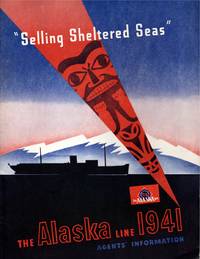
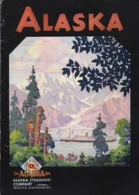
191411421Seattle: Alaska Steamship Company. Near Fine. 1941; 1914. Ephemera. Pacific brochure with 2" split top of spine 1" split bottom; closed 1" tear leading edge front cover; wear at edges with a heavy chip rear top edge causing loss on cover & several pages. Poor condition thus. Alaska Line with slight bump to lower front leading corner else fine. ; Alaska Line: illustrated stapled blue & black wrapper; tab indexed page foredges; includes charts and timetables lodging and transportation informations; information on side trips "what to see"; deck plans including 4 fould out plans in color; large folding map in rear pocket approx. "30 x 20" in color on what appears to be onion skin paper in pristine apparently unused condition. PACIFIC STEAMSHIP brochure: Illustrated stapled wrappers; 15 pp. With map photographs double page deck plan; 4to 11" - 13" tall; 21 pages . Alaska Steamship Company unknown
0331982595.Gpaperback. Good. Access codes and supplements are not guaranteed with used items. May be an ex-library book. paperback
0331982609.Ghardcover. Good. Access codes and supplements are not guaranteed with used items. May be an ex-library book. hardcover
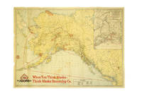
191737386Chicago: Poole Bros. 1917. 1917. ALASKA. First edition. A full-color folded map of Alaska showing both the coastal and seagoing routes that leave from Seattle to Alaska by the Alaska Steamship Company. Points of interest are indicated in red and include the Klondike Region Fairbanks Gold Placers Mt. McKinley National Park Kennecott Copper Mines etc. In the upper right corner is an 11" x 8" inset black & white map of the Copper River & Northwestern RY. and the Alaska Railroad showing Copper River Region in Alaska Prince William Sound the Richardson Automobile Highway Mt. McKinley National Park and Government Telegraph Line and Tributary Territory. Map has a few tears at folds some soiling to the map's surface and general wear from handling and use. Overall a good map of Alaska. Poole Bros., 1917. unknown
1939286138Seattle: Farwest Lithograph and Printing Co 1939. Map. Color Lithograph. 21" x 28".<br/> <br/> This beautifully colored map of Alaska and the Gulf of Alaska shows the Alaskan boat lines from Seattle and was first drawn by Edward Camy for the Alaska Steamship Company in 1934. A great pictographic map includes an inset showing the Alaska Railways route from Seward to Fairbanks and the Richardson Automobile Highway. The bottom of the map shows a series of cartoons of events on the ship. In good condition a great example of Alaska.<br/> <br/> Farwest Lithograph and Printing Co unknown
1931109085Seattle: Alaska Steamship Company 1931. Softcover. good to very good. 40pp.pp. Octavo. Black and white illustrations in text from photos and drawings and folding colour map at end in printed pocket entitled "The Alaska Line" with inset "Map of the Copper River & Northwestern Ry and the Alaska Railroad showing Copper River Region in Alaska Prince William Sound the Richardson Automobile Highway Mt. McKinely National Park Government Telegraph Line and Tributary Territory". Original pictorial wrappers stapled as issued; Old dampstain in top margin of text leaves and minor wear and short tear to rear cover. good to very good 1931 Alaska Steamship Company paperback