Alaska Nautical ChartBiblio.com
469 résultats
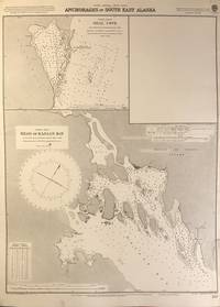
56402London: British Admiralty 1898 1925. An engraved chart on heavy stock uncolored sheet size 20 x 27.5 inches. Published 2nd Aug. 1898; New Edition Nov. 1921; Small corrections printed to 1925 and mss. to 1926. Clean and attractive never folded short tears to margin at lower right some small additions in red pen. In lower right: "Engraved by Davies & Company". Chart number is 837. Small typed label on verso giving chart & folio info. Published under the Superintendence of Rear Admiral Sir W.J.L. Wharton. Two maps: Seal Cove Gravina Island and Head of Kasaan Bay at Prince of Wales Island. <br/><br/> London: British Admiralty, 1898 (1925). unknown
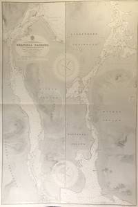
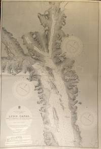
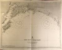
56415London: British Admiralty 1899 1930. . An engraved chart on heavy stock uncolored sheet size 27.5 x 40 inches. Published 20th Feb. 1899; New Edition 17th Jan. 1930. Original horizontal fold a clean and attractive copy some small additions in red pen. In lower right: "Engraved 1899" and "Zc 1930". Chart number is 3022. Small typed label on verso giving chart & folio info. Published under the Superintendence of Rear Admiral Sir W.J.L. Wharton. Divided vertically into two charts this extends from Frederick Sound to Sumner Strait showing the Lindenberg Peninsula Mitkof Island Woewodski Island. Previously known as Wrangell Strait this channel is 22 miles long. <br/><br/> London: British Admiralty, 1899 (1930). unknown
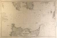
56409London: British Admiralty 1911 1924. An engraved chart on heavy stock uncolored sheet size 40 x 27.5 inches. Published 11th April 1911; New Edition 30th May 1921; Small corrections printed to 1924 and mss. to 1927. Original vertical fold clean and attractive some small additions in red pen. In lower right: "Engraved by Davies & Company". Chart number is 3754. Small typed label on verso giving chart & folio info. Published under the Superintendence of Rear Admiral H.E. Purey-Cust. Good detail of the northern end of Graham Island in the Haida Gwaii formerly Queen Charlotte Islands. The Dixon Entrance remains a contentious area today with ongoing disputes about the precise location of the boundary line between Canada and the USA. This 1924 map shows a dotted line just south of Prince of Wales Island with the text: "Approximate Boundary between British Columbia and Alaska". <br/><br/> London: British Admiralty, 1911 (1924). unknown
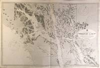
56418London: British Admiralty 1896 1925. . An engraved chart on heavy stock uncolored sheet size 46 x 28 inches. Published 15th Dec. 1896; Large Corrections to July 1907; Small corrections printed to 1925 and mss. to 1929. Original vertical folds a clean and attractive copy some small additions in red pen. In lower right: "Engraved by Davies & Compy.". Chart number is 2458. Small typed label on verso giving chart & folio info. Published under the Superintendence of Rear Admiral W.J.L. Wharton. A large and detailed chart extending from the Dixon Entrance north to Wrangell Island; the chart extends east to the Portland Canal and the edge of British Columbia including Observatory Inlet and Salmon Cove visited by Captain Vancouver in 1793 and so named because he set up his observatory there in order to calibrate the chronometers. Good detail of Prince of Wales Island and Clarence Strait. Originally published in 1896 this is a 1925 printing. <br/><br/> London: British Admiralty, 1896 (1925). unknown
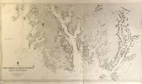
56427London: British Admiralty 1897 1925. . An engraved chart on heavy stock uncolored sheet size 40 x 27.5 inches. Published 6th March 1897; Large Corrections to June 1907; Small corrections printed to 1925 and mss. to 1930. Original vertical fold a clean and attractive copy some small additions in red pen. In lower right: "Engraved by Davies & Company". Chart number is 2462. Small typed label on verso giving chart & folio info. Published under the Superintendence of Rear Admiral W.J.L. Wharton. A highly detailed chart showing the north part of Admiralty Island and Chichagof Island Chatham Strait Glacier Bay; Inset map at the top: Continuation of Lynn Canal. Originally published 1897 this is an edition of 1925. <br/><br/> London: British Admiralty, 1897 (1925). unknown
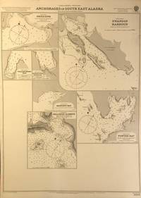
56401London: British Admiralty 1898 1920. An engraved chart on heavy stock uncolored sheet size 20 x 27.5 inches. Published 11th Nov. 1898; Large corrections to April 1904; Small corrections printed to 1920. Clean and attractive never folded some small additions in red pen. In lower right: "Engraved by Edwd. Weller". Chart number is 3008. Small typed label on verso giving chart & folio info. Published under the Superintendence of Rear Admiral Sir W.J.L. Wharton. Maps of seven anchorages at Lynn Canal Glacier Bay and Chatham Strait: Fritz Cove Swanson Harbour William Henry Bay Barlow Cove Anchorage Bartlett Bay Killisnoo Harbour and Funter Bay. <br/><br/> London: British Admiralty, 1898 (1920). unknown
56426London: British Admiralty 1898 1926. . An engraved chart on heavy stock uncolored sheet size 27.5 x 40 inches. Published 23rd July 1898; Large Corrections to 6th August 1926; Small corrections mss. to 1927. Original horizontal fold a clean and attractive copy some small additions in red pen. Some wrinkling of paper at centre but not very noticeable on the printed side. In lower right: "Engraved 1898." and "Zc 1926". Chart number is 2288. Small typed label on verso giving chart & folio info. Published under the Superintendence of Rear Admiral Sir W.J.L. Wharton. A detailed and attractive chart of this major inlet. <br/><br/> London: British Admiralty, 1898 (1926). unknown
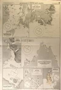
56419London: British Admiralty 1900 1925. An engraved chart on heavy stock uncolored sheet size 27.5 x 40 inches. Published 31st December 1900; New Edition January 1916; Small corrections printed to 1925 and mss. to 1927. Clean and attractive original horizontal fold some small additions in red pen. In lower right: "Engraved by Edwd. Weller". Chart number is 3138. Small typed label on verso giving chart & folio info. Published under the Superintendence of Rear Admiral Sir W.J.L. Wharton. Maps of seven anchorages: Klawak Inlet and Approach Cape Chacon Tamgas Harbour Mary Island Anchorage and Custom House Cove Hassler Harbour Yes Bay and Redfish Bay. Originally published in 1900 this is a 1925 printing. The small plan of Redfish Bay has corrections on a paste-over partly printed in red. Klawak is now known as Klawock and had a variety of names used by the Tlingit Klawerak Tlevak Clevak and Klawak. <br/><br/> London: British Admiralty, 1900 (1925) unknown
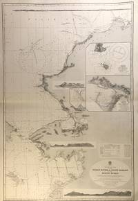
56407London: British Admiralty 1907 1928. An engraved chart on heavy stock uncolored sheet size 27.5 x 40 inches. Published 17th April 1907; New Edition Jan. 1923. Large Corrections 1st June 1928. Original horizontal fold a clean and attractive copy some small additions in red pen. Engraved shorelines in vignette. In lower right: "Malby & Sons". Chart number is 593. Small typed label on verso giving chart & folio info. Published under the Superintendence of Rear Admiral A. Mostyn Field. A large and detailed chart with inset maps of Chamisso and Port Clarence with an additional detailed inset of Port Clarence. From the Yukon River north to the Bering Strait Kotzebue Sound as far as Point Barrow on the coast of Alaska here designated as West Georgia. <br/><br/> London: British Admiralty, 1907 (1928). unknown
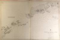
56420London: British Admiralty 1903 1929. . An engraved chart on heavy stock uncolored sheet size 40 x 27.5 inches. Published 23rd April 1903; New Edition 1st March 1929. Clean and attractive original vertical fold some small additions in red pen. In lower right: "Engraved 1903" and "Zc 1929". Chart number is 3336. Small typed label on verso giving chart & folio info. Published under the Superintendence of Rear Admiral Sir W.J.L. Wharton. A detailed chart of the Fox Islands Group in the Eastern Aleutians. <br/><br/> London: British Admiralty, 1903 (1929). unknown
56423London: British Admiralty 1890 1925. . An engraved chart on heavy stock uncolored sheet size 34 x 27 inches. Published 9th July 1890; Large Corrections Jan. 1908; Small corrections printed to 1925 and mss. to 1929. Clean and attractive original vertical fold some additions in red pen. In lower right: "Engraved by Davies & Company". Chart number is 1499. Small typed label on verso giving chart & folio info. Published under the Superintendence of Captain W.J.L. Wharton. The south coast of Alaska centered on Prince William Sound. First published 1890 this is a printing of 1925. <br/><br/> London: British Admiralty, 1890 (1925). unknown
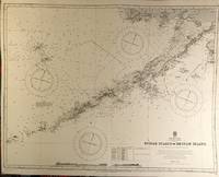
56422London: British Admiralty 1890 1924. . An engraved chart on heavy stock uncolored sheet size 34 x 27 inches. Published 9th July 1890; New Edition 19th Jan. 1917. Small corrections printed to 1924 and mss. to 1929. Clean and attractive original vertical fold some additions in red pen. In lower right: "Engraved by Davies & Company". Chart number is 1500. Small typed label on verso giving chart & folio info. Published under the Superintendence of Captain W.J.L. Wharton. A detailed chart of the Aleutian Islands chain from Alaska to Seguam Island. Several engraved vignettes of shorelines at the bottom. Originally published 1890 this is a 1924 printing. <br/><br/> London: British Admiralty, 1890 (1924). unknown
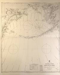
56408London: British Admiralty 1884 1928. . An engraved chart on medium stock uncolored sheet size 27 x 34 inches. Published 28th Oct. 1884; New Edition 15th Jan. 1923. Large Corrections 14th Sept. 1928. Original horizontal fold a clean and attractive copy some small additions in red pen. In lower right: "Engraved by Davies & Company". Chart number is 2460. Small typed label on verso giving chart & folio info. Published under the Superintendence of Captain W.J.L. Wharton. Good details of the Aleutian Islands and Bering Sea Eastern Siberia and the Bering Strait at the top. <br/><br/> London: British Admiralty, 1884 (1928). unknown
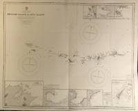
56421London: British Admiralty 1890 1928. . An engraved chart on heavy stock uncolored sheet size 34 x 27 inches. Published 9th July 1890; New Edition 28th Sept. 1928. Clean and attractive original vertical fold. In lower right: "Engraved 1890" and "Zc 1928". Chart number is 1501. Small typed label on verso giving chart & folio info. Published under the Superintendence of Captain W.J.L. Wharton. A detailed chart of the Aleutian islands including the Near Islands Rat Islands and Andreanof Islands groups. Included are nine small inset maps of harbours and anchorages on the various islands: Bay of Islands Korovin Bay Nazan Bay Bay of Waterfalls Suchikof Bay McDonald Bay Constantine Hr. Kiska Hr. and Chichagof Hr. Included in this chart are Attu Island and Kiska Island which were occupied by the Japanese during WW II. Two inset maps provide details of these islands: Chichagof Harbour on Attu Island and Kiska Harbour on Kiska Island. <br/><br/> London: British Admiralty, 1890 (1928). unknown
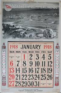
1918137331San Francisco: International Printing Co. 1918. Undetermined. very good. Colour calendar on heavy cardstock. 21" X 14". Occasional very light chipping and to edges. Corners bumped with some creasing. A few other light creases to edges. Full calendar pad Jan - Dec present with penciled notation in most days. Original string hanger present. Colours bright and unfaded. This poster is in very good condition. A scarce advertising calendar for the Northern Commercial Company N.C.Co. a retail company which maintained rural village stores across Alaska and in the Yukon. N.C.Co also operated steamships through Alaskan trade routes. The image on the poster features mining at Iditarod Alaska. Two totem poles on either side of the calendar pad list several stations of the N.C.Co. including Fairbanks Dawson Yukon Territory Bettles Iditarod and many others. The verso of the calendar is a full-page map of Alaska showing sea routes and locations of N.C.Co posts. A later incarnation of the business still maintains 30 stores across rural Alaska. See two other examples in this catalogue. 1918 International Printing Co. unknown
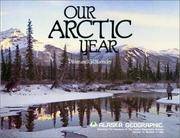
0882402048New. paperback. New. Satisfaction Guaranteed or your money back. paperback
2000mon0000002277Univ of Washington Pr 2000T. paperback. Very Good. 0.2500 in x 11.2500 in x 8.7500 in. 1st edition. Paperback. General wear but clean and solid. Ships from a smoke-free home. Hand-wrapped and packaged in cardboard. Univ of Washington Pr paperback
0931163188.Gpaperback. Good. Access codes and supplements are not guaranteed with used items. May be an ex-library book. paperback
18947777AG. P. Putnams Sons 1894. HB NODJ ISSUED 1894 1st edition with dates matching on title & copyright page NF-/VG AS-ISNODJ 12 mo Green & Grey embossed decorated Cloth with some rub & scuff to Cover primarily spine area & Back Cover X-LIBRARY with some unobstrusive Marks Labels numbers ETC O/W nice Condition & tight light Fox few small light stains cover 201 pages. First Edition. Hard Cover. G. P. Putnams Sons hardcover
BAY_10_SH_010762Kenai Historical Society. Used - Very Good. Binding is unblemished text block is clean boards straight without highlights or markings. Mild rubbing/chipping to dust wrapper edges. Well packaged and promptly shipped from California. Partnered with Friends of the Library since 2010. Kenai Historical Society hardcover
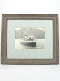
193049601930. Matted framed photograph. Very Good. Black & white platinum photo print in 4 x 6 inch light green matte behind glass 10 x 11.5 inch wood frame. The Princess Fleet were the coastal passenger liners of the Canadian Pacific Railway which also ran the ocean-going Empress Fleet. The Charlotte was commissioned by Captain J. W. Troup and built at the Fairfield shipyard near Glasgow in 1908 to be the finest flyer on the Pacific Coast when it entered service in the summer of 1909. The initial route was Victoria - Vancouver - Seattle. We estimated the date of our photo by examining crew and passenger attire. unknown
0882401769New. paperback. New. Satisfaction Guaranteed or your money back. paperback
1985Q-0882401769Alaska Northwest Books 1985-12-01. Paperback. New. In shrink wrap. Looks like an interesting title! Alaska Northwest Books paperback
193463562Ketchikan AK: United States Indian School ca. 1934. 4to. 59 1 leaves. With 21 leaves of plates illustrating Alaskan Native American basket weaving patterns totem pole designs and other motifs. Green colour-tinted softcovers cover art photo & illustration by Jones Yeltatazie b. 1897 famed Alaskan Haida carver uniform light interior toning underlining corrections and notes by Voget still VG- copy from the library of Frederick Voget 1913-1997 noted American anthropologist and expert on the Crow Indians. First lithoprint mimeograph edition of this very scarce cultural and ethnological history of the Tlingit Haida & Tsimshian Indigenous Peoples drawn from the oral and written accounts by Native American students at the United States Indian School in Ketchikan AK when it was still operating before World War II. Featuring extended discussions of the Alaskan Indigenous Peoples folklore cultural heritage along with illustrations and discussions of their clothing food weapons hunting fishing architecture arts paintings wood carving totem poles canoes trade religion shamanism and much more. Established originally in 1903 the United States Indian School in Ketchikan was intended to educate and assimilate Indigenous Children into mainstream Euro-caucasian culture but following the 1929 decision of Irene Jones vs. Ketchikan Bureau of Education when Judge Harding had ruled that forcing Native American children to continue to be segregated from mainstream public schools was discrimination the boarding school was closed following the 1934 Indian Reorganization Act. The building is now part of the Univ. of Alaska Southeast Ketchikan campus. This original report is quite scarce and although Harvard is the only actual copy listed in Worldcat due to improper mixing of Kirtas Technology reprints & computer copies it is difficult to discern exactly how many originals are still retained. United States Indian School, paperback
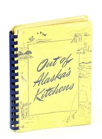
1948615j1278Anchorage Alaska: Alaska Crippled Children's Association. Good. 1948. Second Printing. Plastic Comb Binding. Includes 635 recipes selected from thousands of submissions. 248 3 pp. Several color illustrations. Average wear for a cookbook of this vintage. Minimal markings. A sound example of this wonderful piece of Alaskan epicurean history. Tourville 58 Haycox p.7. ; 8vo . Alaska Crippled Children's Association unknown