1 698 résultats
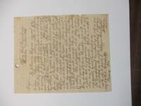
186439285Tallahassee and Quincy Florida; Charleston Columbus 1864. Each a single leaf varying lengths in ink manuscript. Occasional light wear Very Good.<br /> <br /> Shipments of cattle and salt beef to Confederate troops in the field are the primary subject of these letters. Logistic and administrative matters railroad availability and other aspects of supplying the troops are discussed. <br /> Pleasants Woodson White "was born in Georgia in 1820 the son of a Methodist minister who soon moved his family to Quincy Florida. Young White studied at Emory and began practicing law in Quincy in 1848. He was commissioned a major in the Confederate Army in 1861 and as Chief Commissary Officer for Florida commanded the important depot at Quincy. In 1863 despite his attempts at secrecy White's difficulties in supplying beef cattle to the army became known. The shortages thus revealed influenced the military campaign of 1864. White became active in politics after the war and served as Judge of the Second Judicial Circuit 1869-79. He also served as Commissioner of Lands and Immigration from 1881 to 1885 a period of railroad expansion in which his office was deeply involved. He became an attorney for the Florida Coast Line Canal and transport Company which controlled vast acreage near Miami. White became an ardent booster of the South Florida climate and divided his last years between his citrus groves in Lemon city and his civic and business interests in Quincy. He died in 1919" online University of North Florida Digital Commons. unknown
1465258868-11-18Kendall Hunt. 2nd. Very Good. It's a well-cared-for item that has seen limited use. The item may show minor signs of wear. All the text is legible with all pages included. It may have slight markings and/or highlighting. Kendall Hunt unknown
192140736Washington D.C.: Published by the United States Coast and Geodetic Survey 1921. Large folding nautical chart printed on heavy paper stock. Colored. A rare original coastal survey of Florida and Alabama from Pensacola Bay showing Perdido Bay including Pensacola Perdido Key and Orange Beach.<br/> <br/> Established by President Thomas Jefferson in 1807 as the Survey of the Coast the U.S. Coast and Geodetic Survey was the United States' first civilian scientific agency. This agency has followed its mission to survey the U.S. coastline create nautical charts of the coast and help increase maritime safety since its founding and has often played fascinating roles in significant chapters of U.S. history. It served in all theaters of the Civil War in the service of the Union Army and Navy pioneered acoustic exploration in the wake of the sinking of the Titanic and during WWI it worked to detect enemy submarines. In addition this agency worked to survey and produce detailed maps and renderings of the U.S. coast. These nautical survey maps commonly referred to as "T-sheets" provide fascinating insights into the history of the United States coastline which has and will continue to shift. These maps are the most important data source for understanding the physical and ecological characteristics of the U.S. shoreline. The present map is a highly detailed and accurate sea chart of the coastal border between Florida and Alabama and an important historical view of the developing states. Published by the United States Coast and Geodetic Survey unknown
191740710Washington D.C.: Published by the United States Coast and Geodetic Survey 1917. Folding nautical chart printed on heavy paper stock. Uncolored. A rare original coastal survey of Florida's Cedar Keys area.<br/> <br/> Established by President Thomas Jefferson in 1807 as the Survey of the Coast the U.S. Coast and Geodetic Survey was the United States' first civilian scientific agency. This agency has followed its mission to survey the U.S. coastline create nautical charts of the coast and help increase maritime safety since its founding and has often played fascinating roles in significant chapters of U.S. history. It served in all theaters of the Civil War in the service of the Union Army and Navy pioneered acoustic exploration in the wake of the sinking of the Titanic and during WWI it worked to detect enemy submarines. In addition this agency worked to survey and produce detailed maps and renderings of the U.S. coast. These nautical survey maps commonly referred to as "T-sheets" provide fascinating insights into the history of the United States coastline which has and will continue to shift. These maps are the most important data source for understanding the physical and ecological characteristics of the U.S. shoreline. The present map is a highly detailed and accurate sea chart of Florida's Cedar Keys and an important historical view of a developing Florida. Published by the United States Coast and Geodetic Survey unknown
191740726Washington D.C.: Published by the United States Coast and Geodetic Survey 1917. Nautical chart printed on heavy paper stock. Uncolored with minor wear. A rare original coastal survey of the Legare Anchorage in Florida's Biscayne Bay with Elliot Key and Sands Key.<br/> <br/> Established by President Thomas Jefferson in 1807 as the Survey of the Coast the U.S. Coast and Geodetic Survey was the United States' first civilian scientific agency. This agency has followed its mission to survey the U.S. coastline create nautical charts of the coast and help increase maritime safety since its founding and has often played fascinating roles in significant chapters of U.S. history. It served in all theaters of the Civil War in the service of the Union Army and Navy pioneered acoustic exploration in the wake of the sinking of the Titanic and during WWI it worked to detect enemy submarines. In addition this agency worked to survey and produce detailed maps and renderings of the U.S. coast. These nautical survey maps commonly referred to as "T-sheets" provide fascinating insights into the history of the United States coastline which has and will continue to shift. These maps are the most important data source for understanding the physical and ecological characteristics of the U.S. shoreline. The present map is a highly detailed and accurate sea chart of the Biscayne Bay region and an important historical view of a developing Florida. Published by the United States Coast and Geodetic Survey unknown
191740713Washington D.C.: Published by the United States Coast and Geodetic Survey 1917. Large folding nautical chart printed on heavy paper stock. Uncolored. Coastal survey map of Tortugas Harbor and approaches with an inset map in the upper left corner of Fort Jefferson.<br/> <br/> Established by President Thomas Jefferson in 1807 as the Survey of the Coast the U.S. Coast and Geodetic Survey was the United States' first civilian scientific agency. This agency has followed its mission to survey the U.S. coastline create nautical charts of the coast and help increase maritime safety since its founding and has often played fascinating roles in significant chapters of U.S. history. It served in all theaters of the Civil War in the service of the Union Army and Navy pioneered acoustic exploration in the wake of the sinking of the Titanic and during WWI it worked to detect enemy submarines. In addition this agency worked to survey and produce detailed maps and renderings of the U.S. coast. These nautical survey maps commonly referred to as "T-sheets" provide fascinating insights into the history of the United States coastline which has and will continue to shift. These maps are the most important data source for understanding the physical and ecological characteristics of the U.S. shoreline. The present map is inset with a detailed view of Fort Jefferson on Garden Key. Fort Jefferson was an ambitious civil war era coastal defence site which became the largest brick structure in the US. This map is a highly detailed and accurate sea chart of Tortugas Harbor and an important historical view of a developing Florida. Published by the United States Coast and Geodetic Survey unknown
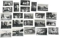
1950233201950. Clearwater Florida photo archive by George Fulmer documenting a Gulf Coast city in the early postwar Sunbelt boom: downtown storefronts automobile traffic tourism businesses beauty shops laundromats pharmacies loan offices civic buildings youth music programs local entertainments and everyday commercial life. George Fulmer identified here through the studio sleeves and the Clearwater job file context worked as a commercial and civic photographer in a period when Pinellas County grew quickly with new residents new retail construction and an increasingly car centered downtown. <br /> <br /> Photo archive of 70 items including 34 silver gelatin photographs with 36 corresponding and unique large format negatives contained in 15 studio sleeves with some annotations ranging from 3" x 5" to 4" x 5" Clearwater Florida circa early 1950s. Storefronts and signs identify Billie Moran Hair Stylist Spotlite Cleaners Launderette Family Loan Co. Loans Lane's Pharmacy Harris Drive In Pharmacy and a downtown block with the Capitol Theatre marquee and McCrory's along a traffic-filled street. Other scenes include audio equipment demonstrations musicians performing before seated audiences children handling rabbits a youth band rehearsal commercial laundry workers golfers near a clubhouse and staged presentation or prize events. Original sleeves strengthen the local identification with handwritten client names addresses dates and job numbers including "Portal Office U.S. Post Office" "P.G.A. Clinic" "Family Loan Office" "Lane Pharm" "Harris Pharmacy" and "Helpy Selfy Laundry." More scenes place people inside the social and commercial interiors of the city: a woman stands beside a microphone while another plays piano; accordion players and guitarists perform before a seated audience in a hall draped with streamers; children and an adult handle rabbits in what appears to be a club or youth program setting; a school band director leans into a room packed with young musicians and music stands; workers stand at wash stations in a commercial laundry; golfers pose and shake hands near a clubhouse; a woman and man stand on a small platform before a seated crowd during what appears to be a staged presentation or prize event.<br /> <br /> These scenes belong to the years when Florida's west coast cities were advertising modern storefronts widening their commercial appeal and absorbing the population growth that followed World War II air conditioning road building and the state's aggressive promotion of itself as a place to live shop vacation and retire. For institutional collections the group supplies named evidence of how a single city looked and conducted business during the first great Sunbelt surge: not only landmark buildings and downtown traffic but service counters display windows local entertainment children's programs and the ordinary businesses that usually vanish first from the record. Light wear minor surface handling and expected age toning to prints and negatives with some sleeves worn from studio use; overall in very good condition. A strong regional archive of Clearwater's commercial and civic life still anchored to the working paperwork that identifies who hired Fulmer and what parts of the city he was asked to record. unknown
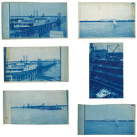
18953633601895. Five views of Lake Worth Beach and Palm Beach in 1895.<br /> <br /> The images are:<br /> <br /> 1 Ferry at Lake Worth with the Royal Poinciana Hotel in the distance. Captioned in the negative "L.W.B. 9.14.95";<br /> 2 Lake Worth with the Royal Poinciana Hotel in the distance. Captioned in the negative "L.W.B. 9.24.95";<br /> 3 View of Lake Worth with a pier in the foreground possibly taken from a boat. Captioned in the negative "L.W.B. 10.9.95";<br /> 4 Sail boat in front of the Royal Poinciana captioned in the negative "Lake Worth" two versions with different exposure times<br /> 5 View of the Palm Beach Inn later renamed The Breakers under construction with the Royal Poinciana in the background not dated but the hotel opened in December 1895.<br /> <br /> The negatives these views were printed from are of somewhat unusual size measuring roughly 4-3/4 by 7-3/4 inches. All but one view have a horizontal orientation. Given that this size does not seem to conform to the standard halfplate negative usually 5-1/2 to 6-1/2 inches in the long direction one might speculate that the photographer made their own camera. The photographs are handcut with somewhat uneven edges and of varying finished sizes all roughly 5 by 8 inches. They are generally very good or better with some toning and spotting. Uncommon subject matter. unknown
1959ZB705266Florida Association of Architects / Roger W. Sherman 1959. Volumes 9 through 26 1959-1976 lacking volume 11#11; 12#12; Bound in buckram with original covers included except for the issues for volume 11 & 12 which are unbound in original wrappers. Ex library text clean & bindings tight. - If you are reading this this item is actually physically in our stock and ready for shipment once ordered. We are not bookjackers. Buyer is responsible for any additional duties taxes or fees required by recipient's country. Photos available upon request. Florida Association of Architects / Roger W. Sherman hardcover
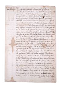
1767351783New Providence Bahamas 1767. 2pp folded folio sheet with integral blank. Old folds minor staining. 2pp folded folio sheet with integral blank. The Brigatine Apollo left the bay of Honduras on 11 June 1767 bound for Rhode Island on a course through the Gulf of Florida. "That about one of the clock in the morning of the day following the said Brigantine got on the reef of Florida whereupon the deponents immediately got out the said Brig.t's long boat and carried out an anchor in order to heave her off & likewise lightened the vessell by throwing over board some of her cargo: That at six of the clock the said brigatine began to leak very much & at eight o'clock these deponents discovered a vessell in shore which soon after came to their assistance & prov'd to be a sloop belonging to New Providence . having attempted in vain to get the said vessell off & the tide then flowing into her they thought it absolutely necessary to endeavor to save whatever they possibly could of the said Brigatine & her cargo and accordingly proceeded to unbend the sails & strip the said vessell . and do hereby solemnly protest aginst the said reef of Florida for all losses damages & expences hitherto sustained thereby ." <br /> <br /> The document does not specify the nature of the cargo going from British Honduras to Rhode Island but was perhaps mahogany or other timber used in colonial New England for cabinet making. unknown
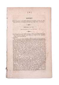
1822339148Washington D.C.: Gales & Seaton 1822. 17th Congress 1st Session House Report No. 47. 35 1 blankpp. 8vo. Disbound. 17th Congress 1st Session House Report No. 47. 35 1 blankpp. 8vo. A request that the association formed by Chazotte be allowed to purchase land in the Key Largo area for the purpose of cultivating coffee cocoa and tropical fruits. Pages 13 through 30 comprise a separate section with its own caption title: Facts and Observations on the Culture of Vines Olives Capers Almonds &c. in the Southern States and of Coffee Cocoa and Cochineal in East Florida. This section first published separately in Philadelphia in 1821. Shoemaker 11210 [Gales & Seaton] unknown
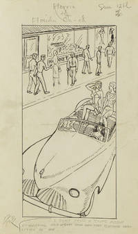
1949313357Gainesville Fla 1949. Aprox 77 pen and ink drawings with the newspaper cliping done generally for Wednesdays and Sundays. 8vo & 4to. In spiral rink notebook. Aprox 77 pen and ink drawings with the newspaper cliping done generally for Wednesdays and Sundays. 8vo & 4to. unknown
192264060Tallahassee FL & Buffalo & New York NY: Department of Agriculture Florida The Matthews-Northrup Works 1922. One large oblong double-atlas folio colour lithograph map sized 50 x 44 in. county lines and railroad lines demarcated in colours fold creases as issued minor dustsoiling edgewear to verso some very slight weakening to a couple fold creases otherwise a VG bright copy. First edition thus of this uncommon and updated sectional map of Florida incorporating the 1920 census numbers as well as updating the agricultural statistics farm properties and average acreage values at the outset of the Roaring 20’s. Also delineated are the railroads reaching into Florida including the Atlantic Coast Line Florida East Coast RR Seaboard Air Lines Georgia Southern & FLorida RR Louisville 7 Nashville RR and others. McRae 1870-1943 headed the Florida Department of Agriculture from 1912-1923. Worldcat locates 2 physical copies U of FL WI Hist. Soc. Department of Agriculture, Florida, The Matthews-Northrup Works, unknown
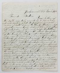
18584106Jacksonville Fl: March 15 1858. Very good plus. 4pp. on a single folded sheet. Old mailing folds. An informative dispatch from antebellum Florida from A.C Scranton to "Friend Barton" in 1858. In his letter Scranton reports that despite some problems he is enjoying southern people and general life in Florida: "The people generally in the south are very kind & hospitibal but I need hardly to tell you that Florida has got some hard times as every new state or Territory has but thare is a more healthy Emigration coming in every year I have been fortunate anough to find some Northern people here which makes it seam a little more like home to me. I am boarding with a family from Georgia whome I like first rate & I do just as I would at home so that things are quite pleasant here considering I am amongst strangers."<br /> <br /> He then provides information on Jacksonville and then two disasters that hit his adopted hometown: "Jacksonville is the largest place in Florida & had at one time about 3000 inhabitants it is not as large as it was once some three years ago it was visited by a very destructive fire & burned nearly half of the town. Last summer there was some kind of Fever here that almost prostrated the place some called it the Yellow Fever & some the African but none could tell for certin.about a hundred & fifteen or twenty that died here in 3 months & a grate many left the town nearly all the stors wer closed not a sound of a hammer was to be heard. When cold weather came it stoped the sickness and it seams quite lively now. It has been for many years a grate resort in the winter season for invaleds but on account of the sickness last summer thare are but few this winter if it continus healthy this summer the place will revive but if not it will kill it entirely."<br /> <br /> Scranton also discusses the transportation system that served Jacksonville and the recent winding down of the Seminole Wars: "It is situated on the Johns River about 23 miles from the mouth and is connected with Charleston & Savana by a regular line of steamers that runs up the river a hundred miles to a place called Platka whare Emigrants land & then travel by land to the interior to settle the country thare is a railroad building from this place to Tallahasse the capital of the state a distance of a hundred & eighty miles which wen completed will be a little help to this place. There is also another in progress from Fernandina a new town that lays in the North East corner of the state to a place called cedar keys on the gulf side whare they intend to carry the US mail direct from New Orleans to New York insted of going round by Key west & will shorten the time considerable. Florida has cost Uncle Sam a large some of money.the government.will make a treaty with them & send them into the Indian Territory & then close the Indian war in Florida." Almost all of the Seminoles remaining in Florida relocated to Indian Territory in the year this letter was written.<br /> <br /> A wonderfully-detailed firsthand account of Jacksonville and its development and challenges during the late 1850s. A printed transcription accompanies the letter. March 15 unknown
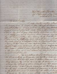
184635409Pensacola 1846. Letter. Very good. Letter. 4 pages. Lined paper folded. 4 pages of content. Postal mark and address written center of the 4th page. Two small wax seals on the edges of page 4. <br /> <br /> Letter is addressed to William Roney Jr. Corner of Third & Branch Sts Philadelphia Pa. Letter written aboard the U.S. Frigate "Raritan" off Pensacola Navy Yard April 3rd 1846 and has a Pensacola post mark and date of April 6 . Written on the eve of the Mexican War April 24 1846 to February 2 1848. Content summarized:<br /> <br /> Thomas Roney Midshipman writes a lengthy letter to his brother about his situation in Pensacola and requests his brother's help with family debts. He writes:“There is very little news from Mexico the latest is that Mr. Slidell has been informed that the government could not receive a Minister from the United States but that there were ready to receive a Commissioner for the settlement of the Texas question. We had consequently demanded his passports and is expected here very shortly in the Ship Manzo. The Mexicans have been making every preparation for a war…were preparing to place Santa Anna at the head of the government again….†Roney had been transferred from the U.S. Brig Bainbridge back to the Raritan. He was relieved as “master†and appointed "midshipman". Roney has no problem with this because the Raritan is more comfortable. Roney recently returned from Rio de Janerio and had to take large advance to pay off debts. The only regret of his demotion to midshipman is that he can’t send money home to Mother any more hopes brothers can make it up. He complains of the cost of his “mess bill†and outfitting upon leaving the coast of Brazil. He writes "Any place is better than the coast of Brazil unknown
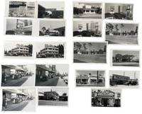
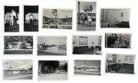
1950233171950. American postwar economic growth and tourism throughout Clearwater Florida photographed by local photographer George Fulmer showing how the Sunbelt expansion operated through roadside motels downtown retail waterfront leisure automobile traffic and service businesses during the rapid growth of the 1950s. The photographs center on the commercial circulation that made Clearwater function as a visitor city spanning rate signage pitched to seasonal travelers motel courts arranged for car access beach parking filled with mid-century automobiles storefront streets where shoppers and pedestrians occupy the sidewalk and crowded dock scenes tied to marine recreation. Clearwater had developed as a resort community by the 1890s and local historical sources note that by 1957 it was known as the fastest growing city in America making this group a concentrated record of the urban and commercial expansion that turned Pinellas County's Gulf Coast into a major tourism economy. <br /> <br /> Photo archive of 72 items including 38 silver gelatin photographs and 34 negatives ranging from 3" x 4" to 4" x 5" contained in 10 photo studio envelopes. Most negatives are duplicates of the print photographs while some are unique images. Clearwater Florida c. 1950s. Repeated and variant views show commercial properties and tourist infrastructure from multiple angles including motels with bold seasonal signage reading "SUMMER RATES $5.00 PER COUPLE FROM APRIL 15 TO NOV. 15" "20 ROOMS $4.00 DOUBLE Apr. 1st-Dec. 1" and "REASONABLE RATES 4 UNITS $5.00 DOUBLE APRIS-JUN." Several prints and negatives picture motel exteriors room interiors with twin beds and lamps a modernist multi-story lodging property with projecting sign and glass-fronted office and a low roadside restaurant or motel building beneath a large fish sign. Other images move into the wider tourist economy: downtown street scenes with McCrory's and Maas Brothers Television signage a storefront reading "Clearwater's American Casuals" a Parsons Paint Co. facade a Brookside Service Travel Gas station advertising regular gasoline at 26 cents and waterfront scenes with rows of parked cars palm-lined drives crowded piers and a dock packed with men women and children waiting or disembarking. The negatives preserve the same emphasis on repeated commercial views indicating studio production for advertising promotional or business use; the group also retains photo studio envelopes inscribed by George Fulmer.<br /> <br /> These photographs place Clearwater within the broader postwar reordering of Florida's Gulf Coast where automobile ownership road travel beach recreation and commercial real estate development produced the built environment commonly identified with Sunbelt growth. Fulmer's images are strongest where they show the interdependence of businesses rather than isolated structures: lodging needed seasonal pricing and motor access downtown retail depended on pedestrian density and curbside traffic waterfront tourism required parking and dock circulation and roadside services converted through-travel into local spending. Visible edge wear light curling and routine handling marks to some prints and negatives; studio envelopes present. Overall good condition. A substantial visual record of how Clearwater's postwar visitor economy operated on the ground with concrete evidence of the businesses prices streets interiors and waterfront traffic that made tourism an urban system rather than a backdrop. unknown
3242Scarce. Black paper wraps. Photograph and title printed in silver to front cover. Front fly made of silver paper. Organized by architect featuring photographs renderings and floorplans of commercial and residential projects located in South Florida including Miami Miami Beach Coral Gables Ft. Lauderdale and Palm Beach; Hobe Sound and Winter Park circa mid/late 30's. Last third of book consists of advertisements for architects contractors designers landscapers and building materials and manufacturers. A nice clean crisp copy without previous owners' names or other markings. ; 4to 11" - 13" tall; 106 54 pages; All shipments through USPS insured Priority Mail. The Miami Visitor Publishing Co., Inc. paperback
1986x-0471826456Wiley-Interscience 1986. Hardcover. New. 1st edition. 594 pages. 10.00x7.00x1.50 inches. Wiley-Interscience hardcover
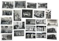
1951233191951. George Fulmer photographs of Clearwater residents businesses club spaces and service interiors recording how the residential economy of postwar Clearwater Florida functioned during early Sunbelt expansion in the 1950s. Fulmer a WWII U.S. Navy enlisted photographer and Clearwater city photographer for more than six decades worked from a studio beside the courthouse and produced a continuous visual record of the city's built environment commercial life and civic spaces; this group preserves that local documentary practice in a concentrated run of early postwar assignments tied to dining rooms lounges staged programs domestic instruction storefront promotion and everyday services. The material shows the interlocking spaces that supported residential growth in Pinellas County: hospitality rooms utility demonstrations cleaners and tailoring shops club events leisure scenes and communal interiors built for a city expanding through retirement migration consumer services and year-round settlement.<br /> <br /> Photo archive of 75 items including 36 silver gelatin photographs and 39 large format duplicate and original negatives ranging from 3 x 4 inches to 5 x 4 inches all contained in 12 original studio envelopes with some annotations by George Fulmer. Clearwater Florida and nearby Pinellas County circa 1951-1953. The most vivid images center on stage performance and organized social programming: women posed onstage around a table with boxed goods and a large lamp presenting household furnishings in a display that links entertainment to domestic consumption; girls lined across a stage in dresses for a group performance; a young female solo performer standing at microphone or center stage; a mixed adult group assembled under stage lighting in what appears to be a presentation or awards moment; and a trio of female performers in matching dance poses. These theatrical scenes are matched by audience and setting views that show older men dining together in booths and at tables large lounge interiors arranged for conversation and gathering office and reception spaces a broad institutional kitchen a man on a ladder opening a ceiling hatch in a decorated hall a child holding a large fish outdoors and exterior views of a corner cleaners and tailoring shop with painted signage reading "EST. 1909 CLEANERS" and "TAILORING." Original studio envelopes retain Fulmer job numbers dates and handwritten identifications including "Hart Cleaners" "BPW Club" "Weekend in Clearwater" "Court Crest Room" "Bank Central Pinellas Largo" and "Pinellas Utility Co. Cooking School" placing the images within the working files of a commercial city photographer covering Clearwater's residential service and promotional life.<br /> <br /> In the years after World War II Florida's Gulf Coast cities grew through in-migration small-business development utility expansion hospitality design and new forms of residential settlement aimed at permanent and seasonal residents alike. Fulmer's photographs place Clearwater within that broader transformation at street level through the rooms services labor and public-facing businesses that made postwar residential growth workable as daily life rather than as abstract development. Some negatives with light damage; photographs very good negatives largely good overall. A coherent single-photographer group of original studio material from George Fulmer's Clearwater practice with negatives prints and job-envelope evidence intact. unknown
187231647Tallahassee: Charles H. Walton State Printer 1872. Stitched untrimmed and uncut. 350 2 blanks 76 pp. Except for a spotted title page which is chipped at the blank corners a clean Very Good copy.<br /> <br /> An informative Journal recounting Floridians' resistance to Radical Reconstruction. Governor Harrison Reed's Message addresses ongoing disturbances and "fatal and disgraceful violence. Nine-tenths of the suffering induced has fallen upon Republicans and mainly upon colored citizens-- giving unerring evidence that these excesses have been strongly tinctured by if they have not entirely originated in political prejudice." Many murders and disruptions had occurred in Calhoun and Jackson Counties forcing citizens to flee their homes and seek shelter in other parts of the State. A Committee of Five was appointed "to examine into the cause of said murders and to ascertain why the perpetrators have not been brought to justice." <br /> The Committee concluded that "there exists an organized band whose object is to resist the laws and who are the supposed authors of the many murders and outrages committed in the county." Threats of violence and a "reign of terror" had deterred witnesses from coming forward. In Jackson County "no less than one hundred and eighty -four murders fifteen of the number being women and children and almost the entire number being colored people brutally assassinated by this band of outlaws for daring to think for themselves." Similar outrages occurred in Lafayette and other counties. <br /> Governor Reed Florida's governor from 1868-73 faced impeachment charges from this Assembly as he had in 1868 and 1870. He was later charged in sixteen Articles with illegally issuing state bonds embezzlement and bribery. The charges were dismissed. The Assembly treated other matters of government including special elections marred by violence; "an act to incorporate Brown's Theological Institute" now Edward Waters College founded in 1866 to educate former slaves and considered the oldest historically black college in Florida. Senate Bill No 82 "to be entitled an act to incorporate the Buckingham Smith Asylum for the colored people of St. Augustine" was passed. Charles H. Walton, State Printer unknown
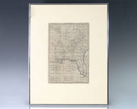
1797139014Paris: Rigobert Bonne 1797. Rare 18th century map of North America by Royal Hydrographer Rigobert Bonne. One page the engraved map extends from Illinois to Florida with one of the earliest insets of Kansas City. Born in the Lorraine region of France French cartographer Rigobert Bonne 1727-1794 was a skilled cartographer and hydrographer and succeeded Jacques Nicolas Bellin as Royal Hydrographer at the Depot de la Marine in 1773. He published many charts for the Depot including some of those for the Atlas Maritimeof 1762. In near fine condition. Matted and framed. The entire piece measures 17 inches by 16 inches. La Louisiane named after Louis XIV of France became a colony of the Kingdom of France in 1682 before passing to Spain in 1763. Louisiana was formed in part of the became part of the Louisiana Purchase from France in 1803. The U.S. would divide that area into two territories the Territory of Orleans which formed what would become the boundaries of Louisiana and the District of Louisiana. Louisiana was admitted as the 18th state of the United States on April 30 1812. Appointed hydrographer of the French Navy at the age of eighteen Jacques-Nicolas Bellin was appointed Hydrographer to the King in 1741. He published numerous sea atlases and charts which would be reprinted into the nineteenth century as well as many maps depicting French colonial territories in the New World. His craftsmanship and commitment to accuracy earned him a distinguished reputation as one of the world's leading cartographers and many other European mapmakers turned to him for source material. Rigobert Bonne unknown
191640686Washington D.C.: Published by the United States Coast and Geodetic Survey 1916. Nautical chart printed on heavy paper stock. Colored. A rare coastal survey of the St. Johns River near Orlando with an inset map of the river continuation in the bottom left corner.<br/> <br/> Established by President Thomas Jefferson in 1807 as the Survey of the Coast the U.S. Coast and Geodetic Survey was the United States' first civilian scientific agency. This agency has followed its mission to survey the U.S. coastline create nautical charts of the coast and help increase maritime safety since its founding and has often played fascinating roles in significant chapters of U.S. history. It served in all theaters of the Civil War in the service of the Union Army and Navy pioneered acoustic exploration in the wake of the sinking of the Titanic and during WWI it worked to detect enemy submarines. In addition this agency worked to survey and produce detailed maps and renderings of the U.S. coast. These nautical survey maps commonly referred to as "T-sheets" provide fascinating insights into the history of the United States coastline which has and will continue to shift. These maps are the most important data source for understanding the physical and ecological characteristics of the U.S. shoreline. The present map is a highly detailed and accurate sea chart of the St Johns River and an important historical view of a developing Florida. Published by the United States Coast and Geodetic Survey unknown
1953233181953. Clearwater Beach tourism photo archive photographed by George Fulmer documenting midcentury Gulf Coast visitor commerce through motel courts apartment lodgings seasonal rate signs furnished rental interiors restaurant frontage retail display and weekend entertainment in 1953 and 1955. Fulmer's assignments record Clearwater during the postwar automobile travel boom when Florida beach towns competed for motorists through inexpensive overnight lodging visible roadside pricing furnished efficiency rooms seafood restaurants and short-stay leisure promotion. The archive preserves the commercial visual language used to attract travelers to Florida's Gulf Coast at the height of early Sunbelt expansion before high-rise redevelopment transformed much of Clearwater Beach. The named studio envelopes and coordinated commercial assignments give the group unusual specificity tying Clearwater's resort economy to identifiable businesses dated jobs and seasonal advertising practices by notable city photographer George Fulmer.<br /> <br /> Photo archive of 40 items including 19 silver gelatin prints with 21 accompanying original and duplicate large format negatives ranging from 3 x 4 to 4 x 5 inches Clearwater Beach and Clearwater Florida 1953-1955. The archive is comprised of some original and some duplicate images between the negatives and photographs. Nine original George Fulmer studio envelopes identify assignments including "Pelican Restaurant" "City Beach Pump House" "Signs Beach Apts." "Wallace Apts. Beach" "Our Bay Restaurant" "Weekend in Clearwater" "Hickey" and "Broadmore Motel" with the Broadmore envelope dated January 14 1955. A low motel court opens onto a central lawn and walkway occupied by seated adults and children; a man and woman stand beside a parked car under a sign reading "WALLACE APTS. / VACANCY / OVERNIGHT"; interiors contain sofas lamps dining sets venetian blinds and compact kitchen areas prepared for seasonal renters. Exterior signs advertise "20 ROOMS $4.00 DOUBLE Apr. 1 to Dec. 1" "15 UNITS $5.00 DOUBLE APRIL 15 NOV. 15" and "SUMMER RATES $5.00 PER COUPLE FROM APRIL 15 TO NOV. 15." Bay Restaurant frontage carries lettering for "SEA FOOD" "PACKAGE GOODS" "STEAKS CHOPS" and "CHICKEN" while performers stand at microphones in the "Weekend in Clearwater" assignment with a pianist visible behind one stage setup. A Hickey-Freeman Customized Clothes storefront adds a downtown retail component to the commercial landscape documented here.<br /> <br /> By the early 1950s Clearwater's economy depended heavily on seasonal tourism tied to automobile travel and winter migration into Florida. Motels apartment lodgings restaurants package stores entertainment venues and retail storefronts competed for travelers arriving along expanding Gulf Coast highway routes often advertising directly through roadside signage visible from passing cars. Fulmer's archive is strongest where it preserves those everyday commercial mechanics in named businesses rather than generalized resort imagery. Light curling corner wear and handling marks to prints and negatives; studio envelopes toned and worn with manuscript annotations. Overall good condition. A tightly focused record of Clearwater Beach tourism at the scale of the motel room roadside vacancy sign restaurant entrance retail storefront and weekend entertainment stage. unknown
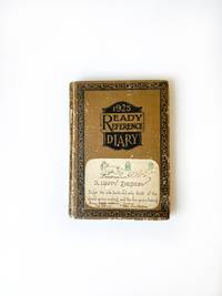
19690010041Madison Georgia. Good with no dust jacket. 1969. Hardcover. On offer is a 1969-1970 American diary from 71-year-old Florida Lamar Poullain Campbell Prior of Madison Georgia. Prior was the descendant of the Poullain and Lamar families who have called Georgia home since the early 1700s. Prior was born in Madison in 1898 and lived her life in that community. She married Walter Truman Prior and had a daughter named Florida C. Prior Jr. Prior passed away in 1991 at the age of 93. Although her name is not inscribed on the book context and the individuals named in her entries point to Priors identity. This diary was printed in 1925 but entries were sporadically made between 1969 and 1970. Prior's writing paints a detailed picture of life in the American South at this time. Personal relationships were very important to Prior and her entries are replete with references to family and friends. She also describes the social events that she participates in and the simple pleasures she experiences in her daily life. "Roy M. Prior passed away around 6: 00 AM. Today. He was my sweet and true friend. We will miss him. Ruth has stayed with us some during his illness and Flo & I have enjoyed being with her" April 11. "Today Florida C Prior Jr & Myself watched astronauts Neil Armstrong & Edwin Aldrin Jr. Walk on the moon & heard Pres. Nixon talk to them from Washington and heard their reply to him. UNBELIEVABLE" July 20. "Claire Stovall Inez W. Kroger Georgia Mallory Marguerite Little Helen de Beaugrine Fanny Harris & Ruth Attaway had lunch with me at Ye Olde Colonial Restaurant. We missed Martha Rhoades & Sara Knight who could not be with us. I enjoyed these sweet friends" July 25. "Mell Burgess Paine invited Flo & I to come to Decater for the day & to go to new S. DeKalb Richs. We took morning train for Atlanta -- first time I have been on this train in over 45 years. It was a great experience" August 20. "Elizabeth Cochran Prior & Roy Prior were married this afternoon at the Apalachee Baptist Church. Martha & Paul Rhoades went with Flo & me. It was very sweet" November 8. The diary measures 7 inches by 5 inches contains 183 pages and is approximately 20 percent complete. The cover binding and pages are all in good condition and the handwriting is quite legible. This small diary offers an interesting grouping of family and friendship links that can flesh out genealogical lines in this historic community and county in Georgia. It also offers insight into life in the South at a time when Americans were landing on the moon and experiencing major social upheaval. ; Manuscripts; 7" x 5"; 183 pages; Keywords: Florida Campbell Prior; Lamar; Lamer; Madison Oaks Inn; 766 East Avenue; Poullain Heights; Morgan County; American South; Georgia; Madison; Historic; The South; Scull Shoals; Antoinne Poullain; Rebecca Lamar; Sarah Poullain Campbell; Thomas Poullain; Ye Olde Colonial Restaurant; Apalachee Baptist Church; Moon Landing; Moon Walk; Neil Armstrong; Edwin Aldrin Jr; Buzz Aldrin; AMERICANA; HANDWRITTEN; MANUSCRIPT; DOCUMENT; LETTER; AUTOGRAPH; WRITER; HAND WRITTEN; DOCUMENTS; SIGNED; LETTERS; MANUSCRIPTS; DIARY; DIARIES; JOURNALS; PERSONAL HISTORY; SOCIAL HISTORY; HISTORICAL; HOLOGRAPH; WRITERS; AUTOGRAPHS; PERSONAL; MEMOIR; MEMORIAL; ANTIQUITÉ CONTRAT; VÉLIN; DOCUMENT; MANUSCRIT; PAPIER ANTIKE; BRIEF; PERGAMENT; DOKUMENT; MANUSKRIPT; PAPIER OGGETTO D'ANTIQUARIATO; ATTO; VELINA; DOCUMENTO; MANOSCRITTO; CARTA ANTIGÜEDAD; HECHO; VITELA; DOCUMENTO; MANUSCRITO; PAPEL . hardcover
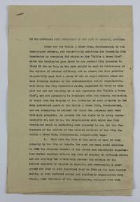
19473905Palatka Fl 1947. Very good. 5pp. typed on folio sheets stapled. Old folds minor wear and creasing light dust-soiling. An unsigned petition from the Hallie Q. Brown Club asking "The Honourable City Commission of the City of Palatka Florida.to recognise its status as the 'Hattie Q Brown Club which the Commission gave leave to use certain City property in Block 81.in furtherance of the welfare of colored children." Apparently a splinter group of the club was also claiming to be the Hallie Q. Brown Club and was illegally collecting rents on the groups club house. In asking for official recognition the group details their history of helping African-American youth in the area "by equiping and over-seeing a playground for them." The authors then detail the internal conflicts which occurred amongst the club members the procession of club leadership including several named individuals and the circumstances which led to the club's incorporation ending with the filing of a charter with a Putnam County judge. The fourth section of the club's petition enumerates their activities and plans in "furtherance of the welfare of the colored children of Palatka." The first two points detail the land clearance and construction of the park and their further plans for same; the third point relates to a study the club has undertaken "of the problem of juvenile delinquency among the colored children." Part of their plan is to work with law enforcement "to work out a parole system for first offenders of tender age" as well as "provide a method and place for the incarceration of colored children accused of or guilty of infractions of the law who are less than 12 years of age so that such children may be kept safely in custody and yet not exposed to the bad example and toughening influence of imprisonment in the County jail." Hattie Quinn Brown was a pioneering African-American educator who actively sought the formation of African-American women's clubs throughout the country. unknown